
border


_Grenze_auf_Fels_2.jpg)


A border ( loan word from Old Polish, cf. old Slavic , (old) Polish granica "border", abbreviations: Gr. And Grz. ) Is the edge of a room and thus a dividing value, a dividing line or a dividing surface .
Borders can limit geographical areas . These include political or administrative boundaries, economic , customs or property borders . Property boundaries are recorded in the property cadastre . Spaces can also be indistinctly delimited, such as landscapes , cultural boundaries or areas of distribution that can hardly be identified in nature using line structures.
The boundaries of a volume can be surfaces, lines or points, such as faces, edges and corners of a cube. The airspace is limited for air traffic purposes ; its boundaries contain a volume.
An example of the limits of one-dimensional spaces is the “upper” and “lower limit” in mathematics (see Supremum ). Colloquially, this is also used as a limit value , threshold value or barrier . Examples of non-geometric spaces are “usual behavior” or the intimate sphere .
There are also limits to rights. The general freedom of action under Article 2, Paragraph 1 of the Basic Law ( Basic Law of the Federal Republic of Germany ) reads:
"Everyone has the right to the free development of his personality, as long as he does not violate the rights of others and does not violate the constitutional order or the moral law."
Your conscience also sets limits to what you can do and not do.
Word origin
The 12/13 Graniza / grænizen / greniz , borrowed from Old Polish in the 17th century, has gradually expanded from the East German colonization areas to the German-speaking area and displaced the German word “ Mark ” ( Old High German marka, marcha ) for border, border area.
The old local "Mark" is still alive today in terms of compositions and derivations such as Markstein (Swiss Marchstein ), boundary stone , important, outstanding point, district , entire area of a municipality, municipality corridor or overmarchen in Swiss for "crossing a border, exaggerating" and on the other hand in names like Mark Brandenburg and Styria (originally areas on the border with the Slavs).
The etymon "border" is also used today in most Slavic languages and in Romanian: granica (Polish, Croatian, Bosnian), граница / graniza (Russian, Bulgarian), граніца / graniza (Belarusian), граница / granica (Serbian), hranice (Czech) and hranica (Slovak, Upper Sorbian), graniţă (Romanian). It belongs to the Slavic group of words ran ', e.g. B. Russian грань / gran ' , border line, border, delimiting surface', also 'facet, (edge) surface'.
Formation of state borders
Older political borders between two countries sometimes coincide with natural obstacles, some of which are difficult to overcome: a mountain range, a sea or an estuary, a desert, a primeval forest or a mountainous country. As a rule, these also represent the linguistic and cultural borders. Rivers, on the other hand, have only formed state borders since around 1800 (new borders as a result of wars or peace treaties), as they used to represent unifying trade routes rather than separating obstacles. Where they are today, the valley path is usually used as a border line in the border treaties , so that the affiliation of islands can also be clearly regulated.
Many later borders, such as those between the states of the USA , were contractually set at certain longitudes or latitudes . These straight borders, which are also found in Africa, are called drawing board borders. They did not arise through centuries of evolutionary processes, but can be traced back to acts of will, usually by foreign rulers ( colonialism ).
A special feature, for example, is the border between the north of the Dutch province of Limburg and Prussia, agreed at the Congress of Vienna in 1815 . It was defined as the boundary line east of the Meuse from which the cannons common at the time could no longer hit ships on the Meuse.
Municipal boundaries also mostly follow the above. Lines, but also mountain ridges (according to the motto: “like a ball rolls and water flows”) and streams.
District boundaries in large cities are usually on traffic routes (roads, rails, paths).
There are still territorial disputes between many states due to conflicting territorial claims . Such disputes have often led to crises and wars throughout history.
The expression “ phantom boundary” brings to mind the mental traces of historical boundaries .
Marking of boundary lines
From the point of view of the real estate cadastre , a “boundary” is a geometrically defined line that is either marked in the location with the help of boundary points or is defined in a reference system by specifying coordinates . Property boundaries can be marked by boundary stones , pipes, boundary bolts, chisel marks and the like. Ä. be marked. These markings mark the local borderline. The position of the boundary points is determined to the centimeter.
Indirect labeling
If a boundary point cannot be marked directly, a boundary sign can also be set as an “indirect” or “indirect marking” in one of the boundaries extending from the boundary point (at a short distance, e.g. one meter). At national borders, a wise man can also indicate a more distant border point if the border point is at a point where it is not possible to set up a border stone, e.g. B. on the street or on river banks.
Exact determination of boundary lines
A boundary is defined by straight or circular connections between the boundary points. Straight border lines have the advantage that they can be defined by two points alone and can be easily implemented with a sight or an alignment . It can be difficult to define the boundary lines in mountains and at river borders:
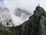
Mountains
In the mountains, the geodesist or the forester has to put in a higher technical effort, on some steep slopes it is difficult to permanently mark the points because the erosion ( landslides etc.) is constantly changing the terrain.
Rivers
In the case of political borders running in river beds, the valley path is usually used as a border line in the border treaties , so that the respective nationality of islands located in the river can be clearly regulated. Since the valley path is subject to constant changes, boundary measurements are necessary at regular intervals. These are usually carried out by both neighboring countries in joint procedures and recorded in intergovernmental agreements and protocols. Once a (former) water course is geodetically defined, changes in the course of the river can lead to the formation of areas that are still part of a regional unit, but separated from it by the new course of the river and therefore often not (or only via foreign territory) are accessible. Sometimes in these cases there is an exchange of territory; furthermore, such areas can also be used as nature reserves or retention areas .
The earlier problems of point stabilization have been a thing of the past since the practicality of the Global Positioning System (around 1985) and the advent of purely digital methods for recording.
Superlatives
The shortest land border with only 85 m is between Peñón de Vélez de la Gomera (Spain) and Morocco. The longest land border is the one between Canada and the USA with 8891 km. The most commonly crossed border is that between Mexico and the United States . The inner-Korean border between North and South Korea is considered to be the most closely guarded. The border between Djibouti and Somalia , which is only defined by a straight line, is the easiest to define, while the border between Bangladesh and India that existed until 2015 with 92 Bangladeshi and 110 Indian exclaves is probably the most complicated. The situation is similar in Baarle on the Belgian-Dutch border. Bahrain has only man-made land borders.
Image selection

Old German boundary stone at the black cross Fürstenwalde (Geising) with markings

Felsmarch from 1584 on a room-sized rock between the Benediktbeuern monastery court and the Tölz district court
The Gatterl from the south (Austria)

Bavarian sign at the state border with Tyrol

Border stone between Austria and Italy at Nassfeld

State border Poland-Belarus in Białystok-Grodno

Abandoned border post on the Umbrail Pass ( border between Italy and Switzerland ) at the time of the First World War

State border between Slovakia-Ukraine. The boundary stone, two border pillars and a fence with video surveillance.


_02.jpg)
See also
- Border fortification
- Borderland (frontier)
- Border Museum
- Border regime
- Field jury member
- List of territorial disputes
- Uti possidetis
- Sea border
- “ Action Border ” as a cover name for a forced resettlement campaign in the GDR
literature
- Maria Baramova: Limits in Europe of the Early Modern Age. In: Institute for European History (Mainz) (Ed.): European History Online . 2010, accessed June 14, 2012.
- Wilfried von Bredow: Limits. A story of coexistence from the Limes to Schengen. Theiss, Darmstadt 2014, ISBN 978-3-8062-2894-6 .
- Federal Agency for Political Education : Borders. Special issue of the magazine Aus Politik und Zeitgeschichte 63 (2014), No. 4–5, with six articles on the topic of borders, ISSN 0479-611X .
- Regina Dauser, Lothar Schilling (Ed.): Borders and contact zones. Reconfigurations of knowledge spaces between France and the German states 1700–1850. First “Euroscientia” workshop, September 15/16, 2011. In: Discussions 7 (2012).
- Pavel Domec: The limit. A concept analytical study of limology. Königshausen & Neumann, Würzburg 2014, ISBN 978-3-8260-5515-7 .
- Michael Gehler, Andreas Pudlat (Ed.): Borders in Europe. Olms, Hildesheim 2009, ISBN 978-3-487-14240-1 .
- Jost Gudelius: double abbot staff and Hebscheidt. Boundary stones and rock fairy tales between the Benediktbeuern monastery court and the Tölz district court. Schneemann, Jachenau 2014, ISBN 978-3-9815341-7-7 .
- Hans Hecker (Ed.): Limits. Social constitutions and transfigurations. Klartext, Essen 2006, ISBN 978-3-89861-386-6 .
- Martin Heintel , Robert Musil, Norbert Weixlbaumer (eds.): Limits. Theoretical, conceptual and practical questions about boundaries and how they are exceeded (= questions of space: city - region - landscape ). Springer, Berlin 2018, ISBN 978-3-658-18432-2 .
- Andreas Rutz: Limits in space - limits in history. Problems and Perspectives. In: Eva Geulen, Stephan Kraft (Hrsg.): Limits in space - limits in literature. In: Journal for German Philology. Special issue for Volume 129, Berlin 2010, pp. 7–32.
- Walter Leimgruber: Limit. In: Historical Lexicon of Switzerland .
- Bernhard Struck: Border regions. In: European History Online , ed. from the Institute for European History, Mainz 2012.
- Grentze, Lat. Terminus. In: Johann Heinrich Zedler : Large complete universal lexicon of all sciences and arts . Volume 11, Leipzig 1735, columns 828-831.
Web links
- Kamilla Kanafa: The meaning and conceptual history of "limit". In: Grenznavigator. P. 5. (PDF; 134 kB)
- Norbert Fuhrmann: Border investigation in the real estate cadastre - 2nd edition 2018 (PDF; 11.164 kB)
- Literature across borders in the catalog of the German National Library
Remarks
- ↑ On the other hand, in standing waters , the shoreline may change constantly, while the cadastral boundary can only be adapted to nature at longer intervals.
Individual evidence
- ↑ Ryszard Lipczu: German loanwords in Polish - History, Fields covered reactions. Retrieved February 3, 2019 .
- ↑ Wolfgang Pfeifer : Etymological Dictionary of German. Akademie, Berlin 1989 and several new editions, each under 1 mark .