List of streets and squares in Berlin-Tiergarten

The list of streets and squares in Berlin-Tiergarten describes the street system in the Berlin district of Tiergarten with the corresponding historical references. At the same time, this compilation is part of the lists of all Berlin streets and places .
overview
In the Tiergarten district, four areas can be clearly demarcated from one another:
- The government district with the Spreebogenpark , bounded by the Spree in the north and the John-Foster-Dulles-Allee - Scheidemannstrasse in the south.
- south of it the Great Zoo to the Lennéstrasse - Tiergartenstrasse - Thomas-Dehler-Strasse and the zoological garden .
- between Tiergartenstrasse and Landwehrkanal the Tiergartenviertel with numerous embassies in the embassy quarter , the Kulturforum and then the area around Potsdamer Platz .
- south of the Landwehr Canal to Kurfürstenstraße and finally Tiergarten-Süd as a residential and business area.
Tiergarten has 14,881 inhabitants (as of December 30, 2019) and includes the postcode areas 10117, 10557, 10785, 10787 and 10963.
Overview of streets and squares
The following table gives an overview of the streets and squares in the district as well as some related information.
- Name / location : current name of the street or square. Via the link Location , the street or the square can be displayed on various map services. The geoposition indicates the approximate center of the street length.
- Traffic routes not listed in the official street directory are marked with * .
- Former or no longer valid street names are in italics . A separate list may be available for important former streets or historical street names.
-
Length / dimensions in meters:
The length information contained in the overview are rounded overview values that were determined in Google Earth using the local scale. They are used for comparison purposes and, if official values are known, are exchanged and marked separately.
For squares, the dimensions are given in the form a × b for rectangular systems and for (approximately) triangular systems as a × b × c with a as the longest side.
If the street continues into neighboring districts, the addition ' in the district ' indicates how long the street section within the district of this article is. - Name origin : origin or reference of the name.
- Notes : further information on adjacent monuments or institutions, the history of the street and historical names.
- Image : Photo of the street or an adjacent object.
| Name / location | Length / dimensions (in meters) |
Origin of name | Date of designation | Remarks | image |
|---|---|---|---|---|---|
|
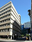
Old Potsdamer Strasse
( Location ) |
300 | Potsdam , capital of the state of Brandenburg | Nov 8, 1997 | Connection of Potsdamer Platz and Marlene-Dietrich-Platz . For the construction of the Potsdamer Strasse building of the Berlin State Library , in 1967 Potsdamer Strasse in the direction of Potsdamer Brücke was extended to a new route as an extension of Leipziger Strasse . On Marlene-Dietrich-Platz, the southwestern end of the old course, the Theater am Potsdamer Platz was built in the 1990s . At the Weinhaus Huth (Alte Potsdamer Strasse 5, until 1937: Potsdamer Strasse 139) there is a memorial plaque for the Brothers Grimm , who lived across the street at Linkstrasse 7. The building, completed in 1912, is a listed building. |

|
|
Altonaer Strasse
( Location ) |
400 (in the district) |
Altona on the Elbe , an independent town until 1938, then the westernmost district of Hamburg | May 23, 1879 | When it was first built, it was called Straße 1, Section V of the development plan. The street runs through the zoo from the Großer Stern to the Hansabrücke . The part from the " Eternit-Haus " to the Hansabrücke is located in the Hansaviertel district . On March 8, 1935, the extension of the Brückenallee between Altonaer Strasse and Großer Stern was also named Altonaer Strasse. |

|
| At Karlsbad
( Location ) |
390 | Prince Friedrich Carl Alexander of Prussia (1801-1883), son of King Friedrich Wilhelm III. and Queen Luise | Feb. 21, 1828 | The street section between Am Karlsbad and Bissingzeile was also given this name on October 3, 1968. Part of the street was pulled in on October 2, 1969. The building of the fire society Berlin, the union building of the union federation of employees from 1927 and the Africa building from 1911 are located here. |

|
| At the park
( Location ) |
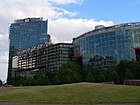
180 | Location at Henriette-Herz-Park in the Lenné triangle | Oct 25, 2004 | The footpath runs between Lennéstraße and Potsdamer Platz at Henriette-Herz-Park. It was created as part of the establishment of the Beisheim Center . |
|
| Auguste-Hauschner-Strasse
( Location ) |
180 | Auguste Hauschner (1850–1924), German-Jewish writer | Sep 7 1999 | The street on the Lenné triangle leads from Lennéstraße to Potsdamer Platz and is divided by Inge-Beisheim-Platz. It was created as part of the establishment of the Beisheim Center . | |
|
Bellevue banks
( Location ) |
440 | Bellevue ( French for 'beautiful view'), a popular name for pleasure palaces since the Baroque era , here related to Bellevue Palace | Jan. 9, 1901 | The footpath leads from the Luther Bridge along the Spree to Bellevue train station at the rear of the Bellevue Palace Park . |

|
| Bellevuestrasse
( Location ) |
280 | Bellevue ( French for 'beautiful view'), a popular name for pleasure palaces since the Baroque era , here related to Bellevue Palace | July 8, 1831 | The street runs between Lennéstraße and Potsdamer Platz at Henriette-Herz-Park. From the 18th century to 1831 it was called Thiergartenweg . From 1935 the People's Court was housed in house no.15, the former Wilhelms-Gymnasium . The building was hit in the USAAF heavy air raid on February 3, 1945 ; the President of the People's Court, Roland Freisler, was killed. The ruin was demolished in the 1950s. | |
| Ben Gurion Street
( Location ) |
790 |
David Ben-Gurion (1886–1973) Israeli Prime Minister |
Jan. 13, 2004 | It is the southern part of the former relief road . The ceremonial unveiling of the street sign was carried out on June 1, 2005 by Israeli President Moshe Katzav . |

|
| Berlin freedom
( Location ) |
80 | reminds of the turning point in the GDR | Oct 25, 2004 | The private road in the former border area in the area of the Beisheim Center leads from Am Park to Inge-Beisheim-Platz. It was created as part of the establishment of the Beisheim Center. | |
| Bettina-von-Arnim-Ufer
( Location ) |
370 |
Bettina von Arnim (1785–1859), writer and important representative of German Romanticism |
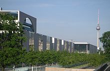
Jan. 20, 1991 | The previous names of individual sections were Kronprinzenufer (1871–1978), Richard-Wagner-Strasse (1889–1934) and Schlieffenufer (1934–1991). It is a footpath between John-Foster-Dulles-Allee and the House of World Cultures . Part of the Schlieffenufer was renamed in 1959; In 1991 the remaining part got its new name. The section between the House of World Cultures and the Moltkebrücke was built over during the construction of the Federal Chancellery and moved in on April 6, 2002. |
|
| Bissing line
( Location ) |
360 | Moritz Ferdinand Freiherr von Bissing (1844–1917), Royal Prussian Colonel General and Governor General of Belgium (1914–1917) | Nov 7, 1936 | The street runs in an L-shape from Potsdamer Strasse to Lützowstrasse. It was created around 1900 and was unofficially called Potsdamer Privatstrasse . On November 7, 1936, it was officially named Bissingzeile. On November 8, 1955, as an unfinished street, it was converted into a public street. House number 11 is a monument . |

|
| Brothers-Grimm-Gasse
( Location ) |
70 |
Brothers Grimm , Jacob Grimm (1785–1863) and Wilhelm Grimm (1786–1859), linguists and collectors of fairy tales. |
Dec 3, 1997 | The short lane connects Linkstrasse with Eichhornstrasse. It was created as part of the rebuilding of the Potsdamer Platz area . | |
|
Budapester Strasse
( Location ) |
540 + 120 (in the district) |
Budapest , capital of Hungary | Apr 22, 1925 | This former north-eastern part of Kurfürstendamm was renamed in 1925 to compensate for the former Budapester Strasse between Potsdamer Platz and Brandenburg Gate , which had previously been renamed Friedrich-Ebert-Strasse . On February 5, 1965, a section of Kurfürstenstrasse between Budapester and Nürnberger Strasse was also given this name. In the 1980s, the street was turned, so that the Olof-Palme-Platz was created. The Hotel Intercontinental is located on Budapester Strasse with its shopping arcades from 1956. Another hotel is Hotel Schweizerhof.
The elephant gate is also located at Olof-Palme-Platz as the entrance to the zoological garden and the Berlin aquarium . |

|
| Burggrafenstrasse
( Location ) |
240 | Burgrave , office from the feudal system of the Middle Ages | May 18, 1876 | The former street 26a, Section IV of the development plan, was created by the Tiergarten public building association. It got its name with reference to the adjacent Kurfürstenstrasse and Landgrafenstrasse. The German Institute for Standardization is located here . At number 87 is the Lenzhaus monument from 1929, the first high-rise in Berlin. From 1905 the impressionist painter Ernst Oppler lived in number 4 . |

|
|
Clara-Wieck-Strasse
( Location ) |
270 |
Clara Wieck (1819–1896), pianist and composer, wife of Robert Schumann |
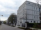
Jan. 16, 2009 | The street connects Köbisstraße with Tiergartenstraße. The buildings are currently (2011) still under construction, the so-called "diplomatic quarter" with exclusive apartments is being built. |
|
| Corneliusstrasse
( Location ) |
450 | Peter von Cornelius (1783–1867), painter | 5th Sep 1867 | From 1849 to 1867 it was called Albrechtshof . It extends along the Landwehr Canal between Drakestrasse and Klingelhöferstrasse, where the Konrad-Adenauer-Haus and the CDU's federal office are located. |

|
|
Dennewitzstrasse
( Location ) |
160 (in the district) |
Dennewitz , a village in the Niedergörsdorf community in the south of the Teltow-Fläming district | Oct. 31, 1864 | When it was first built, it was Straße 22, Section III of the Berlin development plan . Due to a royal decree of July 9, 1864 and a cabinet order of October 31, 1864, the streets were named after battles and military leaders of the wars of liberation ( Battle of Dennewitz ). The house lead -through for the U1 underground line is remarkable . The street is divided by the Nelly-Sachs-Park, it previously ran between Dennewitzplatz and Pohlstraße. The southern part is in Schöneberg . |

|
| Derfflingerstrasse
( Location ) |
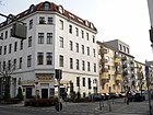
350 | Georg von Derfflinger (1606–1695), field marshal of the Elector of Brandenburg and governor of Pomerania | July 6, 1870 | When it was first built, it was Street 5, Section IV of the development plan. The French grammar school complex is located here . |
|
| DIN space
( Location ) |
40 × 40 × 30 | German Institute for Standardization (DIN) | Jul 22, 2011 | The formerly nameless square between Burggrafenstrasse and Kurfürstenstrasse was named after the facility on July 22, 2011. |

|
| Drake Street
( Location ) |
180 |
Friedrich Drake (1805–1882), sculptor and architect |
5th Sep 1867 | When it was first built, it was called Straße 23, Dept. V / 1 of the development plan. It leads from Corneliusstraße to Thomas-Dehler-Straße on the extension of the zoological garden . The Danish legation and the former Yugoslav legation of Werner March from 1940, in which the German Society for Foreign Policy is now based, are located here as monuments . |

|
|
Ebertstrasse
( Location ) |
110 (in the district) |
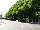
Friedrich Ebert (1871–1925), President of the Reich | July 31, 1947 | Laid out around 1767 as Kasernenstrasse (also Kasernenstrasse at the Brandenburg Gate ), from 1831 the traffic route was named Schulgartenstrasse (1831–1867), Brandenburgische Kommunikation (1845–1867), Königgrätzer Strasse (1867–1915), Sommerstrasse (1859–1925). , Budapester Strasse (1915–1925), Friedrich-Ebert-Strasse (1925–1933) and Hermann-Göring-Strasse (1933–1945). The street forms the border between the districts of Mitte and Tiergarten , where the Berlin Wall used to run. Only the western sidewalk between Scheidemannstrasse and the Brandenburg Gate belongs to Tiergarten. The name Hermann-Göring-Straße was no longer used after the end of the Second World War in 1945; it was not officially renamed until 1947. |
|
| Eichhornstrasse
( Location ) |
180 + 140 |
Johann Albrecht Friedrich von Eichhorn (1779–1856), Prussian statesman and minister of culture |
Jan. 12, 1856 | The street runs from Potsdamer Straße to Linkstraße and is interrupted by Marlene-Dietrich-Platz. |

|
|
Relief road (former road) |
1200 | Functional designation to identify a temporary | Jan. 8, 1962 | After the wall was built, the road was built in just 44 days to relieve traffic flows around the Großer Stern . With the construction of the Tiergarten Spreebogen (TTS) tunnel , it became superfluous, so that in 2006 the section between Straße des 17. Juni and Lennéstraße was dismantled again. Parts of Willy-Brandt-Strasse, Heinrich-von-Gagern-Strasse, Yitzhak-Rabin-Strasse and Ben-Gurion-Strasse run along this route . |

|
|
Flottwellstrasse
( Location ) |
440 | Eduard von Flottwell (1786–1865) Prussian Minister of State and Upper President of the Province of Brandenburg | July 29, 1865 | When it was built, it was Straße 24, Section III of the development plan. On January 16, 1869, the adjacent Wörlitzer Strasse was also given this name. Flottwellstrasse connects Schöneberger Ufer with Dennewitzstrasse and forms the border to Kreuzberg . Here is a neo-baroque building that was given to a Princess Radziwill by a Prince of Hohenzollern. This area is currently in a state of upheaval; on the current fallow land , a completely new district was created in the 2010s, which is directly connected to the park at Gleisdreieck . |

|
|
Fontane Square
( Location ) |
30 × 30 |
Theodor Fontane (1819–1898), writer |
Dec 3, 1997 | The Weinhaus Huth was originally located directly on the (old) Linkstrasse . In the course of the redevelopment of Potsdamer Platz, this received a new route that was shifted parallel to the east and the open space behind the wine house was redesigned as Fontaneplatz. |

|
| Friedrich-Ebert-Platz
( Location ) |
190 × 45 |
Friedrich Ebert (1871–1925), politician and foreign minister |
Aug 21, 1999 | The square separated from the northern section of Ebertstrasse is delimited by the Reichstagufer, Dorotheen-, Scheidemann- and Ebertstrasse. Only number 1, the Reichstag building is in Tiergarten. No. 2, Reichstag President's Palace and No. 3, Jacob-Kaiser-Haus of the German Bundestag , are in Berlin-Mitte . There are no previous names of the square, they are only related to the different names of Ebertstrasse (from 1859). At this place is the listed Reichstag Presidential Palace, which was completed in 1904, with a garden and tunnel. In the area of the square, the white crosses symbolically commemorate the victims of the Wall . |

|
|
Gabriele Tergit Promenade
( Location ) |
560 | Gabriele Tergit ( pseudonym for Elise Reifenberg née Hirschmann, 1894–1982), writer and journalist. | May 2, 1998 | The street connects the Reichpietschufer with the Stresemannstraße in the area of the Potsdamer-Platz area . |

|
| Garden shore
( Location ) |
650 | Garden , demarcated piece of land on which crops are grown | not known | The garden bank is a footpath on the bank of the Landwehr Canal from the lower lock to the Katharina-Heinroth-Ufer. It is locked in the dark because it runs along the zoological garden . The monument to Rosa Luxemburg is located at the Lichtenstein Bridge . | |
| Genthiner Strasse
( Location ) |
530 | Genthin , town in the Jerichower Land district in Saxony-Anhalt | 23 Feb 1863 | At the complex it was called Straße 3, Section V of the development plan. The street leads from Kurfürstenstraße to Schöneberger Ufer. The part between Kurfürstenstrasse and Magdeburger Platz is characterized by furniture stores. Together with Kurfürstenstrasse, it is a center of Berlin street prostitution . The Walter de Gruyter publishing house at No. 13 is a listed building monument |

|
|
great star
( Location ) |
200 (diameter) | Big star, intersection of several major traffic axes, former resting and resting point for stagecoaches | Dec. 1, 1832 | The place was under Elector Friedrich III. Created around 1698 by the court hunter Hemmrich. From 1742 onwards, as part of the redesign of the zoo by Knobelsdorff and from 1833 to 1840 by Peter Joseph Lenné , the Großer Stern was expanded into a representative square. From the 18th century to 1832 it was named Bei den Puppen because of the statues of ancient gods standing there, called " Puppen " by the Berliners .
The Victory Column , which originally stood in front of the Reichstag, was moved here as part of the plans for the world capital Germania and increased by a further column drum. The entire facility is under monument protection. The place is in 10th place in the Berlin traffic accident statistics. In 2011, 20 traffic accidents with personal injuries occurred here, with 22 slightly injured and one seriously injured. |

|
|
Hans-von-Bülow-Strasse
( Location ) |
40 |
Hans von Bülow (1830–1894), piano virtuoso and chief conductor of the Berlin Philharmonic |
March 21, 1998 | The private road is in the area of the Beisheim Center . It was created during the construction of the center. | |
|
Hardenbergplatz
( Location ) |
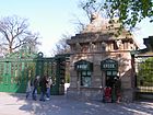
280 × 70 | Karl August von Hardenberg (1750-1822), Prussian statesman | Feb 14, 1958 | The previous name was Joachimsthaler Straße (1887-1958). In Tiergarten the area of the zoological garden with the administration building is at number 8. The street area belongs to Charlottenburg . |
|
| Heinrich-von-Gagern-Strasse
( Location ) |
190 | Heinrich von Gagern (1799–1880), politician at the time of the bourgeois March Revolution | Jan 16, 1998 | The street is part of the former relief road . |

|
|
Herbert-von-Karajan-Strasse
( Location ) |
190 | Herbert von Karajan (1908–1989), longstanding chief conductor of the Berlin Philharmonic | Apr 5, 1998 | From 1846 to 1934 it was called Matthäikirchstraße . From 1934 to 1947 it was renamed Standartenstraße (after the designation of the SA and SS divisions ), then got its ancestral name back. The street was renamed on the occasion of Karajan's 90th birthday at his long-standing place of work, the Berlin Philharmonic . Together with Scharounstrasse, it leads around the Philharmonie and the Chamber Music Hall. |

|
| Hercules bank
( Location ) |
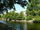
400 | Hercules ( Latin or Latinized spelling of the mythical Greek hero of antiquity), after the Hercules Bridge | Jan. 19, 1901 | The Herkulesufer is a footpath that leads from the Herkulesbrücke on the bank of the Landwehr Canal to the Hiroshimasteg . The listed Villa von der Heydt and the Bauhaus archive are located here . |
|
| Hertzallee
( Location ) |
270 |
Heinrich Hertz (1857-1894), physicist |
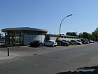
March 30, 1959 | The northern side with the BVG parking lot belongs to Tiergarten, the street area to Charlottenburg . The street was called Kurfürsten Allee from 1862 to 1950 and ran up to the knee (since the 1950s Ernst-Reuter-Platz ). The part in Tiergarten was also given its current name on December 18, 1961. On May 19, 1964, the section of road on the TU campus was de-designated. In the field of BVG parking lot to the Landwehr Canal , a 1846/1847 was by Peter Joseph Lenne scale Hippodrome . |
|
| Hildebrandstrasse
( Location ) |
350 |
Theodor Hildebrand (1791–1872), chocolate manufacturer |
1893 | The street was laid out in 1853 by the purveyor to the court, Hildebrand, as a private street on the property at Tiergartenstraße 21 - formerly the garden restaurant Teichmanns Blumengarten - and was first called Hildebrand's private street . In 1854 a summer house colony was established there. In 1868 the street was widened and in 1878 it was paved. In 1893 it was given its current name. On May 20, 1956, it was dedicated to a public street . Of the buildings that were once erected, only houses No. 5 ( Embassy of Estonia ) and No. 4 ( Embassy of Greece ) have survived, the latter is currently being reconstructed. After the construction work is completed, the Greek embassy - currently located on Wittenbergplatz - will move back in. On the east side of the street is the Bendlerblock and the memorial of the Bundeswehr , the Embassy of Slovakia (No. 25) and the west wing of the Italian Embassy . At the Tiergartenstraße is the Turkish Embassy . |

|
|
Hiroshima Street
( Location ) |
320 | Hiroshima , a port city in the southwest of the Japanese main island of Honshu , where the first atomic bomb was dropped on August 6, 1945 | Nov 1, 1989 | From 1862 to 1933 it was named Hohenzollernstrasse and from 1933 to 1989 Graf-Spee-Strasse . In Hiroshimastraße you will find the Japanese embassy with the street name in relation to it, the Italian embassy , the embassy of the United Arab Emirates and the state representations of North Rhine-Westphalia and Bremen as well as the Friedrich-Ebert-Stiftung . |

|
| Hitzigallee
( Location ) |
220 |
Friedrich Hitzig (1811–1881), architect |
Jul 31, 1947 | When it was built from 1860 to 1935, the street was called Regentenstrasse . From 1935 to 1947 Großadmiral-Prinz-Heinrich-Strasse . The part between Sigismundstrasse and Tiergartenstrasse was withdrawn on November 29, 1982 in favor of building land and deleted from the street directory on December 13, 1982. |

|
| Hofjägerallee
( Location ) |
450 | former residence of the royal court hunter | Dec. 1, 1832 | The Hofjägerallee is an important traffic axis that connects the Großer Stern with the Lützowplatz . In place of the Hofjägerhaus, the Winguthsche Etablissement was later built, a coffee house with a restoration garden that enjoyed great popularity among Berliners. But that no longer exists either. |

|
|
Inge-Beisheim-Platz
( Location ) |
30 × 40 (oval shape) |
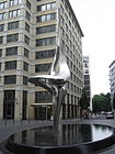
Inge Beisheim (–1999), patroness and wife of Metro founder Otto Beisheim | Oct 1, 2004 | The square is located on the grounds of the Beisheim Center and was created when it was built. The centerpiece is an oval fountain with the Phoenix sculpture created by Gidon Graetz , a gift from the Otto Beisheim Foundation to the city of Berlin. | |
|
John Foster Dulles Avenue
( Location ) |
880 |
John Foster Dulles (1888–1959), US Secretary of State |
Jul 25, 1959 | From 1832 to 1959 it was called Zeltenallee . The Zeltenallee and the subsequent Schlieffenufer to Spreeweg were renamed John-Foster-Dulles-Allee in 1959. On July 20, 1978, the part of the street from Großer Querallee to Scheidemannstraße was also given this name. The street runs along the edge of the Great Zoo and the banks of the Spree . Apart from the congress hall and the carillon , there are no buildings here. |

|
| Joseph-von-Eichendorff-Gasse
( Location ) |
120 | Joseph Freiherr von Eichendorff (1788–1857), romantic poet | Dec 3, 1997 | It is a small alley on the grounds of Potsdamer Platz between Alter Potsdamer Strasse and Linkstrasse. It is interrupted by the Potsdamer Platz Arkaden . | |
| Karl-Heinrich-Ulrichs-Strasse
( Location ) |
180 (in the district) |
Karl Heinrich Ulrichs (1825–1895), champion of the legal equality of homosexuals | Dec 16, 2016 | Karl-Heinrich-Ulrichs-Straße leads from Lützowplatz to Nollendorfplatz in Schöneberg . Until 1934 it was part of Maaßenstrasse. From 1934 to 2016 it was called Einestrasse . |

|
|
Katharina-Heinroth-Ufer
( Location ) |
280 |
Katharina Heinroth (1897–1989), zoologist and director of the Berlin Zoo from 1945 to 1956 |
4th July 1994 | The street was part of the Lützowufer until it was renamed. It runs from the Cornelius Bridge to the zoo's pumping station . |

|
| Keithstrasse
( Location ) |
350 (in the district) |
James Keith , (1696–1758), Prussian field marshal |
March 26, 1872 | It was laid out in 1871 as Street 24, Section IV of the development plan by George Kill-Mar . On March 27, 1939, the part of Lutherstrasse in the Schöneberg district from Kurfürstenstrasse to Kleiststrasse was also named Keithstrasse. Keithstrasse runs from Lützowufer to Kurfürstenstrasse. The part between Kurfürstenstrasse and Kleiststrasse belongs to Schöneberg . Building complexes 28, 30 and 32 was built in 1909 as a state insurance company for the province of Brandenburg. It has been used by the State Criminal Police Office since the 1950s . |

|
|
Kemperplatz
( Location ) |
80 × 30 | Johann Wilhelm Kemper (1766–1840), operator of the Kempers Hof tavern | Apr 1, 1858 | The square is a traffic junction created from Tiergartenstrasse, Lennéstrasse, Ben-Gurion-Strasse and the exit of the Tiergarten Spreebogen (TTS) tunnel . The road layout from the 1960s was changed as a result. From 1933 to 1946 it was called Skagerrakplatz . It is adjacent to the Philharmonie and the Sony Center . The terminus of the M-Bahn was located here until 1991 , but it was demolished for the reopening of the U2 underground line . |

|
| Klingelhöferstrasse
( Location ) |
410 |
Gustav Klingelhöfer (1888–1961), politician ( SPD ) |
Nov 1, 1961 | The street was laid out as Street 21, Section V of the development plan. From October 8, 1874 to November 1, 1961, it was called Friedrich-Wilhelm-Strasse . It delimits the Tiergarten triangle (also known as the "Klingelhöfer triangle") on which today's buildings were erected from 1998. Before that, there was a fairground here in West Berlin times. On the west side are the Nordic Embassies (No. 1/2), the Mexican Embassy (No. 3), the Association of Private Building Societies e. V. (No. 4), the GdW Federal Association of German Housing and Real Estate Companies e. V. (No. 5), the Embassy of Malaysia (No. 6), the embassies of Bahrain , Malta , Monaco and Luxembourg (together in No. 7). The party headquarters of the CDU is located on plot No. 8 .
On the east side, between Landwehr Canal and Von-der-Heydt-Straße, there is the Bauhaus Archive (No. 14) built in 1979 according to plans by Walter Gropius , the National Office of KPMG Germany (No. 16), the Chinese Cultural Center (No. 21 ), the Konrad Adenauer Foundation (No. 23), and the Church of Jesus Christ of Latter-day Saints (No. 24). |
|
| Kluckstrasse
( Location ) |
430 | Alexander von Kluck (1846–1934), Prussian infantry general and commander in chief | Jun 5, 1935 | Previous names were the extended Bendlerstrasse (mid-19th century to 1872) and Magdeburger Strasse (1872–1935). It runs from Schöneberger Ufer to Pohlstrasse and ends there as a residential street . Georg Heinrichs' youth hostel at Kluckstrasse is a monument; also the apartment house No. 36 from 1889. |

|
|
Köbisstrasse
( Location ) |
280 | Albin Köbis (1892–1917), soldier in the Imperial Navy, executed for mutiny during the First World War | Jul 31, 1947 | When it was built by Hofjäger- und Korsostraßen-Aktiengesellschaft, it was called Kaiserin-Augusta-Straße (1874–1933). From 1933 to 1947 Admiral-von-Schröder-Strasse . It is a residential street to develop the city villas in the diplomatic quarter, which were built here in 2005/2006. A part of the street (at the corner of Klingelhöferstrasse) was sold to the Church of Jesus Christ of Latter-day Saints on November 15, 1968 and was confiscated on December 2, 1975. Part of the area was pulled in in 1987 for the new building of the state labor office, and another area was renamed Reichpietschufer on January 1, 1989 . | |
|
Körnerstrasse
( Location ) |
250 |
Theodor Körner (1791–1813), writer |
Feb. 2, 1865 | The Körnerstraße connects Pohlstraße and Lützowstraße. The most striking building is the former post office W 35. |

|
|
Koethener Strasse
( Location ) |
580 | Köthen (officially Cöthen until 1927) is the district town of the Anhalt-Bitterfeld district. | Jan. 24, 1844 | Köthener Straße forms the border with the Kreuzberg district . The western side belongs to Tiergarten. At the former Potsdam train station, the road ran along the site of the “ Stammbahn ”, from where the trains went to Köthen. |

|
| Konrad-Adenauer-Strasse
( Location ) |
290 |
Konrad Adenauer (1876–1967), first Federal Chancellor of the Federal Republic of Germany. |
Jan 16, 1998 | The street is located in the government district (zip code 10557) between Paul-Löbe-Allee and the southwestern bank of the Spree (district boundary to Mitte ). The route leads with the Kronprinzenbrücke over the Spree and continues in Reinhardstrasse in Mitte. The 150 meter long eastern section leads under the roofed porch of the Paul Löbe House of the German Bundestag and is closed to public vehicle traffic and designated as a 30- meter zone with no parking . Because of general safety concerns and the “terror-endangered” concrete pillars supporting the roof, this part of the street was incorporated into level 0 in the street development plan . At the corner of Otto-von-Bismarck-Allee there is access to the Bundestag underground station on the U 55 line . The house of the Bundestag administration located on this section has the representative address “10557, Konrad-Adenauer-Straße 1”. The 140 meter long street section northeast of Otto-von-Bismarck-Allee is listed as the main street of StEP class IV in the urban development plan street, so that additional streets are marked to the Berlin street network . On the east side of this two-lane street with cycle lanes and wide sidewalks is the day care center of the Bundestag, delimited with a (correspondingly 140 meter long) four meter high blue cladding and two views to the outside at an overview height. On the northwest side, the Spreebogenpark borders the street and offers a view of the main station and government building . At the northeast end of the street, the Tiergarter Spreeufer crosses the Reichstagufer to the south and the Ludwig-Erhard-Ufer to the northwest. The Tiergartenring runs along its route, marked with No. 019 of the “20 Green Main Paths in Berlin”. |

|
|
Kurfürstenstrasse
( Location ) |
2000 | Electors were the princes whom the right to elect the Roman-German king state | Sep 1 1863 | The street was built towards the end of the 17th century and was first called Mühlenstraße , also Mühlenweg . A piece of Teltower Straße between Potsdamer and Dennewitzstraße was also named Kurfürstenstraße on March 19, 1869, so that the whole route from the zoological garden to the railway area on Dennewitzstraße was called that. A small part of the street between Nürnberger Strasse (Charlottenburg) and Budapester Strasse (Tiergarten) was outsourced to Budapester Strasse on February 5, 1965 after renovation work. The border to Schöneberg runs along the entire length of the road . In the western part there are commercial buildings such as the Lenz administration building from 1929 on Burggrafenstrasse, one of Berlin's first high-rise buildings and hotels. City villas from the Wilhelminian era dominate between Eine- and Genthiner Straße . B. Villa Roßmann under No. 58, which has been used by Café Einstein since 1980 , or No. 57, which now serves as a registry office. This section belongs to the former Kielgan district . The large parking lot of a furniture store and residential buildings is located between Genthiner and Potsdamer Strasse . Here is a center of Berlin street prostitution . In the part to the east of Potsdamer Straße there are residential buildings, partly preserved old buildings, partly new buildings from the 1950s. |

|
|
Landgrafenstrasse
( Location ) |
310 | Landgrave , prince title and is thus above the normal count status | Oct 14, 1871 | It connects the Kurfürstenstraße with the Lützowufer. The name was given in relation to Kurfürstenstraße. |

|
|
Lennéstrasse
( Location ) |
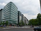
370 | Peter Joseph Lenné (1789–1866), Prussian garden artist and landscape architect of German classicism | Aug 19, 1839 | The street is part of the Lenné triangle (Lennéstraße, Bellevuestraße, Ebertstraße ), which came to center as a result of the district reform in 1938 . Cut off during the construction of the Berlin Wall in 1961, it was added to what was then the Tiergarten district on July 1, 1988 through an exchange of territory agreed by the Berlin Senate and the GDR . As an extension of Tiergartenstrasse, it joins Ebertstrasse. There are five city villas of the Beisheim Center here . The previous name from the 18th century to 1831 was Kanonenweg . This was renamed Thiergarten-Straße . The part between Königgrätzer (after the Second World War Ebertstraße) and Kemperplatz was named Lennéstraße on August 19, 1839. |
|
| Lichtensteinallee
( Location ) |
140 |
Martin Hinrich Lichtenstein (1780–1857), doctor, researcher, zoologist, initiator of the Berlin Zoo |
5th Sep 1867 | The Fasanenallee already existed here in the 19th century because it connected the Großer Stern with the Pheasant Garden, which is now the zoo . The part to the south of the Landwehr Canal was drawn in as a public road in 1927. On May 28, 1964, the section between Tiergartenstrasse and Großem Weg (Parkweg) was drawn in. The Spanish embassy here from 1940 is a listed architectural monument . Here is the entrance to the Café am Neuen See . |

|
| Linkstrasse
( Location ) |
460 | Heinrich Friedrich Link (1767–1851), natural scientist | Jan. 22, 1845 | The street connects Reichpietschufer with Potsdamer Platz . As part of the exchange of areas in 1972, the area between Linkstrasse and Köthener Strasse, on which the route of the underground ( line U2 ) was located, was added to West Berlin. On January 24, 1973, the new street between Bellevuestrasse and Kehre to Linkstrasse was named in the same way. In the course of the redevelopment of Potsdamer Platz in the 1990s, it was moved parallel to the east and rebuilt and now only leads to Potsdamer Platz. The open space created behind the Weinhaus Huth became Fontaneplatz . |

|
| Ludwig-Beck-Strasse
( Location ) |
110 |
Ludwig Beck (1880–1944), general and resistance fighter against the Nazi regime |
Dec 3, 1997 | Ludwig-Beck-Strasse connects Potsdamer Strasse with the old Potsdamer Strasse. It was created as part of the rebuilding of the Potsdamer Platz area. | |
|
Ludwig-Erhard-Ufer
( Location ) |
470 |
Ludwig Erhard (1897–1977), politician ( CDU ), Federal Chancellor |
around 2009 | The Ludwig-Erhard-Ufer is a promenade on the banks of the Spree in the Spreebogenpark. It runs on two levels from the Moltkebrücke to the Kronprinzenbrücke. |

|
|
Lützowplatz
( Location ) |
160 × 100 | Ludwig Adolf Wilhelm von Lützow (1782–1834), Prussian general of the Lützow Free Corps | Nov 23, 1869 | The square was laid out as Straße 28 and Platz 5, Section IV of the development plan. Schillstrasse was also renamed Lützowplatz on September 8, 1929 at the same level as the square. The busy place is south of the Landwehr Canal . The Lützow-, Eine-, Schill- and Klingelhöferstraße as well as the Lützowufer at the Herkulesbrücke flow into it .
To the east is the house on Lützowplatz , where the cabaret artist Wolfgang Neuss beat his drum. The Stiftung Warentest has its headquarters in numbers 11–13 . The Hotel Berlin, Berlin is located on the south side . |

|
| Lützowstrasse
( Location ) |
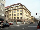
1260 | Ludwig Adolf Wilhelm von Lützow (1782–1834), Prussian general of the Lützow Free Corps | May 23, 1867 | From the 18th century until July 10th 1842 it was the Lietzower Weg . The route originally led from Hallesches Tor to the village of Lietzow in Charlottenburg . The traffic route now connects Lützowplatz with Flottwellstrasse. Several listed monuments are located here, such as the Rütgershaus from 1911, which was used by De Gruyter Verlag in the 21st century, or the Maggihaus from 1909. The Protestant Elisabeth Clinic is on property 24–26. The Schwule Museum has been located in Lützowstraße 73 since 2013 . The commercial building at Lützowstraße 106 was built in the 1970s with a sauna and swimming pool for the employees; the Lützow sauna is located there today. |
|
| Lützowufer
( Location ) |
960 | Ludwig Adolf Wilhelm von Lützow (1782–1834), Prussian general of the Lützow Free Corps | Nov 6, 1849 | The road was created when the Landwehr Canal was built . On July 1, 1965, the section of the garden bank between Budapester Strasse up to the level of Lichtensteinallee was also renamed Lützowufer, and on July 4th it was renamed Katharina-Heinroth-Ufer. The Grand Hotel Esplanade is located on Lützowstraße . |

|
|
Magdeburg Square
( Location ) |
130 × 80 | Magdeburg , capital of Saxony-Anhalt | July 23, 1874 | In the case of the 1872 complex, it was named Place A, Section V of the development plan. Road 35 , which runs along the south side of the square , was also included. |

|
| Marlene-Dietrich-Platz
( Location ) |
80 × 70 × 30 (triangular) |
Marlene Dietrich (1901–1992), German-American actress and singer |
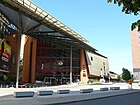
Nov 8, 1997 | The square in the middle of Eichhornstrasse forms the south-western end of Alte Potsdamer Strasse. This is where the Berlin casino and the Potsdamer Platz theater are located . In BlueMax Theater has Blue Man Group domiciled. |
|
| Matthäikirchplatz
( Location ) |
130 × 40 | adjoining St. Matthew's Church | Sep 7 1846 | The square was the center of the "privy council quarter", an upper-class residential area in Tiergarten, which stood in the way of the plans for the " world capital Germania " and was therefore largely demolished before the Second World War . After the war, in which the last remnants of the district were destroyed, the church was given its external shape. The square became the focus of the cultural forum . The St. Matthew Church is a listed architectural monument . |

|
| Müller-Breslau-Strasse
( Location ) |
110 (in the district) |
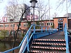
Heinrich Müller-Breslau (1851–1925), civil engineer and professor, rector at the Technical University of Charlottenburg | Apr 1, 1967 | From 1849 to 1967 garden shores . The part between Fasanenstrasse and the pedestrian bridge to Schleuseninsel belongs to Charlottenburg . |
|
|
Olof Palme Square
( Location ) |
130 × 120 × 60 (triangular) | Olof Palme (1927–1986), Swedish politician and two-time Prime Minister of Sweden | March 1, 1991 | The square was created by turning Budapester Strasse into Nürnberger Strasse in the 1980s and at that time had no name. Here is the entrance to the Berlin Aquarium and a little further the elephant gate as the entrance to the zoological garden . |

|
| Otto-von-Bismarck-Allee
( Location ) |
340 |
Otto Bismarck (1815–1898), Prime Minister of Prussia and Federal Chancellor of the North German Confederation and first Chancellor of the German Empire |
Jan 16, 1998 | The street runs from the entrance building of the Federal Chancellery to the north side of the Paul-Löbe-Haus . The Swiss Embassy in No. 4 from 1871 is a listed building monument . |

|
|
Paul-Löbe-Allee
( Location ) |
700 | Paul Löbe (1875–1967), politician ( SPD ) and President of the Reichstag | Jan 16, 1998 | The street runs from the congress hall on the south side of the Federal Chancellery , further past the Paul-Löbe-Haus to the bank of the Spree . From 1882 to 1971 it was called Reichstagplatz , from 1971 to 1998 Paul-Löbe-Straße . |

|
|
Republic Square
( Location ) |
280 × 170 | Weimar Republic | Aug 2, 1926 | The square was built around 1735 as a parade ground. In 1867 the square was designed in terms of garden architecture and called it Königsplatz (1865–1926). The Victory Column was erected here in 1873 , and the Reichstag building was added by 1894 . The Kroll Opera House was on the west side, the General Staff building on the north-west corner and the Palais' des Alsenviertel , of which the Swiss Embassy still exists , in the north . In 1926 the area was called the Republic Square, but it was in the era of National Socialism in royal court rückbenannt. It wasn't until 1948 that it got its current name back.
After the Second World War the place was used for rallies; Ernst Reuter gave his memorable speech on the occasion of the Berlin blockade in front of 300,000 people here in autumn 1948 . Until the fall of the wall , the meadow was used for recreational activities. With the wrapping of the Reichstag in 1995, the redesign of the square and the government district was initiated. The Republic Square and the Spreebogenpark are part of the concept, which includes the partial areas of Ebertplatz with Spreetreppe, the citizens' forum between the Chancellery and House of Parliamentarians, the sculpture meadow and the harbor square in the vicinity of the House of World Cultures. |

|
| Pohlstrasse
( Location ) |
840 |
Ottilie Pohl (1867–1943), politician and resistance fighter |
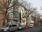
July 31, 1947 | When it was built, it was called Steglitzer Strasse (1862–1936), then Ludendorffstrasse (1936–1947). It originally ran from Genthiner Strasse to Flottwellstrasse. The part between Kluckstrasse and Genthiner Strasse was withdrawn on March 16, 1977 and deleted from the street directory on March 28, 1977. The part on Flottwellstrasse and in Flottwellstrasse itself, which had been fallow for a long time, was built on in the 2010s. |
|
|
Potsdamer Platz
( Location ) |
180 × 90 | former Potsdam Gate | July 8, 1831 | Potsdamer Platz was created in the 18th century as a traffic distributor directly in front of Potsdamer Tor and was called Platz in front of Potsdamer Thor from around 1735 to 1831 . The Potsdamer Bahnhof , built in 1838 , made it one of the busiest squares in Berlin. Due to its proximity to the government district, the buildings on the square were almost completely destroyed by the end of World War II and then cleared of rubble . Due to the division of the city into four sectors and especially due to the construction of the wall , the square got into a peripheral location. The area became livelier again as a result of the area swap in 1971 (U-Bahn line on Linkstrasse) and 1988 (Lennédreieck). From 1983 the M-Bahn was built between Kemperplatz and Gleisdreieck. With the fall of the Berlin Wall on November 9, 1989, Potsdamer Platz was suddenly back in the center of the city. In the 1990s, a new urban district was built on and around the area, dominated by high-rise buildings and colloquially known as Potsdamer Platz. Plots 8 and 9 belong to the district of Mitte , all other properties belong to the district of Tiergarten. The Potsdamer Platz S-Bahn station is a listed building monument . |

|
|
Potsdamer Strasse
( Location ) |
1500 (in the district) |
Potsdam , capital of the state of Brandenburg. | July 8, 1831 | Potsdamer Straße is the first paved “art road” ( Chaussee ) in Prussia (1790–1792) and connected Berlin with Potsdam. The course of the road north of the Landwehr Canal was changed when the Kulturforum was built . There are many important new and old buildings in the street , such as the Sony Center by Helmut Jahn , the Kulturforum and the State Library . This is followed by the Neue Nationalgalerie by Ludwig Mies van der Rohe and on the Landwehr Canal the office building by Loeser & Wolff, built in 1929 according to plans by Albert Biebendt . The building ensemble 103, 105 and 107 between Pohlstrasse and Kurfürstenstrasse is also a listed building monument . Also noteworthy is the Anton von Werner House at Potsdamer Strasse 81a, where the artist Anton von Werner lived from 1874. |

|
|
Rauchstrasse
( Location ) |
360 | Christian Daniel Rauch (1777–1857), sculptor | 5th Sep 1867 | Various embassies have their headquarters in Rauchstrasse: Opposite the Nordic embassies is the Georgian embassy (No. 11), at No. 25 the Embassy of Syria . The Supreme Restitution Court for Berlin had its seat in the building of the Yugoslav Legation at Rauchstrasse 17/18 . The city villas here were built as part of IBA 84 . On October 8, 1874, the extension of Rauchstrasse from Hitzigstrasse (now Stülerstrasse) to Strasse 21 was given the same name. |

|
|
Reichpietschufer
( Location ) |
1500 |
Max Reichpietsch (1894–1917), organizer of the anti-war movement in the Imperial Navy |
July 31, 1947 | The first names were Grabenstrasse (1831-1867), Königin-Augusta-Strasse (1867-1933) and Tirpitzufer (1933-1947). The Reichpietschufer runs from Köthener Strasse (border with the Kreuzberg district ) on the northern bank of the Landwehr Canal to Von-der-Heydt-Strasse. Several listed buildings are located here, such as the house of the Transatlantic Goods Insurance Company , the former Reich Insurance Office, the Berlin Science Center for Social Research , which was built from 1984 to 1987 , the Shell House . The Bendlerblock with the German Resistance Memorial is located between Stauffenbergstrasse and Hildebrandtstrasse . The Friedrich-Ebert-Stiftung building is on Hiroshimastraße . At the Villa von der Heydt it finally turns into Von-der-Heydt-Straße. The Landwehr Canal and with it the Reichpietschufer form the border between the Tiergarten district, which is defined by embassies and public buildings, and the social hotspot “Tiergarten-Süd”. |

|
| Rudolf-von-Gneist-Gasse
( Location ) |
140 |
Rudolf von Gneist (1816–1895), Prussian lawyer and politician |
Dec 3, 1997 | Rudolf-von-Gneist-Gasse is a short street between Marlene-Dietrich-Platz and Linkstraße, which is interrupted by the Potsdamer-Platz arcades . It was created as part of the rebuilding of the Potsdamer Platz area . |

|
|
Scharounplatz
( Location ) |
150 × 40 |
Hans Scharoun (1893–1972), architect |
23 Dec 2019 | Scharounplatz replaces Scharounstraße, which together with Herbert-von-Karajan-Straße form the access to the Chamber Music Hall and Philharmonie. The square runs across the Kulturforum and is intended to enhance the area around the Philharmonie as part of the urban planning concept. | |
| Scharounstrasse
( Location ) |
110 |
Hans Scharoun (1893–1972), architect |
Sep 20 1993 | From 1874 to 1993 it was called Margarethenstrasse . Together with Herbert-von-Karajan-Straße, it leads around the chamber music hall and the philharmonic orchestra . |

|
|
Scheidemannstrasse
( Location ) |
620 | Philipp Scheidemann (1865–1939), politician | Oct 24, 1965 | When it was built, it was called Simsonstrasse from 1895 to 1938 , and Sommerstrasse from 1938 to 1965 . It was renamed Sommerstrasse in 1938 by Eduard von Simson (1810–1899) because of its Jewish origins . Scheidemannstrasse runs as an extension of Dorotheenstrasse between the Reichstag building and the large zoo and thus delimits the government district . On September 11, 1970, the newly built section of road between Entlastungsstraße and John-Foster-Dulles-Allee was given this name to continue west of Scheidemannstraße. |

|
| Schellingstrasse
( Location ) |
210 | Friedrich Wilhelm Joseph Schelling (1775–1854), main exponent of the philosophy of German idealism | Jan. 12, 1856 | Schellingstrasse connects Linkstrasse with Eichhornstrasse. In the course of the construction work on Potsdamer Platz , its course was changed. It previously ran to the Reichpietschufer . | |
| Schillstrasse
( Location ) |
140 | Ferdinand von Schill (1776–1809), Prussian officer and militant | July 6, 1870 | When it was built, it was called Straße 22, Section IV of the development plan. As an extension of the street An der Urania, it leads to Lützowplatz . This is where the Constanze Press House, built in 1971 by the Gruner + Jahr Group, and the Hotel Berlin, Berlin are located . |

|
| Schöneberger Ufer
( Location ) |
980 (in the district) |
Berlin-Schöneberg , part of the Tempelhof-Schöneberg district | Nov 6, 1849 | The street leads on the southern bank of the Landwehr Canal as an extension of the Tempelhofer Ufer from Schöneberger Straße, to which the name referred, to Kluckstraße where it merges into Lützowufer. The studio house of the Association of Berliner Künstlerinnen from 1911 is located at No. 71. Houses 57 and 61 from 1858 to 1859 are among the oldest buildings south of the Landwehr Canal. From 1935 to 1947 she was called Großadmiral-von-Koester-Ufer . |

|
| Sigismundstrasse
( Location ) |
370 | Sigismund, Prince of Prussia (1864–1866), son of Friedrich III. | Jan. 26, 1865 | Sigismundstrasse connects Stauffenbergstrasse and Potsdamer Strasse at the rear of the picture gallery with the integrated Villa Parey. |

|
|
Spreeweg
( Location ) |
350 | Spree | Dec. 1, 1832 | The Spreeweg leads from the Großer Stern to the Lutherbrücke . This is where the official residence of the Federal President is located , Bellevue Palace from 1784 with Bellevue Palace Park and the official building of the Federal President's Office . The Spreeweg used to lead from the Großer Stern to the Spree and along it to the Kurfürstenplatz (Zeltenplatz). In 1934 the part from Lutherbrücke to Kurfürstenplatz was renamed Schlieffenufer and in 1959 part of John-Foster-Dulles-Allee. |

|
| Stauffenbergstrasse
( Location ) |
470 |
Claus Schenk Graf von Stauffenberg (1907–1944), officer, resistance fighter against the Nazi regime , assassin of Adolf Hitler on July 20, 1944 |
Jul 20, 1955 | From 1837 to 1955 it was called Bendlerstraße after the councilor mason and local politician Johann Christoph Bendler . It connects Tiergartenstrasse and Reichpietschufer . The German Resistance Memorial Center is located here . The Egyptian Embassy is located in No. 6/7 . House No. 41 is the listed Villa Friedmann from 1908. |

|
|
June 17th Street
( Location ) |
1700 + 860 (in the district) |
June 17th uprising in the GDR | July 13, 1953 | Previous names in Tiergarten were Charlottenburger Chaussee (1799-1935 and 1945-1953) and East-West Axis (1935-1945). It connects the Brandenburg Gate with the Ernst-Reuter-Platz and emerged in 1697 as a link between the Berlin City Palace and the Charlottenburg Palace . It is interrupted by the big star . Besides the Berlin Pavilion in the Hansaviertel , the Victory Column and the Soviet Memorial from 1946, there are no other buildings here. |

|
| Stülerstrasse
( Location ) |
320 | Friedrich August Stüler (1800–1865), architect, Prussian court building inspector and court building officer (since 1832) | 17 Sep 1938 | From 1867 to 1938 it was called Hitzigstrasse . It connects Budapester Strasse and Tiergartenstrasse. The embassy of the Republic of Korea is located in No. 10 . On the eastern side is the Tiergarten triangle and the back of the Nordic embassies . |

|
|
Theater bank
( Location ) |
180 + 170 | Location to the theaters on Marlene-Dietrich-Platz | around 1997 | The Theaterufer is a footpath that leads from Marlene-Dietrich-Platz on both sides of the fountain at the debis-Haus to the Reichpietschufer . |

|
| Thomas-Dehler-Strasse
( Location ) |
280 |
Thomas Dehler (1897–1967), politician (DDP and FDP) |
May 23, 1975 | When it was renamed, the part of Tiergartenstrasse that was called Stülerstrasse from 1867 to 1938 was involved. When the area was redesigned from 1973 to 1975, Thomas-Dehler-Strasse, which previously ran to the new Stülerstrasse, became a dead end. The Danish Embassy from 1940 is located in No. 1 . |

|
|
Tiergartenstrasse
( Location ) |
1340 | Zoo | July 8, 1831 | A cannon path has existed here since the 18th century, indicating a military training area. Tiergartenstrasse is the southern boundary of the Tiergarten to the Tiergartenviertel . As a continuation of Stülerstraße, it leads to Bellevueallee, where it turns into Lennéstraße. There are numerous embassies and public buildings on it. The musical instrument museum and the philharmonic orchestra , built according to plans by Hans Scharoun , are on plot 1 . The Kulturforum is located between Herbert-von-Karajan-Strasse and Stauffenbergstrasse . Number 12 is the Austrian embassy , next to number 15 is the state representation of Baden-Württemberg , number 17 is the Indian embassy , followed by the South African embassy . The new Turkish embassy was built in 2011/2012 on property 19–21, which has been owned by the (then) Ottoman Empire since 1918 . The Italian Embassy from 1941 is located at number 22. The Japanese Embassy is located on Hiroshima Street . The Canisius College is housed at number 30/31 in the former Krupp House from 1938. Next to it in number 34 there is the Saudi Arabian embassy and finally in number 35 the building of the Konrad-Adenauer-Stiftung .
On the north side, in the Great Tiergarten, there is the Richard Wagner monument and the monument to the Élysée Treaty . |

|
| Tiergartenufer
( Location ) |
930 | Great zoo | The Tiergartenufer is a footpath on the north bank of the Landwehr Canal between Straße des 17. Juni and Lichtensteinallee. |

|
|
|
Varian Fry Street
( Location ) |
60 | Varian Fry (1907–1967), American journalist and freedom fighter | Dec 3, 1997 | Varian-Fry-Straße is a short street on the Potsdamer Platz area that connects Potsdamer Straße with Alte Potsdamer Straße. It was created as part of the rebuilding of the area. | |
| Von-der-Heydt-Strasse
( Location ) |
230 | August von der Heydt (1801–1874), German banker, Prussian trade and finance minister | Oct 16, 1861 | Von-der-Heydt-Straße is the continuation of the Reichpietschufer to Klingelhöferstraße. This is where the von der Heydt villa is located , where the administration of the Prussian Cultural Heritage Foundation and the Bauhaus archive are located . |

|
| Voxstrasse
( Location ) |
150 | Former Vox house from which Germany's first radio program was broadcast | Dec 3, 1997 | Voxstrasse is a short street on the Potsdamer Platz area that connects Eichhornstrasse with Alten-Potsdamer-Strasse. It was created as part of the rebuilding of the area. The Berlinale cinema Cinemaxx is located here . |

|
|
Wichmannstrasse
( Location ) |
440 | Ludwig Wilhelm Wichmann (1788-1859), sculptor | Aug 15, 1873 | The previous names were Street 23a and Street 23b, Section IV of the development plan. It leads from Lützowplatz to Budapester Straße and ends there as a dead end at the Franziskus Hospital . |

|
| Willy-Brandt-Strasse
( Location ) |
380 + 270 | Willy Brandt (1913–1992), politician and Federal Chancellor ( SPD ), winner of the Nobel Peace Prize | Jan 16, 1998 | Willy-Brandt-Straße leads from the Moltkebrücke past the Chancellery ( pedestrian zone ) to Otto-von-Bismarck-Allee. Before it was renamed, it was called Moltkestrasse, named after Helmuth Karl Bernhard von Moltke , and before the renovation was a functional part of the relief road through the Tiergarten. The area in front of the Chancellery is closed to car traffic and may only be used by BVG buses and cyclists. Public transport runs around the Swiss embassy and ends in Paul-Löbe-Allee. However, this part has no name. According to a decision by the city development administration, this section is to be dismantled by 2014 and traffic on the north bank of the Spree is to be routed via Kapelle-Ufer and Konrad-Adenauer-Straße. On September 17, 1999, Federal Chancellor Gerhard Schröder , Brandt's son Peter Brandt and Walter Momper symbolically unveiled a street sign for Willy-Brandt-Strasse, number 1 of which is the Chancellery, during a small ceremony. |

|
|
Yitzhak Rabin Street
( Location ) |
220 | Yitzchak Rabin (1922–1995), Israeli premier and winner of the Nobel Peace Prize | Apr 29, 2004 | The street is part of the former relief road . The solemn naming was made by Israeli President Moshe Katzav . |

|
Some former streets and squares
| Name / location, picture if applicable |
Origin of name | Name since | Name up | Notes current street name |
|---|---|---|---|---|
| Albrechtshof, Albrechtshofer Ufer, Albrechtshof-Ufer | Albrechtshof, since 1835 the name of a property owned by the widow Albrecht | Nov 6, 1849 | May 9, 1867 | The street was in the 33rd police station and in the 48th city district district ( Moritzhof , in the 19th century today's districts did not yet exist). It was laid out as a riverside path along the Landwehr Canal, which was completed in 1850. |
| Flower yard | Johann Carl Friedrich Blume (1819–1875), banker | June 26, 1864 | Aug 6, 1964 | The merchant and owner of the exchange and banking business Friedrich Blume u. Comp. in Leipziger Strasse had the road laid out as a private road and received special permission to call the traffic route Blum's court . It ran from Schöneberger Ufer to Lützowstraße and comprised 15 parcels with horseshoe numbering. The section between the northern street boundary and the corner of Schöneberger Ufer was canceled in November 1962, and the rest of the street disappeared from the official documents on August 6, 1964. In 1931, the government architect Alexander Beer lived here in house number 15 . |
| Kronprinzenufer | Crown Prince , designation of the heir to the throne of kings. Here related to Friedrich Wilhelm of Prussia (1831–1888), 1888 as Friedrich III. "99-day emperor " | June 8, 1871 | Apr 11, 1978 | The Kronprinzenufer ran in the Spreebogen from the Kronprinzenbrücke to the Moltkebrücke . This section was merged with Richard-Wagner-Straße and part of the Spreeweg and renamed in 1934 . The remaining section was incorporated directly into the Bettina-von-Arnim-Ufer in 1978.
→ Schlieffenufer and → Bettina-von-Arnim-Ufer |
| Richard-Wagner-Strasse | Richard Wagner (1813–1883), composer | March 12, 1889 | Feb. 24, 1934 | with the Kronprinzenufer summarized for |
| Schlieffenufer | Alfred von Schlieffen (1833–1913), Prussian field marshal and army reformer | Feb. 24, 1934 | Jan. 20, 1991 | → Bettina-von Arnim-Ufer |
| Viktoriastrasse | Victoria (1840–1901), Princess of Great Britain and Ireland , wife of Emperor Friedrich III. | Dec 5, 1858 | Jan. 20, 1970 | The Viktoriastraße ran from the Königin-Augusta-Straße / Tirpitzufer (since 1947 Reichpietschufer ) to the Kemperplatz , merged into the Potsdamer Straße (south). The Berlin Philharmonic was later built in the northern section . |
Other locations of Tiergarten
Parks, islands and cultural institutions
- Großer Tiergarten , Berlin's second largest park after Tempelhofer Park , gave its name to the former Tiergarten district and the district
- Gas lanterns open air museum
- Henriette-Herz-Park behind the Sony Center symbolizes the break between East and West Berlin through its design .
- Luiseninsel
- Lock island
- Spreebogenpark
- Soviet memorial
- Tilla Durieux Park
- Tiergarten triangle
- Berlin Zoological Garden
- Cultural forum
Bodies of water and other facilities
- New lake
- Pedestrian tunnel to the Victory Column
- Tiergarten district
- Tiergarten triangle
Traffic areas
Government building
- Federal Chancellery
-
Paul-Löbe-Haus
Federal Chancellery and Paul-Löbe-Haus are part of the Federal Band and are located together with the - Reichstag building in the government district
- Bellevue Palace and
- Federal President's Office are in the Spreeweg
- Federal Ministry of Defense in the Bendlerblock
See also
- List of cultural monuments in Berlin-Tiergarten
- List of cinemas in Berlin-Tiergarten
- List of stumbling blocks in Berlin-Tiergarten
literature
- Monuments in the Mitte district of Berlin - Moabit, Hansaviertel and Tiergarten districts; Published by the Berlin State Monument Office; Michael Imhoff Verlag Petersberg 2005, ISBN 3-86568-035-6 .
Web links
- Map of Berlin 1: 5000 with district boundaries. Senate Department for Urban Development Berlin, 2009, accessed on February 26, 2011 .
- Street directory Tiergarten. kaupert media GmbH, accessed on February 25, 2011 .
- Office for Statistics Berlin-Brandenburg: List of streets and squares in the Mitte district (PDF as of February 2015)
- Hermann Jansen: Traffic regulation proposals, Berlin. Old West, 1925
- Hermann Jansen: Traffic regulation proposals, Berlin. Old West, thoroughfare and residential streets, 1925
Individual evidence
- ↑ Peter Brock (ed.): Berlin streets rediscovered. 33 forays through the capital. Jaron Verlag, Berlin 2003, ISBN 3-89773-114-2 , pp. 15-20: A neighborhood for visitors.
- ↑ House Huth
- ↑ Fire law firm Berlin
- ↑ Union House of the Confederation of Employees
- ↑ Africa House
- ↑ Bellevue Palace Park
- ↑ Kronprinzenufer on Luise-berline (Berlin city history one, two, three)
- ↑ Apartment building Bissingzeile 11
- ↑ Hotel Intercontinental
- ↑ Zoological Garden
- ↑ Lenz House
- ↑ Underground reinforcement line with building penetration
- ↑ DIN has its place ( Memento from March 5, 2014 in the Internet Archive )
- ↑ Danish embassy from 1940.
- ↑ former Yugoslav embassy
- ↑ John Erpenbeck: Founder. Volume I, Aufbau-Verlag, Berlin / Weimar 1972, p. 70.
- ↑ a b New construction project at Gleisdreieck . In: Der Tagesspiegel . July 18, 2012.
- ^ District management Tiergarten-Süd: Flottwellstrasse - where to? Retrieved July 19, 2012.
- ↑ Entry in the Berlin State Monument List
- ↑ Walter de Gruyter publishing house
- ↑ Big star with victory column, monuments and gatehouses
- ^ The Police President in Berlin: Road traffic casualty balance 2011 Road safety situation 2011 Berlin. ( Page no longer available , search in web archives ) Info: The link was automatically marked as defective. Please check the link according to the instructions and then remove this notice. (PDF; 3.4 MB)
- ↑ Philharmonic
- ↑ Chamber music hall
- ↑ Villa von der Heydt
- ↑ former Estonian embassy
- ↑ Villa Bergmann and Greek Embassy
- ↑ Italian embassy
- ↑ District Office Mitte: Who was Inge Beisheim ( Memento from October 16, 2014 in the Internet Archive )
- ^ Kauperts: Keithstrasse
- ↑ State Insurance Institute for the Province of Brandenburg
- ↑ Bauhaus Archive
- ↑ Youth hostel Kluckstrasse
- ↑ Tenement building at Kluckstrasse 36
- ^ Kauperts: Köbisstraße
- ↑ Post office W35 (telecommunications service building)
- ↑ address search in the RBS database on the map of Berlin 1: 5000, made by the district's survey offices
- ^ German Bundestag - Paul-Löbe-Haus - Konrad-Adenauer-Straße 1
- ↑ Stadtentwicklung.berlin.de: 20 main green paths - Tiergartenring (directions)
- ↑ Lenz House
- ↑ Monument Villa Roßmann Kurfürstenstrasse 58
- ↑ Villa Schwatlo & registry office Tiergarten
- ↑ Tenement house Kurfürstenstrasse 21, 22, 23
- ^ Kauperts: Lennéstrasse
- ↑ Spanish embassy
- ^ Page of the State of Berlin on the area exchanges since 1971
- ↑ Rütgershaus
- ↑ Maggi house
- ↑ ev. St. Matthew Church
- ↑ Swiss Embassy
- ↑ Potsdamer Platz S-Bahn station
- ↑ Cultural forum
- ↑ Loeser & Wolff GmbH
- ↑ Building ensemble Potsdamer Strasse 103, 105 and 107
- ↑ Anton von Werner House
- ↑ Transatlantic goods insurance company, used by GTZ in the 21st century
- ↑ Architectural monument Reich Insurance Office Reichpietschufer 50
- ↑ Shellhaus Reichpietschufer 60 monument, erected from 1930 to 1932 by Emil Fahrenkamp
- ↑ Reichsmarineamt with a memorial for the victims of July 20, 1944 and a memorial in the Hof & Bendlerblock
- ↑ Frederik Hanssen: 21 years after the master plan: Scharounplatz at the Kulturforum is ready. In: tagesspiegel.de . December 16, 2019, accessed December 19, 2019 .
- ↑ Atelier of the Association of Berlin Women Artists
- ↑ Schöneberger Ufer 57
- ↑ Schöneberger Ufer 61
- ↑ Villa Parey
- ↑ Bellevue Palace
- ↑ Bellevue Palace Park
- ↑ Villa Friedmann
- ↑ Soviet memorial
- ↑ Danish Embassy
- ↑ Musical instrument museum
- ↑ Information about the Turkish Embassy at berlin.emb.mfa.gov.tr. Retrieved September 13, 2013.
- ↑ Italian embassy
- ↑ Krupp house
- ↑ Falk city map from 1966 on landkartenarchiv.de
- ↑ Jörn Hasselmann, Alexander Haneke: No more secret path . In: Der Tagesspiegel. July 6, 2012, accessed July 6, 2013 .
- ↑ Albrechtshof-Ufer at www.berlingeschichte.de
- ↑ General housing = advertisement along with address = and business manual for Berlin, its surroundings and Charlottenburg for the year 1867 : streets and squares 1867 alphabetically as well as listing of the city districts according to numbers.
- ↑ Blumes Hof on www.luise-berlin.de
- ^ Berlin Jewish telephone directory 1931> Beer
- ↑ Viktoriastraße on luise-berlin.de (Berlin from A to Z)
- ^ Senate Department for Urban Development Henriette-Herz-Park


