List of streets and squares in Berlin-Hellersdorf
The list of streets and squares in Berlin-Hellersdorf describes the street system in the Berlin district of Hellersdorf of the Marzahn-Hellersdorf district with the corresponding historical references. At the same time, this compilation is one of the lists of all Berlin streets and squares .
overview
The current district is subdivided into two basic areas: the old village with what will later become the Hellersdorf estate and the new building areas that were built on disused sewage fields from the late 1970s. The names of the new streets were largely based on places in the GDR districts from which the construction workers were drawn; some main roads were given the names of GDR politicians such as Heinz Hoffmann , Albert Norden or Paul Verner . The latter street names were replaced by others from the 1990s onwards by a resolution of the Berlin Senate . After the reunification , further new building areas were built east and south of the first built.
The oldest still preserved street is the former Kaulsdorfer Straße (since 1937 Hellersdorfer Straße) to the south, originally named after its direction. Landsberger Chaussee (originally Chaussee to Alt-Landsberg ) in the north also existed at the beginning of the 19th century. The third oldest street is Cecilienstraße, an early connection between the villages of Marzahn and Kaulsdorf, which was called Albert-Norden-Straße between 1984 and 1992 .
In the 1940s there were first development plans beyond the eastern Berlin city limits, because on a map from 1943 some (still nameless) streets are indicated east of the Wuhle. As a rule, however, these streets were farm roads in the sewage fields.
Hellersdorf has 82,109 inhabitants (as of December 30, 2019) and includes the postcode areas 12619, 12627 and 12629.
Overview of streets and squares
The following table gives an overview of the streets and squares in the district as well as some related information.
- Name / location : current name of the street or square. Via the link Location , the street or the square can be displayed on various map services. The geoposition indicates the approximate center of the street length.
- Traffic routes not listed in the official street directory are marked with * .
- Former or no longer valid street names are in italics . A separate list may be available for important former streets or historical street names.
-
Length / dimensions in meters:
The length information contained in the overview are rounded overview values that were determined in Google Earth using the local scale. They are used for comparison purposes and, if official values are known, are exchanged and marked separately.
For squares, the dimensions are given in the form a × b for rectangular systems and for (approximately) triangular systems as a × b × c with a as the longest side.
If the street continues into neighboring districts, the addition ' in the district ' indicates how long the street section within the district of this article is. - Name origin : origin or reference of the name.
- Notes : further information on adjacent monuments or institutions, the history of the street and historical names.
- Image : Photo of the street or an adjacent object.
| Name / location | Length / dimensions (in meters) |
Origin of name | Date of designation | Remarks | image |
|---|---|---|---|---|---|
|
Adele-Sandrock-Strasse
( Location ) |
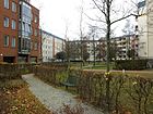
650 | Adele Sandrock (1863–1937), actress | June 1, 1992 | When Wohngebietsstraße was first built in 1987, it was called Erich-Wichert-Straße after MfS General Erich Wichert, who had died two years earlier . Along the double-angled street winding through the residential area stood u. a. a children's combination that was removed around 2007. Instead, the district office had a green area with curved paths, playgrounds and resting points created from the Stadtumbau Ost fund for around 147,000 euros. This is part of the 'Hellersdorf Park Trilogy' planned in a north-south direction. When it was completed, it was given the independent designation Mascha Kalekó Park . (see also under parks and waters ) In addition, the Melanchthon-Gymnasium is located here . |
|
| Adorfer Strasse
( Location ) |
440 | Adorf , city in Saxony | June 9, 1987 | In this short connecting street between Oelsnitzer and Nossener Straße are the day care center of the Evangelical Community Center Hellersdorf and a distribution point for the Berliner Tafel ('Laib und Seele'). |

|
| Albert-Kuntz-Strasse
( Location ) |
520 | Albert Kuntz (1896–1945), politician, resistance fighter against the Nazi regime | June 9, 1987 | It is slightly rolled up around a block of flats and runs from Louis-Lewin-Strasse westwards to Adele-Sandrock-Strasse. |

|
| Alice Salomon Square
( Location ) |
120 × 90 | Alice Salomon (1872–1948), politician, liberal social reformer in the German women's movement | Nov 20, 1995 | The square, which is sealed and partially covered with paving slabs, is crossed by the north-south street of Stendaler / Riesaer Strasse, and Hellersdorfer Strasse branches off to the west. At Alice-Salomon-Platz No. 3 is the Marzahn-Hellersdorf District Office (formerly Hellersdorf Town Hall ), at number 5 the Alice-Salomon University (study of social work and health and care management). Another major building is the MarktPlatzCenter (Stendaler Straße 94; in the center of the picture) on the square. |

|
| Alt-Hellersdorf
( Location ) |
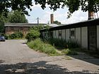
440 | Alt-Hellersdorf , the core of the 14th century village in the Niederbarnim district of the Mark Brandenburg | May 11, 1938 | When it was first built, it was referred to as Dorfstraße , the name itself first appearing in a document in 1926. Under house numbers 6–27, part of the development of the Vorwerk zum Gutshof has been preserved, including barns, workhouses and stables that were built between 1890 and 1900. Stables and storage were used by the LPG for plant and animal breeding until the 1960s . Later the village consumption moved into a building and the LPG switched to mushroom cultivation . After the fall of the Wall, other companies such as a driving school, transport company or craftsman moved to the historic buildings. The mentioned buildings are under monument protection. The street is a dead end and winds between Alte Hellersdorfer and Cottbusser Straße. |
|
| Old Hellersdorfer Strasse
( Location ) |
1810 | Hellersdorf , a village with an estate that was established in the Mark Brandenburg in the 14th century , is now part of the Marzahn-Hellersdorf district | March 5th 1985 | The road runs in a north-south direction between Landsberger Chaussee and Hellersdorfer Straße. It was named in the mid-1920s and was called in its northern part up to the street Alt-Hellersdorf Eichestrasse (after the direction to the village of Eiche ), in the southern part Kaulsdorfer Strasse , also after the direction. In 1937, both streets were merged to form Hellersdorfer Straße , which now ran to Hönower Straße in the Kaulsdorf district (since 1991: Heinrich-Grüber-Straße). With the construction of the new large residential buildings, the course of the southern part of Hellersdorfer Strasse was changed in 1985 and led to the northeast to the intersection with Stendaler / Riesaer Strasse. The part remaining towards Landsberger Chaussee was named Alte Hellersdorfer Straße. |

|
| Altentreptower Strasse
( Location ) |
340 (in the district) |
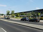
Altentreptow , town in Mecklenburg-Western Pomerania | June 16, 1989 | The street was laid out in connection with the construction of the Wuhletal S and U-Bahn station . It runs from Blumberger Damm in Biesdorf in the west parallel to the S-Bahn route to Parchimer Straße and continues as Gülzower Straße. The section from the bridge over the Wuhle to Parchimer Straße is in the district. |
|
| At the Baltenring
( Location ) |
170 (in the district) |
Balten , collective name for the inhabitants of countries on the Baltic Sea, also known as the 'Baltic Sea' | Nov 9, 1926 | Only the western tip between Lily-Braun-Straße and Uckermarkstraße (house numbers 1 and 74-83) belongs to the district. |

|
| Annaburger Strasse
( Location ) |
260 | Annaburg , city in Saxony-Anhalt | March 28, 1997 | The street connects Adele-Sandrock- with Louis-Lewin-Straße and continues to the east as Forster Straße . |

|
| Arneburger Strasse
( Location ) |
200 | Arneburg , city in Saxony-Anhalt | Apr 2, 2004 | At first it was a cross arm of Stendaler Strasse with house numbers 44–60 and 76–86 (straight). The street going east from Stendaler opens up the living area and was given its own name. |

|
| Auerbacher Ring
( Location ) |
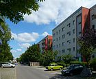
440 | Auerbach , city in Saxony | June 9, 1987 | The Auerbacher Ring branches off in a northerly direction from the Maxie-Wander- / Klingenthaler Strasse intersection and ends after a U-shaped course at the Maxie-Wander- / Schneeberger Strasse intersection. |
|
|
Bansiner Strasse
( Location ) |
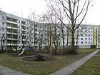
710 | Bansin , seaside resort on Usedom , Mecklenburg-Western Pomerania | Oct 8, 1980 | Bansiner Strasse is very winding between Ludwigsluster and Heringsdorfer Strasse. It has a partially parallel street layout (one arm with even house numbers, another with odd ones). This street was part of the first laid out and named street network in the large housing estate Hellersdorf. This section of the settlement was built by Rostock and Schwerin construction companies. |
|
| Bodo-Uhse-Strasse
( Location ) |
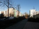
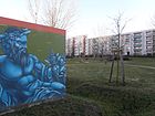
220 | Bodo Uhse (1904–1963), writer | July 15, 1986 | It connects Peter-Huchel- and Cecilienstraße in a north-south direction, and it also has a cross arm. On the former area of a daycare center , the Bodo-Uhse-Straße district park was created on 5617 square meters on behalf of the Stadt-und-Land-Wohnbauten-Gesellschaft with around 106,000 euros from the urban redevelopment program . 22 different trees were planted and some artificial palm trees were set up, which gave the new park the name 'Palmenhof' . In addition, a garage complex was built along Bodo-Uhse-Strasse, the exterior of which was artistically designed with graffiti. |
|
|
Böhlener Strasse
( Location ) |
1040 | Böhlen , city in Saxony | 2nd July 1987 | It is a west-east street between Louis-Lewin-Straße and Mahlsdorfer Straße in the Hönow district of the Brandenburg municipality of Hoppegarten, north parallel to the underground line , which runs here on the ground to the Hönow underground station . To the west, Böhlener Strasse continues as Weißenfelser Strasse. |

|
| Boizenburger Strasse
( Location ) |
540 | Boizenburg , town in Mecklenburg-Western Pomerania | Oct 8, 1980 | The boulevard is a north-south street (dead end) that ends south on Ludwigsluster Straße. About halfway along it has a cross arm that connects Parchimer with Gadebuscher Strasse. This street is part of the first established and named street network in the large housing estate Hellersdorf. The "Geomuseo Edelsteinplanet" is located in the "Green House", Boizenburger Strasse 52. The collection compiled here goes back to the initiatives of the geologist and environmental consultant Herbert Schlegel, who privately participated in a gold panning in the Thuringian Forest . He became a member of the 'German Society for Geological School and Public Education' and then began looking for stones, minerals and fossils himself in Berlin and Brandenburg. From the numerous guided excursions, around 300 special finds came together, including a vertebral bone of an Ice Age rhinoceros. The association also set up the small museum that can be visited free of charge. |

|
| Boulevard Kastanienallee
( Location ) |
1000 | Boulevard , wide comfortable path and chestnuts , deciduous trees | around 2000 | The Kastanienallee boulevard is a pedestrian area that begins in the north at a footbridge over the subway line in the open cut and ends in the south at Glauchauer Strasse. It is planted with numerous chestnut trees on both sides. Around the year 2000 it was given the suffix 'Boulevard' to distinguish it from the Kastanienallee north of the underground line .
In this stretch of road, which was laid out around 1987, there were initially numerous shops; since the opening of the Hellen Mitte in 1997 it has been more an area for walkers and cyclists. |
 
|
| Branitz square
( Location ) |
290 | Branitz , district of Cottbus with landscape park + square : rectangular arrangement of buildings / streets |
July 3, 2006 The naming ceremony took place on August 25, 2006. |
It is a square street, flanked by new residential buildings that enclose a green area. The Branitzer Karree runs from Schwarzheider to Annaburger Straße. A short section already existed in 1988 and formed a corner of Forster Strasse without its own name. |

|
| Branitzer Strasse
( Location ) |
270 | Branitz , district of Cottbus with landscape park | June 9, 1987 | It connects the Schönewalder with the Louis-Lewin-Strasse. |

|
|
Carola-Neher-Strasse
( Location ) |
1110 | Carola Neher (1900–1942), actress, victim of Stalinism | June 10, 1992 | It is a semicircular and forked road between Etkar-André-Straße and the district boundary to Kaulsdorf . It continues there as Uckermarkstrasse. At number 68 it branches off to Klingenthaler Straße. It was called Erwin-Kramer-Straße from 1986 to 1992. |

|
|
Cecilienplatz
( Location ) |
340 × 100 (elongated triangle) |
adjacent Cecilienstraße | 1997 | The place received its name in 1997 and was officially entered on maps and documents in 2006. There are three twelve-storey point buildings on the not clearly delimited square, and the station building is also on the square. A park-like water landscape was built in the center. The western area is a car park at the Kaulsdorf-Nord underground station . At some house entrances to the square, which, however, have the address Cecilienstraße, alienated sculptures were placed as house signs in 1998 . They come from César Othagaray and represent a. a. a 'devil' (no.230), an ' artist ' (no.232) and a female figure, officially without a title '(no.234). |

|
| Cecilienstraße
( Location ) |
1000 (in the district) |
Cecilie zu Mecklenburg (1886–1954), Prussian Crown Princess |
1910 (with interruption) |
It is a connecting road between two neighboring villages, which was initially called Road 14 . She carried the name of the Prussian noblewoman Cecilie until 1984, after which the street in Albert-Norden-Strasse , which was expanded with apartment blocks, was renamed after the GDR politician Albert Norden . The Senate resolution to rename street names led to the reassignment of the previous name in 1992. The greater part of the street is in Berlin-Biesdorf .
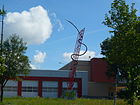
The sculpture in the picture is eleven meters high and made of steel and plastic, it stands on the premises of the Hellersdorf fire station and bears the title Helping between heaven and earth . It was designed by Wang Fu for an invitation competition for the Berlin fire brigade and was awarded first prize. It symbolizes a flame on a ladder and at the same time marks the district boundary between Hellersdorf and Marzahn. |
|
|
Clara-Zetkin-Platz
( Location ) |
120 × 60 (oval) |
Clara Zetkin (1857–1933), politician | June 13, 1997 | The regularly laid out and artfully planted jewelry area extends south of the Teterower Ring to Clara-Zetkin-Weg. In the middle there is a round fountain, which is surrounded by a strip of small granite stones. | |
| Clara Zetkin Way
( Location ) |
160 | according to the previously created Clara-Zetkin-Platz | Jan. 1, 2000 | The footpath between Ludwigsluster Straße and Teterower Ring was nameless when the road system was built around the Hellersdorf underground station. It touches the Clara-Zetkin-Platz. The Kaulsdorf swimming pool is located on a small hill on the square side. |

|
|
Cottbusser Platz
( Location ) |
160 × 100 | Cottbus , city in Brandenburg | March 5th 1985 | The square is enclosed by Spremberger Strasse (two sides), Cottbusser Strasse and Hellersdorfer Strasse; a connection to Cottbusser Straße also bears the postal name Cottbusser Platz. He is the namesake for the nearby Cottbusser Platz underground station . Various social buildings and shopping buildings stand on it, so that it is hardly perceived as a square in the narrower sense. Its boundaries are therefore rather fluid. |

|
| Cottbusser Strasse
( Location ) |
800 | Cottbus , city in Brandenburg | March 5th 1985 | The street laid out in west-east direction is the continuation of Gothaer Straße east of Alte Hellersdorfer Straße and connects it with Janusz-Korzcak-Straße. It has numerous cross arms. The Wolfgang Amadeus Mozart School is located at number 23 (community school in open all-day operation). |

|
|
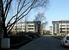
Döbelner Strasse
( Location ) |
650 | Döbeln , city in Saxony | July 8, 1987 | The street runs in a west-east direction between Nossener Straße and Paul-Levi-Platz. |
|
|
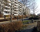
Ehm-Welk-Strasse
( Location ) |
490 | Ehm Welk (1884–1966), writer | Feb 11, 1983 | It is an access road to the east of the Kummerower Ring. |
|
| Eilenburger Strasse
( Location ) |
260 | Eilenburg , city in Saxony | 2nd July 1987 | Eilenburger Strasse bends between Gohliser and Böhlener Strasse. There are two schools on it, the 'Schule am Mummelsoll' (Mummel = yellow pond rose , Soll = small pond) and the 'Bookworm Primary School on the pond' (picture, left side). |

|
|
Eisenacher Strasse
( Location ) |
700 (in the district) |
Eisenach , city in Thuringia | March 5th 1985 | The Marzahner Straße , which existed around 1900, and the Hellersdorfer Weg , which was laid out around 1951, were merged into one continuous street in 1985. This busy street runs between Bärensteinstrasse, over Blumberger Damm in the Marzahn district and over Gothaer Strasse to Alten Hellersdorfer Strasse. It leads over the Wuhle , which also forms the border between Marzahn and Hellersdorf. The Gardens of the World are located on Eisenacher Strasse, with an entrance to the Marzahn area. Particularly striking are the three larger-than-life figures made of aluminum on the flat roofs of two high-rise buildings on the south side (number 61 and 63), which are known as the 'balancing act close to the sky'. The work of art is a symbolic representation of the daily coexistence of people, commissioned by the Hellersdorf housing association (WoGeHe) from the artist Hubertus von Goltz . The flat figures have been there since the renovation of the residential buildings was completed in 1998. |
|
| Erich-Kästner-Strasse
( Location ) |
700 | Erich Kästner (1899–1974), writer | June 25, 1992 | The first name when the road system was laid out in 1986 was Waldemar-Schmidt-Straße , in honor of SED politician Waldemar Schmidt . The double-angled traffic route runs between the Neue Grottkauer near the subway station of the same name and the street Peter-Huchel-Straße / Iselbergstraße. |

|
| Ernst-Bloch-Strasse
( Location ) |
700 | Ernst Bloch (1885–1977), philosopher | 4th June 1992 | It is an access road for a residential block that branches off northwards from Gülzower Strasse, then winds several times to the eastern boundary of the district. When it was first built in 1986, it was called Albert-Schreiner-Strasse after the communist politician and historian Albert Schreiner . At some house numbers on this street the affixing of house signs continues like on Cecilienplatz . Here, a 'French caterpillar' (no. 24), a 'pair of lovers' (no. 34) and a 'monkey woman' (no. 35) were designed by César Othagaray from metal-reinforced synthetic resin. | |
| Etkar-André Street
( Location ) |
410 | Etkar André (1894–1936), politician, resistance fighter | July 15, 1986 | It is an angled residential street that runs between Neue Grottkauer Strasse and Maxie-Wander-Strasse. At the southern end near the underground station Grottkauer Straße is the Hellersdorfer Corso shopping center , at its bend and the confluence of Carola-Neher-Straße is the 'Kulturforum Hellersdorf' (picture). |

|
|
Feldberger Ring
( Location ) |
820 | Feldberg , part of the municipality of Feldberger Seenlandschaft in Mecklenburg-Western Pomerania | Feb 11, 1983 | The Ring is a ring-shaped street east of Hellersdorfer Straße at the Kienberg underground station (Gardens of the World) ; the north side borders on the Jelena-Santic-Friedenspark . In the middle, the ring is divided by a cross connection. Sonnenkieker Street joins its western arch . |

|
| Fercher Street
( Location ) |
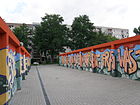
420 | Ferch , part of the community Schwielowsee in Brandenburg | July 22, 1987 | It runs between Kyritzer and Gothaer Straße in a west-east direction with a north arm. This ends at a playground as a dead end. Striking is a complex of car garages on the south side of the street, which were designed with colorful slogans and pictures by a graffiti artist. |
|
| Forster Street
( Location ) |
260 | Forst , district town in Brandenburg | June 9, 1987 | This angled street connects Louis-Lewin-Straße with Kaulsdorfer Straße; it continues at its southern end in Hönow, Brandenburg, as Am Berge. An unnamed drainage ditch runs along the city limits. |

|
|
Fritz-Lang-Platz
( Location ) |
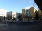
40 × 40 | Fritz Lang (1890–1976), Austrian-American film director | Nov 20, 1995 | This green space represents a regular rhombus , which is planted on the edges with a double row of deciduous trees, the middle with benches and a water basin invites you to linger. Together with Kurt-Weill-Platz to the northwest and Alice-Salomon-Platz to the southeast, a lively district center has been created. Some of the gated apartment blocks and commercial facilities built in the 1990s have green roof areas. |
 |
| Fritz-Lang-Strasse
( Location ) |
140 | Fritz Lang (1890–1976), Austrian-American film director | Nov 20, 1995 | It is part of the street network around the new Helle Mitte district center that was created in the 1990s and was named after artists. It connects Henny-Porten-Strasse in the north with Hellersdorfer Strasse in the south. |

|
| Frohburger Strasse
( Location ) |
180 | Frohburg , city in Saxony | July 31, 1998 | The north-south traffic route connects Riesaer Strasse with Döbelner Strasse and was laid out in the 1990s. |

|
|
Gadebuscher Strasse
( Location ) |
200 | Gadebusch , town in Mecklenburg-Western Pomerania | Oct 8, 1980 | The traffic route initially runs northwards from Ludwigsluster Strasse and then bends east to Lion-Feuchtwanger-Strasse. It is part of the first laid out and named road network of the large housing estate Hellersdorf. |

|
| Gadebusch way
( Location ) |
120 | Gadebusch , town in Mecklenburg-Western Pomerania | Jan. 1, 2000 | The footpath connects Boizenburger Strasse in the west with Gadebuscher Strasse in the east; 20 years after Gadebuscher Strasse was built, it received its own name. |

|
| Geithainer Strasse
( Location ) |
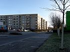
220 | Geithain , city in Saxony | Sep 30 1992 | The newly assigned street name originated from the branching access roads of Leisniger and Riesaer Strasse while retaining the house numbers. It connects Paul-Levi-Platz in the west with Riesaer Straße in the north. The Konrad-Wachsmann-Oberschule is located in this street. |
|
| Glauchauer Strasse
( Location ) |
220 (in the district) |
Glauchau , city in Saxony | June 9, 1987 | This street connects the Nossener Straße over the southern end of the boulevard Kastanienallee with the Grottkauer Straße; 75 meters are outside of the district and run through the suburb of Hellersdorf. The 'Evangelical Community Center Hellersdorf' with the 'TheaterSpielGemeinde e. V. ', meetings for young Christians and other activities. |

|
| Gohliser Strasse
( Location ) |
660 | Gohlis , district of Leipzig | 2nd July 1987 | The street in the northeast area of the district is bent between Torgauer Strasse in the northwest and Böhlener Strasse in the southeast and has a cross arm. In the eastern area it has a carriageway separated by a narrow green strip as access to the parking lots in front of the residential buildings. |

|
| Gothaer Strasse
( Location ) |
620 | Gotha , district town in Thuringia | March 5th 1985 | The street runs in a U-shape west of the Alte Hellersdorfer Straße, from which it branches off in the north and south. The southern connection continues eastwards as Cottbusser Straße . |

|
|
Gülzower Strasse
( Location ) |
1220 (in the district) |
Gülzow , a place in Pomerania, today Golczewo in Poland | June 9, 1933 | The street forms the southwest border of the district, only the section between Finsterberger and Heinrich-Grüber-Straße (district Kaulsdorf ) belongs to Hellersdorf . The house number ranges 15 and 76-105 belong to Hellersdorf, the rest (2–74) to Kaulsdorf. Before it was officially named, it was Street 90 . |

|
|
Havelländer Ring
( Location ) |
1060 | Havelland , region in Brandenburg | March 5th 1985 | This rectangular street docks to the east on Kastanienallee and surrounds an S-shaped residential complex. One of the previous two schools has now been demolished. There is also the 'Evangeliums-Christen-Gemeinde' (ECG) founded in 2004 at number 40. The seat of the ECG was created through the conversion of the former residential area restaurant Zur alten Schäferei . Their facades are decorated with ceramic shepherd motifs by Elena von Martens , which were completed in 1988. In the garden of the complex there is further jewelry from Sigrun Pfitzenreuter (terracotta steles , Funny Bucks).
In May 2007 the western connecting pieces to Kyritzer Straße / Neuruppiner Straße were included in the Havelländer Ring. |
 
|
| Heidenauer Strasse
( Location ) |
500 | Heidenau , city in Saxony | June 9, 1987 | It is a street with multiple angles, with one arm between Riesaer and Mark-Twain-Straße. The “Kiste” has established itself in house number 10, a small cultural meeting point for music and singing. |

|
| Hellersdorf promenade
( Location ) |
60 | Hellersdorf , a village with an estate that was established in the Mark Brandenburg in the 14th century , is now part of the Marzahn-Hellersdorf district | Apr 2, 2004 | The straight pedestrian path in north-south direction between a cross arm of the Stendaler and Tangermünder Straße has shops on both sides. The promenade continues to the south in Lyonel-Feininger-Strasse. The Hellersdorfer Promenade is also known as the "City Mile". The promenade with the adjacent streets was upgraded in the 2000s with funding from the State of Berlin in order to somewhat reduce the social problems that had arisen. |
 
|
| Hellersdorfer Strasse
( Location ) |
2700 (in the district) |
Hellersdorf , a village with an estate that was established in the Mark Brandenburg in the 14th century , is now part of the Marzahn-Hellersdorf district |
March 5, 1985 (in today's alignment) |
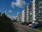
The busy street runs in a north-east-south-west direction, in large parts parallel to the underground line . It begins in the northeast at the Stendaler / Riesaer Strasse, to the south it ends at Heinrich-Grüber-Strasse (already in the Kaulsdorf district). From August 1910, only today's southern 400 meter long area between Gülzower and Heinrich-Grüber-Straße was called Hellersdorfer Straße. The extension of the street in the direction of Hellersdorf to today's Alte Hellersdorfer Straße was not named until 1942. Then the name went over to the entire traffic route up to Landsberger Chaussee in the north. In 1985 the northern part up to Landsberger Chaussee was separated and renamed Alte Hellersdorfer Straße . The Hellersdorfer Straße was continued in a north-easterly direction to the Stendaler / Riesaer Straße. A GDR museum apartment was set up at Hellersdorfer Straße 179, equipped with original furniture and showing the old floor plan of the WBS 70 apartment type . |
|
| Henny Porten Street
( Location ) |
240 | Henny Porten (1890–1960), actress | Nov 20, 1995 | It is part of the road network east and west of Stendaler Straße that was created in the 1990s and was named after artists. The west-east route begins at Kurt-Weill-Platz (Kastanienallee) and turns into Quedlinburger Strasse at the east end. |

|
| Heringsdorfer Strasse
( Location ) |
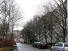
320 | Heringsdorf , seaside resort on Usedom in Mecklenburg-Western Pomerania | Jan. 1, 2000 | The slightly angled west-east street runs between Lion-Feuchtwanger- and Ludwigsluster Straße. |
|
| Hermsdorfer Strasse
( Location ) |
660 | Hermsdorf , city in Thuringia | June 9, 1987 | It connects a short southern arm of Riesaer Strasse with Heinrich-Grüber-Strasse in the Kaulsdorf district and is angled several times. One of the two entrances to the Schleipfuhl nature reserve is located on this street . |

|
| Hoyerswerdaer Strasse
( Location ) |
680 | Hoyerswerda , city in Saxony | June 9, 1987 | The street branches off from Louis-Lewin-Straße to the east and is in the shape of a half-umbrella with a loop. It represents the counterpart to Albert-Kuntz-Straße, which branches off to the west at the same point and roughly follows the mirror-image course. |

|
|
Jänschwalder Strasse
( Location ) |
130 | Jänschwalde , municipality in Brandenburg | June 9, 1987 | The street runs from Louis-Lewin-Straße in the west to the city limits in the east, where it merges into the street An der Schutzbepflanzung / Kaulsdorfer Straße, most of which already belongs to Hönow. |

|
| Janusz Korczak Street
( Location ) |
600 | Janusz Korczak (1878–1942), Polish doctor and educator, victim of National Socialism | Nov 20, 1995 | The road runs from Hellersdorfer Straße to the north, bends at right angles to the east at Kurt-Weill-Platz and ends at Naumburger Ring. The Marzahn-Hellersdorf Employment Agency is located at Janusz-Korczak-Straße 32. |

|
| Jenaer Strasse
( Location ) |
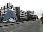
450 | Jena , city in Thuringia | June 9, 1987 | It leads south from Riesaer Straße and continues as Heinrich-Grüber-Straße on the border with the Kaulsdorf district . One of the two entrances to the Schleipfuhl nature reserve is located on this street . |
|
| Jerichower Strasse
( Location ) |
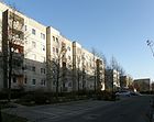
290 | Jerichow , city in Saxony-Anhalt | Apr 2, 2004 | It runs between Stendaler Straße and Hellersdorfer Promenade in a west-east direction with a transverse arm to develop the residential area. Before that it was part of Stendaler Strasse. |
|
| Johannes-Bobrowski-Strasse ( location ) |
240 | Johannes Bobrowski (1917–1965), writer | June 9, 1987 | The street takes an angled course between Martin-Riesenburger- and Lichtenhainer Straße. It encloses a spacious inner courtyard equipped with opportunities to play . |

|
| John Heartfield Street
( Location ) |
540 | John Heartfield (1891–1968), printmaker, photomontage artist | July 15, 1986 | The connection between Carola-Neher- and Etkar-André-Straße is interrupted roughly in the middle by a square-like transverse area. At the confluence with Etkar-André-Straße , the art objects 'Ceramic seating elements' stand in front of a small park. They were made by Martin Enderlein and Andreas Rauch on behalf of the Marzahn-Hellersdorf District Office and installed here in 2005. |

|
|
Kastanienallee
( Location ) |
890 | Chestnuts , deciduous trees | before 1926 | The road, which is almost straight in a north-south direction, is said to have existed as a connection between Mahlsdorf and Eiche in earlier centuries ; it was first mentioned on a map from 1926. It is also shown on a Berlin city map from 1954. The road lined with chestnut trees runs between Zossener Straße and Hellersdorfer Straße and has many cross arms for development. It was shortened to the northern area in 1993 as a motor road. The southern area was given the new name Boulevard Kastanienallee . The children's research center "Helleum" is located in house number 59. This is a joint project between the Senate Education Administration , the District Office and the Alice Salomon University and was awarded on January 14, 2014 as an outstanding “educational idea ” within the framework of the federal competition Ideas for the Republic of Education . |
 |
| Klausdorfer Strasse
( Location ) |
400 | Klausdorf , part of the municipality Am Mellensee in Brandenburg | July 22, 1987 | The street connects the Alte Hellersdorfer Straße with the Zossener Straße . There is the intercultural center 'Babylon' here. |

|
| Klingenthaler Strasse
( Location ) |
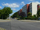
440 | Klingenthal , city in Saxony | June 9, 1987 | Klingenthaler Strasse runs in a north-east-southwest direction between Maxie-Wanderstrasse and Glauchauer Strasse. |
|
|
Kokoschkaplatz
( Location ) |
30 (diameter) |
adjacent Kokoschkastraße | around 2001 | It is a green roundabout and separates Kokoschkastraße into a north and a south area. Kurt-Weill-Gasse and Peter-Weiss-Gasse run towards him. |

|
| Kokoschka Street
( Location ) |
220 | Oskar Kokoschka (1886–1980), Austrian painter and writer | Jan. 19, 1996 | It is part of the road network east and west of Stendaler Strasse that was built in the 1990s and was named after artists. It runs between Quedlinburger Strasse and Nelly-Sachs-Strasse over Kokoschkaplatz. |

|
| Koserower Strasse
( Location ) |
220 | Koserow , municipality in Mecklenburg-Western Pomerania | Jan. 1, 2000 | The slightly angled west-east street between Lion-Feuchtwanger- and Ludwigsluster Strasse was laid out around the turn of the millennium. |

|
| Kummerower Ring
( Location ) |
740 | Kummerow , municipality in Mecklenburg-Western Pomerania | Feb 11, 1983 | The street is a ring-shaped residential area development street west of Hellersdorfer Straße. The ring is divided in the middle by means of a cross connection. Sonnenkieker Street joins its western arch . |

|
| Kurt-Weill-Gasse
( Location ) |
180 | Kurt Weill (1900–1950), composer | Nov 20, 1995 | It is part of the road network east and west of Stendaler Straße that was created in the 1990s and was named after artists. This lane cuts through the new urban center of Hellersdorf in a north-west / south-east direction between Janusz-Korczak-Strasse and the back of the Marzahn-Hellersdorf town hall on Alice-Salomon-Platz . |

|
|
Kurt-Weill-Platz
( Location ) |
40 × 40 | Kurt Weill (1900–1950), composer | Nov 20, 1995 | The square is a natural green area (see picture). It was acquired around 2000 by a now insolvent real estate company, which was supposed to have it designed as a town square . In 2008, with funds from the Senate Department for Urban Development, the Green Space Office planted trees on the edge of the square and set up benches. In 2012 the paths were paved with paving slabs. |

|
| Kyritzer Strasse
( Location ) |
890 | Kyritz , city in Brandenburg | July 22, 1987 | The U-shaped traffic route between Eisenacher and Gothaer Straße has a junction in the east-west direction at the northeastern end, which ends as a dead end after crossing the Alte Hellersdorfer Straße . |

|
|
Leisniger Strasse
( Location ) |
320 | Leisnig , city in Saxony | July 28, 1989 | The north-south traffic route connects Riesaer Straße with Waldheimer Ring and has been renamed from previous sections of Döbelner Straße . It touches the Paul-Levi-Platz. |

|
| Lichtenhainer Strasse
( Location ) |
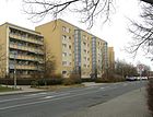
650 | Lichtenhain , part of the city of Sebnitz in Saxony | June 9, 1987 | The Berlin city limits still ran in the direction of this street (north-south) in 1988, the streets to the east such as Albert-Kuntz-Straße or Oschatzer Straße belonged to the Strausberg district . It is angled twice and thus a bit offset between the Sebnitzer and Riesaer Straße. |
|
| Lil Dagover Alley
( Location ) |
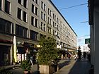
110 | Lil Dagover (1887–1980), actress and dancer | Nov 20, 1995 | The alley is part of the street network east and west of Stendaler Straße that was created in the 1990s and was named after artists. It runs in a south-west-north-east direction between Fritz-Lang-Platz and Janusz-Korczak-Straße and Stendaler Straße. |
|
| Lili-Grün-Weg
( Location ) |
Lili Grün (1904–1942), Austrian writer, victim of the Holocaust | 30 Aug 2017 | The street, a dead end, branches off from Carola-Neher-Straße in an easterly direction. | ||
| Lily-Braun-Strasse
( Location ) |
680 | Lily Braun (1865–1916), writer, suffragette | 4th June 1992 | When it was first named in 1986, it was Wilhelm-Koenen-Straße after the GDR politician Wilhelm Koenen . The north-south street between Erich-Kästner- and Gülzower Straße has an eastern arm up to the Iselbergweg colony (in the Kaulsdorf district ). At some house numbers on this street the affixing of house signs continues like on Cecilienplatz . Here César Othagaray designed a 'dancer' (no. 17) and an 'untitled' (no. 77). |

|
| Lion-Feuchtwanger-Strasse
( Location ) |
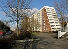
580 | Lion Feuchtwanger (1884–1958), writer, emigrated during the Nazi era | Oct 8, 1980 | The route between Clara-Zetkin-Platz (in the north) and Gülzower Strasse (in the south) continues south as Gutenbergstrasse in the Kaulsdorf district. This street belongs to the street network that was first laid out and named when the large housing estate Hellersdorf was built. |
|
| Lion-Feuchtwanger-Weg
( Location ) |
80 | Lion Feuchtwanger (1884–1958), writer | Jan. 1, 2000 | It is the northern continuation of the street of the same name and leads to Teterower Ring. To the side of the path is a toboggan area. |

|
| Louis-Lewin-Strasse
( Location ) |
1660 | Louis Lewin (1850-1929), medical doctor, toxicologist | June 1, 1992 | When it was first named in 1987, it was called Paul-Verner-Straße after the GDR politician Paul Verner . It is a main road between Berliner Strasse in the Hönow district of the Brandenburg municipality of Hoppegarten in the north and Riesaer Strasse in the south, where it continues as Leisniger Strasse. After about a third of its length, it crosses the subway line by means of a bridge at the Louis-Lewin-Straße subway station . |
 
|
| Lubminer Strasse
( Location ) |
220 | Lubmin , municipality in Mecklenburg-Western Pomerania | Oct 8, 1980 | The street has a northern branch, at the end of which there is a youth club and a sports field. It bends eastwards and is connected there to Lion-Feuchtwanger-Straße. It was part of the road network that was first laid out and named when the Hellersdorf housing estate was built. |

|
| Lubminer way
( Location ) |
100 | Lubmin , municipality in Mecklenburg-Western Pomerania | Jan. 1, 2000 | The Lubminer Weg connects Boizenburger Strasse and Lubminer Strasse within walking distance in a west-east direction. It touches a former school site, the main building of which has been demolished, but the sports hall is still in ruins. |

|
| Luckenwalder Strasse
( Location ) |
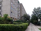
920 | Luckenwalde , district town in Brandenburg | July 22, 1987 | It is a U-shaped and branched road to develop the residential area south of Zossener Straße at its southwest bend. A footpath leads south on the western section to Kyritzer Straße. |
|
| Ludwigsfelder Strasse
( Location ) |
640 | Ludwigsfelde , city in Brandenburg | July 22, 1987 | It is a road to the development of the residential area between Landsberger Chaussee and Zossener Straße , which is provided with an eastern bulge approximately in the middle. In this area there is a children's combination and a school building. |

|
| Ludwigsluster Strasse
( Location ) |
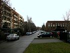
1120 | Ludwigslust , town in Mecklenburg-Western Pomerania | Jan. 1, 2000 | It is a southwest-northeast road that continues at an angle to the north. It runs between Parchimer Strasse, parallel to the U-Bahn line and Gülzower Strasse and then to the west parallel to Hellersdorfer Strasse and Teterower Ring. |
|
| Luzinstrasse
( Location ) |
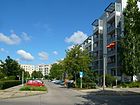
180 | Narrow Luzin and Wide Luzin , lakes near Feldberg in Mecklenburg-Western Pomerania | Feb 11, 1983 | This short west-east street connects a cross arm of Hellersdorfer Straße with its busy route and leads as a dead end to the entrance areas of the residential buildings. The Kienberg underground station (Gardens of the World) is nearby . |
|
| Lyonel-Feininger-Strasse
( Location ) |
270 | Lyonel Feininger (1871–1956), German-American painter and graphic artist | July 22, 1996 | It is part of the road network east and west of Stendaler Straße that was created in the 1990s and was named after artists. This street is the southern continuation of the Hellersdorfer Promenade and leads from Quedlinburger Strasse to Nelly-Sachs-Strasse. |

|
|
Mahlsdorfer Strasse
( Location ) |
120 (in the district) |
Mahlsdorf , part of the Marzahn-Hellersdorf district | before 1893 | According to the official street directory, only the house numbers 65-67 belong to Hellersdorf. These denote the station square at the Hönow subway terminus and two gardens behind Böhlener Straße. The street is otherwise completely in Hönow, Brandenburg . |

|
| Mark-Twain-Strasse
( Location ) |
560 | Mark Twain (1835-1910), American writer | June 12, 1992 | When it was first built in 1987, the street was named Richard-Staimer-Straße after Richard Staimer, a GDR military man . It runs slightly angled between Riesaer and Lichtenhainer Straße. Some entrances to the green courtyard are decorated with graffiti pictures (see picture below). |
 |
| Martin-Riesenburger-Strasse
( Location ) |
370 | Martin Riesenburger (1896–1965), rabbi , persecuted by the Nazi regime | June 9, 1987 | This street, located north of Riesaer Straße, connects Mark-Twain- with Lichtenhainer Straße and is branched out. A memorial plaque for giant burgers was unveiled on April 14, 2015 at the corner of Mark-Twain-Strasse. |

|
| Maxie Wander Strasse
( Location ) |
910 | Maxie Wander (1933–1977), writer | June 25, 1992 | When it was first built in 1986, it was called Fritz-Selbmann-Straße after the GDR politician Fritz Selbmann . This traffic route connects Erich-Kästner-Straße in a northerly direction via Neue Grottkauer Straße with Etkar-André-Straße and bends there to the northeast. It ends at Schneeberger Strasse. |

|
| Michendorfer Strasse
( Location ) |
220 | Michendorf , municipality in Brandenburg | July 22, 1987 | The short street connects two arches of Luckenwalder Straße roughly in the middle and leads north to Zossener Straße . To the south there is a footpath to Fercher Straße. |

|
| Mittenwalder Strasse
( Location ) |
420 | Mittenwalde , city in Brandenburg | July 22, 1987 | It is an angled residential street between Klausdorfer and inner Zossener Strasse with a connection to Teupitzer Strasse. |

|
| Mittweidaer Strasse
( Location ) |
180 | Mittweida , city in Saxony | Sep 30 1992 | The north-south traffic route connects Riesaer Strasse with Döbelner Strasse and was laid out in the 1990s. An unnamed green area stretches along its entire length west to Frohburger Strasse. |

|
| Mylauer way
( Location ) |
280 | Mylau , city in Saxony | Nov 1, 1998 | It runs between the Kastanienallee and Riesaer Straße and is a dead end. The Regine-Hildebrandt-Park is located along it as part of a green corridor along the subway line. On the built-up side there is a birthplace and a meeting place for the handicapped: the 'Haus Erntekranz', a branch of the 'Tiele-Winckler-Haus GmbH' (handicapped aid ). (see image) |

|
|
Naumburg Ring
( Location ) |
660 | Naumburg , district town in Saxony-Anhalt | 2nd July 1987 | This ring road has more of an H-shaped course. Its eastern end turns directly into Weißenfelser Straße. The Turn- und Sportverein Hellersdorf 88 e. Is located at house numbers 3–5. V. (TuS Hellersdorf 88). At one of the kinks is the 'Ark Elementary School'. |

|
| Nelly-Sachs-Strasse
( Location ) |
310 | Nelly Sachs (1891–1970), German- Swedish writer and Nobel Prize for Literature | Nov 20, 1995 | It is part of the road network east and west of Stendaler Straße that was created in the 1990s and was named after artists. The south-west-north-east street runs between Alice-Salomon-Platz and Naumburger Ring. |

|
| New Grottkauer Strasse
( Location ) |
610 | corresponding to Grottkauer Strasse in the Berlin-Kaulsdorf district , which derives its name from the former German town of Grottkau (since 1945 Grodków in Poland) | June 10, 1992 | The street runs in a west-east direction from Hellersdorfer to Uckermarkstraße. The addition "New" resulted from a renaming of the first (1986) Heinz Hoffmann-Strasse (after the GDR politician Heinz Hoffmann ) named traffic route. According to the recommendations of the Senate around 1991, it should be given the same name along with the Grottkauer Straße in Kaulsdorf . Citizens' protests led to the changed name because it prevented house number changes and expenses could be reduced. The area near the Kienberg (Gardens of the World) underground station is occupied by a larger shopping center, the Hellersdorfer Corso (top picture). The work of art "Iron logs" was placed between the corso and another square. It was made from original Brazilian trunks by the Brazilian artist Elisa Bracher for the Expo 2000 in Hanover, but has now found its place in Hellersdorf (lower picture). |
 |
| Neuruppiner Strasse
( Location ) |
300 | Neuruppin , district town in Brandenburg | March 5th 1985 | The eastern cross street of Alte Hellersdorfer Straße runs to the Havelländer Ring, where it bends south. Here she reaches the KGA Alt-Hellersdorf . |

|
| Nossener Strasse
( Location ) |
370 (2 ×) 340 (2 ×) |
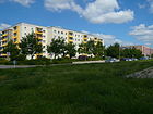
Nossen , city in Saxony | June 12, 1992 | When it was first installed, it was called Gerhart-Eisler-Strasse after the journalist and GDR politician Gerhart Eisler . It is a broad street, the two lanes of which are separated from each other by a green area. It runs in north-south direction between Riesaer and Glauchauer Straße. To the south there is a footpath to the park around the Schleipfuhl . |
|
|
Oelsnitzer Strasse
( Location ) |
210 | Oelsnitz , city in Saxony | June 9, 1987 | It runs between Stollberger and Riesaer Straße. |

|
| Oschatzer ring
( Location ) |
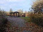
550 | Oschatz , city in Saxony | 2nd July 1987 | The U-shaped guide runs north of Quedlinburger Straße, it has a connecting arm. The southern counterpart is the Weißenfelser and Schönburger Straße system. |
|
|
Parchimer Street
( Location ) |
520 | Parchim , district town in Mecklenburg-Western Pomerania | Oct 8, 1980 | The road has two arms and runs in a north-south direction; it goes off from Ludwigsluster Strasse . |

|
| Paul Levi Square
( Location ) |
80 × 70 | Paul Levi (1883–1930), lawyer and KPD politician | Aug 17, 2000 | This almost square lawn is surrounded by the Leisniger, the Geithainer, the Roßweiner and the Döbelner Straße. |

|
| Peter-Edel-Strasse
( Location ) |
490 | Peter Edel (1921–1983), writer | July 15, 1986 | The southern part is a footpath between Peter-Huchel- and Erich-Kästner-Straße. Then the road begins northwards to Neue Grottkauer Straße. |

|
| Peter-Huchel-Strasse
( Location ) |
480 | Peter Huchel (1903–1981), writer | 5th June 1992 | The traffic route was laid out in 1986 as Alexander-Abusch-Straße (named after the GDR politician Alexander Abusch ). At the southern tip is an unnamed green area, the east side of which is an arm to the street and is about 60 meters long. There are residential buildings only on one side of the street, opposite is a sports hall and the ' BIP creative center ', which was converted from a school building typical of the GDR.
At Peter-Huchel-Straße 43, the 'Wunderwelt' daycare center is worth mentioning, which was recognized as an IGA location by district politicians in February 2016 . Here, those responsible and the hobby beekeeper Klaus Gatzel have set up three houses for bee colonies on the roof of the building, where the children can get to know the life and importance of bees . The project is called 'Bee seeks a flat'. |

|
| Peter-Weiss-Gasse
( Location ) |
270 | Peter Weiss (1916–1982), writer | Nov 20, 1995 | It is part of the road network east and west of Stendaler Strasse that was built in the 1990s and was named after artists. The street runs diagonally in a south-west-north-east direction and touches the Kokoschkaplatz . |

|
|
Peter-Weiss-Platz
( Location ) |
60 × 40 | Peter Weiss (1916–1982), writer | Nov 20, 1995 | The square is bordered by Quedlinburger, Tangermünder and Janusz-Korczak-Straße. Around 2000 it was sold to a real estate company that was unable to prepare the green space due to bankruptcy. In 2007 part of the square was designed and opened to the public on June 11, 2007. A striking feature is a technology container, which in 2006 was equipped by a young sprayer (graco.de) with an all-round graffiti image, which is called "the smallest prefabricated building in the world" and which proclaims a sentence by Peter Weiss on one of the fronts. Directly on the square is the youth recreational facility 'East End', also designed with graffiti. |

|
|
Quedlinburger Strasse
( Location ) |
1010 | Quedlinburg , city in Saxony-Anhalt | 2nd July 1987 | It connects Stendaler Strasse in a west-east direction with Louis-Lewin-Strasse, where it opens across from Theaterplatz . At the intersection with Stendaler Straße, a GDR prefabricated building with a full-surface facade in the Art Nouveau style was designed as an interesting eye-catcher. |

|
|
Rathener Strasse
( Location ) |
290 | Rathen , health resort in Saxony | June 9, 1987 | It connects Heidenauer Strasse with Mark-Twain-Strasse and runs in a south-west-north-east direction. |

|
| Riesaer Strasse
( Location ) |
1660 | Riesa , city in Saxony | June 9, 1987 | It is the continuation of Stendaler Strasse south of the underground line . It runs in a north-west-south-east direction and ends at Hönower Straße in the Mahlsdorf district . One of the two former town halls of the Hellersdorf district is located at Riesaer Straße 94; now it is the 'Office for Citizens' Services'. |

|
|
Roßweiner Ring
( Location ) |
400 | Roßwein , city in Saxony | July 28, 1989 | It branches off from Leisniger Straße in a U-shape to the east. South of the Roßweiner Ring, a single-family housing estate was built after 2005, which was included in the numbering. |

|
|
Schkeuditzer Strasse
( Location ) |
560 | Schkeuditz , city in Saxony | 2nd July 1987 | This purely residential street starts west at Theaterplatz and runs east to Torgauer Straße. Pedestrian areas are connected on both sides. |

|
| Schleipfuhlweg
( Location ) |
40 (in the district) |
Schleipfuhl , meltwater pool from the last Ice Age in the Berlin-Kaulsdorf district on the border with Hellersdorf | Dec 1934 | When it was first planned in the 1920s, it was referred to as path A in the suburban settlement of Hellersdorf, then named after the direction to the lake. Most of it is in the Kaulsdorf district and crosses the suburbs. |

|
| Schneeberger Strasse
( Location ) |
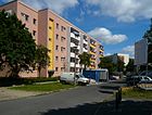
280 | Schneeberg , city in Saxony | June 9, 1987 | The Schneeberger Straße and the eastern part of the Auerbacher Ring form a contiguous street, which is divided by the Maxie-Wander-Straße. |
|
|
Schönburger Strasse
( Location ) |
180 | Schönburg , municipality in Saxony-Anhalt | 2nd July 1987 | The Weißenfelser Strasse and Schönburger Strasse system forms a U-shaped development south of Quedlinburger Strasse and thus mirrors the Oschatzer Ring . |

|
|
Schönewalder Strasse
( Location ) |
250 | Schönewalde , city in Brandenburg | June 9, 1987 | It connects Adele-Sandrock-Strasse with Riesaer Strasse. On the western side, attached to the school building complex of the 'Kolibri-Grundschule' and bordered by the parallel Lichtenhainer Straße, is the 'Schönewalder Straße sports facility complex'. This is followed by the Mascha Kalekó Park . |

|
| Schwarzheider Strasse
( Location ) |
350 | Schwarzheide , city in Brandenburg | March 28, 1997 | It connects Adele-Sandrock-Strasse with Louis-Lewin-Strasse and touches the Branitzer Karree to the north . |

|
| Sebnitzer Strasse
( Location ) |
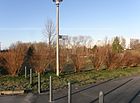
500 | Sebnitz , city in Saxony | June 9, 1987 | The specified length is the addition of the curled ring-shaped arms of the road. It connects Mark-Twain-Straße with Lichtenhainer Straße (east) and forms a drivable ring that is designed as a park. |
|
| Senftenberger Strasse
( Location ) |
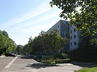
480 | Senftenberg , district town in Brandenburg | March 5th 1985 | The street connects Cottbusser Straße with Kastanienallee and shows a stairway. Murals by various artists have been realized on several gables of the apartment blocks, all between 1992 and 1994 after the facade was renovated. The picture shown here shows a 'dancer' based on a model by Christina Allzeit from 1993; the 'dancer' stands across the corner on the other gable (here covered by the leaves). |
|
| Sonnenkieker ( location ) |
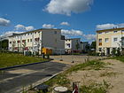
140 | Sonne and "kieken", Berlinisch for "look, look" | Jan. 15, 2001 | It connects the Kummerower Ring with the Feldberger Ring on the eastern bank of the Wuhle and is a private road. The access area opposite Feldberger Ring 38 and 44 was included in the new street. In several steps, a settlement with multi-family houses bearing the same name ('Sonnenkieker settlement') is being built along the new traffic route. |
|
| Spremberger Strasse
( Location ) |
480 | Spremberg , city in Brandenburg | March 5th 1985 | It runs on both sides next to the Wuhleniederung, over the Alte Hellersdorfer Straße to Cottbusser Platz. |

|
| Stendaler Strasse
( Location ) |
1160 | Stendal , district town in Saxony-Anhalt | March 5th 1985 | It is a main road between Landsberger Chaussee and Hellersdorfer Straße. To the south, at the Hellersdorf underground station and Alice-Salomon-Platz, the street continues as Riesaer Straße . |

|
| Stollberger Strasse
( Location ) |
920 | Stollberg , city in Saxony | June 9, 1987 | It is an access road between Riesaer Straße and Nossener Straße with a confusing, winding street layout and numerous bypasses; the length could therefore only be determined roughly. |

|
| Suhler Strasse
( Location ) |
1240 | Suhl , city in Thuringia | March 5th 1985 | It is an angled street between Eisenacher Straße and Gothaer Straße with several arms. The Wuhle hiking trail is easily accessible from here. |

|
|
Tangermünder Strasse
( Location ) |
1050 | Tangermünde , city in Saxony-Anhalt | 2nd July 1987 | It forms the eastern continuation of Zossener Strasse over Stendaler Strasse and, after a bend to the south, connects it with Nelly-Sachs-Strasse. At Tangermünder Straße 7 you will find Die Arche - Christliches Kinder- und Jugendwerk e. V., which offers food and care for children from the poorest families. In addition, the 'Hella Club for Girls and Young Women' was set up here in a low-rise building. |
 
|
| Teterower Ring
( Location ) |
1390 | Teterow , town in Mecklenburg-Western Pomerania | Oct 8, 1980 | The street surrounds connected residential buildings as a complete asymmetrical ring. It is cut in north-south direction by Tollensestrasse. The Wuhletal football stadium is located at Teterower Ring 71. A cul-de-sac leading into the inner courtyard was given the street name of its own, as can be seen from the official sign. |

|
| Teupitzer Strasse
( Location ) |
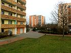
470 | Teupitz , town in Brandenburg | July 22, 1987 | It is a double-kinked street layout between Landsberger Chaussee and Zossener Straße . Teupitzer Straße is accompanied on the east side by a straight footpath that leads through green areas and represents the northernmost part of the original Kastanienallee. On the roofs of the building complex, house numbers 34–44, there is Kunst am Bau , 1998 together with similar objects on Zossener Straße . |
|
|
Theater square
( Location ) |
120 × 110 (total green area) |
' The Wide Theater ', when the square was named in a solitary low-rise building erected here (moved to the building of the Academy of Dramatic Art on the Parkaue in Lichtenberg in 2007 ). |
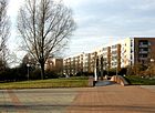
Oct 20, 1997 | The square is on the east side of Louis-Lewin-Straße and is around 8,000 square meters. Until 1995 it was an unused and nameless wasteland, which according to the earlier plans should be built with a high-rise. After the completion as a jewelry place it got its current name. The actual square is divided into three areas: a larger rectangular area covered with natural stones, in the middle of which an oval, planted with flowers and lawn, lies slightly undulating. A square area planted with bushes was added to the northeast corner of this double space. At the entrance from Louis-Lewin-Strasse, a kind of symbolic portal was designed from two vertically positioned granite stones (picture). |
|
| Tollensestrasse
( Location ) |
400 | Tollense , tributary of the Peene and / or Tollensesee , Brandenburg | Oct 8, 1980 | The street is between Cecilienstraße (in the south) and the southern area of the Teterower Ring (in the north). There it goes into Clara-Zetkin-Platz. |

|
| Torgauer Strasse
( Location ) |
210 | Torgau , district town in Saxony on the Elbe | 2nd July 1987 | The north-south road runs between Gohliser and Böhlener Strasse. To the north, Torgauer Straße runs along the Hönower Weiherkette . | |
|
Waldheimer Strasse
( Location ) |
400 | Waldheim , town in Saxony | Sep 30 1992 | Waldheimer Strasse bends between Döbelner and Leisniger Strasse / Roßweiner Ring. |

|
| Weißenfelser Strasse
( Location ) |
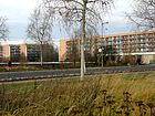
480 | Weißenfels , town in Saxony-Anhalt | 2nd July 1987 | The Weißenfelser Strasse and Schönburger Strasse system forms a U-shaped development south of Quedlinburger Strasse and mirrors the Oschatzer Ring. The Weißenfelser Strasse, however, continues in its west-east train to Louis-Lewin-Strasse. |
|
| Wurzener Strasse
( Location ) |
260 | Wurzen , city in Saxony | 2nd July 1987 | It is a double-kinked access road between Oschatzer Ring and Louis-Lewin-Straße, but as a driveway it is a dead end. At its northeastern end there is a special school for the speech impaired (top picture). |
 
|
|
Zerbster Street
( Location ) |
530 | Zerbst , city in Saxony-Anhalt | 2nd July 1987 | It is bent and with side arms between Tangermünder Straße and Quedlinburger Straße. The street continues to the south as the eastern part of the Naumburger Ring. At the bend, the Beerenpfuhl and the beginning of the Hönower Weiherkette are affected. At this point, the 'Weiher Park' was laid out in 2010 on an earlier wasteland. |

|
|
Zossener Strasse
( Location ) |
1600 | Zossen , city in Brandenburg | 2nd July 1987 | This traffic axis connects Landsberger Allee / Landsberger Chaussee (in the north) with Stendaler Strasse (in the east). It continues on Stendaler Strasse as Tangermünder Strasse . The street branches into parallel access roads of the same name for the residential area to the east and into cross arms. There are some interesting art objects in Zossener Straße. |

|
Allotment gardens (colonies) and settlements
Of the 21 plants that are part of the Berlin-Hellersdorf Association of Garden Friends, the following belong to the Hellersdorf district, the others are in neighboring Berlin districts.
- Colony Alt-Hellersdorf ( Lage ), Alte Hellersdorfer Straße, founded in 1984
- Colony Am Storchennest ( Lage ), Alt-Hellersdorf, founded in 2002
- Colony Am Teterower Ring ( Lage ), founded in 1984 Access is on Cecilienstraße; the gardens are accessed via five private paths. In September 2015, the facility was expanded with additional areas by around 4600 m² for the construction of 13 plots.
-
Gartenland am Beerenpfuhl ( location ) After a daycare center in Tangermünder Strasse had been dismantled, the area was parceled out and in 2007 it was laid out as an allotment garden with 16 parcels.
Parks, waters and other locations

-
Jelena-Santic-Friedenspark , between Hellersdorfer Straße and an der Wuhle. To the west are the Wuhletal Landscape Park and the Gardens of the World. ( Location ) The nine-hectare park was named after Jelena Šantić (1944–2000), a Serbian prima ballerina and peace activist, and has been gradually expanded since 1994 according to plans by an Amsterdam landscape architect.
-
Mascha-Kaléko-Park , named after the German-speaking Jewish poet Mascha Kaléko (1907–1975) ( location ) The green area is separated from Mark-Twain-Strasse (north), Adele-Sandrock-Strasse (east), Riesaer Strasse ( South) and Lichtenhainer Straße (West). The park was named on May 11, 2006.
- Schleipfuhl ( location )
- Hönower Weiherkette , consisting of the already silting fish pond, the Beerenpfuhl and other small lakes and ponds
- Light center ( location )
- Palmenhof , a new green area set up in 2009 in the interior of Bodo-Uhse-Straße
- Weiher Park (*)
- Regine-Hildebrandt-Park (opened 2007) (*)
- Kurt-Julius-Goldstein-Park (opened 2010) (*)
- Wuhle hiking trail
Some of these newly created parks (*) in the district are part of a coherent green band that runs along the Wuhle and other nameless ditches and will be completed over a longer period of time.
See also
literature
- Art in the large housing estate , Marzahn-Hellersdorf district office of Berlin, ISBN 978-3-00-026730-7
Web links
- Map of Berlin 1: 5000 with district boundaries. Senate Department for Urban Development Berlin, 2009, accessed on January 3, 2011 .
- Official street directory of the Marzahn-Hellersdorf district; pdf (as of January 2015)
- Street directory Hellersdorf. kaupert media gmbh, accessed on January 15, 2011 . , Details tw. corrected (districts out of date, incomplete, partly incorrect district assignment)
Individual evidence
- ↑ Berlin city map from 1899; You can see the village center of Hellersdorf and the connection northwards to Landsberger Chaussee ( memento of the original from December 11, 2015 in the Internet Archive ) Info: The archive link was automatically inserted and not yet checked. Please check the original and archive link according to the instructions and then remove this notice.
- ↑ Berlin city map 1943 ( page no longer available , search in web archives ) Info: The link was automatically marked as defective. Please check the link according to the instructions and then remove this notice.
- ↑ Planting at Adele-Sandrock-Straße 25–27 ; Information on stadtumbau.de ; Retrieved January 3, 2011
- ↑ Homepage of the Marzahn-Hellersdorf District Office ( Memento from September 17, 2014 in the Internet Archive )
- ^ Homepage of the AS University
- ↑ Volkmar Draeger: How's the old house doing? On a treasure hunt to Berlin monuments. , Pp. 127–131: Former sewage fields without an odeur. The historical Gut Hellersdorf wants to distinguish itself as a commercial location , Neues Deutschland Druckerei und Verlag GmbH, Berlin 2006, ISBN 3-9807073-7-7
- ↑ BD village center Hellersdorf
- ^ Luise Berlin: Kaulsdorfer Strasse
- ↑ Information on the Palmenhof on stadtumbau.de
- ↑ Birgitt Etzel: Gold splinters and other treasures . In: Berliner Zeitung , April 11, 2013
- ↑ a b City Map 1988, VEB Tourist Verlag, p. 20
- ^ Hellersdorf - The forgotten boulevard. In: Der Tagesspiegel , August 12, 2001, accessed February 2011
- ^ Cecilienplatz on Kauperts.de
- ^ Art in the large housing estate ... ; P. 231.
- ^ Ein Platz für Clara Zetkin , In: Berliner Zeitung , July 5, 1997, accessed on January 9, 2017.
- ↑ Aerial view of Clara-Zetkin-Platz ( memento of the original from August 1, 2010 in the Internet Archive ) Info: The archive link was inserted automatically and has not yet been checked. Please check the original and archive link according to the instructions and then remove this notice.
- ↑ Birgitt Etzel: Heavenly balancing act. A floating group of figures is installed on the roofs of Hellersdorf high-rise buildings. In: Berliner Zeitung , July 21, 1997; Retrieved January 6, 2011
- ↑ Aerial photo of Fritz-Lang-Platz ( memento of the original from August 1, 2010 in the Internet Archive ) Info: The archive link was inserted automatically and has not yet been checked. Please check the original and archive link according to the instructions and then remove this notice.
- ↑ Homepage of the Konrad-Wachsmann-Oberschule ( Memento of the original from April 7, 2011 in the Internet Archive ) Info: The archive link has been inserted automatically and has not yet been checked. Please check the original and archive link according to the instructions and then remove this notice.
- ↑ Homepage of the parish of Hellersdorf ( page can no longer be accessed , search in web archives ) Info: The link was automatically marked as defective. Please check the link according to the instructions and then remove this notice.
- ↑ Press information on the theater community; 2012 , accessed January 24, 2016.
- ↑ Official street directory of the Marzahn-Hellersdorf district; pdf (July 2015) , (PDF; 350 kB)
- ^ Homepage of the Gospel Christian Congregation
- ^ Art in the large housing estate ...; P. 260
- ↑ Local leisure tips. In: Berliner Woche , January 27, 2016, p. 4.
- ^ Hellersdorfer Promenade on Kauperts.de
- ^ Kauperts: Hellersdorfer Strasse
- ↑ City map of Berlin and the eastern outskirts from 1939 ( page no longer available , search in web archives ) Info: The link was automatically marked as defective. Please check the link according to the instructions and then remove this notice. ; Hellersdorfer Strasse is entered here.
- ↑ Museum apartment at Hellersdorfer Straße 179 ( Memento of the original from January 1, 2012 in the Internet Archive ) Info: The archive link was inserted automatically and has not yet been checked. Please check the original and archive link according to the instructions and then remove this notice.
- ^ Art in the large housing estate , p. 235
- ↑ Details on Kastanienallee at Kauperts.de; Retrieved January 8, 2011
- ↑ Kastanienallee in Kaulsdorf on the city map from 1954 ( page no longer available , search in web archives ) Info: The link was automatically marked as defective. Please check the link according to the instructions and then remove this notice.
- ↑ Berliner Zeitung of January 14, 2014, section Berlin / Districts : Marzahn-Hellersdorf; Page 19
- ↑ Homepage of the Babylon Center ( Memento of the original from June 13, 2011 in the Internet Archive ) Info: The archive link was automatically inserted and not yet checked. Please check the original and archive link according to the instructions and then remove this notice.
- ↑ a b Website with information on the Hellersdorf town squares Kurt-Weill-Platz, Kokoschkaplatz and Peter-Weiss-Platz from March 2006; accessed on January 8, 2011 ( page no longer available , search in web archives ) Info: The link was automatically marked as defective. Please check the link according to the instructions and then remove this notice.
- ↑ Inauguration of the street "Lili-Grün-Weg" with a public reading . Press release of the Marzahn-Hellersdorf district office from August 24, 2017
- ↑ here: p. 25 ( Memento of the original from December 15, 2013 in the Internet Archive ) Info: The archive link was inserted automatically and has not yet been checked. Please check the original and archive link according to the instructions and then remove this notice. (PDF; 350 kB)
- ^ Ceremonial unveiling of the memorial plaque for Martin Riesenburger . Press release of the Marzahn-Hellersdorf District Office from April 13, 2015
- ↑ belonging to the Protestant foundation Diakonissenhaus Friedenshort ( memento of the original dated December 2, 2015 in the Internet Archive ) Info: The archive link was inserted automatically and has not yet been checked. Please check the original and archive link according to the instructions and then remove this notice.
- ↑ Homepage of TuS Hellersdorf
- ↑ Marzahn-Hellersdorf district journal, February 2016, p. 8.
- ^ Homepage, Wall Pictures in Berlin ' , accessed on April 17, 2011
- ^ East End website
- ↑ Homepage of the Marzahn-Hellersdorf District Office ( Memento from September 17, 2014 in the Internet Archive )
- ↑ Street renaming and renaming → Schleipfuhlweg and Feierabendweg, Kreppfuhlweg, Randweg . In: Berliner Adreßbuch , 1935, Part I, p. Without.
- ^ Art in the large housing estate ... , p. 248
- ^ Homepage of the Arche Hellersdorf; (New) accessed on January 24, 2016.
- ↑ Website for the Wuhletal Stadium ( memento of the original from July 16, 2018 in the Internet Archive ) Info: The archive link was automatically inserted and not yet checked. Please check the original and archive link according to the instructions and then remove this notice.
- ^ Project with details for the redesign of the theater square, carried out by the Glad Landschaftsarchitekten company until 1995; Retrieved on January 6, 2011 ( Memento of the original from April 7, 2014 in the Internet Archive ) Info: The archive link was inserted automatically and has not yet been checked. Please check the original and archive link according to the instructions and then remove this notice.
- ↑ Homepage of the district association of garden friends Berlin-Hellersdorf
- ↑ Marzahn-Hellersdorf creates additional allotment gardens - transfer of the extension areas on Cecilienstraße. Press release from the Marzahn-Hellersdorf district office, September 24, 2015
- ↑ Homepage of the Senate Department for Urban Development with details about Hellersdorf and individual streets and projects , accessed on November 29, 2011
- ↑ Details on the Jelena Šantić Peace Park on the website of the Senate Department for Urban Development ; Retrieved January 3, 2011
- ↑ Brigitte Eltzel: Park is named after Mascha Kalekó. From: Berliner Zeitung of May 10, 2006; Retrieved January 3, 2011
- ↑ Protected areas / Schleipfuhl; District Office Marzahn-Hellersdorf ( Memento from April 18, 2014 in the Internet Archive )
- ↑ Information on the Hönower Weiherkette ( Memento from July 30, 2014 in the Internet Archive )
- ↑ Website with details about Goldstein-Park ( page no longer available , search in web archives ) Info: The link was automatically marked as defective. Please check the link according to the instructions and then remove this notice.


