
Böhlen (Saxony)
| coat of arms | Germany map | |
|---|---|---|

|
Coordinates: 51 ° 12 ' N , 12 ° 23' E |
|
| Basic data | ||
| State : | Saxony | |
| County : | Leipzig | |
| Height : | 126 m above sea level NHN | |
| Area : | 24.56 km 2 | |
| Residents: | 6651 (Dec. 31, 2019) | |
| Population density : | 271 inhabitants per km 2 | |
| Postal code : | 04564 | |
| Primaries : | 034206 034299 (Großdeuben) |
|
| License plate : | L , BNA, GHA, GRM, MTL, WUR | |
| Community key : | 14 7 29 040 | |
| City structure: | 2 districts | |
City administration address : |
Karl-Marx-Strasse 5 04564 Bohlen |
|
| Website : | ||
| Mayor : | Dietmar Berndt (independent) | |
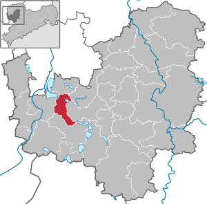
| Location of the city of Böhlen in the Leipzig district | ||
  |
||

Böhlen is a town south of Leipzig in the district of Leipzig , Saxony .
geography
Böhlen is located in the Leipzig lowland bay about 15 km south of Leipzig and 13 km northwest of Borna . The Pleiße flows through Böhlen from south to north. The Stöhna retention basin , which is important for flood protection of the river, extends east of the Großdeuben district . Furthermore, the city is surrounded by various stagnant bodies of water in the Leipziger Neuseenland , including Störmthaler See in the northeast, Hainer See in the southwest and Zwenkauer See in the west.
City structure
- Großdeuben district (with Debitzdeuben and Probstdeuben)
- Gaulis district
The corridors of Zeschwitz ( Zwenkau opencast mine ), Stöhna , Zehmen , Großdeuben (eastern part) (all Espenhain opencast mines ), Trachenau and Treppendorf ( Witznitz opencast mines ) also belong to Böhlen .
Neighboring places
| Zobigker | Gaschwitz | Wachau |
| Zwenkau |
.svg)
|
Rötha |
| Lippendorf | Neukieritzsch | Aspen grove |
history

|
.jpg)
|
|
|
The church around 1840
|
The manor around 1850
|
Although it was settled by Slavs as early as the 7th century, Böhlen was first mentioned in a document in 1353 in connection with a knight seat of Otto de Belen. The name comes from the Old Sorbian word Belina , whose stem bely means white, bright, shiny. The name development then went through Beln (1487), Belen (1517), Böhlen an der Hartha (1791, meaning the Harth forest) and Böhlen b. Zwenkau (1875) to today's Böhlen near Leipzig. (In Saxony there are four places with the name Böhlen: Near Leipzig, near Grimma, near Riesa and near Penig.)
In 1548 the manor was first reported. The owners were, among others, the Osterhausen , Brandenstein and Helldorff families . In the 16th century the Böhlen manor house, the so-called castle, was built. The first records of the old village church date from 1540, but it contains Romanesque components. The baroque altar was created before the Reformation (see elaborations in the altar plate for relics). Like the rest of the country, Böhlen suffered from the consequences of war and epidemics until modern times. In the case of a plague epidemic during the Thirty Years' War , only two families in the entire village are said to have survived.
In 1842 the village got a stop on the Saxon-Bavarian Railway , and in 1879 a school building with five classrooms was built. Until 1856, Böhlen was in the Electoral Saxon or Royal Saxon Office of Pegau . From 1856 the place belonged to the court office Zwenkau and from 1875 to the administrative authority of Leipzig . Böhlen retained its village character until the 20th century. The manor, tree nurseries, gardeners and farmers in Böhlen supplied the nearby Leipzig with their agricultural products. In 1902 the new tenant house of the manor was built, but it has been used as the town hall since 1928.
The lignite industry with an open-cast mining outcrop, which emerged in the 1920s, made Böhlen an industrial community. Workers' apartments were built and the infrastructure expanded. Today's Karl-Marx-Strasse led through the middle of the manor's courtyard. In 1924, the Böhlen opencast mine, which was then the largest opencast mine in the world, went into operation. At that time, Böhlen also had the longest conveyor bridge in the world and was a pioneer in power generation.
Towards the end of the Second World War one was near the factory satellite camp of Buchenwald concentration camp built, the 800 detainees and prisoners of war in the lignite-Benzin AG ( "Brabag") forced labor do had. In the area of today's factory premises of Sächsische Olefinwerke GmbH, some of the almost 5,000 prisoners of war and forced laborers vegetated . These were used in the production of fuel, which was important for the war effort, as a large part of the German workforce had been sent to the front because of the war and production had to continue.
In 1944/1945 Böhlen was exposed to heavy air raids due to the proximity of the war industries. At the end of the war, the town's industry passed into Soviet ownership. In 1952 the work was transferred back to the GDR. It was created through the amalgamation of plants (power plant, coal processing and gasoline plant) of the nationally owned enterprise (VEB) Kombinat "Otto Grotewohl" Böhlen , which became part of the Dow Olefinverbund in the Dow Chemical concern after the political change since 1995 . In 1952, the Böhlen cultural center was opened to the public.
On October 7, 1964, Bohlen was given city status.
| Former parish | date | annotation |
|---|---|---|
| Debit dove | before 1880 | Incorporation to Großdeuben |
| Gaulis | April 1, 1935 | Incorporation to Trachenau |
| Großdeuben | July 1, 1997 | |
| Probstdeuben | April 1, 1934 | Incorporation to Großdeuben |
| Moan | January 1, 1960 | since 1955 eliminated by open pit lignite mining |
| Trachenau | July 1, 1964 | 1962 to 1965 eliminated by open-cast lignite mining (except Gaulis) |
| Treppendorf | April 1, 1935 | Incorporation to Trachenau, eliminated from 1962 to 1965 by open-cast lignite mining |
| Take | 1964 | Incorporation to Großdeuben, since 1957 removed by open-cast lignite mining |
| Zeschwitz | April 1, 1942 | since 1943 eliminated by open pit lignite mining |
politics

City council after the 2019 local elections
Since the local elections on May 26, 2019, the city council has been composed as follows:
| Party / list | Seats |
| SPD | 5 seats |
| AfD | 4 seats |
| CDU | 4 seats |
| LEFT | 3 seats |
| FDP | 1 seat |
| Bü90 / GREEN | 1 seat |
mayor
- 1970–1989: Inge Taddey (SED)
- 1986–1990: Maria Gangloff ( SED )
- 1990–1991: Siegfried Wittmann
- 1991–2001: Rainer Krasselt (SPD)
- 2001–2015: Maria Gangloff ( PDS , LEFT)
- since 2015: Dietmar Berndt independent
Town twinning
There are partnerships with Aichwald in Baden-Württemberg and Vaulx-en-Velin in France .
traffic

The B 2 and the B 95 meet in the Böhlen district of Großdeuben. The A 9 is approx. 35 km, the A 14 is approx. 30 km and the A 38 is only approx. 5 km away.
The city is in the area of the Central German Transport Association (MDV) ; Böhlen is located with its district Großdeuben, the districts and the cities Rötha and Zwenkau in the tariff zone 152. A connection to the rail network has existed since 1842. Böhlen station is on the Leipzig – Hof railway line , where from the beginning there was a stop for people and Freight traffic existed. In 1858 a station building was built. In 1878/79 a new station building and a goods shed were built. In 1911 the tunnel for passenger traffic was ready. In 1913 the branch line from Böhlen to Rötha / Espenhain was put into operation. Böhlen is connected to the network of the S-Bahn Central Germany . The following lines stop:
- S 5 (Halle (Saale) main station - Leipzig / Halle airport - Leipzig exhibition center - City tunnel - Markkleeberg - Böhlen - Altenburg - Gößnitz - Crimmitschau - Werdau - Zwickau (Sachs) main station )
- S 5X (Halle (Saale) Hbf – Airport Leipzig / Halle – Leipzig-Messe – City-Tunnel – Markkleeberg – Böhlen – Altenburg – Gößnitz – Crimmitschau – Werdau – Zwickau (Sachs) Hbf) as an express line that does not stop at all stops en route.
- S 6 (Leipzig Messe – City- Tunnel– Markkleeberg –Böhlen– Borna - Geithain )
In the urban area next to the Bohlen will station Bohlen nor the breakpoint Großdeuben from the S6 and the breakpoint Bohlen works from the S5 and S6 operated.
The buses on lines 101, 122 and 144, which connect Böhlen with the neighboring communities, which are mostly not connected to the railway, stop in Böhlen.
The airfield Bohlen has existed since 1952. It was in the 1970s due to illegal emigration shut down dangerous by the East German authorities and underwent a renaissance in 1990. He is located northwest of the city near the border with the city of Zwenkau .
schools

The construction of a new school was first mentioned in 1879. In 1899 a new extension was built to the north of this. Due to the expansion of the plant by lignite processing, a new building in the Böhlener Lessingstrasse was necessary in 1926. In 1931 the school was expanded to include six classrooms. In 1957 a building for a polytechnic was built on the school grounds. In Böhlen there has been a primary and secondary school as well as the Leipziger Land vocational school center since 1990 , and a free Christian school in the Großdeuben district . The closest grammar school is in Zwenkau .
Churches

The church of the Protestant parish of Böhlen is the St. Christophorus Church. The building, which originated probably in the 12th century and was first mentioned in 1540, is a hall building with a choir just closed and a wide west tower. The foundations are of Romanesque origin, while the window shapes result from later conversions. A font made of sandstone dates from 1613. The organ was built in 1794 by the Donati brothers from Altenburg. The sacristy and entrance porch are from 1904. Twelve late Gothic figures of saints and two of the three bells come from the church of the neighboring village of Zeschwitz , which was devastated in 1943 because of the expansion of the open-cast mine in Böhlen . In 2006 the church was extensively renovated.

The Church of Christ the King of the Catholic parish was built on our own initiative in 1953/1954 from demolition stones from the surrounding areas devastated by coal mining. It is a hall building with a round choir and an asymmetrically standing bell tower. A meeting house was inaugurated in November 2000. It is looked after by the Catholic parish St. Bonifatius Leipzig-Süd, which was re-established in 2019.
Culture

- Böhlen is the sponsoring community of the Leipzig Symphony Orchestra (LSO).
- The Kulturhaus Böhlen is the seat of the Leipzig Symphony Orchestra, the place of instruction of the Music School Leipziger Land, the seat of the Kulturverein Böhlen eV, the Chamber Choir Böhlen and as a cultural center a place for events and celebrations.
- The Kulturhaus Böhlen is also the seat of the Kulturverein Böhlen, in which various groups and circles have been active since 1991.
Sports
Due to the nearby Böhlen lignite processing plant, several branches of sport emerged in company sports associations (BSG) after the Second World War. The BSG Chemie Böhlen (today SV Chemie Böhlen ) played from 1977 to 1979, 1980/81 and 1982/83 in the GDR football league. The best known player was Klaus Havenstein, who was top scorer in 1977/78 with 15 goals. This season, a 1-0 win against runner-up 1. FC Magdeburg was perhaps the greatest success in a single game.
Attractions

- see also: List of cultural monuments in Böhlen
- Town hall (built in 1902 as the tenant house of the manor, since January 1, 1928 it has been used as town hall)
- Kulturhaus (built 1951–1952, at its time the largest cultural center in the Leipzig district , large hall with 765 seats)
- Kugelhaus ("twenty-four family house", built around 1928 after demolition of the manor stables and barns)
- Evangelical Christophorus Church (first mentioned in 1540 and thus the oldest building in the village, the Donatiorgel was installed in 1794)
- City center with petrified cedar
- Baroque Katharinenkirche in Großdeuben (with a Friederici organ )
- Manor house and gatehouse with park in Großdeuben
- Wilhelminian style and Art Nouveau villas in Großdeuben
- Leipzig New Lakeland
- Pleisseau landscape
Memorials
- Memorial stone in front of the town hall in memory of the victims of forced labor
- War cemetery with memorial for perished prisoners of war as well as women and men from several nations who were abducted to Germany during the Second World War and were victims of forced labor
- Memorial complex in front of the factory premises formerly Pulgar with memorial stones for Dutch concentration camp prisoners, for 28 forced laborers from Italy and Poland known by name and other unknowns, as well as for 152 known and 84 unknown Soviet citizens as victims of forced labor
Established businesses

The most important industrial companies in Böhlen are the Lippendorf power plant , which is largely located in the Neukieritzsch community (on the site of the old Böhlen power plant ), Air Liquide with technical gases and the Böhlen chemical plant of the Dow Chemical oil processing company .
Personalities
- Heinrich Dodel - former chairman of the supervisory board of Leipziger Bank - tried to establish high finance in Böhlen by building Fortunapark and villas in 1902.
- Friedrich Rötschke (1891–1969), architect, designed the school in 1926; the Cafe Kirbach (now Sparkasse) in 1928 and the cemetery building in 1929.
- Reinhard Blechert (* 1947), swimmer and Olympic participant
literature
- Fritz Hönsch: From village to city. The development of Böhlen in connection with the development of the Böhlen-Espenhain industrial complex. in: Sächsische Heimatblätter, No. 4/1973, pp. 169–173
- Gregor Kaufmann / Thomas Nabert: Böhlen - from a manor village to an industrial town. With the story of Großdeuben and Gaulis. Verlag Pro Leipzig, Leipzig 2002, ISBN 3-936508-90-9
- Günter Jehnich / Gregor Kaufmann: Böhlen - From opencast mining to lignite processing - Looking back on 70 years of mining in the southern Leipzig area . Löhnert Druck 2010, ISBN 978-3-00-031201-4
- Geschichtsverein Böhlen und Umgebung (Ed.): Booklet series Böhlener Histories , 2003–2009, authors: Gregor Kaufmann, Thomas Körner, Rosemarie Barth, Lutz Klein, Christoph Krebs
- No. 1. From village and city
- No. 2. From the combine
- No. 3. The development of the Catholic community in Böhlen and the
50th consecration day of the Catholic Church - No. 4. Barred years: the fate of Böhlen citizens in Soviet internment camps
- # 5. Lost Places
- No. 6. 80 years of building a new school and kindergarten, nursery and crèche
- No. 7. Experiences with animals
- No. 8. A walk through Böhlen between 1960 and 1990
- No. 9. Kombinat Böhlen - cultural and social issues
- No. 10. 160 years of the railway in Böhlen
- No. 11. Past crafts and trades in the village
- No. 12. History rediscovered
- No. 13. Around the evangelical parish, church, rectory and cemeteries
- Ilona Zschoch: Böhlen. Pictures tell from days gone by. Geiger Verlag, Horb am Neckar 1995, ISBN 3-89570-078-9
- Cornelius Gurlitt : Bohlen. In: Descriptive representation of the older architectural and art monuments of the Kingdom of Saxony. 16. Issue: Amtshauptmannschaft Leipzig (Leipzig Land) . CC Meinhold, Dresden 1894, p. 4.
- Our history - our locations: 60 years of the Böhlen eG housing association, 2015
Web links
- Website of the city of Böhlen
- Böhlen in the Digital Historical Directory of Saxony
Individual evidence
- ↑ Population of the Free State of Saxony by municipalities on December 31, 2019 ( help on this ).
- ^ Ernst Eichler and Hans Walther : Saxony. All city names and their history, Faber and Faber, Leipzig 2007, p. 47
- ↑ a b Cornelius Gurlitt : Böhlen. In: Descriptive representation of the older architectural and art monuments of the Kingdom of Saxony. 16. Issue: Amtshauptmannschaft Leipzig (Leipzig Land) . CC Meinhold, Dresden 1894, p. 4.
- ↑ Album of the manors in Saxony, Leipziger Kreis , Leipzig 1860, p. 236
- ^ Karlheinz Blaschke , Uwe Ulrich Jäschke : Kursächsischer Ämteratlas. Leipzig 2009, ISBN 978-3-937386-14-0 ; P. 62 f.
- ↑ The Amtshauptmannschaft Leipzig in the municipal register 1900
- ↑ a b c d e The Saxony Book, Kommunal-Verlag Sachsen KG, Dresden, 1943
- ↑ State Statistical Office of the Free State of Saxony: Area changes
- ↑ a b c municipalities 1994 and their changes since 01.01.1948 in the new federal states , Metzler-Poeschel publishing house, Stuttgart, 1995, ISBN 3-8246-0321-7 , publisher: Federal Statistical Office
- ↑ Municipal council election 2019. State Statistical Office of the Free State of Saxony , accessed on May 26, 2019 .
- ↑ Current composition of the city council
- ↑ Photos of the establishment of the parish St. Bonifatius Leipzig-Süd. St. Bonifatius Leipzig-Süd, accessed on January 11, 2020 .
- ^ Website of the city