Moan
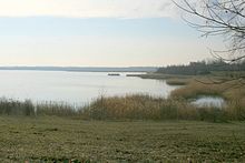
Stöhna was a village south of Leipzig in the Pleißenaue . In 1955 it had to give way to lignite mining and was dredged over by the Espenhain open-cast mine . The area has now been recultivated. The name of the village has been transferred to the Stöhna retention basin , which was created for flood protection .
Location and local characteristics
Stöhna was about 13 km south of the center of Leipzig on the west bank of the Pleiße and on the west side of the Pleißenaue, which was characterized by numerous river branches and meanders between meadows and small woodlands due to the low gradient of the river and thus had a park-like character. The fields were west of the village.
The neighboring towns of Stöhna were clockwise, starting from the north Großdeuben with Probstdeuben, Zehmen , Rüben , Rötha , Böhlen and Zeschwitz before it was demolished.
Stöhna was a lane village with two parallel parts of the village. Although predominantly rural, there have been numerous residents who were employed in the lignite industry in recent years. There was also a mill in Stöhna.
traffic
Stöhna had no long-distance traffic connections. Local connecting roads led to Böhlen, Zeschwitz, Großdeuben and Rüben, the latter with a bridge over the Pleiße. The nearest train station was Böhlen on the Leipzig – Hof railway line that ran past the village .
history
Stöhna was first mentioned in 1305 as a mansion in connection with the name Bernhardus de Ztenen. The name of the developing village was derived from this name and remained similar: 1350 - Stenen, 1548 - Stene, 1562 - Steinen, Stoinen, 1616 - Stehnen and finally Stöhna in 1791.
After 1305 no manor was mentioned more, but the basic rule had the manors Imnitz and later Bohlen. Stöhna did not have its own church. It was parish alternately to Zwenkau and Pulgar and from 1924 to Böhlen.
Administratively, Stöhna belonged to the Pegau office until 1856 , to the Zwenkau court office until 1875, then to the Leipzig office and from 1952 to the Borna district .
The development of the population of Stöhna was as follows:
| year | 1834 | 1871 | 1890 | 1910 | 1925 | 1939 | 1946 | 1950 |
|---|---|---|---|---|---|---|---|---|
| Residents | 157 | 190 | 199 | 219 | 245 | 556 | 768 | 839 |
From 1955, 792 residents of Stöhna were resettled, the place devastated and the area used by the Espenhain open-cast lignite mine. The Pleiße was moved to the west and straightened. After the site has been recultivated, the site of the former location is located on the southwestern edge of the Stöhna retention basin and partly under the current federal highway 95 . The area of the district of the former village of Stöhna was added to Böhlen on January 1, 1960.
Web links
- Stöhna in the Digital Historical Directory of Saxony
- Moan . In: August Schumann : Complete State, Post and Newspaper Lexicon of Saxony. 11th volume. Schumann, Zwickau 1824, p. 398 f.
Individual evidence
Coordinates: 51 ° 12 ′ 48.1 ″ N , 12 ° 23 ′ 37.8 ″ E

