Weissenfels
| coat of arms | Germany map | |
|---|---|---|

|
Coordinates: 51 ° 12 ' N , 11 ° 58' E |
|
| Basic data | ||
| State : | Saxony-Anhalt | |
| County : | Burgenland district | |
| Height : | 100 m above sea level NHN | |
| Area : | 113.55 km 2 | |
| Residents: | 40,192 (Dec. 31, 2019) | |
| Population density : | 354 inhabitants per km 2 | |
| Postcodes : | 06667, 06688 | |
| Primaries : | 03443, 034446 | |
| License plate : | BLK, HHM, NEB, NMB, WSF, ZZ | |
| Community key : | 15 0 84 550 | |
| LOCODE : | DE WEF | |
| NUTS : | DEE08 | |
City administration address : |
Markt 1 06667 Weißenfels |
|
| Website : | ||
| Lord Mayor : | Robby Risch ( independent ) | |
| Location of the city of Weißenfels in the Burgenland district | ||
With around 40,000 inhabitants, Weißenfels is the most populous city in the Burgenland district in Saxony-Anhalt . Since 2010, the city of Weißenfels has included a further eleven districts that were previously independent municipalities.
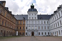
It was the residential city of the Duchy of Saxony-Weißenfels , which existed from 1656 to 1746. The early Baroque Neu-Augustusburg Castle and other important cultural monuments , especially in the Weißenfels core city, bear witness to this time and other epochs .
geography
Weißenfels is located at the exit of the middle Saale from the red sandstone belt of the Thuringian Basin into the Leipzig lowland bay , not far from the A 9 , between Halle / Saale (31 km) and Jena (40 km), 32 km southwest of Leipzig , in the so-called Weißenfels-Jenaer Saaletal . Due to the city's location in the comparatively narrow Saale valley, the altitude of the city varies considerably, mainly in the districts east of the Saale. The height above sea level is around 100 m in the area of the market square; in the area of the industrial park southwest of the Bundeswehr barracks, this is over 180 m (Eidechsenberg 183.50 m).
Parts of the core town Weißenfels (area of the Saaleauen) as well as the western districts are located in the Saale-Unstrut-Triasland nature park , which extends further to the city area to the southwest. The city is also located in the planned Triasland Geopark.
In the urban area, the single vineyards of Burgwerbener Herzogsberg are located in the northeasternmost vineyards of the Saale-Unstrut growing area .
City structure
| Locality | Residents | Districts |
The villages of Weißenfels (clickable map) |
|---|---|---|---|
| Castle woo | 1,023 | Castle woo | |
| Borau | 647 | Borau, Kleben, Selau | |
| Großkorbetha | 1.923 | Gniebendorf, Großkorbetha and Kleinkorbetha | |
| Langendorf | 2,395 | Kößlitz-Wiedebach, Langendorf, Muttlau, Obergreißlau and Untergreißlau | |
| Chisel | 1,512 | Chisel | |
| Market advertising | 682 | Market advertising | |
| Reichardt advertising | 1,227 | Baumchen, Posendorf, Reichardtswirtschaft | |
| Schkortleben | 593 | Kriechau and Schkortleben | |
| Storkau | 574 | Obschütz, Storkau and Pettstädt | |
| Daytime advertising | 811 | Daytime advertising | |
| Uichteritz | 1,394 | Lobitzsch and Uichteritz | |
| Weissenfels * | 28,565 | Weissenfels | |
| Wengelsdorf | 905 | Kraßlau, Leina and Wengelsdorf | |
| *) Not a locality in the legal sense. Has no local council and no local mayor. | |||
Neighboring communities
Neighboring communities are Leuna , Braunsbedra and Müelte (all three SK ) in the north, Goseck and Schönburg in the west, Teuchern in the south and Lützen and Bad Dürrenberg ( SK ) in the east.
climate
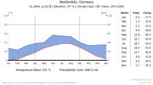
Weißenfels lies in the sub-continentally influenced climate of the inland basin and inland hill country, on the leeward side of the low mountain range Thuringian Forest and Harz, one of the thermally most favored landscapes in Central Germany. The average air temperature in Weißenfels is 9.3 ° C, the annual precipitation 513 millimeters (as of January 1, 2001). The duration of sunshine is around 1600 hours per year.
history
Settlement
The area of the middle Saale, including the area around Weißenfels, has been a preferred settlement area for several millennia. Archaeological findings show a more or less continuous settlement since the Neolithic Age, i.e. from around 3000 BC, as well as over 1000 years of building on the castle hill. Since around the 5th century BC, this area has been populated by peoples who are attributed to the Teutons . The first tribe to settle here, known by name, are the West Germanic Hermundurs from the Suebi tribal group, belonging to the Herminones or Elbe Germans , at the beginning of our era . The fact that the Hermunduren had contacts with the Roman Empire is confirmed by finds such as a Roman glass bowl with grooves worked into it. The find, which was made in Weißenfels in 1917, comes from a grave field from the Roman Empire around 40–70 AD.
During the 3rd / 4th In the 19th century, the Hermunduren probably formed the Thuringian tribe with the influx of fishing rods and warnings and possibly Celtic settlers . The Thuringian built in the 5th century a kingdom whose settlement and probably rule priorities in the area of the middle Saale (be exemplified in the helmet Fund shocks far known of Weissenfels) and lower Unstrut, in the central Thuringian basin and in the eastern Harz mountains (Mansfeld) lay. After the fall of this Thuringian Empire after 534, the country fell under Franconian administration. The settlement areas east of the Saale were in the 6./7. Mostly cleared by the Germans in the 19th century. West Slavic tribes immigrated to these parts of the country. Century have reached the Saale line. A Slavic settlement horizon from the end of the 10th century was proven on the castle hill, which was already abandoned in the early 11th century, which is due to the increased influx of Germanic / Franconian settlers in the hall area.
6th to 9th centuries
Between the 6th and 9th centuries, the Franconian territories were divided into Gaue (administrative districts). In the Hersfeld tithe directory , which was created between 880 and 899, some places are mentioned for the first time that today belong to the city of Weißenfels. The area west of the Saale, including the area of today's Neustadt, was part of the old Saxon / Franconian Hassegau . The area of today's old town belonged to the Gau Weitaha in the Thuringian Mark founded by Emperor Charlemagne around 804 , named after the Wethau river, which flows into the Saale between Naumburg and Weißenfels. The imperial border along the Saale was protected against attacks from the east on imperial territory by a network of castles. In the Weißenfels city area, 3 castles are named in the Hersfeld directory of the late 9th century. These are Uuirbineburg (Burgwerben), Vuirbinaburg (probably Markwerben) and Suemeburg (former castle location near Kraßlau / Leina).
The then Frankish imperial abbey of Hersfeld played an important role in the Christian missionary work of the Thuringian Teutons by the Franks, which from the 8th century systematically spread from the central Thuringian basin to the north and east. The named castles and associated villages in today's Weißenfels testify to the extensive possessions of the imperial abbey in northern Thuringia.
10th to 12th centuries
The first written mention of a castle in Weißenfels takes place at the end of the 10th century. After the year 965 the areas east of the Saale were divided into five areas / brands beyond the Neisse. One of these brands was the Zeitz mark, which also included the area of today's old town. In 985 Ekkehard I , who comes from the seat of the Thuringian noble family of Ekkehardines at the mouth of the Unstrut, was enfeoffed with the margraviate of Meißen-Merseburg-Zeitz and at the same time received the Weißenfelser Land as a fief. The area of today's Weißenfelser Neustadt was still part of the Hassegau in the 10th and 11th centuries. This was first ruled by a Count Palatine of Saxony since 1003 by Burchard I. von Goseck. After the death of the last Ekkehardian margrave Ekkehard II. In 1046, the area of the old town and the county of Weißenfels came to Friedrich II. Von Goseck , the Count Palatine of Saxony, who also owned parts of the western Saalbach area.
The castle in Markwerben on the Gotthardsberg was probably owned by the noble von Werben from the 9th to the middle of the 13th century and possibly the ancestral seat of this noble family. The castle in Burgwerben was brought into the marriage with the Ascan Adalbert II von Ballenstedt in 1062 by Adelheid von Orlamünde, daughter of Count Otto I von Weimar-Orlamünde. The castle remained in the possession of the Ascanians until 1183.
There is so far no clear evidence of the establishment of a Franconian county of Weißenfels in Carolingian times. However, in 988 it was owned by the Ekkehardines. As already described above, this came to the Count Palatine Friedrich II of Saxony in 1046. After the death of Friedrich III. In 1085, after Friedrich's widow, Adelheid von Stade, married Count Ludwig der Springer of Thuringia, acquired a large part of the Palatinate's possessions with the County of Weißenfels.
About 100 years later, as a result of political disputes, the Landgraviate of Thuringia (transferred to the Ludowingers in 1131) was without a male head at the end of the 12th century, which was exploited by neighboring sovereigns. In 1180, the Wettin margrave Otto “the rich” of Meissen bought several manors and castles in Thuringia. This also brought the castle and county of Weißenfels with the German settlement below the castle hill to the Meissen margraves.
Weissenfels has since 1185 city law . In a geographically favorable location, two trade routes ran through the city ; one of them the Via Regia (Königsstraße, also Hohe Straße) leading from the Rhine to Silesia. A Saale ford made the river crossing possible. Due to the already existing castle complex , the emerging city was also used for military purposes.
In the course of the late Middle Ages and the beginning of the modern era, the town of Weißenfels developed a handicraft form - especially the tailoring and shoemaking trade established itself. However, before 1185 there were three villages in what is now the urban area. These were Tauchlitz (along the Greislaubach), Horklitz (on the Georgenberg, later renamed Georgenberg) and Klenkow (e) / Klingau, which was later incorporated as a Klingervorstadt. Tauchlitz first appears in documents in 1047 and Horklitz / Georgenberg was first mentioned in the 10th century.
13th to 18th centuries
With the extinction of the Thuringian Ludowingers in 1247, the dispute over the Landgraviate of Thuringia began . The Weißenfels Castle, located on the eastern edge of the old Ludowingian heartland and now Thuringian heritage, was an important point of contention in the Thuringian War of Succession . On July 1, 1249, the " Weißenfels Treaty " was signed at the castle . With this contract most of the Thuringian counts recognized the Wettin Heinrich III. from Meissen , the illustrious, as Landgrave of Thuringia.
Under the Wettins , the castle and town of Weißenfels were part of the Landgraviate of Thuringia from 1264 onwards. With the death of Wilhelm III. in 1482, who, as a sovereign (Landgrave), for example, acquired the so-called “Herrenmühle” in 1452, the Landgraviate of Thuringia ends as an independent domain. The landgraviate falls to Wilhelm's nephews, the brothers Ernst and Albrecht of Saxony. As a result of the division of Leipzig in 1485, the city and the office of Weißenfels came under the Albertine line of the Wettins . Between 1547 and 1815 Weißenfels was assigned to the Thuringian district of Kursachsen. The city had central administrative tasks , especially in connection with the residence of the Duchy of Saxony-Weißenfels (1656–1746).
Martin Luther is said to have preached in 1518 on the way to the Reichstag in Augsburg and in 1521 on his trip to the Reichstag in Worms in the Weissenfelser Marienkirche. On June 3, 1539, the Reformation was finally introduced in Weißenfels .
During the Thirty Years' War , the city was severely weakened, the population fell from 2200 to 960. A few years after the end of the war, Weißenfels experienced an economic boom. The city on the Saale became the residence of the Duchy of Saxony-Weißenfels . The Castle Neu-Augustusburg was from 1660 by Duke August, Archbishop of Magdeburg , the first since 1657 Duke of Saxony Sekundogenitur built Saxe-Weissenfels. It was built in the old castle complex that was razed by the Swedes during the Thirty Years' War in 1644. His son, Johann Adolf I von Sachsen-Weißenfels , had it completed. The three subsequent dukes also resided here until 1746.
19th century
Due to its alliance with France, as a result of the Congress of Vienna in 1815 , Saxony had to cede its northern and western districts, including all of its possessions in Thuringia, i.e. the Thuringian district with Weißenfels, to the Kingdom of Prussia. The new Prussian province of Saxony was formed from the Thuringian district and other areas further north, such as Merseburg, Halle, Halberstadt, Magdeburg, Torgau, Wittenberg, Stendal and Salzwedel . The lower district of the Thuringian district with Weißenfels was added to the administrative district of Merseburg ; the upper district largely formed the administrative district of Erfurt . Since October 1, 1816, Weißenfels was the district town of the Weißenfels district in the Merseburg administrative district of the Prussian province of Saxony. From April 1, 1899, the municipality of Weißenfels formed its own urban district , but the seat of the district remained in the city.
At the end of the 18th century, but especially in the 19th century, the area around Weißenfels experienced an economic boom. From 1764 coal was mined and, as a result of increasing industrialization from the middle of the 19th century, a rapid development into a growing industrial location began. Many factories were built, and shoe production was particularly important in the city of Weißenfels. In 1895 there were 45 shoe and shaft factories alone. In 1846 Weißenfels was connected to the Thuringian Railway , which further promoted the city's economic development. Industrialization meant that workers were drawn from the predominantly Catholic Eichsfeld, the Sauerland, from Prussian Silesia and Bohemia. A Catholic church was consecrated for them in 1873.
20th century to the present
Before 1900 until the First World War , Weißenfels was a center for processing the skin of the Russian squirrel. The company J. C. Keller & Sohn in Weißenfels is mentioned as the first wrongdoing ever . Up until the introduction of the fur sewing machine in the first third of the 20th century, almost all working women in the city worked from home with the sewing of misery, an intermediate product for making fur linings and furs. An English specialist fur book from 1903 noted, “The best are prepared and sorted in Weißenfels, Germany. This small place, Weißenfels is known all over the world for its furs and fodder. 500,000 false skins are trimmed annually; they provide employment for 6,000 workers, women and children ”.
The large chemical plants Leuna (from 1916) and Buna (from 1936) were established in the area, with employment potential reaching as far as Weißenfels. During these years, the city's cultural offerings were also expanded. Volkshochschule, Stadttheater and Volksbühne should also bring literature, art and music closer to the population. On October 18, 1928, the modern Gloria cinema was inaugurated and is now vacant.
During the time of National Socialism , political opponents of the Nazi regime and other groups that did not fit into the image of the "Aryan national community " were persecuted and many of them were murdered. The synagogue at Nordstrasse 14 was destroyed in the pogrom night of 1938.
US Army troops reached the city on April 12, 1945. The fighting continued until April 15, 1945. After three months, the Americans left the city in early July 1945 and handed it over to the Soviet occupying power . With the dissolution of the State of Prussia by the Allied Control Council in 1947, Weißenfels became part of the newly founded state of Saxony-Anhalt.
The barracks on Zeitzer Strasse and Selauer Strasse ( Strasbourg barracks ) built in the 1930s during the armament of the Wehrmacht were occupied by the CIP and NVA of the GDR and the Soviet / Russian troops after 1945 . The withdrawal of the Russian troops took place in 1992. The Saxony-Anhalt barracks are still used by the German armed forces today.
After the Second World War , many shoe companies were nationalized and the new GDR - Combine Shoes ( Banner of Peace ) with large production facilities, shoe machine construction (Compart) and research institutions was made up of the individual ones . By the end of the 1980s, Weißenfels had developed into the largest shoe production location in the GDR, with over 6000 employees working in the factories in the Weißenfels area, which produced 75% of the shoes for the GDR. After several area changes in the previous decades, a new Weißenfels district was formed in the now Halle district, with Weißenfels remaining the seat of the district.
After German reunification in 1990, the restructuring and privatization of the companies led to a collapse of the entire industry. Due to the opening of the economy to the world market, there was hardly a chance of survival, especially for the large shoe industry of the former GDR, due to the great competition in the low-wage countries. This led to a skyrocketing unemployment rate, reinforced by the massive reduction in the workforce required in the chemical industry in the neighboring Leuna factories . After the Weißenfels district was initially enlarged during the first district reform in the newly formed state of Saxony-Anhalt in 1990, Weißenfels lost its status as a district seat after almost 200 years with the second district reform and the associated merger of the Weißenfels district with the Burgenland district .
After 1990, valuable building stock in the center was partly renovated with EU funding , but there are many houses close to the center that are still waiting for an investor.
Incorporations
In 1833 the suburbs Nikolaivorstadt, Saaltorvorstadt, Georgenberg and Klingenvorstadt were incorporated. Around 1900, Beuditz was incorporated with around 100 inhabitants and on January 1, 1995 Borau (around 800 inhabitants), consisting of the formerly independent villages Borau, Selau and Kleben. Langendorf , Markwerben and Uichteritz followed on January 1, 2010 . On September 1, 2010, the communities of Burgwerben , Großkorbetha , Leißling , Reichardtswerbe , Schkortleben , Storkau , Tagewerbe and Wengelsdorf became further districts of the city of Weißenfels.
Population development
Development of the population (from 1960 on each December 31st):
|
|
|
|
|
- Data source from 1990: State Statistical Office Saxony-Anhalt
1 : October 29th
2 : August 31st
3 : Incorporation of surrounding villages
politics
City council
The city council of Weißenfels consists of 40 elected members. The Lord Mayor is an ex officio member of the City Council .
The 2019 election brought the following result:
| Party / group of voters | Votes (absolute) |
Votes (percent) |
Seats | |
|---|---|---|---|---|
| Christian Democratic Union of Germany (CDU) | 12,073 | 25.46 | 10 | |
| Alternative for Germany (AfD) | 8,836 | 18.63 | 7th | |
| We Weißenfelser (WW) | 6,673 | 14.07 | 6th | |
| The Left (DIE LINKE) | 5,827 | 12.29 | 5 | |
| BfW-WV / rural communities | 4,340 | 9.15 | 4th | |
| Social Democratic Party of Germany (SPD) | 4,272 | 9.01 | 4th | |
| Alliance 90 / The Greens (GREENS) | 1,392 | 2.94 | 1 | |
| Free Democratic Party (FDP) | 1,263 | 2.66 | 1 | |
| Alliance for Justice - Weissenfels Electoral Association (BfG-WV) | 1,220 | 2.57 | 1 | |
| Party for Labor, Rule of Law, Animal Welfare, Promotion of Elites and grassroots initiative (Die PARTTEI) | 958 | 2.02 | 1 | |
| National Democratic Party of Germany (NPD) | 564 | 1.19 | - | |
| total | 47,418 | 100 | 40 | |
| As of June 7, 2019 | ||||
mayor
- 1881–1885: Adalbert Welcker
- 1885–1897: Franz Falkson
- 1897-1907: Christ. Richard Johannes Wadehn
- (1907) 1909–1933: Wilhelm Daehn
- 1933–1937: Philipp Zeitler , Lord Mayor
- (1937–1939): Martin Vogeler (presumably arr.)
- 1939–1945: Ludwig Jungermann , Lord Mayor
- 1945–1947: Friedrich von Basse
- 1950–1952: Erna Wildt-Tanneberger
- 1956–1974: Josef Gentes , Mayor
- 1994–2001: Gisela Bevier , Lord Mayor
- 2001–2008: Manfred Rauner (CDU), Lord Mayor
- 2008 : Robby Risch (independent), Lord Mayor
coat of arms
| Blazon : “In blue, a silver castle with a tinned, black grooved wall, open gate with raised black portcullis as well as two corner towers with red pointed roofs and two black arched window openings each; between the towers a floating golden shield with a black lion. " | |
City colors
The city colors of the city are yellow and blue .
Town twinning
- Kornwestheim , Baden-Württemberg, since February 1990
- Komárno , Slovakia , since October 1995
Culture and sights
- Neu-Augustusburg Castle as one of the largest early Baroque castle complexes in Central Germany with a museum (permanent exhibition on the history of the city, including the shoe museum, changing special exhibitions) and castle church, in which Lutheran services are celebrated on Sundays. The crypt under the castle church can be visited on request or on special occasions ( day of the open monument , castle festival ).
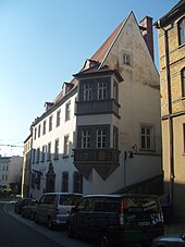
- Escort house with museum and restaurant ; Here the body of the Swedish King Gustav II Adolf, who fell in the battle of Lützen in 1632 , was dissected (blood stain in the bay window) and embalmed. In addition to a diorama about the battle (with 10,000 tin soldiers ), the museum shows the effects of the Thirty Years' War on the city.
- Heinrich Schütz House with museum.
- Novalis House; The city library is located on the ground floor of the building, which was built in 1680, and a museum on the upper floor. The tomb of Novalis designed by Friedrich Schaper is located in the city park directly adjacent to the garden with the Novalis pavilion .
- Marienkirche with Ladegast organ
- Baroque town hall and other baroque facades in the city center
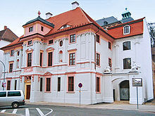
- The baroque princely house at Leipziger Strasse 9 is from the residence period. It was built in 1673 and mainly served as the residence of high ducal court officials. The gray and dusky pink facade of the two and a half storey building, which was renovated between 2004 and 2006, corresponds to the historical color scheme. In the interior, the stucco work on the first floor, which was made by Italian plasterers at the end of the 17th century, stands out. Public use of the building is planned for the future (it already houses the registry office).
- Baroque Old Ducal House ( Princesses Palace )
- Ducal Ballhaus (ball game hall for the ducal children)
- Marstall (part of the palace complex)
- Louise von François House
- Partly very beautiful facades of historicism in Weißenfelser Neustadt, Beuditzstrasse, Naumburger Strasse and their side streets and quarters.
- Jägerhof (hotel) (traditional inn) with Schwedenstein
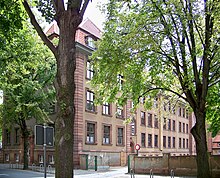
- District court, built 1911/12
- The courthouse is in the simple baroque style, a simple, simple and functional construction was chosen for the time. The entrance portal, the main staircase and the Schöffensaal are a certain exception to this.
- former monastery of St. Klaren ( Poor Clare Monastery , 1283–1580)
- Cemetery chapel , the Gothic choir of the Poor Clare Church, which has been moved to the city cemetery
- Goethe Gymnasium , House I (main building, formerly Goethe Oberschule)
- Police station building (former IFL (Institute for Teacher Education), teacher training college, in front of that Harnisch Institute)
- Banks on Jüdenstrasse (between Saalstrasse and Friedrichstrasse)
- Café Centra am Markt ( Art Nouveau )
- Müller department store in Bauhaus style (former Spiegel department store, whose Jewish owners were expropriated and driven out under the Nazis)
- Shoemaker boy from Weißenfels in the city park (mascot of the city)
- City fountain in Jüdenstrasse, created by Bonifatius Stirnberg
- Fairytale fountain in the new town
- Heimatnaturgarten (animal park, which shows local fauna and flora)
- Saale-Unstrut wine-growing region with the local single-site wine Burgwerbener Herzogsberg
- the Saale in the cityscape with three weirs and locks: Beuditzmühlen lock, bridge mill lock, Herrenmühlen lock; Tourist development for water hikers and cyclists ( Blaues Band , Radacht Saale-Radweg )
- Klemmberg with the Bismarck Tower
- Park Georgenberg with historic city wall and powder tower
- Edelhaus (manor house) on the Georgenberg
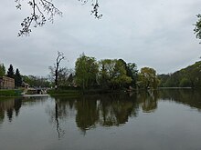
- City park (with old grave sites)
- Meadows and banks of the Saale
- Building of the former Oettler brewery (today the location of the MEG Group and the CK Group )
- Exhibition with diorama about the Battle of Roßbach, 1757, in the district of Reichardtswerbe
- As cultural institutions: Kulturhaus (former city theater), auditorium of the Goethe-Gymnasium as an event room
- Former power station (International Building Exhibition Urban Redevelopment Saxony-Anhalt 2010 IBA theme Weißenfels GRÜN-DER-ZEIT <Neustadtpark)
Memorial sites for the victims of National Socialism
- Commemorative stele in city park for 21 known by name Weißenfelser resistance fighters , the victims of fascism were
- Memorial stone in the municipal cemetery in Friedensstrasse for the 229 Jewish victims of the Shoah from the Soviet Union and Hungary , donated by the Jew Max Wolfson from Weißenfels in 1945, and on which the names of 24 Jewish Weißenfelsers are recorded
- Memorial stone from 1975 in the same cemetery for 32 Poland , during the Second World War deported to Germany and victims of forced labor were
- Memorial stone for the KJVD functionary Fritz Schellbach , who was murdered as a resistance fighter in 1944. Another memorial stone for him on the corner of Gutenbergstrasse and Merseburger Strasse was removed after 1989 because a new residential and commercial building was being built on the open-air site.
- Memorial stone from 1969 on the stadium , which bore his name in GDR times, in memory of the communist worker sportsman Otto Müller, who was murdered in 1944
- Memorial plaque from 1988 in the courtyard of the former synagogue on Nordstrasse 14 in memory of the city's erased Jewish community
- Soviet cemetery of honor from 1949 on the Klemmberg with 89 individual and 64 collective graves of 192 Red Army soldiers and prisoners of war as well as 130 women and men from the district who were abducted to Germany during the Second World War and were victims of forced labor.
- Information board on the prisoner assembly camp in Neu-Augustusburg Castle between March 4 and August 12, 1933
Natural monuments
- European beech on the Georgenberg
- Sequoia in the home garden
Aerial view
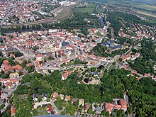
On the adjacent aerial photo, the green in the foreground is the city park. The Georgenberg follows with the Georgenberg tunnel. In the left middle part of the picture is the center of the city with St. Mary's Church and market square. On the left edge of the picture the Goethe-Gymnasium (large red roof), on the right the old and currently unused Clarissenkloster (yellow and gray roof). At the far left of the picture you can see a small piece of the large Saale bridge, which continues upwards (northward) to the straight line Merseburger Strasse (Neustadt district). The bridge in the middle part is reserved for pedestrians ("Pfennigbrücke"). It connects the train station with the center. At the top of the picture half right the new Saale bridge along the bypass road. In the middle part on the right the Neu-Augustusburg Castle. The picture was taken in May 2005.
Sports
basketball
- The Central German Basketball Club is one of the most successful sports clubs in Weißenfels. From 1999 to 2004 the wolves played in the 1st basketball league . In 2004 the team won a European Cup ( FIBA EuroCup Challenge ). In 2006 and 2007, the runner-up in the 2nd basketball Bundesliga was achieved before the promotion to the Bundesliga again in 2009. The home games are played in the Weißenfels town hall.
Floorball / floorball
- The Unihockey Club Sparkasse Weißenfels is the thirteen-time German champion in floorball and floorball (2003-2010, 2012, 2014-2017) and has won the cup competition nine times so far. The women of the UHC have so far collected five championship titles and three cup wins. With around 350 members, the club is the most successful and largest floorball club in Germany.
Casting sport
- The Weißenfels district fishing club is one of the most successful clubs in Germany in the field of casting . It houses u. a. the junior vice world champion and multiple German champion Stefanie Grimm as well as other successful athletes in the youth field.
Soccer
- From 1955 to 1960 the BSG progress Weissenfels played handball and football in the GDR league . The handball teams became champions several times.
- The SSC Weißenfels is one of the city's football clubs. The club played in the Association League Saxony-Anhalt .
- The SV Rot-Weiß Weißenfels 1951 eV is the second most successful soccer club in the city and played in the Landesliga Süd.
- The Weißenfelser FV Schwarz-Gelb eV played in the regional league Burgenland.
Handball
- The Weissenfelser Handballverein '91 eV was founded in 1991.
chess
- The chess club Roland 1919 eV takes part in the game with five adult teams and is very active in the youth field.
Regular events
- Heinrich Schütz Music Festival
- Weißenfels Castle Festival
Economy and Infrastructure
traffic
The federal highways 91 , 87 and 176 cross in Weißenfels . Close to the center, the city is connected to the 9 and 38 motorways. A four-lane bypass with Saale crossing (B 91n) was completed in 1997 and was expanded in 2010 as part of the connection to the B 176. In the center of Weißenfels a road and a pedestrian bridge (at the train station) cross the Saale; the next road bridge upstream is in Naumburg, downstream it is the bridges of the B 91n and the A 38.
The White Rock Station is located on the 1846 opened Thuringian Railway , he is from the DB Station & Service in the station Category ranked third Individual intercity trains also stop in Weißenfels during weekend traffic (Friday and Sunday). In regional traffic, Leipzig, Halle, Erfurt, Eisenach, Jena, Saalfeld and Zeitz can be reached without changing trains. As a result of the municipal reform, there are now two more stops on the Halle-Erfurt regional transport route in the area of the city of Weißenfels - in the districts of Großkorbetha and Leißling. The nearby destinations in southern Saxony-Anhalt have also been served by the Burgenland Railway since 1999 , which has further stops in Weißenfels-West and in the district of Langendorf ( Weißenfels – Zeitz route ).
Leipzig / Halle Airport is around 45 km away and can be easily reached via the A 9 and A 14 motorways.
The Saale in the city area, formerly an important trade route, is now a state waterway only of importance for water tourism. There are three ship locks on the city's territory, the Herrenmühlenschleuse , the Brückenmühlenschleuse and the Beuditzmühlenschleuse . Another, the Oeblitzschleuse, is located between Schönburg (Saale) and the district of Leißling.
Established businesses
The shoe industry traditionally located in Weißenfels (hence the shoe museum in Neu-Augustusburg Castle) could no longer assert itself after 1991. Rather, (the partly already existing) food industry was increasingly expanded. In the meantime, due to the food industry centering here, a network of the food industry has been established for the south of Saxony-Anhalt. In addition, other branches of industry were stabilized and expanded. An intermunicipal industrial park is also planned directly on the A 9 federal motorway.
food industry
- B&C Fleischwerk Tönnies GmbH & Co. KG
- Mitteldeutsche Erfrischungsgetränke GmbH & Co. KG (Leisslinger Mineralbrunnen)
- Frischli Milchwerk Weißenfels GmbH
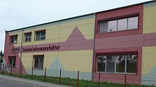
- Argenta Schokoladenmanufaktur GmbH
Other industry
- Schüco International KG, construction supplier
- Drakena GmbH (formerly Nollsche Werke), small iron goods
- Manufacturing technology Weißenfels GmbH (FTW), mechanical engineering
Healthcare
The Asklepios Clinic Weissenfels is a hospital that provides specialist care . It acts as the academic teaching hospital of the Martin Luther University Halle-Wittenberg. It has a certified breast, colon and prostate cancer center as well as a medical care center .
In the city there is a medical education center with a vocational school and a vocational school.
armed forces
Weißenfels is the location of the Bundeswehr in Saxony-Anhalt (largest medical facility in Germany, Saxony-Anhalt barracks ).
Volunteer firefighter
The Weissenfels volunteer fire department was founded in November 1863. The Weißenfels fire station is located on Leopold-Kell-Straße and is staffed around the clock by full-time emergency personnel. At least one watch shift supervisor and two emergency services are available and can move out immediately in the event of an emergency. A total of 17 full-time emergency services are working 24-hour shifts. In the presence area of the Weißenfels fire brigade, the BAB 9 , BAB 38 , B 91 , B 87 , B 176 , several industrial areas, Thuringian Railway with several main tracks (ICE main line), the Saale and a freight and hazardous goods station are located.
media
- BLK Regional TV - regional television in southern Saxony-Anhalt ; Local TV program for most of the Burgenland district, receivable via the regional cable network providers and via online streaming
- Mitteldeutsche Zeitung with regional editorial office in Weißenfels
Public institutions, administration
Weißenfels is:
- Seat of the district court
- Headquarters of Department II of the Burgenland District, consisting of
- Veterinary and Food Inspection Office
- District Planning Office
- Office for Immission Control and Waste Management
- Office for water protection
- Building regulations office
- Headquarters of the police station for the Burgenland district
- Headquarters of the federal motorway - Weissenfels police station
- Headquarters of the Weißenfels motorway maintenance facility as an organizational unit of the Saxony-Anhalt construction company
- Headquarters of the site administration of the Bundeswehr, as well as the medical command III for the military district east ( Saxony-Anhalt barracks )
- Seat of the driving license office of the Burgenland district
- Seat of the Office for Agriculture, Land Management and Forests South
- Branch of the customs office
education
schools
There has been a grammar school in Weißenfels for about 300 years. The first grammar school was named Gymnasium Illustre Augusteum (named after the duke) and in its time had almost the meaning of a university. After the Duke's death, the importance of the Augusteum as a normal high school declined. The Augusteum was later replaced by the Goethe grammar school that exists today .
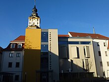
During the GDR era, there was also an institute for teacher training (IfL) in Weißenfels , as well as an engineering school that had specialized primarily in training in the shoe trade. A conversion of the institute for teacher training into a pedagogical university failed after 1990. After 1990 the engineering school was merged into the vocational schools (BBS) as a vocational school.
Today there are the following educational institutions in Weißenfels:
- Goethe high school
- Albert Einstein School (primary school)
- Mountain school (primary school)
- Herderschule (primary school)
- Beuditz School (secondary school)
- Neustadtschule (secondary school)
- Ökowegschule (all-day secondary school)
- Business high school (belonging to the BBS vocational schools)
- Pestalozzi School (special school)
- Castle Garden School (special school)
- Free Evangelical School (Primary School)
Further training
- Vocational School (BBS)
- Vocational School (BBS)
- Technical School (BBS)
- Fachoberschule (BBS)
- Medical Education Center (MBZ) (medical school with technical college)
- Branch of the St. Elisabeth University in Bratislava (Medical College)
Museums and memorials
- Shoe Museum and City Museum in Neu-Augustusburg Castle
- Museum in the Heinrich Schütz House
- Museum in the escort house with diorama of the battle of Lützen
- Organ building museum
- Novalis memorial
- Louise von François Memorial
Libraries
- The city library in the Novalishaus contains around 42,000 books, magazines, sound carriers and other media.
Personalities
literature
- Georg Ernst Otto: History of the city of Weißenfels. 1796.
- Gustav Heinrich Heydenreich: Church and school chronicle of the city and Ephorie Weißenfels since 1539, in memory of the 30-year jubilee celebration of the introduction of the Reformation in Weißenfels and the surrounding area. Weißenfels 1840.
- Karl August Gottlieb Sturm : Chronicle of the city of Weißenfels: edited from sources. Publishing house C. F. Sueß, Weißenfels 1846.
- Karl August Gottlieb Sturm: Small chronicle of the city of Weißenfels: edited from sources. Weißenfels 1869 ( e-copy ).
- Gustav Sommer: Descriptive representation of the older architectural and art monuments of the Weißenfels district . In: Historical Commission for the Province of Saxony and the Duchy of Anhalt (Hrsg.): Descriptive representation of the older architectural and art monuments of the Province of Saxony. Volumes 1–33, published 1879 ff . Hendel, Halle an der Saale 1880.
- Friedrich Gerhardt: History of the city of Weißenfels a. S. with new articles on the history of the Duchy of Saxony-Weißenfels . Schirdewahn, 1907.
- Paul Thieme: Chronicle of the city of Weißenfels. 1928.
- Ingo Bach, Eva-Maria Klapproth, Adolf Schmiedecke: Weißenfels: City Chronicle. Verlag Stadt Weißenfels, publisher Council of the City of Weißenfels, Weißenfels 1980.
- Susanne Riemer-Ranscht, Jörg Riemer: Weißenfels. The city guide . Stekovics, Halle 2007, ISBN 978-3-89923-161-8 .
- Gerhard Bach: Time leaps in Weißenfels . Sutton, Erfurt 2009, ISBN 978-3-86680-497-5 .
Movie
- The Weißenfels history of the first years after the fall of the Wall was shown for the first time on October 1, 1995 on ARD, the documentary The Long Farewell to the GDR. Weißenfels 1990–1995 shown.
- On October 30, 2009, the Spanish television broadcaster La 2 of the rtve radio station broadcast a report entitled “Veinte años sin muro” (German: “Twenty years without a wall”) by the journalist Pilar Requena. However, only a few short sections show places in Weißenfels and their citizens (shoe combination "Banner des Friedens" from 00:38 min .; Simon advertising from 07:00 min .; town hall from 30:53 min .; Mayor Robby Risch from 31:16 Min .; Simon advertising from 31:40 min .; Chocolate Manufactory Argenta from 33:06 min.). The MZ reported on the shooting on June 27, 2009.
Web links
- Official website of the city of Weißenfels
- Weißenfels - facts, impressions and opinions
- Weissenfels, Wissenfels. In: Johann Heinrich Zedler : Large complete universal lexicon of all sciences and arts . Volume 54, Leipzig 1747, column 1324-1332.
- IBA 2010: Urban redevelopment Weißenfels-Neustadt, motto: "Gründerzeit - Grün der Zeit" ( Memento from August 27, 2010 in the Internet Archive ) ( Memento from August 27, 2010 in the Internet Archive )
Individual evidence
- ↑ State Statistical Office Saxony-Anhalt, population of the municipalities - as of December 31, 2019 (PDF) (update) ( help ).
- ↑ Borau, Selau and Gluing. In: weissenfels.de, accessed on August 24, 2017.
- ^ German Weather Service, normal period 1961–1990
- ↑ History of the Catholic parish “St. Elisabeth “ ( Memento from July 17, 2013 in the Internet Archive ). In: kath-weissenfels.de, accessed on August 24, 2017.
- ^ BP Bukow: The Leipziger Brühl then and now. In: The fur clothing. Illustrated monthly magazine for fur fashion and tobacco products. No. 1, March 1925, p. 14.
- ↑ Paul Larisch : The furriers and their characters. Contributions to the history of skinning. Self-published, Berlin 1928, p. 148.
- ↑ George R. Cripps: About Furs. Geo. R. Cripps: Liverpool; George Routledge & Sons, undated (1903), OCLC 77683258 , p. 75.
- ↑ See Sarah Huke: The Gloria in Weissenfels. In: ModerneREGIONAL. 1, 2014 ( online ).
- ↑ On the history of the Jewish community in Weißenfels. In: Alemannia Judaica . October 28, 2014, accessed March 24, 2018.
- ↑ VEB Kombinat shoes Weißenfels. Retrieved November 22, 2019 .
- ↑ StBA: Changes in the municipalities of Germany, see 1995.
- ↑ a b StBA: Area changes from January 1st to December 31st, 2010
- ↑ census database
- ↑ Local election results Weißenfels 2019 (PDF; 855 kB) In: weissenfels.de. City of Weißenfels, May 29, 2019, accessed on June 7, 2019 .
- ^ Burgenlandkreis: Anne-Hedwig on cloud nine. Retrieved October 12, 2013 .
- ↑ § 2 para. 1 main statute of the city of Weißenfels. In: weissenfels.de, accessed on August 24, 2017 ( PDF; 100 kB ).
- ↑ § 2, Paragraph 2 of the main statute of the city of Weißenfels. In: weissenfels.de, accessed on August 24, 2017 ( PDF; 100 kB ).
- ^ Building history of the monastery. In: kloster-st-claren.de, accessed on August 24, 2017.
- ↑ Portrait of the city library ( memento of November 8, 2014 in the Internet Archive ) on the website of the city of Weißenfels (accessed on June 24, 2009) .
- ↑ Report “Veinte años sin muro”. In: rtve.es, accessed on August 24, 2017.
- ↑ MZ article Changes cannot be overlooked ( Memento of October 13, 2013 in the Internet Archive )


