
Saalekreis
| coat of arms | Germany map |
|---|---|

|

Coordinates: 51 ° 26 ' N , 11 ° 52' E |
| Basic data | |
| State : | Saxony-Anhalt |
| Administrative headquarters : | Merseburg |
| Area : | 1,433.67 km 2 |
| Residents: | 183,815 (Dec. 31, 2019) |
| Population density : | 128 inhabitants per km 2 |
| License plate : | SK, MER, MQ, QFT |
| Circle key : | 15 0 88 |
| NUTS : | DEE0B |
| Circle structure: | 20 municipalities |
| Address of the district administration: |
Domplatz 9 06217 Merseburg |
| Website : | |
| District Administrator : | Hartmut Handschak (independent) |
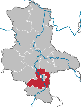
| Location of the Saalekreis in Saxony-Anhalt | |
  |
|
The Saalekreis is a district in Saxony-Anhalt that was created in the course of the second district reform on July 1, 2007 from the Saalkreis and the district of Merseburg-Querfurt .
geography
location
The district is located in the south of Saxony-Anhalt and completely encloses the independent city of Halle (Saale) . In the south it borders on the Burgenlandkreis , in the northwest on the Mansfeld-Südharz district , in the north on the Salzlandkreis and in the northeast on the Anhalt-Bitterfeld district . In addition, it has a border with Thuringia ( Kyffhäuserkreis ) in the west and one with Saxony in the east ( district of Leipzig and district of northern Saxony ).
landscape
,_Blick_von_der_Burg_Giebichenstein_zum_Petersberg.JPG)
The west of the district is characterized by the Querfurter Platte, the east by the Saale-Elster floodplains and the north by the Saale valley and the porphyry peaks. The highest elevation in the district is 298.6 m above sea level. NHN the Kahler Berg ⊙ in the locality of Landgrafroda.
A landmark that can be seen from afar in the north of the district is the rhyolite dome of the Petersberg . This elevation, also called Lauterberg in older times, houses a monastery and a telecommunications tower .
Waters

The largest river in the district is the Saale , which gives it its name , and flows through it from south to north. The White Elster, coming from Leipzig, flows south of Halle . The south-western border of the district is still on the valley of the Unstrut coming from Thuringia, which, however, flows into the Saale in the Burgenland district further south. Other small rivers are the Luppe , Geisel , Laucha and Salza . There are several renatured and flooded residual holes from lignite mining around Merseburg, of which the Geiseltalsee is the largest
raw materials
In the area of the Saalekreis there are various raw materials, some of which were still used economically. In the northern Saalekreis, rhyolite was and is mined in quarries . This rock, also known colloquially as porphyry , is used as building and decorative stone or for gravel extraction. In the past, lignite was mined in large open-cast mines around Merseburg . While mining is still ongoing in the south-eastern districts, the large remaining holes have been renatured in recent years and now some of them are forming large lakes. Potash bodies were mined underground near Teutschenthal and in the Salzatal municipality . In some cases, large hollow bodies were created. In the Teutschenthal mine, these are currently being backfilled in order to prevent subterranean rock attacks and consequent earthquakes like the one in 1996. To the northwest of Halle there are smaller hard coal deposits that were mined in smaller pits in the past. Halden are evidence of this mining activity. Finally, limestone is extracted in the open-cast mines in Schraplau and in Karsdorf not far from Steigra.
The most widespread raw material, however, is the very fertile black earth soils , which have a beneficial effect on agriculture.
Protected areas
There are 23 designated nature reserves in the district (as of February 2017).
history
Today's Saalekreis was created on July 1, 2007 by amalgamating the previous Saalkreis and Merseburg-Querfurt districts . Historically, the entire area has belonged to Prussia ( Province of Saxony ) since 1815 . Before that, the Saalkreis with the city of Halle belonged to the Duchy of Magdeburg and from 1680 to Brandenburg-Prussia ; the old district of Merseburg-Querfurt belonged to the secondary genetics of Albertine Saxony .
In the Prussian province of Saxony, the districts of Querfurt , Merseburg and Saalkreis were in the area of today's district. Shortly before the end of the Second World War, the province of Saxony was divided up. The Saalkreis was now in the province of Halle-Merseburg .
During the division of Germany, the Saalekreis was on the territory of the GDR . In the early years it was in the newly formed state of Saxony-Anhalt. After the dissolution of the federal states in 1952, he came to the newly founded Halle district . Its current area was divided by the former districts of Merseburg , Querfurt and Saalkreis . After the reunification, the area came back to the re-established state of Saxony-Anhalt.
Population development

The population of the Saalekreis has decreased since at least the 1960s. After stagnation at the beginning of the 1990s and slight growth until the beginning of the new millennium, the population of the Saalekreis has been showing a clearly negative trend for several decades:
| year | Residents |
|---|---|
| 1964 | 272,638 |
| 1985 | 223.043 |
| 1990 | 209,742 * |
| 1995 | 209.372 |
| 2000 | 217,487 |
| 2005 | 208.094 |
| 2010 | 196.946 |
| 2015 | 186,431 |
(Territory as of December 31, 2014 / December 31, as of 1995) , *: October 3
According to the 4th regionalized population forecast by the Saxony-Anhalt State Statistical Office of January 30, 2007, 184,716 people will still live in the Saalekreis district in 2025. The Saalekreis benefits in particular from migration from the city of Halle / Saale to the area around the city. The population reduction is therefore less pronounced than in other districts of Saxony-Anhalt.
politics
District council
(Result of the local elections on May 26, 2019)
| Parties and constituencies | Percent 2019 |
Seats 2019 |
Percent 2014 |
Seats 2014 |
Percent 2007 |
Seats 2007 |
Percent 2004 |
Percent 1999 |
|
|---|---|---|---|---|---|---|---|---|---|
| CDU | Christian Democratic Union of Germany | 27.2 | 15th | 38.1 | 21st | 33.5 | 20th | 38.2 | 39.2 |
| AfD | Alternative for Germany | 21.1 | 11 | 1.9 | 1 | - | - | - | - |
| THE LEFT. | THE LEFT. | 15.1 | 8th | 21.3 | 12 | 18.8 | 12 | 18.0 | 16.0 |
| SPD | Social Democratic Party of Germany | 12.1 | 6th | 14.4 | 8th | 19.2 | 12 | 17.8 | 27.8 |
| FDP | Free Democratic Party | 9.0 | 5 | 7.2 | 4th | 9.5 | 6th | 11.1 | 8.6 |
| GREEN | Alliance 90 / The Greens | 6.7 | 4th | 3.8 | 2 | 2.4 | 1 | 2.2 | 1.4 |
| INSTEAD of party | INSTEAD of the party - the independents | 5.3 | 3 | 9.6 | 5 | 7.5 | 4th | 2.5 | 1.7 |
| UBV | Independent citizens' association Teutschenthal eV | 3.0 | 2 | 0.9 | - | - | - | - | - |
| NPD | National Democratic Party of Germany | 0.6 | - | 2.2 | 1 | 2.4 | 1 | 0.4 | - |
| USD | Independent Saalekreis Democrats | - | - | 0.6 | - | 1.2 | 1 | 2.7 | - |
| WG SLS | Social list Saalekreis | - | - | - | - | 2.5 | 2 | 1.7 | - |
| NEW FORUM | New forum | - | - | - | - | 1.2 | 1 | 1.1 | 1.8 |
| FWG | Free community of voters | - | - | - | - | 0.7 | - | - | - |
| FW | Free community of voters | - | - | - | - | 0.7 | - | - | - |
| WASG | Work & Social Justice - The Alternative Choice | - | - | - | - | 0.4 | - | - | - |
| EB | Individual applicants | - | - | - | - | 0.1 | - | 0.3 | 0.2 |
| Otherwise. | Others | - | - | - | - | - | - | 3.9 | 3.2 |
| total | 100 | 54 | 100 | 54 | 100 | 60 | 100 | 100 | |
| Turnout in percent | 56.4 | 44.9 | 32.3 | 45.4 | 53.1 | ||||
- Ezb .: Individual applicants 2007: Günter Keil; 2004 and 1999: k. A.
- The results from 1999 and 2004 were converted to the 2007 territorial status.
District Administrator
In Saxony-Anhalt, the southern German council constitution has been in force since 1990 with the directly elected district administrator as the representative of the district and head of administration.
- 2007–2019: Frank Bannert (CDU)
- since 2019: Hartmut Handschak (independent)
coat of arms
The coat of arms was approved on August 8, 2007 by the Ministry of the Interior of Saxony-Anhalt.
Blazon : “Quartered; Field 1: divided by red over silver, field 2: in gold a red-armored black lion , field 3: in gold a black cross , field 4: divided seven times by silver over red. "
Field 1 shows the coat of arms of the diocese of Magdeburg , field 2 bears the Wettin lion , field 3 shows the black cross of the diocese of Merseburg , while field 4 bears the insignia of the nobles of Querfurt .
The coat of arms was designed by the Magdeburg heraldist Jörg Mantzsch .
The coats of arms of the administrative communities, cities and municipalities of the district can be found in the list of coats of arms in the Saalekreis .
flag
The flag is striped red and white (1: 1) (landscape format: stripes running horizontally, lengthwise: stripes running vertically) and centered with the district coat of arms.
Economy and Transport

In the Future Atlas 2016 , the Saalekreis ranked 369 out of 402 rural districts and independent cities in Germany, making it one of the regions with “high future risks”.
In the east of the district in particular there are locations for the chemical industry near Merseburg and Leuna . The Leunawerke with around 9,000 jobs and the Buna-Werke are located there . To the east of Halle there are also commercial areas with isolated manufacturing, logistics and service providers such as Star Park . There is an old salt mine near Teutschenthal , which is currently used as a backfill mine. In Querfurt in the west of the district there is a widely visible plant of L. Stroetmann GmbH in Querfurt . Smaller businesses are still spread across the entire district.
In Höhnstedt , because of the mild climate for these latitudes, grapes are grown for wines that belong to the Saale-Unstrut region ( Mansfeld Lakes area ). The main growing area in this region is, however, further south in the neighboring counties. There is also a beer brewery in Landsberg that sells its beer in the region ( Landsberger ).
traffic

The district is accessed in the south by the A 38 , in the east by the A 9 and in the north by the A 14 . Due to the lack of a bridge over the Saale in the course of the A 143 , the structure of the trunk road will remain patchy for a long time. In addition, the federal highways B 6 (section Könnern - Schkeuditz), B 80 (section Halle - Eisleben), B 91 (Halle - Zeitz), B 100 (section Halle - Bitterfeld), B 176 (section Freyburg - Weißenfels), B 180 (Eisleben - Naumburg section) and B 181 (Merseburg - Leipzig).
The railway lines Berlin – Halle , Halle – Erfurt , Halle – Kassel , Halle – Halberstadt , Halle – Eilenburg – Cottbus , Magdeburg – Halle – Leipzig and a short section of the Leipzig – Großkorbetha railway , the Geiseltalbahn Merseburg – Müuellen – Querfurt run through the Saalekreis as well as sections of the Unstrutbahn . Three lines of the S-Bahn Central Germany stop in the Saalekreis . The new Erfurt – Leipzig / Halle line crosses the district roughly in the middle; the Saale-Elster valley bridge belonging to it is the longest bridge structure in Germany with a total length of 8,614 m.
Local transport in the district includes the Halle - Bad Dürrenberg regional tram , which serves Schkopau, Merseburg and Leuna.
In addition to rail transport, the Saalekreis is also served by OBS buses. These connect the individual locations with each other and with the centrally located city of Halle. There are also bus connections to the large city of Leipzig to the east , which is one of the largest cities in the new federal states with over 500,000 inhabitants .
License Plate
On July 1, 2007, the district was assigned the SK distinguishing mark, which was introduced in the Saalkreis on January 1, 1991 . Since November 29, 2012, the distinctive signs MER (Merseburg), MQ (Merseburg-Querfurt) and QFT (Querfurt) are also available.
education
There are still five grammar schools, thirteen secondary schools, 45 elementary schools and other schools of other types spread across the Saalekreis.
The Merseburg University of Applied Sciences is located in Merseburg with over 2,800 students. There are also universities and colleges in Halle (Saale), which is enclosed by the Saalekreis, and in nearby Leipzig.
Communities


Unified municipalities
(cities arehighlighted in bold )
(* seat of the district)
| coat of arms | local community | Residents | Area in km² |
|---|---|---|---|
|
|
Solestadt Bad Dürrenberg | 11,466 | 36.15 |
|
|
Goethestadt Bad Lauchstädt | 8773 | 85.37 |
|
|
Braunsbedra | 10,533 | 74.3 |
|
|
Cable ketal | 8837 | 50.99 |
|
|
Landsberg | 15,048 | 125.38 |
|
|
Leuna | 13,908 | 87.71 |
|
|
Merseburg * | 33,873 | 53.76 |
|
|
Müelte (Geiseltal) | 8639 | 98.58 |
|
|
Petersberg | 9498 | 102.68 |
|
|
Querfurt | 10,480 | 155.41 |
|
|
Salzatal | 11,412 | 109.38 |
|
|
Schkopau | 10,926 | 99.74 |
|
|
Teutschenthal | 12,849 | 90.63 |
|
|
Wettin-Löbejün | 9807 | 127.1 |
Association communities with their member communities
(* seat of the association community)
| coat of arms | Member parish | Residents | Area in km² |
|---|---|---|---|
|
|
Barnstädt | 975 | 18.22 |
|
|
Farnstädt | 1482 | 27.12 |
|
|
Nemsdorf-Göhrendorf * | 833 | 17.11 |
|
|
Obhausen | 2249 | 37.33 |
|
|
Shrapnel | 1097 | 7.06 |
|
|
Steigra | 1130 | 29.65 |
Territory changes


Changes at the community level
- Dissolution of the municipalities of Delitz am Berge and Klobikau and the city of Schafstädt - incorporation into Bad Lauchstädt (January 1, 2008)
- Dissolution of the community of Dößel - incorporation after Wettin (July 1, 2008)
- Dissolution of the community of Oebles-Schlechtewitz - incorporation into Bad Dürrenberg (July 1, 2008)
- Dissolution of the municipality of Beuna (Geiseltal) - incorporation into Merseburg (January 1, 2009)
- Dissolution of the communities Friedensdorf , Kreypau , Kötzschau , Rodden , Kötschlitz , Zweimen , Horburg-Maßlau , Günthersdorf , Zöschen and Spergau - incorporation into Leuna (December 31, 2009)
- Dissolution of the community of Wallendorf (Luppe) - incorporation into Schkopau (December 31, 2009)
- Dissolution of the community of Milzau - incorporation into Bad Lauchstädt (January 1, 2010)
- Dissolution of the municipalities of Albersroda and Steigra - merger to form the new municipality of Steigra (January 1, 2010)
- Dissolution of the municipality of Alberstedt - incorporation into Farnstädt (January 1, 2010)
- Dissolution of the community Esperstedt - incorporation into Obhausen (January 1, 2010)
- Dissolution of the municipalities of Niemberg , Oppin and Schwerz - incorporation into Landsberg (January 1, 2010)
- Dissolution of the municipality of Braschwitz - incorporation into Landsberg (April 20, 2010)
- Dissolution of the communities of Hohenthurm and Peißen - incorporation into Landsberg (September 1, 2010)
- Dissolution of the Angersdorf community - incorporation into Teutschenthal (September 1, 2010)
- Dissolution of the cities of Löbejün and Wettin and the municipalities of Brachwitz , Döblitz , Domnitz , Gimritz , Nauendorf , Neutz-Lettewitz , Plötz and Rothenburg - re-establishment of the city of Wettin-Löbejün (January 1, 2011)
Changes in administrative communities (VG)
- Dissolution of the VG Weida-Land - new formation of the Weida-Land association from the member communities (January 1, 2010)
- Dissolution of VG Merseburg - incorporation of the member community Geusa into Merseburg (January 1, 2010)
- Dissolution of the VG Westlicher Saalkreis - amalgamation of the member communities to form the new community Salzatal (January 1, 2010)
- Dissolution of the VG Bad Dürrenberg - incorporation of the member communities Nempitz and Tollwitz into Bad Dürrenberg (January 1, 2010)
- Dissolution of the VG Götschetal-Petersberg - merger of the member communities to form the new Petersberg community (January 1, 2010)
- Dissolution of VG Oberes Geiseltal - incorporation of the member community Oechlitz into Müuellen (Geiseltal) (January 1st, 2010)
- Dissolution of the VG Würde / Salza - incorporation of the member communities Dornstedt , Langenbogen and Steuden into Teutschenthal
- Dissolution of the VG Östlicher Saalkreis - incorporation of the member communities Hohenthurm and Peißen to Landsberg (September 1, 2010)
- Dissolution of the VG Saalkreis Nord - amalgamation of the member communities to form the new town of Löbejün-Wettin (January 1, 2011)
Name changes
- from City of Bad Lauchstädt to Goethestadt Bad Lauchstädt (October 9, 2008)
- from Löbejün-Wettin to Wettin-Löbejün (April 7, 2011)
Web links
- https://www.saalekreis.de : Saalekreis website
Individual evidence
- ↑ State Statistical Office Saxony-Anhalt, population of the municipalities - as of December 31, 2019 (PDF) (update) ( help ).
- ↑ State Office for Surveying and Geoinformation Saxony-Anhalt: Saxony-Anhalt Viewer. Can be found online at: https://lvermgeo.sachsen-anhalt.de , accessed on: November 21, 2019.
- ↑ Website of ard Baustoffwerke GmbH & Co. KG : Schotterwerk Löbejün . Accessed December 11, 2019.
- ↑ LMBV ( Lausitzer und Mitteldeutsche Bergbau-Verwaltungsgesellschaft mbH): Central German lignite district: changes and perspectives 03: Geiseltal . Available online (PDF), accessed December 11, 2019.
- ↑ Vengeance of the Mountain: A disused potash mine threatens the city of Halle. But security is too expensive for the public sector. Report in: Der Spiegel , issue 3/1997. Available online at: https://www.spiegel.de , accessed on December 11, 2019.
- ↑ Hans Martin Latk: On the history of the Wettin coal mining. Published online at https://Kupferspuren.eu , accessed December 11, 2019.
- ↑ State Office for Geology and Mining Saxony-Anhalt: Geological surface map 1: 400,000 ( online ), accessed on December 11, 2019.
- ↑ census database
- ↑ State Statistical Office Saxony-Anhalt: Population movements: Saalekreis (online), accessed on November 21, 2019. The source shows the development from 1964 onwards based on the 2014 territorial status.
- ↑ Results of the district elections 2019
- ^ Result of the district council election 2019 on the Saalekreis website
- ^ Results of the district council elections 1999–2007 on the website of the State Statistical Office of Saxony-Anhalt
- ↑ a b Official Journal of the State Administration Office No. 11/2007 page 189 ( Memento from January 16, 2016 in the Internet Archive ) (PDF; 253 kB)
- ↑ Future Atlas 2016. (No longer available online.) Archived from the original on October 2, 2017 ; accessed on March 23, 2018 .
- ↑ Dirk Skrzypczak: Development in Leuna - Shock turns into pride in the industrial park . In: Mitteldeutsche Zeitung . September 17, 2014 ( mz-web.de [accessed November 21, 2019]).
- ↑ Website of the wine village Höhnstedt : Weingüter, accessed on November 21, 2019.
- ^ Website of the brewery in Landsberg , accessed on November 21, 2019.
- ↑ https://saalekreis.de : Schools and dormitories, accessed on November 21, 2019.
- ^ Die Zeit: Hochschule Merseburg in the Che ranking (online) , accessed on November 21, 2019.
- ↑ a b State Statistical Office Saxony-Anhalt, population of the municipalities - as of December 31, 2019 (PDF) (update) ( help ).
- ↑ a b regionalstatistik.de regional database of the Federal Statistical Office (as of December 31, 2016)
Altmarkkreis Salzwedel | Anhalt-Bitterfeld | Börde | Burgenland District | Dessau-Roßlau | Halle (Saale) | Resin | Jerichower Land | Magdeburg | Mansfeld-Südharz | Saalekreis | Salzlandkreis | Stendal | Wittenberg