Horburg-Maßlau
|
Horburg-Maßlau
City of Leuna
|
|
|---|---|
| Coordinates: 51 ° 21 ′ 57 ″ N , 12 ° 10 ′ 21 ″ E | |
| Height : | 90 m above sea level NN |
| Area : | 3.97 km² |
| Residents : | 537 (Jun. 30, 2017) |
| Population density : | 135 inhabitants / km² |
| Incorporation : | December 31, 2009 |
| Postal code : | 06237 |
| Area code : | 034204 |
|
Location of Horburg-Maßlau in Leuna
|
|
Horburg-Maßlau is a district of the city of Leuna in the Saalekreis in Saxony-Anhalt .
geography
Horburg-Maßlau lies between Merseburg and Leipzig . In the east the district borders on the district Dölzig of the city of Schkeuditz in the district of Northern Saxony .
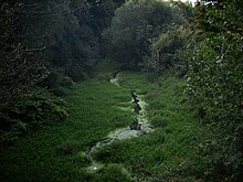
The places Horburg and Maßlau are separated by the river Luppe . The White Elster flows in the north . The Augraben , a former tributary of the Zschampert, flows south of Horburg .
history
The first written mention of Horburg took place in 1124. Like Maßlau, until 1815 the place belonged to the Schkeuditz district of Merseburg , which had been under Electoral Saxon sovereignty since 1561 and belonged to the secondary school principality of Saxony-Merseburg between 1656/57 and 1738 . The church in Horburg burned down on November 22nd, 1773 due to carelessness in using a half-finished oven.
Through the resolutions of the Congress of Vienna , Horburg and Maßlau and the western part of the Schkeuditz office were ceded to Prussia in 1815. In the new political order Prussia they were in 1816 the county Merseburg in the administrative district of Merseburg of the Province of Saxony allocated to which they belonged to the 1952nd On July 1, 1950, Maßlau was incorporated into Horburg. During the district reform in the GDR, Horburg with Maßlau was assigned to the Merseburg district in the Halle district in 1952 , which came to the Merseburg-Querfurt district in 1994 and to the Saale district in 2007 .
On October 1, 1965, the previously independent communities Horburg and Maßlau were incorporated into Kötschlitz . On May 6, 1990 they were released into self-employment as the Horburg-Maßlau community. As of December 31, 2009, it was incorporated into Leuna.
badges and flags
Blazon "In blue over a silver, black grooved, tinned castle with an open gate and two tinned towers, each with a blue window opening, a silver lily."
The colors Horburg-Maßlaus are white-blue.
Horburg-Maßlau flies a flag. This is striped blue-white-blue and has the coat of arms in the middle.
Regular events
The Horburger onion market takes place every year at the beginning of September.
Transport links
The federal highway 181 runs south of Horburg from Merseburg to Leipzig , immediately east of Maßlau the federal highway 9 . The next connection point Leipzig-West on the A 9 is a good 3 km away from Horburg.
Attractions
The Horburger Madonna from the 13th century is attributed to the Naumburg master . It was the reason that Horburg was a place of pilgrimage until the Reformation.
Horburg is located on the Ecumenical Pilgrimage and the Salt Road .
Web links
Individual evidence
- ^ Karlheinz Blaschke , Uwe Ulrich Jäschke : Kursächsischer Ämteratlas , Leipzig 2009, ISBN 978-3-937386-14-0 , p. 84 f.
- ^ The district of Merseburg in the municipal directory 1900
- ↑ Maßlau on gov.genealogy.net
- ↑ Municipalities 1994 and their changes since January 1, 1948 in the new federal states , Metzler-Poeschel publishing house, Stuttgart, 1995, ISBN 3-8246-0321-7 , publisher: Federal Statistical Office
- ^ Freundeskreis Horburger Madonna eV


