
Altmarkkreis Salzwedel
| coat of arms | Germany map |
|---|---|

|

Coordinates: 52 ° 41 ′ N , 11 ° 14 ′ E |
| Basic data | |
| State : | Saxony-Anhalt |
| Administrative headquarters : | Salzwedel |
| Area : | 2,293.03 km 2 |
| Residents: | 83,173 (Dec. 31, 2019) |
| Population density : | 36 inhabitants per km 2 |
| License plate : | SAW, GA, KLZ |
| Circle key : | 15 0 81 |
| NUTS : | DEE04 |
| Circle structure: | 13 municipalities |
| Address of the district administration: |
Karl-Marx-Strasse 32 29410 Salzwedel |
| Website : | |
| District Administrator : | Michael Ziche ( CDU ) |
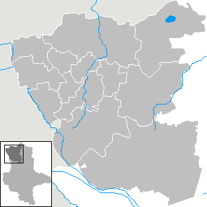
| Location of the Altmarkkreis Salzwedel in Saxony-Anhalt | |
  |
|
The Altmarkkreis Salzwedel is a district in the northwest of the state of Saxony-Anhalt . Neighboring districts are the Lower Saxony district of Lüchow-Dannenberg in the north, the district of Stendal in the east, the district of Börde in the south, the district of Gifhorn in the west and the district of Uelzen in the north-west .
geography

The Altmarkkreis Salzwedel comprises the west of the Altmark landscape and is located in the northwest of Saxony-Anhalt as part of the North German Plain . Important bodies of water are the Jeetze and Milde rivers and the Arendsee . In the southeast the district has a share in the Colbitz-Letzlinger Heide .
The landscape was mainly formed in the penultimate ice age, the Saale Ice Age, and thus belongs to the old moraine region . Large parts of the circle are dominated by flat to flat undulating ground moraine surfaces . Large parts of the deep-lying ground moraines were buried by glacial valleys and form almost table-level areas that are mostly muddy today. Today's rather small rivers only imperfectly fill the extensive lowlands. Higher areas of the old ground moraines protrude from the lowlands as island-shaped plates (e.g. Kalbescher Werder). Starting from the Colbitz-Letzlinger Heide , a terminal moraine continues in a north-northwest direction . The highest elevations in the district are located there. The Hellberge near Zichtau reach over 160 m, the "Pistolsche Berg" near Bonese 121 m above sea level. NN . The land use is varied and consists of around one third each of forest, meadows and arable land.
The Altmarkkreis Salzwedel is the most sparsely populated district in Saxony-Anhalt and the second most sparsely populated district in Germany. Only the Prignitz district in Brandenburg is less populated .
history
The Altmarkkreis Salzwedel emerged from the former districts of Salzwedel , Klötze and Gardelegen and part of the Osterburg district during the 1994 district reform . The places Oebisfelde (district of Klötze) and Calvörde (district of Gardelegen) became part of the then Ohrekreis . The Altmarkkreis Salzwedel remained unchanged during the 2007 district reform .
politics
District Administrator
Michael Ziche (CDU) has been the district administrator of the Altmarkkreis Salzwedel since July 2008. He replaced Hans-Jürgen Ostermann (SPD).
District council
(Result of the local elections on May 26, 2019)
| Parties and constituencies | Percent 2019 |
Seats 2019 |
Percent 2014 |
Seats 2014 |
Percent 2009 |
Seats 2009 |
Percent 2004 |
Seats 2004 |
Percent 1999 |
Seats 1999 |
Percent 1994 |
|
|---|---|---|---|---|---|---|---|---|---|---|---|---|
| CDU | Christian Democratic Union of Germany | 26.8 | 11 | 39.0 | 16 | 39.1 | 16 | 44.0 | 18th | 41.0 | 20th | 33.3 |
| THE LEFT. | THE LEFT. | 17.8 | 8th | 22.1 | 9 | 18.7 | 8th | 18.8 | 8th | 17.4 | 8th | 17.3 |
| SPD | Social Democratic Party of Germany | 15.4 | 7th | 20.1 | 9 | 22.7 | 10 | 22.3 | 9 | 30.1 | 14th | 29.3 |
| AfD | Alternative for Germany | 14.7 | 6th | - | - | - | - | - | - | - | - | - |
| FL | Free list | 11.7 | 5 | 8.5 | 4th | 5.9 | 2 | 3.3 | 1 | - | - | - |
| GREEN | Alliance 90 / The Greens | 7.8 | 3 | 5.4 | 2 | 2.3 | 1 | 1.5 | 1 | 2.1 | 1 | 6.2 |
| FDP | Free Democratic Party | 5.7 | 2 | 4.5 | 2 | 11.2 | 5 | 8.9 | 4th | 3.6 | 2 | 7.5 |
| PIRATES | Pirate Party Germany | - | - | 0.3 | - | - | - | - | - | - | - | - |
| WG AD | Voting group ALTMARK DEMOCRATS | - | - | - | - | - | - | - | - | 3.1 | 2 | 2.4 |
| WG DRÖ | Voting group Drömling | - | - | - | - | - | - | - | - | 2.4 | 1 | - |
| future! | future! - The young alternative | - | - | - | - | - | - | - | - | 0.2 | - | - |
| Others | Others | - | - | - | - | - | - | - | - | - | - | 0.6 |
| EB | Individual applicants | - | - | - | - | - | - | 1.1 | 1 | 0.3 | - | 1.4 |
| total | 100 | 42 | 100 | 42 | 100 | 42 | 100 | 42 | 100 | 48 | 100 | |
| Turnout in percent | 55.4 | 45.4 | 43.0 | 45.5 | 53.8 | 70.2 | ||||||
- DIE LINKE took up the position of PDS until 2004 .
- EB: Individual applicants: 2004–2009: Klaus Ewertowski, 1999: Olaf Ollendorf, 1994: k. A.
- There is no distribution of seats for the 1994 election.
The following parliamentary groups have formed in the district council: CDU / FDP (13 members), DIE LINKE. (8 members), SPD (7 members), AfD (6 members), FL (5 members), GRÜNE (3 members).
coat of arms
The coat of arms was approved by the Interior Ministry on November 24, 1994.
Blazon : “Split and half-divided by silver, gold and blue; at the front of the gap a red eagle with gold reinforcement, at the top at the back an upright blue lion with a red tongue and reinforcement, at the bottom at the back a golden pre-aldic cross-shaped fitting. "
The red Brandenburg eagle symbolizes the centuries-old affiliation of the Altmark to the Mark Brandenburg , from which it was separated in 1807 by being assigned to the Kingdom of Westphalia and in 1816 to the newly formed Prussian province of Saxony. The Lüneburg lion in gold indicates the former affiliation of the office of Klötze to Braunschweig-Lüneburg. In 1815 the office was ceded to Prussia and assigned to the province of Saxony. The previously aldic cross-shaped fitting was taken from the shield used by Albrecht the Bear in his seals; it should remind of the importance of Albrecht for the Altmark.
Colors of the district: blue / yellow
The coats of arms of the administrative communities, cities and municipalities of the district can be found in the list of coats of arms in the Altmarkkreis Salzwedel .
Economy and Infrastructure
economy
The Altmarkkreis Salzwedel is one of the structurally weaker districts in Saxony-Anhalt. It is mainly shaped by agriculture . There is tourism (especially camping ) around the Arendsee . Several medium-sized companies and service industries are located in the towns of the district in particular.
traffic
Street
Federal roads are the B 71 and B 248 in north-south direction and the B 188 and B 190 in east-west direction . The plan is to build an Altmark motorway ( A14 ) from Magdeburg to Schwerin via Stendal and Osterburg (Altmark) , which is to run directly east of the district border, and to expand federal highway 190 to become federal highway 190n . Furthermore, the federal motorway 39 ( Lüneburg - Wolfsburg - Braunschweig route ) is being built in the neighboring district of Gifhorn and connected to the district via the B 190n.
rail
This area received rail connections very late. The Magdeburg-Halberstädter Eisenbahngesellschaft reached today's district town from Stendal in 1870, from which it continued in the direction of Uelzen in 1873. In the meantime, in 1871, Gardelegen was also connected to the Stendal – Hanover line.
At the turn of the twentieth century, Salzwedel developed into an important rail hub. A north-south route of the Prussian State Railway , which connected Dannenberg with Oebisfelde, crossed the Berlin – Bremen long-distance line here; the southern part via Beetzendorf – Klötze to Oebisfelde was opened in 1889, the northern part via Lüchow to Dannenberg followed in 1891.
Two narrow-gauge small railways also started from Salzwedel Neustadt. The trains of the Salzwedeler Kleinbahnen GmbH went to Diesdorf from 1900-1902 and those of the Salzwedeler Kleinbahn-Gesellschaft Südost GmbH to Winterfeld. After their unification in 1921, the conversion to standard gauge followed five years later.
In Winterfeld, this small railway was connected to the east-west line of Kleinbahn AG Bismark-Calbe-Beetzendorf, which opened in 1899 . After it was extended to Diesdorf in 1903, the end point of a Salzwedel narrow-gauge railway was also reached there. The line continued from 1909 to Wittingen and in 1911 was branched off from Rohrberg to Zasenbeck, both endpoints in the province of Hanover.
The name of the company had been changed several times and, after merging with Kleinbahn AG Gardelegen-Calbe, which opened in 1904, was Kleinbahn AG Bismark-Gardelegen-Wittingen since 1908 .
The oldest small railway in the district was the Altmärkische Kleinbahn-GmbH, which was built between 1897 and 1901 from Klötze via Groß Engersen – Lindstedt in the direction of Vinzelberg on the Magdeburg – Oebisfelde main line.
Until 1921/22 it had a track width of 750 mm, then half of it was re-gauged, but was shut down east of Groß Engersen. In 1927 it was merged with Kleinbahn AG Bismark-Gardelegen-Wittingen , which from then on operated as Altmärkische Kleinbahn AG.
Further sections of small railways reached the district area:
- 1908 the Kleinbahn AG Stendal-Arendsee,
- 1911 the Kleinbahn AG Gardelegen-Neuhaldensleben and
- 1914 the Kleinbahn AG Osterburg-Pretzier .
The opening of the Salzwedel – Geestgottberg railway by the Deutsche Reichsbahn in 1922 marked the end of railway construction in the district. At this time the first shutdowns took place. Nevertheless, the railway network reached a peak of over 400 km of routes. Around three quarters of these have now been hired:
| 1921 | Faulenhorst – Groß Engersen – Vinzelberg | 30 km ( track width 750 mm) |
| 1926 | Jeggeleben – Winterfeld | 4 km (track width 1000 mm) |
| 1945 | Salzwedel – Bürgerholz – Wustrow | 6 km |
| Diesdorf – Waddekath-Rade – Wittingen | 6 km | |
| Hanum-Zasenbeck | 1 km | |
| 1951 | Letzlingen – Roxförde – Haldensleben | 6 km |
| 1961 | Rohrberg – Hanum | 14 km |
| 1967 | Wernstedt – Groß Engersen – Gardelegen | 17 km |
| 1968 | Kleinau – German Pretzier | 17 km |
| 1970 | Kalbe – Wernstedt | 4 km |
| Wernstedt – Faulenhorst – Klötze | 18 km | |
| 1971 | Gardelegen – Letzlingen | 13 km |
| 1973 | Beetzendorf – Diesdorf | 17 km |
| 1975 | Osterburg – Kleinau | 22 km |
| 1978 | Stendal – Neulingen – Arendsee | 7 km |
| 1980 | Salzwedel Altperver Tor – Jeggeleben – Badel | 18 km |
| 1991 | Kalbe – Badel – Winterfeld – Beetzendorf | 27 km |
| 1993 | Dehre – Bonese – Diesdorf | 14 km |
| 1995 | Salzwedel – Dehre | 22 km |
| 2001 | Hohenwulsch – Neuendorf-Karritz – Kalbe (Milde) | 16 km |
| 2002 | Oebisfelde – Kunrau – Beetzendorf – Salzwedel | 46 km |
Important railway lines today are:
- The Berlin – Lehrte railway line from Hanover to Berlin (via Gardelegen )
- The Stendal – Uelzen railway line running through the Altmark (today continues to Magdeburg )
Communities


Unified municipalities
(cities arehighlighted in bold )
(* seat of the district)
| coat of arms | local community | Residents | Area in km² |
|---|---|---|---|
|
|
Arendsee (Altmark) | 6750 | 269.68 |
|
|
Hanseatic city of Gardelegen | 22,251 | 632.43 |
|
|
Calf (mildness) | 7580 | 272.7 |
|
|
Blocks | 9922 | 278.29 |
|
|
Hanseatic City of Salzwedel * | 23,453 | 304.58 |
Association communities with their member communities
(* seat of the association community)
| coat of arms | Member parish | Residents | Area in km² |
|---|---|---|---|
|
|
Flecken Apenburg-Winterfeld | 1715 | 59.31 |
|
|
Beetzendorf * | 3140 | 97.97 |
|
|
There | 1464 | 78.72 |
|
|
Spots Diesdorf | 2295 | 100.51 |
|
|
Jübar | 1574 | 70.89 |
|
|
Kuhfelde | 1090 | 45.59 |
|
|
Rohrberg | 1060 | 38.27 |
|
|
Wallstawe | 879 | 44.09 |
Territory changes
In the years since 1990, extensive changes have taken place in the Altmarkkreis Salzwedel as in the entire state of Saxony-Anhalt. The district remained unaffected by the Saxony-Anhalt district reform in 2007 .
On December 31, 2008, six of the original twelve administrative associations still existed. The number of parishes decreased from 125 to 119.
Administrative communities
- Dissolution of the administrative community Salzwedel Stadt , which consisted of Salzwedel and three other municipalities that were incorporated into Salzwedel (January 1, 2003)
- Dissolution of the administrative community Mieste and the administrative community Gardelegen-Land - formation of the administrative community Südliche Altmark from 26 communities of the dissolved VGen (January 1, 2005)
- Dissolution of the administrative community Beetzendorf and the administrative community Diesdorf-Dehre - formation of the administrative community Beetzendorf-Diesdorf from 25 communities the dissolved VGen (January 1, 2005)
- Dissolution of the administrative community Kalbe (Milde) and the administrative community Arendsee / Altmark and the surrounding area - formation of the administrative community Arendsee-Kalbe from 23 municipalities of the dissolved VG, including four municipalities from the dissolved administrative association Altmark-Mitte (January 1, 2005)
- Dissolution of the administrative community Jeetze-Ohre-Drömling - new formation of the administrative community Klötze from 13 communities of the dissolved VG, including three communities from the formerly existing administrative community Klötze (January 1, 2005)
- Dissolution of the administrative community Gardelegen Stadt - formation of the unified municipality Gardelegen (July 1, 2009)
- Dissolution of the Klötze administrative community - incorporation of the 12 member communities into Klötze (January 1, 2010)
- Dissolution of the administrative community Beetzendorf-Diesdorf - formation of the association community Beetzendorf-Diesdorf from the eight communities Apenburg-Winterfeld , Beetzendorf , Dehre , Diesdorf , Jübar , Kuhfelde , Rohrberg and Wallstawe (January 1, 2010)
- Dissolution of the administrative community Arendsee-Kalbe - formation of the unified municipalities Arendsee (Altmark) and Kalbe (Milde) (January 1, 2010)
- Dissolution of the administrative community Salzwedel-Land - incorporation of the three remaining municipalities after Kalbe (Milde) (January 1, 2011)
- Dissolution of the administrative community Südliche Altmark - incorporation of the 18 municipalities of the VG to Gardelegen (January 1, 2011)
Incorporations
- Dissolution of the Röwitz community - incorporation into Kusey (August 1, 2002)
- Dissolution of the municipalities of Brietz , Dambeck and Mahlsdorf - incorporation into Salzwedel (January 1, 2003)
- Dissolution of the community of Gischau - incorporation into Beetzendorf (January 1, 2004)
- Dissolution of the community of Stappenbeck - incorporation into Salzwedel (January 1, 2005)
- Dissolution of the community of Benkendorf - incorporation into Salzwedel (January 1, 2009)
- Dissolution of the municipalities Altmersleben , Güssefeld , Kahrstedt , Neuendorf am Damm , Wernstedt and Winkelstedt - incorporation into Kalbe (Milde) (January 1, 2009)
- Dissolution of the municipalities of Bandau , Jeeben , Hohentramm , Mellin and Tangeln - incorporation into Beetzendorf (January 1, 2009)
- Dissolution of the communities of Algenstedt , Berge , Hemstedt , Neuendorf Abbey and Schenkenhorst - incorporation into Gardelegen (July 1, 2009)
- Dissolution of the municipalities of Brunau , Engersen , Jeetze , Packebusch , Kakerbeck and Vienau - incorporation into Kalbe (Milde) (January 1, 2010)
- Dissolution of the municipalities of Chüden , Henningen , Klein Gartz , Langenapel , Liesten , Osterwohle , Pretzier , Riebau , Seebenau and Tylsen - incorporation into Salzwedel (January 1, 2010)
- Dissolution of the municipalities of Dönitz , Immekath , Jahrstedt , Kunrau , Kusey , Neuendorf , Neuferchau , Ristedt , Schwiesau , Steimke and Wenze - incorporation into Klötze (January 1, 2010)
- Dissolution of the community of Neuekrug - incorporation into Diesdorf (January 1st, 2010)
- Dissolution of the municipalities of Binde , Höwisch , Kaulitz , Kerkau , Kläden , Kleinau , Leppin , Neulingen , Sanne-Kerkuhn , Schrampe , Thielbeer and Ziemendorf - incorporation into Arendsee (Altmark) (January 1, 2010)
- Dissolution of the communities Jeseritz , Potzehne , Roxförde , Wannefeld , Wiepke and Zichtau - incorporation after Gardelegen (January 1, 2010)
- Dissolution of the community of Mehmke - incorporation into Diesdorf (September 1, 2010)
- Dissolution of the communities Wieblitz-Eversdorf and Steinitz - incorporation into Salzwedel (January 1, 2011)
- Dissolution of the municipalities of Mechau , Vissum , Rademin and Fleetmark - incorporation into Arendsee (Altmark) (January 1, 2011)
- Dissolution of the communities Jeggeleben , Badel , and Zethlingen - incorporation after Kalbe (Milde) (January 1, 2011)
- Dissolution of the communities of Breitenfeld , Dannefeld , Estedt , Hottendorf , Jävenitz , Jeggau , Jerchel , Kassieck , Köckte , Letzlingen , Lindstedt , Mieste , Miesterhorst , Peckfitz , Sachau , Seethen , Sichau and Solpke - incorporation into Gardelegen (January 1, 2011)
Church planting
- Dissolution of the municipalities of Bonese , Dehre and Lagendorf - re-establishment of the municipality of Dehre (January 1, 2009)
- Dissolution of the communities of Ahlum , Bierstedt and Rohrberg - reestablishment of the Rohrberg community (January 1, 2009)
- Dissolution of the municipalities Altensalzwedel , Apenburg and Winterfeld - re-establishment of the Apenburg-Winterfeld area (July 1, 2009)
- Dissolution of the communities of Kuhfelde , Püggen and Siedenlangenbeck and Valfitz - re-establishment of the community of Kuhfelde (July 1, 2009)
- Dissolution of the communities of Ellenberg , Gieseritz and Wallstawe - re-establishment of the community of Wallstawe (July 1, 2009)
- Dissolution of the communities of Bornsen , Hanum , Jübar, Lüdelsen and Nettgau - re-establishment of the community of Jübar (January 1, 2010)
Protected areas
There are nine designated nature reserves in the district (as of February 2017).
Others
The Johann Friedrich Danneil Museum is located in Salzwedel , named after the first archaeologist in the Altmark. A branch of the museum is the Longobard workshop in Zethlingen. Together with the Diesdorf open-air museum in the west of the Altmarkkreis, these form the Museums community in the Altmarkkreis Salzwedel.
In the spring of 1945, today's district area became the end of several evacuation transports and death marches from National Socialist concentration camps in northern and central Germany. Today the internationally recognized memorial Feldscheune Isenschnibbe Gardelegen in Gardelegen commemorates them .
In the district area, East Low German Platt is occasionally spoken.
On September 23, 2008 the district received the title “ Place of Diversity ” awarded by the Federal Government .
License Plate
On July 1, 1994, the district was assigned the SAW , which has been valid since January 1, 1991 for the Salzwedel district. It is still issued today.
Until about the year 2000, vehicles from the sub-circles were given special identification numbers:
| area | Letters | numbers |
|---|---|---|
| Salzwedel district | A to Z | 1 to 999 |
| AA to KY | ||
| Gardelegen district | LA to TZ | |
| Part circle blocks | UA to ZZ |
Since November 29, 2012, the distinctive signs GA (Gardelegen) and KLZ (Klötze) have been available in connection with the license plate liberalization .
literature
- Hartmut Bock, Ingelore Fischer, Peter Fischer, Folker Rattey: The north-western Altmark - a cultural landscape . Sparkasse, Gifhorn-Wolfsburg 1991.
Web links
Individual evidence
- ↑ State Statistical Office Saxony-Anhalt, population of the municipalities - as of December 31, 2019 (PDF) (update) ( help ).
- ↑ census database
- ^ Altmarkkreis Salzwedel - preliminary result
- ↑ [1] Results of the district council elections 2004 to 2014
- ↑ [2] Results of the district elections 2009
- ↑ [3] Results of the 2004 district council elections
- ↑ [4] Results of the district elections in 1994 and 1999
- ↑ a b State Statistical Office Saxony-Anhalt, population of the municipalities - as of December 31, 2019 (PDF) (update) ( help ).
- ↑ a b regionalstatistik.de regional database of the Federal Statistical Office (as of December 31, 2016)
- ↑ State Statistical Office Saxony-Anhalt
Altmarkkreis Salzwedel | Anhalt-Bitterfeld | Börde | Burgenland District | Dessau-Roßlau | Halle (Saale) | Resin | Jerichower Land | Magdeburg | Mansfeld-Südharz | Saalekreis | Salzlandkreis | Stendal | Wittenberg