
Beetzendorf
| coat of arms | Germany map | |
|---|---|---|

|
Coordinates: 52 ° 42 ' N , 11 ° 5' E |
|
| Basic data | ||
| State : | Saxony-Anhalt | |
| County : | Altmarkkreis Salzwedel | |
| Association municipality : | Beetzendorf-Diesdorf | |
| Height : | 35 m above sea level NHN | |
| Area : | 97.97 km 2 | |
| Residents: | 3140 (Dec. 31, 2019) | |
| Population density : | 32 inhabitants per km 2 | |
| Postcodes : | 38489, 38486 | |
| Primaries : | 039000, 039007 | |
| License plate : | SAW, GA, KLZ | |
| Community key : | 15 0 81 045 | |
| LOCODE : | DE B4F | |
| Address of the municipal administration: |
Marschweg 3 38489 Beetzendorf |
|
| Website : | ||
| Mayor : | Lothar Köppe ( CDU ) | |
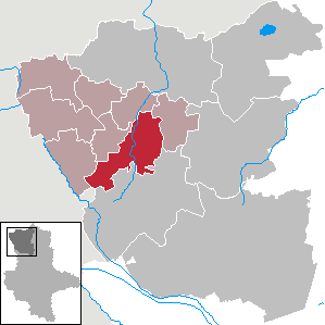
| Location of the municipality of Beetzendorf in the Altmarkkreis Salzwedel | ||
  |
||

Beetzendorf is a municipality in the community of Beetzendorf-Diesdorf in the Altmarkkreis Salzwedel in Saxony-Anhalt .
geography
The place is the seat of the Verbandsgemeinde Beetzendorf-Diesdorf and is located in the Jeetz lowlands around 10 kilometers north-northeast of Klötze and 18 kilometers south of the district town of Salzwedel in the Altmark .
Community structure
The districts (with living spaces ) belong to the municipality :
|
climate

The annual precipitation is 564 mm and is therefore comparatively low as it falls in the lower quarter of the values recorded in Germany. Lower values are registered at 14% of the measuring stations of the German Weather Service . The driest month is February, with the highest rainfall in August. In August there is 1.8 times more rainfall than in February. The precipitation hardly varies and is very evenly distributed over the year. Lower seasonal fluctuations are recorded at only 7% of the measuring stations.
history

Beetzendorf was created with high probability under the protection of a castle in the swamp, the castle Beetzendorf (Becendorf). According to Beckmann, it was first mentioned around 1204, after which the castle complex came into the hands of the von der Schulenburg family as a pledge from the von Kröcher family. The castle has been in the possession of the von der Schulenburg family since 1340 , after they left their ancestral seat, the Schulenburg near Stappenbeck near Salzwedel. Beetzendorf became the family headquarters of the family in the following centuries. The possessions here and in Apenburg were their ancestral estates, which secured the core of their manorial rule until the 19th century.
Up until 1600, Beetzendorf Castle received a fortress-like expansion with moats. The castle complex upgraded the dynasty, which from then on belonged to the upper tier of the Altmark aristocracy. In the 17th century, the members of the noble family settled in the village of Beetzendorf and the surrounding area, so that the fortifications became useless. During the Thirty Years' War the castle was no longer defensible. The last cannon was sold in 1642; In 1780 further parts of the castle complex were demolished. Today only ruins are left of the castle, which are in the high forest of the Beetzendorfer Park. It is the northern castle gate, which was reconstructed in the 19th century and to which an open-air theater was added in the 20th century. Not far away is the approximately 20-meter-high castle keep red brick. A bald cypress avenue was laid out on the edge of the park .
Incorporations
On September 30, 1928, the main parts of the manor districts Beetzendorf I and Beetzendorf II were combined with the rural community of Beetzendorf. On July 1, 1950, Käcklitz was incorporated into the Beetzendorf community. Audorf followed on March 22, 1970. On January 1, 2004, Gischau with its districts Klein Gischau and Groß Gischau was incorporated into Beetzendorf. On January 1, 2009, the previously independent communities of Bandau (with the districts of Peertz and Poppau), Jeeben (with the district of Darnebeck), Hohentramm (with the districts of Siedengrieben and Stapen), Mellin and Tangeln (with the district of Neumühle) were incorporated into Beetzendorf. The municipal area has increased since 2003 from 25.46 km² to 97.17 km².
Population development
Village / municipality
|
|
|
|
|
Good i
| year | Residents |
|---|---|
| 1864 | 139 |
| 1871 | 132 |
| 1885 | 112 |
| 1895 | 120 |
| 1905 | 93 |
Good II
| year | Residents |
|---|---|
| 1864 | 74 |
| 1871 | 87 |
| 1885 | 97 |
| 1895 | 92 |
| 1905 | 105 |
District
|
Swell:
Religions
The 2011 census in the European Union showed that around 30% of the 3313 inhabitants of the municipality of Beetzendorf belonged to the Protestant and around 3% to the Catholic Church.
The Protestant Mary's Church was 1736 as a baroque he central building modeled after the Potsdam Garrison Church built; its lattice tower was replaced by a massive tower in 1926. The organ was also renewed later. The church is located on Beverhol Street and its parish is part of the Salzwedel parish. Further Protestant churches are located in the districts of the community.
The small Catholic Church of the Assumption on Steinweg was built in 1937/38; today it belongs to the parish of St. Hildegard, based in Gardelegen. Before that there was already a Catholic emergency chapel built in 1911 in Beetzendorf, it has since been demolished.


politics
mayor
In February 2015 Lothar Köppe (CDU) was elected mayor. His predecessor Heinrich Schmauch held the office for 23 years.
coat of arms
The coat of arms was awarded on March 1, 1938 by the President of the Province of Saxony.
Blazon : “In silver over blue waves, a three-tower red castle with blue roofs. In the open goal 3 (2: 1) red eagle legs. "
The castle Beetzendorf an der Jeetze (hence the waves) has been owned by the Schulenburg family since the 14th century, whose coat of arms is the three eagle legs. The place has shown the image of the coat of arms in the previous seal for over 50 years.
The coat of arms was designed by State Archives Councilor Otto Korn .
Culture and sights

Buildings
Sports
Beetzendorf is one of the Altmark hiking nests that are organized in the Altmark hiking club.
Economy and Infrastructure

education
- Beetzendorf Primary School, Friedrich-Engels-Strasse 14
- Beetzendorf secondary school, Friedrich-Engels-Strasse 14
- Beetzendorf High School, Goethestrasse 18
- Integrative day care center “House of Little Feet” Beetzendorf, Humboldtstrasse 27
- Day care center “The Little Thugs” Tangeln, Lange Straße 63
traffic
The B 248 runs around three kilometers west of Beetzendorf. Until 2002, Beetzendorf and Bandau were served by local passenger traffic on the Salzwedel – Oebisfelde railway line. Since then, traffic has been carried out with the state buses 300 and 400. Other lines of the Altmärkische Kleinbahn led from Beetzendorf via Diesdorf to Wittingen and to Kalbe (Milde) .
Sons and daughters of the church
- Dietrich von der Schulenburg († 1393), was called Dietrich III. Bishop of Brandenburg
- Jakob von der Schulenburg (1515–1576), imperial field marshal
- Fritz von der Schulenburg (1591–1613), student
- Werner von der Schulenburg (1829–1911), member of the Reichstag
- Friedrich Klaeber (1863–1954), English studies
- Wedige von der Schulenburg (1896–1977), officer and adjutant to Paul von Hindenburg
- Wedige von der Schulenburg (* 1945), politician (CDU)
- Detlev Neudeck (* 1956), Austrian politician (FPÖ / BZÖ)
literature
- Adolph Friedrich Riedel : Codex diplomaticus Brandenburgensis : Collection of documents, chronicles and other source documents . Main part 1st volume 6 . Berlin 1846, p. 232-238 ( digitized version ).
- Erich Neuss : Handbook of the historical places. Province of Saxony Anhalt . Ed .: Berent Schwineköper (= handbook of historical sites . Volume 11). 2nd, revised and supplemented edition, Alfred Kröner Verlag, Stuttgart 1987, ISBN 3-520-31402-9 , Beetzendorf (Kr. Salzwedel / Klötze), pp. 33-34.
- Joachim Stephan: The Vogtei Salzwedel. Country and people from the development of the country to the time of turmoil . Dissertation Humboldt-Universität zu Berlin 2003 (= Klaus Neitmann [Hrsg.]: Sources, finding aids and inventories of the Brandenburg State Main Archives Volume 17). Peter Lang. European Science Publishing House, Frankfurt am Main 2006, ISBN 978-3-631-54808-0 .
- Lieselott Enders : The Altmark. History of a Kurmark landscape in the early modern period (end of the 15th to the beginning of the 19th century) (= Klaus Neitmann [Hrsg.]: Publications of the Brandenburg State Main Archives . Volume 56). Berliner Wissenschafts-Verlag, Berlin 2008, ISBN 978-3-8305-1504-3 .
- Peter P. Rohrlach: Historical local dictionary for the Altmark. Volume 1: A-K . In: Historisches Ortslexikon für die Altmark (= Historisches Ortslexikon für Brandenburg . Teil XII; Klaus Neitmann [Hrsg.]: Publications of the Brandenburg State Main Archives . Volume 68; Publications of the State Archives Administration of the State of Saxony-Anhalt. Series A. Sources for the history of Saxony- Reference Volume 23). 2 volumes, Berliner Wissenschafts-Verlag, Berlin 2018, ISBN 978-3-8305-3743-4 , Beetzendorf nw Klötze, pp. 143–152.
Web links
Individual evidence
- ↑ State Statistical Office Saxony-Anhalt, population of the municipalities - as of December 31, 2019 (PDF) (update) ( help ).
- ↑ a b main statutes (PDF file; 97 kB)
- ↑ District directory of the state of Saxony-Anhalt (directory of the municipalities and parts of the municipality), territorial status January 2014, State Statistical Office Saxony-Anhalt, Halle (Saale), 2016
- ↑ The village is not mentioned in the statutes or in the district directory.
- ^ Johann Christoph Becmann, Bernhard Ludwig Beckmann: Historical description of the Chur and Mark Brandenburg . Ed .: Berlin. tape 2 , 5th part, 1st book, 1753, p. 94 ( digitized version ).
- ↑ Administrative region of Magdeburg (Ed.): Official Gazette of the Government of Magdeburg . 1928, ZDB -ID 3766-7 , p. 216 .
- ↑ a b Federal Statistical Office (ed.): Municipalities 1994 and their changes since 01.01.1948 in the new federal states . Metzler-Poeschel, Stuttgart 1995, ISBN 3-8246-0321-7 , pp. 362 .
- ^ StBA: Changes in the municipalities in Germany, see 2004
- ↑ StBA: Area changes on 01/01/2009
- ^ Peter P. Rohrlach: Historical local dictionary for the Altmark (Historical local dictionary for Brandenburg, part XII) . Berliner Wissenschafts-Verlag, Berlin 2018, ISBN 978-3-8305-2235-5 , pp. 152 .
- ^ Verbandsgemeinde Beetzendorf-Diesdorf: residents of the districts on December 31 for 2015 and 2018 . June 6, 2019.
- ^ Database census 2011, Beetzendorf, Religion
- ↑ Portrait at beetzendorf-diesdorf.de , accessed on March 5, 2013
- ↑ http://www.stala.sachsen-anhalt.de/wahlen/bm15/erg/gem/bm.15081045.20150222.ergtab.dr.html
- ↑ Archive link ( Memento from February 20, 2016 in the Internet Archive )
- ↑ Beetzendorf Primary School (accessed December 6, 2018).
- ↑ Secondary School Beetzendorf (accessed December 6, 2018).
- ↑ Beetzendorf Gymnasium (accessed December 6, 2018).
- ↑ Beetzendorf day care center in the Beetzendorf community (accessed on December 6, 2018).
- ↑ Tangeln day care center in Beetzendorf municipality (accessed on December 6, 2018).
Audorf | Bandau | Beetzendorf | Darnebeck | Groß Gischau | Klein Gischau | Hohentramm | Jeeben | Käcklitz | Mellin | Neumühle | Peertz | Poppau | Simmering cracklings | Stapen | Tangling | Wohlgemuth