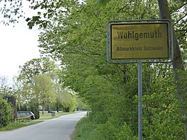
Wohlgemuth (Beetzendorf)
|
Wohlgemuth
Community Beetzendorf
Coordinates: 52 ° 41 ′ 13 ″ N , 11 ° 4 ′ 33 ″ E
|
||
|---|---|---|
| Height : | 38 m above sea level NHN | |
| Residents : | 36 (December 31, 2018) | |
| Incorporation : | September 30, 1928 | |
| Incorporated into: | Beetzendorf | |
| Postal code : | 38489 | |
| Area code : | 039000 | |
|
Location of Wohlgemuth in Saxony-Anhalt |
||
|
Entrance
|
||
Wohlgemuth is a district of the municipality of Beetzendorf in the Verbandsgemeinde Beetzendorf-Diesdorf in the Altmarkkreis Salzwedel in Saxony-Anhalt .
geography
The Altmark village of Wohlgemuth is located 2 kilometers southwest of Beetzendorf and 19 kilometers south of the district town of Salzwedel . The Jeetze and the Stölpengraben flow east of the village .
history
The district was created after the Second World War through the settlement of new farmers as a result of the land reform from the Vorwerk Klein Wohlgemuth and the residential area Groß Wohlgemuth. Initially the name of the district was Groß Wohlgemuth , since 1985 only Wohlgemuth . Klein and Groß Wohlgemuth were two former sheep farms.
The Vorwerk Klein Wohlgemuth formed the southern part of today's village and until 1928 belonged to the estate district Beetzendorf II (former manors Apenburger Hof and Lieberoser Hof). Groß Wohlgemuth is the northern part of today's village, which was part of the Beetzendorf I (Altenhäuser Hof) district until 1928 .
Incorporations
On September 30, 1928, the main parts of the manor districts Beetzendorf I and Beetzendorf II were combined with the rural community of Beetzendorf. So both living spaces came to Beetzendorf. After 1945, both living spaces were merged into one district of Wohlgemuth. Today the district of Wohlgemuth consists of a village called Wohlgemuth.
Population development
Great Wohlgemuth
|
|
Klein Wohlgemuth
|
|
Wohlgemuth
|
Swell:
religion
The Protestant Christians from Wohlgemuth belong to the parish and parish of Beetzendorf. Today, the church belongs to the parish area Beetzendorf the church district Salzwedel in Propst Sprengel Stendal Magdeburg of the Evangelical Church in Central Germany .
Agriculture
The Beetzendorf test station of the State Institute for Agriculture and Horticulture Saxony-Anhalt has been located in Wohlgemuth since 1992. Field trials for regionally adapted varieties are carried out on a 24-hectare trial field.
literature
- Peter P. Rohrlach: Historical local lexicon for the Altmark (Historical local lexicon for Brandenburg, Part XII) . Berliner Wissenschafts-Verlag, Berlin 2018, ISBN 978-3-8305-2235-5 , pp. 2485-2487 .
- Wilhelm Zahn : Local history of the Altmark. Edited by Martin Ehlies based on the bequests of the author. 2nd Edition. Verlag Salzwedeler Wochenblatt, Graphische Anstalt, Salzwedel 1928, DNB 578458357 , OCLC 614308966 , p. 127 .
Web links
- Website of the municipality of Beetzendorf
- Wohlgemuth in the historical directory of the association for computer genealogy
Individual evidence
- ↑ a b Verbandsgemeinde Beetzendorf-Diesdorf: residents of the districts on December 31 for 2015 and 2018 . June 6, 2019.
- ↑ Main statutes of the municipality of Beetzendorf. In: beetzendorf-diesdorf.de. Retrieved January 26, 2018 .
- ↑ Saxony-Anhalt viewer of the State Office for Surveying and Geoinformation ( notes )
- ^ A b Peter P. Rohrlach: Historical Ortlexikon für die Altmark (Historical Ortlexikon für Brandenburg, Part XII) . Berliner Wissenschafts-Verlag, Berlin 2018, ISBN 978-3-8305-2235-5 , pp. 2485-2487 .
- ^ JAF Hermes, MJ Weigelt: Historical-geographical-statistical-topographical manual from the administrative districts of Magdeburg . Topographical part. Ed .: Verlag Heinrichshofen. tape 2 , 1842, p. 323 , 2. Betzendorf ( digitized version ).
- ^ Map of the German Empire, 1: 100,000, Part II / IV: Sheet 264: Klötze. Prussian State Statistical Office, 1906, accessed on January 26, 2018 .
- ↑ a b Royal Prussian State Statistical Office (ed.): Community encyclopedia for the province of Saxony . Based on the materials of the census of December 1, 1905. 1909, p. 178 .
- ↑ Administrative region of Magdeburg (Ed.): Official Gazette of the Government of Magdeburg . 1928, ZDB -ID 3766-7 , p. 216 .
- ↑ Karla Balkow and Werner Christ: Local dictionary of the German Democratic Republic . R. v. Decker's publishing house. G. Schenck GmbH, Heidelberg 1986, ISBN 3-7685-2185-0 , p. 338 .
- ↑ Beetzendorf parish area. Retrieved January 26, 2018 .
- ^ State Institute for Agriculture and Horticulture Saxony-Anhalt. Variety testing, Beetzendorf experimental station. Retrieved January 27, 2018 .


