Wettin
|
Wettin
City of Wettin-Löbejün
|
|
|---|---|
| Coordinates: 51 ° 35 ′ 9 ″ N , 11 ° 48 ′ 27 ″ E | |
| Height : | 91 m |
| Area : | 27.18 km² |
| Residents : | 2355 (Dec. 31, 2009) |
| Population density : | 87 inhabitants / km² |
| Incorporation : | January 1, 2011 |
| Postal code : | 06193 |
| Area code : | 034607 |
|
Location of Wettin in Wettin-Löbejün
|
|
Wettin is a district of the city Wettin-Löbejün in the Saalekreis in Saxony-Anhalt , Germany . The small town is best known for the Wettin dynasty , who provided the margraves, electors and kings in Saxony, Great Britain, Belgium, Bulgaria and Poland.
geography
location
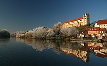
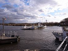
Wettin is located on a steep slope on the right bank of the Saale at Saale kilometer 71, about 20 kilometers north of Halle (Saale) in the Lower Saale Valley Nature Park . The local area extends to the valleys and hills around Wettin Castle . The Luisengraben flows through the village.
Local division
Wettin includes the districts Dobis , Dößel , Müchi , Schachtberg and Zaschwitz, which is on the other side of the Saale. The town of Löbnitzmark, mentioned before 1815, is today just a street in the east of Wettin.
history
In the 6th century the Sorbs settled on the Saale. They built a refuge here , which was subsequently expanded to make it permanent against the Franks . In 961 the Civitas Vitin at the foot of the castle was mentioned for the first time . This came into the possession of Dedo in 985 , whose grandson Thimo von Wettin expanded the castle and the sphere of influence of the Counts of Wettin in the 11th century. Subsequently, the Wettins , who provided the margraves, electors and kings in Saxony, Great Britain, Belgium, Bulgaria and Poland, became one of the most important ruling families in Germany.
The first headquarters was transferred to the Archdiocese of Magdeburg as early as 1288 . Not far from the city, hard coal deposits were discovered in 1382, which were initially mainly mined for the Halloren . During the Thirty Years War the castle and town were plundered by the Swedes several times, and two fires in 1660 destroyed almost the entire town.
With the annexation of the Archbishopric of Magdeburg to Prussia, the city belonged to the Brandenburg-Prussian Duchy of Magdeburg from 1680 and was in the then Saalkreis . It was called the media city. It was surrounded by the royal Prussian office of Wettin .
In 1806 the Saalkreis was occupied by French troops. Under Napoleon the office of Wettin was dissolved in 1806 and the area was incorporated into the Kingdom of Westphalia in the Peace of Tilsit in 1807 . As part of the Saalkreis, Wettin and its surroundings were assigned to the Halle district in the Saale department. The canton Wettin was created from Wettin and nine other municipalities . After Napoleon's defeat and the end of the Kingdom of Westphalia, Napoleon's allied opponents liberated the Saalkreis in early October 1813. During the political reorganization after the Congress of Vienna in 1815, Wettin was attached to the Merseburg administrative district of the Prussian province of Saxony and assigned to the Saalkreis.
Since the end of the 17th century, Wettin experienced an economic boom due to the coal deposits, so that a Prussian mining authority was established here. In the 19th century, the upswing came to a standstill, as stone extraction became more and more expensive. In addition, the supplies were slowly running out, the last mine closed in 1893. Even before that there had been a great decline in population, and industrialization barely affected Wettin. In particular, the poor traffic conditions had a negative effect, they only improved in 1903 with the opening of the Wallwitz – Wettin railway line .
On July 1, 2008, the community Dößel with the districts Dobis and Schachtberg was incorporated into the city of Wettin. On January 1, 2011, the towns of Löbejün and Wettin and the communities of Brachwitz , Döblitz , Domnitz , Gimritz , Nauendorf , Neutz-Lettewitz , Plötz and Rothenburg , which had previously been merged in the Saalkreis Nord administrative community, became the new town of Löbejün-Wettin, which received its current name Wettin-Löbejün on April 7, 2011.
| date | Former parish | Incorporation |
|---|---|---|
| September 30, 1928 | Munch | Incorporation after Wettin |
| July 1, 1950 | Dobis | Incorporation after Dößel |
| July 1, 1950 | Zaschwitz | Incorporation after Wettin |
| July 1, 2008 | Dößel with Schachtberg | Incorporation after Wettin |
| January 1, 2011 | Wettin | Incorporation after Wettin-Löbejün |
Religion and churches
The Protestant St. Nikolai Church is the largest and oldest church in Wettin. It was built in the 12th century in the Romanesque style as a citizen church and in the 16th and 17th centuries it was rebuilt and expanded in the Gothic style. The church could not be used since 1958 because of sponge infestation and fell into disrepair in the following years. Gradual renovation has been taking place since 1990. These have now been completed so that the building is fully usable again. Today the church belongs to the Wettin parish.
The Catholic Church of St. Peter was built in 1955 from a former soap factory. Although it is located in the center of the city, it fits inconspicuously into the cityscape of Wettin. In 2004 the church had to be extensively renovated due to woodworm infestation, the church interior was made smaller and provided with new benches and an organ. The former adjacent rectory now serves as a hostel for church groups. Pastoral care is provided by the parish Halle Nord.
The Templar chapel, which was built in the Gothic style in the second half of the 13th century, is located in the district of Müuellen . It is the only remaining chapel of the Knights Templar in Germany and is a listed building . After extensive renovation, the chapel is now used as a space for concerts and exhibitions.
coat of arms
Blazon : "In red a silver castle with battlements and an open golden gate, with a lower tinned central tower between two pointed tinned side towers with three (1: 2) window openings."
The colors of the Wettin district are white and green.
Culture and sights
music
In addition to a choir from the townspeople, Wettin also has one in the Burg-Gymnasium Wettin .
Buildings
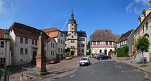
The Templar Chapel in Müelte, Wettin Castle , St. Nikolai Church and the town hall represent the most important architectural points alongside the half-timbered buildings in the city center and the Bismarck Tower .
The Bismarck Tower ( ⊙ ) is a 21.5 m high observation tower, completed in 1905, on the Großer Schweizerling to the west of the town center
Sports
Wettin owns a football club that trains in the sports facility at Burg-Gymnasium.
museum
A bow museum has been located in the Bismarck Tower since April 4, 2015.
Economy and Infrastructure
traffic
Wettin is close to the federal motorway 14 and has its own exit. Since the closure of the Wallwitz – Wettin railway line, the nearest train stations are in Wallwitz , Nauendorf and Domnitz . A new plan approval procedure is currently in progress for the federal motorway 143 , which would cut the Saale valley approx. 6 km south of Wettin. Today Wettin is served by several bus lines of the Omnibusbetrieb Saalekreis .
The village and its castle is located in the center of the route network of the " Prince Street of the Wettins ", a themed road that is currently under construction through the former government area of the Princely House of the Wettins.
education
From 1955 to 1991 Wettin had the only vocational school for sheep farming in Europe .
In addition to the Burg Gymnasium, Wettin now has a kindergarten and a primary school.
Sons and daughters of the village
- Ernst Glück (born May 18, 1654 in Wettin, † May 5, 1705 in Moscow ), German theologian and Bible translator
- Ambrosius Stegmann (born February 24, 1663 in Wettin; † January 21, 1700), German physician and member of the Leopoldina
- Ludwig Heinrich von Jakob (born February 26, 1759 in Wettin; † July 22, 1827 in Bad Lauchstädt ), political scientist, philosopher and economist
- Maria Neide (born October 2, 1780 in Wettin, † October 24, 1831 in Magdeburg ), nurse
- Ferdinand Guericke (born February 25, 1803 in Wettin; † February 4, 1878 in Halle (Saale) ), German old Lutheran theologian and professor at the University of Halle
- Ludwig von Bredow (born April 11, 1825 in Wettin; † May 9, 1877 in Rathenow ), district administrator and member of the Reichstag of the North German Confederation
- Gustav Wilhelm Richard Sorge (born April 6, 1852 in Wettin; † December 1, 1907 in Berlin-Lankwitz ), German technologist
literature
- Gustav Schönermark: The art monuments of the city of Halle and the Saalkreis . Fly head Verlag Halle, 1997. ISBN 3-910147-81-X .
Web links
Individual evidence
- ↑ Löbnitzermark in the Topographical Description of the Duchy of Magdeburg, p. 400
- ^ Description of the city of Wettin and the Wettin office. In: Geography for all stands , p. 123 and 128
- ↑ Description of the Saale Department (PDF)
- ^ The hall circle in the municipality register 1900
- ↑ Changes in the municipalities in Germany, see 2008. StBA
- ↑ StBA: Area changes from January 1st to December 31st, 2011
- ↑ Bismarck Tower Wettin on bismarcktuerme.de


