
At the Mellensee
| coat of arms | Germany map | |
|---|---|---|

|
Coordinates: 52 ° 9 ' N , 13 ° 23' E |
|
| Basic data | ||
| State : | Brandenburg | |
| County : | Teltow-Fläming | |
| Height : | 60 m above sea level NHN | |
| Area : | 104.72 km 2 | |
| Residents: | 6818 (Dec. 31, 2019) | |
| Population density : | 65 inhabitants per km 2 | |
| Postal code : | 15838 | |
| Primaries : | 033703, 03377 (Saalow) | |
| License plate : | TF | |
| Community key : | 12 0 72 002 | |
| Community structure: | 8 districts | |
| Address of the municipal administration: |
Zossener Str.21c, OT Klausdorf 15838 Am Mellensee |
|
| Website : | ||
| Mayor : | Frank Broshog (independent) | |
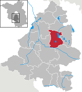
| Location of the community Am Mellensee in the Teltow-Fläming district | ||
  |
||

Am Mellensee is a municipality in the Teltow-Fläming district in Brandenburg .
geography
The community Am Mellensee is located about 40 km (as the crow flies ) south of Berlin-Mitte and borders on the city of Trebbin in the northwest, the city of Zossen in the northeast and east, the city of Baruth / Mark in the southeast and the municipality of Nuthe-Urstromtal in the southwest and West. Heegesee , Mellensee , Neuendorfer See and Schulzensee are each at the borders of the communities .
Community structure
According to its main statute, eight districts are identified for the municipality of Am Mellensee:
- Gadsdorf
- Klausdorf
- Kummersdorf-Alexanderdorf (with the districts Kummersdorf and Alexanderdorf)
- Kummersdorf estate
- Mellensee
- Rehab
- Saalow
- Sperenberg
There are also the following places to live in the municipality:
- Alexanderdorf
- Fernneuendorf
- Hanschenland
- Kummersdorf
- Mönninghausen
- Forest hangover
history
The history of the community Am Mellensee is basically the history of the individual communities that all belonged to the Zossen rule in the Middle Ages . With the emergence of the district division of the Mark Brandenburg in the 17th century, the communities came to the Teltow district , which was dissolved in 1952. All municipalities came to the district of Zossen (1990 to 1993 district of Zossen). Until 1974 there were still ten independent municipalities in the municipality. In 1974 Kummersdorf and Alexanderdorf merged to form the municipality of Kummersdorf-Alexanderdorf, and Fernneuendorf was incorporated into Sperenberg. On December 6, 1993, the district of Zossen in the district of Teltow-Fläming went on.
On June 1, 1992, the eight communities of Gadsdorf, Klausdorf, Kummersdorf-Alexanderdorf, Kummersdorf-Gut, Mellensee, Rehagen, Saalow and Sperenberg merged to form the Am Mellensee Office. The seat of the official administration was Sperenberg.
In the course of the municipal reorganization of the State of Brandenburg, six of the municipalities of the Amt Mellensee - Klausdorf, Kummersdorf-Alexanderdorf, Kummersdorf-Gut, Mellensee, Rehagen and Sperenberg - voluntarily merged on February 1, 2002 to form the municipality Am Mellensee, which was initially still an official. After that the Amt Am Mellensee consisted of only three communities. At the end of the municipal reform, the municipalities of Gadsdorf and Saalow were incorporated into the municipality of Am Mellensee by law with effect from October 26, 2003. The Am Mellensee office was dissolved on October 26, 2003, and the Am Mellensee community free of office.
The community associations and incorporations at a glance:
| Former parish | date | annotation |
|---|---|---|
| Alexanderdorf | 1st January 1974 | Merger with Kummersdorf to Kummersdorf-Alexanderdorf |
| Fernneuendorf | April 1, 1974 | Incorporation to Sperenberg |
| Gadsdorf | October 26, 2003 | |
| Klausdorf | February 1, 2002 | |
| Kummersdorf | 1st January 1974 | Merger with Alexanderdorf to form Kummersdorf-Alexanderdorf |
| Kummersdorf-Alexanderdorf | February 1, 2002 | |
| Kummersdorf estate | February 1, 2002 | |
| Mellensee | February 1, 2002 | |
| Rehab | February 1, 2002 | |
| Saalow | October 26, 2003 | |
| Sperenberg | February 1, 2002 |
Population development
|
|
|
|
Territory of the respective year, number of inhabitants: as of December 31, from 2011 based on the 2011 census
politics
Community representation
The community council consists of 19 community representatives and the full-time mayor. The local election on May 26, 2019 resulted in the following distribution of seats:
| Party / group of voters | Seats |
|---|---|
| Independent voter community | 6th |
| CDU | 4th |
| The left | 3 |
| AfD | 2 |
| SPD | 2 |
| List association Bündnis 90 / Die Grünen - BI Am Mellensee | 1 |
| Free voters at the Mellensee | 1 |
mayor
- 2003–2007: Manfred Donath (SPD) (resignation due to illness)
- since 2007: Frank Broshog (independent)
Broshog was elected in the mayoral election on September 20, 2015 with 61.9% of the valid votes for a further term of eight years (voter turnout 51.8%).
Attractions

- Sperenberg village church , was built in 1752 and 1753 according to plans by the master builder Georg Friedrich Berger. Inside there are two altar candlesticks from a Hamburg shipowner from 1612 and a wooden cross by the Sperenberg sculptor Egon Liebold.
- Benedictine Abbey of St. Gertrud in Alexanderdorf, the only post-Reformation Benedictine monastery in Brandenburg, founded in 1934 and elevated to an abbey in 1984
- Monument place in Klausdorf
- Original paving of Ebereschenallee made of hard-fire bricks
- Heroes' cemetery in Mellensee
- Klausdorf lido
In the list of architectural monuments in Am Mellensee and the list of ground monuments in Am Mellensee are the cultural monuments entered in the list of monuments of the state of Brandenburg .
- Natural monuments
See the list of natural monuments in Am Mellensee
Economy and Infrastructure
traffic
The state roads L 70 ( Trebbin - Dahme / Mark ), L 74 (Sperenberg - Wünsdorf ) and L 79 (Klausdorf - Ludwigsfelde ) run through the municipality . The closest motorway junctions are Ludwigsfelde-Ost and Rangsdorf on the A 10 (southern Berlin Ring) and Bestensee on the A13 (Berlin– Dresden ).
The Mellensee, Rehagen, Sperenberg and Kummersdorf Gut train stations are on the Zossen – Jüterbog line . Passenger traffic was discontinued in 1996 and 1998, respectively. Since 2003, draisines of the Zossen – Jänickendorf adventure railway have been running on the tracks of the former K. M. E. ( Royal Prussian Military Railway ) .
tourism
There is a lock system on the Notte Canal, which was modernized in 2013. Water sports enthusiasts can thus get to Berlin by water. The approximately 25 km long Zossen – Jänickendorf trolley runs across the municipality directly along the Notte Canal. Water sports are possible on the Mellensee. The water sports club at Mellensee e. V. was founded on February 1st, 2008. Round trips with a canal boat are offered on the lake in summer. The Mellensee is also a popular fishing area. There are still full-time fishermen and fishing businesses in the Mellensee district.
In recent years, the network of hiking trails in the municipality has also been expanded.
Personalities
Sons and daughters of the church
- Bartholomäus Krüger (around 1540 – after 1597), writer, born in Sperenberg
- Ernst Meyer (1869–1914), field hunter, head forester and member of the state parliament, born in Kummersdorf
- Franz Noack (1901–1979), resistance fighter against the Nazi regime , born in Sperenberg
- Adele Stolte (* 1932), singer, born in Sperenberg
Personalities associated with the community
- Josef Hafrang (1911–1995), politician (SED), lived in Mellensee
- Jochen Oehler (1942–2017), behavioral and neurobiologist, lived in Mellensee
Web links
Individual evidence
- ↑ Population in the State of Brandenburg according to municipalities, offices and municipalities not subject to official registration on December 31, 2019 (XLSX file; 223 KB) (updated official population figures) ( help on this ).
- ↑ Main statute of the municipality Am Mellensee from November 20, 2013 PDF
- ^ Community on Mellensee on the website of the state of Brandenburg
- ^ Formation of the Mellensee Office. Announcement of the Minister of the Interior of May 30, 1992. Official Gazette for Brandenburg - Joint Ministerial Gazette for the State of Brandenburg, Volume 3, Number 44, of July 3, 1992, p. 835.
- ^ Formation of the new community Am Mellensee. Announcement of the Ministry of the Interior of January 8, 2002. Official Journal for Brandenburg - Joint Ministerial Gazette for the State of Brandenburg, Volume 13, Number 4, January 23, 2002, p. 43. PDF
- ↑ Fourth law for the state-wide municipal area reform concerning the districts Havelland, Potsdam-Mittelmark, Teltow-Fläming
- ↑ Historical municipality register of the state of Brandenburg 1875 to 2005. District Teltow-Fläming . Pp. 14-17
- ↑ Population in the state of Brandenburg from 1991 to 2017 according to independent cities, districts and municipalities , Table 7
- ^ Office for Statistics Berlin-Brandenburg (Ed.): Statistical report AI 7, A II 3, A III 3. Population development and population status in the state of Brandenburg (respective editions of the month of December)
- ^ Result of the local election on May 26, 2019
- ↑ Local elections October 26, 2003. Mayoral elections , p. 33
- ↑ Mayoral election on October 7, 2007 at www.dielinke-teltow-flaeming.de
- ↑ Brandenburg Local Election Act, Section 74
- ^ Result of the mayoral election on September 20, 2015