
Jueterbog
| coat of arms | Germany map | |
|---|---|---|

|
Coordinates: 52 ° 0 ′ N , 13 ° 4 ′ E |
|
| Basic data | ||
| State : | Brandenburg | |
| County : | Teltow-Fläming | |
| Height : | 71 m above sea level NHN | |
| Area : | 176.47 km 2 | |
| Residents: | 12,372 (Dec. 31, 2019) | |
| Population density : | 70 inhabitants per km 2 | |
| Postal code : | 14913 | |
| Area code : | 03372 | |
| License plate : | TF | |
| Community key : | 12 0 72 169 | |
| LOCODE : | DE JBG | |
City administration address : |
Market 21 14913 Jüterbog |
|
| Website : | ||
| Mayor : | Arne Raue | |
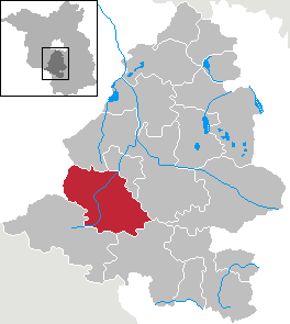
| Location of the town of Jüterbog in the Teltow-Fläming district | ||
  |
||


Jüterbog is a small town in the Teltow-Fläming district in the state of Brandenburg . It is a member of the “Cities with Historic Town Centers” working group of the state of Brandenburg.
geography
Jüterbog is located on the upper Nuthe at the transition between Hohem and Niederer Fläming .
City structure
The following districts belong to the city of Jüterbog:
In addition, there are the Bürgerermühle, Damm, Kaltenhausen , New Houses, New Camps, Neumarkt, Quellenhof, Waldau, Waldsiedlung and Brickworks residential areas .
history
Until the 18th century
In 1007, Thietmar von Merseburg , the chronicler of Archbishop Tagino von Magdeburg, first mentioned the village settlement with a castle wall as "Jutriboc". A century and a half after Thietmar's Chronicle, the Magdeburg Archbishop Wichmann conquered the place (1157) and converted it into a German Burgward , which was the center of a Stiftsmagdeburg exclave between the Mark Brandenburg ( Ascanians ) and the Duchy of Saxony-Wittenberg (Ascanians). The exclave quickly developed into a particularly promoted long-distance trading center. In 1174, for example, the town received its town charter, the second oldest in today's state of Brandenburg. In this document Jüterbog is referred to as the center of the provincia Iutterbogk (Land Jüterbog), as its starting point and head ( exordium et caput ). This land (or Ländchen) Jüterbog also included monastery Zinna , Luckenwalde and Trebbin and extended north to the Seddiner See at the gates of Potsdam . The city tended to stay away from armed conflicts, instead soldiers were provided or compensation payments made.
Around 1350 there is evidence of a medieval leprosarium (an infirmary and a hospital) in Jüterbog "in front of the Zinnaer Tor". The leprosy chapel was demolished in 1523 and the hospital in 1711.
After the city fire in 1478, the reconstruction was funded by the Magdeburg archbishops. However, the plague in 1637 and 1639 and the associated famine claimed considerable victims. The number of residents fell from 4,000 to around 300.
From 1517 on it is proven that the preacher of indulgences Johann Tetzel appeared on behalf of the Archbishop of Mainz in several Central German locations, including in Jüterbog. This was an occasion that led to Martin Luther's 95 theses and thus to the Reformation .
During the Thirty Years War , Jüterbog came to Electoral Saxony in 1635 through the Peace of Prague . On November 21, 1644, in the battle of Jüterbog, the Swedes under Lennart Torstensson defeated the imperial under Matthias Gallas , who wanted to come to the aid of the Danes. The imperial army effectively disbanded. After the end of the Thirty Years' War in 1648, Jüterbog, like many other cities, fell into disrepair and had finally lost its old importance. From 1657 until his return to Electoral Saxony in 1746, Jüterbog belonged to the Duchy of Saxony-Weißenfels .
The Seven Years' War (1756–1763) again brought misery to Jüterbog. Up to 100 soldiers were cared for in the houses, who used up all supplies. After the war, Kloster Zinna was founded as a Prussian weaving town at the gates of the Saxon Jüterbog. At the same time, the neighboring Luckenwalde slowly developed into an industrial location. Jüterbog's economy, based on handicrafts, collapsed and the city became increasingly impoverished. After the battle of Jena and Auerstedt , French troops marched through Jüterbog, which were on their way to Berlin.
19th century
As a way out of economic hardship, the citizens asked since 1824 for soldiers to be stationed to take care of the community. It was not until 1832 that parts of the Prussian 3rd Artillery Brigade were billeted. In 1841, the Jüterbog station on the Berlin-Anhalt Railway was opened and in 1897 a horse-drawn tram for the Jüterbog tram company. When it was replaced by omnibuses in 1928, it was one of the last of its kind in Germany.
From 1864 the artillery stationed in Jüterbog was able to use its own firing range on the northern Birkheide. In 1870 the Prussian military bought land for two barracks in the Niedergörsdorf community . The Jüterbog Artillery School was founded here. The two military settlements belonged to the military estate district "Schießplatz Jüterbog". In 1893 Jüterbog was connected to the Royal Prussian Military Railway .
The Heilig-Geist-Chapel on the Heilig-Geist-Platz fell victim to a fire in 1870. From 1820 to 1874 the population had doubled to around 6,800.
20th century
During the First World War, there were two airship hangars near Niedergörsdorf . The Altes Lager airfield was built there in 1933/34 . In 1934/35 another military airfield was built with the Jüterbog-Damm air base.
In the era of National Socialism had Rechtsreferendare 1933-1939 a training section centrally in specially on the grounds of the new camp set up communal Hanns Kerrl abzuleisten: An estimated 20,000 young lawyers , including Sebastian Haffner and Karl Carstens , had thereon as a compulsory program during their training participate and were trained for eight weeks in accordance with the National Socialist ideology. Furthermore, the barracks of the Prussian army were used again.
In March / April 1945 the last major unit of the Wehrmacht , the RAD infantry division "Friedrich Ludwig Jahn", was set up in Jüterbog . The city was largely spared from the destruction of the Second World War . It was not until April 18, 1945 that the US Air Force carried out a major bomb attack, which was primarily aimed at the railway systems and did not affect the city center. On April 20, the Red Army occupied Jueterbog without heavy fighting. Because of the stationing of armed forces of the USSR Jüterbog remained a garrison town.
Industrial development was limited to the processing of agricultural products and the maintenance and mechanization of this branch of the economy. The perestroika reforms under Gorbachev and a state treaty between the GDR and the USSR led to the withdrawal of the 32nd Guard Armored Division “ Poltava ” in May 1989 . The political change in the GDR ended the military tradition. In 1994 the last soldier left the region.
21st century
In June 2019, the largest forest fire in Brandenburg since the 1970s occurred on a former military training area near Jüterbog . A total of around 750 hectares of land burned. The fire lasted for several days and was finally stopped by the fire brigade and the onset of rain. The soil contaminated with ammunition residues, which made it impossible for the fire brigade to enter some areas of the affected area, proved to be particularly problematic.
Administrative history
In the Congress of Vienna in 1815 , the Kingdom of Saxony had to cede its northern half, including Jüterbog, to Prussia as war compensation. The Saxon office of Jüterbog ( belonging to the Principality of Saxony-Querfurt ) and the Prussian district of Luckenwalde merged to form the district of Jüterbog-Luckenwalde , the district seat became Jüterbog.
With the capitulation of Germany and the reorganization by the victorious powers, the city initially lost the district seat to Luckenwalde , but got it back with the district reforms in the GDR in 1952. The territorial reorganization into districts resulted in two districts, the Jüterbog district and the Luckenwalde district (both Potsdam district ).
After the federal states were re-established in 1990, the Jüterbog district became part of the state of Brandenburg. The district reform in 1993 created the district of Teltow-Fläming from the previous districts of Jüterbog, Luckenwalde and Zossen.
Incorporations
On June 1, 1936, the neighboring village of Damm was incorporated into the city, and on July 1, 1950, the neighboring village of Neumarkt was incorporated into the city. On December 31, 1997, the previously independent towns of Grüna, Zinna Monastery, Markendorf (with Fröhden, which was incorporated on July 1, 1950), Neuheim, Neuhof and Werder were incorporated into the town of Jüterbog.
Place name
The name has received a number of interpretations. The discussion about this is ultimately still not over.
The very widespread interpretation that the name is derived from the Slavic Jutrobog " Morgengott " (after jutro "Morgen" and bog "Gott") can be found in Melanchthon in the 16th century and found its way into the Zedler Universal Lexicon from 1732 to 1754 and thus in the following literature. Such a declaration suggested that a West Slavic deity was worshiped at this place before this site was conquered by the Germans (presumably by Otto I ) and Christianized while preserving the Slavic name. Already in Saxon Grammaticus we find an indication that the Slavs worshiped a morning god (= Jutrobog ). (Saxon Grammaticus, Gesta Danorum)
Another interpretation is also based on a Slavic origin, whereby only the ending bog (in the return to Old Sorbian ) on bok “side, flank, slope” is terminated in a different etymological way.
Schlimpert (1991) suggests a different explanation. He points out that Jüterbog is not only the name of the city, but also the name of a medieval terra (landscape, usually also a domain) and a water body name. Water body names are often the basis for the formation of landscape names and, in turn, derived from them for city names. The basic form -bok is contained in several Polish water names and is explained by Polish research as a derivation from a Germanic water name baka or baki "brook". Other Polish researchers consider the basic form -bok to be an appellative borrowed from Germanic, which has found its way into Slavic geographical terminology. Therefore Schlimpert brings up the discussion whether Jüterbog could not be a Germanic water name. 1307 a section or one of the side arms of the Nuthe is called Juterboch . So if the component -bog can be derived from Germanic -bak , this can not be ruled out for the first component of the name Jutro- . Schlimpert refers to the Itter , a right tributary of the Neckar , which also bears the names Euterbach and Itterbach in the upper sections . It is mentioned in documents in 628 as Jutraha and 798 as Utraha . A connection of the name component Jutr- with the Indo-European root aued- / aud- / ud- with r extension, something in udros = water animal (cf. the water name otter , tributary of the Bever ) is conceivable . Schlimpert thus favors the interpretation that the immigrating Slavs found a Germanic water name Utr-bak / Iutr-bak , which they reinterpreted Slavic and adopted as (Slavic) jutro "morning" and bok "side". The name of the water was later transferred to the terra and the city. In the Jüterbog area, finds from the late migration period and early Slavic found that speak for a contact between the remaining Germanic population and immigrating Slavs.
The buck featured in the coat of arms is based only on folk etymology .
Population development
|
|
|
|
|
Territory of the respective year, number of inhabitants: as of December 31 (from 1991), from 2011 based on the 2011 census
politics
City Council
The city council of Jüterbog consists of 22 city councilors and the full-time mayor. The local elections on May 26, 2019 led to the following result:
| Party / list | Share of votes | Seats |
|---|---|---|
| Flat share for Jüterbog | 19.0% | 4th |
| Citizens' Alliance Jüterbog | 15.7% | 4th |
| SPD | 15.4% | 3 |
| We are Jüterbog | 12.5% | 3 |
| AfD | 11.0% | 3 |
| LEFT | 10.5% | 2 |
| BV * | 9.0% | 2 |
| CDU | 6.0% | 1 |
* Teltow-Fläming farmers' association
mayor
- 1990–2011: Bernd Rüdiger (FDP)
- since 2011: Arne Raue
Raue was elected in the mayoral election on September 1, 2019 with 56.4% of the valid votes for a further term of eight years.
Town twinning
Jüterbog maintains city partnerships with Waldbröl in North Rhine-Westphalia and Aßlar in Hesse .
coat of arms
The coat of arms was approved on March 10, 1998.
Blazon : "In a shield divided by silver and red, a jumping black goat with golden horns and claws."
flag
The flag has white and red stripes with the city's coat of arms in the middle.
Sights and culture


In the list of architectural monuments in Jüterbog and in the list of ground monuments in Jüterbog are the cultural monuments entered in the monuments list of the state of Brandenburg.
Buildings
- City Church St. Nikolai (Gothic)
- City fortifications with three city gates, two of which have a kennel (see Jüterbog city fortifications )
- Town hall (brick Gothic) with Mauritian sculpture
- Liebfrauenkirche (temporarily monastery church of the Cistercian Abbey of Jüterbog )
- Franciscan monks church
- Hedwig's Church (Catholic)
- House Dr. Screed (architect: Konrad Wachsmann )
Historical monuments

- Medieval stone cross on Hexentanzplatz in the Neumarkt district.
- Monument from 1957 in Schillerstrasse for the resistance fighters of the city of Jüterbog against fascism
- Memorial plaque at the town hall on the market for four named resistance fighters
- Two memorial stones from 1975/76 for 14 Polish forced laborers in the southern cemetery on Waldauer Weg
Natural monuments
See the list of natural monuments in Jüterbog
- Castle park , a listed complex whose name goes back to a medieval castle
Jüterbog in literature and art
- Legends and fairy tales: the blacksmith from Jüterbog
- Heinrich von Kleist: Michael Kohlhaas
- Albert Emil Brachvogel : The German Michael
- Walter Petri and G. Ruth Mossner: The freight locomotive from Jüterbog (children's book)
- Loni Heuser : My heart flames like a flower stick for Jüterbog (Text: Helmuth Krüger ; Music: Günter Neumann )
- Scenes from Roman Polanski's 2002 film The Pianist were shot in Jüterbog's northwest.
Economy and Infrastructure
traffic
Jüterbog is on the federal highways 101 ( Luckenwalde - Herzberg (Elster) ), 102 ( Treuenbrietzen - Dahme / Mark ) and 115 (to Baruth / Mark ). The nearest motorway junction Ludwigsfelde -Ost on the A 10 (southern Berliner Ring) is about 45 km north, the Niemegk junction on the A 9 (Berlin- Munich ) about 35 km west of Jüterbog.
The station Jüterbog is located near railroad tracks Berlin-Hall , Jüterbog-Röderau and Jüterbog-Beelitz . He is from the regional express line RE 3 ( Stralsund / Schwedt - Berlin Hauptbahnhof - Falkenberg (Elster) / Wittenberg ), the Regional Express Line RE 4 (Jüterbog - Teltow - Berlin Central Station - Stendal) and the regional rail line RB 33 ( Berlin-Wannsee -Jüterbog ) served.
The railway stations Grüna-Kloster Zinna and Forst Zinna on the Berlin – Halle line were closed in 1994.
The Jüterbog – Dahme (Mark) railway line with the Jüterbog Zinnaer Vorstadt , Bürgermühle , Markendorf and Markendorf Ost train stations was closed in 1963. It was followed in 1993 by Werder station (b Jüterbog) on the Jüterbog – Zossen line .
Sports
In June 2001, the Fläming skate route was opened over 175 km through the district and is today the destination of numerous weekend tourists who use the at least two meters wide asphalt route for inline skating . In 2005 the European speed skating championships took place in Jüterbog. Now there is also a skate arena, which is right next to the skate track.
There is a motocross track on the road to Neuheim.
Jüterbog has been a state base for athletics since 1992. The "Sportplatz Am Rohrteich" competition venue is located in the Damm district on Dennewitzer Strasse. In 2007 and 2008 the world championships in ultra stone shaping were held here.
For hikers, the approximately 11 kilometer long Spitzbubenweg leads around the small town.
Personalities
sons and daughters of the town

- Peter Hafftiz (1525–1601), school man and historian
- Hans XIV. Von Rochow (1596–1660), landlord and company commander of the first standing army of the Mark Brandenburg
- Johann Deutschmann (1625–1706), theologian
- Jeremias Deutschmann (1634–1704), theologian
- Christian father (1651–1732), medic
- Tobias Eckhard (1662–1737), educator and philologist
- Friedrich Gottlob Hayne (1763-1832), botanist
- Emanuel Gottlieb Flemming (1772–1818), founder of the Saxon system for the blind
- Carl Friedrich Flemming (1799-1880), psychiatrist
- Johann Friedrich von Brandt (1802–1879), naturalist
- Wilhelm Wilmanns (1842–1911), Germanist
- Gustav Wilmanns (1845–1878), epigraphist
- Georg Kleinecke (1852–1900), actor
- Max Kämper (1879–1916), cave explorer
- Gustav Schumann (1879–1956), politician ( SPD ), member of the Reichstag
- Eberhard Schmidt (1891–1977), legal scholar
- Georg Kempff (1893–1975), church musician
- Wilhelm Kempff (1895–1991), pianist and composer
- Rolf Becker (1920–2014), publisher
- Helmut Sakowski (1924–2005), writer
- Kurt Krüger (1925–2006), diplomat, ambassador of the GDR in Afghanistan (1982–1986)
- Wolfgang Fischer (1928–1987), track and field athlete
- Ulrich Wegener (1929–2017), first commander of GSG 9
- Werner Pfeil (* 1937), athlete
- Hans Peter Hallwachs (* 1938), actor
- Angelika Krüger-Leißner (* 1951), politician, member of the Bundestag
- Bodo Dieckmann (* 1952), archaeologist
- Dieter Wünsch (1952–2019), soccer player and coach
- Frank Göse (* 1957), historian
- Tim Kleindienst (* 1995), soccer player
Personalities associated with Jüterbog
- Nikolaus Plate von Jüterbog († 1391), monk in the Zinna monastery, titular bishop of Constantia in Phenicia and auxiliary bishop
- Johann Tetzel (1465–1519), preacher of indulgence
- Thomas Müntzer (around 1489–1525), theologian
- Philipp Melanchthon (1497–1560), reformer
- Hans Kohlhase (around 1500–1540), role model for Kleist's Michael Kohlhaas
- Georgius Koppehele (1538–1604), theologian and founder of the family foundation of the same name
- Albrecht von Wallenstein (1583–1634), general in the Thirty Years' War
- Johann Gottlob Werner (1719–1781), Protestant theologian
- Fritz Eunike (1831–1892), commandant at the Jüterbog military training area
- Gustav Schalk (1848–1929), writer
- Erich Sturtevant (1869–1947), painter, regional historian
- Karl Themel (1890–1973), theologian, co-founder of the German Christians
- Konrad Wachsmann (1901–1980), architect
- Paul Backes (1900–1963), architect of the former "Schauburg" cinema
- Henry Maske (* 1964), boxer, began his career in Jüterbog
- Jens Schöne (* 1970), contemporary historian and author, completed his professional training in Jüterbog
literature
- Horst Baltzer: Family book Jüterbog (Teltow-Fläming district), Brandenburg, 1600 to 1900. 5 volumes. Leipzig: AMF 2011 (= Central German local family books of the AMF 63)
- Johann Carl Brandt: History of the district town of Jüterbogk and its surroundings from the oldest to the most recent times. Designed and published from reliable news. 3 volumes. At the expense of the author, Torgau 1826–1830. ( Digitized volume 2 )
- Johann Carl Brandt: Brief history of the district town of Jüterbog from the oldest to the most recent times. A commemorative and occasional publication in memory of the Lutheran freedom of religion granted to the city and the former Magdeburg monastery 300 years ago. Colditz in Commission, Jüterbog 1840, ( GoogleBooks ).
- Marie-Luise Buchinger, Marcus Cante: Monument topography Federal Republic of Germany . Monuments in Brandenburg. District of Teltow-Fläming 17.1 = town of Jüterbog with monastery Zinna and municipality Niedergörsdorf . Wernersche Verlagsgesellschaft , Worms, 2000. ISBN 978-3-88462-154-7
- Carl Christian Heffter: Documented chronicle of the old district town of Jüterbock and its surroundings, namely the Zinna monastery, the factory town of Luckenwalde, the Baruth rule, the former Dahme rule, the little country Beerwalde and the town of Treuenbrietzen. AM Colditz, Jüterbock 1851, digitized .
- Fritz Geisthardt: Jueterbog . In: Gerd Heinrich (Hrsg.): Handbook of the historical sites of Germany . Volume 10: Berlin and Brandenburg (= Kröner's pocket edition . Volume 311). Kröner, Stuttgart 1973, ISBN 3-520-31101-1 , pp. 229-233.
- Erich Sturtevant: Chronicle of the city Jüterbog. Commission publisher Otto Mewes, Jüterbog 1935.
- Henrik Schulze: Jüterbog. A chronicle in pictures. Geiger-Verlag, Horb am Neckar 1991, ISBN 3-89264-532-9 .
- Folker Schmerbach: The "Hanns Kerrl Community Camp" for trainee lawyers in Jüterbog 1933–1939 . Mohr Siebeck Verlag, Tübingen 2008, ISBN 978-3-16-149585-4 .
- Henrik Schulze: Military history Jüterbog, Verlag Dr. E. Meißler, Hoppegarten:
- Jammerbock I - From the beginning until 1918. 2014, ISBN 978-3-932566-74-5 .
- Jammerbock II - The Reichswehr (1919–1934). 2015, ISBN 978-3-932566-75-2 .
- Jammerbock III - The Wehrmacht (1935–1945). 2016, ISBN 978-3-932566-76-9 .
- Jammerbock IV. Soviet Army, German Armed Forces and Conversion (1945-2014). Self-published 2018.
Web links
- Garrison history association Jüterbog "St. Barbara “e. V. with further texts and photos on the history of the military in the Jüterbog area.
Individual evidence
- ↑ Population in the State of Brandenburg according to municipalities, offices and municipalities not subject to official registration on December 31, 2019 (XLSX file; 223 KB) (updated official population figures) ( help on this ).
- ↑ Main statutes of the city of Jüterbog from September 30, 2009 PDF
- ^ Service portal of the state administration Brandenburg. City of Jueterbog
- ↑ Information board Jüterbog during the war at the defense tower corner of Heilig-Geist-Platz / Behind the Wall
- ↑ see data from the Society for Leprosy on Leprosoria in Berlin and Brandenburg, originally published in the journal Klapper, volume 1998, accessed August 31, 2015 ( Memento of the original from October 11, 2016 in the Internet Archive ) Info: The archive link was automatically inserted and not yet checked. Please check the original and archive link according to the instructions and then remove this notice.
- ↑ Ekkehart Eichler: Sharp cuts in the Garden of Eden. Martin Luther was never in Jüterbog. But without the small town in Brandenburg, the Reformation might have been very different. In: Neues Deutschland from 4./5. March 2017, p. 31.
- ↑ Military history tours in the former area of the artillery shooting schools in Jüterbog II, archive link ( Memento of the original dated February 2, 2009 in the Internet Archive ) Info: The archive link was automatically inserted and not yet checked. Please check the original and archive link according to the instructions and then remove this notice.
- ↑ The huge forest fire near Jüterbog has been extinguished . In: Tagesspiegel , June 9, 2019. Retrieved June 10, 2019.
- ^ Federal Statistical Office (Ed.): Municipalities 1994 and their changes since January 1, 1948 in the new federal states. Metzler-Poeschel publishing house, Stuttgart 1995, ISBN 3-8246-0321-7 .
- ^ StBA: Changes in the municipalities, see 1997
- ↑ Jüterbok or Juterbock, Gutterbogen, Güterbock. In: Johann Heinrich Zedler : Large complete universal lexicon of all sciences and arts . Volume 14, Leipzig 1735, column 1539 f.
- ↑ Gerhard Schlimpert: The place names of the Jüterbog-Luckenwalde district (= Brandenburgisches Namenbuch. Vol. 7 = Berlin contributions to name research. Vol. 8). Hermann Böhlaus successor, Weimar 1991, ISBN 3-7400-0138-0 .
- ↑ Historical municipality register of the state of Brandenburg 1875 to 2005. District Teltow-Fläming . Pp. 18-21
- ↑ Population in the state of Brandenburg from 1991 to 2017 according to independent cities, districts and municipalities , Table 7
- ^ Office for Statistics Berlin-Brandenburg (Ed.): Statistical report AI 7, A II 3, A III 3. Population development and population status in the state of Brandenburg (respective editions of the month of December)
- ^ Election results for the 2014 local elections in Jüterbog. Retrieved June 16, 2019 .
- ^ Result of the local election on May 26, 2019
- ^ FDP local association in Jüterbog is dissolved. In: Märkische Allgemeine . March 18, 2015.
- ^ Result of the mayoral election on September 25, 2011
- ↑ Brandenburg Local Election Act, Section 74
- ^ Result of the mayoral election on September 1, 2019
- ↑ Coat of arms information on the service portal of the state administration of Brandenburg
- ↑ Lines and timetables. Retrieved August 20, 2019 .
- ↑ Lines and timetables. Retrieved August 20, 2019 .
Merry | Grüna | Jueterbog | Zinna Monastery | Markendorf | Neuheim | Neuhof | Werder