
Zossen
| coat of arms | Germany map | |
|---|---|---|

|
Coordinates: 52 ° 13 ' N , 13 ° 27' E |
|
| Basic data | ||
| State : | Brandenburg | |
| County : | Teltow-Fläming | |
| Height : | 38 m above sea level NHN | |
| Area : | 180.36 km 2 | |
| Residents: | 19,912 (Dec. 31, 2019) | |
| Population density : | 110 inhabitants per km 2 | |
| Postal code : | 15806 | |
| Primaries : | 03377, 033731 (Nunsdorf) , 033769 (Kallinchen) , 033702 (Lindenbrück, Wünsdorf) | |
| License plate : | TF | |
| Community key : | 12 0 72 477 | |
| City structure: | 7 local parts and 9 parish parts | |
City administration address : |
Marktplatz 20 15806 Zossen |
|
| Website : | ||
| Mayoress : | Wiebke Schwarzweller ( FDP ) | |
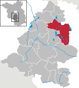
| Location of the city of Zossen in the Teltow-Fläming district | ||
  |
||


Zossen is an official city in the Teltow-Fläming district ( Brandenburg ).
geography
The center of the city of Zossen is about 20 km south of the Berlin city limits on the B 96 federal highway . The urban area covers a total of 17,957 hectares and borders in the north on the area of the municipality of Rangsdorf , in the northeast and east on the city of Mittenwalde , in the southeast on the office of Schenkenländchen , in the south on the city of Baruth / Mark , in the southwest on the municipality Am Mellensee , in the west to the city of Trebbin and in the north-west to the city of Ludwigsfelde . The district of Zossen (with the municipality of Dabendorf ) has 2,859 ha.
The Notte Canal runs right through the city. The former castle, today's Zossen Castle , was on a valley sand island between two arms of the Notte; the southern arm is silted up and z. T. filled.
City structure
According to the main statute of 2009, Zossen consists of the following local and inhabited districts:
|
as well as the housing expansion , Buckowbrücke, Schöneicher Plan, settlement on Motzener See, settlement Horstfelde and forest settlement.
History and etymology
Early to the 16th century
As urn grave finds north of the vineyards show in 2007, the area around Zossen was already settled in the Bronze Age. Like many other towns in Brandenburg, Zossen was originally a Slavic foundation. The name Zossen is probably derived from the Old Sorbian name for the pine ( sosny ); the city arms also refer to this. The place is first mentioned in documents in 1320 as Sossen, Suzozne, Zozne . The early German castle on a small hill in the north-west of the city was built as a margravial-Meissen border fortress and obviously had a Slavic rampart in the typical valley island location at the Notte crossing as its predecessor . At that time, in 1346, Zossen was looked after by the diocese of Meißen with its own provost office in Zossen. In 1375, Czossen (other spellings were Czosen or Czoszen ) appeared in Charles IV's land book as a town and castle ( civitas et castrum; municio ).
In the Middle Ages, Zossen was the capital of a small aristocratic lordship ( Herrschaft Zossen ) and belonged to the Torgau family (Towgow), the Lords of Zossen , from before 1349 , whose ownership had been confirmed by Charles IV . They expanded the castle. A small market town emerged to the east, further east on a tributary of the Kietz, named in 1430 . The historic city center, on the other hand, was on Baruth-Berliner-Strasse with a market-like area. According to reports, it was unpaved and around 330 m × 330 m in size. The Lords of Zossen passed the property on to a Georg von Stein in 1478, who only held it until 1490. In that year the city was acquired by the Brandenburg margrave Johann Cicero and converted into an office. The power extended to "Schloß und Städtchen" as well as Kietz with upper and lower courts, church patronage , as well as services and elevations. According to the Dehio handbook , Zossen developed into "one of the richest offices in the market". Two years after the acquisition, the von Glaubitzs appear , who until the beginning of the 16th century owned a free farm in Zossen together with the Glechow family, ie were exempt from taxes. They also owned another free farm that they had acquired from the Thümen family.
Before 1522, the von Otterstä (e) dt zu Dahlwitz family continued to appear , and their Freihaus and accessories were passed on to the Bardeleben family in 1522 . In 1536, Zossen was in the possession of Eustachius von Schlieben , who had Zossen expanded into a fortress and some outworks built. Under him, the fishing waters were expanded, the Notte made navigable and an official brewery was built in the castle courtyard. However, the further expansion of Zossen was not pursued in favor of the Spandau Citadel . In 1546, Elector Joachim II granted the place far-reaching rights and privileges. This included, for example, the right to cut construction and firewood on the electoral Zossenschen Heide, the duty-free purchase of wheat and grain, the construction of a bridge over the river in Ha (a) ck (with the right to levy taxes there) as well as sub-jurisdiction. Joachim II allowed the Zossenern to build a town hall and council scales on the market and enfeoffed them with the Church of St. Nicolai and Corporis Christi. Until 1583 there were four outlying works and a total of 26 additional villages. The district remained unchanged with 40 hooves, two of which for the pastor. There were seven four-hoofed animals who worked 21 to 30 acres of land, three three-hoofed animals between 19 and 21 acres, and one single-hoofed six acres. At that time 65 people lived in Zossen without Hufner. They owned gardens, fields and meadows and - so the documents report - one had two new meadows "on old Buckow". There were two windmillers, 42 hackers (Hecker) with gardens, 21 herders with meadows, some of whom also had the right to fish. The two fiefdoms of those from Glaubitz and the clerk Löckel were still handed down. The district included an old field to Schöneiche, one in the vineyard near the windmill and a garden "auff den Zeeßlingk". In the area of "Auffm alten Schöneiche", an administrative department with over 228 acres was created, the newly cleared "Hartth" with 25 acres with a sheep farm on which up to 500 animals could be kept. Bardeleben's share came to the Löckel family in 1580, who owned it until the Thirty Years' War in 1646.
17th century
The Glaubitz share went to a Berchelmann family in 1623, who only held it for ten years and then passed it on to a Müller family. From the time before the war in 1624 the “Amt und Städtlein” existed. Conquered by the Swedes in the Thirty Years' War in 1641, the border fortresses and the parish church of St. Katharinen were destroyed. In 1652 the mayor lived in the “little town” with his son and a farmhand, as well as 59 other citizens with five sons and five farmhands - therefore, compared to 1583, there was not a particularly sharp decline in population. In 1655 there were already 65 residents with gardens. Müller's share came to the Hertzberg family in Mittenwalde in 1650; Another feudal property was owned by the pastor Herold's family, who had taken over Löckel's share in 1646 and held it until 1679. There were seven four-hoofed horses, one of which had two farms, three three-hoofed and one single-hoofed. In the meantime, numerous craftsmen were resident in the village, including two butchers, two carpenters, two blacksmiths, a cooper, a linen weaver, a tailor, a furrier, to name just a few. The subdeacon owned a field near Wünsdorf, which was called "the kernels". In addition, there was the administrative office, which owned arable land beyond the old farm, known as the “Koterbude”. Shepherd justice had meanwhile been increased to 1,000 sheep; there was an herb garden and an orchard, as well as a 6.25 acre vineyard. In front of the city were three windmills, one of which was called a "high windmill" and was owned by the office, which it had passed on to a leaseholder. The front mill was a legacy mill owned by the citizen Lamprecht, the middle one owned by the mayor. In 1662 and 1671 there were devastating city fires in which almost all buildings were destroyed. A reconstruction took place under the direction of Johan Gregor Memhardt. He had a rectangular market place built, with the church at the northwest end. To the west was the palace complex, which was rebuilt after the fires and doubled in size. Mittenwalder Straße was created from the Kietz.
18th century
In 1719 Zossen had grown to the stately number of 116 houses and six barns. In 1745 there were a total of seven houses in front of the Berliner Tor, 13 wine master houses in front of the Mühlentor, 20 other houses, six stalls and three outdoor seats in the suburb of Kietz. Outside the city was the royal office and the Vorwerk, the sheep farm and the wine master's house, which belonged to the official vineyard. The three windmills, already mentioned in the 17th century, were still working. Zossen continued to grow and in 1750 there were already 127 houses, 46 barns, but also two desolate places; In 1770 there were 202 houses, 22 barns and a desert spot. In 1756 Frederick II had the Weinberg colony laid out for "foreign" settlers on the eastern outskirts. It was incorporated in 1809/1810.
19th century
In 1801 Zossen consisted of the city, the palace, the suburb in front of the Berliner Tor, the Mittenwald suburb and the Kietz residential area. There were a total of 227 houses, 48 barns and two desolate places. Urban real estate totaled 11,228 acres, of which around 3720 acres were in fields, 1905 acres in meadows and almost as much on pastures. The vineyards took up 84 acres; there was the Kleine Ellenbrucher wood with 96 acres. Five general and livestock markets were held annually on the market square. The statistics mentioned numerous craftsmen, for example 21 brewers, 21 turners, one dyer, five butchers, 30 linen weavers or 12 shoemakers. There were also two midwives, but also a miracle doctor and four city arms. The administration consisted of seven excisers, two actuaries , the mayor and a cantor, a town musician, three preachers and an organist. After the municipal reform in Prussia of 1808 and the associated formation of communities, the Kietz and Weinberge zu Zossen residential areas were incorporated into the municipality in 1809/1810. In 1840 there were 191 houses in Zossen; In addition, there were 20 houses in the Zossen colony. In 1857 the castle complex was transformed into a castle park. In 1858 34 farm owners worked in Zossen, employing 18 servants and maids. There were 173 part-time farmers with a further 106 male and female servants and 260 workers. Of the 207 estates, 61 were between 30 and 300 acres in size (4121 acres in total); however, there were also 80 properties less than five acres in size, which together made up just 200 acres. The supply of the residents was ensured by numerous craftsmen. There were six master bakers with five journeymen and two apprentices, ten master butchers with nine journeymen and five apprentices, 17 master shoemakers with six journeymen and four apprentices and many other trades. In the statistics, for example, two cleaning women with an assistant, a master basketry maker, but also 14 merchants, six traders, nine shopkeepers and a trucking shop with three horses appeared for the first time. There were four inns, a caterer, five innkeepers and six musicians. The statistics also showed an exterminator, 16 civil servants and 21 poor people. In 1860 there was the town with Kietz near Zossen, the Zossen colony and the Zossener vineyards. In addition to ten public buildings, there were now 226 residential buildings and stately 541 farm buildings - including three breweries, a distillation, a brick factory, an earthenware factory and four flour mills. A court house was built in the former castle. A memorial for those who fell in the wars of 1864 , 1866 and 1870/1871 was inaugurated on the Kietz in 1885 . The school on Kirchplatz was enlarged by an extension in 1906.
In 1875 Zossen was connected to the Berlin-Dresden Railway , as was the military railway that ran parallel to its route . On the latter, from 1901 to 1904 , the study society for electric rapid transit systems (St.ES), founded in 1899 between Zossen and Berlin-Marienfelde, carried out high-speed tests with electric locomotives and railcars. For this was not as common today on the track, but next to a three-phase - catenary established. An AEG railcar set the speed record for vehicles at that time with 210 km / h.
20th century

In 1900 Zossen had grown to 330 houses. Factories were built, including an artificial stone and cement factory as well as a lime kiln and a machine factory. Numerous surrounding communities were parish, including Dabendorf, Dergischow, Mellen, next Neuendorf, Saalow and Schöneiche. Zossen was the end point of one of the three southern Berlin suburban railways that ended at Potsdamer Bahnhof , more precisely at the Wannsee train station or the ring and suburban train station, to the west and east of the Potsdam train station. The line was not part of the “ Great Electrification” of Berlin's light rail and suburban railways in the second half of the 1920s. However, after it was merged with the north-western suburban line to Velten via Berlin-Tegel and Hennigsdorf to form a cross-city line through the north-south tunnel , which was continuously in operation in November 1939 , this line should also be connected through the construction of the north-south S-Bahn be electrified. First, however, the line in the Papestraße station (today Berlin-Südkreuz ) was broken, where passengers had to change between a train pulled by steam locomotives to an electric train. In 1940 the electric S-Bahn was started up to Rangsdorf . The electrified line, which was interrupted in 1961 by the construction of the wall, was only rebuilt as far as Blankenfelde in 1992 .

Since 1910, a large military area was created between Zossen and Wünsdorf. During the First World War , Muslim prisoners of war who had fought in the Russian, British and French armies were housed here in the so-called “ half-moon camp ” . These prisoners came from Central Asia, North and West Africa, and India. A wooden mosque was even built for them. They wanted to win over the prisoners for the German side through good treatment and propaganda influence. The long-term goal was also to initiate uprisings in the Muslim world against Germany's opponents of the war. However, these plans were then abandoned. Other French and Russian prisoners of war were housed in the vineyard camp of the former Weinberge residential area . In 1931 there were 480 residential buildings.
After the seizure of power by the Nazi Party in 1933 60 Social Democrats and Communists were arrested in Zossen and in the schoolyard on the church square of SA teams mistreated that there is an early concentration camps were built. A short time later, 32 of the arrested were transferred to the Oranienburg concentration camp , including Alfred Heintz ( KPD ) and Wilhelm Witt ( SPD ). The deacon of the evangelical community, Emil Phillip , was also arrested and transferred after his release. In 1934 the town hall was expanded.
In Wünsdorf , a district of Zossen in the 21st century, the Wehrmacht housed most of the Army High Command (OKH) in the “Maybach I” bunker from August 1939 to 1945 , right next to the “Maybach II” bunker and the “Zeppelin” bunker " , The military intelligence center with the postal code name " Amt 500 ". After the end of the Second World War , the facilities were taken over by the Red Army / Soviet Army , which in 1954 stationed the High Command of the Group of Soviet Armed Forces in Germany (GSSD) there. About 60,000 soldiers and civilians lived here; it was the largest garrison of the Red Army outside the Soviet Union. Since the withdrawal of the Soviet / Russian Western Group of Troops (WGT of the Russian Armed Forces) in 1994, the area has been used for civilian purposes.
After the end of the Second World War, 312 hectares of land were expropriated and 299 hectares of it was divided. 140 businesses were created, which together came to just 24 hectares. 20 other farms jointly cultivated 89 hectares, three farms more than 14 hectares (together 49 hectares). Twelve old farmers received an additional 31 hectares of land. A type III LPG was founded as early as 1952, initially with ten members, who cultivated 78 hectares of agricultural land.
In 1956 the city park was laid out; the VEB steel construction with 121 employees arose. There was VEB Mühlenwerke with 36 employees and a Zossen printing company with 22 employees. In 1958, three PGHs were added: iron and metal casting with 13 members, the electrical trade with ten members and the painting trade with 31 members. In 1960 there was a Type III LPG, which a year later had 161 members and managed 679 hectares. In 1967 it merged with LPG Type III Next Neuendorf. In 1973 the VEB Anlagenbau PKM Leipzig existed with the Zossen production area, the VEB Beverage Combine Potsdam, the Zernsdorf liquor factory with the Zossen division, the VEB Backwaren Zossen, the Zossen brewery and the Zossen printing company. There were also the PGHs iron and metal casting, building services, painting, stove setting and tiling, Baruth and radio and television. In agriculture, the GPG Betriebsteil Zossen as well as the state forestry enterprise Königs Wusterhausen with the Revierforsterei Zossen were active.
21st century
In November 2008, stumbling blocks were laid in front of the house at Berliner Straße 11 in the center of the city to commemorate the residents who were murdered during the time of National Socialism . A city worker was assaulted by a Holocaust denier . The Holocaust denier subsequently ran a shop in this house. In January 2010, the house of democracy used by the association “Zossen shows face”, which was active against right-wing extremist activities in the city, burned down due to arson by a youthful right-wing extremist, the remains were torn down a few weeks later. The perpetrator was acquitted for lack of maturity. Daniel T., who instigated the youth, was on December 1, 2011 a. a. Sentenced to 3 years and 8 months imprisonment for inciting arson and sedition . In this context, Zossen again received nationwide attention in February 2013 when ZDF reported on the work of a local citizens' initiative against right-wing extremism in the series 37 ° .
The citizens' initiative “Zossen shows face” was awarded the Dachau Prize for moral courage in 2013 for its commitment against neo-Nazis .
Administrative history
Zossen and its current districts have belonged to the Teltow district in the Prussian province of Brandenburg since 1817 . With the administrative reform in the GDR in 1952, Zossen became the district town of the newly formed Zossen district in the GDR district of Potsdam . In 1994 the district of Zossen was dissolved and since then the city has belonged to the district of Teltow-Fläming .
Dabendorf was incorporated on January 1, 1974. On October 26, 2003, the town of Zossen expanded to include the municipalities of Glienick, Kallinchen, Next Neuendorf, Nunsdorf, Schöneiche and Wünsdorf in accordance with the municipal area reform law of March 24, 2003.
Population development
|
|
|
|
|
Territory of the respective year, number of inhabitants: as of December 31 (from 1991), from 2011 based on the 2011 census
politics
City Council
The city council assembly (SVV) in Zossen consists of 28 members and the full-time mayor. Since the local elections on May 26, 2019, it has been composed as follows:
| Party / group of voters | Voices 2014 | Voices 2019 | Seats 2014 | Seats 2019 | |
|---|---|---|---|---|---|
| Plan B | 32.5% | 25.4% | 9 | 7th | |
| AfD | 4.7% | 14.8% | 1 | 4th | |
| CDU | 12.4% | 13.9% | 4th | 4th | |
| THE LEFT | 13.0% | 11.4% | 4th | 3 | |
| Alliance 90 / The Greens | 4.1% | 9.7% | 1 | 3 | |
| Association of Independent Citizens | - | 9.5% | - | 3 | |
| SPD | 8.5% | 7.7% | 2 | 2 | |
| FDP | 1.4% | 2.6% | - | 1 | |
| Voter community Kallinchen | 2.1% | 2.4% | 1 | 1 | |
| Zossen Citizens List | 8.8% | - | 2 | - | |
| Free voters for Zossen | 6.0% | - | 2 | - | |
| Individual candidate Freiherr von Lützow | 4.0% | - | 1 | - | |
| Women's Association Next Neuendorf | 2.5% | - | 1 | - |
mayor
- 1990: Gerd Lutze
- 1990–1993: Susanne Michler (CDU)
- 1993–2003: Hans-Jürgen Lüders (SPD)
- 2003–2019: Michaela Schreiber (Plan B)
- since 2019: Wiebke Schwarzweller (FDP)
Schwarzweller was elected for a term of eight years on September 1, 2019 with 58.3% of the valid votes.
The first free democratic election in Zossen after reunification took place on May 29, 1990 in the hall of the Heidel restaurant. From the ranks of the SPD, which won the elections in Zossen with a share of 62% of the vote, the agricultural engineer Gerd Lutze, based in Dabendorf, was elected by a majority as mayor of Zossen. The opposing candidate was Susanne Michler, who later succeeded him in office; the political godfather was Klaus Wowereit from the SPD Berlin-Tempelhof .
.PNG)
coat of arms
The coat of arms was approved on October 16, 1996 and, after the incorporation in 2003, confirmed as an existing coat of arms on June 22, 2004.
Blazon : "A red pine with a green crown growing in silver between a transverse red tree trunk with cut branches and three-pronged black fish spear."
Town twinning
Sister cities of the city are Wittlich in Rhineland-Palatinate and Delbrück in North Rhine-Westphalia .
Sights and culture
Buildings

In the list of architectural monuments in Zossen and in the list of ground monuments in Zossen , the cultural monuments entered in the monuments list of the state of Brandenburg are recorded.
- Trinity Church , designed as a baroque transverse hall building , the foundation stone from May 24, 1734 on the foundation of a previous half-timbered building was renovated in 1938. The pulpit and altar of the church are in the middle of the room opposite the tower.
- The Castle Zossen built in the 13th century as Wasserburg. In 1641 the castle was destroyed by the Swedes. In addition to the historic cellar vaults, the bastion, a brick building from the 16th century and a gate have been preserved.
- Glienick village church , its exact construction date is not known. Experts assume that it is a late medieval building, the east wall of which was renewed in 1730. Inside there is a pulpit altar decorated with carved cheeks from the 18th century with a blown gable . An octagonal, wooden fifth could be dated to the year 1570 and was restored in 1976.
- Wünsdorf village church , hall church in the arched style from the years 1841 to 1843. The church furnishings are uniformly from the construction period.
- Field stone churches and baroque hall churches in the districts, for example the village church Schünow
- Zehrensdorf Indian Cemetery in Zehrensdorf
- Telecommunication tower made of reinforced concrete east of Glienick at 52 ° 15'16 "N 13 ° 23'52" E, 81 meters high, built in 1960. The area around the tower, which is operated and managed by the Federal Network Agency , is to be converted into a leisure, sports and recreation park.
Museums
- Book City Wünsdorf within the formerly used by the Soviet armed forces area , one of the few books cities in Germany. There is also the Garrison Museum Wünsdorf with a permanent exhibition from 1910 to 1945 in a restored horse stable from the imperial era, as well as a motorcycle museum on Bundesstraße 96. The historical circular route through the Forbidden City leads over a length of around 11.3 km from northern in the southern part of the forest city to Wünsdorf.
- Museum of the Teltow in Wünsdorf, permanent exhibition in the former Wünsdorf village school on the history and natural history of the Teltow (since 1994). In addition to a historical outline of the Zossen rule, the exhibition provides information on agriculture, handicrafts and industrial production in the region and depicts important personalities. In a museum garden, a natural history area is shown with a wood history.
- The Alter Krug museum and meeting place in a half-timbered house built around 1750 , in which a royal forester originally lived. From around 1830 to around 1890 the name- giving jug was in the building . It contains the only smoke kitchen in the region that has been completely preserved . The registry office in Zossen operates a branch office there and thus enables a marriage to be celebrated against a historical backdrop. The museum has been run by a local history association since 1992.
- School museum in Zossen: On March 12, 2016, the city opened an “adventure house for young and old” in a listed half-timbered house at Marktplatz 7, consisting of a gallery café with changing exhibitions, the school museum with a historical classroom and a room from the time of the GDR and a hall that can be used for cultural events.
- Local museum
- Radio and TV museum in Dabendorf, privately run, including a Rembrandt FE 852 , the first television set developed for sale in the GDR
Regular events
- Dance in May in Wünsdorf
- Witches Festival in Kallinchen
- Festival of the clubs in Zossen
- Children's festival on the market square in Zossen on the Sunday before or after International Children's Day on June 1st
- Summer, Schützen and Rose Festival in Dabendorf
- Linden blossom festival in Lindenbrück
- Village festivals in Horstfelde, Nunsdorf, Schöneiche and Glienick
- Summer festival in Kallinchen
- Beach festival in Wünsdorf
- Wine festival in Zossen with the award of volunteer residents
- Tree festival in Kallinchen
- Advent market in Wünsdorf
- Christmas market in Zossen and Kallinchen
- Zossen-Ludwigsfelde New Year's Eve run
Economy and Infrastructure
Companies
Energiequelle GmbH , which is active in the wind energy sector , is based in the Kallinchen district . There are a total of 16 business parks in the districts . A bread factory, a car paint shop and a supplier of office supplies and office technology are located there.
The trade tax rate is 7%, the assessment rate is the statutory minimum of 200% . Zossen is therefore also referred to as the inner German tax haven and many letterbox companies have settled here.
Public facilities
The city is the seat of the Zossen district court responsible for the northern part of the Teltow-Fläming district .
The Teltow-Fläming job center is based in Zossen.
The regional authority center with its three sub-areas A, B and C. is located in the district of Wünsdorf. Several regional higher authorities and institutions are located there:
- Brandenburg State Office for Monument Preservation and State Archaeological Museum
- Brandenburg State Office for Real Estate and Construction
- Initial reception facility in Wünsdorf
- State Office for Occupational Safety, Consumer Protection and Health, Dept. of Health
- Landesbetrieb Forst Brandenburg - lower forest authority - operating part Wünsdorf
- State Office for Roads, Region South, Wünsdorf Office
- Central service of the police of the state of Brandenburg
traffic
Rail transport

The Dabendorf stop and the Zossen and Wünsdorf-Waldstadt stations are on the Berlin – Dresden railway line . They are served by the regional express lines RE 5 Rostock / Stralsund- Berlin- Elsterwerda / Wünsdorf -Waldstadt and RE 7 Dessau - Berlin -Wünsdorf-Waldstadt. At the Neuhof stop (near Zossen) on the same route, only the RE 5 runs.
The Zossen – Jüterbog line, formerly the Royal Prussian Military Railway built in 1874 , was closed to passenger traffic in 1998. The Zossen – Mittenwalde line with the Schöneicher Plan station, built in 1900 by the Neukölln-Mittenwalder Railway , was closed in 1974.
Bus transport
Zossen is connected to a PlusBus and other regional bus routes through the Teltow-Fläming transport company .
Road traffic
Zossen is located on the B 96 between Berlin and Luckau and on the B 246 between Trebbin and Storkow (Mark) . The state road L 79 between Ludwigsfelde and Klausdorf also crosses the city. The closest motorway junctions are Rangsdorf on the A 10 (southern Berlin Ring) and Bestensee on the A 13 Berlin – Dresden.
education
- Oertelufer day care center with 24-hour care as well as nine other day-care centers and four after-school care centers
- Primary schools in Zossen, Glienick, Wünsdorf and Dabendorf
- Comprehensive school in Dabendorf with upper secondary school level
- Secondary school in Wünsdorf
- District Music School Wünsdorf
- Youth center at the lime shaft kilns
- City library in Zossen and Wünsdorf with summer reading club
societies
Almost 100 clubs are active in Zossen, including fishing clubs, school and daycare support clubs, but also sports clubs such as the 1st TTC Zossen 07, MSV Zossen 07 or MTV 1910. Several carnival clubs are still active in the districts, for example in Schöneiche, Dabendorf and Kallinchen.
Sports
On Motzener See near the local part Kallinchen the largest and most popular place triathlon event in Brandenburg, the Kallinchen Triathlon held. In 2014 the event organized by the Triathlon-SG Bund was held for the 23rd time.
The Zossen-Wünsdorf lido is located on the Großer Wünsdorfer See . Further bathing beaches are in Kallinchen and Zesch am See, a bathing area in Neuhof and a water ski park in Horstfelde.
Under the name Erlebnisbahn Zossen- Jänickendorf , draisines have been running from Zossen station on the route of the former military railway since 2003 . With a length of 25 kilometers, this adventure ride is one of the region's tourist attractions, along with flaeming skates .
The Notte Canal can be navigated by kayak, hydro bike , boat, paddle boat or motor boat.
The European long-distance hiking trail E 10 , the Fontaneweg F 4 and the 66 lakes hiking trail lead through Zossen . There are also other hiking trails in the districts, for example the 11 km long Schünow-Horstfelde circular route, the 19 km long Mellenseer circular route, the Motzener See circular route or the Glienicker Weinbergweg, which leads to the 88-meter-high vineyard . The Baruther Line area hiking trail opens up the region from Baruth to Blankenfelde.
The oldest sports club is the Schöneiche sports community, which celebrated its 65th anniversary in 2014.
sons and daughters of the town
- Wilhelm Friedrich Adolph Gerresheim (1742–1814), natural scientist and doctor
- Johann Friedrich Wilhelm Frey (1804–1879), Prussian major general
- Franz Kinderling (1820–1895), Vice Admiral of the German Imperial Navy
- Karl Friedrich August Lehmann (1843–1893), stenographer and inventor of shorthand tachygraphy
- Oskar Iden-Zeller (1879–1925), ethnologist
- Frieda Kassen (1895–1970), politician (SPD)
- Walter Budeus (1902–1944), communist and resistance fighter
- Benno Funda (* 1934), cyclist
- Eik Galley (* 1967), sports reporter and journalist
- Nik Page (* 1971), musician
- Roy Präger (* 1971), soccer player
- Niklas Birr (* 1974), rally driver
- Daniel Freiherr von Lützow (* 1974), politician (AfD)
- Stefan Ciupek (* 1976), cameraman and colorist
- Stefan Lupp (* 1978), soccer referee
- Ina Paule Klink (* 1979), actress and singer
- Katharina Wüstenhagen (* 1983), rally co-driver
literature
- Friedrich Wilhelm August Bratring : Statistical-topographical description of the entire Mark Brandenburg . Volume 2: Containing the Mittelmark and Ukermark . Berlin 1805, pp. 342-345 .
- BVB-Verlagsgesellschaft (Ed.): City of Zossen Citizen Information - From A for District Court to Z for Zweckverband 2016/2017 , 2016, p. 44.
- Lieselott Enders : Historical local lexicon for Brandenburg: Teltow (= Historical local lexicon for Brandenburg . Volume 4). Verlag Hermann Böhlaus successor, Weimar 1976.
- Georg Dehio (edited by Gerhard Vinken et al.): Handbook of German Art Monuments - Brandenburg Deutscher Kunstverlag, Munich / Berlin 2012, ISBN 978-3-422-03123-4 .
- Hiltrud and Carsten Preuß: The manor houses and manors in the Teltow-Fläming district , Lukas Verlag für Kunst- und Geistesgeschichte, 1st edition, November 29, 2011, ISBN 978-3-86732-100-6 , p. 244
Web links
Individual evidence
- ↑ Population in the State of Brandenburg according to municipalities, offices and municipalities not subject to official registration on December 31, 2019 (XLSX file; 223 KB) (updated official population figures) ( help on this ).
- ↑ Main statute of the city of Zossen from March 4, 2009 ( Memento of the original from December 13, 2015 in the Internet Archive ) Info: The archive link has been inserted automatically and has not yet been checked. Please check the original and archive link according to the instructions and then remove this notice. (PDF; 43 kB)
- ↑ Statistics of the German Reich, Volume 450: Official municipality directory for the German Reich, Part I, Berlin 1939; Page 249
- ^ Service portal of the state administration of the state of Brandenburg - Zossen
- ^ How the SA and SS harassed Nazi opponents in Zossen . In: Märkische Allgemeine , June 21, 2013
- ↑ The Forbidden City of the Soviets. In: Der Spiegel , November 28, 2011
- ↑ Jan Bosschaart: Zossener Stolpersteinegner is a well-known Holocaust denier . ( Memento from April 10, 2010 in the Internet Archive ) In: Märkische Allgemeine, November 26, 2008
- ↑ Stefan Berg: Right-wing extremist admits arson attack in Zossen . Spiegel Online, January 29, 2010
- ↑ The cake is baked "Neo-Nazi condemned" ( Memento from October 11, 2012 in the Internet Archive ). Märkische Allgemeine from December 1, 2011
- ↑ Jens Blankennagel: Neo-Nazi from Zossen have to be imprisoned for almost four years. In: Berliner Zeitung, December 1, 2011
- ↑ "I will not let myself be driven away". Stand up to right-wing violence ( memento from July 1, 2013 in the Internet Archive )
- ↑ Press release from the City of Dachau ( Memento from January 1, 2014 in the Internet Archive )
- ↑ Municipalities 1994 and their changes since January 1, 1948 in the new federal states , Metzler-Poeschel publishing house, Stuttgart, 1995, ISBN 3-8246-0321-7 , publisher: Federal Statistical Office
- ↑ Fourth law on state-wide municipal area reform concerning the districts Havelland, Potsdam-Mittelmark, Teltow-Fläming (4th GemGebRefGBbg) of March 24, 2003, § 19
- ↑ Historical municipality register of the state of Brandenburg 1875 to 2005. District Teltow-Fläming . Pp. 30-33
- ↑ Population in the state of Brandenburg from 1991 to 2017 according to independent cities, districts and municipalities , Table 7
- ^ Office for Statistics Berlin-Brandenburg (Ed.): Statistical report AI 7, A II 3, A III 3. Population development and population status in the state of Brandenburg (respective editions of the month of December)
- ^ Result of the local elections on May 25, 2014
- ^ Result of the local election on May 26, 2019
- ↑ Local elections October 26, 2003. Mayoral elections , p. 33
- ↑ Brandenburg Local Election Act, Section 74
- ^ Result of the mayoral election on September 1, 2019
- ↑ Coat of arms information on the service portal of the state administration of Brandenburg
- ↑ Garnisonsmuseum Wünsdorf , website of the Förderverein Garnisonsmuseum Wünsdorf, accessed on March 13, 2017.
- ↑ Teltow-Fläming district, Office for Education and Culture: Museum des Teltow - Zossen, Wünsdorf district , flyer, no date, p. 4.
- ↑ Heimatverein Alter Krug Zossen (ed.): Der Alte Krug - Museum and meeting place in Zossen / Weinberge , flyer, no date, p. 4.
- ^ City of Zossen (ed.): City of Zossen and their museums , information card, without date
- ^ City of Zossen (ed.): New life in the old house - Kirchplatz 7 , Flyer, January 2017, p. 4.
- ↑ Website of the school museum , website of the Heimatverein Alter Krug Zossen, accessed on March 13, 2017.
- ↑ Zossen and its museums - not only worth a visit in bad weather , website of the city of Zossen, accessed on March 13, 2017.
- ^ City of Zossen (ed.): City of Zossen and its festivals , information card, without date
- ^ Berliner Zeitung: The secret owner of the real estate group Lebensgut. Retrieved on March 23, 2020 (German).
- ↑ Jobcenter Teltow-Fläming - 15806 Zossen. Retrieved July 23, 2018 .
- ↑ State authorities | Teltow-Fläming district. Accessed July 23, 2018 .
- ^ Registration office of the SU | SU. Retrieved July 23, 2018 .
- ↑ Super User: Wünsdorf . ( drk-fluechtlingshilfe-brb.de [accessed on July 23, 2018]).
- ↑ Central Police Service . ( brandenburg.de [accessed on July 23, 2018]).
Glienick with Advertise | Horstfelde | Kallinchen | Lindenbrück with Funkenmühle and Zesch am See | Next Neuendorf | Nunsdorf | Beautiful oak | Schünow | Wünsdorf with Neuhof , Waldstadt and the former Zehrensdorf | Zossen with Dabendorf