List of streets and squares in Berlin-Neukölln
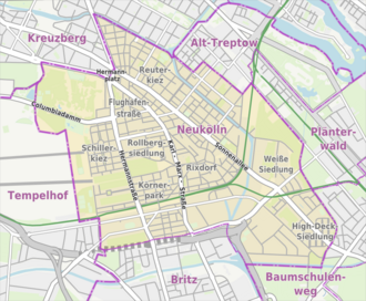
The list of streets and squares in Berlin-Neukölln describes the street system in the Berlin district of Neukölln with the corresponding historical references. At the same time, this compilation is part of the lists of all Berlin streets and places .
overview
Development of the road network in the district
The original town center of Neukölln, which was called Rixdorf until 1912 and was an independent town until 1920, was on Richardplatz . The business center had shifted to Sonnenallee and Karl-Marx-Strasse to Hermannplatz by the 21st century .
From the 20th century a lot of construction activity began, for which a number of construction companies had founded and bought land, including the Berlin Terraingesellschaft Lippmann & Stahl , the Rixdorfer Spar- & Bauverein GmbH , the Union Baugesellschaft auf Actien , the Berlin-Rixdorfer Bodengesellschaft , the Official housing association Neukölln eGmbH u. a. with residential complexes at Edmundstrasse 1–8, Neuköllnischen Allee 39–53a, in the area Gretelstrasse 2–20 as well as Hänselstrasse 1–5 and Harzer Strasse 96–103 as well as the Gemeinnützige Siedlungs- und Wohnungsbaugesellschaft Berlin GmbH u. a with groups of houses in Emser Straße 58-68 and numbers 71/72. Their activities led to a rapid structural expansion of Rixdorf and an increase in the number of inhabitants. The renaming in Neukölln was accompanied by a regulation of the associated municipality area, some streets or parts of them went directly to the city of Berlin, others have been exchanged with the neighboring districts.
Principles of naming and general information on the road system
The existing, dedicated 208 streets and squares [as of January 2016] reveal some clear groupings in their names: 36 streets were given names according to German localities, 33 streets according to German rivers, 32 according to people with a specific regional reference, 22 streets are location or directional information , six streets have a specific connection to the history of Rixdorf / Neukölln. The “other street names” relate to politicians, writers, scientists and engineers, musicians, fairy tale characters, astronomical terms - they do not form a larger group and are distributed over the district (88 in total).
Twelve of the streets belong in part to neighboring districts. The total length of all city and federal roads in Neukölln is 107.6 kilometers. The national highway 179 runs on the road train of Karl Marx Street by Neukölln. 1140 meters of the main carriageway and the provisional Grenzallee junction at the Neukölln motorway triangle on Neukölln are 1140 meters from the city motorway , plus 3870 meters of lanes on the 113 federal motorway to Dresden . These routes all belong to the large-scale road system. The main street system is divided according to the meaning. The higher-level street system includes Columbiadamm , Erkstraße, Flughafenstraße, Grenzallee, Hermannplatz , Hermannstraße , Karl-Marx-Straße , Sonnenallee and Wildenbruchstraße. Dammweg, Hertastraße, Lahnstraße, Mariendorfer Weg, Neuköllniche Allee and Silbersteinstraße are among those leading to the neighboring districts of the regional road system. And finally, the supplementary streets connect the system of the main streets, including Bergiusstraße, Chris-Gueffroy-Allee, Naumburger Straße, Niemetzstraße, Nobelstraße, Pannierstraße, Saalestraße and parts of Silbersteinstraße.
The district of Neukölln has 166,157 inhabitants (as of December 30, 2019) and includes the postcode areas 10965, 10967, 12043, 12045, 12047, 12049, 12051, 12053, 12055, 12057, 12059, 12347 and 12099.
Overview of streets and squares
The following table gives an overview of the streets and squares in the district as well as some related information.
- Name / location : current name of the street or square. Via the link Location , the street or the square can be displayed on various map services. The geoposition indicates the approximate center of the street length.
- Traffic routes not listed in the official street directory are marked with * .
- Former or no longer valid street names are in italics . A separate list may be available for important former streets or historical street names.
-
Length / dimensions in meters:
The length information contained in the overview are rounded overview values that were determined in Google Earth using the local scale. They are used for comparison purposes and, if official values are known, are exchanged and marked separately.
For squares, the dimensions are given in the form a × b for rectangular systems and for (approximately) triangular systems as a × b × c with a as the longest side.
If the street continues into neighboring districts, the addition ' in the district ' indicates how long the street section within the district of this article is. - Name origin : origin or reference of the name.
- Notes : further information on adjacent monuments or institutions, the history of the street and historical names.
- Image : Photo of the street or an adjacent object.
| Name / location | Length / dimensions (in meters) |
Origin of name | Date of designation | Remarks | image |
|---|---|---|---|---|---|
|
Albert-Schweitzer-Platz
( Location ) |
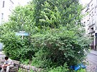
50 × 25 | Albert Schweitzer (1875–1965) , Protestant theologian, organist, music researcher, philosopher and doctor | Dec 1, 1985 | The square is located on Karl-Marx-Straße and forms the forecourt of the Albert Schweitzer School . |
|
|
Alfred-Scholz-Platz
( Location ) |
70 × 20 (triangular shape) |
Alfred Scholz (1876–1944), Neukölln mayor | April 28, 2014 | The square is bounded by Richardstraße, Donaustraße, Ganghoferstraße and Anzengruberstraße. The area only became a square in 1984 when a traffic island was connected to the sidewalk and from July 6, 1985 it was named Platz der Stadt Hof , after Neukölln's twin town Hof an der Saale . From 2012, the district administration had the square redesigned extensively and extended to Richardstrasse. Multi-colored stone mosaics indicate the population of the district, who come from different nationalities. In addition, several notices to residents have been taken into account. In September 2013, considerations became known to rename this place after the last Neukölln (city) mayor Alfred Scholz. The reopening and renaming took place on April 28, 2014 under the new name and in the presence of Scholz's relatives. |

|
| Allerstrasse
( Location ) |
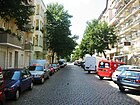
530 | Aller , right tributary of the Weser in Saxony-Anhalt and Lower Saxony | Oct 30, 1899 | The street runs from Hermannstraße to Oderstraße. The house number sequence follows the principle of horseshoe numbering . According to the development plan, it was first street 163a . |
|
| Altenbraker Strasse
( Location ) |
460 | Altenbrak , part of the town of Thale in the Harz district in Saxony-Anhalt | Dec. 4, 1935 | The street leads from Thomasstraße to Siegfriedstraße. The house number sequence follows the principle of orientation numbering . The street was laid out at the end of the 19th century and was first called Bodestrasse . |

|
| At the Oberhafen
( Location ) |
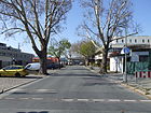
100 | Port part of the construction of the Teltow canal was | June 3, 1916 | The street goes from the Grenzallee. According to the development plan, the previous names were Straße 180 and Straße 180f . The small cul-de-sac opens up the area of the port, which is mainly used by recycling companies. |
|
| At the brewhouse
( Location ) |
160 | Kindl brewery's brewhouse , used as an inn | Apr 1, 2010 | The road goes east from Werbellinstraße in the direction of Rollbergstraße and leads to the site of the former brewery. In the official directory, 60 house numbers are given here. The large storage area is used by a beverage wholesaler and there are regular flea markets here. | |
| Anzengruberstrasse
( Location ) |
340 | Ludwig Anzengruber (1839–1889), Austrian writer | Aug 12, 1908 | The street leads from Karl-Marx-Straße to Sonnenallee . The house number sequence follows the principle of horseshoe numbering.
The previous name was street 13d according to the development plan . The Alte Post is located on the corner of Karl-Marx-Straße . |

|
| Aronsstrasse
( Location ) |
700 | Leo Arons (1860–1919), physicist and politician | June 15, 1973 | The road leads from Dieselstrasse to Dammweg. The house number sequence follows the principle of orientation numbering.
It was first called (from 1901) Sackführerdamm , was named Leo-Arons-Straße in 1926 and was renamed Sackführerdamm in 1934 . In 1973 it was given its current name together with road 559 . |

|
|
Bambachstrasse
( Location ) |
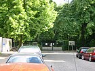
60 | Johann Leonhard Bambach (1820–1913), Berlin local politician | Jan. 18, 1908 | The street is a dead end from Silbersteinstraße . At first it was called Straße 168 according to the development plan . With the naming of the street, Bambach was (also) honored as a co-founder of the "carpenter's colony in Knesebeckstraße" (1936). |
|
| Bartastrasse
( Location ) |
100 | Carl Friedrich Barta (1833–1914), innkeeper and Rixdorf community leader | Jan 15, 1913 | The street is a cul- de-sac leading from Mareschstrasse . According to the development plan, the previous name was Straße 17b . In the 1936 address book, "Barta, old Neukölln family, former owner of the site" (across which the street runs) is named as the namesake. The innkeeper is listed in Kaupert's street directory. |

|
| Bendastrasse
( Location ) |
440 (in the district) |
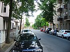
Robert von Benda (1816–1899), politician and manor owner | May 22, 1897 | Bendastraße runs from Ringbahnstraße and Hertastraße over Britzkestraße and then ends as a dead end . A small part of the street is in Britz . The house number sequence follows the principle of horseshoe numbering.
At first it was called Straße 59 according to the development plan . The extension of the street in Britz was also renamed Bendastraße in 1928. |
|
| Bergiusstrasse
( Location ) |
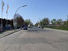
710 | Friedrich Bergius (1884–1949), chemist | Aug 20, 1958 | Bergiusstraße leads from Grenzallee to Nobelstraße. The house number sequence follows the principle of orientation numbering.
It was merged from the previous Straße 11 IV, Straße 4 and Straße 425 . |
|
| Berthelsdorfer Strasse
( Location ) |
190 | Berthelsdorf , district of Herrnhut in Saxony | March 7, 1904 | The street runs from Richardstraße to Donaustraße. The house number sequence follows the principle of horseshoe numbering. From 1902 it was called Triftweg and in the address books it crossed Richardstraße between house numbers 107 and 108. |

|
| Biebricher Strasse
( Location ) |
150 | Biebrich , district of Wiesbaden | Oct 30, 1899 | Biebricher Straße leads from Hermannstraße to Mainzer Straße. The house number sequence follows the principle of horseshoe numbering.
At first the traffic route was called Straße 213 . After the name was given, the street was written as Biebrichstraße for a while (address book 1901). |

|
| Boberstrasse
( Location ) |
70 | Bober , left tributary of the Oder in Poland | Sep 9 1899 | The street leads from Siegfriedstraße to Emser Straße. It was first referred to as Street 164b . |

|
| Boddinplatz
( Location ) |
110 × 40 | Hermann Boddin (1844–1907), Mayor of Rixdorf | Feb 6, 1903 | Boddinplatz is located on Mainzer Strasse and Boddinstrasse. At first it was called place IVa . |

|
| Boddinstrasse
( Location ) |
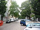
650 | Hermann Boddin (1844–1907), Mayor of Rixdorf | March 6, 1903 | Boddinstraße runs as a one-way street from Hermannstraße to Karl-Marx-Straße. The house number sequence follows the principle of horseshoe numbering.
According to the development plan, the previous name was street 209a . In the inner courtyard at Boddinstrasse 21 there is a garden monument created according to plans by the architect Georg Behnke in the years 1906/1907. The residential complex designed by Erich Köhn and built in 1904–1906 with house numbers 23–31 and the tenement house built in 1906/1907 on the corner of Mainzer Strasse are other listed monuments. |
|
|
Bohemian Square (*)
( Location ) |
60 × 40 | Bohemia , home of Protestant refugees who settled in Rixdorf in the 18th century | Sep 1 2000 | Böhmische Platz is bordered by Böhmische Strasse, Niemetzstrasse and Schudomastrasse. Before being named in 2000, it had no name. |

|
|
Bohemian street
( Location ) |
720 | Bohemia , home of Protestant refugees who settled in Rixdorf in the 18th century | May 2, 1905 | The road runs as a ring road in Rixdorf from Richardstraße to Donaustraße and Treptower Straße. The house number sequence follows the principle of horseshoe numbering.
The individual parts were first referred to as street 100 , street 184 and street 84a . The residential building with the numbers 40/41, built in 1874 according to plans by the architect Ludwig Becker , and the residential complex with the numbers 21 and 23 built in 1928/1929 are under monument protection . |

|
| Bornsdorfer Strasse
( Location ) |
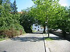
480 | Bornsdorf, part of the municipality Heideblick in the Dahme-Spreewald district in Brandenburg | 1919 | Bornsdorfer Straße leads from Briesestraße (north) to Mittelweg (south). The house numbers follow the principle of orientation numbering. According to the development plan, the first parts of the traffic route were street 202 and street 202a . The northward section ( street 202 ) was named Waßmannsdorfer Straße around 1894 , which was changed to Bornsdorfer Straße in 1919. On March 29, 1939, the part that had meanwhile been extended to the south (former street 202a ), and from 1919 again Waßmannsdorfer Straße , was also renamed Bornsdorfer Straße.
The listed St. Clara Church is on the corner of Briesestrasse . On plot 15 there is a flat bunker built in the 1940s, which has been used by the Neukölln building authority as a file warehouse since 2005. |
|
| Boschweg
( Location ) |
440 | Carl Bosch (1874–1940), chemist and entrepreneur | Sep 1 1966 | The Boschweg leads from Haberstraße to Nobelstraße. It was first referred to as Street 428 . The house at Boschweg 13 was a high-rise chicken building from 1967 to 1972 and the largest battery in Europe. |

|
| Bouchéstrasse
( Location ) |
430 (in the district) |
Bouché , gardening family of Huguenot origin | 1842 | Bouchéstraße leads from Am Treptower Park to Kiehlufer. The house numbers are in a horseshoe shape. The eastern section of Bouchéstraße is in Alt-Treptow .
Until 1896 the parts were called Bouchéweg and in Neuköllner area Straße 11 . The road 11 was included in the Bouchéstraße on 21 February 1,903th From the 1920s onwards there was a lot of building activity along this street, so houses 55–57 were built by the “Bau- und Spargenossenschaft Groß-Berlin GmbH”. The company "Beamten-Wohnungsverein Neukölln eGmbH" had the houses at Bouchéstrasse 58-60 (and the houses on Harzer Strasse around the corner) built. The residential complexes mentioned are listed architectural monuments. The Berlin Wall ran along the section between Harzer Strasse and Heidelberger Strasse . In 1983, GDR citizens Holger Bethke and Michael Becker managed one of the most famous GDR escapes, starting from the residential building at Schmollerstraße 5 and Bouchéstraße 33 . |

|
| Braunschweiger Strasse
( Location ) |
1050 | Braunschweig , city in Lower Saxony | June 1, 1964 | The street runs from Sonnenallee and Ederstraße to Karl-Marx-Straße. The house number sequence follows the principle of orientation numbering. Braunschweiger Straße got its name from the renaming of Thüringer Straße and parts of Teupitzer and Kanner Straße . On the section of the odd house numbers 7-17 is a listed residential complex built in 1929 by the architect Willy Mühlau . The St. Richard Church, consecrated in 1975, is also located in this street . |

|
| Briesestrasse
( Location ) |
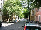
350 + 85 | Briese , tributary of the Havel in Brandenburg | Feb 14, 1950 | From the 1870s to January 1950, the traffic route was called Prinz Handjerystraße . Briesestrasse runs in the eastern area from Karl-Marx-Strasse to Morusstrasse, where it is interrupted by the Rollbergsiedlung and westward from Falkstrasse to Hermannstrasse. On the corner of Bornsdorfer Straße is the listed St. Clara Church .
In the course of the renaming, the house numbers were reassigned; so was z. B. from Prinz Handjerystraße 35 to Briesestraße 70. |
|
| Britzkestrasse
( Location ) |
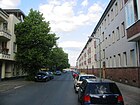
170 | Britzke , noble family and founder of the village of Britz | Jan. 7, 1928 | The street leads from Bendastraße to Rungiusstraße. The house number sequence follows the principle of horseshoe numbering. The road land and the south side of the road belong to Britz .
At first the traffic route was called Straße 46a . |
|
| Brockenstrasse
( Location ) |
170 | Brocken , highest mountain in the Harz | Aug 11, 1909 | The street runs from Kiehlufer to Harzer Straße and is continued there by Sinsheimer Weg. It was first referred to as 33 Street . |

|
| Bruno-Bauer-Strasse
( Location ) |
450 | Bruno Bauer (1809–1882), philosopher | May 22, 1897 | The street runs from Silbersteinstraße via Glasower Straße and Juliusstraße to Britzkestraße, interrupted by an undeveloped section between Julius- and Britzkestraße. The house number sequence follows the principle of orientation numbering. It was first referred to as Street 204 . At Bruno-Bauer-Straße 23 there is a residential complex built between 1909–1912 and now a listed building. |

|
| Brusendorfer Strasse
( Location ) |
240 | Brusendorf , part of the city of Mittenwalde in Brandenburg | Feb. 14, 1907 | The street leads from Mareschstraße over Braunschweiger Straße to Schwarzastraße and Saalestraße. The house numbers are given in a horseshoe shape. At first it was 84 Street .
The houses with the numbers 7-9 are a residential complex completed in 1929, which the architect Willy Mühlau had designed as part of the “non-profit war settlement of the National Socialist War Victims Supply GmbH ” (headquarters in Berlin SW 68). They are now under monument protection. Row 2–5 was built at the same time on behalf of the Britz building cooperative "Ideal". |

|
|
Bürknerstrasse
( Location ) |
390 | August Bürkner (1847–1914), Councilor of Justice and 'unpaid city councilor ' of Rixdorf 1899–1914 | Aug 11, 1909 | The street runs from Maybachufer and Friedelstraße to Kottbusser Damm. The house number sequence follows the principle of horseshoe numbering. It was first referred to as 10 Street . |

|
|
Chris-Gueffroy-Allee
( Location ) |
240 (in the district) |
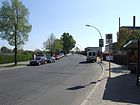
Chris Gueffroy (1968–1989), killed on the Berlin Wall | Aug 10, 2010 | The street leads from Neuköllnische Allee over the Britzer connecting canal to Späthstraße in Baumschulenweg. The southern section of the road runs in Baumschulenweg . Until 2010 the street was called Britzer Allee . In 1903 parts were renamed Späthstraße and spun off from Rixdorf. |
|
|
Columbiadamm
( Location ) |
1050 (in the district) |
Columbia , the name of the aircraft with which two US pilots took a flight from New York to Germany | Aug 14, 1950 | Columbiadamm runs from Dudenstrasse, Tempelhofer Damm , Mehringdamm and Platz der Luftbrücke to Flughafenstrasse and Fontanestrasse. Parts of the street are in Kreuzberg and Tempelhof . The house number sequence follows the principle of orientation numbering.
On the street are the former Tempelhof Airport , the Şehitlik Mosque , the Hasenheide Park , the summer pool and the Columbiadamm cemetery . |

|
|
Causeway
( Location ) |
510 (in the district) |
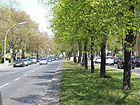
former Knüppeldamm from the Köllnische Heide to the Spree | Jan. 29, 1842 | The Dammweg leads from Kiehnwerderallee to Sonnenallee and Grenzallee. The eastern section of the road runs through Plänterwald . The house numbers are assigned according to the principle of orientation numbering . Only sections 208–228 and 211–251 (from Dammbrücke to Neuköllniche Allee) belong to Neukölln. In the address books available, the Dammweg is only mentioned in 1911; the house numbers 211–280 belonged here, the others belonged to the Treptow district . The “Kleinhaussiedlung am Dammweg” along Einhornstrasse 1-9 is the property of the City of Berlin.
The path used to be colloquially known as Knüppeldamm . In 1909 the magistrate of the city of Rixdorf submitted an application for the name to be changed to Spreeallee , which, however, was rejected by the Treptow municipal council. |
|
| Delbrückstrasse
( Location ) |
600 | Rudolph von Delbrück (1817–1903), politician | before 1877 | The street runs from Karl-Marxstraße and Walterstraße to Hermannstraße, Hertastraße and Mariendorfer Weg. The house number sequence follows the principle of horseshoe numbering. |

|
| Dolphin Street
( Location ) |
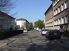
180 | Dolphin , constellation | Apr 22, 1920 | Delphinstrasse is located between Siriusstrasse on Venusplatz and Zwillingestrasse. To the south of Sonnenallee it runs parallel to Planet Street. The house number sequence follows the principle of orientation numbering. According to construction plan was a road 13V traced out. In the address book of 1925, Venusplatz is still undeveloped (construction site), as early as 1921 there is an apartment building with nine middle-class tenants on property 13, 14 and the corner houses are listed as Planet Street 1, 2 and Sirius Street 1, 2. Today plots 3 and 5 (odd) and 4-18 (even) are built on with residential buildings. On the uneven southeast side of the street is the Kepler School (Zwillingestrasse 21) with its cafeteria and school grounds, behind the northwestern property is the “KGA Steinreich”, which previously replaced the ice works on the pond. The district is shown on the map from 1921 as an undeveloped settlement area, but in 1926 it was the first new development area to be developed. The settlement here on both sides of Sonnenallee was created due to its location at the Köllnische Heide S-Bahn station. |
|
| Diesel road
( Location ) |
600 | Rudolf Diesel (1858–1913), engineer and inventor | Oct. 30, 1926 | Dieselstrasse runs from Kiehlufer and Ziegrastrasse over Aronsstrasse. It was first referred to as Street 303 . The extension ( Strasse 560 ) was renamed on January 1, 1974. |

|
| Donaustraße
( Location ) |
1580 | Danube , the second longest river in Europe | Oct 30, 1899 | The street laid out in 1893 leads from Reuterstraße to Treptower Straße and Böhmische Straße. The house number sequence follows the principle of orientation numbering. It was first referred to as Street 29 . Between 1910 and 1916 the address book names Neue Donaustraße , which was an extension and included the (new) house numbers 48-85 (up to Innstraße). After a further extension to Pannierstraße, it was incorporated into Donaustraße, which now received new house numbers: 1–131.
The current Neukölln town hall is on the corner of Erkstraße . In front of house number 18 there is a stumbling block for Manfred Mendelsohn that was laid on December 10, 2007 . Two more stumbling blocks were laid on September 12, 2008 in front of house number 11 for Flora Mandelstamm and Felicia Drucker. |

|
| Drorystrasse
( Location ) |
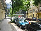
40 | Edward Drory (1844–1904), engineer and entrepreneur | Jan. 18, 1906 | Drorystraße is a dead end from Boehmische Straße. It was first referred to as Street 182 . In the 1940 address book there is additional information about the namesake of the street: “Ed. Drory, Director of the Imperial Continental Gas Association, unselfishly supported the community of Rixdorf in the construction and commissioning of their gas works on Teupitzer Strasse with advice and action " |
|
| Drosselbartstrasse
( Location ) |
340 | King Thrushbeard , fairy tale character | Jan. 18, 1922 | The Drosselbartstraße runs from theplanet street to the Hänselstraße. In the development plan it was called Straße 16 . The extension was incorporated into the current name on January 22, 1924. |

|
| Drübecker way
( Location ) |
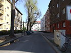
90 | Drübeck , part of the city of Ilsenburg in Saxony-Anhalt | Apr 10, 1931 | Drübecker Weg runs from Treptower Strasse to Kelbraer Strasse. At first the trail was referred to as Road 33a . |
|
|
Ederstrasse
( Location ) |
490 | Eder , tributary of the Fulda in North Rhine-Westphalia and Hesse | June 1, 1964 | Ederstrasse is located between Sonnenallee and Weigandufer on the Neukölln shipping canal. In 1964, the southern section of Teupitzer Straße between Sonnenallee and Weserstraße was renamed Ederstraße because it was separated by the industrial area with the district heating plant. On September 1, 2002, the extension (previously as Straße 613 ) to the Teupitzer Bridge in Ederstraße was included. The expanded driveway ends 190 meters north of Weserstraße in a turning hammer . The continuation is not officially Schwarzer Weg (120 meters length, location , Note performed), and is a pedestrian and bicycle, which allows the connection to Weigandufer Teupitzer at the bridge. The confusing and dimly lit path was closed in 2007 because the area of the path had been destroyed by the roots of the poplars standing here. As a result, a completely new path for pedestrians and cyclists was created and opened on September 11, 2010. |
 |
| Edmundstrasse
( Location ) |
120 | Edmund , male first name | Sep 9 1899 | Edmundstrasse runs between Reinholdstrasse and Delbrückstrasse. It was named Straße 200 according to the development plan . |

|
|
Eduard-Müller-Platz (*)
( Location ) |
60 × 30 (triangular shape) |
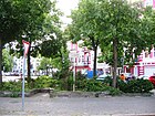
Eduard Müller (1818–1895), priest, member of the Reichstag and co-founder of the Center Party | Sep 1 1984 | Silberstein-, Ilse-, Ringbahn-, Benda- and Hertastraße delimit the newly created Eduard-Müller-Platz. As of January 2013, it is not yet included in the official register. |
|
| Unicorn Street
( Location ) |
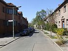
150 | Unicorn , constellation | Jan. 18, 1922 | Einhornstraße runs from Dammweg to Krebsgang. According to the development plan, it was laid out as street 38 V. |
|
| Elbestrasse
( Location ) |
440 | Elbe , rivers in the Czech Republic and Germany | Nov 4, 1898 | Elbestraße runs from Sonnenallee to Weigandufer. The house number sequence follows the principle of horseshoe numbering. According to the development plan, it was built as Straße 11 . On February 21, 1903, the part of the street up to today's Weigandufer was included in the new name. |

|
| Elbingeroder Weg
( Location ) |
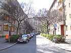
130 | City of Elbingerode (Harz) , part of the city of Oberharz am Brocken in Saxony-Anhalt | Dec 15, 1930 | The Elbingeroder Weg branches off from Harzer Strasse and Sülzhayner Strasse. The house number sequence follows the principle of orientation numbering. It was first referred to as Street 413 . |
|
| Elsenstrasse
( Location ) |
440 (in the district) |
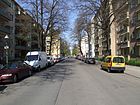
Elsen, outdated term for alder | Nov 21, 1895 | Elsenstrasse runs from Hoffmannstrasse and An den Treptowers to Kiehlufer. The house number sequence follows the principle of horseshoe numbering. Part of the street is in Alt-Treptow . From 1842 it was called Elsen-Allee and was renamed to its current name in 1895 together with Straße 42 of the development plan. By 1902, the stretch of road from was Sonnenallee to the station Treptow throughout the Elsenstraße . The section between Sonnenallee and the shipping canal was then renamed Innstrasse . |
|
| Elsterstrasse
( Location ) |
80 | White Elster , right tributary of the Saale in the Czech Republic, Thuringia and Saxony | Apr 14, 1905 | Elsterstraße runs between Braunschweiger Straße and Saalestraße. The house number sequence follows the principle of horseshoe numbering. It was first referred to as Street 182a . |

|
| Emser Strasse
( Location ) |
1410 | Ems , river in North Rhine-Westphalia and Lower Saxony | 1896 | Emser Strasse runs from Karl-Marxstrasse and Saalestrasse to Oderstrasse. The house number sequence follows the principle of horseshoe numbering.
Emser Strasse was merged from Strasse 203 and Strasse 203d . |

|
| Erkstrasse
( Location ) |
310 | Ludwig Erk (1807–1883), music teacher and composer | before 1877 | Erkstraße runs from Karl-Marx-Straße to Sonnenallee and Wildenbruchstraße. The house numbers are assigned according to the horseshoe numbering principle (change at 14/15). From 1875 to 1901, Depot IV of the Great Berlin Horse Railway was located at Erkstraße 16/17 .
At the same time there was the fire station of the Rixdorf volunteer fire brigade at Erkstraße 18 , along with a practice area on a school site. This fire brigade location no longer exists in later plans and address directories; the Buckow volunteer fire station (Rudower Strasse 126) is named as responsible for Neukölln. In the 1880s, the "Office of the Rixdorf Local and Municipal Administration" was located in the house at Erkstraße 19 and at the corner of Berliner Straße 50, including a registration office, the registry office, a gendarmerie post and the official prison, the forerunner of today's Neukölln town hall . |

|
| Erlanger Street
( Location ) |
190 | Erlangen , city in Bavaria | Feb 6, 1903 | The road leads from Flughafenstrasse and Isarstrasse to Reuterstrasse. The house number sequence follows the principle of horseshoe numbering. It was first referred to as Street 213 . |

|
| Eschersheimer Strasse ( Location ) |
460 | Eschersheim , district of Frankfurt am Main | Apr 20, 1912 | Eschersheimer Straße runs between Silbersteinstraße (as a southern continuation of Oberlandstraße) and Mariendorfer Weg, only house numbers 1–25 (west side of the street) and the street are in Neukölln, the rest in Tempelhof .
Eschersheimer Strasse was merged from Strasse 167b and Strasse 172 . |

|
|
Esperanto Square
( Location ) |
60 × 30 | Esperanto , the most widely used international planned language | Dec 14, 1991 | Esperantoplatz is bordered by Braunschweiger Straße, Schudomastraße and Schwarzastraße. | |
|
Falkstrasse
( Location ) |
310 | Adalbert Falk (1827–1900), Prussian lawyer and politician | before 1877 | Falkstrasse runs from Kopfstrasse to Rollbergstrasse and Mainzer Strasse . |

|
| Finowstrasse
( Location ) |
340 | Finow , left tributary of the Oder in Brandenburg | Apr 14, 1905 | Finowstrasse leads from Sonnenallee to Wildenbruchplatz. It was created by merging road 12b and road 12c . |

|
| Airport road
( Location ) |
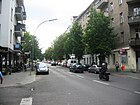
880 | Tempelhof Airport , now Tempelhofer Feld after it was closed in the 21st century | Jan. 7, 1928 | The street runs from Karl-Marx-Straße and Fuldastraße to Fontanestraße and Columbiadamm. The house numbers follow the principle of orientation numbering. Initially, the street led over what would later become the airport site, then continued on Hermannstrasse to what was then Berliner Strasse . From 1936 to 1940 it was shortened from the garrison cemetery to Berliner Straße. The street got its current route before 1957, when the houses were also renumbered. To improve the social situation around this street has established itself in the 21st century. Quartiersmanagement .
The residential building and former Atlas cinema from the 1950s, house number 5, is a listed building. Stumbling blocks for Rosalie and Arthur Drucker were laid in front of house number 41 on November 14, 2009 . |
|
| Fontanestrasse
( Location ) |
360 | Theodor Fontane (1819–1898), poet and writer | March 7, 1894 | Fontanestrasse runs from Karlsgartenstrasse to Selchower Strasse and the Schillerpromenade. Until May 2, 1905, the current section of the Schillerpromenade between Herrfurth- and Selchower Straße belonged to it. It was first referred to as Street 154 . The southeasternmost area of Volkspark Hasenheide stretches along plots 1–8 (between Karlsgartenstrasse and Flughafenstrasse) right up to the street. |

|
| Framstrasse
( Location ) |
160 | Fram , Norwegian polar research vessel | Nov 16, 1911 | Framstrasse runs from Nansenstrasse to Pannierstrasse. It was first referred to as Street 20d . |

|
| Friedelstrasse
( Location ) |
720 | Ernst Friedel (1837–1918), Berlin local politician and local researcher | Sep 12 1895 | Friedelstraße runs from Sonnenallee to Maybachufer. In 1895 only the small part of the street, first named Street 12c, was called Friedelstraße. The Wiebestrasse leading to Maybachufer was incorporated into Friedelstrasse before 1900. The house number sequence follows the principle of horseshoe numbering. The houses with the house numbers 2 and 34 are under monument protection. |

|
| Fritzi-Massary-Strasse
( Location ) |
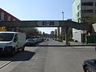
320 | Fritzi Massary (1882–1969), actress | May 1, 1977 | The residential street is located between Neuköllnischer Allee and Sonnenallee in the high-deck housing estate and was built in the 1970s. At the Sonnenallee it ends as a dead end with a turning hammer . It was formed by merging Road 597 and Road 598 . All houses in the settlement are connected to one another via pedestrian walkways and can be reached without a car. The street on the Heidekampgraben lies on Sonnenallee and at the north end is a section of the "Gartenkulturpfad Neukölln", an approximately four-kilometer circular route in the Neukölln district. |
|
| Fulda Street
( Location ) |
690 | Fulda , one of the two headwaters of the Weser | Oct 30, 1899 | Fuldastraße runs from Karl-Marx-Straße to Weigandufer on Weichselplatz. The house number sequence follows the principle of horseshoe numbering. According to the development plan, it was first called Straße 8 .
The residential buildings with the numbers 14, 15, 22–23a, 37–39, 45, 46 and 55–56d are under monument protection . The Martin Luther Church at Fuldastraße 50 is worth mentioning . In front of house number 12 there is a stumbling block for Grete Walter that was laid on November 14, 2009 . |

|
|
Ganghoferstrasse
( Location ) |
150 | Ludwig Ganghofer (1855–1920), writer | Feb 3, 1912 | Ganghoferstraße runs from Karl-Marx-Straße and Werbellinstraße to Donaustraße. It was first referred to as Street 13f .
The residential building with the number 1 and the banking houses with the numbers 2 and 11 are listed . The Stadtbad Neukölln is also located in the street and the Museum Neukölln was located here until it moved to Britz Castle in 2010 . There is also a parking garage on the dark street, which is dominated by traffic looking for a parking space during business hours. |

|
| Gerlachsheimer way
( Location ) |
90 | Gerlachsheim, former manor district in Silesia , today Grabiszyce in Poland | Aug 1, 1966 | The Gerlachsheimer Weg runs from Donaustraße to Kirchgasse. At first the trail was referred to as Road 517 . From 1897 to 1966 part of it was called Gärtnerstraße . |

|
| Geygerstrasse
( Location ) |
170 | Ernst Moritz Geyger (1861–1941), sculptor, painter and etcher | March 27, 1912 | Geygerstraße runs from Sonnenallee to Donaustraße.
The residential complex with house numbers 2–7, built between 1919 and 1929, is a listed building . |

|
| Glasower Strasse
( Location ) |
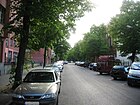
640 | Glasow, district of Blankenfelde-Mahlow in the Teltow-Fläming district in Brandenburg | before 1877 | Glasower Strasse runs from Karl-Marx-Strasse to Hermannstrasse. The house number sequence follows the principle of horseshoe numbering.
Between 1925 and 1929 the previous spelling Glasowstrasse was corrected. The former Franz Weeren ironworks is located in the street at number 27/28; a factory with a town villa, built between 1889 and 1912 and now a listed building. |
|
| Grenzallee
( Location ) |
1600 | Border between Rixdorf and Britz | March 25, 1901 | The noisy and busy street is between Sonnenallee and Karl-Marx-Straße, which as Buschkrugstraße and the south side of Grenzallee is already in the neighboring district of Britz . The house numbers follow the principle of orientation numbering.
Initially, the avenue was laid out as street 187 of the development plan. The section between Neuköllniche Allee and Sonnenallee, which was named Dammweg , was renamed Grenzallee on March 1, 1969. The few residential buildings on the corner of Buschkrugallee are between Grenzallee and the A 100 , so you have noise from both sides. Due to the connection to the industrial area, there is already heavy delivery traffic at night. At the eastern section, the motorway under construction crosses to Treptow. A hiking trail leads from the Grenzalleebrücke under the Neukölln motorway triangle to the Britzer Hafensteg, which is possible as a “circular route Britzer Hafen”. To the north there is a passage through the industrial area to Lahnstrasse. In the 1938 address book, a Neukölln open-air swimming pool is listed at the street 12 at the corner of Grenzallee , with the swimming clubs swimming club Friesen and swimming union Neukölln . It will only have been a separate bath directly in the canal. |

|
| Gretelstrasse
( Location ) |
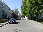
170 | Gretel, character from the fairy tale Hansel and Gretel | Aug 16, 1928 | Gretelstrasse is part of the “Märchensiedlung” and runs from Rübezahlstrasse to Hänselstrasse. It was first referred to as 33 Street .
In front of house number 10 there is a stumbling block for Kurt Gärtner that was laid on September 12, 2008 . |
|
|
Haberstrasse
( Location ) |
500 | Fritz Haber (1868–1934), chemist and Nobel Prize winner | Aug 20, 1958 | Haberstraße runs from Bergiusstraße to Neuköllnische Allee.
When assigning the name, the previous street 2 , street IV and street 428 were combined. |

|
|
Hanselstrasse
( Location ) |
370 (in the district) |
Hansel, character from the fairy tale Hansel and Gretel | Aug 16, 1928 | The Hänselstraße is part of the “Märchensiedlung” and runs with the numbers 1–11b from the Sonnenallee and Jupiterstraße over the Gretelstraße and with the numbers 14–71 from the Kiefholzstraße over the Heidekampweg. Part of the street is in Baumschulenweg .
At first it was called Straße 32 , from 1921 Am Schulenburg Park . The Von-der-Schulenburg-Park borders the Hänselstraße. |

|
|
Hans-Schiftan-Strasse
( Location ) |
60 | Hans Schiftan (1899–1941), resistance fighter | Sep 1 1984 | Hans-Schiftan-Straße runs from Werbellinstraße to Rollbergstraße. It was first referred to as Street 601 . |

|
| Harzer Strasse
( Location ) |
1220 | Harz , low mountain range in Lower Saxony and Saxony-Anhalt | Nov 25, 1895 | Harzer Straße, first street 3 , lies between Lohmühlenstraße (in Alt-Treptow ) and the Kiehlufer up to Teupitzer Straße . When assigning the name, the municipal office included Straße 37 .
Part of the northeast side of the street belongs to Alt-Treptow . The house number sequence follows the principle of horseshoe numbering. The factory building of the Filmkopieranstalt Geyer-Werke AG (house number 39) and the residential complexes with house numbers 18–20, 23 and 96–103 are listed monuments. The Berlin urban development plan STEP 2025 , published in 2018, provides for the complex of the former film copy factory to be supplemented with new buildings and for the ensemble to be restructured for residential purposes with around 250 apartments. |

|
|
Hasenheide
( Location ) |
1140 | adjacent heather and the hares that live there | around 1678 | The noisy main road borders the Volkspark of the same name in the south . It runs from Hermannplatz, Hermannstrasse and Karl-Marx-Strasse to Südstern. Apartments and businesses alternate. The street has wide sidewalks and front gardens. There are garden bars in some front gardens. It was initially laid out as a path in 1678 and later expanded. The house numbers follow the principle of horseshoe numbering. The north side of the street and the street land belong to Kreuzberg . The old spelling Hasenhaide was changed in 1907 to the current one. The Queen Elisabeth Hospital (KEH) was located under Hasenheide 80–87 from 1887 to 1930 . After its relocation, new residential buildings were built after the Second World War. In 1940, at number 79, there is the note “Entrance to the shooting ranges”. The “ Neue Welt ” building at number 107 is a listed building . |

|
| Heidelberger Strasse
( Location ) |
830 (in the district) |
Heidelberg , city in Baden-Württemberg | June 10, 1904 | Heidelberger Strasse runs from Lohmühlenstrasse ( Alt-Treptow ) to Treptower and Teupitzer Strasse . Part of the street is in the Alt-Treptow district. The house numbers are determined according to the principle of horseshoe numbering. At first it was called Straße 106 according to the development plan . A first section in what was then Rixdorf was named on January 11, 1904 after the city of Heidelberg. In June of the same year the section in Treptow was included. In 1936 the traffic route ran continuously from Lohmühlenstraße to Treptower Straße. Street 23a , which branches off from Lohmühlenstraße , was included as an extension of Heidelberger Straße by a resolution of the municipal authorities on June 24, 1960.
Heidelberger Strasse was a frequent starting point for tunnel alignment during the division of Germany . |

|
|
Heinrich-Schlusnus-Strasse
( Location ) |
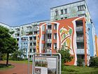
330 | Heinrich Schlusnus (1888–1952), singer ( baritone ) | May 10, 1977 | The residential street is located in the high-deck housing estate and was laid out with it in the 1970s. It is located between Sonnenallee and Neuköllniche Allee . All houses are connected to one another via pedestrian walkways that are above street level. According to the development plan, the street was laid out as street 593 . In 2009, a housing association carried out a renovation project entitled “The Volière” in one of the apartment blocks. French artists from CitéCréation developed a concept together with the residents after the dreary facades were painted with colorful bird motifs. Young people from the settlement were involved in the project and were able to complete training as painters and varnishers here. The street is located southeast at Herbert-Krause-Park , through which there is a pedestrian connection to Jupiterstraße, which is part of the Neukölln Garden Culture Trail. |
|
|
Hermannplatz
( Location ) |
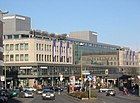
160 × 50 | Hermann the Cherusker , myth and symbol figure | 28 Sep 1885 | Hermannplatz (first spelling Hermann Platz ) is bordered by Sonnenallee, Karl-Marx-Straße, Hermannstraße, Kottbusser Damm, Hasenheide and Urbanstraße. The west side with the Karstadt department store is in Kreuzberg .
First, according to the development plan, the place was designated as place I. Since 1887 the address book has indicated that part of the square belongs to Berlin. The Hermannplatz underground station, completed in 1927, is now a listed building . |
|
|
Hermannstrasse
( Location ) |
2490 | Hermann the Cherusker , myth and symbol figure | around 1875 | The busy residential and commercial street runs from Hermannplatz, Hasenheide and Karl-Marx-Straße to Britzer Damm. The house number sequence follows the principle of horseshoe numbering. From 1859 to 1878 the street was called Straße nach Britz , before that it was nameless. At the turn of the 20th century it was one of the most densely built-up streets in Rixdorf, for example the 1901 address book contains 258 house numbers.
The substation with the rental and commercial building at Hermannstrasse 5–8, the factory building with the number 48, the residential complexes with the house numbers 114, 223 and 256–258, the Kindl ballroom number 218, the cemetery chapel of the churchyard of St. Thomas - Parish number 180, the morgue number 101 and the underground stations Boddin - and Leinestrasse are listed architectural monuments. |

|
| Herrfurthplatz
( Location ) |
100 (diameter) |
Ernst Ludwig Herrfurth (1830–1900), Prussian politician | March 16, 1893 | Herrfurthplatz is located between Herrfurthstrasse and Schillerpromenade. At first it was designated as place I according to the development plan . The Church of Galilee was built on this site in 1903–1905 according to plans by the architect Franz Schwechten (see picture). |

|
| Herrfurthstrasse
( Location ) |
210 + 180 | Ernst Ludwig Herrfurth (1830–1900), Prussian politician | March 16, 1893 | The street runs from Hermannstrasse and Werbellinstrasse to Oderstrasse. It is divided by Herrfurthplatz. The house number sequence follows the principle of horseshoe numbering.
The traffic route was merged from Street 157 and Street 159 when it was named . Stumbling blocks for Pauline and Arthur Wiener were laid in front of house number 5 on November 14, 2009 . |

|
| Moravian Way
( Location ) |
200 | Herrnhut , town in the Görlitz district in Saxony | July 31, 1947 | The Herrnhuter Weg runs from Karl-Marx-Strasse to Richardstrasse. From around 1877 it was called Goethestraße , in 1938 the path was named Langnerweg . The path includes 20 house numbers.
The apartment buildings with the house numbers 11, 13, 15, 16 and 17 are among the adjacent architectural monuments. |

|
| Hertastrasse
( Location ) |
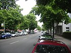
370 | Herta , female name | May 20, 1895 | The street leads from the Ringbahnstraße to Hermannstraße and Mariendorfer Weg. In 1895, parts of the Mariendorfer Weg and the Kirchhofstraße were given their current names, but were first written as Herthastraße (with "h").
The Philipp Melanchthon Church is at number 11 . |
|
| Hertzbergplatz (*)
( Location ) |
190 × 80 | Ewald Friedrich von Hertzberg (1725–1795), Prussian Minister of War | March 19, 1901 | Hertzbergplatz is bordered by Sonnenallee, Treptower Straße, Stuttgarter Straße and Thiemannstraße. First it was designated as place T according to the development plan .
At the beginning of the 20th century there was a war memorial on Hertzbergplatz , shown as a sight in the address book. It is worth mentioning the sports field that connects to Thiemannstrasse along Sonnenallee and is part of the “1. FC Neukölln 1895 e. V. “serves as a game and training facility. |

|
| Hertzbergstrasse
( Location ) |
340 | Ewald Friedrich von Hertzberg (1725–1795), Prussian Minister of War | June 20, 1895 | The street leads from Richardplatz to Sonnenallee. At first it was designated as Straße 40 according to the development plan . |

|
| Hobrechtstrasse
( Location ) |
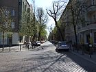
1010 | James Hobrecht (1825–1902), urban planner | Feb 9, 1890 | Hobrechtstrasse leads from Karl-Marx-Strasse to Maybachufer and Schinkestrasse. The house number sequence follows the principle of horseshoe numbering. At first, according to the development plan, it was designated as Straße 10a .
The apartment buildings with the house numbers 47/48 and 83/84 are under monument protection . In front of house number 57 there have been stumbling blocks for Max Fischel, Arthur and Hildegard Hillel, Flora and Leonhard Krieg, Käte Pestachowski, Johanna and Ella Schäffer, Irene Schiftan, Marie Schlesinger and Hedwig Wittkowski since November 14, 2009 . |
|
|
Hüttenroder Weg
( Location ) |
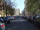
210 | Hüttenrode , part of the city of Blankenburg in Saxony-Anhalt | Aug 4, 1930 | The Hüttenroder Weg runs from Wildenbruchstrasse to Elsenstrasse. At first the path was designated as road 410 according to the development plan . |
|
|
Ilsenhof
( Location ) |
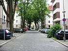
130 | Ilse , river in the Harz | May 17, 1930 | The listed Ilsenhof branches off from Ilsestrasse. It was built in 1928/1929 and is one of the most important examples of reform housing in Berlin. At first it was designated as Straße 212 b according to the development plan . |
|
| Ilsestrasse
( Location ) |
460 | Ilse , river in the Harz | Nov 4, 1898 | Ilsestrasse runs from Siegfriedstrasse to Thomasstrasse. At first it was referred to as Straße 208 according to the development plan . |

|
| Innstrasse
( Location ) |
610 | Inn , tributary of the Danube | Apr 14, 1905 | Innstrasse leads from Weigandufer and Wildenbruchplatz to Donaustrasse. The house number sequence follows the principle of horseshoe numbering. At first it was referred to as Straße 13 according to the development plan .
In front of house number 24 there is a stumbling block for Olga Benario , which was laid on December 10, 2007 and inaugurated on February 12, 2008. |

|
| Isarstrasse
( Location ) |
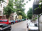
180 | Isar , tributary of the Danube | Nov 4, 1898 | Isarstrasse runs from Flughafenstrasse and Erlanger Strasse to Neckarstrasse. At first it was referred to as Straße 210 according to the development plan . |
|
|
Jan-Hus-Weg
( Location ) |
60 | Jan Hus (around 1370–1415), Christian reformer and martyr | 26 Sep 1983 | The Jan-Hus-Weg leads from Richardstraße to Kirchgasse . |

|
| Jansastrasse
( Location ) |
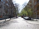
160 | Wilhelm Jansa (1834–1909), farmer and community leader in Rixdorf | Sep 30 1903 | Jansastrasse runs from Sonnenallee to Weserstrasse. The house number sequence follows the principle of horseshoe numbering. At first it was designated as Straße 6a according to the development plan . |
|
| Jonasstrasse
( Location ) |
790 | Ernst Wilhelm Jonas (1842–1914), theologian ; Jonas was the "senior pastor" of the Protestant parish in Rixdorf |
May 22, 1897 | Jonasstraße runs with house numbers 1–8 and 65–69 from Karl-Marx-Straße to Rübelandstraße and with house numbers 14–58 from Selkestraße to Hermannstraße. According to the development plan, it was initially called Straße 205a . Around 1914, the New Jonasstrasse, designated in 1908 (course between Bergstrasse and Hermannstrasse) was added to Jonasstrasse. In 1921, a “Körner Museum” (near the Körnerpark ) in Jonasstraße 66 was described as worth seeing.
In front of house number 4 there are stumbling blocks for Fritz and Margarete Wolff, which were inaugurated on September 17, 2003. At the house with number 20 a plaque commemorates the composer and publisher Will Meisel , who lived here (lower picture). |

|
| Joseph-Schmidt-Strasse
( Location ) |
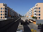
220 | Joseph Schmidt (1904–1942), singer ( tenor ) | May 1, 1977 | Joseph-Schmidt-Strasse leads in the high-deck housing estate from Sonnenallee to Fritzi-Massary-Strasse and runs according to the orientation numbering.
Initially, according to the development plan, it was Street 596 . |
|
| Juliusstrasse
( Location ) |
620 | Wilhelm August Julius Wrede (1822–1895), manufacturer and owner of the Britz estate | before 1877 | Juliusstraße runs from Karl-Marx-Straße to Hermannstraße and follows the principle of horseshoe numbering.
In front of house number 39 there are stumbling blocks for Richard, Margot and Kurt Max Schaefer and Leo Cohn , which were laid in December 2006 and inaugurated on March 19, 2007. |

|
| Jupiter Street
( Location ) |
300 | Jupiter , planet of the solar system | around 1922 | Jupiterstraße is between Sonnenallee and Neuköllnischer Allee. The house number sequence follows the principle of orientation numbering. Previously it was street 22 according to the development plan . In 1926 the part of the street between Sonnenallee and Neuköllnischer Allee was also renamed to its current name. The narrow residential street consists mainly of apartment buildings from the 1920s. There is access to Herbert-Krause-Park on the east side and to the allotment garden "Volksgarten" on the west side of the street, these paths are part of the "Garden Culture Path Neukölln." |

|
|
Kanner Street
( Location ) |
170 | Kanne, name of the old forestry in the Königsheide | Apr 18, 1895 | Until 1908 the spelling was Canner Straße . In 1906 and 1937 the name was partially changed in Niemetzstrasse . In 1964 the section between Unstrutstrasse and Niemetzstrasse became Braunschweiger Strasse . |

|
| Karl-Marx-Platz
( Location ) |
140 × 40 (triangular shape) |
Karl Marx (1818–1883), philosopher and social theorist | Feb 14, 1950 | The square is bounded by Karl-Marx-Straße, Richardplatz and Thomasstraße. Its previous name was Hohenzollernplatz from around 1902 to 1950 . The Kaiser Wilhelm monument on the square was replaced around 1950 by a monument to Karl Marx, the new namesake. In 1987 a fountain was added, created by the sculptor Hartmut Bonk . The three-part group of figures lines a round, low water basin. The facility is called “Imaginary Theater”. |

|
|
Karl-Marx-Strasse
( Location ) |
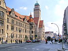
2970 | Karl Marx (1818–1883), philosopher and social theorist | July 31, 1947 | The busy residential and commercial street is Neuköllner Hauptstraße and runs from Hasenheide , Hermannstraße and Hermannplatz to Buschkrugallee and Grenzallee and the properties follow the principle of horseshoe numbering. In addition to many shops, there are street cafes, the Neukölln Opera and the Neukölln Town Hall are on the street. Before that, the north-western area was called Berliner Straße and the southern area up to the town hall was called Bergstraße .
In front of house number 76 there have been stumbling blocks for Frieda and Jacob Löwenthal since September 12, 2008 . |
|
| Karlsgartenstrasse
( Location ) |
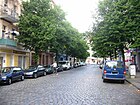
240 | Carl von Prussia (1801–1883), Prussian prince who had a garden laid out here in the Hasenheide | Nov. 27, 1890 | The street was included in the development plan as street 153, section II . It connects Hermannstrasse with Fontanestrasse. Until at least 1893 the street ran over Hermannstrasse to the then unnamed Reuterstrasse. |
|
| Kelbraer Strasse
( Location ) |
110 | Kelbra , city in Saxony-Anhalt | Apr 10, 1931 | The Kelbraer Straße runs from the Kiehlufer to Drübecker Weg. Before it was named, it was an unnamed driveway from the “branch canal” to the warehouse of a timber merchant. |

|
| Kiefholzstrasse
( Location ) |
1320 (in the district) |
Pine , old name for pine trees | Nov 25, 1895 | Parts of the street belong to Alt-Treptow , Plänterwald and Baumschulenweg . From 1842 to 1895 the street was called Kiefholzweg . Kiefholzstrasse runs from Lohmühlenstrasse (in the Alt-Treptow district) to Südostallee and Rixdorfer Strasse. It leads with 428 house numbers through four Berlin districts and three postcode areas and follows the principle of horseshoe numbering. The house numbers 52–99 are in Neukölln. The section between Puderstraße and Karpfenteichstraße was expanded in 1903.
The road was the starting point for several tunnel refugees during the German division . The Black Canal , a Rollheimer village , has relocated to the address Kiefholzstrasse 74 since its expulsion from Mitte . Around 15 people live here permanently. |

|
| Kiehlufer
( Location ) |
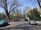
1880 | Reinhold Kiehl (1874–1913), architect and town planner of Neukölln | Apr 5, 1934 | The Kiehlufer runs from Harzer Strasse and Lohmühlenstrasse (in the Alt-Treptow district ) to Ziegrastrasse and Dieselstrasse along the Neukölln shipping canal . The previous name was Köllnisches Ufer from 1905 to 1934 . |
|
| Kienitzer Strasse
( Location ) |
600 + 370 | Kienitz , district of Letschin in the Märkisch-Oderland district in Brandenburg | Feb 14, 1950 | The street is broken by residential buildings. In its western section, it runs from Karl-Marx-Strasse to Morusstrasse and east of Oderstrasse over Herrmannstrasse into a dead end . From 1874 to 1950 it was called Steinmetzstraße . |

|
|
Kirchgasse
( Location ) |
520 | Church of the Moravian Brethren | before 1844 | When naming the street 15c and street 15e were combined. One section was renamed Jan-Hus-Weg in 1983 . The road is not continuous. In its northern area it starts as a dead end from Berthelsdorfer Straße and in its southern section it leads from Richardstraße to Jan-Hus-Weg. The narrow traffic-calmed street ends as a dead end for car traffic . The Wanzlik Path and the Gerlachsheimer Weg continue as a pedestrian link to Donaustraße, while the Jan-Hus-Weg leads pedestrians and cyclists to Richardstraße. The street is mostly built on with single-family houses (former manor houses) from the 17th century. Since 2005 there has been a museum on the history of the Bohemian village in the former school building, in front of which there is a statue of Frederick William I on a pedestal , who brought the persecuted Bohemian brothers in faith into the country. |

|
| Kirchhofstrasse
( Location ) |
670 | first churchyard in Rixdorf | before 1834 | Kirchhofstraße is located at the first churchyard in Rixdorf and runs in horseshoe numbering from Richardplatz to Siegfriedstraße. The previous names were Alter Kotzemarkenweg and Taboritenweg . In 1877 it extended from Richardplatz to Delbrückstraße. The section between Delbrückstrasse and Knesebeckstrasse was renamed Hertastrasse on May 20, 1895 . |

|
| Kirchhofweg (*)
( Location ) |
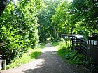
560 | There are churchyards on both sides of the path (St. Thomas Cemetery, Jerusalem and New Church Cemetery, St. Michael Cemetery) | Traditionally (18th century) | The path leads as a foot and bike path from Hermannstraße to Oderstraße. Until the 1950s it was called Grüner Weg , later the site was no longer accessible. The path is not an officially dedicated street (*), after the closure of Tempelhof Airport and St. Thomas-Kirchhof there is a pedestrian and cycle path that belongs to the Inner Parkring and is one of the 20 main green paths in Berlin. The latter crosses the Schwarzer Weg (connection between the two sections of the Oderstrasse ) and then surrounds the airfield, which has been opened for another use. On the official map 1: 5000 in the FIS broker produced by the district environmental authorities, it is again shown as the Green Way between Hermannstrasse and Oderstrasse. |
|
| Kirsten-Heisig-Platz
( Location ) |
30 × 15 (triangular shape) |
Kirsten Heisig , lawyer from Berlin, known for the Neukölln model | March 11, 2016 | The square is on the corner of Emser Strasse, Kirchhofstrasse and Siegfriedstrasse north of the fire brigade. The decision to rename the district council was made on January 12, 2016. |

|
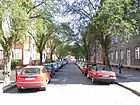
| Kleine Innstrasse
( Location ) |
90 | Inn , tributary of the Danube | May 17, 1930 | Kleine Innstrasse runs from Finowstrasse to Innstrasse. At first it was called Straße 12d according to the development plan . |
|
| Head street
( Location ) |
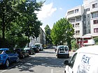
540 | supposedly after a headache caused by searching for a name | before 1877 | The Kopfstraße runs from Hermannstraße over Morusstraße and further. When the name was assigned, street 204c and street 204e were merged.
The road was laid out over the land of the farm owner Daniel Benjamin Niemetz, who gave the name to Niemetzstraße. According to stories, he is said to have searched so intensively for a name that it gave him a headache. A friend suggested the name Kopfstraße. A map from 1877 shows a diagonal route to Thomasstrasse from Hermannstrasse to Bergstrasse . |
|
|
Kottbusser Dam
( Location ) |
950 (in the district) |
Cottbus , city in Brandenburg | before 1874 | The Kottbusser Damm leads from Kottbusser Straße, Planufer and Maybachufer at Kottbusser Brücke to Urbanstraße and Sonnenallee at Hermannplatz. His house numbers follow the principle of horseshoe numbering. Until 1916 it was written Kottbuser Damm (just an "s"). In 1883, Rixdorf handed over responsibility for this traffic route to the city of Berlin, because it says “s. Berlin". There it is continued under its previous name with the note "Numbers 56 to 100 go to Rixdorf". Only the row of houses east of Kottbusser Damm with the house numbers 62-104 belongs to the district, the street area and the western row of houses are in Kreuzberg . The previous name was Rixdorfer Damm from the 16th century until before 1874 . Between 1917 and 1925, the Kottbusser Damm was not listed in the Berlin address book. |

|
| Kranoldplatz
( Location ) |
110 × 40 | Viktor Ferdinand von Kranold (1838–1922), railway official | May 22, 1897 | The space is bounded by Kranoldstrasse, Bruno-Bauer-Strasse and Bendastrasse. It was previously noted as place B on the development plan . |

|
| Kranoldstrasse
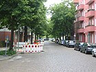
( Location ) |
280 | Viktor Ferdinand von Kranold (1838–1922), railway official | May 22, 1897 | The street runs from Bendastraße and Kranoldplatz to Hermannstraße. According to the development plan, its parts were initially called Straße 201a , Straße 201b and Straße 201c . |
|
| Crab gang
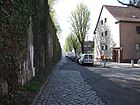
( Location ) |
370 | Cancer , constellation | May 24, 1958 | The Krebsgang runs from Sonnenallee to Widderstrasse. Before that, the corridor was street 5 according to the development plan . The city of Neukölln had the south-east sewage pumping station built here as part of the road network expansion around Sonnenallee. |
|
|
Lahnstrasse
( Location ) |
1300 | Lahn , right tributary of the Rhine | around 1904 | The street runs from Neuköllnische Allee to Silbersteinstrasse and Karl-Marx-Strasse. It follows the principle of orientation numbering. At first it was part of Street 185 . In 1937 the street was extended by part of the Köllnische Allee.
In the area of parcels 14–24, Lahnstrasse forms a south-facing branch that runs along the bank of the Oberhafen as a dead end . According to the address books of the 1940s, this section existed in the 1940s as an access network for the port facilities, crossed by "Am Unterhafen", "Hafenzufahrtsstraße" and Am Oberhafen . Between September and November 2018, the cycle paths for a total length of around 1800 meters were marked in green on behalf of the Senate Department for the Environment, Transport and Climate Protection and by the state-owned company Infravelo as the builder and project manager. |

|
| Laubestrasse
( Location ) |
160 | Heinrich Laube (1806–1884), writer, playwright and theater director | Feb 6, 1903 | Laubestrasse leads from Elbestrasse to Wildenbruchstrasse. According to the development plan, the previous name was street 25a . |

|
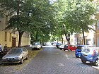
| Leinestrasse
( Location ) |
550 | Leine , left tributary of the Aller | Oct 30, 1899 | It leads from Hermannstrasse to Oderstrasse. The house number sequence follows the principle of horseshoe numbering. At first it was called Straße 165a according to the development plan . In 1953, Street 165b (where the building trade school was established) and Street 165c were included in the current course of the street. |
|
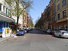
| Lenaustraße
( Location ) |
320 | Nikolaus Lenau (1802–1850), Austrian writer | Feb 9, 1901 | The street runs from Kottbusser Damm to Reuterstraße. The house numbers follow the principle of horseshoe numbering. The previous name of Lenaustraße was street 19a according to the development plan .
In front of house number 21 there have been stumbling blocks for Hedwig Croner and Betty Reichl since November 14, 2009 . |
|
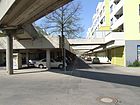
| Leo Slezak Street
( Location ) |
300 | Leo Slezak (1873–1946), tenor | May 1, 1977 | The residential street is located in the high-deck housing estate and was laid out with it in the 1970s. All houses in the settlement are connected to one another via pedestrian walkways and can be reached without a car. It is a side street of Neuköllnische Allee and runs to Heinrich-Schlusnus-Straße. The house numbers follow the principle of orientation numbering. Before the street got its current name in 1977, it was laid out as street 594 and street 595 according to the development plan . |
|
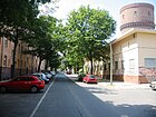
| Leykestrasse
( Location ) |
240 | Gustav Leyke (1851–1910), local politician in Rixdorf | Dec 12, 1911 | Leykestraße runs from Hermannstraße to Mittelweg. The house number sequence of the 18 houses follows the principle of horseshoe numbering. According to the development plan, it was first street 207c ; in 1908 it was named Am Wasserturm . |
|
| Liberdastrasse
( Location ) |
180 | Johann Liberda (1700–1742), theologian | May 2, 1905 | Liberdastraße leads from Pflügerstraße and Reuterstraße to Maybachufer. According to the development plan, it was first called Straße 20a , which had only been laid out in 1904. |

|
|
Lichtenrader Strasse
( Location ) |
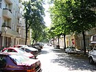
760 | Lichtenrade , district of Berlin; direction | March 7, 1894 | Lichtenrader Straße runs from Mahlower Straße to Leinestraße. The 62 house numbers follow the principle of horseshoe numbering. At first it was street 162 according to the development plan . |
|
| Lilienthalstrasse
( Location ) |
680 | Otto Lilienthal (1848–1896), aviation pioneer | Jan. 7, 1928 | The quiet and centrally located street is on Südstern and is connected to Columbiadamm from Züllichauer Straße. The west side of the street and the road area belong to the district of Kreuzberg with old buildings on the Kreuzberg side. In the southern part of the road, the road area belongs to Tempelhof. The east side of the site cemetery is in the district, here are the Apostolic Nunciature (message of the Vatican) and the largest Catholic church in the city, the "St. John's Basilica ”. In 1929 the streets Siboldstrasse and Lehniner Strasse were included in the previously named Lilienthalstrasse. |

|
| Lohmühlenplatz (*)
( Location ) |
70 × 40 | Lohmühle , which was built here in 1752 | 1905 | Lohmühlenplatz is located between Lohmühlenbrücke, Harzer Straße and Kiehlufer. He came to the district through the exchange of territory between East and West Berlin in 1988. At first it was called Platz F according to the development plan . From the bridge the Lohmühlenstraße goes north-east; the stretch of road on the bridge and a small section along the bank were reckoned to Rixdorf in 1902 with house numbers 45–111; now the street belongs completely to Treptow. The bank of the Neuköllner Schifffahrtskanal forms the western boundary of the square. It is not officially dedicated (*). The responsible district office intends to redesign the areas Lohmühlenplatz and Weichselplatz. In addition, there was a public discussion in December 2012 with a presentation of the projects. |

|
|
Mahlower Strasse
( Location ) |
380 | Mahlow , district of Blankenfelde-Mahlow; direction | March 7, 1894 | Mahlower Strasse runs from Hermannstrasse to Lichtenrader Strasse. The house number sequence follows the principle of horseshoe numbering. According to the development plan, it was 155a at first . |

|
|
Mainzer Strasse
( Location ) |
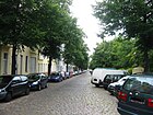
710 | Mainz , state capital of Rhineland-Palatinate | 1896 | Mainzer Strasse runs from Karl-Marx-Strasse to Rollbergstrasse and Falkstrasse. According to the development plan, it was first street 214 . In 1903 another part was included in the current name. The area Mainzer Straße 46-52 was officially shown in the street directory as a marketplace . |
|
| Manitius Street
( Location ) |
350 | Adolph Gebhard Manitius (1682–1754), landowner in Rixdorf | Apr 14, 1905 | The street leads from Liberdastraße to Pannierstraße. The previous names Street 20b and Street 20c were combined in the name assignment. |

|
| Mareschstrasse
( Location ) |
210 | Daniel Maresch (1833–1923), local politician | Feb. 14, 1907 | Mareschstrasse leads from Schudomastrasse to Sonnenallee . According to the development plan, it was previously laid out as street 17a . |

|
| Mariendorfer Weg
( Location ) |
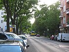
770 | Mariendorf , district of Berlin; direction | before 1895 | The Mariendorfer Weg runs from Hermannstrasse, Delbrückstrasse and Hertastrasse to Gottlieb-Dunkel-Strasse and Eschersheimer Strasse. The house number sequence follows the principle of horseshoe numbering. Before the street got its current name, it was called Straße 167 according to the development plan . A section of the Mariendorfer Weg was renamed Hertastraße in 1895 . |
|
|
Maybachufer
( Location ) |
1490 | Albert von Maybach (1822–1904), lawyer and politician | after 1884 | The Maybachufer has a good residential area in the district and runs with 64 house numbers along the Landwehr Canal from Kottbusser Damm to Weichselstrasse on Lohmühlenplatz . According to the development plan, the original name of the Uferstraße was Straße 45 , later from 1877 Wiesenufer . This Uferstraße was probably assigned to the city of Berlin in 1883, because Wiesen Ufer (first spelling) says “s. Berlin". There is then the hint “go. to Rixdorf ”.
Stumbling blocks for Markus and Flora Goldstein, Lucie, Rosa and Selma Meyer and Georg Lichtenstein were laid in front of house number 8 on September 13, 2008 . - The street is known nationwide for the “BiOriental” Turkish market that takes place on Tuesdays and Fridays. Street cafes and the Turkish weekly market shape the character of the street. The “Ankerklause”, a pub on the corner of Kottbusser Damm with a balcony over the Landwehr Canal, is interesting. |

|
| Mergenthalerring
( Location ) |
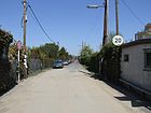
660 | Ottmar Mergenthaler (1854–1899), inventor and entrepreneur | Nov 1, 1983 | The Mergenthalerring runs from Kiefholzstrasse to Dieselstrasse. Before it was named in 1983, the traffic route was an unnamed private road open to public transport. |
|
| Michael Bean Ring
( Location ) |
720 | Michael Bohnen (1887–1965), opera singer and actor | June 15, 1976 | The residential street is a side street of the Sonnenallee in the high-deck housing estate and was built in the 1970s. All houses in the settlement are connected to one another via pedestrian walkways and can be reached without a car. It goes off from Sonnenallee in a U-shape.
The ring was created by merging Straße 590 and Straße 592 . |

|
| Mierstrasse
( Location ) |
160 | Friedrich Wilhelm Mier (1836–1912), local politician | June 3, 1916 | The street runs from Lahnstraße to Mittelbuschweg. At first it was called Straße 180h according to the development plan . |

|
| Mittelbuschweg
( Location ) |
450 | Mittelbusch, historical field name | around 1896 | The Mittelbuschweg leads from Niemetzstraße to Lahnstraße. According to the development plan, the first route was road 185a . |

|
| middle way
( Location ) |
770 | Location of the street in the middle of Rixdorf | around 1896 | The Mittelweg leads from Kopfstraße to Thomasstraße. When the name was assigned, Street 207 and Street 207f were merged. |

|
| More Street
( Location ) |
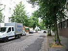
480 | Thomas More (around 1478–1535), English statesman and author | Feb 14, 1950 | The street runs from Rollbergstraße to Mittelweg. From 1878 to 1950 it was called Lessingstrasse . |
|
|
Nansenstrasse
( Location ) |
510 | Fridtjof Nansen (1861–1930), Norwegian polar explorer | Nov 4, 1898 | The street leads from Maybachufer and ends as a dead end on Reuterplatz. The house number sequence follows the principle of horseshoe numbering. At first it was called Straße 20 according to the development plan . In front of house number 18 there is a stumbling block for Elias Radsanowicz that was laid on September 12, 2008 . In 2014, interested parties had a cinema called IL Kino set up in house number 22 from a bakery that had been vacant for 20 years . The operator Carla Molino obtained parts of the equipment from E-Bay . The relatively small movie theater with 52 seats shows documentaries and arthouse films in the original language with subtitles in up to six screenings per day. In 2016, the organizers of the Berlinale chose the room as the venue. |

|
| Naumburger Strasse
( Location ) |
440 | Naumburg , district town in Saxony-Anhalt | Jan. 11, 1904 | Naumburger Strasse leads from Lahnstrasse to Grenzallee. When the name was assigned, street 180 and street 180b were combined. |

|
| Neckarstrasse
( Location ) |
240 | Neckar , river in Baden-Wuerttemberg | Oct 17, 1902 | Neckarstrasse runs from Karl-Marx-Strasse to Isarstrasse. The house number sequence follows the principle of horseshoe numbering. At first it was called Straße 209 according to the development plan . |

|
| Neissestrasse
( Location ) |
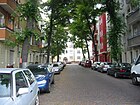
60 | Lusatian Neisse and Glatzer Neisse , left tributaries of the Oder | Sep 9 1899 | The street runs from Siegfriedstraße to Emser Straße. At first it was called Straße 164a according to the development plan . |
|
| Nernstweg
( Location ) |
470 | Walther Nernst (1864–1941), physicist and chemist | Sep 1 1974 | The Nernstweg runs as a footpath from Aronsstraße to Dieselstraße. According to the development plan, the first path was footpath 561 . |

|
| Netzestrasse
( Location ) |
170 | Nets , tributary of the Warta in Poland | Sep 11 1901 | Netzestrasse branches off from Warthestrasse. At first it was called Straße 170b according to the development plan . |

|
| Neuköllniche Allee
( Location ) |
1350 | Neukölln , district of Berlin | March 11, 1937 | Neuköllniche Allee leads from Lahnstraße to Forsthausallee. The house number sequence follows the principle of orientation numbering. The previous names were Kaiserstraße from 1857 to 1902 , then Kanner Chaussee and from 1912 Köllnische Allee . On the northeast side of the street there are apartment blocks from the 1920s and on the border to former East Berlin along Heidekampgraben the high-deck housing estate was built in the 1970s . In the 1940s, the address book shows under “Neukölln. Allee 60–74 and 78 "the" Zöllner Werke - Gesellschaft für Farben und Lackfabrikation GmbH ". On the south side of the road there are large industrial settlements with heavy truck traffic. At the east end the road turns into the Forsthausallee to Alt-Treptow . Part of the Neukölln Garden Culture Path runs here. |

|
| Neuwedeller Strasse
( Location ) |
80 | Neuwedell, town in the Pomerania province , today Drawno in Poland | Apr 22, 1920 | The street runs from Kopfstraße to Mittelweg. Before it was named, it was street 207d in the development plan . |

|
| Niemetzstrasse
( Location ) |
590 | Daniel Benjamin Niemetz (1853–1910), community leader and city councilor in Rixdorf | Jan. 18, 1906 | Niemetzstraße runs from Böhmische Straße to Lahnstraße. The house number sequence follows the principle of orientation numbering. In 1906 and 1937, parts of Kanner Strasse were renamed to their current names. |

|
| Nobel Street
( Location ) |
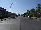
1000 | Alfred Nobel (1833–1896), Swedish chemist and inventor | Aug 20, 1958 | The street runs from Britzer Allee over Bergiusstraße. The house number sequence follows the principle of orientation numbering. The previous Straße 12 IV and Straße 424 were merged when the name was assigned. The street is located in an industrial area on the Britzer connecting canal. In addition to a coffee roastery, there are shipping companies and a cigarette factory here. |
|
| Nogatstrasse
( Location ) |
620 | Nogat , estuary of the Vistula | Oct 30, 1899 | Nogatstraße runs from Kirchhofstraße to Hermannstraße. At first it was called Straße 203b according to the development plan . |

|
|
Oderstrasse
( Location ) |
1100 | Or , river in the Czech Republic, Poland and Germany | Sep 9 1899 | According to the development plan, it was laid out as road 164 . Oderstrasse is a paved road with lots 1–22 and 172–192 (continuous) in a southern section between Siegfriedstrasse and Warthestrasse, with a dead end leading north to the former St. Thomas churchyard. Lot 5 is St. Jacobi-Kirchhof II. On the west side (172–192) of this street section is the "Werner-Seelenbinder-Sportpark Neukölln" behind a green bush front. From the southern end of the street, the Oderstrasse bridge leads to the suburb and district boundary and the traffic route continues in Tempelhof-Schöneberg at the intersection of Silberstein- / Oberland- / Eschersheimer Strasse. At the north end on property 22 there is a youth club with a football field. The course of Oderstrasse was interrupted until the airfield was closed , as the eastern end of the runway ran 50 meters over the road. A northern section, asphalted with a paved parking strip, and the plots 28–52 on the eastern side of the street is between Leinestrasse and Herrfurthstrasse. The western side of the street is the eastern edge of the airfield and Leine -, Oker -, Aller -, Kienitzer and Herrfurthstraße end on Oderstraße from the east. The KGA "Odertal" is located north of the street. The connection between the two sections of the Oderstrasse is a “Black Path” (length 180 meters, location ), which was upgraded during the renovation of Tempelhof Airport. Housing construction is planned for the west side of the northern section of Oderstrasse. The main green path no. 18 runs along the Schwarzer Weg and the northern section. This hiking and cycling path, known as the Inner Parkring, surrounds the Tempelhof airfield eastwards. The feeder is a cycle path that leads between the former St. Thomas- and Kirchhof V of the Jerusalem and Neue Kirchgemeinde to Hermannstraße opposite Thomasstraße and crosses on the Schwarzer Weg. Referred to as 'Grüner Weg' on the official map, it is also called Kirchhofweg.
In the late 1990s, the Rollheimerdorf settled on Oderstrasse, where around 25 people live alternatively. In addition, there is an arm of the road opposite the adjoining St. Jacobi cemetery, which serves as an entrance to the Werner Seelenbinder Sports Park . In front of house 50 there have been stumbling blocks for Berta and Salomon Bikales since November 14, 2009 . |

|
| Okerstrasse
( Location ) |
560 | Oker , tributary of the Aller in Lower Saxony | Oct 30, 1899 | Okerstraße runs in a west-east direction between Oderstraße and Hermannstraße and is crossed by the Schillerpromenade roughly in the middle . At first it was called Straße 163b according to the development plan . When assigning the name, it was first written on Ockerstrasse (address book 1901). Okerstraße, together with the neighboring streets, is a problem area . In order to counter the problems, the Neukölln District Office and the Schillerpromenade district management jointly initiated the Okerstraße Task Force (TFO). Because of the work of the TFO, the neighborhood management was repeatedly attacked by left-wing extremist groups. The Tempelhof für alle initiative criticized the task force for driving the destitute out of the neighborhood. |

|
| Onckenstrasse
( Location ) |
150 (in the district) |
August Oncken (1844–1911), economist | May 17, 1930 | Onckenstraße runs from Schmollerplatz to Kiehlufer. The house number sequence follows the principle of orientation numbering. Part of the street is in Alt-Treptow . The traffic route laid out as Straße 8 in the 19th century was renamed Krüllsstraße in 1909 . In 1930, the western half was renamed Onckenstrasse, and was named after economists like the neighboring streets in Alt-Treptow (Lexisstrasse, Mengerzeile, Schmollerplatz and Schmollerstrasse). |
|
| Ossastrasse
( Location ) |
350 | Ossa , tributary of the Vistula in Poland | Aug 11, 1909 | The street leads over Weichselstraße and Fuldastraße. According to the development plan, the previous parts were called Straße 38 and Straße 38c . |

|
|
Pannierstrasse
( Location ) |
750 | Rudolf Pannier (1821–1897), lawyer and politician | March 7, 1894 | Pannierstraße runs from Donaustraße to Maybachufer and Glogauer Straße. The house number sequence follows the principle of horseshoe numbering. At first it was called Straße 5 according to the development plan . |
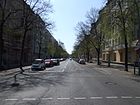
|
| Peter-Anders-Strasse
( Location ) |
260 | Peter Anders (1908–1954), tenor | Apr 1, 1976 | The street runs from Sonnenallee to Michael-Bohnen-Ring and is located in the Neukölln high-deck settlement . At first it was called Straße 591 according to the development plan . |

|
| Pflügerstrasse
( Location ) |
1100 | Karl Pflüger (1784–1833), community school of Deutsch-Rixdorf (1814–1830) | around 1901 | The street runs from Kottbusser Damm over Reuterstraße and from Nansenstraße to Weigandufer.
The previous name was Street 19 . From Friedelstrasse to Weigandufer, it was Strasse 18 and in 1901 was incorporated into Pflügerstrasse. |

|
| Planet road
( Location ) |
770 | Planets of the solar system | Apr 22, 1920 | The planet road runs from Wegastraße to Neuköllnische Allee. The house number sequence follows the principle of orientation numbering. At first it was called Straße 16 V according to the development plan . |

|
|
Reinholdstrasse
( Location ) |
180 | Reinhold , male first name | Sep 9 1899 | Reinholdstrasse runs from Walterstrasse to Bruno-Bauer-Strasse. Previously it was referred to as Street 201d . |

|
| Reuterplatz
( Location ) |
170 × 100 (triangular shape) |
Fritz Reuter (1810–1874), poet and writer | Feb 9, 1901 | The square is on Reuterstrasse and Nansenstrasse. It was created by merging space 20a and space Y . |
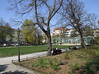
|
| Reuterstrasse
( Location ) |
1230 | Fritz Reuter (1810–1874), poet and writer | Feb 9, 1893 | Reuterstraße runs from Boddinstraße to Pflügerstraße. The house number sequence follows the principle of horseshoe numbering. When they were named, Street 214a , Street 216 and Street 216a were combined. Their course also changed over the years. It was drawn on a city map from 1896 from the then nameless Weserstraße to Münchener Straße . |
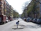
|
|
Richardplatz
( Location ) |
270 × 50 | Richardshof, a court of the Knights Templar | before 1877 | The quiet Richardplatz with good transport connections is bordered by Kirchhofstraße, Schudomastraße, Richardstraße and Hertzbergstraße. Here the old Rixdorfer village was anger . After its name, it was written Richard Platz for a few years . It is mostly made up of old buildings; in addition to multi-family houses, the square on the northern side merges into the Bohemian village with its single-family houses. Restaurants and cafés are located around the square with the old village church, a meeting point is the old village blacksmith's shop and the annual Christmas market is remarkable. |
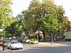
|
|
Richardstrasse
( Location ) |
1110 | Richardshof, a court of the Knights Templar | Apr 18, 1895 | Richardstraße runs from Karl-Marx-Straße and Ganghoferstraße to Braunschweiger Straße. Richardstraße begins on Ganghoferstraße as a densely built-up inner city street with tenement houses that mostly date from the end of the 19th century. Towards the south, the houses get smaller and finally to the north of Richardplatz they form a small settlement with single-family houses and gardens, which together with the Comenius Garden form the listed building ensemble of the Bohemian Village of Rixdorf with an old blacksmith's shop and day laborer's place with a historic smoking kitchen. To the south of Richardplatz, the street continues as a densely built-up inner-city street. The house numbers follow the principle of horseshoe numbering. Richardstrasse was spun off from Berliner Strasse , which was laid out before 1874 and which was given a different route.
In front of house number 49 there is a stumbling block for Horst Kuss that was laid on November 14, 2009 . |

|
| Ringbahnstrasse
( Location ) |
380 | the Berlin Ringbahn, which runs parallel here | Apr 18, 1895 | Before 1895 it was called the connecting railway (1878 in the address book) and for a few years was also called the ring railway (with allocation of parcels). When the Silbersteinstrasse was named, a western area was omitted, so the Ringbahnstrasse was shortened. It connects (now) Karl-Marx-Straße with the Hertastraße – Bendastraße road. |

|
| Roland-Krüger-Strasse | Roland Krüger, police officer murdered in Neukölln in 2003 | Feb. 27, 2020 | |||
| Rollbergstrasse
( Location ) |
750 | Rollberge, a hill in the district | Feb 14, 1950 | The street runs with house numbers 1–41 from Karl-Marx-Strasse over Morusstrasse and with numbers 64–79 from Hermannstrasse to Mainzer Strasse . The first name was Rollberge , from before 1877 to 1950 it was called Jägerstrasse . |

|
| Roseggerstrasse
( Location ) |
630 | Peter Rosegger (1843–1918), Austrian writer | Aug 12, 1908 | Roseggerstraße runs from Donaustraße to Weigandufer. The house number sequence follows the principle of horseshoe numbering. According to the development plan, it was first street 14 . |

|
|
Rübelandstrasse
( Location ) |
130 | Rübeland , part of the town of Oberharz am Brocken in Saxony-Anhalt | March 2, 1910 | The street runs with house numbers 3–11 from Thomasstrasse to Jonasstrasse and with numbers 13–17 from Schierker Strasse to Nogatstrasse. At first it was street 202 according to the development plan . |

|
|
Rübezahlstrasse
( Location ) |
140 | Rübezahl , mountain spirit (Schrat) of the Giant Mountains | Jan. 18, 1922 | The Rübezahlstraße leads from Drosselbartweg to Wegastraße. According to the development plan, it was first street 34 . In 1928 it was expanded to include part of the street Am Schulenburgpark and then ran from Wassermannstrasse via Drosselbartstrasse to Sonnenallee. Around 1930 there was another shortening to Drosselbartstraße. |

|
|
Rütlistraße
( Location ) |
290 | Rütli , mountain meadow in Switzerland and place of the Rütli oath | Jan. 18, 1906 | Rütlistraße runs from Weserstraße to Pflügerstraße. According to the development plan, it was first street 6 . Until 1951 it ran continuously from Weserstraße to Maybachufer, then only to Pflügerstraße.
The 1st community school located here became known nationwide in 2006 when teachers asked the Berlin Senator for Education to close the school because they could no longer contain the violence by students. In 2012 the district office was able to inaugurate a 'district sports hall' in this street. |

|
|
Saalestrasse
( Location ) |
1140 | Saale , tributary of the Elbe in Germany | Jan. 20, 1901 | The Saalestrasse runs from Karl-Marx-Strasse and Emser Strasse to Sonnenallee . The house number sequence follows the principle of horseshoe numbering. Before the street got its current name, it was called Street 250c . Initially, there was also a New Saalestrasse , which was incorporated into Saalestrasse around 1909. |

|
| Saltykowstrasse
( Location ) |
130 | Mikhail Yevgrafowitsch Saltykow-Shchedrin (1826-1889), Russian writer | March 19, 1929 | The street runs from Karl-Marx-Straße to Bornsdorfer Straße. It was initially called Straße 202d . After its name in Saltykowstrasse, it was named Wanzlikstrasse between 1934 and 1947 . |

|
| Sanderstrasse
( Location ) |
350 | Hermann Sander (1845–1939), factory owner and local politician in Neukölln (community leader; city councilor) | Feb. 14, 1907 | Sanderstraße runs from Kottbusser Damm to Friedelstraße. Previously, it was named Straße 10b on the development plan . In 1910, the architect Otto Zeiske lived in house number 10, and he was involved in a later monument in Oranienstrasse Berlin-Kreuzberg.
In front of house number 20 there are stumbling blocks for Max Adler, Else and Gerhard Jolles and Heinrich Putziger, and in front of house number 28 there is another stone for Gertrud Tikotin. The stumbling blocks were laid on November 14, 2009. |
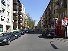
|
| Sasarsteig
( Location ) |
100 | Dietrich von Sasar , Commander of the Templar Order in the 14th century | May 15, 1960 | The Sasarsteig runs from Mainzer Straße to Reuterstraße. The first name of the street was Street 213b . There is a polemic about the namesake on the internet that derives 'Sasar' from ' Ziesar '. |
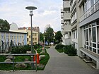
|
| Schandauer Strasse
( Location ) |
170 | Bad Schandau , city in Saxony | Jan. 11, 1904 | Schandauer Straße leads from Elbestraße to Wildenbruchstraße. At first it was called Straße 38a according to the development plan . |
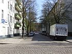
|
| Schierker place
( Location ) |
80 × 40 | Schierke , district of Wernigerode in Saxony-Anhalt | March 29, 1939 | Schierker Platz is on Selkestrasse, Nogatstrasse and Schierker Strasse. The previous name was Stubenrauchplatz from 1909 to 1939 . |

|
| Schierker Strasse
( Location ) |
770 | Schierke , district of Wernigerode in Saxony-Anhalt | Nov 28, 1908 | The street runs from Karl-Marx-Straße and Kirchhofstraße to Hermannstraße . The house number sequence follows the principle of horseshoe numbering. It was previously called Straße 205 .
In front of house number 5 there have been stumbling blocks for Hanna, Hulda, Ruth and Siegfried Zadek since November 14, 2009 . |

|
|
Schiller promenade
( Location ) |
320 + 140 | Friedrich Schiller (1759–1805), poet | May 2, 1905 | The Schillerpromenade runs from Selchower Straße to Leinestraße. The house number sequence follows the principle of horseshoe numbering. When the name was assigned, Street 158 and Street 160 were combined. The street is divided by Herrfurthplatz. |
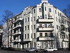
|
| Schinkestrasse
( Location ) |
230 | Johann Friedrich Schinke (1826–1875), community school in Deutsch-Rixdorf | before 1874 | The street runs from Kottbusser Damm to Maybachufer. The house numbers are assigned according to the horse-shoe numbering principle. |

|
| Schmalenbachstrasse
( Location ) |
560 | Eugen Schmalenbach (1873–1955), economist | June 1, 1966 | The street leads from Haberstraße to Nobelstraße. The first name on the zoning plan was Street 427 . |

|
|
Schöneweider Strasse
( Location ) |
210 | Ober - and Niederschöneweide , Berlin districts; direction | before 1885 | The street runs from Wipperstraße to Richardstraße. The house number sequence follows the principle of horseshoe numbering. Before the name was given, in 1884 there was a single house ("Haase'sches Haus") on Lazarusstraße , which was supposed to be called that at first. Until 1899 it was written on Schönweiderstraße [without the "e"]. |

|
|
Schönstedtstrasse
( Location ) |
240 | Karl Heinrich Schönstedt (1833–1924), Prussian lawyer and politician | Oct 30, 1899 | Schönstedtstrasse runs from Karl-Marx-Strasse to Sonnenallee. At first it was called Straße 8a according to the development plan . The public education office was located at Schönstedtstrasse 13 as part of the Neukölln administration. In one of these rooms the city world panorama of Neukölln could be viewed in the 1930s (description: “ Presentation of glass stereoscopic images on art, nature and ethnology”). The whereabouts are unknown. |

|
| Schudomastrasse
( Location ) |
540 | Johann Schudoma (1840–1903), local politician in Rixdorf | Jan. 18, 1906 | Schudomastraße runs from Richardplatz to Saalestraße. The house number sequence follows the principle of horseshoe numbering. Previously, according to the development plan, it was referred to as Straße 84b . |

|
| Schwarzastrasse
( Location ) |
130 | Schwarza , left tributary of the Saale in Thuringia | Apr 18, 1913 | The street runs from Braunschweiger Straße and Schudomastraße to Saalestraße. The first name was street 84c . |

|
| Selchower Strasse
( Location ) |
390 | Selchow , part of the community of Schönefeld in Brandenburg | March 17, 1894 | The street runs from Hermannstraße to Lichtenrader Straße. The house number sequence follows the principle of horseshoe numbering. The first name of Selchower Straße was Straße 155 . |

|
| Selkestrasse
( Location ) |
390 | Selke , right tributary of the Bode in Saxony-Anhalt | Nov 4, 1898 | Selkestrasse connects Emser Strasse and Schierker Strasse as well as Jonasstrasse and Thomasstrasse. In between is the Körnerpark . When assigning the name, street 204a and street 204b were combined. |

|
| Siegfried-Aufhäuser-Platz (*)
( Location ) |
30 (radius) |
Siegfried Aufhäuser (1884–1969), union leader and social democrat | Dec 6, 1984 | The square has the shape of a semicircle and is surrounded by Schudomastraße, Schwarzastraße and Saalestraße. It was only created from 1980 and is not included in the official register (as of January 2013). |

|
| Siegfriedstrasse
( Location ) |
1170 | Siegfried , hero of the Nibelungenlied | 1895 | The street leads from Kirchhofstraße to Oderstraße. The house number sequence follows the principle of horseshoe numbering. According to the development plan, the previous parts were called Straße 103a and Straße 203c . |
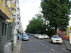
|
| Silbersteinstrasse
( Location ) |
1410 | Raphael Silberstein (1873–1926), Berlin local politician | Feb 14, 1950 | The street runs from Lahnstrasse and Karl-Marx-Strasse to Oberlandstrasse and Eschersheimer Strasse. The house numbers follow the principle of orientation numbering. The street was merged from Street 185 and Street 201 when the name was given . Before 1878 to 1950 the section of road west of Hermannstrasse was called Knesebeckstrasse . In contrast, today's eastern section to Bendastrasse was part of the Ringbahnstrasse.
In front of house number 97 there is a stumbling block for Klara Jacob that was laid on November 14, 2009 . |
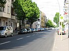
|
| Sinsheimer way
( Location ) |
240 | Sinsheim , town in the Rhein-Neckar district in Baden-Württemberg | Feb. 18, 1960 | The Sinsheimer Weg runs from Heidelberger Strasse to Harzer Strasse and Brockenstrasse. The first name was Street 33 . A section of the road was only included in the Sinsheimer Weg on July 1, 1989. |
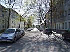
|
| Siriusstrasse
( Location ) |
100 | Sirius , binary star system in the constellation "Big Dog" | Apr 22, 1920 | The road runs from the planet road over the dolphin road. At first it was called Straße 12 according to the development plan . |

|
|
Sonnenallee
( Location ) |
4520 (in the district) |
Sun , central star of our planetary system |
April 20, 1920 (with extensions and interruptions) |
On April 20, 1920, the first section, according to the zoning plan, first street 84 from the Ringbahn to the Neukölln shipping canal , was named Sonnenallee. A later extension to Baumschulenstrasse in the Treptow district was incorporated into Sonnenallee in 1928. Between 1938 and 1947 the entire street was called Braunauer Strasse , in which Kaiser-Friedrich-Strasse had now also merged . On July 31, 1947, the street from Hermannplatz to Baumschulenstrasse was finally given the name Sonnenallee. - There are numerous listed monuments along the street, including the Sonnenallee S-Bahn station building .
In front of house number 137 there is a stumbling block for Willy Kolbe that was laid on September 12, 2008 . |
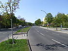
|
| Spremberger Strasse
( Location ) |
120 | Spremberg , city in Brandenburg | Nov 16, 1911 | The street runs from Bürknerstraße to Schinkestraße. At first it was called Straße 10c according to the development plan . |

|
| Capricorn Street
( Location ) |
190 | Capricorn , constellation | Jan. 18, 1928 | The street, laid out as Straße 37 around 1918, runs from Aronsstraße and Dammweg to Krebsgang.
Since December 10, 2007, there are stumbling blocks for Lucie and Arthur Hecht in front of house number 23 . |

|
| Street 12 (*)
( Location ) |
90 | Planning name when the road was first constructed | before 1932 | The street goes from the Grenzallee. Most of the originally longer road was built over by the Neukölln motorway triangle . It is not included in the official register (as of January 2013). |

|
| Street 645 (*)
( Location ) |
390 | Planning name when the road was first constructed | before 1932 | The road connects Oderstrasse with Columbiadamm and runs along the eastern edge of Tempelhofer Feld and the Neukölln summer pool. The Jahn sports hall and the Jahn sports field are on the east side.
It is not included in the official register (as of January 2013). |
|
| Stuttgarter Strasse
( Location ) |
640 | Stuttgart , state capital of Baden-Württemberg | Nov 3, 1904 | The street runs from Innstraße to Thiemannstraße. The house number sequence follows the principle of horseshoe numbering. At first only street 87, Section II, was given a name. Later extensions were made by Street 25b and Street 25c . |

|
|
Sülzhayner Strasse
( Location ) |
240 | Sülzhayn , district of Ellrich in Thuringia | Sep 14 1927 | Sülzhayner Straße goes off Harzer Straße. The house number sequence follows the principle of horseshoe numbering. The first name was Street 42 . |
|
|
Tellstrasse
( Location ) |
160 | Wilhelm Tell , legendary Swiss freedom fighter and murderer of tyrants | Jan. 18, 1905 | Tellstrasse runs from Sonnenallee to Weserstrasse. At first it was called Straße 6b according to the development plan . |
|
| Teupitzer Strasse
( Location ) |
510 | Teupitz , town in the Dahme-Spreewald district in Brandenburg | May 2, 1905 | The street is between Kiehlufer and Heidelberger Straße to Treptower Straße. At first only street 88 was named, later street 36 and street 88a, section II were included. In 1903, the community of Rixdorf had the municipal gas works built on the street 88 at the corner of Kaiser-Friedrich-Straße . On the road 88a the address book is from 1893 to the Niemetz'schen ice factories. On June 1, 1964, the area between Sonnenallee and Niemetzstraße was renamed Braunschweiger Straße and the area between Sonnenallee and Weserstraße was renamed Ederstraße. |

|
| Thiemannstrasse
( Location ) |
560 | August Thiemann (1849–1923), local politician | Oct. 31, 1910 | The street leads from Weigandufer to Bohemian Street. The house number sequence follows the principle of horseshoe numbering. The parts of the street were first called Street 16 , Street 16a and Street 16b . |

|
| Thomasstrasse
( Location ) |
810 | St. Thomas churchyard adjacent to the street | before 1877 | The street leads from Karl-Marx-Straße to Hermannstraße . The Kirchhofweg foot and cycle path connects there as a western extension to Oderstrasse . The house number sequence follows the principle of orientation numbering. In the city map from 1877 the street with its current name was drawn from the St. Thomas burial place to Bergstraße . On February 14, 1950, the Green Way was incorporated into Thomasstrasse. |

|
| Treptower Strasse
( Location ) |
1300 (in the district) |
Treptow , direction of the street | before 1878 | The street runs from Böhmische Strasse to Kiefholzstrasse. The house numbers are arranged according to the principle of horseshoe numbering. The house numbers 51-56 belong to the district Alt-Treptow .
It was marked in the city map from 1877, but had no name yet. She is mentioned by name in the address book of 1878. |

|
| Truseweg
( Location ) |
110 | Truse , tributary of the Werra in Thuringia | Apr 10, 1931 | The Truseweg runs from the Weigandufer to Werrastraße. According to the development plan, the path was initially called Straße 421 . |
|
|
Ulsterstrasse
( Location ) |
110 | Ulster , left tributary of the Werra in Hesse and Thuringia | Dec. 4, 1930 | The street runs from Weigandufer to Werrastraße. At first it was called Straße 417 according to the development plan . |
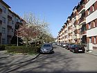
|
| Unstrutstrasse
( Location ) |
60 | Unstrut , tributary of the Saale in Thuringia | March 2, 1910 | Unstrutstraße runs from Saalestraße to Braunschweiger Straße and Kanner Straße. It was previously the road 182b of the development plan. |

|
| Uthmannstrasse
( Location ) |
240 | Gustav Adolf Uthmann (1867–1920), choir conductor | July 31, 1947 | The centrally located residential street with good transport connections in the multicultural part of Neukölln runs from Karl-Marx-Straße to Richardstraße. Their previous names were Rosenstrasse from 1827 to 1938 and Richardsburgweg from 1938 to 1947 . The old buildings, which have now been renovated, were the backdrop in Volker Schlöndorff's film adaptation of the Tin Drum . In the south of the street is the Comeniusgarten as a resting point in the city bustle of the west adjoining Karl-Marx-Straße. |

|
| Uwe-Liescheid-Strasse | Uwe Liescheid, police officer murdered in Neukölln in 2006 | Feb. 27, 2020 | |||
|
Venus Square (*)
( Location ) |
100 × 50 | Venus , planet of the solar system | Apr. 24, 1920 | Venusplatz is located between Sonnenallee and Planet Street . Previously it was registered as place VII in the development plan. It is not included in the official register (as of January 2013) as no properties are assigned. However, it is recorded by name in the official FIS broker map 1: 5000 of the district surveying offices for the green area located here. In 1921 the ice works are still recorded on the area of the square, for 1926 the entire area between the railway line, Delphinstrasse and Zwillingestrasse is designated as Venusplatz, including the area of today's “KGA Steinreich”. |

|
|
Walterstrasse
( Location ) |
280 | Willi Walter, local policeman and community leader in Britz | Apr 18, 1895 | The street runs from Ringbahnstraße to Karl-Marx-Straße and Delbrückstraße. It was called Willi-Walter-Straße between 1934 and 1947 and was briefly called Karl-Marx-Straße in 1947 . |

|
| Wanzlik path
( Location ) |
100 | Daniel Friedrich Wanzlick (1819–1877), last community school in Böhmisch-Rixdorf | 26 Sep 1983 | The Wanzlik path runs from Kirchgasse to Böhmische Strasse. From 1897 to 1983 it was called Gärtnerstraße . |

|
| Waiting place
( Location ) |
80 × 80 | Warta , river in Poland | Sep 9 1899 | The square is on Warthestrasse. |

|
| Warthestrasse
( Location ) |
330 + 190 | Warta , river in Poland | Sep 9 1899 | The street runs from Hermannstraße to Oderstraße and is interrupted in between by Wartheplatz. The house number sequence follows the principle of horseshoe numbering. In front of house number 69 there is a stumbling block for Franziska Smolen that was laid on November 14, 2009 . |

|
| Wegastrasse
( Location ) |
80 | Wega , main star of the constellation "Lyre" | Jan. 27, 1931 | The street leads from the planet street to the Rübezahlstrasse. From 1922 to 1931 it was called Wassermannstrasse . Until 1936 it ran from Dammweg to Köllnische Allee . |

|
| Vistula Square
( Location ) |
200 × 120 (triangular shape) |
Vistula , river in Poland | April 19, 1905 | The Weichselplatz is on the Weichselstrasse and the Weigandufer. Previously it was listed as F place in the development plan . |
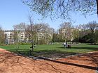
|
| Weichselstrasse
( Location ) |
840 | Vistula , river in Poland | April 19, 1905 | The street runs from Karl-Marx-Straße to Maybachufer . The house number sequence follows the principle of horseshoe numbering. In front of the house with the number 52 there are stumbling blocks for Erna and Dagobert Schlesinger. The stones were laid in July 2007 and inaugurated on October 17, 2007. On September 12, 2008, more stumbling blocks for Curt, Erna, Ilse, Ruth, Bertha and Max Ebstein as well as Georg Weigert were laid in front of house number 28. |

|
|
Weigandufer
( Location ) |
1370 | Hermann Weigand (1854–1926), architect and town planner of Rixdorf | May 2, 1904 | The Weigandufer leads along the Neukölln shipping canal from Fuldastraße on Weichselplatz to Teupitzer Brücke or Teupitzer Straße. The previous Straße 38 and Straße 57 were merged when the name was given. In 1907 the first spelling of Weigand-Ufer was changed. |
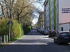
|
| Weisestrasse
( Location ) |
820 | Karl Weise (1813–1888), folk poet and master turner | March 17, 1894 | Weisestrasse runs from Leinestrasse over Mahlower Strasse to Flughafenstrasse and ends there as a dead end . The house number sequence follows the principle of horseshoe numbering. According to the development plan, it was first Street 156 . |
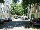
|
| Werbellinstrasse
( Location ) |
780 | Werbellin , the eponymous district of the municipality of Schorfheide in Brandenburg for the Werbellinsee | Feb 14, 1950 | The street runs from Karl-Marx-Straße and Ganghoferstraße to Hermannstraße and Herrfurthstraße. The house number sequence follows the principle of orientation numbering. From before 1877 to 1950 it was called Ziethenstraße .
Between September and December 2018, the total length of around 1,600 meters of the cycle paths were marked in green on behalf of the Senate Department for the Environment, Transport and Climate Protection and by the state-owned company Infravelo as the builder and project manager and widened to 1.90 meters. |
|
| Werrastrasse
( Location ) |
640 | Werra , one of the two source rivers of the Weser | Jan 15, 1913 | The street runs from Innstraße via Treptower Straße to Thiemannstraße and ends there as a dead end . The house number sequence follows the principle of horseshoe numbering. According to the development plan, the previous name was Straße 38d . |

|
| Weserstrasse
( Location ) |
2460 | Weser , river through North Rhine-Westphalia, Lower Saxony and Bremen | Sep 9 1899 | The Weserstrasse runs from Kottbusser Damm to Ederstrasse. The house number sequence follows the principle of horseshoe numbering. At first it was street 25 according to the development plan . In 2017, the section between Kottbusser Damm and Reuterplatz was reworked into Neukölln's first bicycle street.
Weserstraße is known for its lively pub and club culture. In front of the house with number 54 there are stumbling blocks for Reinhold Hermann and Hugo Kapteina . |

|
| Widderstrasse
( Location ) |
250 | Aries , constellation | Jan. 18, 1922 | The Widderstraße leads from Dammweg to Krebsgang. Previously, it was listed as Straße 36 on the development plan . |
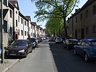
|
| Wildenbruchplatz
( Location ) |
220 × 100 | Ernst von Wildenbruch (1845–1909), writer and diplomat | Oct 14, 1904 | Wildenbruchplatz is located on the banks of the Weigand and leads from Wildenbruchstraße to Innstraße. The previous places according to the development plan, Platz 13a , Platz 13b , Platz 13c , Platz O and Platz O II were merged when the name was assigned. |
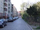
|
| Wildenbruchstrasse
( Location ) |
900 (in the district) |
Ernst von Wildenbruch (1845–1909), writer and diplomat | March 13, 1894 | Wildenbruchstrasse runs from Sonnenallee and Erkstrasse to Kiefholzstrasse. The house number sequence follows the principle of horseshoe numbering. According to the development plan, it was first street 12a .
In the 1901 city map it was drawn from Kaiser-Friedrich-Strasse to Harzer Strasse. The part between Harzerstrasse and Kiefholzstrasse was named between 1921 and 1925. Part of the street runs in Alt-Treptow . During the existence of the Berlin Wall from 1961 to 1989, the street was divided and the course is marked on the street. |

|
| Wilhelm-Busch-Strasse
( Location ) |
220 | Wilhelm Busch (1832–1908), poet and draftsman | Apr 17, 1914 | The street runs from Roseggerstraße to Treptower Straße. According to the development plan, its previous name was Straße 29a . |

|
| Willstätterstrasse
( Location ) |
200 | Richard Willstätter (1872–1942), chemist and Nobel Prize winner | Oct 1, 1987 | Willstätterstrasse is a dead end from Bergiusstrasse. The street was previously a private street and is noted on the development plan as street 611 . |

|
| Wipperstrasse
( Location ) |
280 | Wipper , tributary of the Saale in Saxony-Anhalt | Feb 20, 1901 | Wipperstrasse runs from Saalestrasse to Kirchhofstrasse. The previous street 250a , street 250b and street 250d were merged when the name was assigned. |

|
| Wissmannstrasse
( Location ) |
500 | Hermann von Wissmann (1853–1905), Africa explorer, officer and colonial administrator | Nov. 27, 1890 | The centrally located, quiet cobblestone street runs from Hasenheide to Karlsgartenstraße. The house number sequence follows the principle of horseshoe numbering. According to the development plan, it was initially called Straße 150, Section II . When it was first entered in the address book in 1891, only the 'Waldschenke' was given as the bar of the Bergschloßbrauerei. The preserved and listed building is now number 32, where the Workshop of Cultures is located. The location of the street on the edge of the Berlin glacial valley requires a slight incline from the street Hasenheide to Karlsgartenstraße. The houses are predominantly old buildings from the Wilhelminian era, on the western side of the street is the Hasenheide park with a secondary school and the workshop of cultures. |

|
| Wittmannsdorfer Strasse
( Location ) |
120 | Wittmannsdorf, part of the municipality of Märkische Heide in Brandenburg | Nov 30, 1919 | Wittmannsdorfer Straße runs from Jonasstraße to Schierker Straße. At first it was called Straße 202b according to the development plan . |

|
|
Wörnitzweg
( Location ) |
90 | Wörnitz , left tributary of the Danube in Bavaria | Dec. 4, 1930 | The Wörnitzweg leads from Wilhelm-Busch-Straße to Donaustraße. According to the development plan, the first route was road 420 . |

|
|
Zeitzer Strasse
( Location ) |
60 | Zeitz , city in Saxony-Anhalt | Feb 20, 1901 | The street runs from Saalestraße to Braunschweiger Straße. At first it was called Straße 250c according to the development plan . |

|
| Ziegrastrasse
( Location ) |
550 | Hugo Ziegra (1852–1926), brewery director, local politician and Berlin city elder | Apr 26, 1915 | The street runs from Dieselstraße to Sonnenallee . When the name Ziegrastraße was assigned, Straße 52 and Straße 60 were combined. |
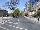
|
| Zwiestädter Strasse
( Location ) |
150 | The two ("two") cities of Berlin and Cölln have owned the Cölln meadows since the Middle Ages . | 23 Sep 1938 | The street runs from Richardplatz to Böhmische Straße. The previous name between 1905 and 1938 was Johann-Hus-Straße . |

|
| Twin street
( Location ) |
110 | Gemini , constellation | Aug 16, 1928 | The road runs from the planet road over the dolphin road. At first it was called Straße 15 according to the development plan . |

|
Former and planned streets
The streets listed here have been compiled by carefully evaluating the Rixdorf address books available online (beginning in 1878, end of 1943). The presentation was supplemented with information from Kauperts' street dictionary.
| Surname | Namesake | from when | by when | current name | Explanations |
|---|---|---|---|---|---|
| Old Kotzemarkenweg | Origin of name unclear | before 1834 | → Kirchhofstrasse | ||
| At the cable factory | Norddeutsche Kabelwerke AG, founded in 1910 | 1917 | Nov. 30, 1967 | canceled | The Norddeutsche Kabelwerke are named as residents of the street. In 1915 this unnamed street was entered on a map for the first time. She goes (went) from Am Oberhafen . In 1967 the name disappeared from city maps and address books. The site was expanded in the later years and in the 21st century belongs to AEG Telefunken Kabelwerk Rheydt as a branch. |
| At Schulenburg Park | Von-der-Schulenburg-Park | 1921 | after 1943 | → Hänselstrasse , Rübezahlstrasse and → Sonnenallee (1947) |
from Sonnenallee to Planet Street along the eponymous park, previously on two sides of the park |
| At the water tower | Water tower that was built on this street in 1887 by the Charlottenburg waterworks | Jan. 18, 1908 | Dec 12, 1911 | → Leykestrasse | Course according to the 1908 address book: 'An der Hermannstraße' ,; in 1910 ten parcels are given and it extends to Mittelstrasse. In the year it was renamed, a number of construction sites were recorded. |
| Mountain road | Rollberge, regional hill | before 1878 | July 31, 1947 | → Karl-Marx-Straße (section leading to the south) | It formed a section of street between Berliner and Rudower Strasse and ran from Jägerstrasse to Delbrückstrasse and is thus a section of the later re- routed Karl-Marx-Strasse . With 163 horse-shoe house numbers assigned, it was already a very busy street at the beginning of the 20th century. The address book from the turn of the century names a war memorial on the corner of Bergstrasse and Richardstrasse as a sight. |
| Berliner Strasse, initially also written Berlinerstrasse | Berlin , direction | before 1878 | July 31, 1947 | → Karl-Marx-Straße (northwest section from Hermannplatz at the Neukölln town hall (noted on the map of the district court and school) to Richardplatz) | A small area between the town hall and Richardplatz was spun off as Richardstraße in 1895. Then the route must have been swiveled. The address book 1881 contains the natural ice works Piehler & Sohn under number 92 . The picture shows the building of the Puhl and Wagner glass mosaic workshops around 1900. |
| Boddinsfelder Strasse | Boddinsfelde , part of the municipality of Mittenwalde in Brandenburg | 1940 | Runs (ran) between Lessingstrasse and Riedebecker Strasse and was added to the address book in 1940 with "undeveloped". | ||
| Bodestrasse | Bode , river in the Harz | 1899 | 1935 | → Altenbraker Strasse | From the 1920s onwards, there was lively construction activity here thanks to numerous housing associations. Houses 8–13 were built on behalf of the “AG für Haus- und Grundbesitzungen Leipzig”, building number 32 by “Grundstücksgesellschaft, Bodenia 'GmbH”. |
| Bean Road | around 1878 | canceled | The name was only found in the 1878 address book, where it was only given as the cross street of Berliner Straße (between numbers 155 and 156). In the years that followed, there was no longer a cross street, so it was either only planned or was probably built over. | ||
| Braunauer Strasse | Braunau am Inn , place and municipality in Austria | May 11, 1938 | July 31, 1947 | → Sonnenallee | The name was changed because Braunau is the birthplace of Adolf Hitler . For the first time, the entire route from Hermannplatz to Baumschulenstrasse was given a uniform name. |
| Causeway | Dam , embankment | 1911 | 1969 | → Grenzallee one section |
The larger area is in Alt-Treptow , although it was specified in Neukölln as the cross street of Kaiser-Friedrich-Straße (later: Sonnenallee ). The name of the route was always included in the Treptow administrative district address book. This dam path was not identical to the current route of the path of the same name . |
| Gartnerstrasse | Gardener , garden designer | 1897 | 1966; 1983 | → Gerlachsheimer Weg
from 1966 (one part); → Wanzlik path from 1983 (another section) |
Gärtnerstraße 8/9: In the 1930s, an old people's home maintained by the city of Berlin was mentioned here, which is neither in today's Wanzlikpfad nor on Gerlachsheimer Weg. |
| Goethestrasse | Johann Wolfgang Goethe , poet | before 1878 | 1938 | → Langnerweg | The road ran from Richardstrasse to Bergstrasse . In 1938 it was renamed Langnerweg . |
| Green way | Grassland , unpaved path over meadows between the two cemeteries | Feb 6, 1903 | 1950 | → Kirchhofweg (parts), → Thomasstraße (other parts) |
On the current map of the land surveying office, the part between Hermann- and Schwarzen Weg of Oderstraße, a pedestrian and cycle path as part of the Inner Parkring, is again referred to as Green Path. |
| Helastrasse | Hel Peninsula , previously spelled Hela | Jan. 18, 1908 | 1909 | Course according to the address book: 'on the Bergstrasse' | |
| Hohenzollernplatz | Hohenzollern , ruling house in Brandenburg-Prussia | around 1900 | 1950 | → Karl-Marx-Platz | In front of the complex as a town square , Mühlenstrasse ran here , the houses of which had been demolished for the preparation of the square and the monument to Kaiser Wilhelm the Great . The monument was created based on a design by the sculptor Wolff ; it is mentioned as a sight in the address book of that time. |
| Jaegerstrasse | Hunter | before 1878 | 1950 | → Rollbergstrasse | At the beginning of the 20th century in the Rixdorf address book the 'Club Brewery of Bavarian Beer' here on Jägerstrasse, numbers 16-40. That would be the forerunner of the later Kindl brewery . |
| Johann Huss Street, and Jan Hus street called | Germanized by Jan Hus , Czech reformer | 1904 | 1938 | → Zwiestädter Strasse | The course was between Richardplatz and Straße 184 . |
| Kaiserstrasse | Kaiser , German ruler title | 1854 | 1902 | → Neuköllniche Allee | The Kaiserstraße ran in 1857 coming from the Köllnische Wiesen over the Dammweg to the south. Before 1884, a small section of Kaiserstraße, which led north across the meadows, was spun off as Kanner Chaussee . However, Kaiserstraße is not included in Rixdorf's address books from 1878 onwards. |
| Kaiser-Friedrich-Strasse | Friedrich III. , German Emperor | around 1893 |
Apr 20, 1920
the eastern section in 1928, the southeasternmost section in 1938 |
→ Sonnenallee |
Initially leading from Hermannplatz to Pannierstrasse. Added in 1938 as a section in Braunauer Strasse .
At the year of the complete renaming to Sonnenallee a contradiction arises between the information from Kauperts / Luise (first section 1920; remainder 1928) for the representation in the address books. Even if a certain lag from the sentence to the publication is assumed, it is hardly possible to explain why this street was still in the address book in 1938 (!) With a newly drawn street image in its entire length ( Neukölln> Sonnenallee> Straße . In: Berliner Address book , 1938, part IV, p. 1956.), from Hermannplatz to the branch canal . |
| Kanner Chaussee; until 1905 also Canner Chaussee | 'Kanne', name of the forester's house in the Königsheide | before 1884 | 1911 | → Neuköllniche Allee | The "Mier'schen Eiswerke" (Mier's Ice Works) were identified in the 1884 address book on this street. In 1897 one of the first public bathing establishments in the area of Berlin, the Kaiser Wilhelms-Bad , was found on Canner Chaussee . In 1912 the Chaussee was renamed Köllniche Allee . |
| Kirchhofstrasse | Churchyard | before 1878 | 1895 | → Hertastraße (parts);
The rest kept his name |
|
| Knesebeckstrasse | Karl Friedrich Freiherr von dem Knesebeck (1768–1848); Berlin politician, member of the military | before 1878 | 1950 | → Silbersteinstrasse | In 1891 an extended Knesebeckstraße was specified in the address book , which (probably) went off on the other side of Hermannstraße: because in the following year the name no longer exists, but Knesebeckstraße now extends over Hermannstraße. Around the turn of the century, the address book names a natural history school museum at Knesebeckstraße 22/23 as a sight. The Museum Neukölln emerged from this museum in several development steps. |
| Köllnische Allee | Cölln | 1912 | March 11, 1937 | → Neuköllniche Allee ;
→ Niemetzstraße (section from the Ringbahn to Lahnstraße); → Lahnstrasse (from Lahnstrasse to the canal) |
The Köllnische Allee is included on a city map of Neukölln in 1912, previously it was the Kanner Chaussee . |
| Köllnisches Ufer | Cölln | 1905 | 1934 | → Kiehlufer | |
| Krüllsstrasse | Peter Krülls (* 1855), engineer and local politician in Treptow | Dec 11, 1909 | May 17, 1930 | → Onckenstrasse | It was indicated in the course of the street of the Köllnischer Ufer on the Neuköllner Schifffahrtskanal as a cross street (south parallel to Bouchéstraße). The section belonging to Neukölln was named Onckenstraße in 1930, Krüllsstraße remained in Treptow after regional reforms (see there ↑ ). |
| Langnerweg | not clear; a supporter of National Socialism is assumed | 23 Sep 1938 | July 31, 1947 | → Moravian Way | Until it was renamed, the path was called Goethestrasse . |
| Lehniner Strasse | Lehnin , a former independent place in Brandenburg, which developed around the monastery of the same name | Aug 4, 1897 | 1929 | → Lilienthalstrasse | The largest section of this traffic route was and is in the Kreuzberg district . Lehniner Straße was not included in the Rixdorf / Neukölln address book until 1943. |
| Leo-Arons-Strasse | Leo Arons (1860–1919), physicist and politician | 1926 | 1934 | since 1973 → Aronsstrasse | Re-assigned in 1926 after the first street so named was incorporated into Treptow in 1907; From 1934 to 1973 the name was Sackführerdamm . |
| Lessingstrasse | Gotthold Ephraim Lessing , poet | before 1878 | 1950 | → More Street | |
| Mariendorfer Weg | Mariendorf , district of Berlin; direction | 1894 | → Hertastrasse
(a section), the larger section kept its name |
When it was first mentioned in the address book, a house was identified; the route began on Hermannstrasse. | |
| Mühlenstrasse | Grain mills , tinder mills | around 1834 | after 1901 | since 1950: → Karl-Marx-Platz | The street ran from Richardplatz to Bergstrasse . Mühlenstrasse 8 (near Richardplatz) was the post and telegraph office in Rixdorf. The artist Ernst Moritz Geyger was born in Mühlenstraße 7 , for whom the district office had the plaque shown here put up. Around 1902 it was renamed Hohenzollernplatz . |
| Munchener Strasse | Munich , Bavarian capital | around 1896 | 1928 | → Flughafenstrasse ,
the outsourced western section |
At first it was called Straße 211 according to the development plan . In particular, it appears in the address book for the first time in 1897, when it was still considered "undeveloped". In 1898 its course between Berliner Straße and Hermannstraße (parcels numbers 1–55) is given; the development was carried out entirely on behalf of the “Berlin-Rixdorf.Terraingesellschaft”. In addition to tenement houses, the necessary facilities and facilities as well (under number 31 the “Allgemeine Handels- und Gewerbebank”) were built. |
| Oberonstrasse | Oberon , moon of the planet Jupiter | 1924 | - (only once in the address book) | It was specified in the address book as a cross street on Sonnenallee between Am Schulenburg-Park and the Neukölln-Schöneweider Railway. | |
| Prinz Handjerystrasse | Nicolaus Prinz Handjery (1836–1900), Prussian politician, district administrator of the Teltow district (1870–1885) | before 1878 | 1950 | → Briesestrasse | The street ran from Bergstrasse to Waßmannsdorfer Strasse . Two buildings from the beginning of the 20th century are worth mentioning here: the 'Berliner Export Weißbier-Brauerei' (number 78–80) and the cooperative bank, Guild Savings and Loan Bank '(number 49). |
| Richardsburgweg |
Richardsburg ,
a tenement for around 126 families in which NS-time in a clubhouse of the SS - the storm was |
1938 | 1947 | → Uthmannstrasse | The first name from 1827 to 1938 was Rosenstrasse . |
| Riedebecker Strasse | Gut Riedebeck in the municipality of Heideblick in the Dahme-Spreewald district | around 1935 | around 1946 | Course between Kienitzstraße (north) and Mittelweg (south), no development was entered. It was removed after 1945 when the Lessinghöhe was filled in. | |
| Rixdorfer dam | Böhmisch-Rixdorf , the historical center of today's Neukölln district | 16th century | 1873 | → Kottbusser Damm | |
| Rixdorf-Canner-Kreis-Chaussee | Böhmisch-Rixdorf and Deutsch-Rixdorf as well as Kreis-Chaussee | 1902 | 1905 | This connecting road along the Hasenheide has been renamed several times.
This street name appears in the street directory Luise-Berlin / Kauperts and on a city map. In the Berlin address book it is not mentioned in any year between 1878 and 1905. In 1905 it became the Kanner Chaussee . |
|
| Rosenstrasse | Roses , noble garden flowers | 1827 | 1938 | → Richardsburgweg | |
| Rudower Strasse | Rudow , direction | before 1878 | 1903 | → Rudower Strasse | 1903 outsourced to Britz |
| Sackführerdamm | Bag handlers are people who “lift the unweighted grain [...] to the place where the mill writer wants it to be”.
In addition, they were obliged to provide their horses to transport syringes and water in case of fire. |
before 1901
Reproduced in 1934 |
1907
1973 |
|
After the first name was given, the dam was outsourced to Treptow.
In 1934, Leo-Arons-Strasse, designated in 1926, was renamed Sackführerdamm. This name was deleted in 1973, the traffic route is now called Aronsstrasse. It runs from Kiefholzstrasse to Braunauer Strasse with an arcade on both sides. |
| Siboldstrasse | Sibold, first abbot of the Lehnin monastery | Aug 4, 1897 | 1929 | → Lilienthalstrasse | The largest section of this traffic route was and is in the Kreuzberg district . Siboldstrasse was not included in the Rixdorf / Neukölln address book. |
| Steinmetzstrasse | Karl Friedrich von Steinmetz (1796–1877), Prussian field marshal | 1874 | 1950 | → Kienitzer Strasse | After the renaming and further development along the street, the section from Hermannstraße was shortened and is now just a dead end . |
| Star avenue, star place | Stars | Apr 22, 1920 | Between 1920 and 1929, the avenue and the square were named in city maps (also a sun place and a comet place ). They can be recognized as "planned" by their hatched representation. The time of their naming is equated with that of the Sonnenallee . On a map from 1930 the street was no longer included and the place was indicated as place IX . Both were built over. | ||
| Road to Britz, Britzer Chaussee | Britz , today's district of Neukölln | 1859 | around 1879 | → Hermannstrasse | The inclusion took place only about five years after the naming of Hermannstrasse (around 1880), both names coexisted for several years. |
| Parlor smoking place | Ernst von Stubenrauch , District Administrator of the Teltow District (1885–1908) | 1909 | 1939 | → Schierker Platz | |
| Taboritenweg | Taborites , a militant wing of the Hussites | handed down | before 1834 | → Kirchhofstraße (parts) | |
| Thuringian Street | Thuringia , at the time the name was given, landscape in Germany | 1897 | 1964 | → Braunschweiger Strasse | |
| Triftweg | Cattle drift , path for grazing cattle | from 1899 | 1905 | → Berthelsdorfer Strasse | The street name was not listed separately, but appeared as a cross street of Richardstrasse between house numbers 107 and 108. It was probably not an official name. |
| Wanzlickstrasse | Daniel Friedrich Wanzlick (1819–1877), local politician | before 1877 | 1928 | → Flughafenstrasse | In 1907 the spelling was changed to Wanzlikstraße ;
After 1934 the former Saltykowstrasse was renamed Wanzlikstrasse , and in 1947 it was reversed. |
| Wanzlikstrasse | Daniel Friedrich Wanzlick (1819–1877), local politician | 1934 | 1947 | → Saltykowstrasse | The street mentioned here was in the Schillerkiez and is neither identical to the above-mentioned Wanzlickstraße nor to the Wanzlikpfad on today's Karl-Marx-Straße . |
| Wassermannstrasse | Aquarius constellation | 1922 | 1931 | → Wegastrasse | |
| Waßmannsdorfer Strasse | Waßmannsdorf , part of the community Schönefeld in the district of Dahme-Spreewald; direction | 1894 | March 29, 1939 | → Bornsdorfer Strasse | According to the development plan, the parts were initially called Straße 202 and Straße 202a . According to the Luisenstädtischer Bildungsverein, the section between Kopfstrasse and Mittelweg was given its name around 1919, and in 1939 the northern extension to Briesestrasse was added. According to the address books, when it was first mentioned in 1894, Waßmannsdorfer Straße ran from Prinz Handjerystraße (today: Briesestraße) southwards (number 1 “Catholic Rosary Church” St. Clara Church ) to Steinmetzstraße (house numbers 1-54 without 5-51, i.e. seven numbers) Also from the address books it follows that around 1920 the southward extension to Bornsdorfer Straße took place and it was re-numbered (1–15).
This leads to the conclusion that the route was changed later, which could be related to construction work during the Nazi era (bunker). |
| Meadow ground | Meadow | before 1903 | around 1906 | → Pannierstrasse
(a section) |
This street appears in the address book in 1903 as a cross street with Pannierstrasse, namely between houses 24 and 25. Because Pannierstrasse runs here in later address books, the Wiesengrund must have been included in this. |
| Pointed banks, initially meadows banks posted | The bank along the Wiesengraben led through meadows | 1877 | after 1885 | → Maybachufer | The southern bank on the westward section (today: Neukölln) and the eastern bank on the northward section (today: Alt-Treptow ) of the Wiesengraben (today: Landwehr Canal ) bore this name. The street here and two others were probably given to the city of Berlin in 1883, because the street says “s. Berlin". There they are continued under their previous name with the note “go. to Rixdorf ”. The course was indicated in the street scene (1940) as follows: At Lohmühlenplatz in the Treptower area, going northeast. Compared to today's maps, a path remained between Ratiborstrasse and Landwehr Canal, which now has no official name and belongs to the site of the hydraulic engineering administration in the Kreuzberg district. |
| Willi-Walter-Strasse | Willi Walter, local policeman and community leader in Britz | 1934 | 1947 | → Walterstrasse | |
| Ziethenstrasse | Großziethen , (originally Groß Ziethen) in the Dahme-Spreewald district | 1877 | 1950 | → Werbellinstrasse |
- Further traffic routes not (yet) assigned to today's streets
122a, 123, Neue Strasse (1878);
Straße 7 (1918) going off from Köllnische Allee, on which the "Squirrel Colony" developed and two market gardens settled up to the Neukölln Schifffahrtskanal (1938)
Straße 62 (1918) with an owner and his coal lighter factory; it goes from the Ziegrastrasse. A (new) street 8 (1918) marked “Fiskus” and Köllnische Heide train station goes from Dammweg.
Other areas and locations in the district
Allotment gardens (KGA)
In the district there are 34 arbor colonies according to the Federal Allotment Garden Act , some of which are on the district boundary to Plänterwald . This belt continues on the Plänterwald side, whereby it should be noted that the Berlin Wall prevented changes to the development in this area until 1990. Some Neukölln allotment gardens are largely secured by the representation in the land use plan or by development plans in the existing building , but the route of the planned extension of the motorway ring road leads through these allotment areas , others are intended for commercial and sports areas.
(RBS = regional reference system; a number system in the Senate database)
- KGA, Alt-Ruhleben 1 ', RBS: 06118 (Dieselstrasse 32, Lage ), conditionally secured allotment gardens with 81 plots on 31,151 m² of leased land owned by the state, but whose land is intended for commercial space and the construction of the A 100 .
- KGA, Alt-Ruhleben 2 ', RBS: 06119 (Aronsstrasse 82a, Lage ) is a permanent allotment garden with 38 plots on 11,729 m² of leased land, part of which is intended for the construction of the A 100.
- KGA 'Antonsruh', RBS: 06177 (Kiefholzstrasse 77, Lage ), conditionally secured allotments with 18 plots on 5,573 m², which are intended for commercial space.
- KGA, Free Hour '(Pannierstrasse 47,49,51, Lage ) is a temporary allotment garden with 38 plots on 8,098 m² of state-owned leased land.
- KGA, Freiheit ', RBS: 06330 (Dammweg 208, Lage ) is a temporary allotment garden with 130 plots on 39,006 m² of state-owned leased land.
- KGA, Friedenstal ', RBS: 06694 (Sonnenallee 261, Lage ) is a temporary allotment garden with 28 plots on 12,509 m² of state-owned leased land, which are, however, provided for in the zoning plan for commercial areas.
- KGA, Georgina '(Mergenthalerring 25, Lage ) is a permanent allotment garden with eleven parcels on 2,584 m² of state-owned leased land and a further 39 lots on 9,978 m² of private leased land.
- KGA, Green Corner ', Weserstrasse. Relocated from a site owned by the Auer company for their expansion.
- KGA, Heinrichs Ruh ', RBS: 06450 (Aronsstraße 46a, Lage ) is a permanent allotment garden with 30 parcels on 10,650 m² of leased land, part of which is intended for the construction of the A 100.
- KGA, Helmutstal ', RBS: 06454 (Mergenthalerring 28, Lage ) conditionally secured allotment gardens with 84 plots on 27,271 m² of state-owned leased land, which, however, are intended for commercial space.
- KGA 'Karlsruhe 2', RBS: 06487 (Britzer Allee 1, Lage ) permanent allotment garden with 28 parcels on 9,075 m² of state-owned leased land.
- BLW ( Railway Agriculture ) sub-district Neukölln Group 'Kiehler Grund', RBS: 06883 (Mergenthaler Ring / Kiehlufer, Lage ) an allotment garden with nine plots on 3,868 m² on railway-owned land.
- KGA 'Kühler Grund', RBS: 06516 (Weserstraße 107 / Ederstraße 11, Lage ) is a temporary allotment garden with 43 plots on 9,579 m² of state-owned leased land, as well as a further 22 plots on 4,851 m² of state-owned land, which are intended for a sports area.
- KGA, Loraberg '; (Kiehlufer corner Brockenstrasse, Lage ) is an allotment garden that is worth preserving with 64 plots on 13,228 m² of private leased land.
- KGA 'Mariental 2', RBS: 06547 (Neuköllniche Allee 166, Lage ) is a permanent allotment garden with 47 plots on 17,811 m² of leased land owned by the state.
- KGA, Märkische Schweiz ', RBS: 08306 (Mergenthalerring 31, Lage ) is a permanently secured allotment garden, with 19 plots with two permanent residents on 5,390 m² of land owned by the state and 81 plots on 30,289 m² of private land.
- KGA, NCR ', RBS: 05983 (Sonnenallee 187, Lage ) is a temporary allotment garden with 32 plots on 8,506 m² of state-owned leased land, which is intended for a sports area.
- KGA, Neuköllner Schweiz ', RBS: 06576 (Dieselstrasse 22, Lage ) is a permanently secured allotment garden, with 14 plots with permanent residents on 5,012 m² of state-owned leased land and 45 plots on 14,897 m² of private land.
- KGA 'Neukölln Wiesen' (Dieselstrasse 18, Lage ) is a permanent allotment garden with 122 parcels, one of which is a permanent resident, on 49,646 m² of state-owned leased land.
- KGA, Odertal ', RBS: 06593 (Herrfurthstraße 15, Lage ) is an allotment garden with 14 plots on 4,419 m² of state-owned leased land, which are only secured temporarily. Another 15 parcels on 4033 m² of private land are worthy of preservation according to the zoning plan.
- KGA, Petersbaude '(Sinsheimer Weg 12, Lage ) is a temporary allotment garden with 29 plots on 6,096 m² of state-owned leased land. The area is planned for another use.
- KGA 'Rübezahl' (Teupitzer Straße 44, Lage ) is a temporary allotment garden with 60 plots on 13,728 m² of state-owned leased land, the area of which is planned for commercial use.
- KGA, Schmidtsruh ', RBS: 06684 (Dieselstrasse 27, Lage ) is a permanent allotment garden with 56 plots on 19,920 m² of state-owned leased land, part of which is claimed by the construction of the motorway ring road.
- KGA 'Stadtbär', RBS: 06731 (Dieselstrasse 34, Lage ), conditionally secured allotments with 112 plots on 43,573 m² of state-owned leased land, which are intended for commercial space and the construction of the A 100.
- KGA, Steinreich ', RBS: 06744 (Grenzallee 7, Lage ) is a temporary allotment garden with 52 parcels (one permanent resident) on 17,824 m² of state-owned leased land, which is intended for other use.
- KGA, Stolz von Rixdorf ', RBS: 06747 (Dammweg 208-211, Lage ), permanent allotment garden with 73 plots on 25,718 m² of state-owned leased land.
- KGA, Südpol ', RBS: 06506 (Dieselstrasse 20, Lage ) is a permanent allotment garden with 46 plots on 15,624 m² of state-owned leased land.
- KGA, Treue Seele ', RBS: 06774 (Aronsstrasse 82b, Lage ) is a permanent allotment garden with 90 plots on 27,921 m² of state-owned leased land, part of which is claimed by the construction of the motorway ring road.
- KGA, Volksgärten ', RBS: 06786 (Neuköllniche Allee 34a, Lage ) is a permanent allotment garden with 148 plots on 56,646 m² of state-owned leased land.
- KGA, Weidental '(Harzer Straße 78, Lage ) is a temporary allotment garden with 14 parcels (one permanent resident) on 3,089 m² of state-owned leased land, which is intended for other use.
- KGA 'Weißer Stern' (Sonnenallee 259, Lage ) is a permanent allotment garden with 37 plots on 10,483 m² of state-owned leased land, part of which is claimed by the construction of the motorway ring road.
- KGA, Wilde Rose ', RBS: 06837 (Harzer Straße 79, Lage ) is an allotment garden with 43 plots on 9,155 m² of state-owned leased land that are planned for other use.
- KGA, Satisfaction ', RBS: 06862 (Mergenthaler Ring, Lage ) is an allotment garden with 20 plots on 6,019 m² of land owned by the railway .
- KGA 'Zur Rose', (Dieselstraße 26, Lage ) is a permanently secured allotment garden with seven parcels on 1995 m² of private land and a further 41 parcels on 12,089 state-owned leased land, part of which is used for the construction of the motorway.
Allotment gardens closed (as of 2012)
- KGA, Hand in Hand ', RBS: 06421 (Rütlistraße 8, Lage ) was an allotment garden with 33 plots on 7,723 m² of state-owned leased land, which was canceled for the Rütli campus in December 2012.
Parks in Neukölln
| Surname |
Length / dimensions (in meters or area) |
Origin of name, location | Date of designation | Remarks | image |
|---|---|---|---|---|---|
|
Anita Berber Park
( Location ) |
|
Anita Berber (1899–1928), dancer , actress and self-expressionist , buried on the property | 2002 | The park was laid out on a former cemetery which, after its closure until 2008, served as an approach path for Tempelhof Airport . |

|
|
Herbert Krause Park
( Location ) |
|
Herbert Krause, former head of the Neukölln Nature Conservation and Green Space Office | 2002 | The central element of the park is the “Saale stone”. This is a natural stone weighing around 40 tons , on the surface of which the course of the Saale was carved. The stone is a gift from the Neukölln community partnership Hof . |

|
| Heidekamppark
( Location ) |
740 11,110 m² |
at Heidekampgraben | The Heidekamppark is a green area west of the Heidekampgraben (on the Neukölln territory) between the Forsthausallee and the sports facility on Michael-Bohnen-Ring . |

|
|
|
Grain park
( Location ) |
190 × 120 | Franz Körner (1838–1911), who owned the gravel pit in which the park is located today | 1916 | The park-like green area is located between Jonasstraße, Schierker Straße, Selkestraße and Wittmannsdorfer Straße and is around 2.4 hectares in size. In addition to water features, there is an orangery , a café and a gallery for changing exhibitions in the western part . A flower garden is laid out in the northern part. The area was designated as place IV in the development plan . |

|
|
Lessinghöhe
( Location ) |
210 × 140 | Gotthold Ephraim Lessing (1729–1781), poet | 1950 | The Lessinghöhe is a park north of Mittelweg, on Kienitzer and Bornsdorfer Strasse. It originated on a former elevation of the Neukölln Rollberge and was piled up as rubble after the Second World War . |
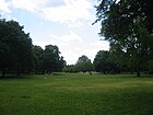
|
| Reuterpark
( Location ) |
6,650 m² | at Reuterplatz | The green space on Reuterplatz is officially named separately. |

|
|
| Richard Park
( Location ) |
1,700 m² | on Richardstrasse | The eastern green area in the Richardplatz area is officially managed as a park. |

|
|
| Rübelandpark
( Location ) |
6,580 m² | Rübelandstrasse | The Rübelandpark is the green area between Thomashöhe and Körnerpark, bounded by Thomas-, Rübeland-, Jonas- and Selkestrasse. However, the developed properties at Selkestrasse 5 and Thomasstrasse 27–31 are not included. The park itself is designated as property on Thomasstrasse 23. The park path below the surrounding street level along Jonasstraße separates the Körnerpark from the Rübelandpark to the south. |

|
|
|
Neukölln Stadium Park
( Location ) |
102,050 m² | Sports stadiums | The area officially run as the 'Stadium Park ' is also known as the Werner-Seelenbinder-Sportpark . It is located west of Oderstrasse on the edge of the district north of the railway line. The Neukölln stadium, the ice rink, a multi-purpose sports hall and the Werner Seelenbinder memorial are located here. |

|
|
|
Thomashöhe
( Location ) |
24,267 m² | Elevation on Thomasstrasse | This park is located east of the St. Thomas Kirchhof in the corner of Mittelweg and Thomasstraße, the former forming the boundary to Lessinghöhe and the latter to the Rübelandpark. To the east, on Karl-Marx-Strasse, is a playground. The height is above street level and, like the Lessinghöhe, is a mountain of rubble from the 1950s. |
|
|
| Trusepark
( Location ) |
9,766 m² | at the Truseweg | The Trusepark is the green area between Roseggerstrasse, Werrastrasse, Truseweg and Weigandufer, the latter located on the Neukölln shipping canal , including the playground in the northeast. |

|
|
|
Volkspark Hasenheide
( Location ) |
1650 × 630 | Use of the site from 1678 as a rabbit enclosure | 1678 | The approximately 50 hectare park is located on the border with the Kreuzberg district . In 1936, on the occasion of the Olympic Games, a renovation was carried out in which the old shooting range, which was previously part of the Tempelhofer Feld parade ground , was integrated into the park. |

|
|
Von-der-Schulenburg-Park
( Location ) |
320 × 170 | Rudolf Wilhelm Graf von der Schulenburg (Chief President of the Province of Brandenburg from 1914 to 1917) from the Schulenburg family | 1913 | The garden monument is located in the southern part of Sonnenallee . In addition to an avenue of plane trees, meadows and a long water basin (also called "mirror basin") there is a fairytale fountain in the park . |
|
| Vistula Park
( Location ) |
12,688 m² | on the Vistula Square | The green surface is situated on the triangular surface of the Vistula space between Weichselstraße, Weigandufer and the Neuköllner Schiffahrtskanal southeast of the Lohmühlenbrücke, except the land Weigandufer 10. On the northeast side is a section of the wheel and trail "Inner Park ring" with the way point 18 in the system of 20 main green paths . |
|
|
| Wildenbruchpark
( Location ) |
15,397 m² | on the Wildenbruchplatz | The park is the green area on Wildenbruchplatz including the playground on the southeast side. It is located between Innstrasse, the access road to properties 1–10, Wildenbruchstrasse and Weigandufer on the Neukölln shipping canal between Elsensteig and Wildenbruchbrücke . |
|
See also
- List of cultural monuments in Berlin-Neukölln
- List of stumbling blocks in Berlin-Neukölln
- List of natural monuments in the Neukölln district
Web links
- Street directory Neukölln. kaupert media gmbh, accessed on October 30, 2010 .
- Office for Statistics Berlin-Brandenburg: Directory of streets and places in the Neukölln district (as of February 2015); pdf
- Stumbling blocks - remembrance in Neukölln
Individual evidence
- ↑ FIS Broker Detail Network (regional reference system)
- ↑ a b c d e f g h i Clarification of the situation on the map 1: 5000, produced by the district surveying offices (Senate Department for Urban Development and the Environment)
- ↑ Platz der Stadt Hof is being extensively renovated. In: Berliner Morgenpost , August 14, 2012; Retrieved October 2, 2013
- ^ Neukölln in Berliner Zeitung , October 2, 2013; Retrieved October 2, 2013
- ↑ alfred-scholz-platz.de
- ^ At the Oberhafen, Berlin-Neukölln: Neukölln lock, Teltow Canal, Oberhafen
- ↑ Sackführerdamm . In: Address book for Berlin and its suburbs , 1901, Part V, p. 184.
- ↑ a b Leo-Arons-Straße (included for the first time) . In: Berliner Adreßbuch , 1928, Part IV, p. 1830.
- ↑ a b c d e supplement> Rixdorf> Bambachstrasse . In: Berliner Adreßbuch , 1908, Part V> Addendum 1908, p. 109.
- ↑ Waßmannsdorfer Straße on luise-berlin.de
- ↑ No more refuge. In: Berliner Zeitung , July 19, 2007
- ↑ How a wall escape with a bow and arrow succeeded. In: Die Welt , March 31, 2008
- ^ Administrative district Neukölln> Neukölln> Directory of streets with all houses and Construction sites along with details of the owner, manager, etc. Tenant . In: Berliner Adreßbuch , 1925, Part IV, p. 1679.
- ^ Neukölln> Directory of the streets with all the houses and building sites together with details of the owners, administrators and tenants . In: Berliner Adreßbuch , 1921, Part V, p. 724.
- ↑ Address search on the FIS broker card 1: 5000 (color edition), produced by the district surveying offices
- ↑ a b Neukölln around June 1921 on the Pharus Plan Berlin (large edition with suburbs) ( page no longer available , search in web archives ) Info: The link was automatically marked as defective. Please check the link according to the instructions and then remove this notice.
- ↑ a b Neukölln around 1926 on the Berlin Sanwald Plan (publisher: Karl Sanwald / Pasing vor München) ( Memento of the original from December 5, 2015 in the Internet Archive ) Info: The archive link was automatically inserted and not yet checked. Please check the original and archive link according to the instructions and then remove this notice.
- ↑ Drorystraße with an explanation of the namesake . In: Berliner Adreßbuch , 1940, Part IV, p. 1903.
- ↑ Address search in the RBS database for the map 1: 5000, produced by the district surveying offices.
- ^ Urban redevelopment east and west: Schwarzer Weg
- ↑ The name was assigned before 1897, as this street was already included in the 1897 address book: at > Emserstraße . In: Address book for Berlin and its suburbs , 1897, part V, p. 132., differently than given by Kauperts with '1899'.
- ↑ Wolfgang Kramer: Depots of the Berlin horse railways . In: Berliner Verkehrsblätter . Volume 6, 1995, pp. 100 .
- ↑ Erkstrasse . In: Berliner Adreßbuch , 1881, Appendix, H., P. 91.
- ↑ Homepage district management Flughafenstrasse
- ↑ Garden culture path in Neukölln, Köllnische Heide, Von-der-Schulenburg-Park, high-deck housing estate, Volksgarten
- ↑ Ganghoferstrasse, Berlin-Neukölln
- ^ Britzer Hafen, Neukölln shipping canal, Neukölln motorway triangle
- ↑ Straße 12> Swimming clubs . In: Berliner Adreßbuch , 1938, Part IV, p. 1960.
- ↑ Ulrich Paul: On field and corridor. Where Berlin is growing: The Senate is planning eleven new residential areas. The Berliners should have a say. In: Berliner Zeitung (print edition), May 29, 2018, p. 14.
- ^ KEH website with a short chronicle , accessed on January 30th
- ↑ Name addition Jonas from the Berlin address book 1940
- ^ Website of the Berlin Senate Administration with a picture and explanation of the fountain on Karl-Marx-Platz in Neukölln
- ^ Black Channel website , accessed September 4, 2012
- ↑ Kirchgasse, Berlin-Neukölln Bohemian Village
- ↑ a b c d 20 main green paths - Innerer Parkring
- ^ Official Journal of Berlin , Volume 66, Issue No. 4, January 29, 2016, ISSN 0943-9064, p. 199 f.
- ↑ Green coating - Lahnstrasse. Retrieved April 25, 2019 .
- ↑ a b Name given to Lohmühlenplatz from the 1905 address book addendum
- ↑ Map of the territorial exchange in 1988 ( Memento of the original from March 4, 2016 in the Internet Archive ) Info: The archive link was inserted automatically and has not yet been checked. Please check the original and archive link according to the instructions and then remove this notice. (PDF; 3.8 MB)
- ↑ Invitation to public participation: Redesign of Lohmühlenplatz / Weichselplatz , press release of the BA Neukölln of November 28, 2012 on the planned improvement of the quality of stay at Lohmühlenplatz and Weichselplatz; Retrieved January 22, 2013
- ↑ The Mainzer Strasse was already listed in the address book in 1897, cf. Rixdorf> Mainzerstrasse . In: Address book for Berlin and its suburbs , 1897, Part V, p. 138 ..
- ↑ The 30 most amazing Berlin streets. Broadcast by the rbb in 2010.
- ↑ Karin Schmidl, Elmar Schütze: When the cinema next door rolls out the red carpet. In: Berliner Zeitung , February 8, 2016, p. 12.
- ↑ address search or road in the RBS database
- ↑ Map of Berlin 1: 5000 (K5 color edition) produced by the district surveying offices
- ↑ Photos of the Oderstrasse
- ↑ Karin Schmidl: Construction trailers instead of building savings. In: Berliner Zeitung , August 31, 2012; P. 16
- ↑ Task Force for Neukölln Okerstraße reports success . In Berliner Morgenpost
- ↑ The Task Force Okerstrasse resisting. Employees see themselves threatened by left-wing autonomists . In berlinonline.de
- ↑ Night boxes for Roma boys at risk . In Der Tagesspiegel , March 11, 2010
- ^ The Pflügerstrasse appears for the first time in the Berlin address book of 1902.
- ^ Richardplatz, Berlin-Neukölln, Alte Schmiede
- ↑ Richard Street-Berlin-Neukoelln Bohemian Village Comenius Garden
- ^ Neukölln> Ringbahnstraße> street picture Hermannstraße . In: Berliner Adreßbuch , 1926, Part IV, p. 1760.
- ^ Address book of Berlin 1849
- ↑ The year of the naming of Rübelandstrasse had to be corrected compared to the information provided by Kauperts; it is only mentioned in an addendum from 1910.
- ^ Residents of Berlin and its suburbs> Zeiske, Otto; Architect and building officer . In: Berliner Adreßbuch , 1910, Part I, p. 3195.
- ↑ Architectural monument residential building and shop in Oranienstrasse
- ↑ HU Berlin e-book on the history of Brandenburg (PDF file; 20.3 MB)
- ↑ Goddess in a jogging suit . In: Der Tagesspiegel , August 20, 2010.
- ↑ Lazarusstrasse . In: Berliner Adreßbuch , 1884, Appendix, p. 95.
- ↑ Schönweiderstraße, Haase'sches Haus . In: Berliner Adreßbuch , 1885, Appendix, H., p. 84.
- ↑ Neukölln> Sights . In: Berliner Adreßbuch , 1935, Part IV, p. 329.
- ^ Rixdorf> Siegfriedstrasse . In: New address book for Berlin and its suburbs , 1896, part V, p. 211.
- ↑ Silbersteinstraße 97, Kulturamt Neukölln ( Memento from June 16, 2013 in the Internet Archive )
- ↑ a b Braunauer Strasse> street scene . In: Berliner Adreßbuch , 1939, Part IV, p. 410.
- ^ Rixdorf> Straße 88 with the note "New construction of the municipal gas works" . In: Berliner Adreßbuch , 1903, Part V, p. 219.
- ^ Rixdorf> Straße 88a . In: Berliner Adreßbuch , 1893, Part V, I., p. 148.
- ↑ Uthmannstrasse-12043-Berlin-Neukoelln
- ↑ Green coating - Werbellinstrasse. Retrieved April 25, 2019 .
- ↑ Weserstraße is now Fahrradstraße. In: BERLINER ABENDBLATT. September 27, 2017, accessed on March 17, 2019 (German).
- ↑ Wissmannstrasse-12049-Berlin-Neukoelln
- ^ Rixdorf . In: Berliner Adreßbuch , 1878, Part V, p. 75.
- ^ Neukölln administrative district> Neukölln . In: Berliner Adreßbuch , 1943, Part IV, p. 1892.
- ↑ a b Taboriten- and Kotzemarkenweg on luise-berlin.de
- ^ Neukölln> Straße Am Kabelwerk . In: Berliner Adreßbuch , 1917, Part V, p. 774.
- ^ Street, Am Kabelwerk 'on luise-berlin.de .
- ↑ a b city map of Berlin 1893 ( page no longer available , search in web archives ) Info: The link was automatically marked as defective. Please check the link according to the instructions and then remove this notice. : Berliner Straße top left, Bergstraße from town hall then downwards
- ↑ Bergstrasse> course of the road . In: Berliner Adreßbuch , 1926, Part IV, p. 1736.
- ↑ a b c Rixdorf with sights . In: Berliner Adreßbuch , 1908, Part V, p. 329.
- ^ Rixdorf> Bohnenstrasse see course of Berliner Strasse, between 1555 and 156 . In: Berliner Adreßbuch , 1878, Part V, p. 77.
- ↑ Goethestrasse in Neukölln on luise-berlin.de Goethestrasse> ("renamed Langnerweg at the time of printing") . In: Berliner Adreßbuch , 1939, Part IV, p. 1919 .; without name origin
- ↑ Explanation of the name at berlingeschichte.de (luise-berlin)
- ↑ The Hohenzollernplatz is already in the address book in 1901.
- ↑ Kaiserstraße on berlingeschichte.de
- ↑ Köllnische Allee on berlingeschichte.de (luise-berlin)
- ↑ Neukölln> (see Berlin)> Köllnisches Ufer with the course shown and all cross streets . In: Berliner Adreßbuch , 1919, Part III, p. 412.
- ^ Rixdorf> Münchener Strasse . In: Address book for Berlin and its suburbs , 1898, Part V, p. 146.
- ↑ The renaming was determined by comparing the location of the St. Clara Chapel: 1880 under Prinz Handjerystraße 71 , today: Briesestraße 15.
- ^ Richardstrasse 35> SS-Sturm , 75/1; right column above . In: Berliner Adreßbuch , 1940, Part IV, p. 1977.
- ^ Riedebecker Straße with the origin of the name . In: Berliner Adreßbuch , 1943, Part IV, p. 1988.
- ↑ Explanation from Detailed description of the art of millers, pasta makers and bakers (authors: Paul J. Malouin, Daniel Gottfried Schreber; 1769) on books.google.de
- ↑ Sackführerdamm on luise-berlin.de
- ↑ Map of Berlin 1926 ( Memento of the original from January 25, 2016 in the Internet Archive ) Info: The archive link was inserted automatically and has not yet been checked. Please check the original and archive link according to the instructions and then remove this notice. : Star place and star road as well as sun place and comet place drawn
- ↑ Sternenallee on luise-berlin.de
- ^ Rixdorf> Waßmannsdorfer Straße . In: Berliner Adreßbuch , 1895, Part V, p. 179.
- ↑ luise-berlin.de : Enter "Waßmannsdorfer Straße" in the search window.
- ^ Waßmannsdorfer Straße (example of the renumbering of the parcels) . In: Berliner Adreßbuch , 1921, Part V, p. 809.
- ^ Map of Berlin. Pierer's Conversations Lexicon, 6th edition, Treptow around 1875 ( page no longer available , search in web archives ) Info: The link was automatically marked as defective. Please check the link according to the instructions and then remove this notice.
- ↑ Allotment gardens in the Neukölln district ( Memento of the original from September 24, 2015 in the Internet Archive ) Info: The archive link was inserted automatically and has not yet been checked. Please check the original and archive link according to the instructions and then remove this notice. (PDF; 28 kB)
- ↑ Senate Department for Urban Development (Dept. I Urban and Open Space Planning): Allotment Garden Development Plan Berlin (KGEP) ( Memento of the original from March 19, 2013 in the Internet Archive ) Info: The archive link was inserted automatically and has not yet been checked. Please check the original and archive link according to the instructions and then remove this notice. (PDF; 465 kB)
- ↑ a b c d Level II: Fictitious permanent allotment gardens, their areas for transport, social or technical projects
- ↑ a b c d e f g h i j k l m Fictitious permanent allotment gardens * according to Sections 16 and 20a of the Federal Allotment Garden Act. The fictitious permanent allotment gardens are additionally protected by being shown in the zoning plan as green areas - allotments.
- ↑ a b c d e f g h i j k l m Fictitious permanent allotment gardens which, according to the representations of the land use plan, are to be used for another purpose. This can also include allotment garden areas below three hectares for which development plans to secure them as permanent allotment gardens have been prepared but have not yet been decided.
- ↑ a b c d e f Allotment garden areas that should be retained according to the presentation of the zoning plan.
- ↑ Birgitt Etzel: Allotment gardeners got new parcels in the Berliner Zeitung of June 7, 1994
- ↑ a b Level I b: Allotment gardens on areas owned by Deutsche Bahn AG that are leased to the railway farm. These are smaller groups of gardens that are close to railway tracks.
- ↑ Level V a: allotment garden areas that are defined as permanent allotment gardens by the development plan.
- ↑ Over and over! ( Memento from August 14, 2013 in the Internet Archive )
- ↑ Clarification of the situation on the map of Berlin 1: 5000, produced by the district surveying offices
- ↑ Description of the interior Parkring


