
Schwarza (Saale)
.png)

The Schwarza is about 53 kilometers long, left tributary of the Saale in Thuringia in Germany . It was the river landscape of 2006/2007.
source
The river has its source near Scheibe-Alsbach , 250 meters northwest of the Rennsteig , at an altitude of 717 m above sea level. NN . The water of the Schwarza spring rises from a great depth at a crack between red sandstone and slate with a constant temperature of 6 degrees Celsius to the daylight. It was framed in 1855.
course
Embedded in a varied low mountain range, the Schwarza flows from its source through narrow gorges and wide valleys to the confluence with the Saale in the Rudolstadt district of Schwarza.
The Schwarza receives 57 tributaries in its course, of which the Lichte , Sorbitz , Werre and Rinne are the most abundant in water. A geological peculiarity are their vortex pots ( pools ) in the lower Schwarzatal. The Schwarza is also the gold-richest river in Germany.
The Schwarza is dammed in the Scheiben-Alsbach dam.
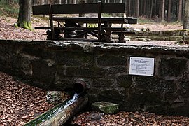
Source near Scheibe-Alsbach

Salus Intrantibus! - The welcome at the entrance to the Schwarzatal near Bad Blankenburg

listed Chrysoprase weir in the Schwarzatal, Bad Blankenburg


Naming
The Schwarza (black river) got its name from the black-brown color of its dark soil in the upper reaches or from the shading of its banks by the originally very dense and almost impenetrable vegetation in the narrow Schwarzatal. The name of the Schwarzburg and the associated noble family was derived from the river.
economy
Sustainable settlement of the Schwarza area took place relatively late and was initially based on the search for ore deposits. In earlier times there was mining and important iron processing on the banks of the Schwarza. Gold , silver and copper were coveted metals that were extracted in mining and in soap works. Many mills , stamp mills , iron and sheet metal hammers were in operation.
In addition to mining, attention was paid to the abundance of wood. The Harzers and Pecher lived from the resin extraction and the Pechsiederei and in sawmills firs, spruces, beeches and oaks were cut into beams, planks and boards. There were also a large number of box makers and clapper splitters. The forest also nourished the bird setters, kustelsteiger and cone pickers, the timber carters and raftsmen . Shepherds and shepherds grazed their flocks on the cleared areas and meadows, while the cattle farmers were dependent on the forest pasture . Numerous coal piles and glassworks are still detectable in the area. The last kiln in the Schwarzatal was still in operation around 1950 on the Pocher bridge below Sitzendorf . Since the late 18th century, with the introduction of the first porcelain manufacturers, an important line of business was found for the Schwarzatal.
In addition to the natural beauties of the valley, tourism is also based on the technical sights available here ( Oberweißbacher Bergbahn , Schwarzatalbahn ).
particularities
natural reserve
The lower Schwarzatal is considered to be one of the most beautiful river valleys in the Thuringian Forest or the Thuringian Slate Mountains . The still near-natural habitat has numerous steep slope sections and has retained its torrent character. In the cool, damp gorge forest you can find numerous rare animals and plants ( kingfisher , dipper ).

Hydrology
Two major hydraulic engineering projects were built in the upper reaches of the Schwarza and Lichte rivers: the Goldisthal pumped storage plant is located in the main course of the Schwarza, and the Leibis-Lichte drinking water reservoir is located in the course of the Lichte tributary .
The black gold
The gold was found in the river itself or on the three adjoining diluvial river terraces (near Sitzendorf ) - the first at around 30 meters, the second at around 60 meters and the third at around 120 meters above the at around 300 m above sea level. NN lying valley floodplain of the Schwarza - washed out of the gravel. The mining of gold ores from the quartz veins in the rock of the Schwarzatal was seldom done, as the construction of tunnels and pits in the hard rock turned out to be very costly and veins worth mining were not discovered in large numbers. In the heyday of gold mining, which was in the 16th century , the total yield is said to have amounted to four tons of pure gold. If you consider the gold content per ton of overburden, the Schwarzatal could definitely keep up with the gold fields of South Africa. So-called river gold ducats were minted from the gold of the Schwarza, but they do not have the usual reference to river gold.
Individual evidence
- ^ Thuringian State Institute for the Environment (ed.): Area and waterway key figures (directory and map). Jena 1998. 26 pp.
- ^ German Hydrological Yearbook Elbe Region, Part I 2014. (PDF) State Office for Flood Protection and Water Management Saxony-Anhalt, p. 165 , accessed on November 3, 2018 (from: lhw.sachsen-anhalt.de).
- ↑ a b Map of the rivers of Thuringia from 10 km² catchment area ( TLUG ; PDF; 1.23 MB)
- ↑ Andrea Diener : In the river gold and trout, otherwise rather poor. The Schwarzatal has been in the heart of Germany since the fall of the Berlin Wall. In: Frankfurter Allgemeine Zeitung . November 6, 2014, pp. R1 and R3, here p. R1 , accessed on December 28, 2017 .
- ↑ Elfriede Ulbricht: The river basin of the Thuringian Saale . 1st edition. Max Niemeyer, Halle (Saale) 1957.
literature
- Horst H. Müller (Hrsg.): Travel guide Thuringian Forest and peripheral areas . Tourist Verlag, Berlin / Leipzig 1977, ISBN 3-350-00263-3 .
