Nice (Middle Rhine)
| Nice | ||
|
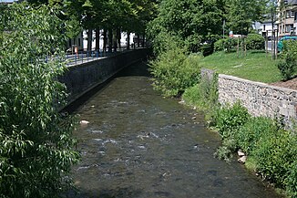
The nice one in Mayen |
||
| Data | ||
| Water code | EN : 2714 | |
| location | Eifel , Rhineland-Palatinate , Germany | |
| River system | Rhine | |
| Drain over | Rhine → North Sea | |
| source | At Hohenleimbach 50 ° 26 ′ 1 ″ N , 7 ° 5 ′ 24 ″ E |
|
| Source height | approx. 562 m above sea level NHN | |
| muzzle | At Weißenthurm in the Rhine Coordinates: 50 ° 25 ′ 42 " N , 7 ° 26 ′ 56" E 50 ° 25 ′ 42 " N , 7 ° 26 ′ 56" E |
|
| Mouth height | approx. 59 m above sea level NHN | |
| Height difference | approx. 503 m | |
| Bottom slope | approx. 8.5 ‰ | |
| length | 59.1 km | |
| Catchment area | 372.398 km² | |
| Discharge at the Nettegut A Eo gauge: 368.7 km² |
NNQ (August 6, 1945) MNQ MQ Mq MHQ HHQ (May 31, 1984) |
243 l / s 716 l / s 2.31 m³ / s 6.3 l / (s km²) 19 m³ / s 52.4 m³ / s |
| Communities | See list | |
|
Course of the Nice |
||
|
Nice (upper course) north of Lederbach |
||
The Nette is a 59.1 km long orographically left tributary of the Rhine in Rhineland-Palatinate .
geography
course
The Nette rises in Hohenleimbach , flows through the districts of Ahrweiler and Mayen-Koblenz , before flowing into the Rhine at Weißenthurm . The upper course in the Eifel above Mayen runs in a partly winding low mountain valley. At the confluence of the Nitzbach coming from the right with the villages Virneburg and Nitz is the Bürresheim Castle . In the middle part, the Nette flows in a winding Kerbsohlental through arable plateaus, separating the Pellenz in the north from the Maifeld in the south.
Tributaries
The main tributaries (downstream) are Selbach, Weiberner Bach, Arfter Bach, Rehbach, Kümperbach and Nitzbach.
economy
In Mayen , the stream supplied the local paper industry with energy and water. The names of the Nette-Pils beer originally brewed in Weißenthurm (now in Koblenz) , the Nette-Gut clinic near Weißenthurm and the local Nette newspaper that appeared in the 1980s refer to him .
nature
At the moment, sections of the river bed with a technical character are being demolished close to nature. Above Mayen, the Nette is a popular fishing spot. Two pairs of eagle owls breed on their steep slopes between Welling and Ochtendung .
In March 2008, Nice was by nature lovers for River Landscape of the Year proclaimed 2008/2009. They provide an "impressive, naturally romantic picture," said the chairman of the association, Michael Müller .
Places on the Nette
The Nette flows from its source to the mouth through the following places:
- Hohenleimbach , Lederbach district
- Arft , district of Netterhöfe
- Riedener mills
- Bürresheim
- Mayen
- Trimbs
- Welling
- Polch , district of Ruitsch
- Attention
- Plaidt
- Saffig
- Andernach , district of Miesenheim
- Weißenthurm
Web links
- Günter Ermlich: A nice encounter. Soon even with Delta: from the Vulkaneifel to the Rhine, the river of the year ripples . In: Die Zeit , No. 25/2008, p. 67
Individual evidence
- ↑ a b Topographic map 1: 25,000
- ↑ a b Rhineland Water Management Administration
- ↑ Measurement data: level Nettegut / waters: Nette


