River landscape of the year
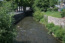
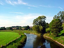
River landscape of the year , sometimes also called river of the year , is an award given every two years since 2000 for a river landscape in Germany and at the same time a warning by the NaturFreunde Deutschlands and the German Anglers Association to raise awareness of the issues of environmental protection and encourage the authorities to intervene.
Award practice
Together with the Federal Environment Ministry , the river landscape of the year is determined at the request of the Friends of Nature in Germany and the German Angler Association . For the respective selection of the river landscape, the two associations have set up a joint aquatic ecology advisory board , which is also responsible for the planning and implementation of the respective program, which is also discussed with the local authorities.
The nomination for river landscape of the year is traditionally made on March 22nd, World Water Day .
aims
The aim of the project is to win the population for the natural and cultural beauties of a river landscape through events, campaigns and information material and to educate them about the threats - above all from an unnatural expansion of the river.
Previous river landscapes of the year
| year | flow | Illustration | description |
|---|---|---|---|
| 2000/2001 | Gottleuba | The Gottleuba is a left tributary of the Elbe in the Czech Republic and Germany . The headwaters of the Gottleuba that in the comb area of the Bohemian part of the eastern Erz Mountains , south of the Czech village Schoenwald ( Krásný Les v Krušných horách ) spring and this drain to the north are the more easterly Rybný Potok (Fischbach) and the more western source river, paradoxically Schönwalder Bach called . Above Bad Gottleuba , it is dammed in the Gottleuba dam (14 million m³). In the further course it flows through the town centers of Bad Gottleuba and Berggießhübels in a V-shaped valley and flows into the Elbe in Pirna after it has absorbed the Seidewitz . | |
| 2002/2003 | Ilz | The Ilz (in the upper reaches also Schönberger Ohe ) is a left tributary of the Danube in the Bavarian Forest . It rises on the German side in the Bavarian-Bohemian border area in the Bavarian Forest National Park . Its source rivers Kleine Ohe (Grafenauer Ohe) , Große Ohe and Mitternacher Ohe come from the region between the mountains Rachel (1,453 m) and Lusen (1,373 m). These unite at the Ettlmühle not far from the village of Eberhardsreuth in the municipality of Schönberg . The Ilz flows into the Danube in Passau , just a little above the mouth of the Inn opposite. Almost its entire length has been largely preserved close to nature. | |
| 2004/2005 | Havel | The Havel [ ˈhaːfl̩ ] is a flowing body of water in northeast Germany and, with a length of 334 kilometers, it is the longest right-hand tributary of the Elbe . The direct distance between the source and the mouth is only 94 kilometers. The Havel rises in Mecklenburg-Western Pomerania , flows through Brandenburg , Berlin and Saxony-Anhalt and flows into the Elbe on the border between Brandenburg and Saxony-Anhalt. It flows first through numerous small lakes to the south, then to the west and finally to the north-west. The difference in height is only 40.6 meters. With an average of 108 cubic meters per second (m³ / s), the Havel has the third largest amount of water among the tributaries of the Elbe, after Moldau (150 m³ / s) and Saale (115 m³ / s). | |
| 2006/2007 | Schwarza | The Schwarza is about 53 kilometers long, left tributary of the Saale in Thuringia . It rises near Scheibe-Alsbach , 250 m northwest of the Rennsteig , at an altitude of 717 m. The water of the Schwarza spring rises from a great depth at a crack between red sandstone and slate with a constant temperature of 6 degrees Celsius to the daylight. It was framed in 1855. Embedded in a varied low mountain range, the Schwarza flows from its source through narrow gorges and wide valleys to the confluence with the Saale in the Rudolstadt district of Schwarza. | |
| 2008/2009 | Nice | The Nette is a 59.1 km long orographically left tributary of the Rhine in Rhineland-Palatinate . It rises in Hohenleimbach , flows through the districts of Ahrweiler and Mayen-Koblenz , before it flows into the Rhine at Weißenthurm . Especially in the upper course, before Mayen , it flows through a mountain landscape. At the mouth of the Nitzbach , an orographically right tributary of the Virneburg and Nitz , is the Bürresheim Castle . In the middle part, the Nette flows through the Pellenz and separates it from the Maifeld to the south . | |
| 2010/2011 | Emscher | The Emscher ( Low German Iämscher ) is an 83.1 kilometer long right tributary of the Rhine . It rises at Holzwickede on the Haarstrang at about 147 m above sea level. NN in a spring pond. Strictly speaking, there are several smaller rivulets from which the Emscher rises, which flow into the said source pond. In its upper reaches, the Emscher flows through the southeast of Dortmund and then turns to the northwest. In the northern Castrop-Rauxel it crosses under the Rhine-Herne Canal in a culvert structure with three concrete tubes. It then flows almost continuously parallel to this canal in a westerly direction as far as Oberhausen . In Oberhausen the river bends to the northwest and then flows to its current confluence with the Rhine near Dinslaken - Eppinghoven . There their flow rate has increased to an average of 16 m³ / s. | |
| 2012/2013 | Helmets | The Helme is an approximately 81 km long, left and western tributary of the Unstrut in Thuringia and Saxony-Anhalt . It rises south of the Harz in the Eichsfeld district near Stöckey . Its source lies in the northern foothills of Ohm Hills between White-Lüderode and Stöckey the "helmet Spring". The Helme flows eastward over the communities Hohenstein and Werther to Nordhausen . In the case of herrings , the flowing water absorbs the water from the Zorge coming from the Harz Mountains . To the north-west of the Kyffhäuser Mountains, it is dammed up in the Golden Aue by the Kelbra dam to form a reservoir and flood retention basin. From there the Helme - now in Saxony-Anhalt - flows further east via Roßla in the direction of Allstedt , after which it turns south and reaches Thuringia again. In Kalbsrieth , southeast of Artern , she joins the Unstrut. | |
| 2014/2015 | Bad | The Argen is a river that flows into Lake Constance between Kressbronn and Langenargen with an average water flow of around 20 m³ / s, making it a tributary of the Rhine . The Argen arises from the Allgäu source rivers Obere Argen and Untere Argen and has a total length of 94.3 kilometers with the latter. After the confluence at the Wangen district of Neuravensburg , the Argen still covers a distance of 23.4 kilometers. The picture shows the steep bank of the Argen north of the Kressbronn district of Gießenbrücke . |
|
| 2016/2017 | Trave | The Trave (Latin Travena or Ptolemaic Chalusus Fluvius ) is a 124 km long river in Schleswig-Holstein that flows into the Baltic Sea. | |
| 2018/2019 | lip | The Lippe is a 220 km long right tributary of the Rhine in North Rhine-Westphalia with a catchment area of 4,889.9 km². | |
| 2020/2021 | White magpie | The White Elster (Bílý Halštrov in Czech) is a 257 kilometer long river that has its source in the Czech Republic , connects the federal states of Saxony , Thuringia and Saxony-Anhalt and finally flows into the Saale near Halle . It is considered the most important river in Central Germany, more than 1.5 million people live in the 5,300 square kilometer catchment area. |
Web links
- Information at www.flusslandschaft.naturfreunde.de , accessed on January 27, 2014
Individual evidence
- ↑ BayernViewer of the Bavarian Surveying Administration ( Memento of the original from September 27, 2013 in the Internet Archive ) Info: The archive link was inserted automatically and has not yet been checked. Please check the original and archive link according to the instructions and then remove this notice.
- ↑ Article " The river landscape of the year is the Argen " in Schwäbischer Zeitung from September 25, 2013 (tet07st4_25_Sep_SV)
- ^ Charles Maty, Michel-Antoine Baudrand: Dictionnaire geographique universel , 1750


