List of streets and squares in Berlin-Blankenfelde

The list of streets and squares in Berlin-Blankenfelde describes the street system in the Berlin district of Blankenfelde ( Pankow district ) with the corresponding historical references. At the same time, this compilation is part of the lists of all Berlin streets and places .
overview
The district of Blankenfelde has 2,064 inhabitants (as of December 30, 2019) and, according to the official street directory, 25 dedicated streets, six of which partly cross the district boundary. The district of Blankenfelde includes the zip code areas 13159 and 13127 (across from the neighboring district). The public road network (city and federal roads) in the district is 30.4 kilometers, including the roads and private roads that were renamed in 2011 (but excluding non-dedicated routes in colonies). For the entire district of Pankow (with its 13 districts) the total length of all roads is given as 604.7 kilometers. In addition to the Steglitz-Zehlendorf district (635.4 km) and the Treptow-Köpenick district (628.1 km), the Pankow district has one of the largest road systems in the capital. The street length in the district is 65% in the other Pankow districts, which is due to the wide green and forest areas, and the Blankenfeld streets also have the character of a settlement. In the district, the Pankow motorway feeder (from the early 1970s) with 1590 meters of the main lane belongs to the spacious and 1030 meters of the AS Schönerlinder Straße entry / exit to the superordinate system of the Berlin road development plan .
The village of Blankenfelde had several connecting routes to the neighboring villages. After the Rieselfelder around the place had been expanded since 1873 , it was not a suitable place for the settlement of Berlin citizens from the imperial capital, as this led to the development of a differentiated road system in other locations around 1900. The suburban settlement of Blankenfelde south of Schildow was rebuilt after the inflation with roads after agricultural equipment or products, such as cucumber or fork path. The streets of the opposite "Schildow Waldeck settlement" west of Schildower Straße have names according to local conditions, such as Heidekrautbahnring or Köppchenseeweg and are also officially listed as private roads (except for Lübarser Weg, which is identical to the Wall Trail ). Another settlement area in the district is Arkenberge .
The place Blankenfelde is a street village in an east-west direction and thus, like all villages in the north and south of Berlin, transversely to the direction of the Berlin arterial roads . The connecting road from Berlin to Oranienburg became a long-distance road to the north from Berlin . Berliner Straße met Dorfstraße (now Hauptstraße ) east of the village center and left it west of the church on Schildower Straße (Alte Schildower Straße). When the Wall was built , the (more important) federal road 96 to Oranienburg (formerly: F 96) , which ran through Reinickendorf in West Berlin , was no longer available . With the connection to the newly established Rostock autobahn in the 1970s, traffic increased via the F 96a from Pankow through Blankenfelde. An asphalt road with two lanes in each direction of travel was laid through the town center, which now crosses the main road east of the village church. The new course (today: Bundesstraße 96a ) was given the name Blankenfelder Chaussee south of the town center and the name Schildower Straße was adopted to the north. The houses on the main road between Blankenfelde and Schildow to the west of the church are now on Alte Schildower Straße , which became a dead end and, for example, the restaurant “Blaue Ente” came next to the main street . The former Berliner Straße from the north of Berlin ( Pankow and Niederschönhausen ) to Blankenburg is now a side street (one-way street) on the eastern side of the district. With the new buildings in French Buchholz (also to Reinickendorf and Lübars ), traffic is increasing in the east-west direction via this Berliner Straße and the subsequent Buchholzer Straße . This route was renovated in the 2010s.
After the discontinuation of the sewage fields around Blankenfelde (Blankenfelde landscape protection area), the location became more attractive and residential building in colonies and allotment gardens increased, the "uses" according to the zoning plan were changed in the early 2000s. Consequently, in 2011 the Pankow district dedicated seven streets in the Schildow-Waldeck facility and eleven streets in the Frohsinn settlement along the existing garden / colony paths. These 18 streets are the newest streets in the district, but their naming and dedication was caused by the nationwide georeferencing.
The connection in east-west direction was once on the route of the Bernauer Heerstraße between Spandau and Bernau , after which a street in Lübars (formerly Wittenauer Straße ) up to Blankenfelde is still named. The continuous connection to the main road existed until the wall was built. The route merged into the main street and crossed (albeit unnamed) the district on the southern edge of the Arkenberge landfill. The Bahnhofstraße with the connection to the main street at Mönchsmühler Straße as “Blankenfelder Chaussee” from Lübars (and Spandau) is today the connection from the district to the west. The construction of the wall interrupted the connection to Lübars and the connection in north-south direction through Blankenfelde became dominant for road traffic. With the start of the motorway construction to Rostock and the expansion of the former F 96a, the Blankenfelder Chaussee , which leads westwards, was renamed Bahnhofstraße from the outskirts . The trunk road from Berlin (today: B 96a) was renamed between the district boundary of Niederschönhausen and the core of the district to the (new) Blankenfelder Chaussee .
Overview of streets and squares
The following table gives an overview of the streets and squares in the district as well as some related information.
- Name / location : current name of the street or square. Via the link Location , the street or the square can be displayed on various map services. The geoposition indicates the approximate center of the street length.
- Traffic routes not listed in the official street directory are marked with * .
- Former or no longer valid street names are in italics . A separate list may be available for important former streets or historical street names.
-
Length / dimensions in meters:
The length information contained in the overview are rounded overview values that were determined in Google Earth using the local scale. They are used for comparison purposes and, if official values are known, are exchanged and marked separately.
For squares, the dimensions are given in the form a × b for rectangular systems and for (approximately) triangular systems as a × b × c with a as the longest side.
If the street continues into neighboring districts, the addition ' in the district ' indicates how long the street section within the district of this article is. - Name origin : origin or reference of the name.
- Notes : further information on adjacent monuments or institutions, the history of the street and historical names.
- Image : Photo of the street or an adjacent object.
| Name / location | Length / dimensions (in meters) |
Origin of name | Date of designation | Remarks | image |
|---|---|---|---|---|---|
|
Alsaceweg
( Location ) |
70 | Alsace is a landscape in France | March 31, 2011 | The narrow driveway ( traffic-calmed area ) lies in the former Frohsinn allotment garden between Rosenthaler Weg and Am Nordgraben and in a section in an extension of Am Nordgraben to the west, it turns again to Rosenthaler Weg. The choice of name is related to the neighboring French district of Buchholz . Plots 1–5 (odd) are assigned to the path, these are on the section from Am Nordgraben to the north and 6–8 (even) are on the section to the west in continuation of Am Nordgraben. |

|
| Alte Schildower Strasse
( Location ) |
400 | Schildow , northern neighboring town, direction of the street | March 15, 2005 | Schildower Strasse led from the main road (west of the church) to Schildow in the north. As a bypass of the B 96 , which was interrupted between Reinickendorf (West Berlin) and Oranienburg, the trunk road F 96a (today B 96a ) was set up in the GDR , which led through Blankenfelde. This street layout was laid directly through the town center and called Blankenfelder Chaussee. To the north of the town center, this new street was integrated into the existing Schildower Straße. With the new construction of the trunk road, the parallel section from the main road was separated from the northward section and became a dead end. “[That] repeatedly led to confusion among the police, fire brigade and suppliers. Truck drivers with large and long trucks who were unfamiliar with the area had no way of turning. They had to drive backwards to the main street at the level of the school and the kindergarten, which was a serious hazard for the children and also for the traffic on the main street. ”Therefore, the parallel street layout was renamed Alte Schildower Straße. |

|
| At the north ditch
( Location ) |
770 | Nordgraben is in the south of the street | 2012 | The street ( traffic-calmed area ) was run as street 19 . It lies between the former settlement of Frohsinn and the north ditch, which runs deep through a strip of trees south along the path and whose south bank is the boundary to the neighboring district of Rosenthal . After the signs, the so-called road begins on Alsaceweg, according to the map on Rosenthaler Weg. There are no properties assigned to the path and there are no entrances from this side, but all eleven paths of this settlement northwards to Rosenthaler Weg begin here. The continuation to the east over the local suburbs on Picardiestraße to French Buchholz is also called Am Nordgraben, but the name is not yet dedicated here. |

|
| At the sheepfold
( Location ) |
510 (private road) |
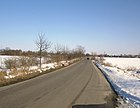
Sheepfold , years of shepherding Möller field and folklore Blankenfelde | after 1995 | The access road to the former Arkenberge garbage dump (today: rubble dump) is two-lane and paved. The street is marked on Schönerlinder Straße with the sign Privatstraße without an official street sign, the name is unofficial, but is used on current maps. The road bypasses the nearby junction of the federal highway 114 and is located from Schönerlinder Straße to the northwest. At the opposite point goes straight for a lockable unpaved track to the Möller field of prolonged, to the southwest Schillingweg as a footpath and the paved road to the right as landfill Bauernweg on. It should be noted that the district boundary to French Buchholz runs in the middle of the street. The street will be renamed Straße nach Arkenberge and will be included as a street with the Bauernweg between Schönerlinder Straße and building rubble dump at KGA Arkenberger Grund. |
|
| Argonnenweg
( Location ) |
390 | Argonne is a landscape in France | March 31, 2011 | The narrow driveway ( traffic-calmed area ) is in the former KGA Frohsinn between Rosenthaler Weg and Am Nordgraben, along the driveway along the Nordgraben . The settlement borders eastward on the French Buchholz district, which determines the name of the settlement routes. Plots 1–39 (odd) and 2–36 (even) are assigned to the path. The name of the KGA path was Gooseberry Path . |

|
|
Bahnhofstrasse
( Location ) |
760 (in the district) |
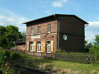
Blankenfelde station of the " Heidekrautbahn " | 1901 | The road initially led as an extension of the main road between Mönchmühler Straße and the stop of the Heidekrautbahn, which was built in the summer of 1898 and opened on May 21, 1901 . The further course of the street was called Wittenauer Straße (today in Lübars as Alter Bernauer Heerweg ). After 1961, behind the station after was Luebars further Blankenfelder road to the county line Reinickendorf (district boundary between Blankenfelde and Lübars and at this time of the Berlin Wall ) included in the Bahnhofstrasse. Due to the construction of the wall, it was no longer possible to use the road to Lübars since 1961. On the road is the closed Pankow VIII cemetery , the war cemetery of which was taken over by the Pankow III cemetery because of vandalism. The station at Bahnhofstrasse 10 is registered as a monument, completed in 1901, based on designs by Becker, Mirau and Steinfeld. In the address book of 1922 Bahnhofstrasse between Hauptstrasse and Lübars district is noted, on the southern side is the property of the estate administration (owned by the City of Berlin), followed by the Rieselfelder (today: the Blankenfelde landscape protection area) on both sides of the railway track. On the north side lies the manor barracks, followed by Rieselfeldern (today: the Blankenfelde landscape protection area around the Zingergraben), the Blankenfelde station of the Reinickendorf = Liebenwalder = Gr.Schönebecker Eisenbahn A. = G. and sewage fields up to the municipal boundary. |
|
| Bamboo path
( Location ) |
340 | Bamboo , one of the twelve subfamilies of the sweet grass family (Poaceae) | Nov 11, 2014 | The bamboo path is a private road in the Idehorst complex. It lies to the northeast, parallel to the adjacent KGA 'Recreation', between the entrance at Kapellenweg 32 and Ideallee, thus access to other facility routes. The previous plant name was Fasanenplan . Plots 1–27 (odd) and 14, 16, 24–28 (even) are assigned. The name Ideallee was already an internal designation for the largest path in the Idehorst facility; the other paths were named after plants. |

|
| Bauernweg
( Location ) |
3310 (private road) |
Farmer , the land was still used for agriculture | after 1980 | Officially, the route is recorded as a footpath with a length of 460 meters. It is located between the main street in Arkenberge at the northern end and the street Am Schafstall near the motorway junction at Schönerlinder Straße . The street under this name is a private road and leads in the western section through the KGA Arkenberge at the northern end of which there is a gate. In the further course to the east, the rubble dump and the former garbage dump (Arkenberge household waste dump) are touched to the north. Furthermore, along the Berlin outer ring on which the S 8 and regional trains run, the Bauernweg is an asphalt, partly concrete road throughout. The Bauernweg is the paved asphalt access road to the recycling center. This asphalt road leads past the Arkenberger Baggersee and the dog run area and lies in the southern part along the Pankow motorway feeder and goes around the junction (ASt Schönerlinder Strasse) south-west to the street Am Schafstall , which is the continuation of the private landfill road to Schönerlinder Strasse and after Buchholz is French . The street is used by dog owners and in summer by bathers, there are parking spaces here. Access to the “KGA Arkenberger Grund” is also via this street. The “(Old) Bernauer Heerstraße” crosses between Arkenberger Baggersee, the landfill and on the western edge of the “KGA Arkenberger Grund”, which is not so named in the district, but streets are still named in the neighboring towns. The route of the road is at the northern point of contact near the railway line for 20 meters above Brandenburg territory. A dog exercise area created at the end of the 1990s is accessible via the Bauernweg (parking lot at Arkenberger Baggersee). However, this area established by the district is no longer included in the lists of the Senate Administration. |

|
| Berlin street
( Location ) |
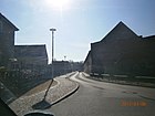
490 | Connection road with Berlin | 1922 | The old connection route to Berlin is already marked on the measuring table sheet from 1871 and led east from Gut Blankenfelde to Niederschönhausen . The connecting road to the north coming from Berlin was named Berliner Straße in 1922. Since East Berlin had to bypass the B 96 in Reinickendorf ( West Berlin ) since 1950 , the long-distance road, known as the F 96, ran over Schönhauser Allee from Pankow through Blankenfelde to Oranienburg. In Blankenfelde, a new route was laid through the sewage field, which crossed the town center and the main road east of the church. This shortened Berliner Straße to the section between Hauptstraße and the connection to the (more western) bypass road that today bears this name. The part of the village ensemble at Berliner Straße No. 1 and No. 2 was included as a monument. In the 1922 address book, Berliner Straße is specified between Hauptstraße and the Rosenthal district, between Hauptstraße and Buchholzer Straße are properties 1, 3, 5 on the left and Gut Blankenfelde on the right, and the Rieselfelder (today: the Blankenfelde landscape protection area) to the south. |
|
| Pear tree ring
( Location ) |
880 | Pear tree to match neighboring streets | Dec 13, 1934 | The street in the suburb of Blankenfelde was initially called Weg 1. It encloses the settlement in the east. |

|
| Blankenfelder Chaussee
( Location ) |
1970 | Connection path from Niederschönhausen to Blankenfelde | after 1950 | The street lies between the transition to Schildower Straße (490 meters north of the main street) and the district boundary to Rosenthal. 500 meters south of the district (intersection with the main street) it runs along the route of the (formerly) Berliner Straße. The arterial road from Berlin to the north is already shown on old maps along Berliner, Dorf- and Schildower Straße. Around 1950, the trunk road F 96 through Pankow to Blankenburg was set up to bypass the federal highway 96 in East Berlin, which ran through West Berlin . Before 1955, a bypass of the transverse section of the main road (formerly Dorfstraße) was created via Rieselfeldgelände and through the town center (east of the church). The new street, including the southern route on Berliner Straße, was given the name Blankenfelder Chaussee from the district boundary . Sections of Berliner Strasse remained south of the main road with a connection to the new route and Schildower Strasse north of the main road without a connection to this Blankenfelder Chaussee. After 1961, the existing connection via the Bundesstraße 96 was no longer available due to the construction of the Wall, and when the Rostock motorway and the motorway ring were built, the trunk road through Blankenfelde was expanded. The road was expanded to have two lanes, each two lanes wide. Bundesstraße 96a is on Blankenfelder Chaussee . The Volkspark Pankow-Blankenfelde with the Blankenfelde district forester, laid out in 1909 as a municipal school garden , is located on Blankenfelder Chaussee, which mostly leads through the former Rieselfeld area . In the northern part of the early 1950s there was an old people's home (on the site of today's Revierförsterei).
The section of Blankenfelder Chaussee in Lübars at the southwest corner of the Pankow VIII cemetery, which previously existed up to the corner of Wittenauer Straße , has ended since the name of the trunk road at the district boundary and was included in Bahnhofstraße . |

|
| Bretagneweg
( Location ) |
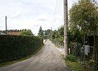
200 | Brittany , a region of western France | March 31, 2011 | The narrow driveway ( traffic-calmed area ) is in the leisure settlement on the area of the former KGA Frohsinn between Rosenthaler Weg and Am Nordgraben , along the driveway along the Nordgraben . The settlement borders eastward on the French Buchholz district, which determines the name of the settlement routes. Plots 1–19 (odd) and 2–18 (even) are assigned to the path. As a path in the allotment garden, this driveway was called the Himbeerweg . |
|
| Buchholzer Strasse
( Location ) |
1730 (in the district) |
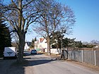
Connection path to Buchholz | 1922 | The street bears this name between Berliner Straße and the district boundary. At first it was (officially) without a name and was given the name in connection with the relocation of Nord-Süd-Straße Berlin – Oranienburg, in the Groß-Berliner address book of 1922 it is mentioned between Berliner Straße and the Buchholz district, the properties are built on and inhabited 7-11 (odd) and 8-12, 20 and 22 (even). |
|
|
Cantalweg
( Location ) |
290 | Cantal , French department in the middle of the country in the Auvergne-Rhône-Alpes region | March 31, 2011 | The narrow driveway ( traffic-calmed area ) is in the leisure settlement Frohsinn between Rosenthaler Weg and Am Nordgraben, along the driveway along the Nordgraben . The settlement borders eastward on the French Buchholz district, which determines the name of the settlement routes. Plots 1–27 (odd) and 2–26 (even) are assigned to the path. This newly named street was called the Holunderweerweg in the allotment gardens . |

|
| Champagne route
( Location ) |
320 | Champagne , a landscape and historical province in north-eastern France | March 31, 2011 | The narrow driveway ( traffic-calmed area ) is in the Frohsinn settlement and between Rosenthaler Weg and Am Nordgraben, along the driveway along the Nordgraben . The settlement borders eastward on the French Buchholz district, which determines the name of the settlement routes. Plots 1–31 (odd) and 2–30 (even) are assigned to the path. The plant name in the KGA Frohsinn was Maulbeerweg . |

|
|
Dietzgenstrasse
( Location ) |
60 (in the district) |
Josef Dietzgen (1828–1888), philosopher | Nov 1, 2006 | The part of the trunk road B 96a , which continued south of Blankenfelder Chaussee (previously Berliner Straße ), previously called Blankenfelder Straße , led south of Rosenthaler Weg (below the botanical complex) into Niederschönhausen . The street names in the Pankow district were standardized in 2006. As part of the old street name remained here, it was incorporated into Dietzgenstraße. The border between the districts of Blankenfelde and Rosenthal crosses diagonally across the street, so the property 191 on the west side is already in the neighboring district and only the commercial property Dietzgenstraße 194 belongs to the district, it is located towards the city (south) of the water management system that is responsible for the inflow of the Blankenfelder Trench is built in the north trench. |
 and and
|
|
Feldsteinweg
( Location ) |
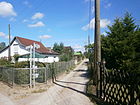
600 | Field stone , stones lying on fields that hinder arable cultivation, the name was chosen in connection with the local nature reserve of Blankenfelde | March 31, 2011 | The street is with lots 3–29 (odd) and 6–24 (even) between Lübarser and Röhrichtweg and with a branch along the Heidekrautgraben . It is one of seven private roads in the Schildow-Waldeck complex and named after shapes in the neighboring Blankenfelde nature reserve. The previous numbering of the properties in the complex was replaced by building addresses for which a street name must be available in order to assign house numbers , which was missing in the Schildow-Waldeck complex. The unofficial plant names were Finkenweg and Weißdornweg . |
|
| Feuerdornweg
( Location ) |
250 | Firethorn , a genus of evergreen shrubs from the rose family | Nov 11, 2014 | The Feuerdornweg is a private road in the Idehorst complex. It lies to the northwest between the Schillingweg (border with French Buchholz) and the Bambusweg . The previous system name was Adlerweg . Plots 2–16 and 3–19 are assigned. The name Ideallee was already an internal designation for the largest path in the Idehorst facility; the other paths were named after plants. |

|
| Finger shrub path
( Location ) |
110 | Finger shrub , species of the genus Potentilla | Nov 11, 2014 | Fingerstrauchweg is a private road in the Idehorst complex. It lies to the northwest between the adjacent KGA 'Am Koppelgraben' and the Bambusweg. The previous plant name was Lerchenweg . Plots 1–9 and 2–10 are assigned. The owners have chosen path names. The name Ideallee was already an internal designation for the largest path in the Idehorst facility; the other paths were named after plants. |

|
| Forkensteig
( Location ) |
220 | Fork matching neighboring streets | Dec 13, 1934 | The Forkensteig, previously referred to as Weg 6 , is located in the suburb of Blankenfelde east of Schildower Straße. In 1943 the street was listed in the address book. Plots 1–20 on the outskirts are owned by the City of Berlin, residents are workers, craftsmen and also trickle keepers. |

|
|
Gascogneweg
( Location ) |
350 | Gascony , a historic province in southwestern France | March 31, 2011 | The narrow driveway ( traffic-calmed area ) is located in the Frohsinn settlement between Rosenthaler Weg and Am Nordgraben, along the driveway along the Nordgraben . The settlement borders eastward on the French Buchholz district, which determines the name of the settlement routes. Plots 1–39 (odd) and 2–36 (even) are assigned to the path. The path already existed in the repealed allotment garden as a currant path . |

|
| Cucumber dough
( Location ) |
220 | Cucumber , suitable for neighboring streets | Dec 13, 1934 | The Gurkensteig, previously referred to as Weg 2 , is located in the suburb of Blankenfelde east of Schildower Straße. In 1943 the street was listed in the address book. Plots 1–24 on the outskirts are owned by the City of Berlin, residents are workers, craftsmen and also trickle keepers. |

|
|
Main road
( Location ) |
3730 | Main street (general) | around 1900 | With the expansion of the road network, the traditional form was the village street by the more official term main road replaced. This name between Mönchmühler Straße and the place also has the further course of the road to the north to the colony "Arkenberge" and the KGA "An den Teichen". Here a footpath and road leads across the Berlin city limits with a transition to Mönchmühle . The Bernauer Heerstraße from Spandau to Bernau (and Stettin) ran east-west through Blankenfelde over the main road. In Lübars the old Bernauer Heerweg is still named. From the northern section of the main road, this military road branched off to the northeast on a route between today's landfill and the Arkenberg quarry ponds to Gut Schönerlinde. Beyond the city limits in Schönerlinde (Land Brandenburg) the name (Old) Bernauer Heerstraße still exists. In 1922 the main street between Bahnhofstrasse and the Schönerlinde district is noted, on the north side (left side) the plots 1-19, Schildower Strasse followed by the church and cemetery and the built and inhabited plots 21-59, in 59 the Schnitterhaus. Plots 2–30, Berliner Strasse, 32–58, are on the right-hand south side. 33 and 34 do not exist, 20 is the community school and 24–30 is the manor. There are no further entries between the Vorwerk Möllersfelde (today Möllersfelder Weg) and the Schönerlinde district. The main street continues to the west today with the Bahnhofstraße (category III; regional main street) into the Blankenfelder Chaussee to Lübars. Another guided tour from French Buchholz to Reinickendorf and the Märkisches Viertel is the Buchholzer, Berliner, Haupt-, Mönchmühler Straße street, which has the category of a supplementary street (StEP level IV) in the Berlin street network and is connected to Wilhelmsruher Damm. A planned relief of these roads through the north bypass is always in discussion but not included in the plans.
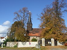
The entire village center with all the adjacent farmsteads and buildings, such as the Schnitterkaserne, Dorfkrug and Gut Blankenfelde, is included in the list of monuments. Monument: Evangelical village church Hauptstrasse 21 |

|
| Dog Rose Trail
( Location ) |
270 | Dog rose , species of the genus Rosen (Rosa) within the rose family (Rosaceae) | Nov 11, 2014 | The Heckenrosenweg is a private road in the Idehorst complex. It lies to the northwest between the Schillingweg (border with French Buchholz) and the Bambusweg. The previous plant name was Falkenhorst . Plots 1–23 and 4–38 are assigned. The owners have chosen path names. The name Ideallee was already an internal designation for the largest path in the Idehorst facility; the other paths were named after plants. |

|
| Heidekrautbahnring
( Location ) |
600 | Heidekrautbahn to the west | March 31, 2011 | The street lies in a curve on the western edge of the complex with lots 1–81 (odd) and 2–74 (even) between Lübarser Weg and Schildower Straße across Waldeckkarree. It is one of seven private roads in the Schildow-Waldeck complex and named after shapes in the neighboring Blankenfelde nature reserve. The previous numbering of the properties in the complex was replaced by building addresses for which a street name must be available in order to assign house numbers , which was missing in the Schildow-Waldeck complex. “The names chosen reflect names from this landscape protection area. The name Heidekrautbahnring was used because of its proximity to the Heidekrautbahn that runs through Blankenfelde. ”The name previously used internally in the allotment area was Waldweg |

|
|
Ideallee
( Location ) |
550 (private road) |
Access to the Idehorst facility at the neighboring Idehorst NSG | Nov 11, 2014 | The Ideallee in the Idehorst facility is located at the end of Kapellenweg on the eastern edge of the facility from Schillingweg (border with French Buchholz) to the northwest, parallel to Graben 52 Buchholz . Plots 3–61 (odd) and 2–60 (even) are assigned. The owners have chosen path names. The name Ideallee was already an internal designation for the largest path in the Idehorst facility; the other paths were named after plants. |

|
|
Kapellenweg
( Location ) |
950 | Name of the parcel | 1941 | The name was probably chosen after a field name. On a map around 1750, the area is indicated as "Capellen". The route leads from the Martha-Aue settlement on Buchholzer Strasse to the KGA “Recreation”, south of Möllersfelde . In 1943 the street was listed in the address book. The north side is undeveloped, opposite at 11 there is the inhabited Sabisch house, followed by undeveloped land, a garden, the private path, summer houses and the arbor. |

|
| Potato dough
( Location ) |
760 | Potato , suitable for neighboring streets | Dec 13, 1934 | The Kartoffelsteig, previously referred to as path 3 , is located in the suburb of Blankenfelde east of Schildower Straße. In 1943 the street was listed in the address book. Plots 1–39 (several plots do not exist) on the outskirts are owned by the City of Berlin, residents are workers, craftsmen and also trickle keepers. |

|
| Cherry laurel path
( Location ) |
240 | Cherry laurel , a type of plant from the rose family | Nov 11, 2014 | The Kirschlorbeerweg is a private road in the Idehorst complex. It lies to the northwest between the Schillingweg (border with French Buchholz) and the Bambusweg. The previous plant name was Sperberweg . Plots 3–17 and 4–20 are assigned. The owners have chosen path names. The name Ideallee was already an internal designation for the largest path in the Idehorst facility; the other paths were named after plants. |

|
| Köppchenseeweg
( Location ) |
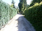
570 | Köppchensee , is located to the west in the Tegeler Fließal nature reserve | March 31, 2011 | The street is with lots 1–107 (odd) and 94–112 (even) southwest of Lübarser Weg in the opposite arc to the Heidekrautbahnring and crosses Waldkarree, to the Heidekrautbahnring there are three side streets (previously Dahlien-, Carnation-, Blumenweg ) to the northwest to connect the properties here. The previous designation internally in the plant was Fliederweg south and Wiesenweg north . It is one of seven private roads in the Schildow-Waldeck complex and named after shapes in the neighboring Blankenfelde nature reserve. The previously existing numbering of the properties in the complex was replaced by building addresses for which a street name must be available in order to assign house numbers ; these were previously missing in the Schildow-Waldeck complex. The name after the Köppchensee was chosen in connection with the nearby landscape protection area, on the north bank of the lake in the 1960s, at that time near the Berlin Wall , a garbage dumping had started. |
|
| Pumpkin dough
( Location ) |
260 | Pumpkin to match neighboring streets | Dec 13, 1934 | The Kürbissteig, previously referred to as Weg 4 , is located in the suburb of Blankenfelde, east of Schildower Straße. In 1943 the street was listed in the address book. Plots 1–20 on the outskirts are owned by the City of Berlin, residents are workers and craftsmen. |

|
| Tree of Life Path
( Location ) |
110 | Arborvitae , genus of plants in the cypress family (Cupressaceae) | Nov 11, 2014 | The Lebensbaumweg is a private road in the Idehorst complex. It lies to the northwest between the adjacent KGA 'Am Koppelgraben' and the Bambusweg. The previous plant name was Meisenweg . Plots 1–7 and 2–10 are assigned. The owners have chosen path names. The name Ideallee was already an internal designation for the largest path in the Idehorst facility; the other paths were named after plants. |

|
|
Lorraineweg
( Location ) |
240 | Lorraine , a region in northeastern France | March 31, 2011 | The narrow driveway ( traffic-calmed area ) is noted as a dedicated street and is located in the leisure settlement Frohsinn between Rosenthaler Weg and Am Nordgraben, along the driveway along the Nordgraben . The settlement borders eastward on the French Buchholz district, which determines the name of the settlement routes. Plots 1–23 (odd) and 2–22 (even) are assigned to the path. The road in the allotment garden was called the Blackberry Trail . |

|
| Lübarser way
( Location ) |
590 | Neighboring place of Lübars | before 1913 | The connecting route from Lübars via Blankenfelde to Schildow is called on the section between Schildower Straße and the railway line Lübarser Weg and continues from the railway line as Schildower Weg. It is a two-lane asphalt road, partly with an integrated footpath, and belongs to the outskirts settlement of Blankenfelde west of Schildower Strasse, the Schildow-Waldeck settlement, with single-family houses. The unpaved roads going out through the settlement are not officially listed. |

|
|
Medlar way
( Location ) |
110 | Medlar , plant species of the pome fruit family (Pyrinae) in the rose family (Rosaceae) | Nov 11, 2014 | The Mispelweg is a private road in the Idehorst complex. It lies to the northwest between the adjacent KGA 'Am Koppelgraben' and the Bambusweg. The previous plant name was Finkenweg . Plots 1–9 and 2–10 are assigned. The owners have chosen path names. The name Ideallee was already an internal designation for the largest path in the Idehorst facility; the other paths were named after plants. |

|
| Moorwiesenring
( Location ) |
350 | Moorwiese , the name was chosen due to the locality of the terrain of the nearby nature reserve Blankenfelde | March 31, 2011 | The street is in the northern part of the Schildow-Waldeck settlement with lots 1–41 (odd) and 4–46 (even). The newly named street is made up of several (previous) access routes. Tännichtweg was the name of the section parallel to Schildower Straße. The southern lily path and the northern thistle path were included , which form the arch open to the east that led to the term “-ring”. The plots of Alter Spielplatz on the path going into the arch are now numbered under the new name. Some properties to the south, which previously belonged to Brunnenweg , were assigned to Schildower Straße when the property was renumbered . The Moorwiesenring is one of seven private roads in the Schildow-Waldeck facility, which were named after shapes in the neighboring "Blankenfelde Landscape Protection Area". Previously, the postal address consisted of a plant (overall) address from Schildower Straße, the individual properties were addressed with a plant route and a number that was not suitable as a house number . In order to obtain the (nationwide) georeferenceable address, building addresses were created by the district office (upon application by the owner). For this a street name had to be available in order to assign house numbers . The path names (Heidekrautbahnring, Köppchenseeweg, Moorwiesenring, Waldeckkarree, Reppfuhlring, Röhrichtweg, Feldsteinweg) were chosen because they create a connection with the nearby "Blankenfelde Landscape Protection Area". The boggy meadows to the west of the Köppchensee are named for the Moorwiesenring. These have stratified springs that are distinctive for the area around the LSG Lübarser Fliess. |

|
| Möllersfelde
( Location ) |
180 × 80 | Möllersfelde , former Vorwerk of Gut Blankenfelde. | around 1900 | The Vorwerk Möllersfelde was still called "Schötzsches Etablissement" in 1817, later became Müllersfelde and was ultimately given its current name and with its stables belonged to the Blankenfelde estate until 1990. The development of the area has been influenced by the temporary use in the sewage field economy. The place officially named today with the property designation "Möllersfelde 1" is located near the junction to the A 114 Schönerlinder Straße, around 440 meters on an unnamed path extending from Am Schafstall in the direction of Arkenberge. There is currently a riding stables here. In the 1925 Silvaplan, a road between Schönerlinder Strasse and Hauptstrasse (at the level of today's KGA Arkenberge) is indicated through the Rieselfelder past Möllersfelde, which is crossed by roads on the Möllersfelder Weg and the (former) Bernauer Heerstrasse . |

|
| Möllersfelder Weg
( Location ) |
1250 | Way to Möllersfelde , Vorwerk of Gut Blankenfelde. | after 1800 | A way to Möllersfelde (from Blankenfelde) already existed on the Mes table sheet from 1871. This is between Möllersfelde and the main road and is the extension of the main road , which in turn continues north towards Arkenberge and as a footpath across the city limits to Mönchmühle. The green main path No. 13 (Barnimer Dörferweg) leads between the NSG Idehorst and the eastern village center over the Möllersfelder Weg. |

|
| Mönchmühler Strasse
( Location ) |
1350 (in the district) |
Mönchmühle, district of Mühlenbeck | Aug 4, 1930 | The road is an old connecting route from Rosenthal via Blankenfelde to Mönchmühle and is already recorded in the original Mes table sheet from 1871. It lies between the district boundary of Rosenthal (on the former industrial railway embankment ) and the main road and runs through the former Rieselfeld area. In 1943 the street is listed in the address book between Hauptstraße and the Rosenthal district. The plots 1-17 and 2-16 belong to Rosenthal, 19-141 (west) and 18-134 (east) are Rieselfelder (today: landscape protection area Blankenfelde), 136 is undeveloped, 138 is built on and inhabited and 140 and 142 belong to the main street 2. Mönchmühler Strasse is ranked IV (supplementary street) in the Berlin street system as the main street and despite its condition as a cobblestone street and through the former sewage field area on Zingergraben, it takes up traffic between the Märkische Viertel (Wilhelmsruher Damm) and French Buchholz bypassing Lübars. The north bypass is under discussion (also because of resident protests) was taken out of the planning again. |

|
|
Normandie Path
( Location ) |
110 | Normandy , a historic province in northern France | March 31, 2011 | The narrow driveway ( traffic-calmed area ) is in the Frohsinn settlement and between Rosenthaler Weg and Am Nordgraben, along the driveway along the Nordgraben . The settlement borders eastward on the French Buchholz district, which determines the name of the settlement routes. As a private route of the KGA, it was called Erdbeerweg . Plots 1–11 (odd) and 2–8 (even) are assigned to the path. Before the decision of the Pankow district to name it, the route was a private route within the KGA Frohsinn with the name Erdbeerweg . |

|
|
Picardieweg
( Location ) |
530 | Picardy , a region and historical province in northern France | March 31, 2011 | The narrow driveway ( traffic-calmed area ) is located in the Frohsinn settlement between Rosenthaler Weg and Am Nordgraben, along the driveway along the Nordgraben . The settlement borders eastward on the French Buchholz district, which determines the name of the settlement routes. The Picardieweg lies completely with its properties in the district, but to the east of it lies the district boundary to French Buchholz. Plots 3–17 (odd) and 2–46 (even) are assigned to the path. Before the settlement's status "KGA" was lifted, the path in the complex was called Blaubeerweg . In contrast to the current course, this was interrupted and shifted by a crossway called Vogelbeerweg in east-west direction. The Vogelbeerweg is the only cross-running (east-west) path in the settlement between the district boundary with French Buchholz (formerly Blaubeerweg ) and Gascogneweg , but has not been renamed. |

|
| Provence way
( Location ) |
440 | Provence , a landscape in southeast France, on the Mediterranean Sea | March 31, 2011 | The narrow driveway ( traffic-calmed area ) is in the leisure settlement Frohsinn between Rosenthaler Weg and Am Nordgraben, along the driveway along the Nordgraben . The settlement borders eastward on the French Buchholz district, which determines the name of the settlement routes. Plots 1–43 (odd) and 2–42 (even) are assigned to the path. The name before the official street dedication was as KGA-Weg: Wacholderbeerweg . |

|
|
Reppfuhlring
( Location ) |
420 | Reppfuhl , a neighboring silted lake, the name was chosen because of the local ties to the nearby nature reserve Blankenfelde | March 31, 2011 | The street is located with lots 2–34 (even) and 15–41 (odd) in a square southeast of and to Lübarser and crosses the Röhrichtweg. The north-eastern section of the path runs along the Heidekrautgraben . The road is one of seven private roads in the Schildow-Waldeck facility and named after shapes in the neighboring Blankenfelde nature reserve. The previously existing numbering of the properties in the complex was replaced by building addresses for which a street name must be available in order to assign house numbers . The path names (Heidekrautbahnring, Köppchenseeweg, Moorwiesenring, Waldeckkarree, Reppfuhlring, Röhrichtweg, Feldsteinweg) were chosen in order to establish a connection with the nearby nature reserve Blankenfelde. The Große Reppfuhl lies south of the settlement on the wet meadows and collects three trenches running here that were used during the Rieselfeld period. The street was laid out on the previous paths with the internal system names Schwalben , Drosselweg and Bachstelzensteig . |

|
| Röhrichtweg
( Location ) |
260 | Reeds , biotope type and plant community in shallow water and bank edge areas of waters | March 31, 2011 | The area around the settlement is characterized by wet meadows as far as it is lower, to which the name of this private road with the word part Röhricht refers, the name was chosen in connection with the nearby landscape protection area Blankenfelde. The unpaved road lies between Lübarser Weg and Schildower Strasse, the unofficial internal name in the facility was Hauptweg , as it connected the southern part of the facility with the bus stop on Schildower Strasse. Plots 1–19 (odd) and 4–24 (even) are assigned to the street and is one of seven private streets in the Schildow-Waldeck complex. The previously existing numbering (1–112 consecutively) of the properties in the system was replaced by building addresses for which a street name must be available in order to assign house numbers . The path names (Heidekrautbahnring, Köppchenseeweg, Moorwiesenring, Waldeckkarree, Reppfuhlring, Röhrichtweg, Feldsteinweg) were chosen because they create a connection with the nearby nature reserve Blankenfelde. |

|
| Rosenthaler way
( Location ) |
900 (in the district) |
Rosenthal , neighboring town | after 1810 | The old connecting route between Buchholz and Rosenthal is already shown in the measuring table from 1871. The path with this name is east of the Blankenfelder Chaussee coming from French Buchholz . In the district it is located south of the former Rieselfeldgelände and along the Frohsinn facility between Blankenfelder Chaussee and the district boundary at Picardieweg (formerly Blaubeerweg). The tram line 50, which was created after 1990 during the residential construction in French Buchholz-West, has its turning loop north of the street in the district. |

|
|
Savoy path
( Location ) |
150 | Savoy , a landscape in the south of France between Switzerland and Piedmont | March 31, 2011 | The narrow driveway ( traffic-calmed area ) is in the Frohsinn settlement and between Rosenthaler Weg and Am Nordgraben, along the driveway along the Nordgraben . The settlement borders eastward on the French Buchholz district, which determines the name of the settlement routes. Plots 1–15 (odd) and 2–12 (even) are assigned to the path. Before it was designated as an official street, the name in the allotment area was: Preißelbeerweg . |

|
| Schildower Strasse
( Location ) |
2410 | Schildow , northern neighbor. | after 1871 | The street is an old connection between the places Blankenfelde and Schildow, which is marked on the measuring table sheet from 1871. It is part of the B 96a and is located north of the main road to the district boundary to Schildow, which is also the state border between Berlin and Brandenburg. The houses no.3 (tenement and restaurant around 1885), house no.4 (community pastoral house around 1780), house no.5 (residential building, stable with coach house and wall around 1895) and house no.7 (bakery and shop around 1905, rebuilt around 1930), as well as houses No. 8 and 9 are included as part of the overall architectural ensemble of the village center Blankenfelde. In 1922, Schildower Strasse is listed between Hauptstrasse and the Schildow district. On the west side (left) are the developed and (mostly by farmers) inhabited plots 3–15 (1 is undeveloped) and opposite the cemetery on 2, the manor house inhabited by the Upper Swiss and the pig master (4, owner City of Berlin) and on Plots 6-14 are where the sheep farm is, inhabited by the sheep master and two sheep assistants. |

|
| Schillingweg
( Location ) |
2200 (in the district) partly only north side |
Schilling (19th century, Reinickendorf ), cigar manufacturer and landowner | after 1961 | The southern side of the road, east of path A, is beyond the suburb in French Buchholz. To the west of Buchholzer Straße, south of the Elisabethaue settlement, the path ends at the green strip in front of the Blankenfelder Graben on Blankenfelder Chaussee . |

|
| Schönerlinder Strasse
( Location ) |
700 (in the district) (only western side) |
Schönerlinde , north of Blankenfelde. | after 1824 | In the vicinity of the Schönerlinder Straße junction of the A 114 up to the railway line, the western road belongs to the district and forms the boundary with French Buchholz . Beyond the railway bridge (north of the motorway) it continues in Buch . |

|
| Sichelsteig
( Location ) |
280 | Sickle , suitable for neighboring streets | Dec 13, 1934 | The Sichelsteig, previously known as Weg 5 , is located in the suburb of Blankenfelde east of Schildower Straße. In 1943 the street was listed in the address book. Plots 1–25 on the outskirts are owned by the City of Berlin, residents are workers and craftsmen. The path leads into the sewage fields. |

|
| Sunflower path
( Location ) |
420 | Sunflower , suitable for neighboring streets | Dec 13, 1934 | The Sonnenblumensteig, previously referred to as Weg 7 , is located in the suburb of Blankenfelde east of Schildower Straße. In 1943 the street was listed in the address book. Plots 1–40 on the outskirts are owned by the City of Berlin, residents are workers and craftsmen and sewage field workers. The trail leads into the Feldmark, but lots 1–13 on the Birnbaumring are undeveloped and belong to the drainage ditch. |

|
| Road to Arkenberge
( Location ) |
420 | Arkenberge , direction | 3rd Sep 2013 | The streets previously named Am Schafstall and continuing as Bauernweg in various maps were dedicated by the district office in accordance with planning regulations with the intention of naming them as the road to Arkenberge. “The intention is to rename the public road to Arkenberge south of the junction (AS) Schönerlinder Straße as 'Straße nach Arkenberge'." This will rename the eastern part of the farm path between Am Schafstall and the entrance to the building rubble dump and recycling plant Arkenberge , to which the connection to the Schönerlinder Straße ( B 109 with the road in French Buchholz ) will be renamed with the name Am Schafstall, which was previously shown on maps and a street sign. |

|
|
Waldeck square
( Location ) |
750 | Waldeckkarree creates a connection to the name of the Schildow-Waldeck settlement | March 31, 2011 | The street curves to the west between the Lübarser and the Heidekrautbahnring, and continues over the latter with connection to Schildower Straße. The Heidekrautbahnring is crossed in the path (previous internal name Rosenweg ) and the northern (outer) section in the arch from there has a parallel (inner) section to the south (previously Elderunderweg ). Both end on a transverse section - in the direction of Schildower Straße (previously Elsenweg ). Plots 1–75 (odd) and 6–60 (even) are assigned to the path as an access road . Waldeckkarree is one of seven private roads in the Schildow-Waldeck facility. The previously existing consecutive numbering of the properties in the complex was replaced by building addresses for which a street name must be available in order to assign house numbers that were previously missing in the Schildow-Waldeck complex. It should be noted that the western section of the square in front of the Heidekrautbahn leads around a small elevation, so that the properties partially have a slope (west on the outside of the square) and the properties on the east inner side of the square have an increase in the area. |

|
| Way a
( Location ) |
330 | next to route B (unspecified) |
before 1945 | The settlement path between Kapellenweg and Schillingweg is located in the Wilkesiedlung. It lies west of the KGA "On coupling ditch" in parallel with the eastern route B . |

|
| Way B
( Location ) |
290 | next to route A (unspecific) |
before 1945 | The settlement path is located in the Wilkesiedlung between Kapellenweg and Schillingweg. It lies east of the KGA "Am Kapellenweg" parallel to path A . |
|
| Cypress path
( Location ) |
190 | Cypress , genus of plants in the cypress family (Cupressaceae) | Nov 11, 2014 | The Zypressenweg is a private road in the Idehorst complex. It opens up part of the facility north of Kapellenweg to the northwest, parallel to the adjacent KGA 'recovery' between Kapellenweg and Koppelgraben. The previous plant name was Drosselweg . Plots 3–13 (odd) and 4–14 (even) are assigned. The owners have chosen path names. The name Ideallee was already an internal designation for the largest path in the Idehorst facility; the other paths were named after plants. |

|
Planned and former streets
Previously planned but not implemented streets and former names of renamed streets.
- Dietzgenstraße : The longest section of the street today belongs to the Niederschönhausen district and Rosenthal, only plot 194 belongs to Blankenfelde. The part of the street leading further north is called Blankenfelder Chaussee. The old name in Niederschönhausen until the beginning of the 1890s was Dorfstraße . In the course of loyalty to the emperor, the name was changed to Niederschönhausen and Rosental and at least partially also to Blankenfelde in Kaiser-Wilhelm-Straße . This name was replaced on April 12, 1951 by Dietzgenstrasse and Blankenfelder Strasse was also included.
- As Blankenfelder Chaussee was until 1961 in the district (also) the road from Lübars (where this name still exists) to Blankenfelde up to the junction with Wittenauer Straße . Due to the separation as a result of the construction of the wall , the section from the district boundary to Lübars (1961–1989: "State border" of the GDR to West Berlin ) to the main road at the Mönchmühler Straße junction was included in Bahnhofstraße, although the railway line was also closed at this time was. The double designation with the long-distance road through the town center and south to Niederschönhausen and Rosenthal, which belonged to the Pankow district, was also canceled.
- The Wittenauer Strasse , which connected Wittenau and Blankenfelde, was part of the Bernauer Heerstrasse . It is not listed in the address book for the district, as it led through arable land that had not been built on. From the Lübars district boundary , which became the state border between East (Pankow district) and West Berlin (Reinickendorf district) with the construction of the Wall in 1961 , and the railway line, the same name also existed for this traffic route in Blankenfelde. The route of the Heerstraße led (from the railway site) over the Bahnhofstraße to the main street into the village of Blankenfelde. Due to the wall, this road to the border area became obsolete and was torn down. Today only a turning loop on Bahnhofstrasse reminds of this junction (formerly the corner of Lübarser Blankenfelder Chaussee ) and the interrupted direct route from Bahnhofstrasse to Alte Bernauer Heerstrasse in Lübars is noticeable on the map .
Other locations in Blankenfelde
Allotment colonies
- KGA 'An den Teichen' - 03046 (Hauptstrasse 162, Lage ) is a permanently secured garden with 60 plots on 28,143 m² on the state-owned land according to the allotment garden development plan of Berlin and the part on private land is highly secured with 27 plots on 18,386 m². It is located opposite the Mönchmühler ponds that give it its name in the NSG Kalktufgelände in the extreme north of the district on the Berlin city limits to Brandenburg.
- KGA "Arkenberge" - 03048 (Hauptstrasse 128, Lage ), the 147 parcels are highly secured on a private lease area of 86,479 m², it borders in the southeast on the Arkenberge rubble dump, which took its name from the Arkenberge landfill. The roads in the KGA all go parallel to each other from the main road to the northeast on both sides of the farm road . These private roads are from the landfill site (former garbage dump / today building rubble dump) in the southeast to northeast (KGA An den teichen, Schildow): field path, gravel path, broad path, valley path, farm path, high path, mountain path, meadow path, forest path.
- KGA, Buchholzer Straße '- 03052 (Buchholzer Straße 1–13, Lage ), the facility in the center of the village opposite the former Gut Blankenfelde is only temporarily secured on 3539 m² of private land for the nine plots according to the allotment garden development plan (KGEP) and is intended for other use.
- KGA, Recreation '- 03060 (Kapellenweg 29, Lage ), the allotment garden includes 45,647 m² of private land with 75 parcels that are classified as highly secured. It is located north of Kapellenweg and borders on the Idehorst NSG. In the area there are several permanent allotment gardens in the district and in the French Buchholz district.
- KGA, Kapellenweg '- 03076 (Kapellenweg 10, Lage ) is located on the allotment garden between Blankenkenfelde Kapellenweg and French Buchholz Rupertweg . Twelve parcels on 3,256 m² are permanently secured by Berlin planning and the 84 parcels on 38,196 private land are highly secured by the location. It lies between the two housing estates Marthaaue (to the west) and the Wilke housing estate bordering to the east.
- KGA 'Am Koppelgraben' - (Kapellenweg 30, Lage ) was suggested by seven interested parties from VEB Wasserwerk in July 1981 and was founded on March 31, 1983. The plant was built on previous farmland. The facility between Schilling- and Kapellenweg on 7.4 hectares includes 155 plots.
- KGA, Möllersfelder Weg '- 03085 (Möllersfelder Weg 22, Lage ) is a highly secured garden with 39 plots on 21,180 m² of private leased land according to the planning in the state of Berlin. The facility is located between Koppelgraben and Möllerfelder Weg north of the KGA recovery in the area of the former Möllersfelde estate.
Housing estates
The settlement history has been preserved in the existing settlements, particularly in the areas of the Berlin districts near the city limits. In the 2010s, in large garden and settlement complexes, addresses were defined for adjacent public roads with internal route names and parcel numbers. Such an address form cannot be georeferenced ; according to federal law, Berlin must introduce the ALKIS program system into the existing real estate cadastre . A “unique address with house number” is required for “geo-referenced building address”. In the district, new street names were assigned in coordination with the residents and owners, whereby the planning process also checked whether these new street names are unambiguous in the urban area (of the state) of Berlin .
- The 'Frohsinn settlement and garden complex' ( location ) borders the French Buchholz district in the triangle of Nordgraben (to Niederschönhausen ) and Rosenthaler Weg. On March 5, 2007 the KGA Blankenfelder Chaussee 4 (street number 44159) was renamed “Anlage Frohsinn” (street number 09037) and was no longer a KGA under the Allotment Garden Act due to the existing settlement and the wishes of the residents. The previous garden paths were named as private streets with official street names in 2011 after they were rededicated as housing developments by decision of the Pankow district. The choice of name takes up the history of French Buchholz and the streets were named after French regions, they bear the new names from east (on the district boundary to French Buchholz) to west. The access to the property at the western corner of the complex was previously unnamed and is now dedicated as Alsaceweg (10524). At the same time as the dedication, the road bounding the south along the Nordgraben was also signposted as Am Nordgraben . The Vogelbeerweg , located in the former KGA Frohsinn , the crossroad between Picardie and Gascogneweg, remained unnamed when the street was named in 2011. The street names give the properties their own postal addresses, although some - like on Vogelbeerweg - have been renumbered.
- Blaubeerweg (10534) → Picardieweg
- Juniper Berry Trail (10533) →
- Gooseberry Trail (10532) → Argonnenweg
- Currant Trail (10531) → Gascogneweg
- Mulberry Trail (10530) → Champagneweg
- Elderberry Trail (10529) → Cantal Trail
- Brombeerweg (10528) → Lorraineweg
- Himbeerweg (10527) → Bretagneweg
- Preißelbeerweg (10526) → Savoyenweg
- Erdbeerweg (10525) → Normandieweg
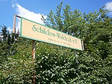
- Enclosure 'Schildow-Waldeck' ( location ) The paths of the Schildow-Waldeck settlement are listed as private roads in the official directory with the exception of Lübarser Weg . Until the 2000s the settlement had the status of an allotment garden. The streets were named on the basis of a resolution by the Pankow district in 2011 on March 31, 2011. The street names chosen were based on neighboring locations and natural forms. The zoning plan as of 2004 already stated: “The Schildow-Waldeck colony already has a structural density far beyond what is permitted for allotment gardens.” () The street names are included in the list above. The area of the facility between Schildower Straße and Heidekrautbahn shows considerable height differences, which had an impact on the development. In addition to Lübarser Weg, four of the new street names were named “-ring” ( Moorwiesenring , Heidekrautbahnring , Reppfuhlring , Waldeckkarree ) and three as “-weg” ( Röhrichtweg , Feldsteinweg , Köppchenseeweg ). The new construction of streets according to the list was associated with an actual renumbering of the plots.
- 'Outskirts settlement Blankenfelde' ( location ). The paths of the suburban settlement east of Schildower Straße were renamed in 1934 and are officially dedicated streets
- Path 1 → pear tree ring
- Path 2 → Gurkensteig
- Path 3 → Kartoffelsteig
- Path 4 → pumpkin dough
- Path 5 → Sichelsteig
- Path 6 → Forkensteig
- Path 7 → Sonnenblumensteig
- Wilke settlement location
- Marthaaue Lage settlement
- Settlement Elisabethaue location 52.613993016380284, 94479370
- Plant 'Idehorst' - 03075 (Kapellenweg 32, Lage ) is located in an allotment garden area between Kapellenweg and the border with French Buchholz (Schillingweg) on the edge of Idehorst Park across the Rieselfeldgraben. On the 69,673 m² private leased land there are 119 parcels with 41 permanent users. In the 2010 development plan, this KGA was a highly secured facility. In the list of allotment gardens in the Pankow district, 2014 edition, the system is no longer included because the users as a community have created owner gardens. Building according to building law is no longer possible in accordance with the restrictions of the Federal Allotment Garden Act . In the Pankow district, as part of the nationwide georeferencing in large areas, the garden paths are dedicated as private roads. In the complex Idehorst nine routes have been renamed: Ideallee , Kirschlorbeerweg , Feuerdornweg , rear Rosenweg , Fingerstrauchweg , Mispelweg , Lebensbaumweg , Bambusweg , Cypresses .
Parks and natural areas
- Möllersfelde ( location )
- NSG Idehorst and Idehorstpark ( location )
- NSG Kalktufgelände ( location ), in the north with the Mönchmühler pond and the fish ponds.
- Pankow Botanical Park ( location ). It is located to the west of Blankenfelder Chaussee and is listed as a garden monument. Today's Volkspark was designed by garden architect Albert Brodersen in 1909–1929 and created as a school garden for children in the urban environment of Berlin from 1909 onwards.
- Köppchensee ( Lage ) as part of the NSG Tegeler Fließal.
- Natural area (the former northern Rieselfelder) north of Bahnhofstrasse between Schildower Strasse and the western boundary of the district and Schildower Weg in the north. Crossed by the Heidekrautgraben, the Großer Reppfuhl a formerly elongated lake and crossed by the route of the Heidekrautbahn. ( Location )
- Former sewage areas ( location ) east of Blankenburger Chaussee to Buchholzer Straße and the suburbs border. (Landscape protection area Blankenfelde)
- Nordendarena sports fields ( location )
- Arkenberge dog exercise area ( location ): a 40 hectare area near Möllersfelde directly on the road to Arkenberge ( Bauernweg ) for dogs to run around and run around undisturbed.
See also
literature
- Ines Rautenberg: Street names in Berlin-Pankow. Origin and history. Kulturamt Pankow and Friends of the Chronicle Pankows, Berlin 1999, DNB 960005862 .
Web links
- Map of Berlin 1: 5000 with district boundaries. Senate Department for Urban Development Berlin, 2009, accessed on January 11, 2011 .
- Street directory Blankenfelde. kaupert media GmbH, accessed on December 5, 2011 .
- Office for Statistics Berlin-Brandenburg: List of streets and places in the Pankow district (as of February 2015); pdf
- List of monuments Pankow (pdf; 2.2 MB) Retrieved January 9, 2012
Individual evidence
- ^ Pankow civil engineering department
- ↑ a b c d e f g h The card is on Commons
- ^ Map in the address book from 1922
- ↑ a b c Blankenfelde around 1938 ( page no longer available , search in web archives ) Info: The link was automatically marked as defective. Please check the link according to the instructions and then remove this notice.
- ↑ Land use planning Berlin: Changes 2004
- ^ Arkenberge Recycling landfill
- ↑ a b c d e f g h i j k Decision of BVV Pankow of March 31, 2011 (printed matter - VI-1290) ( page no longer available , search in web archives ) Info: The link was automatically marked as defective. Please check the link according to the instructions and then remove this notice. . The naming of the private roads in the Frohsinn facility is based on French regions / provinces / landscapes / administrative districts
- ↑ a b c d e f g h i j k l Decision of BVV Pankow of March 31, 2011 (printed matter - VI-1290) ( page no longer available , search in web archives ) Info: The link was automatically marked as defective. Please check the link according to the instructions and then remove this notice. , General plan with plot numbering and the new streets
- ↑ Printed matter - V-0902 of BVV Pankow from March 13, 2005
- ↑ a b c Clarification of the situation with the map of Berlin 1: 5000 (K5 color edition) produced by the district surveying offices
- ↑ The naming of the nine private paths in the Idehorst facility occurs at the request of the Idehorst facility owners. Four ways belong to private owners and five ways belong to the Pankow District Office, Youth and Facility Management Department, SE Facility Management.
- ↑ [1] ( Page no longer available , search in web archives ) Info: The link was automatically marked as defective. Please check the link according to the instructions and then remove this notice. Intent to name the public road going south of the junction (AS) Schönerlinder Strasse to Arkenberge in the Blankenfelde district
- ↑ a b According to the district office resolution no. VII-0231/2012 of September 25, 2012, the "Road to Arkenberge" was assigned to the civil engineering and landscape planning office. Hence this street was dedicated. The dedication was published in Official Gazette No. 28 on June 28, 2013.
- ↑ a b c d e f Blankenfelde around 1954 ( page no longer available , search in web archives ) Info: The link was automatically marked as defective. Please check the link according to the instructions and then remove this notice.
- ↑ Blankenfelde station of the Niederbarnimer Railway, the so-called "Heidekrautbahn"
- ↑ a b c d e address book 1922: Streets and houses of Berlin, Pankow administrative district: Blankenfelde. Part IV, p. 1789 ff.
- ↑ a b c d e f g h i Streets of the Idehorst facility FIS-Broker (map of Berlin 1: 5000 (K5 color edition)) of the Berlin Senate Department for Urban Development and Environment
- ↑ a b c d e f g h i As part of the nationwide introduction of the ALKIS program system in the real estate cadastre, the Senate Department for Urban Development and the Environment demands a connection between the automated real estate book (ALB) and the automated real estate map (ALK). A “georeferenced building address” is required for this, consisting of the street name and property number (house number). This was missing in the Idehorst plant. A complete numbering of the plots and parcels in the Idehorst facility was not possible and it was necessary to name nine paths in the Idehorst facility. The owners have chosen path names.
- ↑ a b c d e f g h i printed matter - VII-0835: Naming of nine private roads in the Idehorst facility in the Blankenfelde district
- ^ Arkenberge, Berlin-Blankenfelde , accessed March 25, 2013.
- ↑ Berliner Zeitung of December 14, 2000: The Arkenberge are to become a recreation area . Retrieved March 25, 2013.
- ↑ Umweltblatt 17: Through the local recreation area Berliner Barnim
- ↑ Berliner Straße No. 1: House & barn & stable from 1880–1900
- ↑ Berliner Straße Nr. 2: House, barn and stable from 1880 to 1900
- ↑ a b c d e f g DRS 1288 Pankow district, annex explanations ( page no longer available , search in web archives ) Info: The link was automatically marked as defective. Please check the link according to the instructions and then remove this notice.
- ↑ a b c d e f g h Printed matter DRS 1288 Site plan of the Schildow-Waldeck plant ( page no longer available , search in web archives ) Info: The link was automatically marked as defective. Please check the link according to the instructions and then remove this notice.
- ↑ a b c d e f g h Address book 1943: Heads of household [… Pankow administrative district: Blankenfelde. Part IV, p. 2389 ff]
- ↑ Ensemble of the village complex on Haupt- / Berliner / Schildower Strasse
- ↑ Hauptstrasse 15 and 17, complete Schnitterkaserne complex, farm workers' house, stable and farm building, 1890
- ↑ The Schultheiß-Patzenhofer society and rifle house, Hauptstrasse 35, with a hall from 1870 and 1910, as part of the overall complex
- ↑ Hauptstraße 24, 26, 28 and 30, the entire estate, manor house, administration building, stable, wheelwright, syringe house, enclosure, garden house and spa house, 1851–1900
- ↑ Village church built around 1400, rebuilt 1938–1941
- ↑ Vorwerk Möller field
- ↑ 20 main green paths: The individual paths - Barnimer Dörferweg
- ↑ Felling trees at the Großer Reppfuhl (PDF; 937 kB)
- ↑ Schildower Straße 3 restaurant
- ↑ Ensemble part community shepherd's house
- ↑ Schildower Straße 5, part of the entire village center complex
- ↑ Schildower Straße 7, ensemble part of residential building with shop, bakery and coach house
- ↑ Intented naming for a public street ( page no longer available , search in web archives ) Info: The link was automatically marked as defective. Please check the link according to the instructions and then remove this notice.
- ↑ a b Level Vb: Fictitious permanent allotment gardens according to §§ 16 and 20a BKleingG. The fictitious permanent allotment gardens are additionally protected by the representation in the FNP as green areas - allotments.
- ↑ a b c d e f Level IV: Allotment garden areas that are to be retained according to the FNP. The state-owned areas at this stage are allotment gardens that were established after the BKleingG came into force and are therefore not fictitious permanent allotments.
- ↑ Berlin's huge trash can . In: Berliner Zeitung , October 5, 2004. Retrieved March 25, 2013.
- ↑ Level Ia: Allotment gardens on private areas which, according to the FNP, are intended for another use. A termination is possible at any time in compliance with the allotment garden regulations.
- ↑ Location of the facility
- ^ History of the allotment garden association
- ↑ Site plan of the parcels
- ↑ Printed matter - VI-1290: Designation of 11 private roads in the Frohsinn facility in the Blankenfelde district according to French regions
- ↑ Printed matter - VI-1288 Designation of 7 private roads in the Schildow-Waldeck facility in the Blankenfelde district
- ↑ FNP Berlin (as of January 2004)
- ^ Allotment garden development plan Berlin, update 2014: data for the district of Pankow
- ↑ Botanical complex and school gardenComplete Botanical Park
