List of streets and squares in Berlin-Fennpfuhl
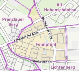
The list of streets and squares in Berlin-Fennpfuhl describes the complete street system in the Berlin district of Fennpfuhl in the Lichtenberg district with the corresponding historical references. At the same time, this compilation is part of the lists of all Berlin streets and places .
Overview and road holding
Fennpfuhl has 34,074 inhabitants (as of December 30, 2019) and includes the postcode areas 10367 and 10369. Until the late 1960s, the district consisted of only a few streets and paths and extensive allotment gardens.
The oldest streets in the district are the continuous traffic routes in north-south and west-east direction: Weißenseer Weg and the former Landsberger Chaussee . In addition, there are the streets to the northwest of Lichtenberger Dorfstrasse (since 1910 Möllendorffstrasse ) in the 1880 plan and laid out streets (see the lower part of the list ). At the end of the 19th century, the municipality of Lichtenberg in the Wilhelmsberg area planned the first road network, but this was not fully implemented. A real residential development was not (yet) possible because of the difficult, damp building ground around the Ice Age relics of several puddles, allotment gardens were created . In the mid-1970s, after extensive drainage of the area, the construction of the Lichtenberg-Nord residential district began with various prefabricated buildings in accordance with the GDR's housing program . The apartment blocks were loosened up and set according to citizen-oriented characteristics. House entrances were oriented to the south away from the main roads or balconies, which is why the construction roads were oriented accordingly and specified the future course of the road. This explains the sometimes changing direction of streets instead of the alignment on the traditional street fronts.
For example, the routing of Wolfgang- and Eberhardstraße was canceled by the management of Paul-Junius- and Alfred-Jung-Straße. The access roads behind the new buildings on Landsberger Allee and Weißenseer Weg, which are part of the main traffic route, are assigned to them and bear the same name. Residential area streets are often made up of several access roads (sometimes as dead ends ). Eighteen of the twenty newly laid streets were given names (in keeping with the times ) of communist resistance fighters against National Socialism . After the reunification , the street names were retained.
Overview of streets and squares
The following table gives an overview of the streets and squares in the district as well as some related information.
- Name / location : current name of the street or square. Via the link Location , the street or the square can be displayed on various map services. The geoposition indicates the approximate center of the street length.
- Traffic routes not listed in the official street directory are marked with * .
- Former or no longer valid street names are in italics . A separate list may be available for important former streets or historical street names.
-
Length / dimensions in meters:
The length information contained in the overview are rounded overview values that were determined in Google Earth using the local scale. They are used for comparison purposes and, if official values are known, are exchanged and marked separately.
For squares, the dimensions are given in the form a × b for rectangular systems and for (approximately) triangular systems as a × b × c with a as the longest side.
If the street continues into neighboring districts, the addition ' in the district ' indicates how long the street section within the district of this article is. - Name origin : origin or reference of the name.
- Notes : further information on adjacent monuments or institutions, the history of the street and historical names.
- Image : Photo of the street or an adjacent object.
| Name / location | Length / dimensions (in meters) |
Origin of name | Date of designation | Notes and picture |
|---|---|---|---|---|
|
Alfred-Jung-Strasse
( Location ) |
420 + 360 | Alfred Jung (1908–1944), resistance fighter | Apr 2, 1975 |
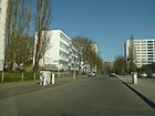
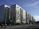
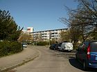
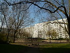
The street runs in a T-shape, a short distance south of Storkower Straße, where the people's solidarity retirement home is located, but does not belong to the Fennpfuhl area. The building to be seen in the picture is the “Schule am Fennpfuhl”, on the right side (behind the cars) is the former club restaurant “Solidarity” from the GDR times. It will continue to be used as a trading facility. |
|
Anton-Saefkow-Platz
( Location ) |
115 × 60 | Anton Saefkow (1903–1944), resistance fighter | Apr 2, 1975 | The square forms the communal center of the district with a swimming pool and library. It is not clearly delineated. The development consists of several high-rise residential buildings, a building constructed as a department store, which was converted into a residential and commercial building. |
| Arthur-Weisbrodt-Strasse
( Location ) |
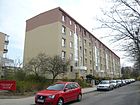
180 | Arthur Weisbrodt (1909–1944), resistance fighter | July 13, 1962 | The street leads to individually standing new apartment blocks. It is located between Max-Brunow- and Erich-Kuttner-Straße, with the apartment blocks 2/8, 10/16, 18/24 (straight) facing northwest across the street on comb-shaped access roads and blocks 1-9 on the southeast side of the Street front stands. The blocks consist of five storeys in a row. |
|
Bernhard-Bästlein-Strasse
( Location ) |
860 + 240 | Bernhard Bästlein (1894–1944), resistance fighter | July 11, 1973 |
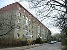
The road is T-shaped and zigzagged. Next to it is a school in the GDR standard type building (with an outside staircase decorated with terracotta panels and embossed letters, see photo), a food discounter in place of the previous GDR club restaurant ('Lichtenberger Krug', 1976 to March 2010), a now planted basin of an earlier stainless steel fountain, designed in 1976 by the sculptor Friedrich Schötschel . In addition, there are municipal childcare facilities in the street. Part of the street surrounds a spacious inner courtyard.
On September 8, 2011, a memorial plaque for the rescuers of Hans Rosenthal was unveiled in front of the primary school at Roederplatz , Bernhard-Bästlein-Straße 22 . It reminds us that between 1943 and 1945 Rosenthal was hidden in the former allotment garden Dreieinigkeit by the Lichtenberg women Ida Jauch, Emma Hardt and Maria Schönebeck. They saved him from racist persecution during the Nazi era . A commemorative plaque for the cabaret artist has been on the former home of Edgar Külow ( no.20 ) since October 2, 2019. |
| Buggenhagenstrasse
( Location ) |
115 | G. Buggenhagen, brick factory owner, owner of six houses on this street | 1897 | According to the development plan, the traffic route was laid out around 1880 as Straße 59, Section XIII / 2 between Roederstraße and Landsberger Chaussee. In the beginning it was mainly family members of the landowner who built their residential buildings on Roederstraße, including the Buggenhagen inn . The road, which was routed further south, was shortened to the north-south course between Karl-Lade-Strasse and Erich-Kuttner-Strasse as the development increased . There are contiguous rows of living quarters from the 1930s on both sides. This shorter street layout compared to the projected version is made clear by the numbering of the house numbers. Plots 19–35 (odd) on the east side and 22–36 (even) on the west side are built on. The other properties are built over from the neighboring streets. In the 1930 address book, on the left (west side) of Buggenhagenstrasse, houses 1–8 (consecutive) from Landsberger Chaussee can be found. At number 9 there is a coal field and construction sites facing Roederstraße, on the opposite side next to construction sites is the Radzuweit'sche house. |
|
Elli-Voigt-Strasse
( Location ) |
510 | Elli Voigt (1912–1944), resistance fighter | July 11, 1973 | The road runs in a sawtooth shape in a north-south direction and opens up the northeastern area of the district. There is a spacious parking lot between Vulkanstraße and Elli-Voigt-Straße. |
| Erich-Kuttner-Strasse
( Location ) |
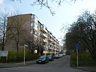
500 | Erich Kuttner (1887–1942), resistance fighter | July 13, 1962 | The street runs between Landsberger Allee (with which it is only connected for pedestrians) and Franz-Jacob-Straße. At its western end there has been a listed experimental panel building of type P2 since 1962 . The residential row was created according to a design by the team of architects Wilfried Stallknecht under the direction of Hermann Henselmann . Together with the cross streets, the apartment blocks form spacious and green interior areas. Some buildings from the 1970s received additional balconies instead of the previous French windows when they were renovated at the beginning of the 21st century. A barrack from GDR times (house number 31a) houses the 'Technical Service' area of the Lichtenberg housing association . |
| Ernst-Reinke-Strasse
( Location ) |
140 | Ernst Reinke (1891–1943), resistance fighter | Aug 10, 1962 | The street is an angled cul-de-sac with a new building block and at the same time cross street of Erich-Kuttner-Straße. It is connected to Max-Brunnow-Straße by a footpath. |
|
Franz-Jacob-Strasse
( Location ) |
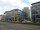
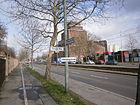
800 | Franz Jacob (1906–1944), resistance fighter | Apr 2, 1975 | The previous name was Plöseweg between 1940 and 1975 . Before 1940 it existed as Straße 134 in the gardens south of Roederstraße. It begins north on Landsberger Allee, crosses Karl-Lade-Strasse and leads to Storkower Strasse. At this junction are the Gustavo-Haus (rear right picture) and the 'Storkower Bogen' shopping center (rear left picture). |
|
Georg-Lehnig-Strasse
( Location ) |
140 | Georg Lehnig (1907–1945), resistance fighter | Aug 10, 1962 | The street is an angled cul-de-sac with a new building block, cross street from Erich-Kuttner-Straße. It is connected to Max-Brunnow-Straße by a footpath. |
| Gustav-Zahnke-Strasse
( Location ) |
140 | Gustav Zahnke (1908–1930), resistance fighter | Aug 10, 1962 | The street is an angled cul-de-sac with a new building block, cross street from Erich-Kuttner-Straße. It is connected to Max-Brunnow-Straße by a footpath. |
|
Herbert-Tschäpe-Strasse
( Location ) |
600 | Herbert Tschäpe (1913–1944), resistance fighter | July 11, 1973 | This inner-area access road winds between Hohenschönhauser Strasse and Landsberger Allee in four sections around the loose residential development. |
|
Herzbergstrasse
( Location ) |
420 (in the district) |
Herzberg, 58.4 m above sea level NHN east of the street. | 1893 | The western part of Herzbergstrasse between Roederplatz and Vulkanstrasse belongs to the district of Fennpfuhl, which includes plots 1–10. The residential buildings on the south side (30 meters from the edge of the sidewalk) are in two apartment blocks 1-6 and 7-10, separated by Paul-Zobel-Straße. On the north side is the apartment block on plots 149–155, next to Bernhard-Bästlein-Straße is the parking lot of the department store and a green space designed as Roederplatz. The end of the street in the northwest is marked by the flat building on plot 160. The eastern plots including the Vulkanstraße intersection are in (Alt-) Lichtenberg. The tram drives through the street. |
| Hohenschönhauser Strasse
( Location ) |
820 | Direction to Hohenschönhausen | around 1885 |
The right picture shows the view from Volkspark to Hohenschönhauser Straße (in the foreground) and the subsequent residential area towards Landsberger Allee in 1978. The road runs between Maiglöckchenweg as a continuation of Oderbruchstraße to Weißenseer Weg (without the intersection) and sits down as Konrad -Wolf-Straße (previously: Berliner Straße ) in the Alt-Hohenschönhausen district . The M5 and M6 metro lines drive through the street. There is a parking lot on the south side, followed by two apartment blocks 1–8 and 9–15 on an access road to Judith-Auer-Straße, to which the transverse building (senior citizens' club) belongs. The parking areas on the opposite north side were left in the district when the Volkspark areas were replaced. From Otto-Marquardt-Straße there is an access road fifteen meters from the road to houses 20/23, 24/26 and 27/29, which leads further south-east to Weißenseer Weg. Plots 66–75 are located west of the street as a flanked apartment block between the BVG site and the Volkspark (beyond the district boundary), building 76 belongs to the sports field and 77 on the corner of Stellerweg to the tennis court. Plots 80, 80a and 80b (housing estate and KGA restaurant, on the other side of the “Hauptweg”) belong to the neighboring district of Prenzlauer Berg. The route is already entered in the Hobrecht plan, section XIII, as street 39 starting from street 17 (Oderbruchstraße) and marked as an avenue. When it was built, it was called Hohen-Schönhausener Strasse and began under this name on Landsberger Chaussee with properties 1 and 2 (opposite Thaerstrasse), followed by construction sites on Berlin-Lichtenb. Terrain Ges. To Weißenseer Weg. The road was part of the old connection route from Berlin to Hohenschönhausen from the road to Alt Landsberg. Since 1911, when Oderbruchstrasse was laid, Hohenschönhauser Strasse has been located from this to the intersection of Weißenseer Weg / Konrad-Wolf-Strasse. At that time, the road with horseshoe numbering ran on the north side from road 17 to Weißenseer Weg. According to the city map, the street leads to the summer street (Lichtenberger border) of Wilhemsberg. In the 1943 address book, the street in the Hohenschönhausen district of the Weißensee administrative district is listed and had a petrol station and several factory buildings. Until the 1970s - with the construction of the apartment blocks around the Fennpfuhl - the street consisted of a one-sided carriageway with the tram on the edge. |
|
Josef-Orlopp-Strasse
( Location ) |
360 (in the district) |
Josef Orlopp (1888–1960), trade union official and member of the National Council of the National Front | Aug 19, 1960 | A short western section of the street belongs to the district of Fennpfuhl and thus forms its southern border. The remaining 1000 meters run in Lichtenberg . When the industrial area around Herzbergstrasse was laid out, the street was called Rittergutstrasse after the former Rittergut Lichtenberg in the east of Dorfstrasse. |
| Judith-Auer-Strasse
( Location ) |
280 | Judith Auer (1905–1944), resistance fighter | July 11, 1973 | The street runs between Hohenschönhauser Straße and Landsberger Allee and continues south on Franz-Jacob-Straße. The most striking building is the 'Castello', a shopping center designed by the architect Hinrich Baller on the corner of Landsberger Allee. |
|
Karl-Lade-Strasse
( Location ) |
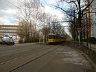
1000 | Karl Lade (1909–1945), resistance fighter | Jun 26, 1975 | The street is part of the former Roederstraße . On the northeast side of the street, restaurants, market gardens and a natural ice cream factory had settled near the Fennpfuhl ( Eiswerke Lichtenberg Louis Dittmar ). At the beginning of the 20th century, there was a wheelhouse at the junction with Landsberger Allee . His name was still preserved until 2011 in a local pub on the corner of Buggenhagenstrasse. Karl-Lade-Strasse runs from Landsberger Allee to Franz-Jacob-Strasse and ends shortly after crossing it. The Roederstraße led on to Roederplatz , where the traffic route continued with a slight bend as Herzbergstraße . Since the redesign in the late 1970s, only the tram has been running on this part of Roederstrasse , which has been de-dedicated since the residential area was built, and a pedestrian and bicycle path runs parallel. |
| Karl-Vesper-Strasse
( Location ) |
70 | Karl Vesper (1883–1933), resistance fighter | July 13, 1962 | The first name was Stichstrasse 4 . The angled cul-de-sac contains only one new block and a daycare center in the corner. |
|
Landsberger Allee
( Location ) |
1000 (in the district) |
Altlandsberg , city in Brandenburg | Jan. 31, 1992 | The street section of Landsberger Allee in Fennpfuhl borders on the districts of Prenzlauer Berg (west) and Alt-Hohenschönhausen (east). Fennpfuhl has properties 106–228d (even) on the south side and 131a – 191a (odd) on the north side. The northern side of the street between the Ringbahn and Oderbruchstrasse belongs to the Prenzlauer Berg district. Landsberger Allee leaves the district at the confluence of Vulkanstrasse . The 'andel's Hotel Berlin' (No. 106) and the shopping center ' Castello ' (No. 171) are located in the avenue area Berlin-Fennpfuhl . The street was originally called Landsberger Allee (from 1950 Leninallee ) between the S-Bahn station Landsberger Allee and Oderbruchstrasse , from there it was called Landsberger Chaussee out of town . In 1973 Landsberger Chaussee was incorporated into Leninallee up to Vulkanstraße . When it was renamed in 1992, the entire Leninallee was given the name Landsberger Allee. |
|
Max-Brunnow-Strasse
( Location ) |
550 | Max Brunnow (1896–1940), resistance fighter | July 13, 1962 | The street is located inside the residential area and runs there in a U-shape. There are apartment blocks from the 1960s on the quiet residential street. In the quiet residential street there are apartment blocks from the 1960s and various garage buildings. A prefabricated building is reserved for various uses, so the prisoners were housed during the renovation of the prison in Düppel. At the confluence with Storkower Straße there is a car dealership and behind it a small three-story, publicly used prefabricated building, which served from 2007 to 2010 as temporary accommodation for inmates of the JVA Düppel . |
|
Möllendorffstrasse
( Location ) |
420 (in the district) |
Wichard von Möllendorff (1724–1816), Prussian field marshal |
69091231 (with interruption) |
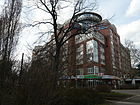
Only the northern part of this street between Storkower Straße and Herzbergstraße belongs to the Fennpfuhl area, the rest to (Alt-) Lichtenberg. Since it was built in earlier centuries, the traffic route was called Dorfstraße , and from 1910 Möllendorffstraße . Between January 1976 and January 9, 1992 it was named Jacques-Duclos-Straße after the French communist Jacques Duclos . The most conspicuous building ensemble is the 'Möllendorff-Passage', an office and business complex that was built in the late 1990s by a Bavarian group of investors. |
| Oderbruchstrasse | 320 | Oderbruch , a landscape in Brandenburg | Nov 9, 1911 | The street, originally Street 17, Section XIII / 1 of the Hobrecht Plan , was the northern extension of Thaerstraße when it was named . It forms the border between Prenzlauer Berg and Fennpfuhl. With the expansion of the Oderbruchkippe the course ceased, the road 106 was led to the Lichtenberg area . |
| Otto-Marquardt-Strasse
( Location ) |
350 | Otto Marquardt (1893–1944), resistance fighter | July 11, 1973 | The street runs twice angled between Hohenschönhauser Straße and Landsberger Allee . At its edges are the 'Judith Auer' senior citizens' home, a school building that was newly inaugurated in 2014 for handicapped people, as well as the Europa-Kita, developed from an earlier service cube, and the 'Entdeckerland' day-care center. The seagull fountain, a work by Baldur Schönfelder from 1981, is located in the open space southeast of the retirement home . |
|
Paul-Junius-Strasse
( Location ) |
500 + 360 (in the district) |
Paul Junius (1901–1944), resistance fighter | Apr 2, 1975 |
The street is angled several times and with branches mainly in north-south direction. It begins on Scheffelstrasse, so the southern part of the street is in the Lichtenberg district . It crosses Storkower Straße and branches off between Wolfgangspfuhl and Möllendorffstraße , bends to the east and ends with its northern tip at Weißenseer Weg .
The first name of the street, which has existed since the end of the 19th century, was Woerdenstraße or Extended Woerdenstraße . At the northern end there is the Shostakovich Music School Berlin-Lichtenberg , which, together with the Adult Education Center (VHS) Lichtenberg, uses a school building opened in 1907. At the end of June 2011, the adult education center was given the honorary name Margarete Steffin . There is also access to the Evangelical Community Center Am Fennpfuhl and the Fennpfuhlpark . The Lichtenberg district office, which owns a playground by the water, invested around 280,000 euros in 2015 to create an attractive rock climbing landscape at this point. According to the confirmed plans of the landscape office atelier8, several three meter high rocks made of shotcrete are to be built in the center, which will offer different degrees of difficulty in climbing . All around the foundations, a 40 centimeter thick layer of fall protection gravel ensures adequate safety. The Spielberg will be redesigned around the climbing facility with a radius of around 13 meters and will have concrete loungers as a resting area. The 'House of Generations' is located in the Paul-Junius-Straße 64 building, where numerous cultural events take place. |
| Paul-Zobel-Strasse
( Location ) |
650 | Paul Zobel (1891–1945), resistance fighter | July 11, 1973 | The inner-area access road with a green, park-like inner courtyard is U-shaped. At the eastern residential buildings, a glass elevator added on the outside during the renovation over half a floor made the entrances accessible for the disabled . |
|
Roederplatz
( Location ) |
110 × 40 | Hermann Roeder (1856–1941), manor owner and local politician in the Lichtenberg community |
1896 1975 to June 2011 unnamed |
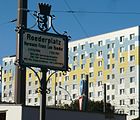
The intersection of the streets Weißenseer Weg , Möllendorffstraße , Roederstraße and Herzbergstraße was named Roederplatz when the road system was expanded. With the emergence of the new building area around the Fennpfuhl, the square and its name were canceled, but it was preserved in the knowledge of the population and on some maps. At the request of Roeder's heirs, BVV Lichtenberg decided on June 3, 2011 to reassign the historic square name for a small green area further east. On September 14, 2011, representatives of the district office unveiled the new plaza in the presence of a descendant of the Roeder family and a historian. |
| Rudolf-Seiffert-Strasse
( Location ) |
1030 | Rudolf Seiffert (1908–1945), resistance fighter | Apr 2, 1975 | The road essentially forms a square that was created on a previous allotment garden. In the spacious inner courtyard there are, among other things, three kindergarten type buildings with a day care center and youth welfare facilities. The low building, house number 53, is the "Gospel Christian Congregation, meeting place for young and old". |
|
Storkower Strasse
( Location ) |
1740 (in the district) |
Storkow , town in the Oder-Spree district in Brandenburg | 1919 | The busy street is in the district right next to the Ringbahn , residential blocks and parking spaces determine the north side. The section between Landsberger Allee, excluding the intersection and its streets, and Möllendorffstraße belongs to the district . The Fennpfuhler section was created in 1975 as an extension of Storkower Strasse beyond the connection to Thaerstrasse and what was then Leninallee . |
| Street 106
( Location ) |
270 | Numbering when routing | after 1955 | The road 106 is located in the Lichtenberg area between the south-east corner (border point Lichtenberg / Weißensee / Prenzlauer Berg) of the Jewish cemetery belonging to Weißensee and the Weißenseer Weg , which belongs to Alt-Hohenschönhausen . It is an unpaved path that runs between a commercial property (bus parking space) and the strip of "KGA Langes Höhe" along the cemetery wall in front of the Jewish cemetery. The road 106 is the extension of the Oderbruchstrasse, which ran straight from the corner to the Hohenschönhauser Strasse on the border to Prenzlauer Berg and was covered by the Oderbruchkippe . The road 106 leads the Gürtelstraße (west) from the Volkspark Prenzlauer Berg to the Steller Weg at the Sportforum Hohenschönhausen . This extension of the Oderbruchstrasse initially led through arbor colonies and was overdue due to the expansion of the Oderbruchkippe from the rubble mountain of the war years. The last allotment garden on the Kippengelände (designed as Volkspark Prenzlauer Berg ) was closed in 1982. In the 2010s the traffic route is shown with a street sign, but since no properties are assigned, it is not included in the official street list. |
|
Volcano road
( Location ) |
1120 | formerly resident industrial company Vulkan-Werke | 1913 | The northern section was planned as street G , but the part reaching to Herzbergstraße was already called Vulkanstraße. In the 1920 address book the undeveloped Vulkanstrasse from Herzbergstrasse is named, in 1943 coal yards, construction sites and a heavy transport station of the Liechtenberg manor are listed on the road between Herzbergstrasse and Landsberger Chaussee. On the map from 1946, a guided tour to the south to Rittergutsstraße is shown, which enables a connection between Landsberger and Frankfurter Allee via Ruschestraße. The road forms the eastern border between the districts of Lichtenberg and Fennpfuhl, with the road area in Lichtenberg. It runs in a north-south direction between Landsberger Allee and Josef-Orlopp-Straße and continues south in Ruschestraße in the Lichtenberg district. Plots 1, 3, 10, 12, 13 are indicated for commercial areas on the eastern side of the street. On the west side are the eleven-storey WBS-70 apartment blocks 20-23, on the cross street of the same name (a low-rise building) and block 25/26, which are connected along street 27/28/29. The low-rise building 30 stands on another side street of the same name, before (on the edge of the residential area) the parking areas are filled with strips of trees to Elli-Voigt-Straße (south of Herzbergstraße) to Paul-Zobel-Straße . At the southern end are the two six-story apartment blocks on 50/54 and 55/57, which continue at right angles at Josef-Orlopp-Straße 31-17 . |
|
Weißenseer Weg
( Location ) |
1720 | Direction to Weißensee | 1850 | A north-eastern part of the street is in Alt-Hohenschönhausen , part of which forms the district boundary. The road has been a traffic route between the former villages of Lichtenberg and Weißensee that has existed for several hundred years. It is the southern continuation of the former Lichtenberger Straße and in turn continues south in Möllendorffstraße . In 1976 the traffic route was named Ho Chi Minh Street . In 1992 it was renamed, although the street in the real sense should rather be classified as a promenade or avenue, i.e. Weg in the literal sense of the word does not apply. |
Roads or road sections that no longer exist
Some street names that existed in the mid-1970s honored personalities from the GDR. After the fall of the Wall (1992) they got their previous names back, for example Jacques-Duclos-Straße was the name of → Möllendorffstraße from January 1976 to January 9, 1992 . Ho-Chi-Minh-Strasse was the name of the → Weißenseer Weg between Strasse 106 and Herzbergstrasse . Leninallee had been the inner city name of the street in the direction of Marzahn since 1950, Landsberger Chaussee followed in 1973 with the construction of the Marzahn district, before it was renamed → Landsberger Allee in 1992 .
| Name / location | Length / dimensions (in meters) |
Origin of name | Designation date |
Renaming / cancellation |
Remarks |
|---|---|---|---|---|---|
| Amelangstrasse | Person with the surname Amelang | Feb 21, 1940 | Apr 1, 1975 | It was included in a section of → Alfred-Jung-Strasse in the 1970s . This short west-east street led through allotment gardens in 1955 and was located between Wolfgangstraße, which originally reached Roederstraße (no longer preserved), and Woerdenstraße . It was first listed in the Berlin address book in 1941 and is already extensively built on. The owner of larger areas was the Wolfgang-Grundstücks-GmbH from Berlin-Wilmersdorf , which became insolvent in 1942 and placed under compulsory administration. Luise-Berlin specifies the namesake as a former council of war . In the address book of the year 1840 the war councilor C. A. F. Amelang, an official in the Ministry of Finance, is mentioned. |
|
| Eberhardstrasse | 450 | Eberhard , male first name | before 1907 | around 1975 | The traffic route was laid out as road 64a west of Dorfstrasse parallel between Wördenstrasse and Wolfgangstrasse. It originally ran between Scheffelstrasse and Roederstrasse. The northern part has merged into Paul-Junius-Straße , a southern part has been preserved in a cul-de-sac in (Alt-) Lichtenberg . |
| Hohenschönhausen (ne) r way | 1150 | Direction to Hohenschönhausen | around 1899 | around 1975 | This unpaved road more than 1000 meters long in the allotment garden colony diagonally between Roederplatz / Herzbergstraße and Landsberger Chaussee was first mentioned in the address book for Berlin and its suburbs in 1899. When the new residential areas in the west of Lichtenberg were built in the mid-1970s, it was built over and → pulled in. |
| Plöseweg | 150 | Johann (Hans) Plöse (18th century), local politician in the Lichtenberg community | Feb 21, 1940 | Apr 1, 1975 | According to the development plan from 1880, it is laid out as road 61 in section XIII . In 1960 the west side of the street up to Buggenhagenstraße on Roederstraße was built on. The routed continuation to the southwest leads through allotment gardens to the Ringbahn area . From 1975 onwards, this tour will be re-routed to → Franz-Jacob-Straße . |
| Roederstrasse | 1000 | The Roeder family of landowners in the municipality of Lichtenberg | after 1896 | Apr 1, 1975 | → Karl-Lade-Strasse
It reached from Landsberger Chaussee (later Landsberger Allee ) to Dorfstrasse (later Möllendorffstrasse ) and Roederplatz at its northern end. Parcel numbers were not set until the 20th century. The first residential buildings were named after their owners: Beinsches Haus, Schultzsches Haus, Pellachsches Haus. In 1897 and 1898, the address book contains Roederstraße with two residential buildings and construction sites, including that of manor owner L. Roeder in 1898. |
| Woerdenstrasse (also: Wördenstrasse ) and Extended Woerdenstrasse |
220 (extended Woerdenstrasse: around 400) |
historical hallway name; Field strips that lay behind the farms were referred to as 'Wörden'. |
around 1906 | Apr 1, 1975 | Wördenstraße is mentioned for the first time in the address book in 1907, and goes off from Eldenaer Straße . The location is between Eldenaer Straße (from 1908: Scheffelstraße) and Roederstraße and later via this to Weißenseer Weg as extended Wördenstraße . With the new district around the Fennpfuhl that was built in the 1970s, it was incorporated into the → Paul-Junius-Strasse - Alfred-Jung-Strasse in 1975, including the extended Woerdenstrasse . At the northern end of the street there was a sanatorium run by the State Insurance Institute. Across Roederstraße, on the extended Wördenstraße to Weißenseer Weg, a massive school building was inaugurated in 1907, which was initially a community school. Later a polytechnic high school (EOS) moved into one half of the building, the other half is used by the Lichtenberg VHS . Instead of the EOS, the Lichtenberg Music School has been located in the southern wing of the building since the 21st century .
The route of the Wördenstraße formed the western edge of the development of the Dorfstraße Lichtenberg, the course of which was determined by the flow that formed an outflow from the Langpfuhl and Fennpfuhl (Vennpfuhl) from the Wilhelmsberg district to the Rummelsburger Bucht . |
| Wolfgangstrasse | 220 | Wolfgang von Anhalt (1492–1566), sovereign prince | after 1906 | Apr 1, 1975 | The existing street west of Möllendorffstrasse became part of the → Paul-Junius-Strasse route with the construction of the neighborhood surrounding the Fennpfuhl . On the special map of Berlin, the route to the west parallel to Lichtenberger Dorfstrasse is named Wolfgangstrasse. She is from the village road (north of Frankfurt Street, district Lichtenberg) to the northwest to Eldenaer road over road 54 and between "Krause Pfuhl" and 54a through the space T (with the Fenn Pfuhl) at the Roedernstraße , continue on the road 62 away and the southeast of the "Langen Pfuhl" cut to the intersection of Weißenseer Straße / Landsberger Chaussee . In the Hobrecht plan of 1863, this route corresponds to the northern section of Platz U and Street 57 ( street to Lichtenberg ) as a route from Street 64 / Section XIII . The street name is said to have been determined by Kaiser Wilhelm I when a commemorative coin allegedly found along the street was brought to him. Their coinage came from Prince Wolfgang. The street is listed for the first time in the address book from 1907, starting from Eldenaer Straße and noted as vacant. The street is (1907) between Eldenaer Straße (one year later already Scheffelstraße) and Roederstraße west of Dorfstraße (Möllendorffstraße) parallel to Wördenstraße . |
Further locations of Fennpfuhl
- Allotment garden facility (KGA) 'An der Roedersiedlung', located between Karl-Lade-Strasse and Erich-Kuttner-Strasse. The facility was founded in 1905 and until around 2005 was called the colony 'Am Alten Steuerhaus' after the nearby historic Lichtenberg wheelhouse . Around 2006 it was named after the Roeder family, who lived in the former municipality of Lichtenberg . In 2010 the facility still comprised 46 parcels on an area of 8070 m².
- Allotment garden 'Langes Höhe' (Stellerweg 29), located on the district border between Lichtenberg and Pankow or the district border to Prenzlauer Berg and Weißensee , in the northernmost tip of Fennpfuhl. The area, acquired by Otto Lange and divided into 136 parcels, was leased to interested parties in 1906. The KGA is accessed through a right-angled system of colony paths. In the north-west-south-east direction the border road and Stellerweg, leaving Glaßstraße from the transverse Alpine path, continued to Weißenseer Weg Grünweg, to the south-east parallel to it: Dorf-, Wiesen-, Feld-, Koloniestraße. There is an industrial site between Grenz- / Grünstraße and Weißenseer Weg, and a BVG company site adjoins it in the southeast. The Stellerweg lies in the route of the routed road. The facility was built in 1906 on barren land. The garden users have built a home for themselves at Stellerweg 139.
-
Fennpfuhlpark with
- Fennpfuhl and
- Langpfuhl
- Fennpfuhl Bridge
-
Youth club 'Tube' formerly BBC (Bernhard-Baestlein-Club) :
A pedestrian tunnel built in 1976 under the Weißenseer Weg near the intersection of Karl-Lade-, Möllendorff- and Herzbergstraße had to be closed in 2000 because of dilapidation and constant vandalism . Between September 2010 and January 2011, this facility was converted into a new youth club house for 435,000 euros, which is sponsored by the Social Diakoniewerk.
See also
Web links
- Office for Statistics Berlin-Brandenburg: List of streets and squares in the Lichtenberg district (as of February 2015) (PDF; 1513 kB)
- Street directory Fennpfuhl. kaupert media gmbh, accessed on October 30, 2010 .
Individual evidence
- ↑ City map Berlin 1907: north of the central cattle yard
- ^ Wilhelmsberg . In: Address book for Berlin and its suburbs , 1900, V. Theil, p. 110.
- ^ Street map of Berlin . VEB Landkartenverlag, Berlin 1961.
- ↑ a b c Berlin plan 1987, VEB Tourist-Verlag, Berlin / Leipzig.
- ↑ Website of the Senate Department for Urban Development and the Environment Public wells with brief information and a photo of the well, the information is no longer up-to-date because the metal parts have been dismantled.
- ↑ Memorial for Hans Rosenthal and his three Lichtenberg rescuers will be inaugurated on September 8th. Press release from the Lichtenberg District Office, August 29, 2011
- ↑ Press release of the Lichtenberg District Office from September 24, 2019
- ↑ Buggenhagenstrasse . In: Address book for Berlin and its suburbs , 1899, V. Theil, p. 99. “Landsberger Chaussee * 1,1a – 5: owner Ziegeleibes. G. Buggenhagen (apartment buildings), 6: new building (Schlächtermstrasse), 7–9: building sites, 10: four-party building (E: Darmhndl.), Building sites * Roederstraße “(Buggenheimstraße not yet mentioned in the 1898 address book).
- ↑ a b Roederstrasse . In: Address book for Berlin and its suburbs , 1898, V, p. 95. “Roederplatz: Dorfstraße, Roederstraße: on Roederplatz: construction site of manor owner L. Roeder (wh. Outside), Openheimer'sches Haus, Schultz'sches Haus, construction sites * Strasse 59 * Construction sites * Landsberger Chaussee “.
- ^ Berlin address books from 1880 and 1882 (Wilhelmsberg)
- ↑ a b Berlin city map from 1906 , accessed again on April 9, 2019.
- ↑ a b c d e Berlin city map (around 1954): Hohenschönhausen around 1954
- ↑ Buggenhagenstrasse . In: Berliner Adreßbuch , 1930, Part IV, p. 2048.
- ↑ Monument P2 experimental building
- ↑ Marcel Gäding: A five-storey building in the Fennpfuhl residential area was the model for residential construction in the GDR . In: Berliner Zeitung , May 25, 2002; Retrieved August 22, 2012.
- ↑ a b c d e Berlin city map (1921)
- ↑ The "Heart Mountain" lies between the White Dove and the Herzberge insane asylum (Evangelical Hospital Queen Elisabeth Herzberge): City map Berlin 1907
- ↑ Hohen-Schönhausenerstrasse . In: Berliner Adreßbuch , 1905, V, p. 159.
- ^ Hohenschönhausener Strasse . In: Berliner Adreßbuch , 1912, V, p. 292. “Hohenschönhauser Strasse (Post Wilhelmsberg)”.
- ↑ City map of Berlin (1946). Richard Schwarz, map dealer u. Geogr. Verlag, Berlin W.35
- ↑ Weißensee administrative district> Hohenschönhauser Strasse . In: Berliner Adreßbuch , 1943, IV, p. 2336.
- ^ Streets with names of resistance fighters . In: Neues Deutschland , June 27, 1975, p. 8.
- ↑ Roederstrasse . In: Address book for Berlin and its suburbs , 1900, V, p. 106.
- ↑ Landsberger Allee property allocation to districts ; newly accessed on April 27, 2019.
- ↑ City map Berlin 1955
- ↑ Streets bear the names of resistance fighters . In: Neues Deutschland , September 25, 1973, p. 8.
- ^ Homepage of the Senate Department for Justice with brief information on the JVA branch in Lichtenberg; Retrieved September 25, 2011
- ↑ Information on Möllendorffstrasse near Kaupert
- ↑ Nils Holgersohn School inaugurated ; accessed on May 10, 2015.
- ↑ possibly day care center ; accessed on May 10, 2015
- ^ Website of the Berlin Senate Public Fountains in Berlin ; Retrieved April 18, 2010
- ↑ VHS gets a new name . In: Berliner Morgenpost , weekend extra, 26./27. February 2011
- ↑ Climbing rocks to play with . In: Berliner Woche , February 25, 2015, p. 9.
- ^ Instructions for puberty . In: Berliner Woche , January 27, 2016, p. 4.
- ↑ a b Roederstrasse . In: Address book for Berlin and its suburbs , 1899, V. Theil, p. 101 (entry of Roederstraße between Dorfstraße / Roederplatz - Buggenhagenstraße (south) - Landsberger Chaussee, with three inhabited houses and construction sites).
- ^ Roederplatz on Luise-berlin
- ^ Information on the re-erection of the Roederplatz sign on the BVV / Die Linke website , accessed on September 29, 2011
- ↑ Storkower Strasse near Kauperts
- ↑ City map Berlin (1960), Verlag Richard Schwarz Nachf .: Lichtenberg around 1960
- ^ Berlin with sector boundaries , Verlag Richard Schwarz Nachf. Lichtenberg around 1960 , accessed again on April 27, 2019.
- ↑ a b Berlin city map (1961), Verlag Richard Schwarz Nachf .: Weißensee
- ↑ Vulkanstrasse . In: Berliner Adreßbuch , 1920, Part V., p. 132.
- ↑ Vulkanstrasse . In: Berliner Adreßbuch , 1943, Part IV, p. 2301.
- ↑ Berlin city map from 1869 ; accessed again on April 19, 2019
- ↑ Genwiki with explanations on Amelang
- ↑ a b City map of Berlin 1955
- ↑ a b c Berlin city map from 1943
- ↑ Amelangstrasse . In: General housing gazette for Berlin, Charlottenburg and surroundings , 1841, part IV, p. 2238. "Wolfgang- bis Eberhardstr .: construction sites, 19-25: Wolfgang-Grundstück GmbH,".
- ↑ Amelangstrasse on berlingeschichte.de
- ↑ Council of War Amelang . In: General housing gazette for Berlin, Charlottenburg and surrounding areas , 1840, I. Theil, p. 7. “Amelang, CAF, Kriegsrath, Exped. in Finance Minist., Dorotheenstr. 13 ".
- ↑ Eberhardstrasse . In: Berliner Adreßbuch , 1908, V. Teil, p. 216 (Eberhardstrasse is mentioned in the address book for the first time in 1908. It is undeveloped and goes from Scheffelstrasse.).
- ↑ Hohenschönhausen way . In: Address book for Berlin and its suburbs , 1899, V. Theil, p. 100. "<- Roederplatz -> (unbuilt)".
- ↑ Berlin city map 1961
- ↑ Roederstrasse . In: Berliner Adreßbuch , 1895, V, p. 111.
- ↑ Roederstrasse . In: Address book for Berlin and its suburbs , 1897, V, p. 80 (The Roederstraße is entered from Dorstrßaße / Roederplatz with the Openheimer and Schultzschen houses.).
- ↑ a b Website of Luise-berlin with the street name explanation. Retrieved April 11, 2010.
- ↑ Wördenstrasse . In: Adreßbuch für Berlin und seine Vororte , 1899, V, p. 101 (Before 1906 there was no entry on Wördenstrasse. In 1899, only Buggenhagenstrasse with construction sites was listed as the intersection of Roederstrasse.).
- ↑ Wördenstrasse . In: Berliner Adreßbuch , 1907, V, p. 210 (Wördenstrasse is included as an undeveloped street from Eldenaer Strasse.).
- ↑ Kiessling's large special card for the area around Berlin . Published by Alexius Kiessling in Berlin.
- ↑ Wolfgangstrasse . In: Adreßbuch für Berlin und seine Vororte , 1899, Theil V., p. 101 (Before 1906 there was no entry for Wolfgangstrasse, cross street of Roederstrasse is only Buggenhagenstrasse with construction sites in 1899).
- ↑ Wolfgangstrasse . In: Berliner Adreßbuch , 1905, Theil V., p. 101 (1905 there is no entry for Wolfgangstrasse. The intersection of Eldenaer Strasse is Dorfstrasse and for Roederstrasse only Buggenhagenstrasse.).
- ↑ Special plan of Berlin with precise details of the police stations and main team boundaries on a scale of 1: 15000. Processed according to official material. Printed and published by Hans Müncheberg
- ↑ Luise-Berlin to Wolfgangstrasse
- ↑ Wolfgangstrasse . In: Berliner Adreßbuch , 1907, 5th part, p. 210. "Wolfgangstrasse (unbuilt) <-Eldenaer Strasse->".
- ↑ a b Homepage Gartenfreunde Lichtenberg , accessed on June 18, 2010
- ^ Website of the KGA Langes Höhe
- ↑ What you should know about us
