List of pedestrian tunnels in Berlin
Pedestrian tunnels in Berlin have existed since the 19th century. They often link the pedestrian network to broad infrastructure facilities in Berlin .
History of the Berlin pedestrian tunnel
At the end of the 19th century , the Berlin train stations represented a major obstacle to through traffic. The first pedestrian tunnels therefore led under the extensive track aprons and saved pedestrians long detours. No new pedestrian tunnels were built during World War I and the following years. With the expansion of the subway in the period from 1923 to 1931, newly built subway stations were mostly built at a depth of one and a half times and equipped with mezzanines, which enabled pedestrians to safely cross the increasingly busy streets without having to pass the platform barriers. In the Third Reich , new pedestrian tunnels were built in connection with construction work for the Olympic Games in 1936 and the expansion of the east-west axis . Some mezzanine floors of the north-south S-Bahn, which opened between 1936 and 1939, could also be used by pedestrians.
After the Second World War , there were different framework conditions for urban planning in the western and eastern parts of Berlin. In the western part of Berlin, the construction of pedestrian tunnels reached its peak in the 1960s and 1970s. During these decades, plans were implemented whose basic idea of a car-friendly city dates back to the 1950s. The aim was to spatially separate the various types of transport. A closed city ring and four tangents were planned that would cross the city center and at the same time create a connection to the Berliner Ring . At the same time, the widening of many main roads was planned. Pedestrians should be able to safely pass through busy roads and especially crossings with the help of bridges or tunnels. This also increased the vehicle capacity at the intersections, as no times for pedestrians had to be taken into account when determining the traffic light phases.
In the eastern part there were two important planning sections, in which some pedestrian tunnels were also created. The first section began in the 1960s. The historic center of Berlin was to be redesigned into a socialist city center. Above all, the area around Alexanderplatz was generously changed, as can still be seen today in the Berlin TV tower and the buildings around the square. The streets Leipziger Strasse - Grunerstrasse and Adlergestell - Schnellerstrasse were also significantly rebuilt. The second phase was the decision to build the new housing estates in the Marzahn and Hellersdorf districts in the 1970s . During the expansion of the tram , several tunnels were created as access to the stops.
After reunification , only one new tunnel was built in Staaken . At the same time, other systems were extensively renovated, such as the tunnel at the Treptower Park S-Bahn station or at the Schöneweide S-Bahn station . Systems that are not used regularly are for the most part in a neglected condition. Many pedestrian tunnels have therefore now been closed or even demolished.
List of tunnels
The list summarizes the public pedestrian tunnels in Berlin in a table. It does not include private facilities or the access structures to underground or S-Bahn stations, which can often also be used to cross the streets. The list is sorted chronologically according to the year it was opened.
| image | tunnel | supporting documents | location |
|---|---|---|---|

|
The Schwartzkopffstrasse pedestrian tunnel under the platform in front of the Szczecin train station connected Schwartzkopffstrasse and Feldstrasse. In 1952 the east portal that led directly to the (political) west on Feldstrasse was bricked up. After the Berlin Wall was built, the tunnel was in the immediate border area. Therefore, more walls were drawn in in the following years and the exit on Schwartzkopffstrasse was filled. The walling on Feldstrasse was replaced by an access grille in 2008. | 52 ° 32 '12 "N, 13 ° 23' 1" E | |
| The tunnel under Königstrasse, which was probably opened in 1905, was located east of Glienicke Bridge and connected the two parks. Originally the tunnel was only 13 meters long. It was lengthened to almost 30 meters when Königstrasse was widened in 1939. In 1974 it was closed. | 52 ° 24 '49 "N, 13 ° 5' 32" E | ||

|
The tunnel opened in 1910/11 under the sidings of the Grunewald station connects Cordesweg and Werkstättenweg. After reunification, it was completely demolished and rebuilt when the parking area was rebuilt. | 52 ° 29 ′ 45 ″ N, 13 ° 16 ′ 29 ″ E | |

|
The tunnel, opened in 1910, crosses under the tracks of the Rummelsburg depot and connected Saganer Strasse with Fischerstrasse. Its closing date is unknown. The tunnel is currently being used as a route for two district heating pipes . | 52 ° 29 ′ 48 ″ N, 13 ° 29 ′ 27 ″ E | |

|
This tunnel served as an underpass under the Dresden Railway north of the former Großbeerenstraße level crossing . The opening date and closing date are unknown. The level crossing was replaced at the end of the 1970s by a new construction of the Großbeerenstraße underpass. The entrances to the tunnel are walled up. | 52 ° 25 '35 "N, 13 ° 22' 25" E | |

|
This underpass is located to the west of Kaulsdorf train station as a connection between Heinrich-Grüber-Straße and Heinrich-Grüber-Platz. The tunnel was built in 1903. This is not the access tunnel to the platform, which is further east. | 52 ° 30 '44 "N, 13 ° 35' 15" E | |

|
The tunnel, opened in 1910, ran under the track apron of Görlitzer Bahnhof and connected Liegnitzer Strasse and Oppelner Strasse. On June 30, 1985, goods traffic was stopped by the Deutsche Reichsbahn . After 1990, the area was redesigned to become the Görlitzer Park green area . Most of the tunnel was demolished. | 52 ° 29 ′ 46 ″ N, 13 ° 26 ′ 14 ″ E | |
| The Excelsior Tunnel , opened in 1928, is a tunnel construction between the hotel and the Anhalter Bahnhof , privately financed by the owner of the Hotel Excelsior , but which was also available to the public to cross under Königgrätzer Straße (today Stresemannstraße). It was probably closed as early as 1945. It was demolished after 1985. | 52 ° 30 ′ 13 ″ N, 13 ° 23 ′ 0 ″ E | ||

|
Until the opening of the Spree Tunnel in Friedrichshagen in 1928, there was no fixed possibility of crossing the Spree and the Müggelsee between Rahnsdorf (Hessenwinkel) and Köpenick . The excursion traffic was so heavy that the ferries in Friedrichshagen were hopelessly overloaded. This is why this tunnel was built between Josef-Nawrocki-Straße and the “Am Müggelsee” hiking trail. The tunnel was built in three sections using caisson construction. It is a listed building. | 52 ° 26 ′ 41 ″ N, 13 ° 37 ′ 34 ″ E | |
| The tunnel was built on the occasion of the German Building Exhibition 1930/1931 and served as an internal connection between the former Messhallen II and III . He crossed under Masurenallee at the height of today's central bus station . Whether there was public use after the war is still to be determined, but it was marked in the development plans. The tunnel was demolished in the mid-1970s while preparing to build the new ICC . | 52 ° 30 ′ 23 "N, 13 ° 16 ′ 47" E | ||
| This tunnel was built on the occasion of the 1936 Summer Olympics . He passed under Passenheimer Strasse north of Schirwindter Allee. Its closing date is unknown. The tunnel was filled in in 2000, the entrances being completely demolished. | 52 ° 30 '42 "N, 13 ° 13' 51" E | ||

|
Originally, the Spreetunnel Stralau – Treptow was a tram tunnel from 1899 to 1932 and led from the tunnel road to the square at the Spreetunnel. In 1936 it was reopened to pedestrians. During the Second World War it was used as a provisional air raid shelter. The entrances were filled in after the war. In 1997 the eastern tunnel area was exposed for inspection, but filled in again after a few days. The invisible tunnel is a listed building. | 52 ° 29 ′ 20 "N, 13 ° 28 ′ 45" E | |

|
In 1938, two tunnels to the east and west of the central island were opened at the Großer Stern , which cross under the Strait of June 17 and also serve as access to the central island. There is no barrier-free access to the central island. The four gatehouses of the tunnels are under monument protection. | 52 ° 30 ′ 52 "N, 13 ° 20 ′ 58" E | |
| When Tempelhof Airport was built in the late 1930s, construction of a pedestrian tunnel began, but it was never completed. It led "from an airport building next to the entrance to the former departure hall to the other side of the street". The length of the preliminary construction work was 43 meters. | 52 ° 29 ′ 2 ″ N, 13 ° 23 ′ 16 ″ E | ||

|
The tunnel crosses under the Stettiner Bahn at Karower Kreuz and connects Rudelsburgstrasse with Ilsenburgstrasse at the level of Freischützstrasse. It was probably created with the expansion of the Karower Cross in the 1950s. | 52 ° 36 ′ 5 "N, 13 ° 27 ′ 18" E | |

|
The tunnel, built in 1958/1959, is the entrance to the central island of Ernst-Reuter-Platz and begins in the access structure from the Ernst-Reuter-Platz underground station . There is no barrier-free access to the central island. | 52 ° 30 ′ 44 ″ N, 13 ° 19 ′ 19 ″ E | |

|
This tunnel probably dates from the 1960s and is located under the Herkulesbrücke on the south bank of the Landwehr Canal. The western half under the bridge is a gallery open to the canal, to the east the actual tunnel to Lützowplatz is connected . | 52 ° 30 ′ 20 ″ N, 13 ° 21 ′ 10 ″ E | |

|
When the city motorway was expanded in the late 1950s, the Messedamm was rebuilt. In this context, a pedestrian tunnel was built at the intersection north of the Halenseestrasse intersection. The tunnel was demolished in the mid-1970s while preparing to build the new ICC . | 52 ° 30 ′ 15 ″ N, 13 ° 16 ′ 46 ″ E | |
| The planned tunnel under the Unter den Eichen road at the level of the Tietzenweg is an unrealized plan from the 1960s in connection with the expansion of the Unter den Eichen road as part of the western bypass, similar to the expressway . | 52 ° 26 ′ 52 "N, 13 ° 17 ′ 58" E | ||
| The planned tunnel under the Bundesallee at the level of Durlacher Straße is an unrealized plan from the 1960s in connection with the expansion of the Bundesallee, which is similar to an expressway. | 52 ° 28 ′ 54 "N, 13 ° 19 ′ 46" E | ||

|
Immediately in front of the exit of the Treptower Park S-Bahn station is a pedestrian tunnel, opened in 1964/1965, which crosses under the street “An den Treptowers” at the level of Hoffmannstraße. The tunnel was renovated in 1993 and equipped with escalators . | 52 ° 29 ′ 38 "N, 13 ° 27 ′ 40" E | |
|
external image |
This tunnel served as a connection from the Europa Center to the central island of Breitscheidplatz . It opened in the mid-1960s. In 1977/78 the square was rebuilt, and the street crossed under was included in the pedestrian area. The tunnel has therefore become superfluous. The tunnel was probably then used to build the public toilet. | 52 ° 30 ′ 18 ″ N, 13 ° 20 ′ 12 ″ E | |

|
When the city motorway was expanded, Jakob-Kaiser-Platz was redesigned and crossed by what is now the 111 federal motorway . In order to be able to cross under the northern motorway ramp, the access tunnel of the underground station , which was built ready for shell construction in the early 1970s, was released as a pedestrian tunnel. The subway was only opened in 1980; since then, the tunnel has served as the only access to the platform. | 52 ° 32 ′ 11 "N, 13 ° 17 ′ 38" E | |

|
The tunnel, opened in 1968, was created during the construction of the west bypass and runs under Albrechtstrasse. At that time there were no pedestrian lights at this point. The tunnel, which was closed in 2006, is still there, the entrances have been torn off and covered. | 52 ° 27 ′ 23 "N, 13 ° 19 ′ 23" E | |

|
When Alexanderplatz was redesigned in 1968, several pedestrian tunnels were built. The largest led east of the Alexanderplatz underground station, which was directly accessible, under the Grunerstraße car tunnel to Karl-Marx-Allee . In 2008/09 the tunnel was closed and its entrances were demolished. | 52 ° 31 '19 "N, 13 ° 24' 50" E | |

|
There was a short tunnel under Karl-Liebknecht-Strasse immediately west of the tram . It opened in 1968 and closed in 2010. | 52 ° 31 ′ 19 ″ N, 13 ° 24 ′ 32 ″ E | |

|
At the intersection of Memhardstrasse and Karl-Liebknecht-Strasse was a tunnel opened in 1968 that connected all four street corners. The tunnel, which was closed in 2006, has since been demolished. | 52 ° 31 '24 "N, 13 ° 24' 43" E | |

|
The tunnel passed under Gertraudenstrasse on Breite Strasse . It was believed to have opened in the late 1960s and closed after 1999. The southern exit was demolished when the corner property was being rebuilt, the remaining tunnel from 2007. | 52 ° 30 ′ 51 ″ N, 13 ° 24 ′ 19 ″ E | |

|
The tunnel on Jerusalemer Strasse leads under Leipziger Strasse . There is also a pram ramp on each side of the street. | 52 ° 30 '39 "N, 13 ° 23' 47" E | |

|
At the Zehlendorf motorway junction there are a total of four tunnels for cycle and footpaths under the access roads to the A 115 , the entrances to which were built exclusively as ramps because of the cycle paths. | 52 ° 25 '18 "N, 13 ° 11' 57" E | |

|
Immediately at the northern exit of the car tunnel, the pedestrian tunnel crosses under Lewishamnstrasse at the level of Sybelstrasse. It opened in 1972 and closed in 2010. | 52 ° 30 ′ 8 ″ N, 13 ° 18 ′ 21 ″ E | |

|
The tunnel was opened in 1974 under Michael-Brückner-Straße at the level of Brückenstraße, directly in front of the entrance to the Schöneweide S-Bahn station . It has elevators and escalators.
In the meantime shut down. |
52 ° 27 '23 "N, 13 ° 30' 37" E | |

|
The so-called passerelle is located under Neue Kantstraße directly in front of the ICC and has a total of 6 exits with 12 escalators and two elevators. There is also direct access to the basement of the ICC. When building a 40-meter-long underground tunnel was the then planned extension of uhlandstraße to place Theodor Heuss subway station built, which is now used as a storage room. There is also an underground toilet facility that has been shut down for years. | 52 ° 30 ′ 22 "N, 13 ° 16 ′ 51" E | |

|
Under the Allee der Kosmonauten , in the area of the Helene-Weigel-Platz tram stop, there is a tunnel that also serves as access to the tram stop. | 52 ° 31 '33 "N, 13 ° 32' 36" E | |

|
Under Weißenseer Weg , in the area of the Herzbergstrasse tram stop, there is a disused tunnel that also served as access to the tram stop. It opened in 1976 and closed after 1999. The tunnel was rebuilt and in September 2011 the BBC youth club moved in . | 52 ° 31 ′ 38 "N, 13 ° 28 ′ 46" E | |

|
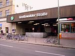
Directly in front of the entrance to the Greifswalder Straße S-Bahn station is a tunnel that was opened in 1986 and also serves as access to the tram stop. | 52 ° 32 ′ 27 "N, 13 ° 26 ′ 17" E | |

|
Directly in front of the entrance to the Landsberger Allee S-Bahn station is a tunnel opened in 1991, which also serves as access to the tram stop. | 52 ° 31 '43 "N, 13 ° 27' 21" E | |

|
When the high-speed line from Hanover to Berlin was built in the mid-1990s, a tunnel was built on the “Am alten Gaswerk” road to replace a restricted level crossing. It also has ramps for wheelchair users, cyclists and prams. | 52 ° 32 '18 "N, 13 ° 7' 50" E |
Web links
Individual evidence
- ↑ Berlin zoning plan for the districts II = Tiergarten, III = Wedding, VI = Kreuzberg, VII = Charlottenburg, VIII = Spandau, IX = Wilmersdorf, X = Zehlendorf, XI = Schöneberg, XII = Steglitz, XIII = Tempelhof, XIV = Neukölln , XX = Reinickendorf. Senator for Construction and Housing, Berlin 1971.
- ↑ Berlin, capital of the German Democratic Republic: general development plan, general transport plan. Urban Development and Architecture Department of the Greater Berlin City Administration, Berlin 1969
- ↑ New railway systems in the north of Berlin . In: Annals for Commerce & Construction . Volume 40. FC Glaser Verlag, Berlin 1897, pp. 223-239 u. Fig. P. 236 f.
- ↑ Walled up . In: Nacht-Depesche , No. 218/3, September 19, 1952
- ↑ Pedestrian tunnel between parks will be demolished . In: Berliner Morgenpost , September 10, 2012
- ↑ Dietmar Arnold : Dark Worlds: Bunkers, tunnels and vaults under Berlin . Ch.links Verlag, Berlin 1997, p. 99.
- ↑ Blum and Giese: The expansion of the Grunewald train station near Berlin , panels 71-72. In: Atlas to the journal for construction . Berlin 1911.
- ↑ Hilmar Bärthel, Günter Kley: Clarified! 125 years of urban drainage in Berlin . Huss-Medien, 2003, p. 76.
- ↑ The tunnel under the Görlitz train station . In: Mitteilungen der Berliner Elektricitäts-Werke , 1910, pp. 125–126.
- ↑ Connecting tunnel between the Anhalter Bahnhof - corner of Möckernstraße, Askanischer Platz - and the Hotel Excelsior in Berlin . In: Bautechnik , 1928, pp. 43–44.
- ↑ Passenger tunnel from Anhalter Bahnhof in Berlin to the Hotel Excelsior . In: Newspaper of the Association of German Railway Administrations, 1929, pp. 425–426.
- ↑ La Baume: The construction of the pedestrian tunnel under the Spree in Berlin-Friedrichshagen . In: Bautechnik , 1928, pp. 4-7, 41-43, 63-66.
- ↑ Entry in the Berlin State Monument List 09046029
- ↑ a b c H.-R. Hermann: Traffic and civil engineering measures to develop the International Congress Center Berlin (ICC) . In: Berliner Bauwirtschaft , 1977, Volume 27, Issue 18, pp. 442–443.
- ↑ Westermanns Plan von Berlin, 1932 ( page no longer available , search in web archives ) Info: The link was automatically marked as defective. Please check the link according to the instructions and then remove this notice.
- ↑ Development plan VII-100 published on October 7, 1964, District Office Charlottenburg.
- ↑ Michael Prellberg: 65 year old tunnel is being torn down . In: Berliner Zeitung , April 20, 2000.
- ↑ The Spree Tunnel . In: Die Fahrt , 1932, issue 5 of March 1, 1932. pp. 37–38
- ↑ Jürgen Meyer-Kronthaler: Spreetunnel - past and future . In: Berliner Verkehrsblätter , 1997, pp. 69, 71–73.
- ↑ Entry in the Berlin State Monument List 09080614
- ^ The reconstruction of the imperial capital / start of construction work . In: Verkehrstechnik , June 20, 1938, p. 287.
- ↑ H. Langer: The Berlin east-west axis as a traffic route . In: Verkehrstechnik , 1939, pp. 409-415.
- ↑ Entry in the Berlin State Monument List 09050419
- ↑ Tunnel expedition was postponed . In: Berliner Morgenpost , January 9, 1969.
- ↑ The tunnel was actually intended for pedestrians . In: Berliner Morgenpost , February 2, 1969.
- ↑ Edmund Wronski (Senator for Transport and Enterprises): Answer to the small question no. 2963 of the MP Peter Tiedt (FDP) of January 30, 1987 about "unused tunnels in Berlin" on April 6, 1987.
- ↑ Station buildings of the Berlin subway. In: Berliner Verkehrsblätter 1959, issue 4, p. 15.
- ↑ Development plan XII-60. Published on March 4, 1963, Steglitz district office.
- ↑ Development plan IX-73. Published on October 7, 1964, District Office Wilmersdorf
- ↑ Reconstruction of the pedestrian tunnel Elsenstrasse Berlin-Treptow. Senator for Construction and Housing, 1993.
- ↑ Berliner Verkehrs-Blätter, Volume 12, No. 2/65, p. 26
- ↑ Georg Mandel: Verkehrs-Tunnelbau , Volume 2: Network design, operating features and construction methods of underground traffic systems in metropolitan areas. Ernst & Sohn, 1969, p. 41.
- ^ Jürgen Meyer-Kronthaler: Berlin's subway stations. The first hundred years . Be.Bra-Verlag, Berlin 1995, p. 126
- ↑ Pedestrian tunnel will be closed . In: Berliner Morgenpost , February 10, 2006.
- ↑ a b Günter Dahlke, Karl-Heinz Holz, Eberhard Strümpf, Werner Striegler: Pedestrian floors Alexanderplatz and breakthrough Liebknechtstraße in Berlin . In: Bauplanung und Bautechnik , 1968, pp. 285–288.
- ↑ Uwe Aulich: The pedestrian tunnel on the Alex is closed from today . In: Berliner Zeitung , March 21, 2006.
- ↑ Thomas Fülling: Pedestrian tunnel under the Alex before demolition . In: Die Welt , March 22, 2006.
- ↑ Uwe Aulich: The maple leaf monument is being torn down . In: Berliner Zeitung , December 24, 1999
- ^ Heinz Bülow: For the handover of the road tunnel under the Kurfürstendamm in the course of the Brandenburgische Strasse – Lewishamstrasse . In: Berliner Bauwirtschaft , 1972, Volume 22, Issue 22, pp. 799–803.
- ^ Temporary closure of the pedestrian tunnel Sybel-Waitz-Straße in Berlin-Charlottenburg / Wilmersdorf. Press release of the Senate Department for Urban Development from November 26th, 2010 ( page no longer available , search in web archives ) Info: The link was automatically marked as defective. Please check the link according to the instructions and then remove this notice.
- ↑ Steffi Bey: Dry on the other side. Converted pedestrian tunnel opened at Schöneweide S-Bahn station . In: Berliner Zeitung , March 30, 1995.
- ↑ Karin Schmidl: Pictures against fear. The tunnel at Schöneweide station is being redesigned . In: Berliner Zeitung , April 4, 2006.
- ↑ Claudia Fuchs: Concerts under the street - an old pedestrian tunnel is to become a youth club . In: Berliner Zeitung , February 11, 2009.
- ^ Sebastian Höhn: Rapping in the tunnel - Lichtenberg youth club moves underground . In: Berliner Zeitung , October 28, 2010.
- ↑ Brief message from Berliner Verkehrsblätter , 1991, p. 261.