
Gertraudenstrasse
|
|
|
|---|---|
|
|
|
 |
|
| View towards Spittelmarkt | |
| Basic data | |
| place | Berlin |
| District | center |
| Created | Beginning of the 18th century |
| Newly designed | 20th century with widening of the road and a new car bridge |
| Hist. Names |
Gertrautenstrasse, Gertraudtenstrasse |
| Connecting roads |
Mühlendamm (northeast) , Leipziger Strasse (southwest) |
| Cross streets |
Breite Strasse , Fischerinsel, Oberwasserstrasse, Kleine Gertraudenstrasse |
| Places | Petriplatz, Spittelmarkt |
| Buildings | Jewel Palais |
| use | |
| User groups | Pedestrian traffic , bicycle traffic , car traffic , public transport |
| Technical specifications | |
| Street length | 420 meters |
The Gertraudenstraße in Berlin ( Mitte district ) connects via the (New) Gertraud bridge the Spittelmarkt with the Spree Island and goes on Köllnischen Fish Market (now crossing Broad Street / Fisherman's Island) in the over the Spree leading Mühlendamm over. As part of Bundesstraße 1 , it is one of the most important traffic arteries in the historic center of Berlin and is therefore correspondingly frequented.
history

The Gertraudenstraße - former spellings: Gertrautenstraße (1799) and Gertraudtenstraße - belonged to the center of the old Cölln , just like the no longer existing important buildings of the time. The old town hall of Cölln stood on the southwest side of the Köllnischer Fischmarkt, which was replaced by a new building on the opposite side (Gertraudenstrasse 1) from 1710–1723. This structure got in the way of town planning at the end of the 19th century and was demolished. The Gertraudenstrasse touched the centrally located Petriplatz with the Petrikirche, built around 1200 as a Romanesque basilica and replaced in 1853 by a new building in the neo-Gothic style . After the Second World War , only a ruin remained of the church, which was demolished in 1964 . An archaeological visitor center will be built here in the future.
The original bridge over the 18-meter-wide Spreearm was a construction for pedestrians built in 1737 and clad with basalt lava . The "old" Gertraudenbrücke , built in 1895/1896, is now only used for pedestrian traffic. In the northern parapet stands the statue of Saint Gertrude on a high plinth in memory of the Gertraudenhospital on Spittelmarkt, which was abandoned in 1871 : She is the patroness of travelers, and in the statue she offers a hiker a drink. In 1977 an unadorned car bridge was built next to the old bridge.
Around 1800 the houses were numbered counterclockwise from 1 (on Breiten Straße) to 15 (on Roßstraße). It had the following cross streets: Breite Strasse, Neue Kirchgasse, An der Gertrautenbrücke / An der Friedrichsgracht, Alte Grünstrasse, Lappstrasse, Roßstrasse.
David Leib Levin had already opened a factory for women's coats at Gertraudenstrasse 11 in 1840 . He was one of the prominent co-founders of Berlin ready-to-wear . The first electric trams operated in Gertraudenstrasse around 1900 . In 1901 James Cloppenburg inaugurated the first Peek & Cloppenburg- Haus (P&C) near the business center for textile, clothing and dyeing on Spittelmarkt. The later famous painter Eugen Bracht had his wool shop Eugen Bracht & Co. at the fish market in Cologne .
From 1973 to 2000 the large Ahornblatt restaurant on the corner of Fischerinsel was an eye-catcher on Gertraudenstrasse.
Uses
The two-storey building at Gertraudenstrasse 16, also known as Palais Splitgerber , stood between 1735 and its demolition in 1969. Initially , the seat of the banking and trading company Splitgerber & Daum , from 1910 onwards it became the seat of Deutsche Girozentrale . Due to severe war damage and a changed route over the new Gertrauden Bridge, it was demolished.
The Berlin Senate is planning to restore the main features of the historical center of the city (see: Plan work ). The Gertraudenstrasse is to be reduced to its old width and led back over the historic bridge. The original course of the street can be seen on the only remaining building on the "old Gertraudenbrücke". The residential and commercial building, completed in 1898, was built according to plans by Max Jacob and Georg Roensch for Wilhelm Müller, who operated a gold goods wholesaler here for decades. The neo-Gothic style of the house was chosen by the architects with reference to the Petrikirche . In 2002 the South Baden entrepreneur Karlheinz Hurle had the house renovated. In reference to its historical use, it has since been called the Juwel-Palais .
Large Ahornblatt restaurant (2000, before demolition)

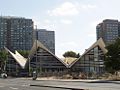
GDR Ministry of Construction, Breite Strasse at the corner of Gertraudenstrasse

Spittelmarkt and Gertraudenstrasse, 2012

View into Gertraudenstrasse, on the left the Juwel-Palais , 2012

Excavations at Petriplatz , 2012


.jpg)
literature
- Markus Sebastian Braun (Ed.): Berlin - The Architecture Guide . Econ Ullstein List, Munich 2001, ISBN 3-88679-355-9 , p. 78.
- Institute for Monument Preservation (Ed.): The architectural and art monuments of the GDR. Capital Berlin-II . Henschelverlag, Berlin 1984, p. 86, 131 .
Web links
- Gertraudenstrasse. In: Street name lexicon of the Luisenstädtischer Bildungsverein (near Kaupert )
Individual evidence
- ↑ Gertraudtenstrasse . In: General housing gazette for Berlin, Charlottenburg and surroundings , 1840, part 3, p. 16.
- ↑ The new Petriplatz . ( Memento of the original from November 29, 2016 in the Internet Archive ) Info: The archive link was inserted automatically and has not yet been checked. Please check the original and archive link according to the instructions and then remove this notice. Historical Berlin Society V.
- ^ Gertrauten-Strasse . In: Karl Neander von Petersheiden: Illustrative Tables , 1799, street representations and residents, p. 39.
- ↑ Historical buildings - almost all large town houses and aristocratic palaces have been destroyed or torn down. But there are ideas to make their traces in old locations visible. Six examples from the old center. Picture-text article in Berliner Zeitung , based on elaborations by Benedikt Goebel (stadtforschung.berlin) and Lutz Mauersberger (berlin-mitte-archiv.com) October 9, 2017, p. 16.
- ^ Measure Gertraudenstrasse / Breite Strasse. ( Memento of the original from March 4, 2016 in the Internet Archive ) Info: The archive link was inserted automatically and has not yet been checked. Please check the original and archive link according to the instructions and then remove this notice. (PDF; 351 kB) stadtentwicklung.berlin.de
Coordinates: 52 ° 30 ′ 47 ″ N , 13 ° 24 ′ 16 ″ E