Karl-Liebknecht-Strasse (Berlin)
|
formerly: Kaiser-Wilhelm-Strasse
|
|
|---|---|
| Street in Berlin | |
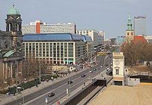
| Karl-Liebknecht-Strasse with the palace hotel and television tower , 1981 |
|
| Basic data | |
| place | Berlin |
| District | center |
| Created | 15th century |
| Newly designed | several times, most recently in the 1990s |
| Hist. Names |
(individual sections) Am Kramhause, Hinter der Badstube, Papenstrasse (16th century to 1887) , Heinersdorfer Strasse (around 1750–1788) , Prenzlauer Strasse (1788–1969) , Kaiser-Wilhelm-Strasse (1887–1947) , Liebknechtstrasse (1947–1969) |
| Connecting roads |
Prenzlauer Allee (northeast) , Schloßplatz (southwest) |
| Cross streets |
(Selection) Spandauer Strasse , Dircksenstrasse, Memhardstrasse , Alexanderstrasse , Hirtenstrasse (west) |
| Places |
Schloßplatz , Alexanderplatz |
| Buildings | some structures on this street |
| use | |
| User groups | Pedestrian traffic , bicycle traffic , car traffic , public transport |
| Technical specifications | |
| Street length | 1240 |
The Karl-Liebknecht-Straße in Berlin is one of the most important main roads in the district center around the Alexanderplatz . It begins at the Berliner Dom behind the Liebknechtbrücke over the Spree and runs from there in a north-easterly direction to the Torstrasse / Mollstrasse intersection ( Prenzlauer Tor ), where it turns into Prenzlauer Allee . More than half of the approximately 1.2 kilometer long street is part of the two federal highways B 2 and B 5 , which together lead from the Brandenburg Gate via the boulevard Unter den Linden , Schloßplatz and Karl-Liebknecht-Straße to Alexanderplatz.
Kaiser-Wilhelm-Strasse , which was located in the Soviet sector after the end of the war, was initially renamed Liebknechtstrasse in 1947 after Karl Liebknecht , co-founder of the Communist Party of Germany . After the redesign of Alexanderplatz with the neighboring television tower , the magistrate of Berlin, capital of the GDR, changed the name to Karl-Liebknecht-Straße in 1969 . There are some striking historical and modern buildings in Berlin .
course
At its beginning, the Liebknechtbrücke over the Spree, on the southern side is the Marx-Engels-Forum, which was inaugurated in 1986 . After the intersection with Spandauer Strasse , Karl-Liebknecht-Strasse forms the north-western boundary of the open space around the Berlin television tower. Here the Marienkirche is preserved as a monument. About 600 meters after it started it passes under the Alexanderplatz station , the route of the light rail . Behind the railway bridge it leads past the north-western edge of Alexanderplatz, crosses Memhardstraße / Alexanderstraße and finally turns into Prenzlauer Allee after the intersection of Torstraße / Mollstraße, the place of the former Prenzlauer Tor . There is also the district border to Pankow and its district Prenzlauer Berg .
The course from Karl-Liebknecht-Strasse and Prenzlauer Allee forms one of the radial arterial roads in the historic center of Berlin .
These include - starting from the center from northwest to southeast - clockwise:
- Hackescher Markt - Oranienburger Strasse - Friedrichstrasse / Oranienburger Tor - Chausseestrasse - Müllerstrasse
- Hackescher Markt - Rosenthaler Strasse - Rosenthaler Platz - Brunnenstrasse - Badstrasse
- Alexanderplatz - Rosa-Luxemburg-Strasse - Rosa-Luxemburg-Platz - Schönhauser Allee - Berliner Strasse
- Alexanderplatz - Karl-Liebknecht-Straße - Prenzlauer Tor - Prenzlauer Allee - Prenzlauer Promenade
- Molkenmarkt - Grunerstraße / Alexanderstraße - Otto-Braun-Straße - Greifswalder Straße - Berliner Allee
- Prenzlauer Tor - Mollstrasse - United Nations Square - Landsberger Allee
- Alexanderplatz - Karl-Marx-Allee - Strausberger Platz - Karl-Marx-Allee / Frankfurter Tor - Frankfurter Allee
- Spandauer Strasse / Molkenmarkt - Stralauer Strasse - Holzmarktstrasse - Stralauer Platz - Mühlenstrasse - Stralauer Allee
as well as west across the Spree :
- Molkenmarkt - Mühlendamm / -brücke - Gertraudenstrasse / Gertraudenbrücke - Spittelmarkt - Leipziger Strasse
- Alexanderplatz - Karl-Liebknecht-Straße - Liebknechtbrücke - Schloßplatz - Schloßbrücke - Unter den Linden
House number counting
The house numbers follow the orientation numbering (also called "Berlin System"), which indicates the odd numbers on the "left" side of the street (seen from the city center ) and the even numbers on the other. In Karl-Liebknecht-Straße they include numbers 1–34. In the past, as Kaiser-Wilhelm-Straße and with a guided tour to Hirtenstraße, there were house numbers 1–62, also determined according to the Berlin system.
Expansion and public transport
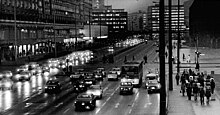
The entire length of Karl-Liebknecht-Straße has six lanes, only the Liebknechtbrücke has four lanes. The outer strips are set up as bus lanes . Among other things, the bus lines 100 and 200 of the BVG , which are often used as an inexpensive alternative to city tours, operate here. The area between Spandauer Straße and Alexanderplatz station is accessed by four tram lines. Since the end of May 2007, the M2 tram line has also been running in the section between Alexanderplatz station and Prenzlauer Tor.
Buildings


The Liebknecht Bridge was built in 1949/1950 in place of the Kaiser Wilhelm Bridge that opened in 1889 and blown up by German troops in 1945 . On the north side of the street, the Liebknechtbrücke is connected to the connected building complex of the CityQuartier DomAquarée , which opened in 2003, with the AquaDom and the GDR Museum on the Spree side. The palace hotel , one of the largest interhotels in the GDR , stood at this point from 1979 to the 1990s . After the intersection with Spandauer Straße, on the southern side of the street, there is the open-air area designed after the construction of the television tower, under which the foundation walls of the medieval residential buildings have largely been preserved. The Neptune Fountain , which was erected on the southwest side of the palace before the war was destroyed , was given a new location here. The only historical building that has been preserved here is St. Mary's Church, which dates back to the 13th century. In front of it there has been a monument to Martin Luther since 1989 , designed by Paul Otto , completed after his death by Robert Toberentz and unveiled in 1895. Along the north side of the street is between the intersection with Spandauer Straße and the confluence with Rosa-Luxemburg- Street is a long row of 13-story prefabricated buildings that were erected between 1967 and 1973. This complex was a model building of the GDR, which was designed in close relation to the television tower ensemble and contained a mixture of apartments, shops, restaurants, service facilities, offices and cultural facilities. The cultural centers of Poland and Hungary in the GDR were located here until 1991 (opened in 1972 and 1973 respectively). The Berlin Carré , created in 1969 from the former central market hall , was also integrated into the street front .
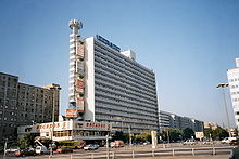
This is followed by the overpass of the light rail and on the south side of the Alexanderplatz station . This is followed by the former Centrum Warenhaus (today: Galeria Kaufhof ) and the Hotel Park Inn (formerly: Hotel Stadt Berlin ), two buildings that opened in 1970 and define the center of East Berlin . The north-eastern part of Karl-Liebknecht-Strasse (behind the Alexanderstrasse / Memhardstrasse intersection) was not built until the end of the 1960s and is dominated by prefabricated office buildings. Dominant in this section are the Berlin publishing house on the corner of Memhardstrasse and opposite the former Electrical Engineering House (HdE) with the brewery, which was created through the redesign of the HdE company canteen.
history
The traffic routing between Unter den Linden and Alexanderplatz differed fundamentally from the current situation until the 1880s. All traffic from the direction of Unter den Linden had to swivel from the Schloßbrücke over the Schloßfreiheit to the axis of today's Rathausstrasse , which has long since ceased to meet the increasing demands on road traffic. In order to expand the street in its current course, part of the old castle pharmacy was demolished for compensation of 500,000 marks (adjusted for purchasing power in today's currency: around 3 million euros). The property owners in the Marienviertel on the now heavily widened road area (Kleine Burgstrasse, Brauhausstrasse, Papenstrasse and the breakthrough from Klosterstrasse over Neue Friedrichstrasse ) had also resisted. The centuries-old development was abandoned in 1887 on the basis of plans by the architect August Orth and then replaced by magnificent buildings (mostly commercial buildings).
In 1889 a roadworthy bridge over the Spree was built here for the first time, after the “Cavalier Bridge” ( popularly known as the “Sechserbrücke” because of the user fee) had only been a wooden walkway for pedestrians. The new connection to Alexanderplatz station was named Kaiser-Wilhelm-Brücke and Kaiser-Wilhelm-Straße , which they carried until 1947.
The Kaiser-Wilhelm-Straße was later extended several times (bends to the north) so that it finally ended in the area of today's Rosa-Luxemburg-Platz .
As a result of the Allied air raids in World War II , around a third of the buildings were considered destroyed, damaged but rebuildable, and undamaged. Between May 1945 and August 1946 the name was changed to Liebknechtstrasse in honor of Karl Liebknecht. After almost all of the development had been cleared, the street had only a few buildings within fallow land until the 1960s.

In the 1960s, the leadership of the SED and the GDR Council of Ministers decided to convert the area around Alexanderplatz into the representative center of the GDR capital . A collective of architects from the GDR Building Academy carried out the town planning including the new residential development; construction work began in the mid-1960s. When the work was completed in 1969, the area north of Alexanderplatz train station was completely redesigned and a direct connection was established from Unter den Linden to Prenzlauer Allee. On September 3, 1969, in the northeastern section of newly created route was included in the road, while the former northern section of road in honor of Rosa Luxembourg in Rosa Luxembourg Street has been renamed.
The housing association Mitte (WBM), as the owner of the residential and commercial buildings, began redesigning this row of houses in 2011 between Spandauer Strasse and the railway viaduct. The arcades in front of the shops were expanded, so that the shop window front could be moved around three meters further to the street. The concrete facade was partially clad with aluminum panels . The changes also led to a change in users. Some larger providers such as WMF , Bambus Dreams or Birkenstock stayed, in other places there were new tenants. Instead of the Berlin Carré , a shopping center was built with Kaufland as the main tenant. The Museum of Illusions was opened in 2018 .
Web links
-
Karl-Liebknecht-Strasse. In: Street name lexicon of the Luisenstädtischer Bildungsverein (near Kaupert )
- Papenstrasse . In: Luise.
- Kaiser-Wilhelm-Strasse . In: Luise.
- Liebknechtstrasse . In: Luise.
Individual evidence
- ↑ Liebknechtstrasse . In: Street name lexicon of the Luisenstädtischer Bildungsverein
- ^ Kaiser-Wilhelm-Strasse . In: Berliner Adreßbuch , 1943, part 4, p. 401 (with house numbers and the cross streets at that time).
- ^ Initiative Offene Mitte Berlin : Catalog for the exhibition The complex Karl-Liebknecht-Straße between utopia and reality , 2019
- ↑ Otto Schilling: The inner city expansion . Berlin 1915 (dissertation).
- ↑ Kleine Burgstrasse . In: Luise.
- ↑ Brauhausstrasse . In: Luise.
- ↑ Map of the building damage 1945 to be reached via "Start" and "Historical maps / building damage 1945". Senate Department for Urban Development
- ↑ Street guide through Berlin. With all the changes. German address book publisher Dr. Walter Kaupert , Berlin 1946, p. IX, 225
- ^ Karl-Liebknecht-Strasse: Ulbricht's dream, Hitler's shadow . In: Der Tagesspiegel , October 10, 2010, Berliner Lifelines (17)
- ^ Uwe Aulich: Adieu to the market hall. The housing company WBM breaks with a tradition at Alex. Instead of small shops, it is now building modern lines of business . In: Berliner Zeitung , December 21, 2012, p. 21
Coordinates: 52 ° 31 ′ 17 " N , 13 ° 24 ′ 26" E


