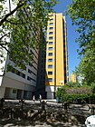
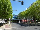
List of streets in Berlin-Märkisches Viertel

The list of streets in Berlin-Märkisches Viertel shows the streets in the Berlin district of Märkisches Viertel with their historical references. At the same time, this compilation is part of the lists of all Berlin streets and squares .
overview
Road system
The Berlin street list includes 35 streets with a total length of 22.2 kilometers, places are not named. Five of these streets lead under the same name beyond the district. The Wilhelmsruher Damm as a central east-west axis and the Schorfheidestraße southwards to the (planned) north bypass ( Am Nordgraben ) belong to the Berlin system of superordinate road connections . In addition to the B 96 , which does not go through the district. Further traffic routes classified as supplementary roads in the road system are:
- Dannenwalder Weg (development of the southern and northeastern part),
- Finsterwalder Strasse (northwest)
- Quickborner Strasse (east)
- The Eichhorster Weg to the north over Wilhelmsruher Damm as a supplement to Schorfheider Strasse is of less importance for the Berlin road network and remains in the list as the main thoroughfare without categorization .
- The Senftenberger Ring , which is not a main road, surrounds settlements with a block-like character and building chains grouped around inner courtyards to the north of Wilhelmsruher Damm (near the shopping mall). This extensive development without peripheral development around the central field basin (Packereigraben) corresponds to the planning concepts of the 1960s. It divides after 350 meters and forms a ring with a diameter of around 500 meters, which is only connected to the outside at two points ( Calauer and Wesendorfer Straße ).
Location
The district was the first new housing estate in what was then West Berlin . It was created after the Wall was built in 1961 on previous arable land, gardening centers and allotment garden colonies. Projected from the beginning as an urban landscape, the streets were built with the construction of the apartments between 1964 and the last new building for the time being in 1974. Since 1999, the large estate with the adjacent green areas has been declared by the district as the 10th district. The street names designate places in the former Mark Brandenburg and explain the origin of the name of the large settlement (which was built in a short period of time). Exceptions to this are streets that already existed before the construction of the Märkisches Viertel: Wilhelmsruher Damm, named after the nearby Wilhelmsruh part of the Pankow district , and Quickborner Straße.
The Märkisches Viertel has 40,379 inhabitants (as of December 30, 2019) and includes the postal code areas 13435 and 13439.
Overview of the streets
The following table gives an overview of the existing streets in the district and some related information.
- Name / location : current name of the street. The street can be displayed on various map services via the Location link . The geoposition indicates the approximate center of the street length.
- Traffic routes not listed in the official street directory are marked with * .
- Former or no longer valid street names are in italics . A separate list may be available for important former streets or historical street names.
-
Length / dimensions in meters:
The length information contained in the overview are rounded overview values that were determined in Google Earth using the local scale. They are used for comparison purposes and, if official values are known, are exchanged and marked separately.
If the street continues into neighboring districts, the addition ' in the district ' indicates how long the street section within the district of this article is. - Name origin : origin or reference of the name.
- Notes : further information on adjacent monuments or institutions, the history of the street and historical names.
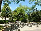
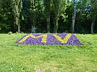
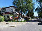
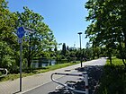
- Image : Photo of the street or an adjacent object.
| Name / location | Length / dimensions (in meters) |
Origin of name | Date of designation | Remarks | image |
|---|---|---|---|---|---|
|
Birkenwerderstrasse
( Location ) |
460 | Birkenwerder , municipality in Brandenburg | Apr 1, 1967 | The previous name was 130 Street . |

|
| Borgsdorfer Strasse
( Location ) |
460 | Borgsdorf , district of Hohen Neuendorf in Brandenburg | Apr 1, 1967 | The previous name was Street 129 . |

|
|
Calauer Strasse
( Location ) |
110 | Calau , city in Brandenburg | Apr 1, 1967 | The previous name was 432 Street . |

|
|
Dannenwalder Weg
( Location ) |
1600 | Dannenwalde , part of the town of Gransee in Brandenburg | Feb. 20, 1933 | The previous name was Street 5 of the zoning plan. The Dannenwalder Weg ran from Wittenauer Straße (today Wilhelmsruher Damm) to Tornower Weg. On December 1, 1936, the extension, Straße 116 , was also given this name, so that it was now arched on Wittenauer Straße. On April 1, 1967, street 439 was named that way. |

|
| Drebkauer Strasse
( Location ) |
140 | Drebkau , city in Brandenburg . | Apr 1, 1967 | The previous name was Street 120 . |

|
|
Eichhorster way
( Location ) |
560 (in the district) |
Eichhorst, part of Finowfurt in Brandenburg | Aug 6, 1937 | The street originally ran from Wilhelmsruher Damm to Oranienburger Straße, but was shortened to Lübarser Weg through overbuilding. On April 1, 1967, its northern extension from Lübarser Weg to Wittenauer Strasse, Strasse 427 , was included in Eichhorster Weg. Part of the road runs in Wittenau |

|
|
Finsterwalder Strasse
( Location ) |
1560 (in the district) |
Finsterwalde , city in Brandenburg | Apr 1, 1967 | The previous names were Street 123 and Street 431 . Part of the street runs in Lübars . |

|
|
Gandenitzer Weg
( Location ) |
500 | Gandenitz , part of Templin in Brandenburg | Apr 15, 1982 | The previous name was 492 Street . |
|
| Germendorfer Strasse
( Location ) |
640 | Germendorf , part of Oranienburg in Brandenburg | Apr 1, 1967 | The previous name was Street 128 . On November 1, 1968, its extension, Strasse 460 , was also named Germendorfer Strasse. |

|
| Guhlener line
( Location ) |
240 | Guhlen , part of the Brandenburg community Schwielochsee | Apr 1, 1967 | The previous name was Street 124 . |

|
|
Koenigshorster Strasse
( Location ) |
220 | Königshorst , part of the municipality of Fehrbellin in Brandenburg | Apr 1, 1967 | The previous name was 447 street . |

|
| Krangener way
( Location ) |
100 | Krangen , part of Neuruppin in Brandenburg | Nov 1, 1968 | The previous name was 403 Street . |

|
|
Lieberoser Strasse
( Location ) |
390 | Lieberose , city in Brandenburg | Apr 1, 1967 | The previous name was 118 Street . |

|
|
Markendorfer Strasse
( Location ) |
520 | Markendorf , district of Frankfurt (Oder) in Brandenburg | Apr 1, 1967 | The previous name was 117 Street . |

|
|
Märkische line
( Location ) |
70 | to the Mark Brandenburg | around 1976 | The Märkischezeile is a footpath in the " Märkisches Zentrum " shopping center between Senftenberger Ring and Brunnenplatz. |

|
| Mehrower line
( Location ) |
260 | Mehrow , district of Ahrensfelde in Brandenburg | Apr 1, 1967 | The previous name was Street 126 . |

|
|
Quickborner Strasse
( Location ) |
760 (in the district) |
Quickborn , town in Schleswig-Holstein . Quickborn is also possible as an old name for a fountain of youth . | Dec 11, 1936 | The previous names were Lübarser Weg (before 1913 to 1936), Lübarser Straße (before 1913 to 1936) and Rosenthaler Weg (before 1922 to 1936). Parts of the street run through Lübars and Rosenthal |

|
|
Sagritzer way
( Location ) |
200 | Sagritz , district of Golßen in Brandenburg | Apr 1, 1967 | The previous name was 430 Street . |

|
| Sallgaster Street
( Location ) |
260 | Sallgast , place in Brandenburg | Apr 1, 1967 | The previous name was 119 Street . |

|
| Schorfheidestrasse
( Location ) |
600 (in the district) |
Schorfheide , forest area in Brandenburg | Apr 1, 1967 | The previous names were 426 Street and 121 Street . Part of the road runs in Wittenau |
|
| Senftenberger Ring
( Location ) |
2400 | Senftenberg , city in Brandenburg | Apr 1, 1967 | The street is an essential part of the development of the Märkisches Viertel. It forms a ring with a diameter of around 500 meters. |

|
| Senziger line
( Location ) |
260 | Senzig , district of Königs Wusterhausen in Brandenburg | Apr 1, 1967 | The previous name was Street 125 . |

|
| Steinkirchener Strasse
( Location ) |
480 | Steinkirchen , district of Lübben (Spreewald) in Brandenburg | Apr 1, 1967 | The previous name was Street 127 . |
|
| Straupitzer Steig
( Location ) |
160 | Straupitz , place in Brandenburg | July 1, 1976 | The previous name was 485 Street . |

|
|
Teschendorfer Weg
( Location ) |
240 | Teschendorf , part of the municipality of Löwenberger Land in Brandenburg | July 1, 1976 | The street branches out into smaller residential streets. |

|
| Tiefenseer Strasse
( Location ) |
200 | Tiefensee , district of Werneuchen in the Barnim district in Brandenburg | before 1971 |

|
|
| Tornower Weg
( Location ) |
340 | Tornow , district of Fürstenberg / Havel in Brandenburg | Jan. 30, 1933 | The previous name was Street 2 . |

|
| Hitchhikers way
( Location ) |
120 | Trampe, district of Breydin in Brandenburg | July 1, 1976 | The previous name was 441 street . |

|
| Treuenbrietzener Strasse
( Location ) |
860 | Treuenbrietzen , city in Brandenburg | July 1, 1976 | The previous name was 437 Street . |
|
|
Welzower Steig
( Location ) |
1200 | Welzow , city in Brandenburg | Apr 15, 1982 |
|
|
| Wentowsteig
( Location ) |
260 | Großer Wentowsee , body of water in the Oberhavel district in Brandenburg | Jan. 30, 1933 | The previous name was Street 3 . |

|
| Wesendorfer Strasse
( Location ) |
170 | Wesendorf , district of Zehdenick in Brandenburg | Apr 1, 1967 | The previous name was 438 Street . |

|
| Wilhelmsruher Damm
( Location ) |
2090 (in the district) |
Wilhelmsruh , part of the Pankow district | May 20, 1937 | The previous names were Rosenthaler Strasse (before 1902 to 1937), Wittenauer Weg (1905 to around 1929) and Wittenauer Strasse (before 1912 to 1937). Parts of the street run in Wittenau and Rosenthal . |

|
|
Shredder ring
( Location ) |
590 | Zerpenschleuse , district of Wandlitz in Brandenburg | Apr 1, 1967 | The previous name was 456 Street . |

|
Other locations in the Märkisches Viertel
Allotment gardens (colonies)
See also
Web links
- Street directory Märkisches Viertel. Retrieved June 21, 2010 .
- Office for Statistics Berlin-Brandenburg: Directory of streets and places in the Reinickendorf district (as of February 2015); pdf
Individual evidence
- ↑ National map series sheet 4434 (city map of Berlin) is available online from the years 1928 to 1986 ( memento of the original from November 16, 2016 in the Internet Archive ) Info: The archive link was inserted automatically and has not yet been checked. Please check the original and archive link according to the instructions and then remove this notice.
- ↑ District Office Reinickendorf: Districts - Mäerkisches Viertel
- ↑ Map from 1954 ( page no longer available , search in web archives ) Info: The link was automatically marked as defective. Please check the link according to the instructions and then remove this notice.


