List of streets and squares in Berlin-Blankenburg
The list of streets and squares in Berlin-Blankenburg describes the street system in the Berlin district of Blankenburg in the Pankow district with the corresponding historical references. At the same time, this compilation is part of the lists of all Berlin streets and places .
overview
The district of Blankenburg with the postal code area 13129 has 6,875 inhabitants (as of December 30, 2019). According to the official street directory, these live in 122 dedicated streets, 41 of which are officially designated private streets in the "Blankenburg complex". The public road network has a length of 37.1 kilometers and a further 22 kilometers of roads and paths for this facility were added in 2011 because it is located on land owned by the state.
The Blankenburg road system developed around the entry and exit road from Berlin to the Niederbarnim . The road connects the old village center to the east to Rieselgut Malchow and was built at the end of the 19th century as a Blankenburg paved road. The connection to the west to French Buchholz was attached to the station of the Stettiner Bahn as Bahnhofstrasse . The settlement areas north of the village center developed from 1902 on are divided by the Szczecin Railway. The "Burgviertel", named after an excavated Slavic castle of the Sprewanen, lies between the railway and the Pankeniederung . The river Laake borders the district to the north. To the east of the railway, more roads were laid out around the 1920s and named after places in the Harz Mountains . They establish a relationship with the noble Blankenborch family, who expanded the place on a formerly Slavic settlement. To the southeast of Karower Damm, numbered plan streets were first named after places in Carinthia . Most of the settlement streets were laid out by 1938, the areas to Heinersdorf remained, west of Heinersdorfer Straße used by gardens. The area to the east formed a system of sewage fields until the 1980s . The road network only began to expand in the 1990s after these areas had been drained.
When the Berlin outer ring was built in the early 1950s , there were changes in the road grid, and in 1957 there was a division between Blankenburg and the district of Karow. The area belonging to the district (streets 28, 31 and 33) lies north of the outer ring as far as the Laake and is accessed by the Lindenberger Weg bridge, a pedestrian bridge. Motor vehicles can only reach this area via road 50 from Karow. The construction of the Pankow feeder cut the Burgwallstraße somewhat, as the route runs along the Panke and the western boundary of the district.
Often the roads were Blankenburger but to the town center still in the 2010s unpaved and without road drainage with bilateral banquets provided. The former village character of Blankenburg is evident in the 21st century in street names such as Priesterstege and Krugstege and in the status of the building complex of Alt-Blankenburg as a monument. To the east of Heinersdorfer Strasse and on both sides of Karower Damm there are smaller areas of agricultural land, some of which are on former sewage areas . To the southeast of the village stood a mill and a brick factory, which can be found in the street names.
The last street names for the time being have been assigned in the area of the Blankenburg plant. This developed west of the Panke from 1909, and the first permanent residents moved to the suburbs southwest of the village center during the First World War . With the increase in area due to disused sewage fields, allotment gardens and connecting paths with names that were specified by the residents and were not part of the official register were created. Since the mid-2000s , official street names have been assigned to these private streets in Berlin gardens that are not subject to the Federal Allotment Garden Act if they are state-owned leased areas. The street names were selected at the request of the owner and manager, the Pankow district office, in coordination with the Blankenburg plant association. The pool of names available was limited by streets and paths named after Finken and Ammern in other districts.
Overview of streets and squares
The following table gives an overview of the streets and squares in the district as well as some related information.
- Name / location : current name of the street or square. Via the link Location , the street or the square can be displayed on various map services. The geoposition indicates the approximate center of the street length.
- Traffic routes not listed in the official street directory are marked with * .
- Former or no longer valid street names are in italics . A separate list may be available for important former streets or historical street names.
-
Length / dimensions in meters:
The length information contained in the overview are rounded overview values that were determined in Google Earth using the local scale. They are used for comparison purposes and, if official values are known, are exchanged and marked separately.
For squares, the dimensions are given in the form a × b for rectangular systems and for (approximately) triangular systems as a × b × c with a as the longest side.
If the street continues into neighboring districts, the addition ' in the district ' indicates how long the street section within the district of this article is. - Name origin : origin or reference of the name.
- Notes : further information on adjacent monuments or institutions, the history of the street and historical names.
- Image : Photo of the street or an adjacent object.
| Name / location | Length / dimensions (in meters) |
Origin of name | Date of designation | Remarks | image |
|---|---|---|---|---|---|
|
Maple Avenue
( Location ) |
450 | Maple , deciduous tree | before 1911 | Eastern parallel street of Kastanienallee, with which it was named, between Harzburger and Urbacher Straße. |

|
| Old Blankenburg
( Location ) |
600 | formerly anger of the village Blankenburg | May 11, 1938 | Passed down as Dorfstraße, after the incorporation of the villages into Greater Berlin, the renaming became necessary. The entire ensemble of Alt-Blankenburg is a listed building and all individual buildings from the years 1880 to 1959 are listed.40 meters of the road are assigned to OKSTRA class N and are therefore not subject to a municipal road during the expansion. |

|
| At the wet angle
( Location ) |
50 (in the district) |
neighboring allotments | June 5, 2001 | The name is adapted from the allotment garden Feuchter Winkel (No. 15), to which the road leads. The branch of the road, which has been developed as a motorway feeder, is in the Pankow district, and this includes the petrol station (No. 11). The passage to the Heinersdorfer branch of this street with the former railway works (No. 21) was closed around 2006. The street has officially continued since 2011 as Rostsperlingsweg ( private street of the facility) northwards into the district. |
 |
| At the flow
( Location ) |
650 | On flow located | before 1920 | Runs parallel to the river ditch between Gernroder and Ziegelstrasse. |

|
| Andenzeisigweg
( Location ) |
130 | Andes chisel , genus within the finch family | May 11, 2011 | This private road , formerly Lilienweg , in the Blankenburg complex, is the northernmost cross-connection (parallel south of Bahnhofstraße) in section II between Maronensperling- and Rostsperlingweg with lots 2-10 (even) and 3-9 (odd). |

|
|
Bahnhofstrasse
( Location ) |
920 (in the district) |
Blankenburg station | around 1877 | The road runs past the train station and connects the core of Blankenburg with French Buchholz. When the paths in the Blankenburg facility were broken down, property entrances were assigned to the regilar road, so 70 meters of the road are assigned to OKSTRA class N and are therefore not part of the municipal road during the expansion.
The train station from the years 1909 to 1913 owned by the Royal Railway Construction Department is a listed building, and the railway keeper's house (residential building and stable) is also on the list of monuments. |

|
| Bartzeisigweg
( Location ) |
130 | Bearded siskin , a species of the finch family | May 11, 2011 | This private road in the Blankenburg complex is a cross connection in section II between Maronensperling- and Rostsperlingweg with lots 2–14 (even) and 3–9 (odd). The garden path, previously named Levkojenweg by the residents, is located parallel between the Andenzisig- and Fichtenzeisigweg. |

|
| Blankenburger Chaussee
( Location ) |
100 (in the district, just west) |
Chaussee coming from Blankenburg | 1878 | The street is part of the former Heerstraße, which was paved in 1878 and therefore renamed as (Actien-) Chaussee . In the district to the west, next to the bridge ramp, there are only plots 44/45 (formerly a plastic parts factory, now a recycling area) in front of the Blankenburg Laake bridge and the Sellheim bridge. The district includes the railway line . |
|
| Blankenburg paved path
( Location ) |
900 (in the district) |
paved road coming from Blankenburg | after 1882 | Until 1882 it has been handed down from Malchow and Hohenschönhausen to Blankenburger Dorfstraße as Blankenburger Weg . In 1882 the city of Berlin bought the manors Blankenburg and Malchow in order to be able to create sewage fields. This connecting path between Blankenburg and Malchow was initially paved as a paved path, but has had an asphalt surface since at least the 1980s . |

|
| Brockenweg
( Location ) |
570 | Brocken , mountain in the Harz Mountains | 1920 | It was entered in the address book in 1929. It runs parallel to Suderoder Straße between Mühlenstraße and the golf course in the North-East Nature Park. |

|
| Burgwallstrasse
( Location ) |
1560 | Castle wall | before 1920 | It is located in the Burgviertel, parallel to the 114 federal motorway between Bahnhofstrasse and Rudelsburgstrasse, to which it turns off before Laake. Remains of the former Slavic castle were found on the property at Burgwallstrasse No. 76/77. |

|
|
Ditfurter Strasse
( Location ) |
230 | Ditfurt , place in the Harz Mountains | Nov 9, 1926 | It is located between Sulzer and Urbacher Strasse. |

|
|
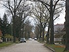
Eifelstrasse
( Location ) |
300 | Eifel | before 1920 | All parallel streets between Ilsenburgstrasse and Triftstrasse are named after German low mountain ranges. |
|
| Siskin Trail
( Location ) |
620 | Siskin , a species of bird in the finch family | May 11, 2011 | A private road , which in the plant Blankenburg in south-north direction between the quail trench on Papstfink- and the Malchower flow trench on Rotkardinalweg located in the Department V. The lots on this private road are 5–15 and 27, 31 (odd), and 6, 8 and 20–34 (even). Named as Fasanenweg before the official establishment of the roads in 2011 . |

|
|
Fichtenzeisigweg
( Location ) |
130 | Spruce siskin , a species of North American finch | May 11, 2011 | This previously called Holunderallee private road in the Blankenburg complex is located in Section II as a cross connection between Maronensperling- and Rostsperlingweg with lots 4-14 (even) and 3-11 (odd), the parallel paths are Bearded Siskin and Yellow-bellied Siskin Path . |

|
| Flaischlenstrasse
( Location ) |
700 | Flaischlen , a Württemberg dialect poet living in Berlin | June 9, 1933 | From 1920 to 1933 it was called Römerstraße . It leads from Freischützstraße to the Berlin outer ring on the border with Karow. On June 7, 1957, the northern Karow part of Flaischlenstraße, beyond the railway line, was named Straße 100 . Almost 40 meters of the street is assigned to OKSTRA class N and is therefore not part of the municipal street during the expansion. |

|
| Frankensteinstrasse
( Location ) |
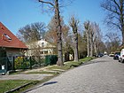
460 | Frankenstein , castle and community in the Palatinate | before 1920 | The street in the Burgviertel is located south of the Wolkenstein and Königstein streets between Flaischlen and Rudelsburgestraße. |
|
| Frankenstrasse
( Location ) |
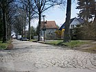
640 | Franconia , a region in Germany | before 1920 | It runs from Flaischlenstraße north to the railway site. On June 7, 1957, the part of Frankenstrasse north of the outer ring was incorporated into (Karower) Böttnerstrasse. |
|
| Freischützstrasse
( Location ) |
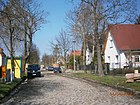
390 | Freischütz , opera character from medieval romanticism | before 1920 | It is located in the Burgviertel, parallel between Oberonstrasse and Scharfensteinstrasse. |
|
| Fuchsammerweg
( Location ) |
440 | Fuchsammer , a species of bird from the Ammern family | May 11, 2011 | This private road in the Blankenburg complex is located from the Fließgrabenbrücke to the southeast between Rotkardinalweg and Heinersdorfer Straße / Schäferstege. Before it was officially named, it was unofficially referred to as the Rotkehlchenweg of the gardens. The plots 1–37 (odd) and 2–34 (even) belong to Fuchsammerweg, all private roads in the Blankenburg complex have been given the orientation numbering, the previous name was Rotkehlchenweg . |
 
|
|
gardenstreet
( Location ) |
420 | Garden , outskirts of the local homesteads | before 1911 | The road runs between Triftstrasse and the cemetery to the north behind the farmsteads of the former Dorfstrasse. The street was originally a communications route (municipal route). It is marked on the map from 1911, was still undeveloped in 1929 and is still only built on one side.
Gartenstrasse 10, 12 and 14 belong to the building ensemble of the Alt-Blankenburg monument. |

|
| Yellow-bellied siskin path
( Location ) |
130 | Yellow-bellied siskin , genus within the finch family | May 11, 2011 | This private road in the Blankenburg complex is a cross-connection with properties 2–14 (even) and 3–9 (odd) in section II between the Maronensperling- and Rostsperlingweg and the parallel paths are the Fichtenzeisig- and Goldzeisigweg. The southern plots of the path border the river ditch, the Goldzeisigweg thus in section I. The route designation used by the residents before the official name was given was Gladiolenweg . |

|
| Georgenstrasse
( Location ) |
490 | Emil David George (1807–1866), landowner in Blankenburg | before 1911 | It is a cross street south of the Karower Damm, which leads to the river ditch. 200 meters of the road are assigned to OKSTRA class F and are therefore being expanded for pedestrian use. |

|
| Gernroder Strasse
( Location ) |
390 | Gernrode | before 1920 | It leads from Alt-Blankenburg south to Suderoder Straße.
The houses at Gernroder Strasse 1–14 belong to the Alt-Blankenburg architectural monument ensemble. |

|
| Golden Siskin Trail
( Location ) |
400 | Golden siskin , a North American siskin species from the finch family | May 11, 2011 | This private road in the Blankenburg complex is located as a cross connection with properties 2–12 (even) and 5–15 (odd) between Maronensperlingweg and Rostsperlingweg. The path, formerly Dahlienweg , on both sides of the river ditch belongs to section I and section II. |

|
| Grünkardinalweg
( Location ) |
1220 | Green Cardinal , a songbird from the Tangaren family | May 11, 2011 | This private road in the Blankenburg facility is a wide road through the facility, which previously was unofficially called Malchower Weg as a wide driveway , but is paved as the main path between the east and west edges of the facility. Since the construction of the motorway , it has been separated from the connection to the west (An der Industriebahn) at the level of the flow point of the river ditch , but has a passage through the railway line . The dirt road lies between Maronensperlingsweg and Heinersdorfer Straße. To the east of the railway line, the path separates sections VII and VI of the gardens. Beyond the Heinersdorfer, an unnamed continuation delimits the southern end of Department V. The name given to the bird species "Cardinal" designates this street as a main path of the complex. |

|
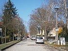
| Gutenfelsstrasse
( Location ) |
280 | Gutenfels Castle , above Kaub | before 1920 | It is located in the Burgviertel, parallel between Heimburgstrasse and Scharfensteinstrasse. |
|
|
Hartmutstrasse
( Location ) |
150 | Hartmut, hero from the Gudrun song | before 1920 | It is located in the Burgviertel, parallel between Rüdigerstrasse and Herwigstrasse. Almost 40 meters of the street assigned to OKSTRA class N and therefore not part of the municipal street of RBS class V when it is being expanded. |

|
| Harzburger Strasse
( Location ) |
440 | Bad Harzburg | before 1911 | It is located in the settlement area north of the former village between Lautentaler Straße and Ahornallee, but does not lead through to Karower Damm. |

|
| Heimburgstrasse
( Location ) |
240 | Heimburg Castle , castle ruins in the town of Blankenburg in the Harz Mountains | before 1920 | It is located in the Burgviertel between Straße 7 and Gutenfelsstraße. |

|
| Heinersdorfer Strasse
( Location ) |
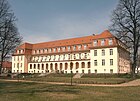
1250 | Heinersdorf , neighboring town in the south | 1878 | Until 1878 as Heinersdorfer Weg part of the Heerstraße from Berlin to Uckermark , it was renamed in 1878 with the fortification of the "Chaussee auf Aktien". It lies between the suburbs as an extension of Blankenburger Straße and the Fließgraben, where it is extended to the north from Krugstege to Alt-Blankenburg. To the west is the Blankenburg facility, to the east there are still agricultural areas and partly grassland, until the 1960s there were still sewage fields. The Rieselfelder were originally north of the Schmöckpfuhl- and south of the Fließgraben on both sides of Heinersdorfer Strasse up to the Berlin-Stettiner Eisenbahn . For the official naming of streets and roads of the plant Blankenburg were assigned on the west side of the street the Heinersdorfer way several plots that were previously managed as an asset paths with internal name: Specht web Oriole bridge, Stieglitz bridge, dragonflies jetty and in particular the Bachstelzenweg of on both sides of the single trench along from the corner Heinersdorfer street / Grünkardinalweg to the corner Purpurkardinal- / Papstfinkweg leads, with a renumbering of the plots was carried out. When the paths in the Blankenburg facility were broken down, property entrances were assigned to Heinersdorfer Straße, so 30 meters of the street are assigned to OKSTRA class N and are therefore not part of the municipal street during the expansion. |
|
| Herwigstrasse
( Location ) |
180 | Herwig, hero from the Gudrun song | before 1920 | Herwigstrasse is the southernmost of the parallel streets between Burgwallstrasse and Rudelsburgstrasse in the Burgviertel. |

|
|
Ilsenburgstrasse
( Location ) |
990 | Ilsenburg | before 1920 | It runs east parallel to the Szczecin Railway and belongs to the settlement area north of the old village center. In the south it turns into a footpath and road that leads next to the Ilsenburggraben to Bahnhofstrasse. |

|
| Indigofinkweg
( Location ) |
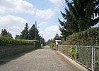
700 | Indigo finch , a North American songbird in the cardinal family. | May 11, 2011 | This private road in the Blankenburg complex is located in section VII between Rotkardinalweg and Heinersdorfer Straße . The plots of the garden path previously referred to as the Eagle Walk are 1–61 (odd) and 2–54 (even) in orientation numbering. |
|
|
Jungbornstrasse
( Location ) |
960 | Fountain of youth , traditional notion of the miracle fountain | before 1920 | It runs parallel to Kastanienallee in a north-south direction between the eastern exit of the village center and the Laake. 60 meters of the road are assigned to OKSTRA class N and are therefore not part of the municipal road during the expansion.
The house at Jungbornstraße 1 belongs to the ensemble of the Alt-Blankenburg monument. |

|
|
Kapsperlingweg
( Location ) |
280 | Cape sparrow, a species of bird in the sparrow family | May 11, 2011 | This private road in the Blankenburg complex is located as a southern longitudinal connection in section I parallel to the Maronensperlingweg and Rostsperlingweg. Plots 2–12 (even) and 3–11 (odd) are assigned to the garden path , which was previously named Asternweg , and is delimited between the southern olive siskin path and the northern masked siskin path. |

|
| Hooded Siskin Path
( Location ) |
360 | Hooded siskin , a species of bird in the finch family | May 11, 2011 | The private road in the Blankenburg complex is a cross connection in section I between Maronensperlingweg (highway side) and Rostsperlingweg (railway side) with lots 4, 10 (even) and 1, 3, 5 (odd). The course of the route is on the former route of the industrial railway, accordingly the previous unofficial name in the system was also An der Industriebahn . |

|
| Karower Dam
( Location ) |
910 | Karow , northern neighbor | 1878 | Until 1878 the Karower Weg , part of the Heerstrasse from Berlin to the Uckermark . With the fortification to the Chaussee renamed to shares, "Damm" now refers to the fortification against the damp subsoil. Since the construction of the bridge ramp to the Sellheim Bridge and the Blankenburg Laake Bridge, the properties to the east can only be reached via side access roads at site level. This driveway is also called Karower Damm. The western properties in the district already belong to Blankenburger Chaussee (in Karow). | |
| Kastanienallee
( Location ) |
1070 | chestnut | before 1911 | It is located between Gartenstrasse (at the entrance to the cemetery) and Urbacher Strasse in the settlement area north of the village center. |

|
| Kirchstrasse
( Location ) |
490 | Presumably after the parcel 'Kirchacker' | before 1911 | It runs between Georgenstrasse and Ziegelstrasse in an east-west direction, crosses Mühlenstrasse and is one of the old farm roads south of Karower Damm. |

|
| Klagenfurter Strasse
( Location ) |
430 | Klagenfurt , capital of the Austrian state of Carinthia | Nov 9, 1926 | Previously known as Straße 57 , it branches off from Lindenberger Weg as a cross street parallel to Straße 56, crosses Villacher Straße and Straße 26 and ends at the Berlin outer ring . It is only built on on the western side. |

|
| Kokosfinkweg
( Location ) |
620 | Coconut finch , tanagers are a family in the order of the passerine birds | May 11, 2011 | This private road in the Blankenburg complex is located in section VII between Rotkardinalweg and Heinersdorfer Straße . Before it was named Mövenweg in 2011 , plots 1–53 (odd) and 4–46 (even) now belong to Kokosfinkweg. |

|
|
Koenigsteinstrasse
( Location ) |
450 | Königstein , market in the Upper Palatinate | before 1920 | It lies south parallel to Frankensteinstrasse and the Laake in the castle district. |

|
| Korsikazeisigweg
( Location ) |
310 | Corsican siskin , a species of the finch family | May 11, 2011 | This private road in the Blankenburg facility is located with lots 2-6, 10 (even) and 3, 5, 7 (odd) parallel to the southern Magellanzeisigweg, but even more south than the sloping Kapuzenzeisigweg in section I of the facility. |

|
| Krontaler Strasse
( Location ) |
310 (in the district) |
Kronthal , mineral bath and climatic health resort | 1926 | The road lies along the Panke on the border of the Blankenburg district with French-Buchholz and continues at the Flaischlen (railway) bridge in the Karow district. It is part of the Pankewanderweg in the district . The street was already marked on the Berlin city map from 1926 as Kronentaler Straße. It was not mentioned in the Berlin address book until 1927. During the construction of the Berlin outer ring, the road was relocated a little to the west to the Pankelauf so that it runs together with the Fliess at the Flaischlenbrücke under the railway line. |

|
| Pitcher bars
( Location ) |
210 | Jetties on the side of the village jug | 1926 | As in many villages north of Berlin, the Dorfstrasse through the church faces east-west, while the long-distance connections from Berlin are north-south. So the Krugstege turns south at the western end of the village and merges into Heinersdorfer Straße. Its northern continuation is the Priesterstege, which merges into Triftstraße. The street was first mentioned in the Berlin address book in 1926.
The children's house 'Janusz Korczak' (formerly: Heimstätte Blankenburg) in Krugstege 2 is a monument as a whole. |

|
|
Lautentaler Strasse
( Location ) |
700 | Lautenthal , town in the Goslar district | Nov 9, 1926 | Previously listed as Straße 37 , it was still vacant in 1929. It is between Gartenstrasse and Sulzerstrasse, parallel to Thaler Strasse. |

|
| Lindenberger way
( Location ) |
1000 (in the district) |
Lindenberg , northeastern neighbor | after 1750 | The name has been handed down as an old connecting route between Blankenburg and Lindenberg. It leads east from Karower Damm and has been interrupted by its embankment since the Berlin outer ring was built . Behind it, he then continues across the district boundary to the Malchow area. The neighboring Malchow villagers referred to it as the "Böhm'scher Weg". |

|
|
Magellanzeisigweg
( Location ) |
70 | Magellanic ice , a species from the goldfinch subfamily | May 11, 2011 | This private road in the Blankenburg facility is located in section I between Rostsperling- and Maronensperlingweg. The Korsikazeisigweg is parallel to the north and the Maskenzeisigweg to the south. The street with lots 1-15 and 4-12 was previously called Bananenweg . |

|
| Marie-Grünberg-Strasse
( Location ) |
370 | Marie Grünberg , who hid fellow Jews | Nov 12, 2016 | The previous name was 46 Street . Marie-Grünberg-Straße extends Mittelstraße from Georgenstraße via Mühlenstraße to Ziegelstraße, south of Suderoder Straße. |

|
| Chestnut Sparrow Path
( Location ) |
2180 | Chestnut Sparrow, belongs to the species of sparrow | May 11, 2011 | This private road in the Blankenburg complex is located in section III north of Bahnhofstrasse, parallel to the west of Wüstensperlingsweg, whereby all cross paths, like the former Erikaweg, lead to the property under the name Maronensperlingweg. This paved private road with the properties 2–234 (straight) continues directly east along the autobahn south of Bahnhofstrasse in Division II and south of the river ditch in Division I. The wide driveway was created with the construction of the motorway, with garden plots being lost, which is why it was named Hauptweg in the complex before it was officially named . To the north of Bahnhofstrasse in section III, the eastern side routes (from south to north) were also included with the former main route : hawthorn, rose, tulip, fir, elm route , which lead to Wüstensperlingweg and are renumbered accordingly in the properties. |

|
| Masked Siskin Path
( Location ) |
70 | Masked siskin , a species from the goldfinch subfamily | May 11, 2011 | This private road, previously known as the Apfelweg , in the Blankenburg complex, is located as a cross connection in Section I between the Maronensperlingweg and Rostsperlingweg with lots 2–10 (even) and 3–11 (odd). In the north lies the Magellanzeisigweg and in the south the Mexicozeisigweg. |

|
| Meisengimpelweg
( Location ) |
330 | Titmouse , a species of bird in the finch family | May 11, 2011 | This private road in the Blankenburg complex is in section IV. The location corresponds to the previous unofficially known as the ant trail and lies directly on the north bank of the Fleßgraben along the west and east of the Schäferstege at the east end to the intersection of Bahnhofstrasse and Heinersdorfer Strasse. The choice of name corresponds to the Pirolgimpelweg located further west on the southern edge of Section IV . Since lots are mainly north of the path, lots 3–31 (odd) - with an 11a instead of 13 - are only assigned at the eastern end of the path, which is 26-30 (even) away from the ditch. 200 meters of the road are assigned to OKSTRA class F and are therefore being expanded for pedestrian use. |

|
| Mexican Siskin Trail
( Location ) |
140 | Mexican siskin , a species of bird from the goldfinch subfamily | May 11, 2011 | This private road in the Blankenburg complex is a cross connection in the south of Section I between Maronensperling- and Rostsperlingweg with lots 2–12 (even) and 3–11 (odd). It lies parallel to the Olivzeisigweg to the south, which closes the facility to the south. |

|
| Mittelstrasse
( Location ) |
400 | Mittelweg , between Parkstrasse and Suderoder Strasse | before 1911 | The street lies between Am Fließ (northern branch) and Georgenstraße and continues as Marie-Grünberg-Straße. |

|
| Morgenammerweg
( Location ) |
460 | Morgenammer , a species of bird from the Ammern family | May 11, 2011 | This private road in the Blankenburg facility is located between Safranammerweg and Heinersdorfer Straße across the Schäferstege, the previous name of the facility path was Habichtweg . When the garden path was dedicated to the private road, 130 meters were assigned to OKSTRA class N and are therefore not subject to the conditions of a municipal road during the expansion. |

|
| Mühlenstrasse
( Location ) |
770 | The mill was on Lindenberger Weg | before 1911 | As an old farm road, it lies south between Lindenberger Weg and the Fließgraben at the corner of Ziegelstraße. |

|
|
Oberonstrasse
( Location ) |
280 | Oberon , the elf king and opera figure | before 1920 | It is located in the Burgviertel, parallel to Freischützstrasse and Rheinfelsstrasse. |

|
| Okertalstrasse
( Location ) |
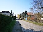
430 | Okertal | before 1920 | It runs between Brockenstrasse and Lindenberger Weg to the outer ring of Berlin . It is already marked on the map from 1920 and mentioned in the Berlin address book from 1929. However, until 1932 it was probably listed as Ockertalstraße with a typo . |
|
| Olivzeisigweg
( Location ) |
150 | Oliveisig , genus within the finch family | May 11, 2011 | This private road in the Blankenburg complex is located as a cross connection in section I between Maronensperling- and Rostsperlingweg with lots 2–8 (even) and 3–13 (odd). The path is the southern end of the Zum Feuchten Winkel department and continued eastwards through the railway embankment to Am Graben until 2010 , before this passage was removed during railway work. The name of the plant path at the Pankower entrance was Anemonenweg . |

|
|
Papstfinkweg
( Location ) |
770 | Pope's finch , North American songbird from the cardinal family | May 11, 2011 | This private street in the Blankenburg complex is located with lots 3–71 (odd) and 4–54 (even) between the railway underpass on Rotkardinalweg and Heinersdorfer Straße in section VI of the complex; it leads over Heinersdorfer Straße to section V. The Goldzeisigweg continues to the west through the railway underpass. Partly on the train of the former Kuckucksweg it lies on both sides of the Wachtelgraben, the continuation to the southeast was previously called Eulenhorstweg . The continuation to the KGA Märchenland, which is mostly in the suburb of Malchow , is the Rübezahlweg. |

|
| Parkstrasse
( Location ) |
540 | to the east of the (today's) children's home park on the Krugstege | before 1911 | The street lies between the northern bank of the river ditch at the level of the children's home and Mühlenstraße and parallel between Mittelstraße and the southern branch of Am Fließgraben. |

|
| Oriole Trail
( Location ) |
370 | Golden Oriole , a small species of the goldfinch subfamily | May 11, 2011 | This private road in the Blankenburg complex is in section IV with lots 3–29 (odd) and 2–28 (even) between Rohrammerweg and Rotkardinalweg. The U-shaped course opens up properties south of the Waldammerweg and the river ditch. When naming the streets in the complex, the western section of the former Hummelweg and the eastern section of the former Grillenweg were combined. |

|
| Priest bars
( Location ) |
150 | Footbridges , west of the village green to the north | before 1926 | The street name is first listed in the Berlin address book in 1926. At the western exit of the village, it continues the Krugstege north to Gartenstraße and turns into Triftweg. |

|
| Purpurkardinalweg
( Location ) |
990 | Purple Cardinal , a bird family from the order of the passerine birds | May 11, 2011 | This private road in the Blankenburg complex is located between Heinersdorfer Strasse / the corner of Schäferstege at the northern end of the path and the Spechtfinkweg on the southern edge of the complex and opens up the east side of the complex with departments V, VI and VII, due to its location and length along the complex it was also named after a type of cardinals . In the official designation, the northern Wachelsteg located at the Wachtelgraben was combined with the crane path adjoining it to the south and its eastern branch to the bees' ditch, the butterfly path . On the southern part, the path runs along the eastern bank of the wild duck trench . |

|
|
Reisfinkweg
( Location ) |
480 | Rice finch , a species of the finch family | May 11, 2011 | This private road in the Blankenburg complex is located with lots 2–46 (even) and 3–41 (odd) in section VI between Purpurkardinalweg and Rotkardinalweg , parallel to the more northerly Papstfinkweg. The street was previously unofficially called Amselsteg west of Rosenbauchfinkweg and Saatkrähenweg to the east . The staggered continuation of the path ( butterfly path ) to the bees ' ditch is assigned to the purple cardinal path . |

|
| Rheinfelsstrasse
( Location ) |
240 | Rheinfels | before 1920 | It is located in the Burgviertel and is the northern parallel street of Oberonstraße. |

|
| Rhönstrasse
( Location ) |
450 | Rhön , volcanic low mountain range | before 1920 | The street is east of the Stettiner Bahn between Ilsenburgstrasse and Triftstrasse, parallel to the Black Forest and Eifelstrasse. The Rhönstraße has a passage under the Stettiner Bahn to Straße 7. |

|
| Rohrammerweg
( Location ) |
800 | Reed bunting, a species of bird in the Ammern family | May 11, 2011 | This private road in the Blankenburg facility is located in section IV and connects to the east of the railway line with Bahnhofstrasse, to the south it leads over the river ditch into section V to Papstfinkweg. The plots of the path are 4-54 (even) and 3-79 (odd), while those in section IV west of the railway line or the Ilsenburggraben are also accessed from the Rohrammerweg. The previous names were for the wide road from Bahnhofstrasse to the south, Lindenallee , while the western sections of Hummel- and Grillenweg and Am Graben were included. To the south of the river ditch, the Sängerweg , which leads south-west, was included. |

|
| Rose belly finch path
( Location ) |
490 | Rose-bellied finch , a bird family from the order of the passerine birds | May 11, 2011 | This private road in the Blankenburg complex is located in sections VII and VI between Papstfinkweg and Spechtfinkweg . Plots 3–43 (odd) and 4–38 (even) are assigned to the path, formerly Lerchenweg , in orientation numbering . The path crosses the Malchower Weg (today Grünkardinalweg) and borders the Kulturhaus- and Festplatz to the west. |

|
| Rostsperlingweg
( Location ) |
1210 | Rust sparrow, a species of bird in the sparrow family | May 11, 2011 | This private road in the Blankenburg facility is located in sections I and II between Bahnhofstrasse and Am Feuchten Winkel on the west side of the railway line. A railway underpass leads from the path to the Grünkardinalweg. In contrast to the wide access road of the Maronensperlingsweg, which is parallel to the west of the motorway, it is a partially narrow garden path that provides access to plots 3–121 (odd), the non-existent straight plots would be on the railway site. On the Bahnhofstrasse, the Rudelsburgstrasse is opposite, which is located between Section III of the facility and the railway line. |
 |
| Rotkardinalweg
( Location ) |
1610 | Red cardinal , a species of bird in the cardinal family | May 11, 2011 | This private road in the Blankenburg facility is located with lots 4–78 (even) on the south side of the Fließgraben and in the southern section east along the route of the sections of the Tegel-Friedrichsfelde industrial railway previously located here, so that the uneven side remains unoccupied. In the north, the path ends at Erlenzeisigweg, as the continuation on the south bank of the river ditch - formerly known unofficially as the Fasanenweg - lies in the renaturation system of the river ditch . To the west from here along the south bank of the river ditch and the industrial railway, the previous name was Falkensteg , in the south this and today's road ended at Spechtfinkweg on the north bank of the Schmöckpfuhlgraben . The former Falkensteg led over the Schmöckpfuhlgraben and ran eastwards to Fafnerstrasse . The properties belong from north to south to Safranammerweg (formerly: Drosselweg ) to section V, to Grünkardinalweg (formerly: Malchower Weg ) to section VI of the complex and further to section VII. The three streets named after cardinals are main routes, the Rotkardinalweg opens up the departments east of the railway line. |

|
| Rudelsburgstrasse
( Location ) |
1980 | Rudelsburg , castle ruins on the Saale | before 1920 | It belongs to the 'Burg-Viertel' and lies to the west along the Szczecin Railway to the junction of the S8 line to the Berlin outer ring , parallel to the eastern side of the railway line is Ilsenbrgstraße. On June 7, 1957, the part of Rudelsburgstrasse located between Neustädter Strasse and the northern outer ring of the Reichsbahn was separated and incorporated into Boenkestrasse (Karow district). |

|
| Rudigerstrasse
( Location ) |
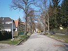
170 | Rüdiger, hero from the Gudrun song | before 1920 | Rüdigerstrasse between Burgwallstrasse and Rudelsburgstrasse is located in the Burgviertel, parallel to Hartmutstrasse and Strasse 47. |
|
|
Safranammerweg
( Location ) |
650 | Saffron bunting , a species of bird in the Ammern family | May 11, 2011 | This private road , before the renaming as Drosselweg , in the Blankenburg facility, continues the Rohrammerweg eastward from the river ditch. It is located between Rotkardinalweg and over Heinersdorfer Straße with lots 4–62 (even) and 3–41 (odd). Between Rotkardinal- and Erlenzeisigweg, the path separates the northern section V from the southern section VI and lies further east in section V of the facility, while the path east of Heinersdorfer Strasse limits the area there from section V to the north. The name chosen after the bird species Ammer is typical of the trails in the northeast. |

|
|
Schäferstege
( Location ) |
1050 | Jetties to the sheep farm , in the former manor | before 1928 | The street lies between Heinersdorfer Straße and the boundary of today's nursing home, which is built on the site of the Blankenburg manor (east of the village center). The name Stege refers to the old system of economic roads and the location parallel to the Krug- and Priesterstege. The section south of Bahnhofstrasse was only officially named in 2011 with the street names in the Blankenburg facility. A section south of the river ditch is not open to the public because it leads over the area of the renaturation facility for the cleaning of the river ditch, the initially wide unpaved road is therefore blocked off by large boulders at the river ditch . |

|
| Scharfensteinstrasse
( Location ) |
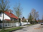
310 | Scharfenstein castle ruins in the Rheingau | before 1920 | It is located in the Burgviertel, parallel between Freischützstrasse and Gutenfelsstrasse. |
|
| Snow bunting path
( Location ) |
410 | Snow bunting, a species of bird in the Ammern family | May 11, 2011 | This private road in the Blankenburg complex is located with lots 4–36 (even) and 3–35 (odd) in section V between Purpurkardinalweg and Rotkardinalweg, it is parallel to the northern Fuchsammer and the southern Singammerweg. The eastern continuation of the road is offset slightly to the south on the Erlenzeisigweg. This tour corresponds to the previous facility, with the unofficial name in the western section being the Nachtigallensteg and in the eastern Nachtigallenweg . |

|
| Snow path
( Location ) |
630 | Snow finch , a species of bird in the sparrow family | May 11, 2011 | This private road in the Blankenburg complex lies in a north-south direction, partly as a narrow garden path between Spechtfink- and Papstfinkweg in sections VI and VII. Plots 1–31, 41 (odd) and 2–10, 22 (even) are on Garden path previously run as a golden chicken path. |

|
|
Black Forest Road
( Location ) |
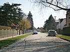
160 | Black Forest | before 1920 | It lies between Ilsenburgstrasse and Triftstrasse and north of Rhönstrasse. |
|
| Schwirrammerweg
( Location ) |
490 | Schwirrammer , a small passerine bird from the Ammern family | May 11, 2011 | This private road in the Blankenburg complex is located with lots 4–46 (even) and 3–43 (odd) in section VI between Purpurkardinalweg and Rotkardinalweg , it lies parallel to the northern Wiesenammerweg and the southern Grünkardinalweg. The street was previously unofficially called Reihersteg and eastern Elstersteg west of Rohrammerweg . The continuation of the path across the Wachtelgraben is assigned to Heinersdorfer Straße . |

|
| Singammerweg
( Location ) |
400 | Songhammer , a species of bird in the family of the Ammern | May 11, 2011 | This private road in the Blankenburg complex is located with plots 4–36 (even) and 1–35 (odd) in section V between Purpurkardinalweg and Rotkardinalweg, it is parallel to the northern Schneammmerweg and the southern Safranammerweg. The eastern continuation of the road is offset slightly to the south on the Erlenzeisigweg. This tour corresponds to the previous system, with the unofficial name being Finkensteg in the western section and Finkenweg in the eastern section . For the continuation of the path across the Wachtelgraben , the properties are assigned to Heinersdorfer Straße . |

|
| Spechtfinkweg
( Location ) |
600 | Woodpecker finch , tanagers are a family in the order of the passerine birds | May 11, 2011 | This private road in the Blankenburg complex is located in section VII between Rotkardinalweg and Heinersdorfer Straße . It is located at the southern end of the complex near the suburb of Heinersdorf, parallel to the northern plots of Fafnerstrasse with plots 1-59 (odd) and 30-34 (even). The previous name was Kiebietzweg , and the Rotkehlchenweg , located between the snow-finch and rose- bellied finch , was also included. |

|
|
Street 7
( Location ) |
270 | numbered and still unnamed | before 1925 | It is located in the Burgviertel between Burgwallstrasse and Rudelsburgstrasse, parallel to Heimburgstrasse and Strasse 47. The passage under the Stettiner Bahn connects it to Rhönstrasse. |

|
| Street 18
( Location ) |
310 | numbered, still without a name | before 1925 | It extends the garden over the Triftstrasse to the west to the Ilsenburgstrasse and lies north of the former manor. |

|
| Street 24
( Location ) |
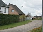
50 | numbered, still without a name | before 1925 | It is a short side street of Mühlenstraße, is parallel to streets 26 and 27 and leads west to arable land. The road is assigned to OKSTRA class F and is therefore being expanded for pedestrian use. |
|
| Street 26
( Location ) |
480 | numbered, still without a name | before 1925 | Straße 26 extends Treseburger Straße east of Karower Damm over Mühlenstraße and Klagenfurter Straße to the Berlin outer ring at the corner of Okertalstraße. It is parallel to street 27. |

|
| Street 27
( Location ) |
120 | numbered, still without a name | before 1925 | The unpaved road with shoulder on both sides limits road 56 to the north. It ends at the corner of Klagenfurter Strasse through the Berlin outer ring . At the western end it meets the bridge ramp to Sellheimbrücke, so only one road leads to Karower Damm, which is level again on road 26. 90 meters of the traffic route, which is otherwise officially classified as a road (RBS class: STRA), is assigned to OKSTRA class N and is therefore not subject to the conditions of a municipal road during expansion. |

|
| Street 28
( Location ) |
90 | numbered, still without a name | before 1925 | The street 28 is located in Blankenburg area northwest of the Berlin outer ring and ends on both sides of the street 33 in farmland. |

|
| Street 31
( Location ) |
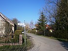
200 | numbered, still without a name | before 1925 | The street 31 leads across the street 33 to the Berlin outer ring . The extension of Okertalstraße north of the railway was probably included in its construction, so that road 31 opens up the homes there with a right-angled bend. With another branch to the east, it joins street 33 at the beginning of street 50 (which continues to Karow) . From the southern undeveloped part of the street, a pedestrian bridge over the railway line to Lindenberger Weg at the corner of street 40 connects to the district. |
|
| Street 33
( Location ) |
530 | numbered, still without a name | before 1925 | The road leads from the eastern branch of Lindenberger Weg to the north-west of the railway embankment, paved with a single lane with broad grass banks on both sides to the north. At the northern end, because of the Laak lowland, road 33 runs east to road 31 at the junction of road 50 and west to (Karower) road 52 and ends in grass and arable land. |

|
| Street 39
( Location ) |
400 | numbered, still without a name | before 1925 | The street 39 is, however, separated by the embankment of the Berlin outer ring , a southern extension of the street 33. It is a paved street between Lindenberger Weg and a wooded area on the golf course area. |

|
| Street 40
( Location ) |
460 | numbered, still without a name | before 1925 | The street 40 lies west between Lindenberger Weg and Suderoder Straße parallel to the street 39. In the south it ends at the border of the golf course and in the north it connects the pedestrian bridge Lindenberger-Weg-Brücke with the street 31. |

|
| Street 42
( Location ) |
190 | numbered, still without a name | before 1925 | It is an unpaved road between Mühlenstrasse and Ziegelstrasse and lies parallel between Lindenberger and Brockenweg. |

|
| Street 45
( Location ) |
100 | numbered, still without a name | before 1925 | Straße 45 is a paved road between Mühlenstraße across Ziegelstraße and the golf course boundary, south of the parallel Marie-Grünberg-Straße. |

|
| Street 47
( Location ) |
180 | (unsystematically) numbered | before 1925 | The street 47 is a dead end street in the castle district east of the Burgwallstraße. It lies parallel between Rüdiger Strasse and Strasse 7 but does not lead through to Rudelsburgstrasse. |

|
| Street 50
( Location ) |
170 (in the district) |
(unsystematically) numbered | before 1925 | Straße 50 lies between the junction of Straße 31 and Straße 33 and enables the settlers to drive through Karow northwest of the Berlin outer ring . Road 50 continues north of the bridge over the Laake as Karower Straße . The bridge is located in the district and officially bears the name: Brücke Straße 50. The road to the south lies in arable and fallow land, which is marked as building land, so the road in the district does not have any land, but only has an access function. |

|
| Road 56
( Location ) |
520 | numbered, still without a name | before 1925 | The road 56 is north between Lindeberger Weg and road 27 and ends at the embankment, which leads here over the Laake. |

|
| Street 87
( Location ) |
40 | numbered, still without a name | before 1925 | The road 87 is a dead end south of the Königsteinstrasse. Their numbering is consistent with the streets in French Buchholz , which have been “behind” the motorway since the A 114 was built. |

|
| Suderoder Strasse
( Location ) |
970 | Suderode , near Thale in the Harz Mountains | 1911 | It lies between Gernroder Strasse and Strasse 40 and ends at the golf resort. |

|
| Sulzer Street
( Location ) |
420 | Sulz am Neckar | before 1920 | It is located in the settlement area north of the village center between Triftstrasse and Kastanienallee. |

|
|
Thaler Strasse
( Location ) |
660 | Thale in the Harz | 1931 | From 1920 to 1931 it was run as Thalestrasse . It lies between Gartenstrasse and Sulzer Strasse, parallel between Lautentaler and Jungbornstrasse and crosses Harzburger Strasse. |

|
| Tigerfinkweg
( Location ) |
460 | Tiger finch , a genus of the finch family | May 11, 2011 | This private road in the Blankenburg complex lies between Purpurkardinalweg and Rosenbauchfinkweg and leads north and east around the central area of the cultural center of the complex, north parallel to Grünkardinalweg . The path includes lots 3–37 (odd) and 4–38 (even) as well as the lot of the cultural center with number 45, the old garden path name was Schwalbensteg . |

|
| Treseburger Strasse
( Location ) |
640 | Treseburg , district of Thale | before 1920 | It is located between Thaler Straße and Karower Damm, on which, in contrast to the parallel streets opposite Straße 26, it has an exit. |

|
| Triftstrasse
( Location ) |
1020 | Trift , the way to drive cattle from homestead to pasture | before 1911 | Triftstraße is (as in neighboring Buchholz) to the west of the village center and the sheep farm of the former manor. The name is certainly one of the original names in the Blankenburg street system. As an extension of the Priesterstege, it lies between Gartenstrasse and Urbacher Strasse and ends in the north at the Berliner Bahnring. In the southern part of the street, the area facing Lauterbacher Straße is undeveloped wasteland. |

|
|
Urbacher Strasse
( Location ) |
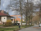
500 | Urbach (Remstal) , municipality in Baden-Württemberg | before 1925 | It runs south of the Laak lowlands to the embankment between Triftstrasse and Ahornallee. 40 meters of the traffic route, which is otherwise officially classified as a road (RBS class: STRA), is assigned to OKSTRA class N and is therefore not subject to the conditions of a municipal road during expansion. |
|
|
Villacher Strasse
( Location ) |
150 | Villach , Carinthia | Nov 9, 1926 | The street connects Straße 56 and Klagenfurter Straße north of Lindenberger Weg and Straße 26. It is probably incomplete in the street grid. |

|
| Vosges road
( Location ) |
80 | Vosges , low mountain range west of the Rhine, opposite the Black Forest | before 1920 | As a cul-de-sac south of Eifelstrasse, it leads to a lawn north of the estate and the sports field. In the street grid she aims at the Schäferstege. |

|
|
Waldammerweg
( Location ) |
750 | Waldammer , a species of bird from the Ammern family | May 11, 2011 | This private road in the Blankenburg facility is located in section IV, which lies between Bahnhofstrasse and Fließgraben. This path , which was unofficially designated as a bee path before the renaming, lies south parallel to Bahnhofsstraße between Rohrammerweg and Schäferstege and also the two cross paths between Fließgraben and Bahnhofstraße, previously the eastern sections of Hummel- and Goldkäferweg are with their properties the Waldammerweg and its 4–7 (straight ) and 3–57 (odd). |

|
| Wiesenammerweg
( Location ) |
370 | Meadow bammer , a species of bird from the Ammern family | May 11, 2011 | This private road in the Blankenburg complex is located with lots 4–32 (even) and 3–33 (odd) with the section west of Erlenzeisigweg in section VI and from there in section V between Purpurkardinalweg and Rohrammerweg, it is parallel to the northern Safranammer - and the southern Schwirrammerweg. The street with the previous unofficial name Sperlingssteg is on the Erlenzeisigweg in the eastern continuation slightly to the south. For the continuation of the path across the Wachtelgraben , the properties are assigned to Heinersdorfer Straße . |

|
| Wolkensteinstrasse
( Location ) |
240 | Wolkenstein , castle ruins in Franconian Switzerland | before 1920 | The street in the Burgviertel is parallel to Frankensteinstraße and the green space at the Blankenburger Bahnkreuz. It goes over at Flaischlen- into Krontaler Straße. |

|
| Desert Sparrow Path
( Location ) |
420 | Desert sparrow, a species of bird in the sparrow family | May 11, 2011 | This private road in section III, north of Bahnhofstrasse, of the Blankenburg facility is located with plots 2–36 (straight) on the eastern edge of the facility, parallel to Rudelsburgstrasse. Its side paths to the west were included with the few parcels of the Maronensperlingweg running through Bahnhofstrasse . |

|
|
Zebra Finch Path
( Location ) |
500 | Zebra finch , a species of the finch family | May 11, 2011 | This private road in the Blankenburg complex is located in section VII between Rotkardinalweg and Heinersdorfer Straße . The path runs in the section west of the Purpurkardinalweg on both sides of the Wildentengraben and was previously called Wildentenweg , this was combined with the eastern Meisensteg and the plots 2–48 (even) and 3–47 (odd) are separated from the moat on both sides of the path , associated with the official name of the private road. |

|
| Ziegelstrasse
( Location ) |
930 | Blankenburg brickworks that stood here. | before 1911 | The Blankenburg brickworks existed on this street before 1892 and was producing until the turn of the century. Many houses in Alt-Blankenburg were built with bricks from this brick factory. In the southern part of the street, the eastern plots are located with the Suderoder Graben on the district boundary, which flows into the river ditch. |

|
| Zwergammerweg
( Location ) |
330 | Small bunting , a species of bird in the Ammern family | May 11, 2011 | This private road in the Blankenburg complex is located with lots 4–30 (even) and 7–27 (odd) in section V between Schäferstege and Rotkardinalweg , it is the northernmost of several parallel “Ammer” paths. The previous unofficial plant name was Goldammersteg . |

|
Other locations of Blankenburg
Allotment gardens
- Bahn-Landwirtschaft 'Grabenwinkel' (Asgardstraße, Lage ) with 38 parcels on 20,361 m² is located in the extreme southwest of the district on the former Reichsbahn site. The colony does not belong to the Blankenburg complex, but is subject to the allotment garden law and is named under 03201 in the allotment garden development law.
- In the southeast of the district there are 78,770 m² of the 'allotment garden area Märchenland' ( location ) in the area of the district. In this part are the Aladin- and Andersenweg, the western section of the Schneewittchen- and Dornröschenweg north of the Andersenweg and south of it the Isegrimm- and Sieben-Raben-Weg, on the western edge of the Sterntalerweg and parallel to this the Aladin- and Froschkönigweg and in the Hauffallee in the southeast corner. The largest part is located in the neighboring district of the outskirts of Malchow to the east . The entire Märchenland facility (Am Graben 35) has a size of 441,693 m² with 1028 parcels on state-owned land, which is permanently secured according to the allotment garden development plan.
- KGA Feuchter Winkel Ost
According to the 'Urban Development Plan Living 2015', the KGA is only secured until 2025, after which it is to be built on with residential buildings, which means it is considered 'at risk'.
Housing estate
The history of settlement has been preserved in existing settlements, especially in the areas of the Berlin districts near the city limits. In the 2010s, in large garden and settlement complexes, addresses were defined for adjacent public roads with internal route names and parcel numbers. Such an address form cannot be georeferenced ; according to federal law, Berlin must introduce the ALKIS program system into the existing real estate cadastre . A “unique address with house number” is required for “geo-referenced building address”. In the district, new street names were assigned in coordination with the residents and owners, whereby the planning process also checked whether these new street names are unambiguous in the urban area (of the state) of Berlin .
- The Blankenburg complex is a large settlement and garden complex with recreational gardens and permanent residents south of Blankenburger Bahnhofstrasse and west of Heinersdorfer Strasse (Garten- und Siedlerfreunde Anlage Blankenburg eV). The facility ( location ) extends over the entire south-west of the district. With an area of almost 100 hectares , it is divided into seven departments. The facility is cut through by the Heinersdorf − Karow railway line, which existed before it was founded, and by the A 114 built in the mid-1970s . A strip of the disused former industrial line Tegel – Friedrichsfelde is used in the facility and results in sloping paths and property boundaries. Department I meets Am Feuchten Winkel in the southwest , the feeder to the Berlin motorway ring from Pankow. At the request of the settlers, the entire complex was not given the status of a KGA according to the Federal Allotment Garden Act, but was converted into a housing estate, so that single-family houses can also be built on the land and extended use is possible.
As a result of this transformation, the system of garden paths was reassessed and the streets in the facility, the access roads to the gardens and settler properties were given official names in accordance with Section 15 of the District Administration Act (BezVG) after the road naming process was completed on May 11, 2011 by decision of the Pankow District Office. All roads are classified as private roads . The streets named after different bird species are mostly distributed among the individual departments of the "Blankenburg facility". For some paths, the feeder was called Heinersdorfer Straße with a total length of the side streets of 680 meters. In addition, the Schäferstege was extended over the Bahnhofstrasse to the south to Heinersdorfer Strasse.- Section I ( location ) lies between the railway line and the motorway south of the river ditch.
- Department II ( location ) is partly in French Buchholz west of the motorway, in the district it is between the motorway and the railway line from Bahnhofstraße as the northern boundary and the river ditch as the southern boundary.
- Department III ( location ) is the part north of Bahnhofstrasse between the Autobahn and Rudelsburgstrasse .
- Department IV ( Lage ) lies between Bahnhofstrasse and Fließgraben.
- Division V ( location ) is located within a triangular area of two trenches that flow into the quail pit. The residential properties east of Heinersdorfer Straße also belong to this department of the Blankenburg complex.
- Department VI ( Lage ) is located to the west of the Autobahn and Heinersdorfer Strasse; it is bounded in the north by the Wachtelgraben and to the south by the wild duck and the eastern part of the Schmöckpfuhlgraben.
- Department VII ( location ) in the south of the facility and borders on the allotment gardens in Heinersdorf, it is bordered by the Wildentengraben to Schmöckpfuhlgraben and the line of the former industrial railway.
- The streets in the system of the former garden paths are all named after bird species, with the families (bunting, Darwin's finches, cardinals, splendid finches, sparrows and siskins) in the foreground, but rather the parts of the word. In sections I, II, III, the longitudinal paths are named after Sperlingen and the cross paths after Zeisigen. The bullfinches and two bunting are for the streets of Section IV and the other three sections have finches, cardinals, and bunting.
Parks and other open spaces
The district includes agriculturally used areas as well as extensively used commercial areas and some fallow areas .
- North of the Blankenburger Pflasterweg lies the western part of a nine-hole golf course ( location , proportionately 10.5 hectares) which belongs to the North-East Landscape Park . The latter is set up as far as Hohenschönhausen and beyond the city limits to Brandenburg .
- At the western end there is a built-up and unused area on both sides of the Blankenburger Pflasterweg (status: 2012). North of the road to Krugstege ( Lage ) is the area (6.6 hectares) of the ' FHTW Campus Blankenburg', which was closed in 2009 (originally LPG university, later part of the engineering college and called 'Farmer's School' because of the agricultural subjects) and south of the street facing Heinersdorfer Strasse ( Lage ) on an area of 11.0 hectares are the buildings of the former riot police barracks, the former special tasks department and the no longer used student dormitories of the FHTW.
- To the south of these unused buildings up to the suburb outskirts of Malchow , in the south-east of the district, there is an agricultural area ( location ) of 74.8 hectares. The Mörderberg is still in the district (56 meters above sea level , Lage ). This area is drained and irrigated in the south by the Schmöckpfuhlgraben and further east from Märchenland by the Heinersdorfer Graben. The centrally located Rübezahlweg between Heinersdorfer Straße and the Märchenland complex (Malchow suburb) is a private road .
- State-owned cemetery Blankenburg ( location ) on Kastanienallee.
See also
literature
- Ines Rautenberg: Street names in Berlin-Pankow. Origin and history. Kulturamt Pankow and Friends of the Chronicle Pankow, Berlin 1999.
Web links
- Map of Berlin 1: 5000 with district boundaries. Senate Department for Urban Development Berlin, 2009, accessed on January 11, 2011 .
- Street directory Pankow. kaupert media GmbH, accessed on December 5, 2011 .
- Office for Statistics Berlin-Brandenburg: List of streets and places in the Pankow district (as of February 2015); pdf
- List of monuments Pankow (pdf; 2.2 MB) Retrieved January 9, 2012
Individual evidence
- ↑ a b Blankenburg on the map in the address book from 1925
- ^ Slavic castles in Berlin (Berlin-Blankenburg)
- ↑ Blankenburg.html - keyword Slawenburg ( Memento of the original from February 29, 2012 in the Internet Archive ) Info: The archive link was inserted automatically and has not yet been checked. Please check the original and archive link according to the instructions and then remove this notice.
- ↑ panke-guide.de: Description of the settlement history of Blankenburg ( Memento of the original from February 29, 2012 in the Internet Archive ) Info: The archive link was automatically inserted and not yet checked. Please check the original and archive link according to the instructions and then remove this notice.
- ↑ a b berlin-blankenburg / history Brief information about the village green in Blankenburg
- ↑ dorfanger-blankenburg.de: Rieselfelder
- ^ History of the plant. Retrieved December 12, 2011
- ↑ According to printed matter - VI-1333 : “The names are necessary to ensure sufficient orientation possibilities within the meaning of Section 5, Paragraph 1, Clause 2 of the Berlin Roads Act (BerlStrG). A property number for a property or a parcel can only be determined on the basis of the specifications. "
- ↑ Old Blankenburg
- ↑ a b c d e f g h i j k l m n o p q r s t u v w x y z aa ab ac ad ae af ag ah ai aj ak al am an The private paths in the Blankenburg facility are designed according to bird species named. All species belong to the order of passerine birds from the families of sparrows, bunting, cardinals, finches, magnificent finches and tanagers. Designation of 42 private roads in the Blankenburg facility in the districts of Blankenfelde and French Buchholz ( page no longer available , search in web archives ) Info: The link was automatically marked as defective. Please check the link according to the instructions and then remove this notice.
- ↑ a b c d e f g h i j k l m n o p q r s t u v w x y z aa ab ac ad ae af ag ah ai aj ak al am an street naming plan Annex Blankenburg 1: 2000 ( page not more available , search in web archives ) Info: The link was automatically marked as defective. Please check the link according to the instructions and then remove this notice.
- ↑ Blankenburg S-Bahn station
- ↑ Bahnhofstrasse
- ↑ a b FIS broker map display map of Berlin 1: 5000 (K5 color edition) updated on: January 1st, 2011
- ↑ a b Berlin address book 1929> Part IV. Streets and houses of Berlin> Pankow administrative district: Blankenburg
- ↑ gardenstreet
- ↑ Gernroder Strasse
- ↑ a b c d Location of the industrial railroad track on route map RBD Berlin 1927 , also situation according to city map Berlin 1955 :
- ↑ Pharus city map Berlin large edition: Blankenburg around 1954 ( page no longer available , search in web archives ) Info: The link was automatically marked as defective. Please check the link according to the instructions and then remove this notice.
- ↑ BERLIN and THE SURROUNDING AREA. FA Brockhaus' Geogr.-artist. Institution, Leipzig. Blankenburg around 1899. ( Memento of the original from January 8, 2016 in the Internet Archive ) Info: The archive link was inserted automatically and has not yet been checked. Please check the original and archive link according to the instructions and then remove this notice.
- ↑ Jungbornstrasse
- ↑ a b Berlin address book 1926> Part IV. Streets and houses in Berlin> Pankow administrative district: Blankenburg
- ↑ Krugstege children's home from 1906
- ↑ See address book 1925
- ↑ (keyword) Bahn-Landwirtschaft UB 054 Weißensee - Grabenwinkel. Retrieved December 12, 2011
- ↑ Level Vb: Fictitious permanent allotment gardens according to §§ 16 and 20a BKleingG. The fictitious permanent allotment gardens are additionally protected by the representation in the FNP as green areas - allotments.
- ^ The property , Journal of the VDGN, 11 / 12-2016, p. 07: Endangered allotment garden algae in Berlin .
- ↑ The Blankenburg facility is already shown in the land use plan (status: 1994) as a construction area. On the Blankenburg annex, p. 11 (PDF; 319 kB) accessed on March 30, 2013
- ↑ Development plan overview for Blankenburg ( Memento of the original of September 24, 2015 in the Internet Archive ) Info: The archive link was automatically inserted and not yet checked. Please check the original and archive link according to the instructions and then remove this notice.
- ^ Agreement on cooperation between the Blankenburg plant and the Pankow district office
- ↑ Document VI-1333 - Resolutions
- ↑ Dinkelweg yes, savory path no?


