
Rauenstein (mountain)
| Rauenstein | ||
|---|---|---|
 View from Rathen to the Rauenstein |
||
| height | 303.7 m above sea level NHN | |
| location | Saxony ( Germany ) | |
| Mountains | Saxon Switzerland | |
| Coordinates | 50 ° 57 '7 " N , 14 ° 3' 41" E | |
|
||
| Type | Table Mountain | |
| rock | Sandstone | |

The Rauenstein is a table mountain in Saxon Switzerland . It protrudes from the area on the left bank of the Elbe near Rathen . The up to 303.7 m above sea level. NHN high mountain drops to the north against the Elbe valley below . The Rauenstein is almost completely forested, but has some landscape-dominating sandstone walls . The mountain was developed for tourism from 1884. Since 1893 there has been a mountain restaurant on the eastern part of the Rauenstein plateau.
Location and surroundings
On the east side of the Rauenstein lies the Struppen district of Weißig . On the north and east side there are various climbing peaks, the most famous of which, the 18 meter high nun or Nonnenstein , is located around 200 meters from the east side of the Rauenstein. In the Middle Ages, the rock was the seat of a castle guard.
history
Various dates and carvings on the rock walls indicate that the Rauenstein was used earlier. The year 1813 appears in various places and proves that the rugged rock massif was evidently sought after as a place of refuge by the inhabitants of the surrounding villages during the Napoleonic era during the wars of liberation . The year 1754 was preserved as a chisel on the south-western ascent.
Despite its proximity to the tourist resorts of Wehlen and Rathen, the Rauenstein was opened up for tourism relatively late due to its rugged structure. On the initiative of the Dresden Section of the Mountain Association for Saxon-Bohemian Switzerland , the 1745-meter-long Rauensteingratweg was laid in 1885 over the ridge of the rock massif running from west to east. Three larger gorges had to be bridged or overcome by stairs. The largest gorge was the Lehmann Gorge , named after Oskar Lehmann , the initiator of the development. In the lower part of the gorge it was even necessary to blast the pathway. The total construction costs of the path amounted to 603 marks.
One year after the trail was opened , a small summer pub with drinks was set up in the Kapphöhle (also known as the Kappmeyer or Kammhöhle ) on the summit plateau at the Lehmann Gorge in 1886 . In 1893, the mountain restaurant that still exists today was built at the southeast end of the Rauenstein.
The wooden and sandstone climbing systems of the Rauensteingratweg were replaced by metal stairs and ladders in 1968 as part of a renovation.
The mountain restaurant was extensively renovated in 2006/2007.
geology
The Rauenstein is about 600 meters long and about 200 meters wide. The elongated rock massif sits on a base, which is at a height of about 220 m above sea level. NHN is located. This base zone is mainly formed by small-bank layers of level c and several clay intermediate layers.
The rock massif on this base with a height of up to 80 meters is formed by large and medium-sized sandstone layers of levels c and d, which were created in the Turon .
In general, the sandstone on the Rauenstein is very soft and heavily weathered. The rock massif has a correspondingly rugged structure. The deeply cut Lehmann Gorge divides the rock massif, so that in older literature there is also talk of "the rough stones" .
The Pudelstein , which is protected as FND, is located on the south side of the western Rauenstein . The sandstone rocks here are littered with small spherical lumps of brown iron stone (brown iron incrustations). However, only the outer layer of the tubers is made of brown iron, the core is made of light-colored sandstone. Due to this structure, the tubers are comparatively resistant to weathering and therefore protrude from the surrounding sandstone. The origin of these tubers is not fully understood. They may have arisen as an iron enrichment as a result of basaltic igneous rock that got stuck in the depths.
Climbing rock
The Rauenstein is part of the Saxon Switzerland climbing area (part of the stones) and has eight climbing peaks, of which the nun (first ascent in 1888) is the most famous. The other climbing rocks are Rauensteinwächter , Rauensteinkopf , Rauensteinturm , Rauensteinspitze , Dreifreundestein , Khedive and Pudelstein .
view
The Rauenstein offers a comprehensive view from various points on the ridge path and from the south-east view at the mountain restaurant. In the south-south-east direction, the table mountains of Saxon Switzerland on the left Elbe ( Großer and Kleiner Bärenstein , Königstein , Pfaffenstein , Lilienstein ) dominate the close-up view. In the north-northeast direction, the bastion massif dominates the field of vision with the characteristic, light-colored demolition surfaces of the disused sandstone quarries ("white quarries"). Above this, the Hohburkersdorfer Rundblick and the Waitzdorfer Höhe mark the transition to the heights of the Lausitz ( Lausitz Fault ) on the horizon . In an easterly direction, the view extends over the village of Weißig to the mountains and heights of the Upper Saxon Switzerland (including Schrammsteine , Zirkelstein , Großer Winterberg ) and Bohemian Switzerland with the striking Růžovský vrch (Rosenberg). In a westerly direction, the high-rise buildings of the Pirna-Sonnenstein housing estate come into view.
Paths to the summit
- A hiking trail marked with a yellow line leads over the Rauenstein from Königstein to Stadt Wehlen . The path is part of the Malerweg , established in 2006 , the main hiking trail in Saxon Switzerland.
- At the foot of the southeast rock of the Rauenstein, a hiking trail marked with a red line leads from the town of Wehlen over the Bärensteine to the health resort of Rathen.
- The two hiking car parks in Weißig are a good starting point for visiting the mountain. From here the mountain restaurant can be reached in around 30 minutes.
gallery
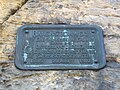
Sign for the creation of the Rauensteinweg
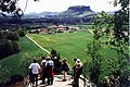
View from Rauenstein (mountain restaurant) towards Lilienstein

The Rauenstein seen from Weißig


Individual evidence
- ↑ Peter Rölke (Ed.): Saxon Switzerland. Stair hiking guide . Berg- und Naturverlag Rölke, Dresden 2012, p. 50ff.
- ↑ The Rauenstein. Berggaststätte Fels Rauenstein, accessed on December 30, 2014 .
- ↑ Ferdinand Thal: Guide to Saxon Switzerland . Dresden 1846, p. 106.
literature
- Königstein area, Saxon Switzerland (= values of the German homeland . Volume 1). 1st edition. Akademie Verlag, Berlin 1957.
- Peter Rölke: Saxon Switzerland. Stair hiking guide. Berg- und Naturverlag Rölke, Dresden 2012, ISBN 978-3-934514-27-0 .
- Peter Rölke: hiking and nature guide Saxon Switzerland. Volume 2: Front and South Saxon Switzerland. Berg- und Naturverlag Rölke, Dresden 2013, ISBN 978-3-934514-09-6 .