
Struppen
| coat of arms | Germany map | |
|---|---|---|

|
Coordinates: 50 ° 56 ' N , 14 ° 1' E |
|
| Basic data | ||
| State : | Saxony | |
| County : | Saxon Switzerland-Eastern Ore Mountains | |
| Management Community : | Koenigstein / Saxon. Schw. | |
| Height : | 219 m above sea level NHN | |
| Area : | 20.64 km 2 | |
| Residents: | 2512 (Dec. 31, 2019) | |
| Population density : | 122 inhabitants per km 2 | |
| Postal code : | 01796 | |
| Area code : | 035020 | |
| License plate : | PIR, DW, FTL, SEB | |
| Community key : | 14 6 28 390 | |
| Community structure: | 5 districts | |
| Association administration address: | Hauptstrasse 48 01796 Struppen |
|
| Website : | ||
| Mayor : | Rainer Schuhmann ( CDU ) | |
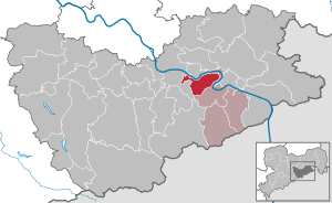
| Location of the municipality Struppen in the district of Saxon Switzerland-Eastern Ore Mountains | ||
  |
||


Struppen is a municipality in the district of Saxon Switzerland-Eastern Ore Mountains , Free State of Saxony . It lies in a wide valley to the left of the Elbe and belongs to the Königstein administrative community .
geography
The municipality of Struppen is located around 25 kilometers up the Elbe from Dresden city center in Saxon Switzerland . Between the city of Wehlen , Rathen , Königstein and the district town of Pirna , the municipality nestles against a loop of the Elbe without having the course of the river as the municipality boundary.
history


As early as 1275, a knightly manor in the village was named as Ztrupin . A Bertoldus des Strupin was first mentioned in 1310, the place itself as Strupein in 1354.
In 1445 “the village Struppin owned 30 men, they have 6 crossbows”, in 1548 the Strippen farmers had a total of 28 hooves and 7 gardeners, in 1835 there were still 35 farms; the municipality, which was cleared from Struppen, Klein- and Neu-Struppen, comprised 1,576 people in 1919. The very old church was under the dean's office of Aussig and under the patronage of the German order at the time of the Bohemian rule. The soldiers 'boys' education center was formerly located in high-lying small troops, now (1928) a children's rest home is housed.
Local division
Struppen is divided into the districts of Kleinstruppen (incorporated into Struppen on February 1, 1918), Neustruppen ( incorporated into Struppen on February 1, 1919), Struppen-Siedlung , Naundorf ( incorporated into Struppen on January 1, 1994), Thürmsdorf ( incorporated into Struppen on January 1, 1919) January 1994 incorporated into Struppen), Weißig (incorporated into Thürmsdorf on January 1, 1973), Ebenheit (incorporated into Struppen on January 1, 1973) and Strand .
Flatness
Flatness lies on a plain lined with fields and apple orchards. The village has almost 100 inhabitants. A few small handicraft businesses have settled in the village, agriculture, which was once very important, is hardly practiced as a livelihood. The local "Geflügelhof Struppen" specializes in keeping poultry and selling eggs. There is also a volunteer fire brigade. In addition to the many historic three-sided courtyards, a stone pillar from the time of Napoleon testifies to the more than 450-year history of the district. The town of Pirna is only two kilometers away.
Naundorf

Naundorf is located in a creek at the foot of the Bärensteine and borders directly on the Elbe Valley near the town of Wehlen . Below the village the slope drops steeply into the Elbe valley. There are old sandstone quarries here .
The Impressionist painter Robert Sterl (1867–1932), who became famous for his “Steinbrecher” pictures, lived for a long time in a house in a secluded group of houses above the Pötzscha settlement . His former residential building is the museum-like Robert-Sterl-Haus, in which numerous pictures and studio objects are exhibited.
In the village there is the Catholic Caritas family vacation home St. Ursula , a place of pilgrimage and pilgrimage of the Schoenstatt Movement . The Gothic winged altar and a bronze bell from 1781 are noteworthy.
Thürmsdorf
The place Thürmsdorf, about 1 km east of the district Struppen at the foot of the Bärensteine at about 200 m above sea level. Located NN , is crossed by the Pehnabach . Thürmsdorf was first mentioned in a document in 1420. In addition to a war memorial, the castle-like manor with its famous park and rose garden is the main attraction.
The bronze sculpture “Adoration” by the Norwegian sculptor Stephan Sinding (1846–1922) with approaches from the beginning Art Nouveau stands in the palace gardens .
The manor had constantly changing owners (19th century von Friesen / le Fevre, from around 1900 Freiherr von Biedermann, from 1932–43 Baron von Arnim, 1943–45 the construction management of the Todt Organization for the secret project Schwalbe II , after the war vacation home of the synthesis plant Schwarzheide , then FDGB rest home, now privately owned).
From the mausoleum (1924 by Biedermann) on the Elbe slope you have a beautiful view of the Elbe valley.
The Pehna Fall is the highest waterfall in Saxon Switzerland with a height of around 20 m .
Whitish
On the eastern edge of the plateau in front of the Bärensteinen and the Rauenstein , Weißig is located on the left bank of the Elbe near Oberrathen . The district, about five kilometers from the center of Struppens, arranged in a semicircle around a basin, is said to have existed as a small Slavic hamlet even before the German settlement . In the north, the wooded sandstone of the Kulm rises up, where near the thief's cave is the stone “Kleines Schiff”, which served as an air raid shelter during World War II.
politics
Since the municipal council election on May 26, 2019 , the 14 seats of the municipal council have been distributed among the individual groups as follows:
Memorials
- A memorial stone from 1948 on the main street in the Struppen district commemorates the victims of fascism .
- A memorial from 1948 in the cemetery of the Struppen district commemorates the graves of five named concentration camp inmates and prisoners of war from various countries that were located there until 1951 .
- Commemorative plaques on the house at Hauptstrasse 32 and on the manor commemorated the Communist opponents of Hitler, Martin Hering (murdered in 1933 in Hohnstein concentration camp ) and Artur Tiermann (shot in 1935 in a forest near Altenberg).
Development of the municipality area
Incorporations
- February 1, 1918: Small troops
- February 1, 1919: New troops
- January 1, 1973: flatness
- January 1, 1994: Struppen merges with Naundorf and Thürmsdorf to form the Struppen municipality.
Development of the population
- 1548/51: 45 possessed men and 44 residents
- 1764: 29 possessed men, 5 gardeners and 9 cottagers
- 1834: 406 inhabitants
- 1871: 649 inhabitants
- 1890: 840 inhabitants
- 1910: 938 inhabitants
- 1925: 1472 inhabitants (after the incorporation of small and new troops)
- 1939: 1766 inhabitants
- 1946: 2051 inhabitants
- 1950: 2044 inhabitants
- 1964: 1942 inhabitants
- 1990: 1396 inhabitants
- 1994: 2387 inhabitants, including 1,436 in Struppen, 575 in Thürmsdorf and 376 in Naundorf
- 2000: 2853 inhabitants
- 2005: 2736 inhabitants
- 2010: 2560 inhabitants
- 2015: 2523 inhabitants
Culture and sights
.jpg)
The village church Struppen from 1740 contains Romanesque elements and a baroque organ from 1720. In the rectory there is a memorial plaque for the pastor and "pioneer of Saxon Switzerland " Wilhelm Leberecht Götzinger , who was born here in 1758, and a sandstone baptism from the 16th century. In the Struppener Schloss (a manor first mentioned in 1310 ) there is a remarkable Wendelstein from the 16th century.
Personalities
- Wilhelm Leberecht Götzinger (born September 1, 1758 in Struppen, † 1818 in Neustadt in Saxony) was a pastor and author. With his publications History and Description of the Cursächsisches Amt Hohnstein and Schandau and its surroundings or Description of Saxon Switzerland (1804), Götzinger played an essential part in the development of Saxon Switzerland . He spent his childhood in Struppen until 1765.
- Richard Freiherr von Friesen (born August 9, 1808 in Thürmsdorf, † February 25, 1884 in Dresden) was a Saxon politician. In 1858 Richard von Friesen was appointed finance minister of the Kingdom of Saxony.
- Robert Sterl (born June 23, 1867 in Großdobritz; † January 10, 1932 in Naundorf) was a painter and an important representative of German Impressionism . Sterl lived in Naundorf from 1919.
- Werner Großmann (born March 9, 1929) secret service officer, former Deputy Minister for State Security of the GDR
literature
- Rudolf Bradsky von Laboun: History of the Thürmsdorf manors, small troops and new troops with their villages . Thürmsdorf 1905.
- Richard Steche : Struppen. In: Descriptive representation of the older architectural and art monuments of the Kingdom of Saxony. 1. Booklet: Official Authority Pirna . CC Meinhold, Dresden 1882, p. 91.
Web links
- Homepage of the Struppen community
- Struppen in the Digital Historical Directory of Saxony
Individual evidence
- ↑ Population of the Free State of Saxony by municipalities on December 31, 2019 ( help on this ).
- ↑ from: Otto Eduard Schmidt. Kursahsische forays . Sixth volume Dresden and Saxon Switzerland . Book printer of Wilhelm and Bertha v. Baensch Foundation, Dresden 1928, p. 330
- ↑ Results of the 2019 municipal council elections
Flatness | Naundorf | Beach | Troops (with small troops and new troops ) | Struppen Settlement | Thürmsdorf | Whitish
Altenberg | Bad Gottleuba-Berggießhübel | Bad Schandau | Bahretal | Bannewitz | Dippoldiswalde | Dohma | Dohna | Village grove | Dürrröhrsdorf-Dittersbach | Freital | Glassworks | Gohrisch | Hartmannsdorf-Reichenau | Heidenau | Hermsdorf / Erzgeb. | Hohnstein | Klingenberg | Königstein (Saxon Switzerland) | Kreischa | Liebstadt | Wages | Müglitztal | Neustadt in Saxony | Pirna | Rabenau | Rathen | Rathmannsdorf | Reinhardtsdorf-Schöna | Rosenthal-Bielatal | Sebnitz | City of Wehlen | Stumble | Struppen | Tharandt | Wilsdruff