
Altenberg (Ore Mountains)
| coat of arms | Germany map | |
|---|---|---|

|
Coordinates: 50 ° 46 ' N , 13 ° 45' E |
|
| Basic data | ||
| State : | Saxony | |
| County : | Saxon Switzerland-Eastern Ore Mountains | |
| Management Community : | Altenberg | |
| Height : | 750 m above sea level NHN | |
| Area : | 145.89 km 2 | |
| Residents: | 7934 (Dec. 31, 2019) | |
| Population density : | 54 inhabitants per km 2 | |
| Postcodes : | 01773, 01778 (Fürstenau, Fürstenwalde, Geising, Lauenstein, Liebenau, Müglitz) |
|
| Primaries : | 035056, 035052 (Schellerhau, Waldidylle, Falkenhain, Kipsdorf) , 035054 (Bärenstein, Fürstenau, Lauenstein, Müglitz, Rudolphsdorf) , 035057 (Rehefeld-Zaunhaus) | |
| License plate : | PIR, DW, FTL, SEB | |
| Community key : | 14 6 28 010 | |
| City structure: | 20 districts | |
City administration address : |
Platz des Bergmanns 2 01773 Altenberg |
|
| Website : | ||
| Mayor : | Thomas Kirsten (Free Voters) | |
| Location of the city Altenberg in the district of Saxon Switzerland-Eastern Ore Mountains | ||
  |
||

_2006-10-30.jpg)

Altenberg is a town in the Saxon district of Saxon Switzerland-Eastern Ore Mountains . It is one of the state-approved health resorts in the Eastern Ore Mountains . The city is the seat of the Altenberg administrative community . Historically, tin ore mining was important for centuries.
geography
Location description
The city of Altenberg is located in the Eastern Ore Mountains , its highest point is the Kahleberg ( 905 m above sea level ). The Rote Weißeritz , one of the two source rivers of the Weißeritz , has its source in the municipality . While the districts of Kipsdorf and Bärenstein in the Weißeritztal and Müglitztal are at around 400 to 500 m above sea level, the Falkenhain district is at around 650 to 700 m above sea level; the district of Zinnwald-Georgenfeld is over 800 m above sea level. To the north of Altenberg is the Weigelswalde desert .
The border with the Czech Republic is five kilometers away.
City structure
The municipal parts belong to the city of Altenberg (sorted according to the date of incorporation):
Bärenstein, Geising and Lauenstein are districts, the other places are referred to as districts.
| District | Incorporation | population |
|---|---|---|
| Altenberg (core town) | - | 1904 |
| Bear Rock | 1999 | 279 |
| Bear stone | 2004 | 900 |
| Falcon Grove | 1999 | 232 |
| Fürstenau | 2011 | 183 |
| Fürstenwalde | 2011 | 301 |
| Geising | 2011 | 1206 |
| Faithful to God | 2011 | 20th |
| Deer jump | 1965 | 124 |
| Kipsdorf | 1996 | 273 |
| Lauenstein | 2011 | 517 |
| Liebenau | 2011 | 424 |
| Lion grove | 2011 | 178 |
| Müglitz | 2011 | 29 |
| Neu-Rehefeld | 1994 | 14th |
| Upper Bear Castle | 1996 | 214 |
| Rehefeld fence house | 1994 | 145 |
| Schellerhau | 1996 | 383 |
| Forest Bear Castle | 1996 | 21st |
| Forest idyll | 1999 | 139 |
| Zinnwald-Georgenfeld | 1994 | 423 |
As of December 31, 2018
history
founding
After miners at the southern foot of the Ore Mountains in the vicinity of Krupka (Graupen) had probably already started to mine tin soaps in the 12th century , in later decades they pushed further and further towards the Ore Mountains in search of the actual deposit. They first discovered the deposits around Zinnwald (mentioned in a document in 1378) before they found it in Altenberg around 1440. The deposit , the so-called hermaphrodite , has proven to be the most important tin deposit in Central Europe over the centuries . In the immediate vicinity of the countless small collieries in which mining began, Altenberg emerged as a scattered settlement for miners.
Development of the city
Originally the parcels belonged to the Lords of Bernstein, owners of the Bärenstein estate. On December 16, 1446, the knight Hans von Bernstein sold the fourth part of his rule to the elector, so that the elector became the landlord of the area that is now Altenberg. Due to the productivity of the ore deposits, the place quickly developed into the most important mountain town in the Eastern Ore Mountains . The economic upturn led to the granting of town and market rights as early as 1451. In this context, the place was mentioned as "frymarkt". As a city Altenberg was mentioned in 1489 as "uf dem Aldenberge" and in 1534 as "zum Aldenbergk". The name is explained as (in comparison with the mountain and the place Geising ) old mountain . The Altenberger Pinge , a collapse funnel built in 1620, the pewter wash (technical display system), one of the former 13 washes with stamping mills and shaking ovens in the Altenberg-Geising-Zinnwald area, and the Neubeschert-Glück- Stolln, in which the old mining methods are recreated.

Since 18./19. In the 19th century, various homework ( wooden toys and immortelle production) supplemented the opportunities to earn a living in mining. In the first half of the 20th century, Altenberg developed into a winter sports center in the Eastern Ore Mountains due to its snow-sure location and good accessibility ( connection to the railway network in 1923 ).
From February 9 to 14, 1937, the German Ski Championships took place in Altenberg .
Altenberg was spared direct combat operations during the Second World War until just before the end of the war. In the course of the Prague operation , Soviet troops advanced on May 6, 1945 over the ridge of the Eastern Ore Mountains towards Prague . This resulted in retreat skirmishes with the troops of the German Army Group Center in Altenberg and the surrounding area . The Altenberg train station was attacked from the air on May 4th, 5th and 7th 1945 to interrupt the routes of retreat. The town church of St. Nicholas from the early 16th century was also destroyed, the ruins were removed in 1953. On May 8, 1945, the German troops fleeing through the city to Bohemia were attacked several times by Soviet low-flying aircraft. Members of the Wehrmacht looted the partly abandoned houses on May 9 and bought civilian clothing. At the same time, there was a battle between the Soviet troops and a werewolf group founded in Altenberg in April 1945 . On the evening of May 9th, a fire broke out in the city, which spread to a large part of the development by the next day and destroyed 120 houses. The causes of the fire have not yet been fully clarified. In total, around three quarters of the historic city center was destroyed in the last days of the war. Among the destroyed town houses were numerous characteristic buildings from the 17th and 18th centuries. The 17th century tradesmen's house on the broad market was considered the most prestigious building. It had a half-timbered upper floor and a steep hipped roof above the ground floor made of quarry stone.


In the 1950s, the expansion of the spa system began. After the mining was stopped in 1991 for economic reasons, the place concentrated more on tourism and the recreation and health resort. In 2004 the city was given the title Kneipp health resort . Altenberg has developed into an important winter sports center in the Eastern Ore Mountains.
Incorporations
Hirschsprung was incorporated into the municipality in 1965. Two municipalities followed in 1994, three municipalities in 1996, two municipalities in 1999, Bärenstein in 2004 and Geising in 2011.
| Former parish | date | annotation |
|---|---|---|
| Bear Castle | January 1, 1996 | |
| Bear Rock | January 1, 1999 | |
| Bärenstein (village) | 1926 | Incorporation to Bärenstein (city) |
| Bärenstein (city) | January 1, 2004 | |
| Falcon Grove | January 1, 1999 | |
| Fürstenau | January 1, 1994 | Incorporation to Geising |
| Fürstenwalde | January 1, 1994 | Incorporation to Geising |
| Geising | January 1, 2011 | |
| Georgenfeld | July 1, 1950 | Merger with Zinnwald to Zinnwald-Georgenfeld |
| Deer jump | January 1, 1965 | |
| Kipsdorf | April 1, 1996 | |
| Lauenstein | March 1, 1994 | Incorporation to Bärenstein |
| Liebenau | January 1, 1994 | Incorporation to Geising |
| Lion grove | 1st January 1974 | Incorporation to Geising |
| Rehefeld | March 1, 1879 | Merger with Zaunhaus to form Rehefeld-Zaunhaus |
| Rehefeld fence house | January 1, 1994 | |
| Schellerhau | January 1, 1996 | |
| Fence house | March 1, 1879 | Merger with Rehefeld to form Rehefeld-Zaunhaus |
| Tin forest | July 1, 1950 | Merger with Georgenfeld to form Zinnwald-Georgenfeld |
| Zinnwald-Georgenfeld | January 1, 1994 |
Incorporation of Geising
The Geisinger city council voted 21 December 2010 mainly to the incorporation to Altenberg on January 1, 2011th The incorporation was approved on December 29, 2010 by the municipal supervisory authority of the Saxon Switzerland-Eastern Ore Mountains district. It was significantly influenced by Geising's precarious financial situation. The city was unable to present a balanced budget in 2010, the debts amounted to € 4.8 million at the end of 2010, including € 2.28 million deficits .
As a result of the incorporation, Altenberg grew to an area of over 146 km², making it by far the largest municipality in the district. The population rose from around 5,700 to just under 8,900. At the same time, a new regional tourist stronghold emerged: in 2009, both communities together counted just under 423,000 overnight stays, which corresponds to around 17% of the overnight stays registered in the district. Tourism and health resorts secure around 1,800 jobs in both communities.
Development of the population
- 1550: 228 possessed men and 196 residents (corresponds to 1,341 inhabitants) (1)
- 1697: 1104 (2)
- 1764: 1220, 72 Häusler
- 1792: 1365
- 1801: 1374
- 1815: 1378
- 1834: 1913 (3)
- 1871: 2352
- 1890: 1888
- 1910: 1836
- 1925: 1740
- 1939: 2032
- 1946: 1796
- 1960: 2314
- 1964: 2389
- 1970: 2490
- 1990: 6586 (4)
- 1998: 6183
- 2000: 5848
- 2001: 5592
- 2002: 5401
- 2003: 6312
- 2004: 6162
- 2005: 6007
- 2006: 5890
- 2007: 5829
- 2008: 5825
- 2009: 5694 (5)
- 2010: 8723 (6)
- 2011: 8429 (7)
- 2012: 8317
- 2013: 8272
- 2014: 8143
- 2015: 8211
Compilation based on BLASCHKE 2003, German Academy of Sciences in Berlin 1964, ZÜHLKE 1966 and information from the State Statistical Office of Saxony, from 1998: status as of December 31. of the respective year
(1): calculated according to tax lists, cf. BLASCHKE 2003
(2): adult residents, including 244 citizens, 184 houses and 138 desolate residential areas
(3): 243 houses
(4): population on October 3, 1990
(5): residents with main residence: 5575, including 2079 in Altenberg itself
(6): After incorporation of Geising
(7): After data renewal by the 2011 census
politics
City council
Since the municipal council election on May 26, 2019 , the 22 seats of the city council have been distributed among the individual groups as follows:
_Rathaus_(01).jpg)
| Party / list | Share of votes | +/-% p | Seats | +/- |
| Free voters Altenberg (FWA) | 29.9% | - 1.0 | 6th | + 1 |
| CDU | 19.2% | - 11.4 | 6th | + 1 |
| The left | 10.5% | - 1.1 | 2 | ± 0 |
| AfD | 16.2% | + 16.2 | 2 | ± 0 |
| Voters' Association Geising (WVG) | 14.4% | + 5.7 | 1 | ± 0 |
| Bärenstein Electoral Association (BWV) | 9.9% | + 2.4> | 5 | + 1 |
+/−: Change compared to local elections on May 25, 2014
coat of arms
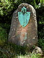
Description: The coat of arms is split into red and blue and divided into gold. On the right a golden bishop with a staff and on the left a double-tailed lion divided in white and red . Below is a working kneeling miner in black.
Town twinning
- Košťany , Czech Republic
- Sulz am Neckar , Baden-Wuerttemberg
Culture and sights


- see also: List of cultural monuments in Altenberg
Mining, structures, parts of the landscape
The Altenberg tin ore mining is a selected site for the proposed candidacy for the UNESCO World Heritage Site of the Ore Mountains Mining Region .
- Ping
- Bells of Peace and Spa Park (in the Bärenfels district )
- Geisingberg
- Kahleberg
- Rehefeld hunting lodge
- Cross-border mining nature trail
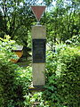
- Kursächsische Postdistanzsäule and royal Saxon milestone (station stone ) at the place of the miner as well as royal Saxon milestone (whole milestone) as a kilometer stone on the road to Rehefeld-Zaunhaus , the latter from the postal courses to Sayda and Frauenstein
- Schellerhau Botanical Garden
- Georgenfelder Hochmoor
church
_Evangelische_Kirche.jpg)
The Evangelical Church of Altenberg (address: Dippoldiswalder Straße 6a) is a successor to the former town church of St. Nicholas. This was essentially late Gothic and exposed to frequent fires (most recently in 1876). Structural changes followed. In 1878 the choir was redesigned as a polygon, a gable roof was built and the tower with a pointed helmet was rebuilt. The interior was neo-Gothic. After the end of the Second World War, on May 9, 1945, the church was bombed several times by the Soviet air force, and the church, the parish hall, the diaconate, the rectory and the city suffered severe damage. The ruins were removed in 1953. The current church was built between May 1989 and December 1991.
Museums and exhibitions
- Altenberg Mining Museum
- The technical museum, which opened in 1957, is located in a pewter pound wash that was originally built in the 16th century and has been technically functional again after renovation. In connection with the 180 m long Neubeschert-Glück tunnel ( excavated 1802–1849, exhibition tunnel since 1971), it shows the path of tin from mining to processing.
- Visitor mine Unites Zwitterfeld to Zinnwald in Zinnwald-Georgenfeld
- The visitor mine, opened in 1992, opens up the deep-Bünau tunnel, which was excavated by the von Bünau noble family in 1686 . Above all, the widening of the rich roaster created by setting fire is impressive. The nearly three-kilometer tour leads underground to the German-Czech border.
Recreation
- Recreation area Galgenteiche with camping site and giant slide
- Bathing landscape in the rehabilitation clinic Raupennest
- Recreational area in the vicinity of the Oberbärenberg chapel
Culinary specialties
Culinary specialties in the area are herbal liqueurs with regionally appropriate names such as "Knappenfeuer", "Kufenwärmer", "Pyramidenöl" and others, which have been produced in various brands in the Altenberg herb liqueur factory since 1842.
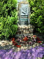
Memorials and monuments
- OdF monument on the road to Schellerhau , not far from aisle 31, in memory of the communists Max Niklas , Walter Richter and Arthur Thiermann who were shot on July 4, 1935 after smuggling across the Czechoslovak border .
- OdF memorial stone from 1945 in the cemetery on Mühlenstrasse for eleven unknown concentration camp prisoners who were murdered by SS men in April 1945.
- War memorial in the cemetery at the mill line for the roll-call the fallen of the First World War .
- Memorial stone with cross in the cemetery on Mühlenstrasse for the victims of the Second World War .
- Gravesites in the cemetery on Mühlenstrasse for Soviet soldiers.
- Memorial stone with medallion in the cemetery on Mühlenstrasse, grave of the local poet and singer Max Nacke .
- Monument, gneiss monolith with a coat of arms-like bronze plaque, created in 1932 by the Dresden sculptor Johannes Ernst Born , near the old caterpillar nest for the honorary citizen Max Gross .
- Goethe monument at the Aschergraben , monolith with memorial plaque and relief as well as a stone with an inscription in front of it.
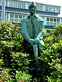
- Monument bronze figure on natural stone plinth The skier at the station forecourt, created in 1931 by the Dresden sculptor Rudolf Löhner .
- Memorial on Neustadt / Hirschsprunger Strasse, memorial stone with likeness and inscription for the local poet and singer Max Nacke.
- Retaining wall with miner's well on the old church terrace (Rathausstrasse).
- Electoral Saxon post mile column from 1722 with colored coat of arms reliefs on Dresdner Strasse.
- Monument to Anton Günther on Zinnwalder Straße with a fountain, natural stone with medallion with a portrait , on Zinnwalder Straße.
- Bronze figure on a natural stone base Bergmann with compressed air tool at the Arno-Lippmann-Schacht, Zinnwalder Straße 5.
- Bronze figure Caroline, entrance to the health center Raupennest Rehefelder Strasse.

OdF memorial aisle 31
OdF memorial cemetery
Monument to Max Gross

Goethe monument at the Aschergraben

Skier memorial
Local poet and singer Max Nacke

Saxon postal mileage column

Miner's well, detail
Miners Monument

Bronze figure Caroline, Health Center New Caterpillar Nest


Winter sports


Altenberg is considered an international winter sports center. Up until the 1950s there was also a ski jump and an ice rink on Geisingberg , but a racing sled and bobsled run has existed since 1986.
- Racing sled and bobsled run : 1,413 m long; 17 curves; Difference in altitude 122 m; Gradient up to 15%; Speeds of up to 130 km / h can be driven; The venue for World Cups, European and World Championships in bobsleigh, luge and skeleton. In 2020 it hosted the Bobsleigh and Skeleton World Championships for the sixth time .
- State sports center ( mountain bike , skeleton , luge , bobsleigh )
- Sparkassen Arena Osterzgebirge ( biathlon , cross-country skiing )
- Summer toboggan run
- Ski lifts
- Cross-country ski trail network , ski slope with snowmaking
Economy and Infrastructure
traffic

Altenberg is located on federal highway 170 , which connects Dresden via Zinnwald with northern Bohemia and Prague . This road has become an important link between Saxony and the Czech Republic since it was built in the 1840s. As Europastraße 55 , it was part of the pan-European traffic corridor IV, which ran from Scandinavia to Southeastern Europe. As a result of the changed economic development after German reunification and the eastward expansion of the EU , the volume of traffic had increased significantly, especially in heavy goods vehicle traffic. This was also due to the fact that the Zinnwald-Georgenfeld border crossing between the Vogtland ( Bad Brambach ) and Upper Lusatia ( Neugersdorf ) is the only crossing between Saxony and Bohemia that can be used without restrictions for truck traffic. After the construction of the new handling facilities (2001), it is characterized by very short truck handling times (15 minutes), which attracted additional traffic. As a result, Altenberg was passed by around 3,900 trucks per day in the summer of 2005. This through traffic (about every 22 seconds a truck) was a major burden (noise, source of danger, etc.) not only for Altenberg itself, but also for the district of Kipsdorf. From March 21st December 2006, the chronically overloaded B 170 was therefore for the Uphill heavy goods traffic is blocked and was only released again when the federal motorway 17 Dresden – Prague was put into operation .
Since 1923 Altenberg has been the end point of the 38 km long Müglitztalbahn , which connects the mountain town through the Müglitztal with Heidenau and the upper Elbe valley. The railway line made a significant contribution to the development of Altenberg into a winter sports center in the Eastern Ore Mountains. Initially laid out as a narrow-gauge railway, it has been operated as a standard-gauge railway since 1938. Since 2002, DB Regio Südost has been using Siemens Desiro Classic (DB class 642) railcars for passenger trains instead of locomotive-hauled trains on regional line 72 . Since December 12, 2010, the city railway of Saxony , which also uses Siemens Desiro Classic , has been running on the Müglitztalbahn . If winter sports conditions are favorable, there are also special winter sports trains that tourists can use to get to Altenberg directly from Dresden Hbf . Immediately at the “Kurort Altenberg” train station there is a covered public transport interface to the intercity bus service. Seven lines connect Altenberg to the surrounding area, including the Czech border town of Teplice :
- Line 360: Dresden - Dippoldiswalde - Altenberg - Zinnwald
- Line 367: Geising - Altenberg - Kipsdorf
- Line 368: Glashütte - Lauenstein - Geising - Altenberg
- Line 370: Altenberg - Oberbärenburg - Falkenhain - Dippoldiswalde
- Line 373: Altenberg - Rehefeld - Hermsdorf
- Line 398: Altenberg - Teplice
- Line 733: Altenberg - Rehefeld - Hermsdorf - Holzhau
Established businesses
- Raupennest Rehabilitation Clinic (Johannesbad Raupennest AG & Co KG) (210 employees)
- Herbrig & Co. GmbH, CNC turning shop (120 employees)
education
In Altenberg there is a primary school and the Altenberg branch of the "Glückauf" high school in Dippoldiswalde / Altenberg with a sports focus ( elite school of sports ). There is a high school in the neighboring town of Geising.
Personalities
Honorary citizen
- Hans Alexander von Bosse (* 1835, † 1898), lawyer and politician, from 1874 to 1877 governor in Dippoldiswalde , in this function significantly involved in the reconstruction of Altenberg after the city fire of 1876, donor to support needy Altenbergers, namesake of Bosseplatz (since 1939 ), Honorary citizen since 1877
- Adolf Fürchtegott Büttner, factory owner and city councilor, donor to support needy Altenbergers, honorary citizen since 1881, namesake of Büttnerstrasse
- Max Gross (* 1880, † 1931), Chief Postal Director in Dresden, co-founder and later chairman of the Altenberger Landsmannschaft (association of former Altenberg students), honorary citizen since 1929
- Hans-Georg Günzel († 2001), pastor in Schellerhau , honorary citizen since 2001
- Paul Haucke (* 1859, † 1935), pastor in Altenberg, co-founder and director of the Post and Railway School, honorary citizen since 1907, namesake of Paul-Haucke-Straße
- Anton Unger (* 1831, † 1909), lawyer and manufacturer from Riesa , spent his summer months in Altenberg and in 1905 founded a foundation for needy residents, honorary citizens since 1905, namesake of Anton-Unger-Straße
sons and daughters of the town
- Basilius Köhler , 1586–1589 Kreuzkantor in Dresden
- Friedrich Leibnütz (1597–1652), lawyer, philosopher
- Christoph Meißner (1703–1780), teacher and chronicler
- Johann Gottlob Bergold (1742–1803), legal scholar
- Ernst Viktor Schellenberg (1827–1896), writer
- Max Nacke (1883–1958), dialect poet
- Fritz Große (1904–1957), resistance fighter, GDR ambassador
- Richard von Rosen (* 1922 in Hirschsprung; † 2015), major general, defense attaché at the German Embassy in Paris
- Theo Schumann (1928–1990), jazz musician and band leader ("Theo Schumann Combo")
- Dieter Hofmann (1941-2020), artistic gymnastics trainer
- Horst Koschka (* 1943), biathlete
- Manfred Beer (* 1953), biathlete
- Ralf Eißler (* 1958), politician (PDS)
- Michael Rösch (* 1983), Olympic champion with the men's biathlon relay at the 2006 Winter Olympics in Turin
Personalities who have worked on site
- Balthasar Rösler (1605–1673), 1663–1673 mountain master and Markscheider in Altenberg
- God of honor Leberecht Meutzner , mountain official, mountain school teacher and draftsman in Altenberg
- Hans Richard Heinmann (1875–1947), painter and graphic artist from the Saxon Eastern Ore Mountains
- Josef Kaiser (1910–1991), architect and town planner, died in Altenberg
- Helmut Kempe (1916–1997), architect and urban planner
literature
- Around Altenberg, Geising and Lauenstein (= values of the German homeland . Volume 7). 1st edition. Akademie Verlag, Berlin 1964.
- Eastern Ore Mountains (= values of the German homeland . Volume 10). 1st edition. Akademie Verlag, Berlin 1966, pp. 244-257.
- Artur and Edith Kamprath: Altenberg. Discover this beautiful city. Altenberg 2016
- Egbert Kamprath: Altenberg. Pictures of a city. Dresden 1999.
- Christoph Meißner : Cumbersome news from the Churfl. Saxon. Schrifftsäßigen Zien-Berg-Stadt Altenberg, located in Meissen on the Bohemian border, along with the associated diplomatic bus, and an appendix […]. Lesch and Hübner, Dresden and Leipzig, 1747. ( digital version (pdf, 37.2 MB) )
- Richard Steche : Altenberg. In: Descriptive representation of the older architectural and art monuments of the Kingdom of Saxony. 2. Issue: Amtshauptmannschaft Dippoldiswalde . CC Meinhold, Dresden 1883, p. 3.
Web links
- Official website of Altenberg in the Ore Mountains
- Altenberg in the Digital Historical Directory of Saxony
- Literature about Altenberg in the Saxon Bibliography
Individual evidence
- ↑ Population of the Free State of Saxony by municipalities on December 31, 2019 ( help on this ).
- ↑ Announcement of the Saxon State Ministry for Economics, Labor and Transport on the change of the list of health and recreation places in the Free State of Saxony according to § 3 Abs. 5 SächsKurG from January 20, 2014
- ↑ Wolfgang Fleischer: The end of the war in Saxony 1945 . Podzun Pallas, Wölfersheim-Berstadt 2004, p. 146
- ↑ Information on the Altenberg Church from www.altenberg.de ( accessed January 3, 2014)
- ↑ Wolfgang Fleischer: The end of the war in Saxony 1945 . Podzun Pallas, Wölfersheim-Berstadt 2004, p. 151
- ^ Heinrich Magirius: Altenberg . In: Götz Eckardt (ed.) Fate of German monuments in the Second World War . Volume 2, Henschel-Verlag, Berlin 1978, p. 369
- ↑ a b c d e f g h i j k l m State Statistical Office of the Free State of Saxony: Area changes
- ^ Bärenstein in the Digital Historical Directory of Saxony
- ↑ a b c d municipalities 1994 and their changes since January 1, 1948 in the new federal states , Metzler-Poeschel publishing house, Stuttgart, 1995, ISBN 3-8246-0321-7 , publisher: Federal Statistical Office
- ↑ a b Lists of the municipalities incorporated since May 1945 and evidence of the breakdown of the independent manor districts and state forest districts, 1952, publisher: Ministry of the Interior of the State of Saxony
- ^ A b Directory of communities and places for the Kingdom of Saxony, 1904, publisher: Statistical Bureau of the Royal Ministry of the Interior
- ↑ Maik Brückner: Geising agrees to the incorporation , Sächsische Zeitung of December 23, 2010
- ↑ a b Mandy Schaks: The cities of Altenberg and Geising are going together from January , Sächsische Zeitung (Dippoldiswalde) of December 30, 2010
- ↑ Maik Brückner: Is Geising doing too much? , Sächsische Zeitung (Dippoldiswalde) of October 23, 2010
- ↑ State Statistical Office Saxony - Municipal Statistics Saxony
- ↑ cf. Facts and figures ( Memento from February 20, 2010 in the Internet Archive )
- ↑ Results of the local council election 2019 Altenberg
- ↑ Wolfgang Fleischer: The end of the war in Saxony 1945. Podzun Pallas, Wölfersheim-Berstadt 2004, p. 146 ff.
- ^ Cultural monuments in the Free State of Saxony, District: Weißeritzkreis; Location: Altenberg from December 17, 1999.
- ^ Infrastructure program of the transport association - Altenberg crossing point. Verkehrsverbund Oberelbe , archived from the original on December 3, 2013 ; accessed on February 12, 2020 .
Altenberg | Bear Castle | Bear Rock | Bear Stone | Falkenhain | Fürstenau | Fürstenwalde | Geising | Faithful to God | Deer jump | Kipsdorf | Lauenstein | Liebenau | Lion's Grove | Müglitz | Neu-Rehefeld | Neuhermsdorf | Rehefeld fence house | Rudolphsdorf | Schellerhau | Forest idyll | Zinnwald-Georgenfeld
Altenberg | Bad Gottleuba-Berggießhübel | Bad Schandau | Bahretal | Bannewitz | Dippoldiswalde | Dohma | Dohna | Village grove | Dürrröhrsdorf-Dittersbach | Freital | Glassworks | Gohrisch | Hartmannsdorf-Reichenau | Heidenau | Hermsdorf / Erzgeb. | Hohnstein | Klingenberg | Königstein (Saxon Switzerland) | Kreischa | Liebstadt | Wages | Müglitztal | Neustadt in Saxony | Pirna | Rabenau | Rathen | Rathmannsdorf | Reinhardtsdorf-Schöna | Rosenthal-Bielatal | Sebnitz | City of Wehlen | Stumble | Struppen | Tharandt | Wilsdruff