
Fürstenwalde (Altenberg)
|
Fürstenwalde
City of Altenberg
Coordinates: 50 ° 45 ′ 39 " N , 13 ° 52 ′ 3" E
|
||
|---|---|---|
| Height : | 629 m above sea level NHN | |
| Residents : | 301 (December 31, 2018) | |
| Incorporation : | January 1, 1994 | |
| Incorporated into: | Geising | |
Location of Fürstenwalde in Saxony |
||
_2006-06-28.jpg) Church in Fürstenwalde
|
||

Fürstenwalde is a district of Altenberg in Saxony in the eastern Eastern Ore Mountains , not far from the Czech border.


geography
Fürstenwalde is located about 45 km south of Dresden in the Eastern Ore Mountains , near the Czech border. Along the border, Fürstenwalde is a neighboring town to Müglitz , Liebenau and Oelsen . On the Czech side it is Adolfov (Adolfsgrün), about 200 m behind the corpse stone to the south and the corridors of Böhmisch Müglitz.
history
_Oberreit_1821.jpg)
Fürstenwalde was mentioned for the first time in 1324 and belonged to the Lauenstein lordship. Probably the founders of the village were loggers and coal burners who laid out the place in the form of a row and forest hoof village along the stream. The place stretches over a length of two kilometers and overcomes 120 meters in altitude. Around 1340 20 farmhouses, a chapel and two mills are said to have stood. After the discovery of iron ore in Lauenstein, mining flourished, to which the former Lauensteiner district Kratzhammer owes its origin. In the old hammer house ("Hammerschänke") the iron was processed. The access to the village was the old iron road in the lower village . The iron was once transported to the Netherlands on it.
In the middle of the 15th century, the Dresden-Teplitzer Poststrasse or Salzstrasse was built from Pirna , which , coming from Breitenau , led via the upper village in Fürstenwalde to the border ( Black Cross ) to Bohemia . This road also served as a postal route, as demonstrated by the Saxon post mile pillars as a half mile pillar in the direction of Liebenau and from 2012 as a quarter milestone in the direction of the Schwarzes Kreuz . The forest and agriculture with the associated trades played an important role in the village for centuries. The rough area was often hit by storms, wars brought disaster, devastation, disease and hardship.
The Müglitzbach , which rises 4 km from Fürstenwalde in the Bohemian region and then runs through the Müglitz district on the border with the Czech Republic, often terrified the valley when storms turned the brook into a torrent, most recently in August 2002. In 1927, too, a severe storm raged in the village.
1956 Kratzhammer was incorporated into Fürstenwalde. On January 1, 1994, Fürstenwalde was incorporated into Geising. Geising was incorporated into Altenberg on January 1, 2011.


One of the three halls that once existed in the village has remained. The one in the Hammerschänke was rebuilt, the Erbgericht (in GDR times a complete renovation was planned as a luxury holiday home) was demolished and the one in the country inn was greatly reduced in size. A newly built club house opposite the Hammerschänke is now home to the Fürstenwalder events, and a bowling alley is also available.
The black cross

Between Fiirstenwalde and Müglitz, directly at the border of the old Teplitzer Post road from Dresden via Dohna through which Harthe ( nose Bach , A 17 ) to Fiirstenwalde and continue past the Geier Burg about Teplitz to Prague led, is directly at the boundary stream on the Ebersdorfer Weiler a Wooden cross, commonly known as the Black Cross . It is located in the Black Meadows, which got their name from the dense tree cover and the water-filled hollows, which became moor and swamp meadows. The border forest was formerly called the Black Forest because of its impenetrability.

Old German boundary stone at the Black Cross Fürstenwalde (Geising)
Formerly CS, now a Czech boundary stone near Fürstenwalde (Geising)
Czech boundary stone near Fürstenwalde (Geising)


Rudolphsdorf
→ see Rudolphsdorf (Altenberg)
Scratch hammer
→ see scraper hammer
The restaurant and memorial room for George Bähr are still preserved .
Population development in Fürstenwalde
|
|
|
|
|
(1): from 1997: population at the beginning of the year (residents' office of the city of Geising)
(2): population including Rudolphsdorf
Sons and daughters of the place
- George Bähr (born March 15, 1666 in Fürstenwalde, † March 16, 1738 in Dresden), Protestant baroque architect, the builder of the Dresden Frauenkirche (1722). For the life and work of this great master builder of the Saxon Baroque, a memorial room was erected in the Hammerschänke and an obelisk in the village.
- Johann August Görenz (born July 10, 1765 in Fürstenwalde / Erzgebirge, † February 3, 1836 in Schwerin), librarian, teacher, philologist, director of the Fridericianum Schwerin
- Johann George Schmidt (* 1707 in Fürstenwalde / Erzgebirge; † July 24, 1774 in Dresden), master builder, master carpenter
Culture and sights
Museums, sights
- Black Grouse Sanctuary
- Fürstenauer Heide nature reserve
- Large- scale nature conservation project mountain meadows in the Eastern Ore Mountains
- Resettlement of the ground squirrel by the BUND Landesverband Sachsen e. V.
- Memorial room for George Bähr and the Dresden Frauenkirche in the Hammerschänke
Buildings
- The house where George Bähr was born in Fürstenwalde
- The black cross on the border with the Czech Republic, at the Geiersberger Pass
- The village church in Fürstenwalde
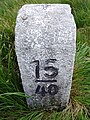
- The quarter mile column (1732) on Alte Dresden-Teplitzer Poststrasse in the Harte
- The half-mile column No. 18 (1729) on the Alte Dresden-Teplitzer Poststrasse
- The stone “tailor's cross” near the connecting road to Liebenau
- The corpse stone in the "Haberfeld" forest (near Rudolphsdorf)
freetime and sports
- Bowling alley in Kratzhammer
- Football pitches in Kratzhammer and between Oberdorf and Müglitz (located outside the forest)
- Bathing pond in the lower village, near Kratzhammer
- popular climbing rock “Grafenstein” between Kratzhammer and the flood retention basin Lauenstein
Regular events
- Carnival in Fürstenwalde (for Mardi Gras and early November) with the Fürstenwalder Karnevalsklub e. V.
- Local festival in Fürstenwalde
- Spring festival with performance comparison of the volunteer fire brigades of the Altenberg community (former fire brigade festival)
- Solstice celebration
- Witches' fire on the old sports field (April 30th)
- Slaughter festival
- Pond festival
partnership
- Fürstenstein (Bavaria)
literature
- Around Altenberg, Geising and Lauenstein (= values of the German homeland . Volume 7). 1st edition. Akademie Verlag, Berlin 1964.
- Günter Groß , Rikarda Groß : Löwenhain and Fürstenwalde. Two villages on the Osterzgebirgskamm . Dippoldiswalde 2012
- Richard Steche : Fürstenwalde. In: Descriptive representation of the older architectural and art monuments of the Kingdom of Saxony. 2. Issue: Amtshauptmannschaft Dippoldiswalde . CC Meinhold, Dresden 1883, p. 30.
Web links
- Fürstenwalde on altenberg.de
- Information about Fürstenwalde on the Geising website
- Fürstenwalde in the Digital Historical Directory of Saxony
Individual evidence
- ↑ Numbers and facts on the website of the city of Altenberg
- ↑ Municipalities 1994 and their changes since January 1, 1948 in the new federal states , Metzler-Poeschel publishing house, Stuttgart, 1995, ISBN 3-8246-0321-7 , publisher: Federal Statistical Office

Altenberg | Bear Castle | Bear Rock | Bear Stone | Falkenhain | Fürstenau | Fürstenwalde | Geising | Faithful to God | Deer jump | Kipsdorf | Lauenstein | Liebenau | Lion's Grove | Müglitz | Neu-Rehefeld | Neuhermsdorf | Rehefeld fence house | Rudolphsdorf | Schellerhau | Forest idyll | Zinnwald-Georgenfeld