
Fürstenstein
| coat of arms | Germany map | |
|---|---|---|

|
Coordinates: 48 ° 43 ' N , 13 ° 20' E |
|
| Basic data | ||
| State : | Bavaria | |
| Administrative region : | Lower Bavaria | |
| County : | Passau | |
| Height : | 577 m above sea level NHN | |
| Area : | 19.29 km 2 | |
| Residents: | 3428 (Dec. 31, 2019) | |
| Population density : | 178 inhabitants per km 2 | |
| Postal code : | 94538 | |
| Primaries : | 08504, 08544 | |
| License plate : | PA | |
| Community key : | 09 2 75 121 | |
| LOCODE : | DE FSN | |
| Community structure: | 20 districts | |
| Address of the municipal administration: |
Vilshofener Str. 9 94538 Fürstenstein |
|
| Website : | ||
| Mayor : | Stephan Gawlik ( CSU ) | |
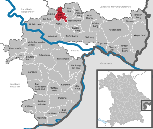
| Location of the community of Fürstenstein in the district of Passau | ||
  |
||


Fürstenstein is a municipality in the Lower Bavarian district of Passau .
geography
Geographical location
Fürstenstein is located in the Danube Forest region in the northern district of Passau and in the southern Bavarian Forest , here regionally referred to as Dreiburgenland . Fürstenstein is located 20 kilometers northeast of Vilshofen an der Donau , ten kilometers from the federal motorway 3 (exit Aicha vorm Wald ) and 22 kilometers from Passau and Grafenau .
Neighboring communities
- Eging at the lake
- Aicha in front of the forest
- Neukirchen in front of the forest
- Tittling
- Thurmansbang ( Freyung-Grafenau district )
Community structure
The community has 20 districts:
|
There is only the district of Fürstenstein.
history
Until the 19th century
Fürstenstein belonged to the Count de la Perusa. The place was part of the Electorate of Bavaria and formed a closed Hofmark , whose seat was Schloss Fürstenstein . In 1818 the political community was established.
The construction of the Danube bridge near Vilshofen gave the impetus to develop the rich granite deposits near Fürstenstein in 1871/72. In the following decades, numerous quarries were built in the area as well as ten granite factories, in which different types of paving stones were made.
20th century
The year 1913 brought the connection to the Deggendorf – Kalteneck railway line , which helped the Fürstenstein granite industry to flourish again in the 1920s. The global economic crisis then had a particularly difficult impact in Fürstenstein with hundreds of unemployed people.
In April 1945, an evacuation train from Buchenwald with 4480 prisoners from Buchenwald concentration camp arrived at the station in the district of Nammering , and they did not make it to their intended destination in Dachau concentration camp . 794 of the prisoners died from exhaustion and from the brutal treatment of the SS guards , who were buried or distributed to various cemeteries. Several memorial stones and a memorial commemorate this event.
In 1958, the Ernst Roederstein company, Spezialfabrik für Capacitors GmbH, started production with ten people. In 1960 and 1961, the plant in Oberpolling was significantly expanded. At the beginning of the 1980s, more than 1,100 employees worked here.
Population development
In the period from 1988 to 2018, the number of inhabitants fell from 3,552 to 3,363 by 189 inhabitants or 5.3%.
| Population in the year | ||||||||||||||||||||||||
|---|---|---|---|---|---|---|---|---|---|---|---|---|---|---|---|---|---|---|---|---|---|---|---|---|
| 1840 | 1871 | 1900 | 1925 | 1939 | 1950 | 1961 | 1970 | 1987 | 1991 | 1995 | 2000 | 2005 | 2007 | 2008 | 2009 | 2010 | 2011 | 2012 | 2013 | 2014 | 2015 | 2016 | ||
| 908 | 1246 | 1658 | 2339 | 3066 | 3931 | 3446 | 3669 | 3550 | 3654 | 3598 | 3489 | 3495 | 3473 | 3452 | 3408 | 3392 | 3332 | 3292 | 3279 | 3289 | 3399 | 3372 | ||
politics
Municipal council
Since the local elections on March 15, 2020, the municipal council has been composed as follows:
Compared to the 2014 to 2020 term of office, the CSU won a mandate from the FWG.
mayor
Mayor is Stephan Gawlik (CSU). He was the successor to Josef Wax ( New List of the Municipality ) in 2002, confirmed for the second time in 2014 with 61.33 percent of the valid votes and was re-elected for the third time on March 15, 2020 with 75.0% of the votes.
coat of arms
The community has had its own coat of arms since 1953. The stepped gable made of black stones is the talking shield figure of the lords of Schwarzenstein, who died out in 1599, who played an important role as lords of the town and castle of Fürstenstein and Englburg in the history of the community from 1474 to 1597 and as holders of high Bavarian and Prince-Bishop-Passau offices. The black stepped gable in the coat of arms of the Schwarzenstein family passed in 1602 to their legal successors and partial heirs, the Barons of Taufkirchen.
Partnerships
- Fürstenwalde (Saxony, Eastern Ore Mountains)
Culture and sights

Fürstenstein Castle
The Książ is the symbol of the community and is next to the Saldenburg and Englburg one of the three buildings of the eponymous Three Burgenland in the Bavarian Forest . When the castle was built is still unclear today. The oldest known date in history is the destruction of the castle in 1332. In the following years it was rebuilt and was the seat of many noble families. In 1848 the castle was destroyed by fire and fell into disrepair. In 1860 the Passau bishop Heinrich von Hofstätter acquired the ruins. He had Fürstenstein Castle rebuilt and handed it over to the English Fräulein in 1861 . They set up a reformatory for neglected boys. The castle has been privately owned since May 2007.
Memorial to the concentration camp transport in 1945
The 1945 concentration camp transport memorial is located in the Nammering district. In 1984 it was built to commemorate the victims of various nationalities on the evacuation train from Buchenwald. Coming from the Buchenwald concentration camp, a train reached Nammering on April 20, 1945 after traveling for several weeks and accepting hundreds of fatalities on the way to the Dachau concentration camp. Here in Nammering, on the one hand, the prisoners who died during the transport were buried and, on the other hand, survivors were shot in a quarry near the former railway site. The concentration camp transport 1945 memorial was erected about 300 meters east of state road 2127 at the point where the transport in 1945 stopped for several days. A memorial plaque on the former Nammeringen railway site commemorates the events and crimes of those days. In 1984 it was built to commemorate the victims of various nationalities on the evacuation train from Buchenwald. As part of a commemoration on April 19, 2015 for the 70th anniversary of the transport, IG Metall erected a further memorial stone for the murdered union members on the train. Since then, the 1945 concentration camp transport group has presented a permanent exhibition with the events of 1945 along the Danube-Ilz cycle path.
leisure
Naturidyll Kollnbergmühle

The picturesque and listed nature idyll Kollnbergmühle with the oldest mill pond in the Bavarian Forest and a still functioning waterwheel is a popular local recreation destination in the region. A water treading pool with a rest area invite you to linger. In winter, the Kollnbergmühle is the entry point for a wonderful cross-country ski run.
Rock massif at the Hohen Stein
The rock shapes of the unique and bizarre rock massif Am Hohen Stein not far from the castle are reminiscent of the bow of a ship from prehistoric times. This is why the impressive rock monument is popularly known as Noah's Ark. There are wonderful views to the south of the wide Danube valley and, with good visibility, over to the Alps. In the north the view opens up over the waves of the Bavarian Forest and the other castles of the Dreiburgenland.
Danube-Ilz cycle path
The Donau-Ilz cycle path is 50 km long. It leads from the Danube in Niederalteich on a former railway line through the Sonnenwald and the Dreiburgenland via the community of Fürstenstein into the Ilztal . From here it goes on quiet side streets with hilly passages to the connection to the Adalbert-Stifter-Radweg in Bruckmühle, which creates a connection to the border triangle Bavaria-Austria-Czech Republic. When converting disused railway lines into cycle paths, rails and gravel are removed and since the subsoil is heavily compacted due to the previous use as a railway line, they are ideal as a basis for cycle paths.
Via Nova pilgrimage route
The Via Nova is a new European pilgrimage route created in July 2004 , which follows old pilgrimage routes and connects with three main strands and a few side routes Bogen in Bavaria, Příbram in the Czech Republic and St. Wolfgang in the Salzkammergut (Austria), an important pilgrimage center throughout Europe since the Middle Ages. This young, contemporary pilgrimage route leads 280 kilometers across Lower Bavaria and Upper Austria. The route also runs through the municipality of Fürstenstein.
Economy and Infrastructure
Economy including agriculture and forestry
In 1998, according to official statistics, there were 420 employees at the place of work in the manufacturing sector and 228 in the trade and transport sector. There were a total of 1139 employees at the place of residence subject to social security contributions. There were 14 companies in the manufacturing sector and ten companies in the construction sector . In addition, in 1999 there were 62 farms with an agricultural area of 780 ha, of which 242 ha were arable land and 537 ha were permanent green space.
education
There are the following facilities:
- Kindergartens
- Fürstenstein: Kindergarten (60 places) and crèche (20 places), company kindergarten in the retirement home (15 places),
- Nammering: Kindergarten (28 places),
- Oberpolling: Kindergarten (28 places)
- a primary school with four classes, five teachers and 98 students (status: 2013/14 school year)
Personalities
- Bishop Hartmann von Brixen , born in the Oberpolling district
Web links
Individual evidence
- ↑ "Data 2" sheet, Statistical Report A1200C 202041 Population of the municipalities, districts and administrative districts 1st quarter 2020 (population based on the 2011 census) ( help ).
- ↑ Database of the Bavarian State Library Online with details on the Fürstenstein community
- ↑ Memorial stones on the railroad track in the direction of Aicha , at the Nammeringer Church (with a text that conceals the specific event) and on the Fürstensteiner Friedhof , where 39 of the victims were buried. In Nammering was Memorial Sub-Transport 1945 built. Source : Memorials for the Victims of National Socialism . A documentation, Volume 1 . Federal Agency for Civic Education, Bonn 1995, ISBN 3-89331-208-0 , p. 139
- ↑ Data from the State Office for Statistics in Bavaria
- ↑ 2020 municipal council election , accessed on July 16, 2020
- ^ Stephan Gawlik. Fürstenstein parish, accessed on July 7, 2020 .
- ^ Entry on the coat of arms of Fürstenstein in the database of the House of Bavarian History
- ^ Passauer Neue Presse: Kindergarten remains in operation. In: Passau Land - News - Newspaper - PNP. Retrieved June 3, 2016 .
- ^ Passauer Neue Presse: A retirement home where children are looked after. In: Passau Land - News - Newspaper - PNP. Retrieved June 3, 2016 .
- ^ Passauer Neue Presse: Kindergarten remains in operation. In: Passau Land - News - Newspaper - PNP. Retrieved June 3, 2016 .
- ^ Passauer Neue Presse: Kindergarten remains in operation. In: Passau Land - News - Newspaper - PNP. Retrieved June 3, 2016 .
- ↑ State Office for Statistics in Bavaria, Statistics of General Education Schools , accessed on January 8, 2015
Aicha in front of the forest | Aidenbach | Aldersbach | Bad Füssing | Bad Griesbach im Rottal | Beutelsbach | Breitenberg | Büchlberg | Eging am See | Fürstenstein | Fürstenzell | Haarbach | Hauzenberg | Hofkirchen | Hutthurm | Kirchham | Kößlarn | Malching | Neuburg am Inn | Neuhaus am Inn | Neukirchen vorm Wald | Obernzell | Ortenburg | Pocking | Rotthalmünster | Rowing | Ruhstorf an der Rott | Salt Trail | Suns | Tettenweis | Thyrnau | Tiefenbach | Tittling | Untergriesbach | Vilshofen on the Danube | Wegscheid | Windorf | Witzmannsberg