
Tettenweis
| coat of arms | Germany map | |
|---|---|---|

|
Coordinates: 48 ° 27 ' N , 13 ° 16' E |
|
| Basic data | ||
| State : | Bavaria | |
| Administrative region : | Lower Bavaria | |
| County : | Passau | |
| Height : | 335 m above sea level NHN | |
| Area : | 28.69 km 2 | |
| Residents: | 1774 (Dec. 31, 2019) | |
| Population density : | 62 inhabitants per km 2 | |
| Postcodes : | 94167, 94060 | |
| Area code : | 08534 | |
| License plate : | PA | |
| Community key : | 09 2 75 149 | |
| LOCODE : | DE TTI | |
| Community structure: | 62 districts | |
| Address of the municipal administration: |
Kirchplatz 15 94167 Tettenweis |
|
| Website : | ||
| Mayor : | Robert Stiglmayr | |
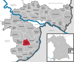
| Location of the municipality of Tettenweis in the district of Passau | ||
  |
||


Tettenweis is a municipality in the Lower Bavarian district of Passau .
geography
Geographical location
The community is located in the lower Rott valley and in the Lower Bavarian spa triangle Bad Füssing - Bad Griesbach - Bad Birnbach . Tettenweis is not far from the B 388 , the B 12 and the federal motorway 3 (exit Pocking ) about 25 km southwest of Passau , 25 km south of Vilshofen an der Donau , 15 km west of Schärding and 30 km east of Pfarrkirchen .
Community structure
The municipality of Tettenweis has 62 districts:
The districts are Tettenweis, Oberschwärzenbach and Poigham.
Neighboring communities
history
The origins and early history of Tettenweis are completely in the dark. For the first time, the place Tettenweis is referred to on a document in 1182 as "tetinvis" (= patch or village of Teto or Tato ). New settlements were then named after the founder. In the traditions of the Hochstift Passau, a tato appears around 790 that could be considered the founder of Tettenweis. The syllable “weis” from the place name Tettenweis comes from the Old High German “wihs”, which means “village”. Due to the New High German sound shift, “wihs” or “wis” became “weis”. New High German is counted from around 1500 and in fact the name Tettenweis was spelled with "i" (Tetenwis) around 1400.
The parish of Tettenweis has belonged to the St. Aegidien Hospital in the Passau Innstadt since the 12th century . The local "Innbruckamt" administered the Innbrücke and the Leprosen-Hospital as well as the parishes incorporated into the St. Aegidien Hospital, which were to be assigned by the respective "Bruckpfarrer". In addition to St. Severin with Schardenberg and Wernstein , these included St. Weihflorian , Kellberg , Hauzenberg , Kopfing, Münzkirchen and Tettenweis.
The parish village of Tettenweis had been a closed Hofmark since the beginning of the 15th century with a small castle surrounded by a pond. It was a ducal fiefdom. The old castle was demolished around 1870 and the Lindlbauer Inn was built in its place in 1879, which has meanwhile been replaced by a new building. The new castle was built on the outskirts of Tettenweis in 1797 by Count Franz Xaver Peter von Joner auf Tettenweiss . This castle was acquired by the Frauenchiemsee monastery in 1899 and the Benedictine nuns moved into it in the same year. A short time later, it was expanded to create the Benedictine Abbey of St. Gertrud , which has been in existence to this day.
Today's municipality of Tettenweis is a typical rural municipality and was formed on July 1, 1970 from the municipalities of Tettenweis, Oberschwärzenbach and Poigham. In 1978 the state enforced membership of the former administrative community Griesbach im Rottal, and since January 1, 1990 Tettenweis has been an independent municipality again.
Population development
Between 1988 and 2018 the municipality grew from 1,677 to 1,751 by 74 inhabitants or 4.4%.
politics
- ET : 5
- FO : 4
- EP : 3

Municipal council
In the local elections on March 15, 2020, 933 of the 1,442 residents entitled to vote in the municipality of Tettenweis exercised their right to vote, bringing the turnout to 64.70%.
mayor
1. Mayor is Robert Stiglmayr (community of voters progress Oberschwärzenbach), who was elected in 2014 with 62.00% of the valid votes. In the local elections on March 15, 2020, he was re-elected with 92.49% of the vote.
coat of arms
The Tettenweiser municipal coat of arms consists of the coats of arms of the various owners of Hofmark and Schloss Tettenweis.
Zigzag bar
From the coat of arms of the Schachner family (1574 to 1649).
Roses
from the coat of arms of the Adlzreiter family (1651 to 1680).
Deer rod
From the coat of arms of the Barons von Joner (1732 to 1872).
Attractions
- Benedictine convent of St. Gertrud
- Parish church of St. Martin based on a design by Hansjakob Lill
- Birthplace of the painter Franz von Stuck
economy
In 2017, according to official statistics, there were 320 jobs subject to social insurance in the municipality.
education
In 2018 there were two day-care centers with 95 places and 87 visitors.
Personalities
In the course of its history, the community produced a number of well-known personalities such as the two artists Franz von Stuck (1863–1928) and Ludwig Kirschner . The heraldist and genealogist Alois Freiherr Weiß von Starkenfels (1847–1895) appeared in the town as the castle and estate owner of Tettenweis and Kleeberg .
The imperial counts of Joner auf Tettenweis were resident in the community for centuries and were wealthy in the area. The community can also have a reference to the saint of the Rottal, namely to Johann Birndorfer, the later brother Konrad von Parzham . On July 16, 1843, he joined the Scapular Brotherhood of Toettenweis [sic!], A prayer community that was particularly dedicated to the veneration of the Blessed Virgin Mary. She played a very central role in the life of the Holy Brother Konrad. In Tettenweis, Johann Birndorfer let Maria take him by the hand and let her lead him to Jesus.
- Benedikt Bachmeier (* 1887 in Mitterhaarbach; † 1970 in Leoprechting) was a German politician of the Bavarian Farmers' Union .
- Eduard Kirschner (* 1953 in Tettenweis), soccer player and coach
Individual evidence
- ↑ "Data 2" sheet, Statistical Report A1200C 202041 Population of the municipalities, districts and administrative districts 1st quarter 2020 (population based on the 2011 census) ( help ).
- ^ Community Tettenweis in the local database of the Bavarian State Library Online . Bayerische Staatsbibliothek, accessed on September 4, 2018.
- ^ Hugo Lerch: The dispute between the Passau canon and Innbruckmaster Johann von Malenthein with the Passau cathedral chapter 1544–1549. In: Ostbairische Grenzmarken 6 (1962/1963), pp. 249–261, here pp. 250–251. - Theodor Ebner: The anti-giant estuary. In: Yearbook of the Upper Austrian Museum Association. Volume 148, Linz 2003, pp. 257–284 ( PDF (2.2 MB) on ZOBODAT ), here p. 279. - Johann Ev. Lamprecht : Description of the kk landesfürstl. Gränzstadt Schärding am Inn and its surroundings. Wels 1860 ( online ), pp. 275-276. - Johann Ev. Lamprecht : Historical-topographical register or historical local directory of the land ob der Enns, as an explanation of the map of the land ob der Ens in its shape and division from the 8th to the 14th centuries , Vienna 1863 ( online ), pp. 133, 212.
- ^ Wilhelm Volkert (ed.): Handbook of Bavarian offices, communities and courts 1799–1980 . CH Beck, Munich 1983, ISBN 3-406-09669-7 , p. 474 .
- ↑ City council election 2020
- ↑ City council election 2020
- ↑ Mayoral election 2020
Web links
- Entry on the coat of arms of Tettenweis in the database of the House of Bavarian History
Aicha in front of the forest | Aidenbach | Aldersbach | Bad Füssing | Bad Griesbach im Rottal | Beutelsbach | Breitenberg | Büchlberg | Eging am See | Fürstenstein | Fürstenzell | Haarbach | Hauzenberg | Hofkirchen | Hutthurm | Kirchham | Kößlarn | Malching | Neuburg am Inn | Neuhaus am Inn | Neukirchen vorm Wald | Obernzell | Ortenburg | Pocking | Rotthalmünster | Rowing | Ruhstorf an der Rott | Salt Trail | Suns | Tettenweis | Thyrnau | Tiefenbach | Tittling | Untergriesbach | Vilshofen on the Danube | Wegscheid | Windorf | Witzmannsberg