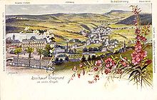
Erzgebirge passes
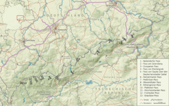
Ore Mountain passes are passages and culverts in the ridge of the Ore Mountains , over which paths, roads, rail connections and product lines lead from the Free State of Saxony in the Federal Republic of Germany to Bohemia in the Czech Republic and vice versa.
The natural area of the Upper Ore Mountains from the perspective of transport
Under the physical-geographic conditions, the surface shape and the climate in particular exert a decisive influence on the traffic routing and design of the routes across the Ore Mountains to this day. Morphologically , the mountains represent a pult raised in the south with a gradual incline to the north. The mountain impression in the Saxon part is caused less by the absolute heights than by up to 200 meters deep indented and sometimes winding valleys. The gently rising plateaus between the valleys made it possible to have good transport links at an early stage. H. especially low-incline routes. The traffic routing only turned out to be problematic where one of the deeply cut valleys had to be crossed. On the other hand, the steep drop to the south in the direction of Bohemia shows a significant disadvantage in terms of traffic, as the Ore Mountains here drop by up to 700 meters in less than 10 kilometers. Even today, even developed transit roads in this section have gradients of over 10 percent in some cases.
The Erzgebirge ridge itself forms a sequence of plateaus and individual mountains, which is interrupted by saddles . From the Vogtland the ridge rises to about 1000 m above sea level. NN and falls at Johanngeorgenstadt (Plattener Pass) to around 720 m above sea level. NN from. Another rise takes place up to the Fichtelberg / Keilberg (Klínovec) to over 1200 m above sea level. NN . Between the two mountains, the ridge in the Wiesenthaler Pass descends to 1080 m above sea level. NN . As far as the Deutscheinsiedler Sattel , the deepest passage in the mountains, the Reitzenhainer Pass ( 820 m nm ) descends to 750 m above sea level. NN . In a north-easterly direction the ridge in the Kahleberg once again reaches over 900 m above sea level. NN , before he reaches about 500 m above sea level NN drops to the Elbe Sandstone Mountains .
Due to the lack of a breakthrough valley , the mountain passes are comparatively high. The mean ridge height of the Ore Mountains is around 880 m above sea level. NN , the mean saddle height is just under 10 meters below. Because of the unilateral uplift of the Pultscholle along the Egergraben and the different course of the border from the ridge line, the Ore Mountains reach their greatest heights on the Bohemian side. As a result, most of the passes are already in Bohemia. On average they reach heights of 700 to 900 m above sea level. NN . The highest pass is the Wiesenthaler Pass at 1083 m above sea level. NN , the lowest of the Nollendorfer Pass at 680 m above sea level. NN .
In the upper regions of the Ore Mountains, the climate can clearly be characterized as harsh. That is why the area of the Upper Ore Mountains was also referred to as Saxon Siberia in the past . The annual rainfall increases up to the ridge layers to over 1,100 millimeters, with a large part falling as snow. The annual mean temperatures only reach values of 3 to 5 ° C. At 922 m above sea level Oberwiesenthal , located above sea level , only occurs about 140 frost-free days per year on average. In the transport sector, these winter temperatures and snowfalls, especially on the pass heights, lead to traffic obstructions, congestion and cancellations even in the winter months up to the present day. According to the reports of older chroniclers, the winters in the upper Ore Mountains in the past centuries must have been even harder than they are today. Long periods of frost and continuous blankets of snow, meter-high drifts and repeated snow storms have made individual paths and passes impassable for weeks. Reports from the post office of the mountain town of Sayda on the road to the Deutscheinsiedler Sattel from February 1855 say that "... because of the enormous amount of snow it is almost impossible to get ahead , just as it is impossible for the snow to be thrown out" . The mail had to be transported with small sleds and by messenger because "two horses next to each other are not able to wade through the snow masses" .
The risk of flooding when the snow melts or during summer thunderstorms must also be mentioned . In the past, floods have repeatedly caused considerable damage to the access roads to the Erzgebirge passes in the valley , most recently in August 2002 .
History of the Erzgebirge passes
Prehistory and the Early Middle Ages
Despite its apparent impenetrability, the dense border forest of the Ore Mountains was partially used before the Middle Ages and was crossed at its edges as a connection between the fertile old settlements of today's northern and central Germany and Bohemia. Nevertheless, it can be assumed that when passing the Ore Mountains, the eastern part between Altenberg and the Elbe Valley and the western transition area to the Elster Mountains in the Vogtland were preferred, as the Ore Mountains were the lowest here and the forest edge was the narrowest. The most important connection in prehistory and early history and up to the 12th century was the Kulmer Steig , which ran roughly parallel to the Elbe breakthrough . In the Eastern Ore Mountains , numerous archaeological finds (hatchets, axes, graves) from the stone , Bronze and Iron Ages towards a mountain crossing that has existed since ancient times. It has been proven that even before the establishment of the Margraviate of Meissen , the center of which was Meissen Castle on the Elbe , a network of paths , paths and climbs ran across the mountains in the area between Pirna and Litoměřice . However, the exact course of these prehistoric paths can no longer be precisely reconstructed today. Certainly already in prehistoric times, probably also in the early and high Middle Ages, the much flatter Vogtland was crossed over the Ullitzer Pass . So the relatively high Central and Western Ore Mountains were bypassed not only to the east, but also to the west.
High and late Middle Ages and early modern times
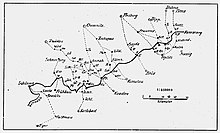
The dense settlement of the Ore Mountains that began in the first half and the middle of the 12th century, down to the Meissnian and Bohemian ridges, inevitably led to a significant expansion of the network of paths and roads. It is no coincidence that the first climbs and passes are documented from around 1100. At the same time, the settlement of the mountains accelerated the expansion of the existing roads. A document from 1449 says that the connection leading from Chemnitz via Zschopau to Bohemia should be secured in such a way that three loaded rescue vehicles could drive next to each other. A map of the Meissen-Thuringian countries published around the same time shows road connections from Lübeck via Halle , Leipzig , Borna , Chemnitz, Heinzebank , Marienberg , Komotau (Chomutov) to Prague (Praha) and from Heinzebank via Annaberg , St. Joachimsthal (Jáchymov) ) to Karlsbad (Karlovy Vary) and Eger (Cheb) .
One of the earliest descriptions of the area comes from around 1490. There it says, translated from Latin, u. a .:
“An immense forest flows contiguously towards Lichtenstadt . It contains mountains, hills and sudden valleys. Many springs gush in it, the beginnings of streams and rivers. The hiker is particularly astonished that two rivers rise there on a mountain, which turn towards different regions. On the right the Mulde, which runs through a large part of Meissen, on the left, not far from it, the Zwota, which flows to Bohemia, but loses its name as soon as it flows into the Eger. However, not only one peak rises, but there are many, especially towards the ridge of the forest mountains. The forest is spacious and so elongated that it almost encloses the whole of Bohemia. That is why it is called the Bohemian Forest. "
Traders and merchants in particular use the routes across the Ore Mountains. One of the first commodities was probably salt . Bohemia and the Danube countries further south relied on the import of salt for cooking and, above all, for preserving food, which was completely lacking as a raw material in the local countries and therefore had to be obtained in particular from the salt pans in Halle (Saale) and the surrounding area. The so-called salt roads stretched along a bundle of trails in several routes over the Ore Mountains ridge. There is evidence that one used the Preßnitzer Pass coming from Zwickau , another the saddle between Sayda and Brüx (Most) near the present day Deutscheinsiedel . Other commodities were mining products and long-distance trade goods such as wine, leather goods, hides, fabrics, cloths and fish, which were traded at nationally important market and trade fair locations such as Leipzig.
In addition to traders and pilgrims (for example to the Mariaschein monastery near Graupen), the paths were also used by armies and smaller military units. In times of military conflict, the passports were beaten , i. H. blocked. This was u. a. with Spanish riders and the use of guards. The easiest way was to fell trees, as is done e.g. B. is described by Christian Lehmann for the year 1632:
"Thu fell a lot of 100 trees and a whole streaked 3 to 6 cubits high at one time that the earth shook, and whoever wanted something outside of Bohemia had to either drag it up over it or go through it."
The smuggling of cars, which began after 1990, has forced numerous forest paths to be blocked by means of tree and stone barriers. The passports themselves are not affected.
Development of the messenger system and the post roads
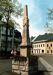
From the 15th century, the roads and passes also became more important for messengers . In the course of this development, the most important connections were precisely measured at the beginning of the 18th century by the Saxon Land and Border Commissioner Adam Friedrich Zürner (1679–1742) and provided with post mile columns and in some cases further expanded. At that time, the Dresden-Teplitzer Poststrasse was one of the most important connections across the Eastern Ore Mountains, which was increasingly used by spa guests from Teplice . The pass over the mountain town of Platten was very popular with visitors to the world-famous Karlsbad (Karlovy Vary), and in the late 18th century the lower pass over Wildenthal and Hirschenstand (Jelení) .
Overall, however, the roads leading from Saxony to Bohemia, like the entire Saxon road network, remained in poor condition until the end of the 18th century, as wars and the associated economic downturns often prevented continuous expansion. In spite of numerous road construction mandates, for example on the Saxon side from 1781, many roads remained only sparsely paved roads, the stuck soil of which was often difficult or sometimes impossible to pass in bad weather or on steep passages. It is reported from the mountain town of Sayda, located on the Oederan –Brüx (Most) trade route , that the road had been about three meters deep by 1550. The landlord Caspar von Schönberg auf Purschenstein had it paved in the city area as early as 1555, which, however, may have been an exception. As a rule, the access roads to the passes formed a bundle of several side-by-side paths or ravines, so-called tracks, which were used depending on the weather and the goods to be transported until the 18th century.
In contrast to the high mountain passes , in the Middle Ages and the early modern period, these paths ran almost exclusively on the mountain ranges, as the narrow and marshy river valleys were mostly unsuitable as traffic routes. They could also be easily blocked in the event of war. The use of the plateaus was also supported by the lack of extreme inclines and declines and the possibility of being able to orientate oneself by looking from above at striking mountains and landscape points due to the lack of maps and path markings. Only after the electoral Saxon orders of 1795 and 1800 have been issued can a beginning plan and roadway , i.e. H. fortified expansion of the pass roads on the Saxon mountain side. In the Kingdom of Bohemia, similar road construction mandates were issued just a few years later. As one of the first connections, the Leipzig – Reitzenhain road from 1803 and the Neue Dresden-Teplitzer Poststraße leading to the Nollendorfer Pass were fundamentally expanded.
industrialization
With industrialization in the second half of the 19th century, a significant change in the meaning of the pass roads began. On the one hand, traffic shifted from the high roads to the newly built valley roads. For example, the previously insignificant mountain crossing at Zinnwald was upgraded by the construction of the Müglitztalstraße from 1846 and the expansion of the Dresden - Dippoldiswalde - Schmiedeberg - Altenberg connection from 1842, while the neighboring Alte Dresden-Teplitzer Poststraße over the pass at the Geiersburg (Kyšperk ) and the border crossing near Fürstenwalde was closed in 1860. The pass over the mountain town of Graupen (Krupka) to Zinnwald also lost its former importance due to the road expansion of the route over Eichwald (Dubí) .
In 1858 there was a fundamental innovation on the Saxon side of the mountains, as all postal rates available at the time were re-measured and marked with royal Saxon milestones. So-called border crossing stones were set up immediately at the border crossings of the postal routes used as a postal route, some of which are still available today. In Bohemia, on the other hand, the exemplary erection of post columns and milestones was not adopted, here the wooden signposts were used.
In the 19th century, the construction of the Ore Mountain Cross Railways changed the role and importance of the Ore Mountain passes. As early as 1843 a plan was drawn up for the construction of a railway from Pirna along the Old Dresden-Teplitzer to Aussig . But it was not until 1872 that the first train ran across the mountains on the continuous connection Komotau (Chomutov) - Weipert (Vejprty) - Annaberg. It was followed in 1875 by the Komotau – Flöha connections via the Reitzenhainer Pass , in 1884 Nossen –Brüx (Most) via the pass from Klostergrab (Hrob) , 1886 Falkenau (Sokolov) - Klingenthal via the Graslitzer Pass and in 1899 Johanngeorgenstadt – Karlsbad (Karlovy Vary) the Plattener Pass.
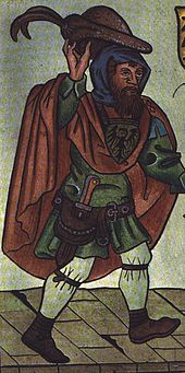
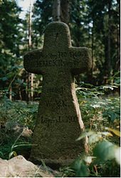
Up until the beginning of the 20th century, the dense ridge forests of the Ore Mountains were often a popular place to stay for gangs of robbers, smugglers and poachers. It is not without reason that numerous ordinances have been issued to combat the predators on both sides of the mountains. The poacher Karl Stülpner became legendary in the Ore Mountains , but countless stories are still told about the two robber chiefs Nikol List and Lips Tullian . Especially where the pass roads led into the thick forests of the Ore Mountains, stagecoaches and passers-by were attacked, robbed and often even killed by road campers. Several stone and atonement crosses are still reminiscent of cruel murders.
20th century
In the first half of the 20th century, not least because of the connection of the Sudetenland in October 1938 , the passes over the Erzgebirge ridge were used most intensively. Schmidt (1935) names 16 major military roads that crossed the Saxon-Bohemian border. There were also a large number of smaller routes and the five railway connections already mentioned.
This permeability was drastically reduced for about 25 years after 1945 when the railroad crossings and almost all road crossings were closed. Increased permeability only occurred again after the introduction of visa-free border traffic between the German Democratic Republic (GDR) and Czechoslovakia (ČSSR) from 1972. The (re) opening of the centuries-old road border crossings in the course of the Wiesenthal (1972) and Reitzenhain (1978) passes accounted for the development of mutual holiday and shopping tourism. With the opening of the Bahratal border crossing (1976), the northern approach to the Nollendorfer Pass was opened to traffic again. The five railway lines leading over the Erzgebirgskamm remained closed during the existence of the GDR. Before 1990, a train journey from Saxony to Bohemia and vice versa was only possible via the border crossings Bad Brambach / Vojtanov in the Vogtland and Bad Schandau / Děčín in the Elbe Valley outside the Ore Mountains . With the natural gas pipeline Nordlicht of RWE Transgas (1972) and the chemical product pipeline Böhlen - Oberleutensdorf (Litvínov) (both over the saddle from Deutscheinsiedel) as well as a 380 kV high voltage line from Röhrsdorf to Hradec and a 220 kV high voltage line from Zwönitz to Hradec During the GDR era, there were also new infrastructure lines across the Ore Mountains.
After the economic opening of the Eastern European states, the Ore Mountains regained their former importance as a transit country in north-south traffic in 1990. This led to the reopening of numerous road and pedestrian crossings and the resumption of rail traffic between Klingenthal and Falkenau (Sokolov) , Johanngeorgenstadt and Karlsbad (Karlovy Vary) as well as between Chemnitz and Komotau (Chomutov) via Weipert (Vejprty). The accession of the Czech Republic to the Schengen area on December 21, 2007 and the abolition of border controls opened up new opportunities for development.
present
In the course of adapting the traffic routes to new requirements, some of the access roads to the Erzgebirge passes have been re-routed since 1990, mainly by building bypasses . This concerns u. a. Sections of the B 170 Dresden – Zinnwald, the B 174 Chemnitz – Reitzenhain and the Komotau (Chomutov) –Reitzenhain road. The currently only new road construction over the Ore Mountains is the federal motorway 17 Dresden – Prague (Praha), which was completed in December 2006. Its course largely follows the centuries-old western route of the Kulmer Steige. From an economic point of view, this speaks for the rationality according to which our ancestors looked for their ways over the mountains.
As of January 2008, three railroad crossings, fourteen road crossings and twenty footpath crossings are currently open between Klingenthal and Bahratal . You use largely centuries-old passes and climbing facilities. In the former district of Aue-Schwarzenberg there was no road border crossing between Saxony and Bohemia for a long time, as the Czech municipality of Breitenbach (Potůčky) successfully fought against the reopening of the Johanngeorgenstadt crossing in order to benefit from the income for the oversized shopping market that was created on the Czech side. The passage was also opened to motor vehicles on January 16, 2008.

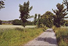
The federal motorway 17 first cuts Dresden in a west-east direction in the south of the urban area and turns south-east after Pirna . On the one hand, the European road leading from Dresden to Prague serves regional road traffic, on the other hand it uses the flat Nollendorfer Pass. Through the modern prestressed concrete structures over the Kerbtäler, for example the Lockwitztalbrücke or the Seidewitztalbrücke , this pass was relocated from the valley to the flat heights of the Pultscholle in the Ore Mountains. This means that the only motorway that crosses the mountains follows what is probably the oldest pass. It approaches the Alte Dresden-Teplitzer Poststrasse, which is partly still used as a state and district road, often within a few meters and intersects it.
In the medium to long term, the state of Saxony plans to re-route the B 93 between Schneeberg and Johanngeorgenstadt to continue to Karlsbad (Karlovy Vary) via a completely new border crossing between the Plattener and Hirschenstander Pass. This is primarily intended to bundle the main flows of cross-border long-distance traffic flowing into the Aue-Schneeberg area. A cross connection to the B 101 near Lauter is part of the planning. There are also considerations to close the gap between the Teplitz Semmering Railway and the Nossen – Holzhau line and to build a high-speed line from Dresden to Prague .
The Elbe Valley Railway between Dresden and Děčín bypasses the Ore Mountains to the east and is the most efficient main line between Germany and the Czech Republic . Due to the relatively small radii in the narrow Elbe valley, no high-speed traffic is possible there.
First mentions of routes across the Ore Mountains

The oldest written sources only show a direct connection between Saxony and Bohemia, without any statements about an exact route. Insofar as the description of the more detailed circumstances gives any clues for a localization, they point to the use of the Kulmer Steig until around 1100.
- 805: In that year Charlemagne had the ruler Semela, active in Bohemia, attacked with three armies, one of which moved together with the Saxons over the Warnenfeld and Daleminzien to Bohemia (" tertium vero transmisit cum Saxonibus super Hwerenofelda et Demelchion ", Chronicon Moissiacense ). The three armies met at the Eger ("ad fluvium qui vocatur Agara") and then there was fighting at Canburg Castle.
- 892: The Würzburg bishop Arn was attacked and killed by Slavs on his way back from an army campaign to Bohemia together with his companions. Thietmar von Merseburg described in his chronicle about a hundred years later that this had happened " in pago Chutizi ". The route used and the exact location are not recorded. Subsequent localization suggestions lack a credible justification. In the 19th and 20th centuries, however, the view that the place of death in Arn was in the area of Chemnitz or Zschopau became more firmly established, which is why the martyrdom of Arn is often cited as alleged evidence of early use of the path along the two rivers. Much more likely, however, is Arns' move over the Kulmer Steig and his violent death in the area of the old settlement along the Elbe, Mulde or Pleiße.
- 929/30: King Heinrich I conquered the Brandenburg an der Havel and Gana , the main castle of the Daleminzians . He then founded Meißen Castle on the Elbe and, with a very high degree of probability, moved over the Kulmer Steig to Bohemia.
- around 960/970: Following his participation in a court day of Emperor Otto the Great in Quedlinburg, the Arab businessman Ibrahim Ibn Jakub traveled to Prague via Halle, Nienburg (Saale) and the Mulde region ( Wurzen or Püchau ) . Among other things, a wooden bridge is mentioned that was somewhere on the long stretch. This bridge was and is still often associated with the city of Most in northern Bohemia, and it was assumed that Ibrahim ibn Jaqub reached the Bohemian Basin via one of the Bohemian paths. Czech historians and archaeologists were able to show, however, that there is no basis for equating the bridge mentioned in the text with must and that all archaeological and historical evidence speak against it. Because of the text as the only source for the trip, nothing concrete can be said about the connections between Central Germany and the Bohemian Basin. However, it can be assumed that Ibrahim ibn Jaqub also traveled over the Kulmer Steig.
- 1040: The Meissnian Margrave Ekkehard II moved in 1040 with an army over the Kulmer Steig to Bohemia.
- 1118: When a church in Zwickau was founded by Countess Bertha , who is related to the Schwarzburgers , a customs office was mentioned. This can be seen as indirect evidence of the existence of a route from Leipzig via Zwickau, Grünhain, Weipert (Vejprty) and over the Preßnitzer Pass to and Kaaden (Kadan). This path has been documented since 1325.
- 1143: A document proves the existence of a Steiges ( semita Bohemica ) leading from Altenburg via Waldenburg and Zschopau to Bohemia
- 1185: The pass over Deutscheinsiedel is first mentioned in a document from Margrave Otto von Meißen .
Historic passports, listed from east to west
Nollendorfer Pass
- Coordinates: 50 ° 45 ' N , 13 ° 59' E

A variant of the Kulmer Steige route led over the Nollendorfer Pass in the eastern Eastern Ore Mountains. The road crossed the Saxon-Bohemian border between Fürstenwalde in the west and Oelsen in the east and led over the steep slope of the Ore Mountains into the Bohemian Kulm (Chlumec u Chabařovic) and further into the interior of the Kingdom of Bohemia.
There is evidence that the Kulmer Steig was already in use in the 13th century. The pass became famous through the Wars of Liberation and the Battle of Kulm and Nollendorf on August 29 and 30, 1813. In Berlin-Schöneberg , Nollendorfplatz and Nollendorfstrasse are named after the small Erzgebirge village of Nollendorf ( Nakléřov ), from whose church tower, which no longer exists today According to legend, Napoleon is said to have observed the battle.
In 1794 a traveler reported that on the last hill before Peterswalde a blacksmith was on the lookout for traveling wagons and had tools ready, since in his experience no vehicle could use the bad route without suffering damage.
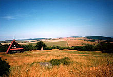
From 1913 until shortly after 1950 there was a 21-meter-high observation tower on Nollendorfer Höhe , which was named Kaiserwarte and after 1919 Carl-Weis-Warte .
In recent history, the Nollendorfer Pass has repeatedly made positive and negative headlines. In 1936 the Olympic flame passed the pass road on its way from Athens to Berlin . A memorial stone erected at the Bahratal border crossing reminds of this. In 1968 the Red Army used the mountain crossing to invade the former Czechoslovakia to crush the Prague Spring .
Pass on the Geiersberg
- Coordinates: 50 ° 42 ' N , 13 ° 53' E
The Geiersberger Pass, over which the well-known Alte Dresden-Teplitzer Poststrasse ran until 1860 , began in what is now the Graupener (Krupka) district of Hohenstein (Unčín). Here the trail from Teplice reached the edge of the forest behind the Mariaschein (Bohosudov) monastery . From there it rose steeply past the Geiersburg (Kyšperk) and the Goldammer Cross , which was built before 1785, to the Osterzgebirgskamm. This was exceeded about 1.5 kilometers east of the Mückenberg (Komáří hůrka) at an altitude of about 720 m nm . Then the route branched out. A branch followed the old Dresden-Teplitzer Poststrasse leading into the Elbe valley via the small Bohemian village of Ebersdorf , of which only a few remains are today. The border crossing was marked by the Black Cross (also erected before 1785). Another branch led west to the Mückenberg and reached the road leading from here to Freiberg . A section of this Zinnstrasse near Bobritzsch is still known today as Geiersweg .
The Geiersbergstrasse, which originally led from Hohenstein ( Unčín ) to the ridge, was probably carved in large parts by Graupener miners as a narrow path into the rock of the Bohemian Ore Mountains slope. This is still indicated today by rocky lanes that can be seen in sections apart from the current route. The descent over the Geiersberger Pass to Hohenstein (Unčín) was in the past one of the steepest and therefore most risky sections of the Ore Mountain passes. A travel report from 1698 notes:
“Climbing down from the famous Geiersberg is not a thing that you pass by in silence. So you will learn that when we reached the edge of the abyss, which with holy horror cause the traveler to tremble, we stopped and got out of the car. We sat down in the armchairs which several porters carried down the mountain. I thought about the benefit of breaking my neck while the porters jumped from one stone to another. "
These topographical conditions are likely to be responsible for the rapid desertification of the road after the expansion of the neighboring roads between Eichwald (Dubí) and Zinnwald as well as Peterswald (Petrovice u Chabařovic) and Kulm (Chlumec u Chabařovic) at the beginning of the 19th century. Today the Geiersbergstrasse is only used as a forestry and hiking trail.
Graupener Pass
- Coordinates: 50 ° 42 ' N , 13 ° 51' E
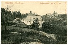

The Graupener Pass leads from the mountain town of Graupen (Krupka) past the Rosenburg (Rosenberg) to Obergraupen (Horni Krupka) and reaches the plateau on the ridge of the Eastern Ore Mountains directly at the 808 m high Mückenberg (Komáří hůrka) . The origin of this connection is to be seen in connection with the tin mining . In search of new deposits, Bohemian miners have probably been advancing over the ridge since the end of the 14th century and discovered the important Altenberg tin deposit around 1440 . As they advanced, they laid out this path or expanded an already existing path. The Graupener Pass was z. B. used by participating mercenary armies in June 1426 in connection with the costly battle of Aussig . On the north side of the mountain range, the crossing has three entrances, which indicates, on the one hand, its high frequency of use and, on the other, its greater importance compared to the closely neighboring Geiersberger Pass. Access was from the Freiberg mining center in the Ore Mountains via Zinnwald on the so-called Zinnstrasse . The second access was coming from Dippoldiswalde and Altenberg on the Fürstenweg . A third access led from Lauenstein to the pass. This path was part of a medieval pilgrimage route that up to the 16th century led from the Elbe valley via Dohna and Liebstadt to the Mariaschein (Bohosudov) monastery near Graupen (Krupka) . After removing the road between Eichwald (Dubi) and Zinnwald at the beginning of the 19th century, today's federal highway 170 used connection between Dresden and Prague (Praha), lost the Graupener pass its significance and was only still used as a side line.
Pass from monastery tomb
- Coordinates: 50 ° 43 ' N , 13 ° 41' E
The Alte Freiberg-Teplitzer Poststrasse led over this pass . Between the sources of the Hirschbach and those of the Holperbach, it crossed the border between the Electorate of Saxony and the Kingdom of Bohemia in today's Altenberg district of Neurehefeld , where immediately after the border several houses, including the once well-known Gasthaus Fischerhaus , around the Moldau border station, built in 1884 ( Moldava) group.
The border crossing and the current town of Neustadt (Nove Mesto) are now connected by an asphalt road over the former Glaserberg. Long trenches can be seen on both sides of this, the remains of the old course of the road. Neustadt (Nove Mesto) is located almost on the highest point of the Pultscholle in the south of the Ore Mountains. From here you can get to Niklasberg (Mikulov) on a very sloping road. This road was only rebuilt in the last third of the 19th century, as its old course had proven to be too steep and, especially when the snow melted, hardly passable. From Niklasberg (Mikulov) you get to the monastery tomb (Hrob) in the Bourlivec valley. In earlier centuries, however, the shorter connection via the 869 m high striker (Bouřňák) seems to have been preferred. To the west of today's connecting road between Neustadt (Nove Mesto) and the mountain plateau is an unmistakable, 2 to 3 m wide, excavated ditch on longer stretches. According to the site findings, the steep slope of the Ore Mountains was overcome around 300 m west of the summit plateau and as a continuation of this ditch. There are several staggered and south-facing ravines up to about 6 m deep. These are remains of the centuries-old pass road to the monastery grave (Hrob) and on to Teplice (Teplice).
In 1884 the railway connection Nossen – Moldau (Moldava) and on to Brüx (Most) was used for the first time over the pass from Klostergrab . Cross-border traffic was discontinued in 1945, probably also because the track had become unusable due to the use of Soviet tanks on the advance towards Prague (Praha). In 1972 the section between Holzhau and Hermsdorf-Rehefeld was shut down and the track system was later dismantled. Reconstruction of the cross-border connection has been a topic of discussion since 1990. Due to high costs and a lack of political will, the project, which particularly serves tourism, has so far failed.
Pass from Sayda over the Deutscheinsiedler Sattel
- Coordinates: 50 ° 38 ' N , 13 ° 29' E
About the already mentioned in 1250 as oppidum , 680 m above sea level. NN high altitude former resting and customs station Sayda and the 720 m above sea level. NN little higher and therefore comparatively shallow mountain saddle at German Einsiedel resulted in the Middle Ages, the old trade route Leipzig - Prague (Praha). It passed Wurzen , Leisnig and Oederan before reaching the border at Bohemian Einsiedel (Mníšek) via Sayda . The customs post of Brüx (Most) located here also reached a cross connection from Marienberg. In Bohemia the further course led over Ossegg (Osek) to Brüx (Most) and further inland.
This Old Bohemian Trail, as the Sayda pass was also called, was protected . a. through the customs and escort castle Purschenstein on the right bank of the Flöha , which was later the seat of a bailiff. The town of Sayda belonged to the margraviate of Meißen from 1300 and after the partition of Leipzig in 1485 it came into the possession of the Wettins as a Bohemian fief . At that time the mountain crossing had already lost its importance as a trade route in favor of the neighboring passes. It is said that the road in Sayda was six cubits deep in 1555, which indicates its earlier meaning. At the same time, sovereign instructions in the eastern Ore Mountains promoted a route over the neighboring Freiberg since 1318, they said ... that nowhere should cars drive to Bohemia except through the city of Freiberg . In later years, especially during the Seven Years' War and the Wars of Liberation , the Sayda pass was used several times by army units who repeatedly plundered the city.
After the commissioning of a rail link from Pockau to Olbernhau in Saxony, the communities in Schweinitztal demanded a rail connection two years later. Initially, this was rejected for economic reasons, but discussed again from 1908, with the idea of Austria-Hungary to build a route beyond Deutschneudorf over the Deutscheinsiedler Sattel to the Bohemian lignite district around Oberleutensdorf (Litvínov). This was also rejected by the Saxon side, but in 1913 a license was granted for a route between Olbernhau and Deutschneudorf . Due to various obstacles, this could not be put into operation until 1927. The original project of a connection to Litvínov was temporarily postponed in 1931 and later not taken up again due to lack of need.
GDR times were with the natural gas pipeline Northern Lights of RWE Transgas (1972) and chemical products line Bohlen - Litvínov ( Litvínov ) conducted two other economically important infrastructure lines over this saddle. The road crossings Deutschneudorf and Deutscheinsiedel remained closed after 1945. The transition from Deutscheinsiedel to Böhmisch-Einsiedel (Mníšek) has been usable again for motor vehicles since 2002, and that from Deutschneudorf since 2007.
Reitzenhainer Pass
- Coordinates: 50 ° 33 ' N , 13 ° 14' E
One of the old salt roads from Halle (Saale) via Leipzig and Chemnitz leads over the Reitzenhainer Pass to Komotau (Chomutov) and Prague (Praha) . It was primarily used to trade and transport salt to Bohemia and the Danube countries to the south and was also known as Hohe, Reitzenhainer or Böhmische Straße. Originally the pass led from Zschopau via Zöblitz , Kriegwald, Platten to Komotau. After Marienberg was founded in 1521, the course of the road over this new mountain town and Kühnhaide was relocated until the road over the newly founded border village Reitzenhain finally prevailed. About two kilometers north-west of the village, a memorial stone with the inscription An der Umspanne 1400-1823 indicates the formerly existing horse changing station. The top of the current road is between Reitzenhain and Sebastiansberg (Hora Svatého Šebestiána) at about 840 m nm. This makes the pass one of the lowest in the central Ore Mountains. Its northern access is now the federal highway 174. The Reitzenhain border crossing itself was closed until October 1978 after the end of the Second World War . In the mid-2000s, the border crossing was opened to all traffic. This was accompanied by a sharp increase in heavy goods traffic. A traffic census in 2015 showed that individual sections of the route are used by more than 1,800 trucks every day.
Since 1872 there has been a railway connection from Komotau (Chomutov) via Krima (Křimov) to Weipert (Vejprty) with a connection to Annaberg-Buchholz in Saxony . Starting from the Krima station, a rail connection to Reitzenhain over the pass of the same name with continuation to Flöha was put into operation three years later . Due to completely changed political conditions, there was no longer any cross-border traffic after 1945. In 1972 the Czechoslovak section of this connection over the Reitzenhainer Pass was shut down and the road border crossing was built in place of the railway border bridge and the railway structure there. Between 1985 and 1987 all track systems were then dismantled. The track system of the Reitzenhain – Marienberg section on the German side was dismantled in 2013 in order to later create a railway cycle path . This should be completed in 2020.
Pressnitz Pass
- Coordinates: 50 ° 28 ' N , 13 ° 8' E
The Preßnitzer Pass (792 m above sea level) is one of the oldest pathways that led from the center of Central Germany over the dense border forest to Bohemia. It is located on the old road from Pressnitz to Pleil / Pleyl (Černý Potok). To the right of the highest point of the pass road is the "Hussar Grave" (Hrob Chorvatu), a stone probably erected in memory of fallen soldiers, on which the year 1635 can hardly be read. The path is first mentioned in a document together with the city of Preßnitz in 1335: " via que ducit de oppido Presnitz "
Its original route went from Halle (Saale) via Altenburg , Zwickau, Hartenstein , Grünhain and Zwönitz to Schlettau . The upper Zschopau was crossed here. The route then led via Kühberg past the Blechhammer to Weipert (Vejprty) and then swung eastwards via Pleil (Černý Potok) with Preßnitz (Přísečnice), the oldest mountain town in the Ore Mountains.
The path then passed Reischdorf (Rusová) , in whose locality it branched. The western led to Kaaden (Kadaň) , the eastern to Kralupp (Kralupy u Chomutova) . The pass heights of around 850 m nm were also reached here.
The Preßnitzer Pass was thus significantly lower than the passes adjoining it to the west via Wiesenthal, Rittersgrün, Platten, Hirschenstand and Frühbuß. This was one of the reasons for its frequent use during the Thirty Years War .
In a document from Johann von Böhmen and his son Karl to Friedrich and Hermann von Schönburg dated April 30, 1339, which, among other things, concerns the silver mines near Preßnitz, detailed provisions on the pass road are contained. In order to ensure supplies for the miners, it was ordered that traders who transport their goods from Bohemia should be exempt from all duties and fees. However, this did not apply in the opposite direction; the customs duties granted to the Schönburgers continued to apply to such. This is also the first mention of the existence of the Preßnitz customs office. In the early Middle Ages this was located in Kralupp at the foot of the southern roof of the mountains. Together with the advancing settlement of the mountain ridge, it was moved to the ridge near the national border.
Even if one of the old salt roads led over the Preßnitzer Pass, the traffic density was relatively low. The monastery town of Grünhain, located on the pass road, was only passed by five to six salt trade trains (20–30 carters) per year around 1700. Between September 1830 and March 1831, 81 salt wagons with around 4,700 hundredweight of cooking, cattle and fertilizer salt were counted at the Preßnitzer Pass.
The section of the pass route leading through the eponymous town of Preßnitz (Přísečnice) was flooded with the construction and filling of the Preßnitz dam (vodní nádrž Přísečnice) at the beginning of the 1970s. The city was relocated, abandoned and demolished after the construction decision, the former urban area with remains and ruins lies sunk under the surface of the water.
Wiesenthaler Pass
- Coordinates: 50 ° 25 ' N , 12 ° 56' E
The pass road that came from Leipzig via the two once independent mining towns of Annaberg and Buchholz led over the Wiesenthaler Pass to the well-known spa and bathing resort of Karlsbad (Karlovy Vary). Behind the highest German town of Oberwiesenthal, which was built in the 16th century, it gradually followed the Zechengrund up to the Erzgebirge ridge and to the border crossing to Gottesgab (Boží Dar) at the New House located between Keilberg and Fichtelberg .
The pass height is 1083 m above sea level. NN and is thus the highest pass in the Ore Mountains. In winter, the road over it was often almost completely impassable for several weeks, which had consequences that are hardly imaginable today. In a cold winter at the beginning of the 1730s, several Salzburg exiles died when they were expelled from Austria-Hungary at the impassable Wiesenthaler Pass and were buried outside the Gottesgaber cemetery wall.
During the Thirty Years' War, the Wiesenthaler Pass and the Rittersgrüner Pass, which ran just a few kilometers to the west, were repeatedly passed by numerous troops, which left great devastation in Oberwiesenthal and other cities in the Upper Ore Mountains. Therefore the pass was blocked several times. This was u. a. with so-called Spanish riders and the establishment of guard houses. A gallows was temporarily set up at the border as a deterrent .
With the flourishing of bathing and spa facilities in Karlovy Vary, the pass was frequented by numerous spa guests at the beginning and the end of the bathing season and the places on the pass saw numerous famous personalities pass through. This is of course also in connection with the Leipzig Post, which ran regularly over this Ore Mountains Pass from 1708 onwards.
In 1945 the border crossing at the New House was also closed for many years. It was not reopened until 1972. Since 1976, a bypass road on federal highway 95 leading to the pass has relieved the town center of Oberwiesenthal and a bypass around Boží Dar built in the early 2000s from through traffic. This has increased significantly in recent years. In 2004, an average of 3,950 vehicles passed the border crossing at Wiesenthaler Pass, in 2000 there were still 2,500.
Knight Green Pass
- Coordinates: 50 ° 25 ' N , 12 ° 50' E
The path over the Rittersgrüner Pass connects Schwarzenberg / Erzgeb. over Rittersgrün , past the Bohemian Mill and the small scattered settlements Goldenhöhe (Zlatý Kopec) and Försterhäuser (Myslivny) with the mountain town of Sankt Joachimsthal (Jáchymov). A height of 980 m nm has to be overcome between Försterhäuser and Sankt Joachimsthal . West of the Rittersgrüner Pass, a branch of the pass road, the so-called Halbmeiler or Joachimsthaler Straße, led over a ridge. From Breitenbrunn , this route ran over the mining settlement of Halbemeile / Halbmeil (Rozhraní) , which is divided into a Saxon and Bohemian half, and the Himmelswiese to Försterhäuser (Myslivny) in the upper Black Water Valley . Here it reunited with Rittersgrüner Strasse. From half a mile there was also a path via Zwittermühl (Háje) and Irrgang (Bludná) to Neudek (Nejdek) and Karlsbad (Karlovy Vary).
In contrast to the neighboring passes, the Rittersgrüner Pass only acquired a certain importance after the establishment of Sankt Joachimsthal (Jáchymov) in 1516. Its main purpose was to transport ore and mining products between Sankt Joachimsthal (Jáchymov) and the important hammer mill area around Aue and Schwarzenberg in the Western Ore Mountains . During the Thirty Years' War, the Rittersgrüner Pass was one of the most frequently used Erzgebirge crossings by war troops. In particular, the imperial field marshal Heinrich Graf von Holk and his troops repeatedly invaded Saxony over the pass and left great devastation in the settlements along the road. With the introduction of regular stagecoach and messenger courses, the Rittersgrüner Pass lost its importance in the 18th century in favor of the neighboring passes. As a local connection road between Saxony and Bohemia, however, it retained national fame until 1945.
Plattener Pass
- Coordinates: 50 ° 23 ′ 22.5 ″ N , 12 ° 45 ′ 26.5 ″ E
The Plattener Pass led from Schwarzenberg / Erzgeb. or Schneeberg via the Wittigsthal hammer mill founded in 1651 at the confluence of the Breitenbach into the Schwarzwasser. Above Wittigsthal, the refugee settlement Johanngeorgenstadt was built on Fastenberg in 1654 , which soon flourished as the last mountain town in the Ore Mountains and led to a revival of trade in the Upper Ore Mountains.
The pass road crossed the border between Saxony and Bohemia in Wittigsthal and now led upwards to the mountain town of Platten (Horní Blatná) , past several blue paintworks that were built in the 17th century in the valley of the Breitenbach . Until the end of the Schmalkaldic War in 1547, the border was south of Platten (Horní Blatná). After the cession of the area around Platten (Horní Blatná) and Gottesgab (Boží Dar) to the King of Bohemia, the borderline shifted about 8 km to the north. For the route to Karlsbad (Karlovy Vary) there were descents via Bärringen (Pernink) , Lichtenstadt (Hroznětín) or Hohenstollen near Neudek (Nejdek).
The Plattener Pass was already used as a post road in the late 17th century. Even Goethe traveled to Karlsbad (Karlovy Vary) via Johanngeorgenstadt in 1785 and 1786. In the 19th century the Plattener Pass lost its importance in favor of the new pass leading via Oberwildenthal to Hirschenstand (Jeleni).
In 1899 the last stagecoach ran through him between Johanngeorgenstadt and Karlsbad (Karlovy Vary), since that year the continuous railway line Johanngeorgenstadt – Neudek (Nejdek) –Karlsbad started operations. After 1945 there was no longer any cross-border traffic, as a result of the political change after 1990, a passenger train passed the state border for the first time in 1992 and in the same year the regular cross-border traffic was resumed. At 914 m nm , this railway line has the highest apex of the Erzgebirge cross-railways. It is remarkable that the apex of this railway, known in today's Czech Republic as Krušnohorský Semmering (Erzgebirge Semmering), exceeds that of the Semmering Railway by 16 m.
The road border crossing was closed after the end of the Second World War. Since 1991 it can be used again by pedestrians and cyclists, and since 2008 also by cars. However, the topographical conditions do not allow existing roads to be expanded, so that the B 93 between Schneeberg and Johanngeorgenstadt is to be completely redrawn for the probable continuation via a border crossing to Karlsbad (Karlovy Vary) that has yet to be created. The currently preferred variant 3 of the planning documents provides for the following course in the southern area: New construction of the Jägerhäuser wing - Schwarzwassertal bypass - Johanngeorgenstadt bypass between the districts of Steinbach and Neustadt. A route in the direction of the Hirschenstander Pass, which was also examined on the Saxon side, was rejected for financial and ecological reasons. With the route now favored, costs of around € 96.6 million are assumed for the 24 km long Saxon section alone. The commissioning of this new mountain crossing is not expected before 2015. In contrast, the pedestrian border crossing in Johanngeorgenstadt, which has existed since 1991, was opened to traffic with vehicles up to 3.5 t on January 16, 2008, which significantly revitalized this old Erzgebirge pass on its old route.
Early Busser and later Hirschenstander Pass
- Coordinates Frühbußer Pass: 50 ° 25 ' N , 12 ° 36' O
The pass over the mountain town of Frühbuß (Přebuz) is one of the oldest in the Western Ore Mountains and one of the highest in the Ore Mountains. Its main northern access, coming from Schneeberg , crossed the valley of the Zwickauer Mulde north of Eibenstock and led over the Eibenstock plateau, past the former Waldschänke inn , into the dense forest. Here the course continued in a southerly direction on what is still known today as the Früßbusser Strasse (formerly known as the Frühbusser Steig) at 964 m above sea level. NN Brückenberg and the late medieval Fletschmaul mine to the customs office at Weitersglashütte . The Saxon-Bohemian border was not far from the Great Crane Lake at 943 m above sea level. NN exceeded. On the Bohemian side, the pass road led via Sauersack , Frühbuß (Prebuz) , Schönlind to Heinrichsgrün (Jindřichovice v Krušných horách), where it met the road coming from the Graslitzer pass. Both roads descended from here together into the Egertal to Falkenau (Sokolov) .
- Coordinates Hirschenstander Pass: 50 ° 25 ′ N , 12 ° 39 ′ E
After the newly established Wildenthal hammer mill flourished in the first half of the 17th century, more and more carts pulled over the hammer in the valley of the Große Bockau in order to avoid the long and unsafe road section in the Ore Mountain Forest between the Waldschänke and Sauersack (Rolava). The official postal route from Zwickau via Schneeberg to Karlsbad (Karlovy Vary) was also placed via Wildenthal. The road originally led from Wildenthal via Sauschwemme and Steinbach to Johanngeorgenstadt in order to reach Karlsbad (Karlovy Vary) via the Plattener Pass. This leadership changed in the course of the 18th century. During this time, the road in the upper valley of the Große Bockau south of Oberwildenthal was used more and more for trips and walks to Bohemia, because this path had fewer inclines than the post road over the Sauschwemme to Johanngeorgenstadt. In 1819 this route was over Hirschenstand (Jelení) , the highest point when crossing the border at 938 m above sea level. NN reached, specified in a contract between Saxony and Austria as an extra post route. In 1827 the road from Schneeberg via Eibenstock and Wildenthal to the border not far from the Buchkamm south of Oberwildenthal began. Work on expanding the road on the Bohemian side from Karlsbad (Karlovy Vary) via Neudek (Nejdek), Neuhammer (Nové Hamry) to Hirschenstand (Jeleni) was not started until 1829. The last section between Hirschenstand (Jeleni) and the border was completed in 1832. The heavily frequented summer express mail route Zwickau-Karlsbad (Karlovy Vary) has been using the new road since 1837. In return, the connection via Johanngeorgenstadt and Platten to Karlsbad (Karlovy Vary) lost its importance. The Hirschenstander Pass was further upgraded when its northern approach was classified as Reichsstraße 93 in the 20th century. In 1945 the border crossing was closed, and after it reopened in 1997, it is used by hikers, cyclists and skiers. It is not possible to cross the border by motor vehicle at this point. This border crossing is of exemplary importance for the eventful history of the old Erzgebirge passes : While in May 1968 the participants of the International Peace Tour passed the border gate on their 5th stage, as they did on May 20, 1964, a few weeks later, in the night on August 21, 1968, Soviet tanks passed through here to crush the Prague Spring .
Graslitzer Pass
- Coordinates: 50 ° 21 ' N , 12 ° 29' E
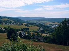
In the past, the northern access to the Graslitzer Pass began in the Vogtland capital Plauen and ran from there over the plateaus to the Schöneck castle hamlet, which was built around 1200 . From here the pass road crossed the wooded Schönecker Forest and stretched to the state border in the later Musikwinkel , where the market town of Klingenthal emerged around 1600 . After crossing the border, the pass road first led in the Zwota valley through the Bohemian town of Graslitz (Kraslice) before reaching Falkenau (Sokolov) on the Eger via Heinrichsgrün (Jindrichovice) . From here the imperial city of Eger (Cheb) could be reached quickly in a westerly direction, while to the west it was only about 15 kilometers from there to Karlsbad (Karlovy Vary). From a geological point of view, the Graslitzer Pass is still in the western Ore Mountains, but politically the area around Klingenthal already belonged to the territory of the Vogtland and is therefore not always recognized as an Ore Mountains Pass in some publications. As a special feature, it should be emphasized that the Graslitzer Pass is one of the few historic Erzgebirge passes that largely follows a valley.
The Sokolov (Falkenau) –Klingenthal railway connection, opened in 1886, runs over the pass . After 1945 there was no more cross-border traffic and in 1975 the bridge over the Zwota in Klingenthal was demolished. As a result of the political change in 1990, politicians called for the connection to be rebuilt. In 2000 the gap was closed and cross-border operations resumed. In its northern continuation via Zwotental and Muldenberg to Falkenstein / Vogtl. the connection to the historical route to the castle spot Schöneck has a topographical peculiarity: In contrast to the other Erzgebirge cross-railways, the highest point is 772 m above sea level. Reached NN in the Saxon town of Schöneck.
Literature (selection)
- Renate Arnold: The Bohemian Steige in the Middle Ore Mountains from the middle of the 10th century to the middle of the 14th century. Diploma thesis at the University of Education in Dresden, 1979
- Adolf Böhm: The former Erzgebirge cross-railways . In: Communications of the State Association of Saxon Homeland Security, issue 1/1995. Dresden 1995. pp. 18-25.
- Ingolf Gräßler: Passes over the Ore Mountains. Pass paths and pass roads between Freiberger and Zwickauer Mulde in the Middle Ages. In: Rainer Aurig / Steffen Herzog / Simone Lässig (eds.): State history in Saxony. Tradition and innovation. Dresden 1997, pp. 97-108. ISBN 3-89534-210-6 .
- Johannes Hemleben: The passes of the Ore Mountains . Diss. Berlin 1911.
- Albrecht Cherry: Generations of long-distance routes across the Ore Mountains. in: Sächsische Heimatblätter issue 4/2007, pp. 311–321
- Manfred Ruttkowski: Old roads in the Ore Mountains. Archaeological Monument Inventory Bohemian Path. In: Work and research reports on Saxon soil monument preservation 44, 2002, ISSN 0402-7817 , pp. 264–297.
- Heinrich Schurtz: The passes of the Ore Mountains . Leipzig 1891 digitized
- Hans Siegert: The passes of the Ore Mountains. In: Calendar for the Ore Mountains and the rest of Saxony, 1920. pp. 21–26.
- H. Wiechel: The oldest ways in Saxony . Meeting reports of the Isis Natural Science Society. Dresden 1901. ( digitized version )
- R. Wißuwa: The development of the old streets in the area of today's district Karl-Marx-Stadt from the middle of the 10th century to the middle of the 14th century. A contribution to the reconstruction of the old road network on an archaeological basis. Dissertation (A) 1987
- From main passes and other routes over the Ober-Ertz Mountains. In: Historical scene of their natural peculiarities in the Meißnischen Ober-Ertzgebirge. Leipzig 1699, pp. 151–155 ( digitized version )
Web links
- The old Erzgebirgsübergangs , in: Illustrierter Erzgebirgisches Sonntagsblatt, 126th volume, No. 1/1933 ff, accessed on March 1, 2015, on alterzgebirge.de
Individual evidence
- ↑ oA: Snowstorms in the winters of 1855 and 1856 . in: Saydaer Amts- und Heimatblatt. Issue 12/2004. P. 16.
- ↑ Gerhard Heilfurth : God's Judgment , in: Glückauf 55 (1933), p. 176.
- ↑ Christian Lehmann: The War Chronicle. Saxony with the Ore Mountains . Reprint of the edition edited by P. Bönhoff in 1916. Scheibenberg 1998. p. 33.
- ^ Carl Wilhelm Hering: History of the Saxon Highlands. Volume 2, Leipzig 1828, p. 47.
- ↑ Joseph von Westfalen: Proposal: to carry out the projected railway from Prague to Dresden from Aussig not on the Elbe, but towards the Ore Mountains and over the same from Herbitz . Dresden 1843
- ↑ Codex diplomaticus Saxoniae regiae , IA 2, No. 510
- ↑ quoted in: Hermann Adalbert Daniel: Germany after his physical and political relationships , Volume 1, Physical Geography, 4th edition, Fues-Verlag, Leipzig 1873, p. 266 ( link to the digitized version )
- ↑ cit. in Christian Preiß: The Alte Teplitzer Poststrasse. From the prehistoric climb to the highway of the 21st century . Pirna 2004 (self-published). P. 60.
- ↑ cit. in Eduard Zak : Wetterfichten am Kahleberg . Dresden 1955. p. 49.
- ↑ https://www.freipresse.de/NACHRICHTEN/SACHSEN/Auf-altem-Bahndamm-bis-zur-Grenze-artikel10228031.php
- ↑ Various authors (including Stanislav Ded): Přísečnice - zatopena, ale nezapomenuta / Preßnitz - lost but not forgotten ; Anthology, Chomutov Regional Museum, 2004, no ISBN. Cape. Die Stadt am Passweg, Preßnitzer Pass p. 62 (Czech / German).
- ↑ Various authors (including Stanislav Ded): Přísečnice - zatopena, ale nezapomenuta / Preßnitz - lost but not forgotten ; Anthology, Chomutov Regional Museum, 2004, no ISBN. Cape. The city on the Passweg, hussar grave on the Preßnitzer Pass p. 62, illustration of the hussar grave p. 71 (Czech / German).
- ↑ a b Michaela Balášová, Ivonne Burghardt: An unknown document from 1339 as the oldest written evidence of silver mining in the Bohemian Ore Mountains . In: State Office for Archeology, Regina Smolnik (Hrsg.): Work and research reports on the preservation of soil monuments in Saxony . Supplement 29, 2013, ISBN 978-3-943770-16-2 , ISSN 0138-4546 , p. 177–178 ( online version at academia.edu [accessed August 9, 2016]).
- ↑ Michaela Balášová, Ivonne Burghardt: An unknown document from 1339 as the oldest written evidence of silver mining in the Bohemian Ore Mountains . ... p. 178 .
- ↑ Construction of the B 93 to the Czech Republic not before 2015. February 14, 2006, accessed on September 12, 2013 .
