Rolava (Přebuz)
| Rolava | ||||
|---|---|---|---|---|
|
||||
| Basic data | ||||
| State : |
|
|||
| Region : | Karlovarský kraj | |||
| District : | Sokolov | |||
| Municipality : | Přebuz | |||
| Area : | 1117.8785 ha | |||
| Geographic location : | 50 ° 23 ' N , 12 ° 37' E | |||
| Height: | 900 m nm | |||
| Residents : | 0 | |||
Rolava ( German Sauersack ) is a part of the municipality Přebuz (German early penance ) in the Czech Republic .
geography
Geographical location
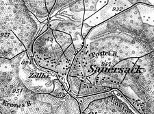
Sauersack is located at an altitude of 900 m nm in the western Ore Mountains on the connecting road from Kraslice to Nové Hamry . It belongs to the Sokolov district in the Karlovy Vary region .
Districts
The districts of Schusterpeint, Vordersauersack, Matzenwinkel, Hintersauersack and Stumpelhäuser belonged to Sauersack.
history
The establishment of Sauersack can be traced back to the mining industry. However, nothing is known about the beginning of mining in the community, as mining was carried out by trades based in Frübuss. A mine is documented in 1492. Another mention of a mine dates from 1556 when it was awarded the Gottes-Zinn colliery in the Schusterpeint. In 1654 the village of Sauersack had eleven houses, of which only nine were inhabited.
After the Thirty Years' War and the decline in mining, the inhabitants lived mainly from forest work, peat cutting , and homework such as embroidery and sewing . From 1700 lace making also spread in Sauersack and became the main source of income. However, it could not replace the income from mining, which ceased shortly after 1800. Despite many attempts over the next few decades, it was not possible to get mining going again.
Since the place was parish at early penance, it did not have its own church, but only a "Mariahilf" chapel. As in the neighboring early penance, the inhabitants of Sauersack resisted the Counter-Reformation for the longest time , so that between 1679 and 1684 the future Archbishop of Prague Daniel Joseph Ignatz Mayer had to work as a Catholic missionary. For the few residents of the New Apostolic faith there was a separate church in the village. A local school is first mentioned in 1847. She only had 2 classrooms. In 1882 a more modern school building was built, in which up to 160 students were taught.
In 1847 the village had 126 houses with 971 inhabitants, 1 community school, 1 chapel, 1 customs office, 1 hunter's house, 2 inns and 1 mill. Until the abolition of patrimonial rule in 1848/49, Sauersack belonged to the Neudek rule . From 1910 the municipality was part of the Neudek district . The tourism brought after 1900 only a few guests in the secluded place in contemporary guidebooks as "Moordorf" was called.
After the First World War , the Sudetenland was added to the newly founded Czechoslovakia on October 28, 1918 in the State Treaty of Saint-Germain-en-Laye of September 10, 1919 . The new state partially enforced its property claims militarily. So Sauersack was occupied by Czechoslovak units as early as the summer of 1919. With the occupation of the Sudetenland on October 1, 1938 by Nazi Germany and the formation of the Reichsgau Sudetenland on April 15, 1939, Sauersack was administratively assigned to the Neudek district in the administrative district of Eger .
From the end of 1939, Zinnbergbau Sudetenland GmbH established a modern tin mining company in the old mining area on the Kranisberg between Hirschenstand and Sauersack. The first French prisoners of war were deployed here as early as 1941. The barrack camp of the administration was rebuilt and expanded after their move to the new building in the shaft area under the name Birkhahn camp for Eastern workers as well as French and Soviet prisoners of war.
After the end of the Second World War , the Sauersack area remained temporarily unoccupied. The German population was then expelled between July 1945 and May 1946 . The tin mine was cannibalized between 1946 and 1947 and left to its own devices.
After the eviction, almost all the houses in the village were demolished. What remained was a residential building, the former post office, which is now used as a weekend property.
Population development
|
|
|
Culture and sights
- " Großer Kranichsee " high moor on the German border
Sons of the place
- Johann Joseph Kunzmann (1773–1826), lace trader, wholesaler and entrepreneur
- Joseph Kunzmann (1814–1873), lace and white goods manufacturer in Vienna
- Karl Kunzmann (1842–1918), top manufacturer, kk district chairman, mayor of Neudek
literature
- Walter Lauber: Sauersack. A disappeared village in the Ore Mountains. A collection of reports about Sauersack, a village whose residents were brutally expelled by the Czechs and whose houses were razed to the ground. Ulrich Möckel, Schönheide 2004.
Web links
- genealogy
- Short description of the location
- Regional Museum Sokolov (Czech; with photos)
- Views from before 1945
Individual evidence
- ↑ uir.cz
- ↑ Elbogner Kreis: 15 . Ehrlich, 1847 ( google.de [accessed March 31, 2020]).
- ^ Michael Rademacher: German administrative history from the unification of the empire in 1871 to the reunification in 1990. sud_neudek.html. (Online material for the dissertation, Osnabrück 2006).
- ↑ Historický lexikon obcí České republiky - 1869-2015. Český statistický úřad, December 18, 2015, accessed on February 14, 2016 (Czech).


