
Purschenstein


Purschenstein is a castle in Neuhausen / Erzgeb. in the Free State of Saxony , which was the center of a rulership of the same name in the Middle Ages and early modern times . It was built in the late 12th century, or around 1200, probably by Boresch I (Borso), from the Slavic Hrabischitz family, the name derives from Castrum Borsensteyn and refers to the main name of the sex (Boresch, Borso). The customs and escort castle built at that time protected one of the salt roads leading to Bohemia . This long-distance trade route , also known as the “old Bohemian Steig ”, ran from Leipzig past today's Neuhausen over the Deutscheinsiedler Sattel in the direction of Prague .
history

The complex and its lands (referred to as the Purschenstein rulership ), first mentioned in a document in 1289 , came into the possession of the Margraves of Meißen in the 13th century . In 1350 the castle was given as a fief to the von Riesenburg family . Margrave Friedrich der Strenge followed two years later, and another 20 years later it came into the possession of the Lords of Schönberg . This noble family built the castle in 1550 in a Renaissance - Schloss order.
During the Thirty Years War (1642/43) large parts of the castle were destroyed or fell victim to the fire.
_-_Schloss_Purschenstein_(01-2).jpg)
Until his death in 1735, the castle was owned by the royal Polish and electoral Saxon chamberlain Wolf Rudolph von Schönberg . Since his widow married Gotthelf Friedrich von Schönberg in his second marriage , he raised claims to Purschenstein Castle. On the other hand, several members of von Schönberg litigated who, as co-leaners, also made claims on Purschenstein.
In the 18th century, the Saxon general postmaster Adam Rudolph von Schönberg expanded the palace further. It was u. a. the south wing was redesigned into a baroque chapel between 1776 and 1789 . In the middle of the 18th century, the north wing was also expanded in the baroque style.

In 1800 the castle suffered severe damage as a result of a lightning strike . In 1842 it was almost completely destroyed in a fire. Because of the fires and renovations, only a few parts of the original castle are left, including the old 42 m high keep from the 13th / 14th. Century with its 2.85 m thick walls.
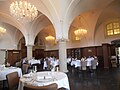
After the expropriation of the von Schönberg family in 1945, the castle was looted. Until 1948 there was a party school in the castle. From 1951 to 1955 the Catholic Caritas was able to use the castle as a children's home and the Catholic community could celebrate their services here . From 1955 to 1989 the castle was used as the FDGB culture house (“Clubhouse of the Unions”). On April 3, 1989, large parts of the castle burned down. It was rebuilt between 1990 and 2001. Thereafter, a restaurant has been established and the exhibition of the GDR - motorcycle collection housed the Black family. In addition, rooms for wedding celebrations were set up.
In 2005 the castle was sold to the Dutch businessman Roelof Praagman, who converted it into an upscale hotel complex with a restaurant and wellness area. It is run by Bastiaan Praagman.

View of the snow-covered castle

Castle and the town church

View from Schwartenberg to the castle
Remise of Purschenstein Castle, now a restaurant


_2006-07-15.JPG)

Personalities
- Heinrich von Schönberg (1549–1616), electoral councilor and governor
- Wolf Rudolph von Schönberg (1668–1735), royal Polish and electoral Saxon chamberlain and governor
See also
literature
- Richard Steche : Purschenstein. In: Descriptive representation of the older architectural and art monuments of the Kingdom of Saxony. 3. Issue: Amtshauptmannschaft Freiberg . CC Meinhold, Dresden 1884, p. 115.
- Renate Findeklee: Purschenstein Castle. Landmark and historical origin of Neuhausen in the Ore Mountains. Neuhausen community, 2014, 160 pp.
Web links
- That of the Schönbergs on Purschenstein
- Castle Hotel Purschenstein
- Purschenstein Castle on Burgenwelt.de
- more detailed information on Purschenstein in the "Alte Salzstraße" project
Individual evidence
- ↑ Volkmar Geupel , The medieval development of the Hrabischitz in the Saxon Ore Mountains, in: Communications of the Working Group for Archeology of the Middle Ages and the Modern Age, volume. 8 (1997), ed. from the German Society for Archeology of the Middle Ages and Modern Times in Heidelberg
Coordinates: 50 ° 40 ′ 35 ″ N , 13 ° 27 ′ 48 ″ E