Bridge Mountain
| Bridge Mountain | ||
|---|---|---|
|
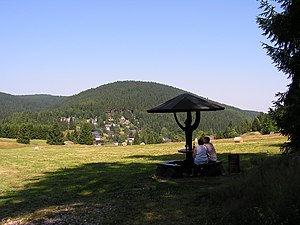
Brückenberg (in the background) and Elbogen near Wildenthal |
||
| height | 963.8 m above sea level NHN | |
| location | Erzgebirgskreis , Saxony ( Germany ) | |
| Mountains | Ore Mountains | |
| Dominance | 2.8 km → Auersberg | |
| Notch height | 149 m | |
| Coordinates | 50 ° 27 '15 " N , 12 ° 36' 30" E | |
|
|
||
The Brückenberg belongs with its 963.8 m above sea level. NHN to the highest mountains in the Saxon Ore Mountains .
Geography and location
The Brückenberg is located in the Western Ore Mountains about one kilometer west of Wildenthal and a good two kilometers north-northeast of Carlsfeld , two districts of the town of Eibenstock in the Erzgebirge district . It is separated from the neighboring Auersberg by the valley of the Große Bockau , from which the Brückenberg rises steeply. Several brooks arise on its ridge, such as the Dönitzbach, which flows north to Eibenstock. According to Siegfried Sieber , some of the sources are low in radium. Very hard, fine-grain tourmaline granite was once broken in an old quarry.
According to the natural map of Saxony, the Brückenberg belongs to the mesogeochore "Eibenstocker Bergrücken". This complex also includes the surrounding wooded plateau with its mountains such as Zeisiggesang (west-northwest of Brückenberg, 922.4 m), Elbogen (east), Steinberg (south-west on the edge of Carlsfeld, 914.6 m) and Wintergrün (north, 928.1 m)
Traffic and walking
The Frühbuser Steig, an old pass road into the Bohemian region, runs between Brückenberg and Ellbogen (899 m) . After the Brückenberg, the Ehrethausweg leads from Wildenthal, past the old forest pool and over the Frühbuser Steig. The Carlsfeld-Eibenstocker Weg, which is signposted as a hiking trail from Carlsfeld to Eibenstock, runs one kilometer west of the Brückenberg. The Carlsfeld mining trail is at the same distance from the summit .
literature
- Siegfried Sieber Brückenberg. In: The mining landscape of Schneeberg and Eibenstock (= values of the German homeland . Volume 11). 1st edition. Akademie Verlag, Berlin 1967, pp. 156–157.
Individual evidence
- ↑ a b Saxony Atlas of the Free State of Saxony ( notes )
- ↑ a b The mining landscape of Schneeberg and Eibenstock (= values of the German homeland . Volume 11). 1st edition. Akademie Verlag, Berlin 1967, p. 156.
- ↑ Topographic map 1: 25,000, edition with hiking trails, sheet 15 Westerzgebirge Eibenstock, Johanngeorgenstadt, Sächsischer Staatsbetrieb Geobasisinformation und Vermessung, 2nd edition, Dresden 2010, ISBN 978-3-86170-717-2

