
Bärenstein (Ore Mountains)
| coat of arms | Germany map | |
|---|---|---|

|
Coordinates: 50 ° 30 ' N , 13 ° 2' E |
|
| Basic data | ||
| State : | Saxony | |
| County : | Erzgebirgskreis | |
| Management Community : | Bärenstein-Königswalde | |
| Height : | 713 m above sea level NHN | |
| Area : | 5.47 km 2 | |
| Residents: | 2282 (Dec. 31, 2019) | |
| Population density : | 417 inhabitants per km 2 | |
| Postal code : | 09471 | |
| Area code : | 037347 | |
| License plate : | ERZ, ANA, ASZ, AU, MAB, MEK, STL, SZB, ZP | |
| Community key : | 14 5 21 060 | |
| Address of the municipal administration: |
Oberwiesenthaler Str. 14 09471 Bärenstein |
|
| Website : | ||
| Mayor : | Silvio Wagner | |
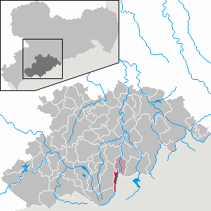
| Location of the municipality of Bärenstein in the Erzgebirge district | ||
  |
||

Bärenstein is a municipality on the Pöhlbach in the Erzgebirgskreis in Saxony .
geography

The place is in the Middle Ore Mountains in about 710 m above sea level. NN directly on the German-Czech border in the valley of the Pöhlbach . The highest point is the bear stone of the same name at 898 m above sea level. NHN .

Neighboring communities
Neighboring communities are Königswalde in the north , Sehmatal in the west and Oberwiesenthal in the south . In the east lies the Czech city Vejprty (Weipert). The next larger town in the north is Annaberg-Buchholz .
structure
Although there are no official districts, a distinction is made between Bärenstein, Stahlberg , Kühberg and precipitation . Together with Königswalde, the municipality forms the Bärenstein-Königswalde administrative community.
history
16th to 18th century

The place Bärenstein was created in the first half of the 16th century. 1525 is the first documentary mention: "am Pernstein". At that time, the place was in the rule of Schlettau in the Ernestine Electorate of Saxony , which was owned by the Grünhain monastery . On November 10, 1527, the Saxon mining clerk Hans Röhling acquired the area around the Bärenstein from the Grünhain monastery as an inheritance . The subsequent clearing and the settlement of farmers gave the developing community a significant boost. This year is therefore considered to be the founding date of Bärenstein. Under the Elector Moritz von Sachsen (reigned 1547–1553), the Röhlingsche Vorwerk was raised from hereditary property to man-made property . At the same time it was given lower jurisdiction . The other settlers on the Bärenstein were subject to him, paying interest and debts, and were no longer part of the Königswalde official site. The area around the Bärenstein was first parish in the Catholic Church in Schlettau. After the construction of the church in Königswalde, Bärenstein and Kühberg had been parish to Königswalde since 1523. Since the rule of Schlettau was once a Bohemian fiefdom, it was under the Archdiocese of Prague . In 1529 the Reformation was introduced in the area of the Grünhain Monastery and in large parts of Bohemia .
The dissolution of the Grünhain monastery in 1536 went hand in hand with the Reformation. Politically, Bärenstein was assigned to the newly established Schlettau Office, which was merged with the Grünhain Office a short time later . After the place with the office Schlettau came to the Albertine Electorate of Saxony in the course of the Wittenberg surrender in 1547, Bärenstein became a council village of Annaberg in 1548 . The land bridge, which was later known as the “Bohemian Bridge” or “Border Bridge”, was built in 1557 over the Pöhlbach at the lower end of the town of Kühberg. It existed until 1945. At that time, mining flourished on both sides of the Pöhlbach, which caused numerous miners to settle. Pits around Bärenstein carried u. a. the names "Brotherly Association", "Johannes Fundgrube", "New Hope Stolln am Bärenstein", "Prince Josef Stolln am Bärenstein", "Tiefer Prussia Stolln", "Unexpected happiness with joy at Bärenstein", "Weinrebe Stolln", "Zwickauer" Stolln am Bärenstein ”and“ Berghäusel ”(in Kühberg).
The Annaberg raft ditch was built between 1564 and 1566 to bring in large quantities of firewood, pit, smelter and construction wood, as well as additional surcharge, industrial and drinking water for the mountain town of Annaberg . The eleven-kilometer-long ditch began at the field boundary of the Stahlberg settlement, which was not built until the 17th century . Then it ran diagonally across the meadows to today's federal highway 95 and along the slope side to the center of Bärenstein. Then it led below today's Bahnhofstrasse to the location of today's Bärenstein station to the former Kühberg stop and on towards Königswalde upper station. The trench was in operation until the rafting operations were abandoned in 1844.
On November 16, 1613 Erasmus Mittelbach sold the Mannlehngut to the council of the city of Annaberg. The property was still mentioned in 1696 and 1820, but nothing has survived today. With around 700 inhabitants, Bärenstein was one of the most populous villages in the Ore Mountains after the Thirty Years War . This had u. a. to do with the onset of the Counter-Reformation in the neighboring Kingdom of Bohemia and the settlement of the evicted Protestant exiles on the Saxon side. Due to the shorter route, many Bärensteiners visited the Protestant church in the neighboring Bohemian town of Weipert, which was consecrated in 1551. But since Protestant church services were forbidden there and the evangelical pastors and believers were expelled, the desire for their own place of worship grew in Bärenstein. With the influx of religious refugees, not only did Bärenstein experience a rapid increase in population, but the new settlements Stahlberg, Precipitation and Hammerunterwiesenthal also emerged in the vicinity of the village . After the Saxon Elector Johann Georg I had given his permission to build a church, the Bärensteiner Erlöserkirche was inaugurated on November 4, 1655 after six months of construction as a subsidiary church of Königswalde. The school building followed a year later. In 1657 the Bärensteiner church became its own parish , in which the same year the exile settlement precipitation and in 1658 the exile settlement Stahlberg were parished. The gilded communion chalice donated by Electress Magdalena Sibilla von Sachsen in 1658 is still in use today. There were numerous hammer smiths among the exiles who settled in Bärenstein . These initially continued to work in the Blechhammer in Weipert-Grund , which was on the Bohemian side across from Kühberg. It was not until 1667 that Georg Meyer built a hammer mill in Bärenstein. It is proven up to the year 1783. At the end of the 18th century, the industrialization of Bärenstein gradually began. The road from Bärenstein to Annaberg was built between 1827 and 1830.
19th century
In 1834 Bärenstein was granted market rights. At that time, however, the place was still under the manorial power of the city council of Annaberg. Bärenstein and the Kühberg settlement belonging to the village belonged to the Electoral Saxon or Royal Saxon Office of Grünhain ( Unteramt Schlettau ) until 1856 . From 1856 the place belonged to the court office Annaberg and from 1875 to the official authority Annaberg . With the construction of the railway line from Annaberg to Weipert in 1867 and the opening of this line as well as the continuing Komotau – Weipert railway on the Bohemian side, the economic upswing began, especially in the textile industry ( trimmings ). For the construction of the railway line to Annaberg, the Annaberg raft ditch, which had not been used since 1844, was filled in and tracks were laid on it. The border station was in Weipert, Bohemia. In the year 1896, the neighboring town of Stahlberg, adjoining it to the south, was incorporated into the rural community of Bärenstein . The Bärenstein town hall was built in 1898 and 1899.
20th century to the present


_Empfangsgeb%C3%A4ude_(5).jpg)
On November 30, 1913, with the inauguration of the mountain inn with observation tower, the first tourist development of Bärenstein's local mountain of the same name took place. In 1937 the building was expanded and completely renovated in 1992/93. Winter sports were revived with the construction of a ski jump on the eastern slope of the mountain in 1921. In the 1930s, the Bärenstein began to be more touristically developed.
The Catholic "St. Bonifatius Church" was built in 1920/21. It had become necessary as a result of the influx of Catholics from Bohemia, which had belonged to Czechoslovakia since the end of the First World War .
With the incorporation of the Sudetenland into the German Reich in October 1938, the state border to Weipert ceased to exist. As a result of the Second World War , the border bridge between Bärenstein and Weipert (renamed Vejprty after 1945) was closed in 1945.
Between 1946 and 1954, uranium ore was mined in Bärenstein by the SAG Wismut . In Stahlberg the ore was mined in the shafts "Stalinschacht 281" and "Stalinschacht 282". With the arrival of miners, the population of Bärenstein rose to 6,000 in a very short time. After the end of the mining industry, the miners found new jobs in the growing industrial plants in the area. Bärenstein has been a state-approved resort since 1970 .
As a result of the second district reform in the GDR , the municipality of Bärenstein became part of the Annaberg district in the Chemnitz district (renamed the Karl-Marx-Stadt district in 1953 ), which was continued as the Saxon district of Annaberg from 1990 and was added to the Ore Mountains in 2008. With the political change after 1990, Bärenstein was also exposed to changed economic conditions. While industry declined sharply, the construction and commercial sectors experienced an upswing.
In 1991 the road border crossing to the neighboring Czech Vejprty was reopened. On December 16, 2005, the border crossing to Vejprty was reopened for vehicles (up to 3.5 t) after 60 years, after the border bridge had been rebuilt shortly before. On the Czech side, closed factories were demolished. After the repair of the railway border bridge between Bärenstein and Vejprty, the first train ran on the section between Germany and the Czech Republic on August 1, 1993 after 48 years of interruption. In 1995 the regular train service across the border was resumed. This was reduced to the weekend in 2011 and dropped entirely in 2014. Since May 1, 2016, cross-border travel between Vejprty and Cranzahl has been resumed as a temporary tourist offer in the summer months. The Bärenstein train station, located outside the village, is a stop in demand. After the demolition of various industrial wastelands near the border, the "Common Center" was created. H. a common center of Bärenstein and Vejprty. A pavilion opened there in 2013, which serves as an exhibition room, information center and cultural hall.
The municipalities of Bärenstein and Königswalde have been working together in the Bärenstein-Königswalde administrative community since 1996 . When the community Hammerunterwiesenthal was incorporated into Oberwiesenthal on January 1, 1997, the district of precipitation was reclassified to Bärenstein due to a signature campaign by the residents. On December 1, 2008, precipitation and Kühberg were stripped of their status as part of the municipality of Bärenstein.
With the rise in raw material prices, the extraction of raw materials in the deposit on fluorspar and barite became economically interesting again. On March 4, 2008, the Saxon Mining Authority granted the “Erzgebirgische Fluss- und Schwerspatwerke GmbH” a license in accordance with Section 8 of the Federal Mining Act (BBergG) for the extraction of fluorspar and heavy spar. On November 8, 2013, the mine was officially opened after a two-week trial run. It is already in the hallway of Hammerunterwiesenthal and therefore belongs to Oberwiesenthal. The mine has been in regular operation since 2015.
Development of the population
|
|
|
On October 3, 1990, Bärenstein had 3,171 inhabitants. The following population figures refer to December 31 of the previous year:
|
|
|
|
politics
Municipal council
2014: 47.6%
Since the municipal council election on May 26, 2019 , the 12 seats of the municipal council have been distributed among the individual groups as follows:
partnership
The partner municipality has been the municipality of Planegg near Munich since 1992 . A partnership agreement has been in place with the immediate Czech neighbor Vejprty since 2005.
coat of arms
Blazon : "In gold on growing red rock, a striding black bear ."
Declaration of coat of arms: The local coat of arms shows the place name "Bärenstein" as a talking coat of arms .
Culture and sights
- see also: List of cultural monuments in Bärenstein

In Bärenstein, directly on the B 95, is the Evangelical Lutheran Church of the Redeemer from 1655, and opposite the town hall is the 2013 replica of the Saxon half-mile pillar No. 54 of the former postal route Leipzig - Chemnitz - Annaberg - Karlsbad from 1723.
Not far from the village is the Bärenstein , one of the Upper Ore Mountains basalt mountains with a lookout tower and accommodation. The ridge path Erzgebirge – Vogtland and the Stoneman Miriquidi , the most demanding mountain bike route in the Erzgebirge, run over the mountain.
Economy and Infrastructure
From an economic point of view, tourism is particularly important in winter. A new mine was opened on November 8, 2013 near the district of precipitation . The Precipitation Pit will produce between 50,000 and 130,000 tons of fluorspar annually . The operator is the Erzgebirgische Fluss- und Schwerspatwerke GmbH. This mine is the first new mine in Germany for 40 years.
traffic
The federal road 95 ( Leipzig - Chemnitz - Oberwiesenthal ), which continues to Karlovy Vary (Karlsbad), and the railway line Vejprty – Annaberg-Buchholz und Bf , which leads on the Czech side to Chomutov ( Komotau ), lead through the village . The Bärenstein station (Kr Annaberg) is currently without regular rail traffic. In the district of precipitation there is a train station on the narrow-gauge railway Cranzahl-Kurort Oberwiesenthal (Fichtelbergbahn). Bärenstein has a border crossing to Vejprty (Weipert).
Personalities
Sons and daughters of the church
- Melchior Hoffmann (≈1679–1715), composer
- Friedrich Ludwig August Mayer (1790–1829), opera singer (baritone) and opera composer
- Franz Ulbrich (1885–1950), director and general manager
- Carl Adolf Marks (1894–1945), businessman and resistance fighter against National Socialism
- Rüdiger Alberti (1898–1953), pastor
- Curt Herbert Richter (1898–1974), zither soloist and composer
- Lukas Richter (1923–2000), music historian
- Rudolf Pleil (1924–1958), later serial killer
- Heinz Werner Höber (born May 20, 1931; † May 15, 1996 in Berlin-Charlottenburg ), novelist; is considered the father of the paperback hero G-Man Jerry Cotton
- Peter Gessner (1939–2019), business mathematician
- Steffen Flath (* 1957), politician (CDU)
People connected to the place
- Friedrich Hermann Löscher (born September 14, 1860 in Annaberg ; † December 27, 1944 in Bärenstein), pastor and local researcher of the Ore Mountains
- Rolf Peter Kahl known as RP Kahl , (born November 8, 1970 in Cottbus ), actor , director and film producer
literature
- Bärenstein, also Beerenstein . In: August Schumann : Complete State, Post and Newspaper Lexicon of Saxony. 14th volume. Schumann, Zwickau 1827, p. 259.
- Richard Steche : Bear stone. In: Descriptive representation of the older architectural and art monuments of the Kingdom of Saxony. 4th booklet: Official Authority Annaberg . CC Meinhold, Dresden 1885, p. 53.
Web links
- Official web presence of the Bärenstein-Königswalde administrative association
- Bärenstein in the Digital Historical Directory of Saxony
Individual evidence
- ↑ Population of the Free State of Saxony by municipalities on December 31, 2019 ( help on this ).
- ↑ Gottfried Schlegel, Helmut Frank: Field names in Bärenstein and the surrounding area . In: Bärensteiner information and news sheet . No. 7 , June 14, 2012, p. 8 ( baerenstein-erzgebirge.de [PDF; 3.2 MB ]). PDF; 3.2 MB ( Memento of the original dated November 6, 2016 in the Internet Archive ) Info: The archive link was inserted automatically and has not yet been checked. Please check the original and archive link according to the instructions and then remove this notice.
- ^ A b Gottfried Schlegel, Walter Bergner: 550 years of mining in and around Bärenstein in the Ore Mountains . Ed .: Erzgebirgszweigverein Bärenstein. Bärenstein 1993, p. 7 .
- ^ Kühberg and the Schloßstein on a private website about Königswalde and the surrounding area
- ↑ a b Official Gazette of the municipality of Bärenstein from July 23, 2012, section “From our local history” ( Memento from April 20, 2017 in the Internet Archive )
- ↑ The treasure trove around Bärenstein on www.sachsen.de
- ↑ The Bärenstein estate at www.sachsens-schlösser.de
- ↑ Official Journal of the Bärenstein community, edition 01/2011, p. 6 ( Memento from April 20, 2017 in the Internet Archive )
- ↑ Official Journal of the Bärenstein municipality, edition 07/2011, p. 10 ( Memento from November 26, 2013 in the Internet Archive )
- ^ Bärenstein in the "Handbuch der Geographie", p. 324f.
- ^ Karlheinz Blaschke , Uwe Ulrich Jäschke : Kursächsischer Ämteratlas. Leipzig 2009, ISBN 978-3-937386-14-0 ; P. 66 f.
- ^ The official authority Annaberg in the municipal register 1900
- ↑ [1]
- ^ Website of the Erzgebirgische Fluss- und Schwerspatwerke GmbH
- ↑ Information and timetable for seasonal traffic between Cranzahl and Vejprty ( Memento from May 10, 2016 in the Internet Archive )
- ^ Website of the common center Bärenstein –Vejprty
- ↑ Hammerunterwiesenthal on gov.genealogy.net
- ^ History of the Bärenstein community on the town's website
- ^ StBA: Changes in the municipalities, see 1997
- ↑ Extraction in ore and spar deposits within the scope of permits under Section 8 of the Federal Mining Act (BBergG), as of July 9, 2014 ( Memento of March 4, 2016 in the Internet Archive )
- ^ The treasure of Oberwiesenthal (n-tv). Retrieved July 20, 2014 .
- ↑ Toothpaste from the mountain (Der Tagesspiegel). Retrieved July 20, 2014 .
- ↑ New mine opened in Oberwiesenthal health resort . In: Official and information sheet of the city of Kurort Oberwiesenthal . Volume 2013, December 2, 2013, p. 5–6 ( oberwiesenthal.de [PDF; 818 kB ; accessed on May 15, 2018]).
- ^ Website of the Erzgebirgische Fluss- und Schwerspatwerke GmbH
- ^ Bärenstein in the Digital Historical Directory of Saxony
- ↑ State Statistical Office of the Free State of Saxony
- ↑ Results of the 2014 municipal council elections
- ↑ Results of the 2019 municipal council elections
- ↑ Bärenstein Church of the Redeemer. In: Erloeserkirche-Bärenstein.de. Bärenstein Evangelical Lutheran Parish, accessed on January 19, 2011 .
- ↑ The Stoneman Miriquidi on www.erzgebirge-tourismus.de ( Memento from April 23, 2017 in the Internet Archive )
- ^ Website of the Stoneman Miriquidi
- ↑ First ore mine in decades is opened. (No longer available online.) In: freiepresse.de. Chemnitzer Verlag und Druck GmbH & Co. KG, archived from the original on December 7, 2010 ; Retrieved October 31, 2010 .
- ^ Hannes Vogel: Search for raw materials in Germany. The treasure of Oberwiesenthal. n-tv.de, November 8, 2013, accessed on August 4, 2014 .

Amtsberg | Annaberg-Buchholz | Aue-Bad Schlema | Auerbach | Bear Stone | Bockau | Börnichen / Erzgeb. | Breitenbrunn / Erzgeb. | Burkhardtsdorf | Crottendorf | Deutschneudorf | Drebach | Ehrenfriedersdorf | Eibenstock | Parents | Gelenau / Erzgeb. | Geyer | Gornau / Erzgeb. | Gornsdorf | Großolbersdorf | Großrückerswalde | Grünhain-Beierfeld | Grünhainichen | Heidersdorf | Hohndorf | Jahnsdorf / Erzgeb. | Johanngeorgenstadt | Jöhstadt | Königswalde | Lauter-Bernsbach | Loessnitz | Lugau | Marienberg | Mildenau | Neukirchen / Erzgeb. | Niederdorf | Niederwürschnitz | Oberwiesenthal | Oelsnitz / Erzgeb. | Olbernhau | Pockau-Lengefeld | Raschau-Markersbach | Scheibenberg | Schlettau | Schneeberg | Schönheide | Schwarzenberg / Erzgeb. | Sehmatal | Seiffen / Erzgeb. | Stollberg / Erzgeb. | Column green | Tannenberg | Thalheim / Erzgeb. | Thermal bath Wiesenbad | Thum | Selva | Zschopau | Zschorlau | Zwönitz