
Heidersdorf
| coat of arms | Germany map | |
|---|---|---|

|
Coordinates: 50 ° 41 ′ N , 13 ° 24 ′ E |
|
| Basic data | ||
| State : | Saxony | |
| County : | Erzgebirgskreis | |
| Management Community : | Seiffen / Erzgeb. | |
| Height : | 574 m above sea level NHN | |
| Area : | 9.51 km 2 | |
| Residents: | 784 (Dec. 31, 2019) | |
| Population density : | 82 inhabitants per km 2 | |
| Postal code : | 09526 | |
| Area code : | 037361 | |
| License plate : | ERZ, ANA, ASZ, AU, MAB, MEK, STL, SZB, ZP | |
| Community key : | 14 5 21 280 | |
| LOCODE : | DE F9D | |
| Address of the municipal administration: |
Olbernhauer Str. 3 09526 Heidersdorf |
|
| Website : | ||
| Mayor : | Andreas Börner (PBI (non-party citizens' initiative)) | |
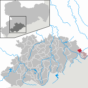
| Location of the community of Heidersdorf in the Erzgebirge district | ||
  |
||

Heidersdorf is a municipality in the east of the Erzgebirgskreis in Saxony (Germany).
geography
The community Heidersdorf is a Waldhufendorf in a side valley on the upper reaches of the Flöha . From the valley the place lies in a north-westerly direction. The highest point of the place is the Krähenberg at 652 m, the lowest is in the Flöhatal.
Neighboring communities
The neighboring community to the south, west and northwest is Olbernhau , Sayda to the north and Neuhausen / Erzgeb to the east . and in the southeast Seiffen / Erzgeb.
Community structure
In addition to the village of Heidersdorf, the district of Niederseiffenbach belongs to the municipality.
history
.jpg)
On January 20, 1451, the place was first mentioned in a document as "Heyderstorff". The place belongs to the rule of Schönberg on Purschenstein and Sayda. With the Reformation in 1539 Heidersdorf came to the Parish Sayda. A first teacher is mentioned in 1662, a schoolhouse is used from 1666. In 1767 a new school building was built. A cemetery was built in 1834 and a parenting hall in 1873 . The volunteer fire brigade was founded on February 6, 1878. Several factories were built in the 1880s. Heidersdorf had had a postal agency since 1888. With the opening of the Flöhatalbahn to Neuhausen on October 1, 1895, Heidersdorf received a rail connection in the then independent neighboring village of Niederseiffenbach. The station only received the name of Heidersdorf when the place was incorporated into Heidersdorf. On January 1, 1908, Heidersdorf became an independent parish. In 1912 it was connected to the electricity supply. In 1924 the town hall was inaugurated. The district of Mortelgrund was assigned to the city of Sayda in 1925 .
During the GDR era, VEB Wasserversorgung Leipzig maintained a company holiday home for its employees.
In 1969 the school was expanded. In July 1981 there was storm damage. In 1982 a central drinking water supply was established. Since 1992 Heidersdorf has only had one elementary school.

Incorporations
| Former parish or manor district | date | Increase in ha | Increase in residents | annotation |
|---|---|---|---|---|
| Purschenstein manor, manor district | April 1, 1921 | 54.74 | 0 | Part inclusion (parcel numbers 159, 178, 179, 186, 219a, 220b, 221, 222, 228a, 260, 261, 261a, 360a) |
| Mortelgrund (part of Heidersdorf) | July 14, 1925 | Reclassification of the district from Heidersdorf to Sayda | ||
| Niederseiffenbach with OT Lässigherd | April 1, 1939 | 135.30 | 371 | Partial integration (50% of the area) without the districts of Hirschberg, Wettinhöhe and Seiffengrund (Niederseiffenbach share), at the same time the subdivision of Niederseiffenbach is dissolved |
| Iron mine | April 1, 1939 | 31 | Incorporation of the Oberneuschönberg district | |
| State forest district Hirschberg, manor district | October 13, 1948 | 186.88 | 0 | Part inclusion (new parcel numbers 1139 to 1154) |
| State forest district Hirschberg, manor district | March 21, 1949 | 2.95 | 0 | Partial integration of departments 7, 8 and 58 (new parcel numbers 1136 to 1138) in the course of the land reform |
Population development
The following population figures refer to December 31 of the previous year with the territory January 2008:
|
1982 to 1988
|
1989 to 1995
|
1996 to 2002
|
2003 to 2012
|
from 2013
|
- Source: State Statistical Office of the Free State of Saxony
politics
Municipal council
Since the municipal council election on May 26, 2019 , the 6 seats of the municipal council have been distributed among the individual groups as follows:
- Non-party Citizens' Initiative Heidersdorf eV (PBI): 4 seats
- Regional farmers' association Erzgebirge e. V. (RBV): 1 seat
- WV Neuber, Dietmar: 1 seats
mayor
- 1990–2015: Dieter Lippmann (non-party citizens' initiative)
- since 2015: Andreas Börner (non-party citizens' initiative)
Culture and sights
Personalities
- Tom Reichelt (* 1982), cross-country skier, Olympic participant 2010
Web links
- Heidersdorf in the Digital Historical Directory of Saxony
Individual evidence
- ↑ Population of the Free State of Saxony by municipalities on December 31, 2019 ( help on this ).
- ↑ Facebook entry
- ↑ a b c The Saxony Book, Kommunal-Verlag Sachsen KG, Dresden, 1943
- ↑ a b lists of the municipalities incorporated since May 1945 and evidence of the subdivision of the independent manor districts and state forest districts, 1952, published by the Ministry of the Interior of Saxony
- ↑ Results of the 2019 municipal council elections

Amtsberg | Annaberg-Buchholz | Aue-Bad Schlema | Auerbach | Bear Stone | Bockau | Börnichen / Erzgeb. | Breitenbrunn / Erzgeb. | Burkhardtsdorf | Crottendorf | Deutschneudorf | Drebach | Ehrenfriedersdorf | Eibenstock | Parents | Gelenau / Erzgeb. | Geyer | Gornau / Erzgeb. | Gornsdorf | Großolbersdorf | Großrückerswalde | Grünhain-Beierfeld | Grünhainichen | Heidersdorf | Hohndorf | Jahnsdorf / Erzgeb. | Johanngeorgenstadt | Jöhstadt | Königswalde | Lauter-Bernsbach | Loessnitz | Lugau | Marienberg | Mildenau | Neukirchen / Erzgeb. | Niederdorf | Niederwürschnitz | Oberwiesenthal | Oelsnitz / Erzgeb. | Olbernhau | Pockau-Lengefeld | Raschau-Markersbach | Scheibenberg | Schlettau | Schneeberg | Schönheide | Schwarzenberg / Erzgeb. | Sehmatal | Seiffen / Erzgeb. | Stollberg / Erzgeb. | Column green | Tannenberg | Thalheim / Erzgeb. | Thermal bath Wiesenbad | Thum | Selva | Zschopau | Zschorlau | Zwönitz