
Parents
| coat of arms | Germany map | |
|---|---|---|

|
Coordinates: 50 ° 35 ' N , 12 ° 52' E |
|
| Basic data | ||
| State : | Saxony | |
| County : | Erzgebirgskreis | |
| Management Community : | Zwönitz | |
| Height : | 620 m above sea level NHN | |
| Area : | 45.74 km 2 | |
| Residents: | 2849 (Dec. 31, 2019) | |
| Population density : | 62 inhabitants per km 2 | |
| Postal code : | 09481 | |
| Area code : | 037349 | |
| License plate : | ERZ, ANA, ASZ, AU, MAB, MEK, STL, SZB, ZP | |
| Community key : | 14 5 21 180 | |
| LOCODE : | DE ELT | |
| City structure: | 3 districts | |
City administration address : |
Market 28 09481 Elterlein |
|
| Website : | ||
| come over. Mayor: | Jörg Hartmann | |
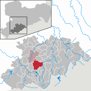
| Location of the city of Elterlein in the Erzgebirge district | ||
  |
||


Elterlein , in the local dialect called "Alterle" is a erzgebirgische small town in the Ore Mountains in Saxony .
geography
location
Elterlein is in the Ore Mountains. The city spreads out in a star shape. The center is the market square on a high plateau. It spreads upwards in the direction of Schatzenstein and sloping down on three sides to the floodplains on the Schlangengraben and Schwarzbach surrounding the place.
Districts

The town of Elterlein has consisted of two districts since Schwarzbach was incorporated in 1996 and three districts since Hermannsdorf was incorporated in 1999. Burgstädtel , located on State Road 258 between Elterlein and Zwönitz, does not form a separate district.
Neighboring communities
In the north, the towns of Zwönitz and Geyer and the municipality of Tannenberg border Elterlein. In the east it is the city of Schlettau , in the south the city of Scheibenberg and the municipality of Raschau-Markersbach and in the west the city of Grünhain-Beierfeld .
Highest elevation
The highest point in the city, at 760 m, is the Schatzenstein , located immediately northwest of Elterlein, on the municipal borders with Zwönitz and Grünhain-Beierfeld in the Grünhain Forest .
history
Parents
In the Middle Ages, the place was on an important trade route between Halle and Prague , the salt route over the Pressnitz Pass . The name Elterlein is mostly derived from Altarlein , a small altar along this path. For the first time the Elterlein mentioned in documents 1406th Information that the place already existed in 1118 is not documented. The first mention of the city as a city is only documented in writing for 1483.
At the time of the Great Mountain Scream, Elterlein quickly gained importance due to the flourishing mining industry in the Ore Mountains. Around 1500 the city had its own mining authority for its mines . In the middle of the 19th century, as in the entire region, mining declined in Elterlein and was discontinued. However, numerous testimonies of old mining can still be found today. In addition to tunnels - mouth holes , heaps and quarries , the idyllic Black Pond , which was created at the end of the 16th century together with the artificial stone ditch to operate a colliery.
As a result of mining, manufacturing industries such as mills, hammer and steel mills emerged early on. During industrialization , Elterlein was next to Mittweida in March 1848, the scene of the nail smiths' uprising . This was directed against new factories, with which the nail smiths, as craftsmen and small entrepreneurs, could not compete in free competition and therefore saw their livelihoods threatened by them. In Elterlein, the insurgents stormed the Leinbrock factory.
Elterlein was often badly destroyed by several extensive city fires in 1662, 1676, 1719, 1861 and 1868.
Schwarzbach
In 1240, the forest hoof village Schwarzbach was first mentioned in a deed of ownership to the Grünhain monastery .
The place was incorporated on April 1, 1996.
Hermannsdorf
Hermannsdorf is a forest hoof village that was probably settled around 1200 and was first mentioned in a document in 1460 . Here, too, up until 1873, in addition to agriculture, mining in particular shaped life for centuries and left visible signs such as the soapy ground with two mighty Raithalden.
The place was incorporated on January 1, 1999.
Castle complexes near Elterlein
- Hermannsburg in the Hermannsdorf district. The facility was located about 1 kilometer north of Hermannsdorf at the east end of the Singer or Sommersteine. Small remains of the wall have been preserved.
- "Quedlinburg", probably completely abandoned castle. The Quedlinburg is drawn northwest of Elterlein on a third of the route from Elterlein to Zwönitz and west of Geyer on the map of the "AltenGrafschaft Hartenstein" for the year 1406, by the historian L. Bönhoff. In addition to the castles Hartenstein and Wildenfels, Quedlinburg is said to have been one of the three main castles of this county and the only castle in the upper part of the county of Hartenstein. The source mentioned does not provide any further information about the castle or castle site. A possible location for this castle could have been the Schatzenstein , also northeast of Elterlein .
Population development
On October 3, 1990, Elterlein had 3,668 inhabitants. The following population figures refer to December 31 of the previous year:
|
1993 to 1997
|
1998 to 2002
|
2003 to 2007
|
from 2009 on
|
- Source: State Statistical Office of the Free State of Saxony
politics
City council
Since the municipal council election on May 26, 2019 , the 14 seats of the city council have been distributed among the individual groups as follows:
New compared to the previous election is the electoral association Together for the City of Elterlein (WVGE) and the AfD; Die Linke , the Free Voters' Community in Hermannsdorf , the Wahlervereinigung Schwarzbach , the list Pro Elterlein and the former list Together for the City of Elterlein (GSE) are no longer represented .
mayor
Karl Weinhold (CDU) was the full-time mayor of the city of Elterlein from 1990 to 2009. Then Siegbert Ullrich (Free Voters Hermannsdorf) held the office of honorary mayor until he resigned in March 2016 for health reasons. His former deputy Jörg Hartmann has been in charge of official business since January 2015. In July 2016 Hartmann was elected mayor (independent).
Administrative community
Elterlein has been a member of the Zwönitz administrative community since January 1st, 2009 , in which Zwönitz is the fulfilling municipality. The city was previously a member of the Geyer administrative community .
Twin cities
Since September 14, 2004 there has been an official town twinning with the municipality of Belm in Lower Saxony , based on initial contacts in the 1950s. There have been connections with the municipality of Remshalden in Baden-Württemberg since 1953 , which were also sealed by an official partnership in 2003.
religion
With those of the St. Laurentius Church Elterlein, the St. Michaelis Church Hermannsdorf and the Dorfkirche Schwarzbach there are three parishes of the Evangelical Lutheran Regional Church . Within the Evangelical Regional Church there is also the regional church community and in the Elterlein district a parish of the Evangelical Methodist Church has its church hall .
Culture and sights
- see also: List of cultural monuments in Elterlein

Buildings / excursion destinations / recreation
- St. Laurentius Church Elterlein ( foundation stone laid in 1481; foundation stone laid for the new tower in 1889)
- St. Michaelis Church in Hermannsdorf (built 1611) with bollard organ
- Half-timbered houses in the upper part of Hermannsdorf
- Saxon Post Distance Column from 1729 in Elterlein (original location: Marktplatz)
- Barbara Uthmann Memorial in Elterlein
- Village church Schwarzbach
- Schatzenstein ( 763 m ) and Gansberg ( 654 m )
- Hermannsdorfer Wiesen nature reserve and "Black Pond"
- Hermannsburg (Saxony) in the Hermannsdorf district. Little leftovers.
Regular events
- Dengelfest in the district of Schwarzbach (in June)
- Star hike to the Schatzenstein (first Saturday in October)
- Parish fair in Elterlein (second Sunday in September)
- Christmas market in Elterlein (1st Advent)
- Tower blowing from the tower of St. Laurentius Church Elterlein (every Sunday in Advent)
leisure
- hike
- horse riding
- bowling
- Sled dogs

Economy and Infrastructure
economy
Building on the tradition of the manufacturing industry that existed early on, Elterlein is today one of the most important regional industrial locations with the automotive supplier industry as the largest employer , measured against the total of 1471 employees subject to social insurance contributions (as of June 30, 2007) and total and foreign sales . Significant resident companies include Bodet & Horst GmbH & Co. KG, Linnemann-Schnetzer Sachsen GmbH, Max Bögl Bauunternehmung GmbH & Co. KG and Takata-Petri (Saxony) GmbH .
traffic
Road traffic
Elterlein is located on a motorway slip road for the Upper Ore Mountains, the state road 258. It offers a direct and fast connection between the A 72 (AS Stollberg -West) and the B 101 (near Scheibenberg ).
Rail transport
.jpg)
With the Zwönitz – Scheibenberg railway line , the city also had a rail connection from 1900. After the partial dismantling of the line in 1947 as a reparation payment to the Soviet Union, rail traffic was finally stopped in 1966 and the remaining line between Elterlein and Scheibenberg was also dismantled.
Personalities
sons and daughters of the town
- Wolf Hünerkopf (around 1494–1566), mint master, miner and landowner
- Wolfgang Uhle (1512–1594), known as the plague pastor of Annaberg
- Christian Gotthold Hoffmann (1713–1784), important personality in the rétablissement (Electoral Saxony)
- Gotthold Schramm (1932–2018), Colonel of the GDR State Security
- Manfred Günther (1942–2005), automobile racing driver
- Karl Weinhold (1946–2018), politician (CDU), Member of the Bundestag, Mayor of Elterlein (1990–2009)
People who are connected to Parents
- Christian Lehmann (1611–1688), childhood and first job as an assistant chaplain in Elterlein, one of the most important old chroniclers of the Ore Mountains
- Johannes Oertel (1840–1916), Mayor of Elterlein, owner of the Hammergut Tännicht
literature
- Jens Hahn: Elterlein-Scheibenberg-Oberwiesenthal. Three mining towns in the Ore Mountains. Ore mining and miners' services until the middle of the 20th century. Upper Erzgebirge Silver Mirror, Zwönitz 2010, ISBN 978-3-00-029673-4 .
- Richard Steche : Parents. In: Descriptive representation of the older architectural and art monuments of the Kingdom of Saxony. 4th booklet: Official Authority Annaberg . CC Meinhold, Dresden 1885, p. 68.
Web links
- Official website of the city of Elterlein
- Elterlein in the Digital Historical Directory of Saxony
Individual evidence
- ↑ Population of the Free State of Saxony by municipalities on December 31, 2019 ( help on this ).
- ↑ Interactive dictionary of Erzgebirgisch dialect Erzgebirgisch.de
- ^ Ernst Eichler and Hans Walther : Saxony. All city names and their history , Faber and Faber Verlag, Leipzig 2007, ISBN 978-3-86730-038-4 , p. 58f.
- ^ StBA: Changes in the municipalities in Germany, see 1996
- ↑ StBA: Changes in the municipalities in Germany, see 1999
- ^ Author collective, u. a. Helmut Bräuer, Robby Joachim Götze, Steffen Winkler and Wolf-Dieter Röber : The Schönburger, economy, politics, culture . Brochure for the special exhibition of the same name 1990–91 in the museum and art collection Schloss Hinterglauchau, Glauchau 1990, chap. "Mining" (Siegfried Pausch), p. 38, map of the "AltenGrafschaft Hartenstein" in 1406 according to L.Bönhoff
- ↑ The State Returning Officer , State Statistical Office of the Free State of Saxony: Election results for municipal council elections 2019 - Elterlein
- ↑ Elterlein's mayor has resigned , in: Freie Presse, local edition Annaberg of March 22, 2016.
- ↑ https://www.freipresse.de/LOKALES/ERZGEBIRGE/ANNABERG/Die-Elterleiner-haben-gewaehlt-artikel9578854.php#

Amtsberg | Annaberg-Buchholz | Aue-Bad Schlema | Auerbach | Bear Stone | Bockau | Börnichen / Erzgeb. | Breitenbrunn / Erzgeb. | Burkhardtsdorf | Crottendorf | Deutschneudorf | Drebach | Ehrenfriedersdorf | Eibenstock | Parents | Gelenau / Erzgeb. | Geyer | Gornau / Erzgeb. | Gornsdorf | Großolbersdorf | Großrückerswalde | Grünhain-Beierfeld | Grünhainichen | Heidersdorf | Hohndorf | Jahnsdorf / Erzgeb. | Johanngeorgenstadt | Jöhstadt | Königswalde | Lauter-Bernsbach | Loessnitz | Lugau | Marienberg | Mildenau | Neukirchen / Erzgeb. | Niederdorf | Niederwürschnitz | Oberwiesenthal | Oelsnitz / Erzgeb. | Olbernhau | Pockau-Lengefeld | Raschau-Markersbach | Scheibenberg | Schlettau | Schneeberg | Schönheide | Schwarzenberg / Erzgeb. | Sehmatal | Seiffen / Erzgeb. | Stollberg / Erzgeb. | Column green | Tannenberg | Thalheim / Erzgeb. | Thermal bath Wiesenbad | Thum | Selva | Zschopau | Zschorlau | Zwönitz