
Lohmen (Saxony)
| coat of arms | Germany map | |
|---|---|---|
_Wappen.png)
|
Coordinates: 50 ° 59 ′ N , 14 ° 0 ′ E |
|
| Basic data | ||
| State : | Saxony | |
| County : | Saxon Switzerland-Eastern Ore Mountains | |
| Management Community : | Lohmen / City of Wehlen | |
| Height : | 219 m above sea level NHN | |
| Area : | 25.9 km 2 | |
| Residents: | 3084 (Dec. 31, 2019) | |
| Population density : | 119 inhabitants per km 2 | |
| Postal code : | 01847 | |
| Primaries : | 03501, 035024 | |
| License plate : | PIR, DW, FTL, SEB | |
| Community key : | 14 6 28 240 | |
| Community structure: | 4 districts | |
| Address of the municipal administration: |
Lohmen Castle 1 01847 Lohmen |
|
| Website : | ||
| Mayor : | Jörg Mildner ( CDU ) | |
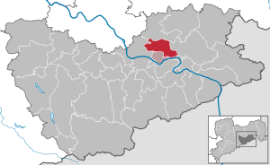
| Location of the community Lohmen in the Saxon Switzerland-Eastern Ore Mountains district | ||
  |
||


Lohmen is a municipality in the Saxon Switzerland-Eastern Ore Mountains district in Saxony . It is the seat of the administrative community Lohmen / Stadt Wehlen . The main access road to the Bastei and the Saxon Switzerland National Park leads through Lohmen . The community is therefore also known as the “Gateway to Saxon Switzerland”.
geography
Lohmen is located between Pirna and the Saxon Switzerland National Park .
Districts
Districts are Daube , Doberzeit , Mühlsdorf and Uttewalde . The place Lohmen itself is generally divided into Ober-, Mittel- and Unterlohmen, which is determined by the central mountain in the place. The district of Lohmen is centrally located in the municipality, to which the districts of Mühlsdorf and Daube adjoin in the north-west and west. A little further away is the district of Doberzeit in the southwest, the district of Uttewalde is in the southeast at the northwestern foot of the Steinerne Bär. Lohmen and Mühlsdorf have the structure of a forest hoof village , while in the districts of Daube, Doberzeit and Uttewalde the settlement form Rundling has largely been preserved.
Neighboring communities
Surrounding communities are Dürrröhrsdorf-Dittersbach in the north, Hohnstein in the east, Kurort Rathen in the southeast, Struppen in the south, town of Wehlen in the southwest and the district town of Pirna in the west.
history
Lohmen was first mentioned in a document in 1292. Already in 1206 a "Timo de Lome" appears as a documentary witness. The place name is derived from the Old Slavic lom = fraction. In the area there were the first sandstone quarries as early as 1200 and thus the first in the wider area.
At the time of the German settlement in the 12th and 13th centuries, Lohmen may have developed as a row village with a forest hoofed area. It can be assumed that the area was originally a Bohemian fiefdom, but already after the death of the oldest verifiable owner Poppo von Köckritz there were secure ties to Meißen , namely when Margrave Friedrich der Strenge Dörfer, Gut, Wälder, Acker und Wiesen was his banker in 1365 , the Dresden citizen Franz von Magdeburg, pledged. Niederlohmen and Oberlohmen were mentioned as districts in 1387.
In 1470 there was both a mill and a hammer in Lohmen . In the 16th century, the village gained such importance that it was even referred to as a "town". There is evidence of a large sheep farm for 1543 , and in 1765 200 merino sheep were obtained from Spain for breeding . Up until the middle of the 20th century, animal breeding was of considerable importance in Lohmen.
Between 1574 and 1576 a paper mill was built on the Wesenitz . In the middle of the 16th century Lohmen was an electoral chamber estate and seat of the Lohmen office. 12 of the surrounding villages belonged to his area. In the village itself there was a brewery since 1581 . The craft also developed here at that time. At the end of the 16th century, a wire mill had emerged from the old hammer , which again existed as an iron hammer until 1832 .
The place and the rule Wehlen-Lohmen belonged to the Lords of Schönburg until 1543 , when this property was transferred to the sovereign, Margrave Moritz of Saxony, in exchange for other goods . On September 20, 1567, the Elector August Lohmen gave his Chamber Secretary Johann Jenitz as a present . After his death in 1590, Elector Christian bought it back from his heirs. Shortly thereafter, the rule was combined with the rule of Hohnstein to form a joint office, which existed until the 19th century and finally became part of the Pirna administration .
Around 1800 Lohmen became the gateway to the Elbe Sandstone Mountains . In 1811 the street running through the village was expanded. Before that, it had existed as an ancient side path - leading on the northern border of the sandstone mountains above the grounds on the right Elbe from Dresden via Pirna to Hohnstein and Sebnitz . This path is known from prehistoric times and is one of the oldest in the area. It connected central Upper Lusatia and the Bohemian Netherlands with central Saxony .
From the year 1835 it is reported that the guides gathered every day in front of the inn “Zum Erbgericht” to ask the numerous strangers who had come on foot or in a carriage from Dresden and Pirna for the “romantic grounds”, the picturesque rocky areas and to lead to the “delightful viewpoints”.
Incorporations
- July 1, 1950 Mühlsdorf to Lohmen
- June 20, 1957 Daube after Dober time
- August 1st, 1961 Uttewalde to Lohmen
- January 1, 1969 Dober time to Lohmen
politics

Municipal council
Since the municipal council election on May 26, 2019 , the 16 seats of the municipal council have been distributed among the individual groups as follows:
Partner communities
A partnership has existed with Oberteuringen in Baden-Württemberg since 1991 and with Pielgrzymka in Poland since 1996. There have been friendly relations with the municipality of Lohmen in Mecklenburg since 1990, which were sealed in 2006 by a partnership document. Friendly relations have also existed with Svoboda nad Úpou in the Czech Republic since 2004 .
Public facilities
- Lohmen volunteer fire brigade
- Lohmen Primary School
- Kindergarten and crèche
- Lohmen Castle: municipal administration
Economy and Transport

In 1765, Elector Johann Georg I established a regular sheep farm on the castle. In the basement of one of the houses in this castle, he built a brewery. This brewery was owned by FA Uhlemann; Oswin Mauksch directed it from 1895 and Ewald Seidel leased it from 1808. In 1920 the brewery was closed. The H. Büttner Brewery & Malthouse was founded in 1872 and existed until it closed in 1987.
Lohmen is located with one stop on the southern part of the Kamenz – Pirna railway , which is served hourly by regional trains of the Central German Regiobahn to Pirna and Neustadt in Saxony .
Culture and sights

The Lohmen area includes the Bastei , the rock castle Neurathen and the Lohmener Klamm in the Wesenitztal as well as the former Lochmühle with the Richard Wagner monument and the Daubemühle hydroelectric power station.
In the Uttewalder Grund, the Uttewalder Tor is a popular destination. The rebuilt castle, in which the municipal administration has its seat, is worth seeing.
The village church Lohmen was built in 1789 by a student of the builder of the Dresden Frauenkirche, George Bähr , and has its identical counterpart in Uhyst am Taucher . A special architectural feature is the construction used here with a side tower and altar pulpit organ in one line. In addition, with 835 seats, it is the largest sacred building in Saxon Switzerland and one of the largest village churches in Saxony.
Personalities
On February 23, 2006 the congregation celebrated the fiftieth anniversary of the death of the dialect poet Bruno Barthel . His well-known work Im di Bastei rim describes life in the community of Lohmen in Saxon dialect.
Carl Heinrich Nicolai lived and worked in Lohmen , who together with Wilhelm Leberecht Götzinger began to develop Saxon Switzerland for tourism at the end of the 18th and the beginning of the 19th century. A plaque on the Bastei bridge honors these two men.
Landscape gardener Gustav Hermann Krumbiegel was born in Lohmen in 1865. He worked at Pillnitz Castle, among other things, and then worked as a gardener for the Maharajah for more than six decades in Bangalore and Mysore in southern India .
literature
- Königstein area, Saxon Switzerland (= values of the German homeland . Volume 1). 1st edition. Akademie Verlag, Berlin 1957.
- Municipal administration Lohmen (ed.): Lohmen - once the gateway to Saxon Switzerland , Dresden 1997
- Wilhelm Leberecht Götzinger : History and description of the Chursächsischen Amt Hohnstein with Lohmen, in particular the city of Sebniz, which belongs to this office. Freiberg 1786 (Reprint Sebnitz 1987) ( digitized )
- Eberhard Müller: The former wire mill in Lohmen . In: Announcements of the Landesverein Sächsischer Heimatschutz eV 2/2016, pp. 9-10
Web links
Individual evidence
- ↑ Population of the Free State of Saxony by municipalities on December 31, 2019 ( help on this ).
- ^ Lohmen in the Digital Historical Directory of Saxony
- ^ Lohmen Saxony - history. Retrieved February 25, 2017 .
- ^ Lohmen Saxony - history. Retrieved February 25, 2017 .
- ↑ Results of the 2019 municipal council elections
Altenberg | Bad Gottleuba-Berggießhübel | Bad Schandau | Bahretal | Bannewitz | Dippoldiswalde | Dohma | Dohna | Village grove | Dürrröhrsdorf-Dittersbach | Freital | Glassworks | Gohrisch | Hartmannsdorf-Reichenau | Heidenau | Hermsdorf / Erzgeb. | Hohnstein | Klingenberg | Königstein (Saxon Switzerland) | Kreischa | Liebstadt | Wages | Müglitztal | Neustadt in Saxony | Pirna | Rabenau | Rathen | Rathmannsdorf | Reinhardtsdorf-Schöna | Rosenthal-Bielatal | Sebnitz | City of Wehlen | Stumble | Struppen | Tharandt | Wilsdruff