
Wesenitz

The Wesenitz ( Upper Sorbian Wjazońca ) is a right tributary of the Elbe in Saxony . The name comes from wjaz , the Sorbian word for " elm ".
geography

The Wesenitz rises in the Hohwald , part of the Lusatian Mountains , at 515 m above sea level on the Valtenberg from the mouth of the Valentin Erbstollen, an old mine .
It flows through Neukirch , Bischofswerda , past Stolpen and passes the Lusatian Fault near Dürrröhrsdorf at the so-called Teufelskanzel , where it enters the Elbe sandstone . Here it flows through the Liebethaler Grund . It flows into the Elbe in the Pratzschwitz district of Pirna .
With a length of 83 kilometers, the Wesenitz is one of the longer right tributaries of the Elbe.
history
Since the Pleistocene , the Wesenitz formed an arc with the swampy surrounding area in the area of today's Bischofswerda . This natural borderline favored the foundation and defense of the city on the north bank of the Wesenitz.
Between the 8th and 12th centuries, an important connecting route between the Slavic tribes of the Milzener in Upper Lusatia and the Nisans in the Elbe Valley ran from Bischofswerda via Stolpen to Pratzschwitz in the valley of the Wesenitz . In the Upper Lusatian border document , the river was mentioned several times as Wazouniza around 1223/41 .
From the 15th to the middle of the 19th century, gold was panned in the Wesenitz catchment area . Locals, but repeatedly also whales , made a particularly intensive effort in the source area, at several tributaries such as in Goldbach and Großdrebnitz as well as directly on the Wesenitz between Schmiedefeld and Rennersdorf . However, the yield was low.
In August 2002, like many rivers in Saxony, the Wesenitz caused devastating floods .
Excursion destinations

_2006-06-08.jpg)
The much-visited Stolpen Castle was first mentioned in a document in 1222. It was originally owned by the bishops of Meissen and in 1559 became the property of the Electorate of Saxony under Elector August . The castle became famous because the former mistress of August the Strong (Elector of Saxony 1696–1733), Countess Anna Constantia von Cosel , was imprisoned here from 1716 to 1765 .
Other well-known excursion destinations on the river are the castle park in Großharthau , the Schöne Höhe near Dürrröhrsdorf-Dittersbach , the Wesenitzklamm near Lohmen and the largest Richard Wagner monument in the world by Richard Guhr at the former Lochmühle . The old hydropower plants between Lochmühle and Liebethal are also worth seeing .
The Liebethaler Grund is the narrow, deeply cut valley of the Wesenitz near Liebethal near Pirna . A popular hiking trail runs through the valley, and it is known as the “gateway to Saxon Switzerland ” (on the classic route).
Use of hydropower

In the past, the Wesenitz and its tributaries drove more than 100 mills. In 1895, Bruno Steglich , in The Fish Waters in the Kingdom of Saxony, mentions 63 hydropower plants for Wesenitz alone, 44 of which are mills.
Today there are five hydropower plants along the river in the area of the old district of Saxon Switzerland . One of them is operated by the municipality of Lohmen in the former Daubemühle in Liebethaler Grund with two Francis turbines .
Former mills were among others
- Oberneukircher mill
- Buschmühle Neukirch
- Brettmühle Oberputzkau
- Buschmühle Putzkau
- Fischermühle Bischofswerda
- Disc mill Schmiedefeld
- Buschmühle near Lauterbach
- Stadtmühle (also fulling mill) Stolpen
- Brettmühle Stolpen
- Neumühle Stolpen
- Upper mill (Kappler's mill) Helmsdorf
- Niedermühle Helmsdorf
- Buschmühle Niederhelmsdorf
- Geibeltsmühle Dittersbach
- Dittersbach paper mill
- Leiermühle Dittersbach
- Rote Mühle or Merlinmühle Dürrröhrsdorf
- Dittersbacher Hofemühle
- Ramm's cutting mill
- Elbersdorf Mill Elbersdorf
- Porschendorfer Mill Porschendorf
- Winkelmühle Porschendorf
- Wauermühle (or Hintermühle) Lohmen
- Vordermühle Lohmen
- Lohmen paper mill
- Roller mill (hammer mill) Lohmen (power station)
- Daubemühle Daube (power plant)
- Lochmühle Mühlsdorf
- Liebethaler Mühle Liebethal (Pirna-Liebethal power station)
- Grundmühle Liebethal
- Jessen valley mill
- Dietzmühle Jessen
- Copitz Brückmühle
- Neumühle Copitz
- Pratzschwitzer Mill Pratzschwitz
Fish fauna

Due to its hydrological and structural-morphological properties with an average water width of 10 m and an average gradient of 0.53% as well as the existing key and accompanying fish species, today's Wesenitz in the lower reaches of the fishing biology is assigned to the grayling region , the middle and upper reaches of the trout region . This is the result of various hydraulic engineering measures, so that such a classification differs for the past. For example, a large number of other meanders existed in the upper and middle reaches of the upper and middle reaches , as they can still be found below Bischofswerda today. They caused a lower gradient and a significantly lower flow velocity and thus different fish-faunistic conditions.
The Wesenitz below the Buschmühle in Helmsdorf counts as a fauna and flora habitat . This is justified, among other things, with the occurrence of bullhead and minnow .
Since 1989 there have been intensified efforts to reverse the historical decline in fish fauna by number of species and individuals due to industrial pollution. According to Bruno Steglich, 22 industrial plants discharged their sewage into the river in 1895, which was devoid of fish from Ringenhain to Oberputzkau. In 1994 a project for the reintroduction of salmon was started. It had completely disappeared 100 years earlier.
fishing

In addition to the so-called wild fishery in the Wesenitz, the Meißen bishops operated carp production in two dammed river sections until 1559 and after the transfer of ownership temporarily the Saxon electors .
Beginning in 1476 when Johann V. von Weißenbach took office , the Goldbacher Teich between Goldbach and Kleindrebnitz and in Bischofswerda the Bischofswerdaer Teich each on an area of about 20 hectares. Around 1815 these two pond farms were closed for economic and technical reasons ( siltation , dam damage).
According to the fish population, the Wesenitz housed a considerable number of otters, which fishermen hated . They were practically exterminated by organized combat by 1920. In 1969 it was possible to provide evidence for the first time at Großharthau . Since then, the Wesenitz has been slowly repopulated from the Black Elster water system . This is recognizable z. B. A large number of dead otters in the area of the B6 . The land changes in question are to the west of Großharthau and east of Bischofswerda. Today the otter is under nature protection.
More pictures
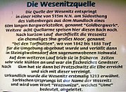
Description of the essence source

Sign to the Wesenitzquelle

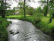
The Wesenitz near Neukirch / Lausitz

The Wesenitz in Bischofswerda
The Wesenitz in Großharthau with the confluence of the Gruna

The Wesenitz near Lohmen

Technical monument Niezelgrund hydroelectric power station on the Wesenitz

At the Wesenitz below the castle in Lohmen


See also
Web links
- Hydrological manual. (PDF; 115 kB) Part 2 - Area Codes. Free State of Saxony - State Office for Environment and Geology, p. 5 , accessed on December 25, 2017 .
Individual evidence
- ^ German Hydrological Yearbook Elbe Region, Part I 2014. (PDF) State Office for Flood Protection and Water Management Saxony-Anhalt, p. 108 , accessed on November 3, 2018 (from: lhw.sachsen-anhalt.de).
- ^ Jan Meschgang: The place names of Upper Lusatia. Domowina Verlag, Bautzen 1973, p. 97
- ↑ The hike along the Wesenitz - from the source to the mouth - from the granite through the sandstone into the Elbe
- ^ Roland Paeßler: The Erbrichters in the area of Bischofswerda . In: Mathias Hüsni (ed.): Schiebocker Landstreicher . H. 3, Burkau 2008. ISSN 1866-7872 . Pp. 8-16
- ↑ a b Manfred Schober , René Misterek: The mills of Saxon Switzerland: Right Elbe area . 1st edition. Berg- und Naturverlag Rölke, Dresden 2009, ISBN 978-3-934514-24-9 .
- ^ Roland Paeßler: Money and Gold in Upper Lusatia . Landesverein Sächsischer Heimatschutz: Bautzener Land, no. 6, pp. 159–164, 2001
- ↑ Mill tour along the Wesenitz ( Memento of the original from December 3, 2011 in the Internet Archive ) Info: The archive link was automatically inserted and not yet checked. Please check the original and archive link according to the instructions and then remove this notice. (PDF file; 558 kB)
- ↑ E. Nierich: The mills of the upper Wesenitztal . In: Our home . No. 5–7, 1930: 14 mills from the source to the Putzkau local border; Karl Wilhelm Mittag : Chronicle of the royal Saxon city of Bischofswerda . 1861, pp. 84–89: in the city of Bischofswerda 4 mills; S. Störzner: What the electoral Schösser reported about the Stolpen-Bischofswerdaer care in 1586 . In: Our home . No. 39, 1928: from Rennersdorf to Altstadt (Stolpen) 6 mills
- ↑ Mill tour along the Wesenitz , accessed on March 20, 2017
- ↑ Page no longer available , search in web archives:
- ↑ Frank Fiedler : On the changes in the fish fauna in the former grayling region of Wesenitz (1591–1989). In: Sächsische Heimatblätter 2, magazine for Saxon history, monument preservation, nature and the environment. Verlag Klaus Gumnior, Chemnitz 2003, pp. 127-133
- ↑ No. 162 in the list of FFH areas due to their community importance for the EU according to Annex II of EU Directive 92/43 / EEC
- ^ Frank Fiedler: Historical pond management in the Bischofswerda area. Between Wesenitz and Löbauer Wasser 3rd home pages of the district of Bautzen. 1998, pp. 41-49
- ^ Frank Fiedler: On the occurrence of the otter in the district of Bischofswerda. Ber. Natural science. Upper Lusatia Society, Görlitz. Volume 2, 1993, pp. 35-39