Breitenbachplatz
| Breitenbachplatz | |
|---|---|
| Place in Berlin | |
 View from the southwest of Breitenbachplatz |
|
| Basic data | |
| place | Berlin |
| District | Dahlem |
| Created | 1892 |
| Confluent streets |
Südwestkorso , Schorlemerallee , Schildhornstraße , Dillenburger Straße , AS of the A 104 (spanning as a bridge) |
| use | |
| User groups | Pedestrians , cyclists , road traffic , public transport |
| Space design | Georg Kuphaldt |
The Breitenbachplatz is located in the Berlin district Steglitz- Zehlendorf , district Dahlem on the border with the districts Steglitz (also Steglitz-Zehlendorf) and Wilmersdorf in Charlottenburg-Wilmersdorf . From 1892 to 1913 it was called Rastatter Platz . The Schorlemerallee , the Südwestkorso , the Dillenburger Strasse and the Schildhornstrasse all flow onto it .
The garden architect Georg Kuphaldt designed the green areas of the square .
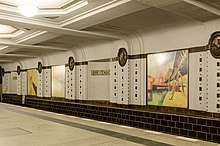
The square was given its current name on the occasion of the opening of the underground line to Dahlem on August 26, 1913. It was named after the Prussian Minister of Public Works Paul von Breitenbach, who was present at the opening . He played a major role in the construction of this line. The U3 trains , which run between Warschauer Straße and Krumme Lanke, run via the Breitenbachplatz underground station .
The Reichsknappschaftshaus adjoins the north-eastern side of Breitenbachplatz as an architectural monument. The route of the Berlin Marathon regularly leads directly past the northern end of Breitenbachplatz (route km 27).
Breitenbachplatz Bridge
In the 1970s, as part of the expansion of the Berlin urban motorway network in the northeastern area of Breitenbachplatz, a feeder to the A 100 city ring was built across the square as the later A 104 . In the course of this route there is a motorway overhang, which is unique in Germany, at Schlangenbader Straße . Originally, this city motorway was to be extended over Schildhornstrasse to Schloßstrasse and the A 103 , but this plan was never implemented. The building of the bridge was preceded by massive public protest, especially from the residents of Schildhornstrasse. In the meantime, the A 104 is just a branch of the A 100. Currently there is again a citizens' initiative that is campaigning for the demolition of the motorway bridge and the restoration of the square.
On May 16, 2019, the Transport Committee of the Berlin House of Representatives asked the Senate to submit a feasibility study by May 31, 2020 with the aim of demolishing the dilapidated bridge.
Bicycle traffic
One of 17 permanently installed automatic bike counting stations in Berlin has been located at Breitenbachplatz since 2016. Among all of the city's squares with counting points, the square is the eleventh most frequented place by bicycle traffic.
Web links
-
Breitenbachplatz. In: Street name lexicon of the Luisenstädtischer Bildungsverein (near Kaupert )
- Rastatter Platz . In: Luise.
- Page of the "Initiative Breitenbachplatz" with information about the history of the square.
Individual evidence
- ↑ The demolition of the bridge at Breitenbachplatz is being investigated. In: Berliner Morgenpost , May 17, 2019
- ↑ Traffic survey bike counter for Berlin: How many cyclists are there? In: berlin.de. Retrieved February 5, 2019 .
Coordinates: 52 ° 28 ′ 1 ″ N , 13 ° 18 ′ 32 ″ E

