
Subway line 3 (Berlin)
| Line Berlin U-Bahn small profile |
|||||||||||||||||||||||||||||||||||||||||||||||||||||||||||||||||||||||||||||||||||||||||||||||||||||||||||||||||||||||||||||||||||||||||||||||||||||||||||||||||||||
|---|---|---|---|---|---|---|---|---|---|---|---|---|---|---|---|---|---|---|---|---|---|---|---|---|---|---|---|---|---|---|---|---|---|---|---|---|---|---|---|---|---|---|---|---|---|---|---|---|---|---|---|---|---|---|---|---|---|---|---|---|---|---|---|---|---|---|---|---|---|---|---|---|---|---|---|---|---|---|---|---|---|---|---|---|---|---|---|---|---|---|---|---|---|---|---|---|---|---|---|---|---|---|---|---|---|---|---|---|---|---|---|---|---|---|---|---|---|---|---|---|---|---|---|---|---|---|---|---|---|---|---|---|---|---|---|---|---|---|---|---|---|---|---|---|---|---|---|---|---|---|---|---|---|---|---|---|---|---|---|---|---|---|---|---|---|
 | |||||||||||||||||||||||||||||||||||||||||||||||||||||||||||||||||||||||||||||||||||||||||||||||||||||||||||||||||||||||||||||||||||||||||||||||||||||||||||||||||||||
| Route length: | 19.7 km | ||||||||||||||||||||||||||||||||||||||||||||||||||||||||||||||||||||||||||||||||||||||||||||||||||||||||||||||||||||||||||||||||||||||||||||||||||||||||||||||||||||
| Gauge : | 1435 mm ( standard gauge ) | ||||||||||||||||||||||||||||||||||||||||||||||||||||||||||||||||||||||||||||||||||||||||||||||||||||||||||||||||||||||||||||||||||||||||||||||||||||||||||||||||||||
| Power system : | side busbar painted above 750 V = |
||||||||||||||||||||||||||||||||||||||||||||||||||||||||||||||||||||||||||||||||||||||||||||||||||||||||||||||||||||||||||||||||||||||||||||||||||||||||||||||||||||
|
|||||||||||||||||||||||||||||||||||||||||||||||||||||||||||||||||||||||||||||||||||||||||||||||||||||||||||||||||||||||||||||||||||||||||||||||||||||||||||||||||||||
The U3 line of the Berlin subway has 24 stations and is 19.7 kilometers long. It connects Zehlendorf and Dahlem with the western center on Wittenbergplatz . Since May 7, 2018, the U3 has been running on the elevated railway through Kreuzberg to the Warschauer Straße station . Like the U1 , U2 and U4 lines , it belongs to the sub-network of the Berlin subway that was opened before 1914 and is known as the “ small-profile network” because of the narrower vehicles and tunnels .
The subway line in the south-west of Berlin is of particular importance due to the connection to the Free University, mainly at the Dahlem-Dorf and Free University (Thielplatz) stations .
Line identification color and designations
The route to the Krumme Lanke underground station has changed its name several times in the course of its existence. First, line A connected the Krumme Lanke in the southwest of Berlin with Pankow in the north and was marked in red on the network plans. From 1957, the south-western section of the route was even served by two lines: the red route A II to Pankow as before and a green route B II to the Warsaw Bridge . After the Berlin Wall was built in 1961, the small-profile network was completely redesigned in 1966. The line to Dahlem was given line designation 2, it initially led to Gleisdreieck via Bülowstrasse , and from 1972 only to Wittenbergplatz. The "3" - with its dark green color code at the time - was assigned to the stub route Uhlandstraße - Wittenbergplatz. This only changed again in 1993. Now the route was marked green again and was given the line number U1, which led to Warschauer Straße . The designation U3 for the route to Uhlandstraße was dropped, however, this now served a line U15, also to Warschauer Straße. After all, since the timetable change in December 2004, the line has appeared in the network plans in turquoise and is called U3. Since 2005 the line has also been operating at night. From March 4 to 7, 2013, due to construction work on the section between Uhlandstrasse and Kurfürstendamm , the trains ran again as U1 between Krumme Lanke and Warschauer Strasse. Unlike in analogous cases ( U12 ), no corresponding line designation (U13) was introduced here.
course


The U3 currently begins in the Warschauer Straße underground station . From there it runs jointly with the U1 on its route to the Wittenbergplatz underground station (→ underground line 1 (Berlin) ). Under Tauentzienstrasse , it turns at a right angle to the southwest in a tight bend and follows the Nürnberger Strasse - Spichernstrasse to the Spichernstrasse underground station (transfer station to the U9 ) at the intersection with Bundesallee . It follows the Hohenzollerndamm to the Fehrbelliner Platz underground station , where it is possible to change to the U7 , and continues south under Barstrasse. Below street level, it crosses the Fennsee in the Volkspark Wilmersdorf in a joint bridge structure . Behind the city motorway and after undergoing the ring line at the Heidelberger Platz underground and suburban railway station, follow the Aßmannshauser Straße - Rüdesheimer Straße - Schorlemerallee street and exit the tunnel immediately in front of the Podbielskiallee underground station . From there, it continues in a cut in the site next to Archivstrasse and later Brümmerstrasse, turning all the way west after the Freie Universität subway station (Thielplatz) . The last section runs south of the Saargemünder Straße - Argentinischer Allee. At the intersection of Fischerhüttenstrasse and Argentinische Allee, the U3 ends at the Krumme Lanke underground station , which is named after Krummen Lanke , a nearby lake.
history
Planning and construction
In the summer of 1907, the elevated railway company of the young city of Deutsch-Wilmersdorf (Berlin-Wilmersdorf from 1912, independent until 1920) proposed the construction of an underground railway through its area. A route was planned to Nürnberger Platz and, if Deutsch-Wilmersdorf paid for it, further to Rastatter Platz, today's Breitenbachplatz . Since Deutsch-Wilmersdorf had poor transport connections, this suggestion was gladly accepted. The commission for the conversion of the Dahlem domain - the land of which was further south and was still largely undeveloped - was also very interested in a rail link. She wanted to build the planned line from Breitenbachplatz to Thielplatz.
However, a big problem arose. The future route would partially run through the Charlottenburg area , but the city of Charlottenburg saw in Deutsch-Wilmersdorf a major competitor in the settlement of financially strong taxpayers. Long negotiations were carried out until the following proposal finally prevailed in the summer of 1910: In addition to the already planned line, another line was to be built in the Charlottenburg area under Kurfürstendamm with the provisional Uhlandstrasse terminus .
According to another reading, the then Prussian minister of public works , Paul von Breitenbach , is said to have forced the city of Charlottenburg to allow the construction of the Wilmersdorfer subway, which is why the Rastatter Platz station and the square itself even before the opening of the subway from the grateful city of Deutsch-Wilmersdorf received the name Breitenbachplatz.
Construction work began in the summer of 1910. The following stations had to be built or converted:
- Wittenbergplatz (renovation)
- Nürnberger Platz (no longer available today)
- Hohenzollernplatz
- Fehrbelliner Platz
- Heidelberger Platz
- Rüdesheimer Platz
- Breitenbachplatz (originally planned as Rastatter Platz )
- Podbielskiallee
- Dahlem village
- Thielplatz (provisional terminus, at that time with a small storage hall)
as well as on the Charlottenburg line:
- Uhlandstrasse
The previously double-track Wittenbergplatz underground station, which was equipped with only two side platforms , had to be completely rebuilt. A branch station with five tracks was built, a sixth was prepared and a vestibule was built. The cities of Deutsch-Wilmersdorf and Charlottenburg submitted various proposals, but in the end the royal police president recommended the construction according to the plans of Alfred Grenander , the house architect of the elevated railway company.
The subway stations in the (German) Wilmersdorf area were lavishly designed, because the city had money and wanted to show it. This can still be seen today at the stations at Hohenzollernplatz, Fehrbelliner Platz, Heidelberger Platz, Rüdesheimer Platz and Breitenbachplatz.
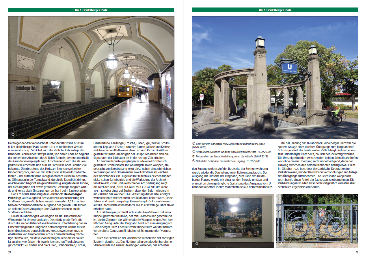
The Heidelberger Platz was an additional specialty, because the very deep route of the Ringbahn (in a sunken aisle) had to be tunnelled 'even deeper'. Therefore, on the other side of the Ringbahn crossing, there was especially the opportunity here to use the 'remaining' large space between the height of the car and the surface of the earth and to make the station even more splendid than the others on this line, namely cathedral-like with hall vaults and hanging lighted candelabra (in the literature the station is occasionally even compared with the magnificent underground stations of the Moscow Metro from the 1930s). In addition, outside the station, the tunnels were given a tunnel-vault-like profile in both directions up to a certain distance, as long as the depth below the surface allowed this (the purpose of this subway tunnel construction, which was rare in Berlin at the time, was to save large quantities of steel girders, which was other shaft construction were required everywhere).
Behind the Breitenbachplatz, the route reached the Dahlem domain. Due to the sparse development, the route could be built in an open cut. Since the platforms could not be decorated any further, the architects primarily focused on the individual design of the access building.
The additional route to Uhlandstrasse, which Charlottenburg had won in “negotiation poker”, only received one more station. The line branches off at Wittenbergplatz, runs parallel to the tracks of today's U1 as far as Breitscheidplatz and continues under Kurfürstendamm to Uhlandstraße underground station ; an extension to Halensee was planned . At the intersection with the newly built large-profile route G (now: Line U9), another station was added in 1961 with the Kurfürstendamm underground station , which received side platforms.
Both routes, both to Thielplatz and to Uhlandstrasse, were opened on October 12, 1913. Together they were about ten kilometers long. This was the last subway construction in Berlin before the First World War , which began on August 1, 1914. Only ten years later was an underground line to be reopened.
A free subway route


In the south of the Wilmersdorfer-Dahlemer-U-Bahn it didn't look very cheap for an extension. The Dahlem route has been unprofitable since it opened, from Breitenbachplatz there was even only a single car as a so-called “solo car” to the Thielplatz terminus.
Greater Berlin , which was unified in 1920, fought against a takeover of the route (including operating cost subsidies) demanded by the Prussian state or the Dahlem Commission - up to and including proceedings before the Reichsgericht . But in the following years the economic situation of the route improved considerably as the development increased. The Prussian state was finally able to hand over the route to the city on January 1, 1928 free of charge and free of debt.
At the same time, the Sommerfeld Group, which owned large areas still to be built on in the southwest of Berlin, offered free land and assumption of construction costs for an extension to Krumme Lanke. In fact, the city was given three kilometers of the subway.
The route should have the following stations, also located in the cut:
- Oskar-Helene-Heim
- Uncle Tom's Cabin
- Krumme Lanke (end point with upstream four-track workshop and storage hall)
This section went into operation on December 22, 1929. The underground station and the Onkel Toms Hütte settlement were named after a nearby pub of the same name (see: Riemeisterfenn ). The Krumme Lanke underground station received a very functional entrance building, which was one of Alfred Grenander's late works. The station forecourt has been named after him since June 6, 2009. Since the building was in disrepair in 1988, it had to be demolished. In 1989 a true-to-original replica was built. The terminus of today's line U3 is named after a nearby lake .
At the Krumme Lanke train station, a company workshop, a carriage hall with a workshop building, was built. However, in 1968 the workshop was closed due to a lack of capacity and necessary repairs were outsourced to the Grunewald workshop . In the years that followed, the depot was primarily used as a parking facility, where only occasional minor repairs such as changing the light source were carried out. After years of not investing in the maintenance of the hall, in 2014 it had to be closed due to dilapidation. The hall is a listed building .
Conversions
When building line G, today's U9 , a transfer station was to be created at the intersection of the two lines. However, since there was no station at the Spichernstrasse / Bundesallee intersection on today's U3 - then Line 2 - the Spichernstrasse underground station was created . The nearby Nürnberger Platz underground station was closed on July 1, 1959 and completely gutted. The area of the former central platform was converted into a double-track parking facility that is accessed from the Spichernstrasse underground station. However, the distance of 1106 meters between the Wittenbergplatz and Spichernstrasse stations was not acceptable for the inner city area , so the new Augsburger Strasse station was built. At both of the new small-profile stations, the aim was to keep interference with the existing substance as low as possible, which is why both stations were built with side platforms. They were opened on June 2, 1959 (Spichernstrasse) and May 8, 1961 (Augsburger Strasse). The architecture is based heavily on the Grenander model. The buildings were carried out in the functional style based on designs by the then underground architect Bruno Grimmek . Augsburger Strasse train station was designed with red-brown tiles, Spichernstrasse with light blue tiles.
The Thielplatz station received a second entrance building in 1981, which also houses a substation . This shortened the way to the campus of the FU Berlin .
Extension to Warschauer Strasse
On May 7, 2018, the U3 was extended to the east on the existing route used by the U1 to the terminus Warschauer Straße, which, among other things. a. It makes it easier for students to get to the Free University from there and brings them closer to the east from Nollendorfplatz. The extension of the route was favored by the fact that the new four-car trains of the IK18 series have been available since April 2018 .
Opening dates
- October 12, 1913: Wittenbergplatz - Thielplatz
- October 24, 1926: Wittenbergplatz - Nollendorfplatz (underground)
- December 22, 1929: Thielplatz - Krumme Lanke
- June 2, 1959: Spichernstrasse station opened; Simultaneous closure of the Nürnberger Platz train station
- May 8, 1961: Augsburger Strasse station
Route planning
|
|
|||||||||||||||||||||||||||||||||||||||||||||
|---|---|---|---|---|---|---|---|---|---|---|---|---|---|---|---|---|---|---|---|---|---|---|---|---|---|---|---|---|---|---|---|---|---|---|---|---|---|---|---|---|---|---|---|---|---|
|
|||||||||||||||||||||||||||||||||||||||||||||
| → See: Senate Department for Transport and Enterprises | |||||||||||||||||||||||||||||||||||||||||||||
For the U3 line, an extension is initially only expected to the south, although there are currently no concrete plans to implement it. Already in the early days it was planned to run the line to today 's Mexikoplatz S-Bahn station . In the 1920s and 1930s, an extension to the Machnower lock was planned. Partly taken up again after the war, this section is no longer included in the long-term route planning of the Senate Administration for Transport and Enterprises from 1995.
The BVG had made a cost-effective proposal for an extension, in which no parking and sweeping system would have had to be built at the terminus at Mexikoplatz . The single-track extension would cost around 20 million euros, 700 meters of the route would have to be rebuilt, and the shell of 200 meters has already been completed.
Timetable
| line | Mon - Fri (6:30 a.m. - 7:45 p.m.) |
Sa (5:30 a.m. - 10:30 p.m.) |
Sunday and public holidays (7:30 a.m. - 9:30 p.m.) |
Off-peak time (Mon-Thu 19: 45-21: 30) (Fri 19: 45-22: 30 pm) |
Off-peak time (Mon-Fri 4: 30-6: 30 pm) (Mon-Thu / Sun 21: 30-0: 30 pm) (Fri / Sat 22: 30-0: 30 pm) |
Night Fri / Sat and Sat / Sun as well as on the nights before public holidays (Fri / Sat 0: 30-5: 30 a.m. and Sat / Sun 0: 30-7 a.m.) |
|---|---|---|---|---|---|---|
| Warschauer Strasse ↔ Nollendorfplatz |
5 min | 10 min (from 10 a.m.) | 10 min (from 10 a.m.) | 10 min | no operation | no operation (until 10 a.m.) |
| Nollendorfplatz ↔ Krumme Lanke |
5 min | 10 min | 10 min | 10 min | 10 min | 15 minutes |
| On the nights from Friday to Saturday and Saturday to Sunday, the trains of the U3 line run every 15 minutes from 0:30 a.m. to around 4:30 a.m. between Nollendorfplatz and Krumme Lanke. On the other nights, the N3 night bus takes over the tasks of the U3 line. | ||||||
The planned U3
| Line Berlin U-Bahn large profile |
|||||||||||||||||||||||||||||||||||||||||||||||||||||||||||||||||||||||||||||||||
|---|---|---|---|---|---|---|---|---|---|---|---|---|---|---|---|---|---|---|---|---|---|---|---|---|---|---|---|---|---|---|---|---|---|---|---|---|---|---|---|---|---|---|---|---|---|---|---|---|---|---|---|---|---|---|---|---|---|---|---|---|---|---|---|---|---|---|---|---|---|---|---|---|---|---|---|---|---|---|---|---|---|
 | |||||||||||||||||||||||||||||||||||||||||||||||||||||||||||||||||||||||||||||||||
| Route length: | 31.8 km | ||||||||||||||||||||||||||||||||||||||||||||||||||||||||||||||||||||||||||||||||
| Gauge : | 1435 mm ( standard gauge ) | ||||||||||||||||||||||||||||||||||||||||||||||||||||||||||||||||||||||||||||||||
| Power system : | side busbar, painted below, 750 V = |
||||||||||||||||||||||||||||||||||||||||||||||||||||||||||||||||||||||||||||||||
|
|||||||||||||||||||||||||||||||||||||||||||||||||||||||||||||||||||||||||||||||||
In the planned destination network, it is planned that the U1 line will run from Wittenbergplatz to Krumme Lanke on the track described here. The western branch of the U1 between Wittenbergplatz and Uhlandstraße is to be extended as the new U3 by two stations to Adenauerplatz and converted into a large-profile line. East of Wittenbergplatz, this line is to be run from Alexanderplatz to Weissensee. The Kurfürstendamm underground station, which opened in 1961, was laid out during construction so that it can later be converted from a small to a large profile .
The construction of this line would relieve the Metrotram line M4 and the underground line U2 and increase the transport speed on this section. It has not yet been investigated whether this parallel alignment makes economic sense.
Since the urban development plan for transport was updated in 2003, the plans for the U3 are no longer part of the public transport development plan of the State of Berlin (measures up to 2015), and the line is no longer included in the public transport network priorities up to 2030. Nevertheless, the line in the variant from 1994 is still included in the state's current land use plan (status: end of 2009). For example, during the construction of the Rotes Rathaus station on the U5, the parking facility located below the station level will be built so that it can later be converted into a station on the U3.
Originally, this line was to be run under the name U10 from west of Alexanderplatz to Steglitz. However, this variant was discarded after 1993 in favor of this plan.
Advance payments
The plans for the construction of Line 3 had always become very specific, but ultimately they were not implemented. Therefore, there is a lot of preliminary work today .
- The Stadtmitte underground station of the U6, which opened in 1923, was arranged in the middle under the intersection of Leipziger Straße / Friedrichstraße, with the supporting pillars in the middle of the platform so that a cross-step to the Leipziger Straße underground could later be installed there. Therefore, it is also relatively far away from the U2 station, which opened in 1908, which is atypical for Berlin.

- During the construction of the platforms of today's U5 subway line in the Alexanderplatz (Al) station , two outer track troughs were built for the Weißenseer line in order to later enable transfers at the same level as the platform. Today, tracks have been laid in the troughs, some of which are used to park trains and for underground convertible trips. At the end of the 1960s, when Alexanderplatz was redesigned, the two tunnel nozzles in the direction of Weissensee were each supplemented by a shield chamber in order to enable two single-track tunnels to be driven quickly using the shield driving method. However, these plans later failed due to financial possibilities. Including the adjoining tunnel nozzles in both directions, the structure on Line F has lengths of 650 meters (in the direction of Weißensee) and 575 meters (in the direction of Potsdamer Platz).
- In the course of the renovation of the Mühlendamm Bridge from 1936, a 95-meter-long tunnel section was implemented as a storage building partly below the Spree bed. When, after the reunification of Berlin, the plans to build a subway became more concrete again, a shield drive was planned in the area of the Fischerinsel , which is why the now useless so-called “Mühlendamm tunnel” was backfilled in 1997.

- With the extension of underground line 7, extensive civil engineering work was carried out on Adenauerplatz in the 1970s . In addition to the underground line U7 running in north-south direction , a parallel road tunnel was built on Lewishamstrasse and Brandenburgische Strasse to pass under Kurfürstendamm without crossing. There is a spacious distribution level under the intersection with access to all four street corners. The road tunnel and the platform of the U7 (Ado) are below this level . The lower platform of the planned subway line U3 (Adu) is at right angles to this . This shell with a length of 104 meters is directly connected to the distribution level via a stairwell. In addition, a stair cross is structurally prepared for a direct transition from the U7 to the U3. Due to the favorable location at a later intersection of two underground lines, a converter plant was built under Adenauerplatz, which is designed to feed power to both underground lines.

- The expansion plans for the Berlin subway in the 1970s provided for a route beyond Adenauerplatz to Theodor-Heuss-Platz , where there would have been a connection to today's U2 subway line . In the course of this, an expanding 60 meter long tunnel section was built during the construction of the International Congress Center (ICC) on Messedamm. This is located below the Messedamm / Masurenallee intersection and would represent the eastern entrance to the Messedamm underground station, which was planned at the time. An extensive distribution level was arranged as an access structure between the street level and the underground tunnel, which can now be used as a pedestrian underpass. The station trumpet (widening the tunnel from the normal cross-section to the station width) is currently used as a warehouse.

- In the course of the new construction of the Potsdamer Platz regional train station, which opened in May 2006, the platform for the U3 line was also built. The side platforms separate the S-Bahn passerelle in an east-west direction. The connection is ensured via the lower-lying passerelle of the regional train station (shown in dark gray in the picture). At the western end of the northern platform, a direct transition to the also planned tram in the course of Potsdamer Straße has been structurally prepared. The plan approval section at the time still extends to the eastern end of Leipziger Platz, where it is planned to undercut the U2 underground line . This part was not carried out. Overall, the completed construction section is 392 meters long. The shell tunnel is occasionally used for event purposes.
- With the start of work to close the gap on the U5 underground line since 2010 from Alexanderplatz station to Brandenburger Tor station, another transfer station will be conceptually built with the Rotes Rathaus station. The subway line U3 is located on the lower level of the two-story building. Since the U3 is not expected to be implemented anytime soon, this level will initially be used as a four-track storage facility for U5 trains. A possible conversion to a later train station with side platforms will be considered structurally.
Web links
- Very detailed history of the Berlin subway
- Historical plans for the extension of the U3 line to Kleinmachnow
Individual evidence
- ↑ a b U3 runs from Dahlem to Warschauer Straße from May. In: Der Tagesspiegel . March 7, 2018, accessed March 17, 2018 .
- ↑ U3 - the Wilmersdorfer subway Wittenbergplatz - Breitenbachplatz. (No longer available online.) Archived from the original on March 21, 2008 ; Retrieved May 19, 2008 .
- ↑ http://www.robert-schwandl.de/berlin/u3/U3-78.png
- ^ Alfred Wedemeyer: The extension of the Berlin express train Thielplatz - Krumme Lanke. in: Deutsche Bauzeitung , 64th year 1930, supplement Stadt und Siedlung , No. 4, p. 25 ff.
- ↑ Berlin gets an Alfred-Grenander-Platz. Press and Information Department of the TU Berlin , October 12, 2009, accessed on December 30, 2009 .
- ↑ New direct route: U3 is to be extended to Friedrichshain. In: Berliner Zeitung. December 1, 2017, accessed March 20, 2018 .
- ↑ Senate Department for Transport and Enterprises, as of 1995
- ↑ Peter Neumann: CDU calls for closing gaps in the rapid transit network . In: Berliner Zeitung , April 24, 2007
- ↑ mobil2010 - Urban Development Plan Transport Berlin. ( Memento from December 27, 2010 in the Internet Archive ) Senate Department for Urban Development, 2003
- ↑ Current land use plan. Senate Department for Urban Development, 2009
- ↑ New construction of the U5 ( Memento from November 22, 2013 in the Internet Archive ) at construction-doku.info
- ↑ Definition of terms ( memento of October 8, 2013 in the Internet Archive ) (PDF) at BauNetz; accessed on February 1, 2014