| District
|
Identifier
|
Address
location
LOR / Kiez
|
shape
|
Depth to
year
|
Image, notes
|
| center
|
001
|
Schwartzkopffstraße vs.. 8
Location
Invalidenstrasse
|
New Krause
thick column (two-part)
|
04-7 m
|
The location (OSM-ID: 1210108226 ) is on the north corner of Schwartzkopff- with Pflugstraße on the edge of the sidewalk. The water outlet and handle are at right angles to the front yard of Pflugstrasse 1. During the trial pumping, a clear water jet was achieved in May 2018. The water drain goes directly to the paved area around the well body and from there to the road channel.
|
| Moabi
|
001
|
Arminiusstrasse 1
Location
Emdener Strasse
|
one-piece column (Z)
|
04-7 m
|
The fountain (OSM-ID: 940066698 ) is at the back of the Tiergarten town hall on the southern sidewalk between Bremer and Jonasstraße in the middle, opposite is the entrance to the Moabiter Zunfthalle ( Arminiusmarkthalle , Arminiusstraße 2). The pump water drains to the edge of the road. The outlet pipe is in a sleeve on the well stand , it has a horn-like hook on the pipe bend. The heavy body is a cylinder directly above the handle of the handle, the impact is dampened by a hard rubber plate screwed to the well body . The axis at the pivot point of the handle is secured against slipping out on both sides by screwed brackets .
|
| center
|
002
|
Scharnhorststraße 4b
Location
Charitéviertel
|
New Krause
thick column (two-part)
|
04-7 m
|
The fountain (OSM-ID: 1157197275 ) is in front of the residential block Am Pankepark on a triangle next to the children's playground, where a block of flats (3b, 3c) has now been built. The pump water drains onto the pavement slab. The entrance to the Invalidenfriedhof is to the southwest . The course of the Panke , known as the Südpanke since its resumption , lies 150 to the northeast. The Berlin-Spandauer Schifffahrtskanal is located 160 meters northwest.
|
| Moabi
|
002
|
Agricolastraße 10b
Location
Elberfelder Straße
|
Krause
|
03–4 m
|
The fountain (OSM-ID: 938653721 ) is in front of house 10b and was dismantled and overhauled in 2017/2018. In June 2018 the Krause fountain body was available again and it is also included in the BA list from 2018 (Agricolastraße 11). The body of the fountain is located on the edge of the south-eastern sidewalk, while the draining water runs directly onto the paved surface and exercises the curb on the channel of the asphalt roadway. The location is in the Spreebogen of the Westphalian Quarter and is 200 meters (Hansa-Ufwe) to the southeast and 300 meters (Wikinger-Ufer) to the northwest from the bank of the Spree. The post office 212, previously NW87, was located on the opposite property No. 23 / Levetzowstraße 11.
|
| Moabi
|
003
|
Zinzendorfstrasse 15
Location
Elberfelder Strasse
|
Borsig
hexagonal shaft
|
04-7 m
|
The fountain (OSM-ID: 938653725 ) is in front of the sports hall (No. 15) of the Miriam Makeba School. From the well location to Levetzowstraße (100 meters) the groundwater distance increases and to Alt-Moabit (100 meters) it decreases. The Borsigsäule has a flat cone at the top and the district coat of arms. A rectangular trough plate with a drainage channel to the roadway serves as a drain.
|
| center
|
003
|
Chausseestraße 33
position
Invalidenstraße
|
Lauchhammer type II
|
04-7 m
|
The street fountain (OSM-ID: 1600066927 ) in the Mitte district stands in front of the 2010 new commercial building (hotel construction TRYP Berlin-Mitte) at Chausseestraße 33 opposite the mouth of Habersaathstraße. It is a well casing from the Lauchhammer iron foundry from the late 1890s and is a listed building. With the dragon's head covering the water outlet for this street furniture designed by Otto Stahn, there is a type II model. The sides are also decorated with small dragons and on the upper end of the case are ribbons as decoration, and opposite the handle approach is a grim (ghost) face poured. The cylindrical and fluted fountain shaft is finished with a cone covered by (dragon) scales, which ends in a pine cone. The water outlet to the handle is 90 ° counterclockwise. Its drain falls into a soaking stone with a rectangular trough and inlet arch. The one is worked into a curb, the curved side of which faces the fountain, so that it runs straight to the street. During the on-site inspection in January 2018, use was prevented by a sheet metal band in the handle and around the shaft of the well.
|
| center
|
004
|
Zinnowitzer Straße 2
Location
Invalidenstraße
|
Lauchhammer Type I.
|
04-7 m
|
The street fountain (OSM-ID: 1433138032 ) with a fish head and spherical end cone with (symbolized water lily) leaves, which is listed as a historical monument, is a type I fountain from the Lauchhammer art and bell foundry based on a design by Otto Stahn . The location is in front of the new commercial building Zinnowitzer Straße 2 from the end of the 1990s (corner house with Chausseestraße 23). The emergency water well is 40 meters from the south-east corner of Chausseestrasse, opposite it is the gate passage Zinnowitzer Strasse 1, the entrance for number 2 offset by a few meters. The drainage of the pump water reaches the oval impregnation stone trough in a curb on the edge of the trees on Zinnowitzer Strasse lies. With its smooth side facing the road and the curved side facing the well, it is four widths of the small pavement from the edge of the curb of the road. The crown of the pine cone on the fountain is damaged and half broken off. The two shields on the upper wreath with the soaring frogs opposite the side of the handle are unlabeled. The oval cap with a tendril pattern on the base of the housing opposite the handle side, which is suitable as an access flap, can be screwed on.
|
| Moabit
|
004
|
Alt-Moabit vs. 84b
Location
Elberfelder Strasse
|
Schliephacke
Rümmler
|
02-3 m
|
The street fountain (OSM-ID:) is in the western part of the Kleiner Tiergarten on the way next to the Heilandskirche and thus opposite the house 84b, which borders the building above the subway entrance . The green painted fountain body stands on the unpaved edge on the path that extends next to the church of Alt-Moabit to Turmstrasse. The water runoff happens in the ground of the park.
|
| Moabi
|
005
|
Alt-Moabit vs. 100
Location
Thomasiusstrasse
|
Lauchhammer Type I.
|
04-7 m
|
The fountain (OSM-ID: 938653722 ) is located north on the roadside in front of the Kleiner Tiergarten . The location is next to a street tree on a sidewalk between the sloping-to-the-road parking areas. There is no separate street inlet, the water under the fish head flows parallel to the roadway onto the pavement. Two traffic signs, a post and, finally, the road tree provide protection against collision. The entrance to “Der Spreebogen” (as Alt-Moabit 100) with the commercial space is on the opposite side of the street. A special feature is the lettering KEIN TRINKWASSER cast on a metal block under the handle . The lettering "Schoening Berlin" and opposite in the triangle the "cS" and the year 1978 are cast on the upper shield surfaces.
|
| center
|
005
|
Brunnenstrasse 36
position
Arkonaplatz
|
Lauchhammer type II
|
15-20 m
|
The fountain (OSM-ID: 1476098726 ) is on the parking lane on the eastern edge of the carriageway on the tree line in front of House 36, 65 meters from the exit of the Brunnenstrasse underground station. In 1945/1946 a British officer recorded the gathering of people at this well when drawing water. The Lauchhammer housing was repaired (at least) with the plate opposite the water outlet in the form of the dragon's head. The inscription "Lauchhammer-Pump Type I", the dates 1894 (original) and 1987 (renovated) and the iron casting company (VEB Kunstschmiede Berlin) are cast in here. Under the outlet pipe, the water flows into an oval soaking stone with a drainage channel on the roadside.
|
| Moabi
|
006
|
Bandelstrasse 37 (to) 38
Location
Lübecker Strasse
|
Lauchhammer Type I.
|
03–5 m
|
The fountain (OSM-ID: 940066721 ) is on the west side of the street and next to the property and the building of the Christ Embassy Church (Bandelstraße 40). The location is on a recessed area between the parking pockets on the roadside. At the foot of the fountain, the soaking stone is located between the small pavement. The year 1978 and the company of the reconstruction are recorded on the mirrors on the fountain head .
|
| center
|
006
|
Elisabethkirchstraße 21
Location
Invalidenstraße
|
Krause
|
5-7 m
|
The street fountain No. 6 is at the back of the St. Elisabeth Church (Invalidenstraße 3). The pump drains into an oval impregnation stone with an overflow channel to the mosaic pavement, which here is expanded as a parking bay but is blocked off by bollards. Elisabethkirchstraße leads from Invalidenstraße around the church and its outbuildings (number 21) to Ackerstraße. The fountain is across from Strelitzer Strasse, which flows north. In the BA list of 2018, Strelitzer Strasse is opposite. 1 noted as location.
|
| Moabi
|
007
|
Beusselstraße 8a
location
Zwinglistraße
|
Lauchhammer Type I.
|
02–2.5 m
|
The fountain (OSM-ID: 778710948 ) is in front of the house 8a and 15 meters opposite the confluence of Erasmusstrasse and 30 meters to the confluence of Zwinglistrasse. The handle is in the direction of the street, the water outlet to the roadway, the location in the edge of the street trees. It is 200 meters to the banks of the Spree on Kaiserin-Augusta-Allee.
|
| center
|
007
|
Kastanienallee 43
position
Arkonaplatz
|
Lauchhammer type II
|
15-20 m
|
The fountain (OSM-ID: 778710948 ) stands on the strip of trees between the sidewalk and the roadway. The fountain stands in front of a restaurant with road service right on the edge of the curbs, so the curved side of the impregnation stone with an oval hollow faces the road.
|
| Moabi
|
008
|
Birkenstrasse 71
Location
Lübecker Strasse
|
Schliephacke
Rümmler
|
04-7 m
|
Street fountain number 8 (OSM-ID: 940066692 ) in Moabit is on the strip of trees on Birkenstrasse, in front of the house at Birkenstrasse 71. The fountain is ten meters away from the acute-angled southeast corner of Wilsnacker Strasse. The pump, which is painted green throughout, stands parallel to the roadside between small pavement. The water drains over the curb into the street channel.
|
| center
|
008
|
Schlegelstraße 11
Location
Invalidenstraße
|
Krause
|
04-7 m
|
The fountain is in the Schlegelstraße at the intersection Eichendorffstraße on the southern sidewalk southwestern corner house before its edge stands the well is recorded as Eichendorffstraße 17th Diagonally across the intersection (northeast) is a playground with the “paddling pool at the Nordnahnhof” on an open area that was cleared from ruins and caused by war damage. There is no mention of the renovation in 1978 on the well body of the Krausepumpe, because of the arched curb as a drinking stone with a lateral outflow channel, this location could have existed since the 1900s. In 2008 there was a Lauchhammer fountain here.
|
| Moabi
|
009
|
Essener Straße 22
Location
Elberfelder Straße
|
one-piece column
Wolf 2
|
03–4 m
|
The fountain (OSM-ID: 938653723 ) is on the south side of Essener Straße, east of Bochumer Straße. According to the view in StreetView, there was still a Schliephack pump at this location until 2010, which has apparently since been replaced by a Wolf system. At the location there is an (oval) hollow stone in the curb with a drainage channel directly on the edge of the road. However, the water outlet at the pipe bend does not reach above this stone, and a change in the small paving can be seen around the well stand in the edge of the sidewalk. The handle moved and water flowed.
|
| center
|
009
|
Borsigstrasse 28
Location
Invalidenstrasse
|
Krause
|
04-7 m
|
The fountain (OSM-ID: 1161503001 ) is on the western edge of the road in front of the restaurant with front garden at corner house 28 / Tieckstraße 13. The water outlet ends above a drinking stone, the curved side of which extends to the road with a drainage channel, the fountain itself is in the pavement of the paving strip on the sidewalk.
|
| Moabi
|
010
|
Calvinstraße 9
Location
Thomasiusstraße
|
Schliephacke
Rümmler
|
04-7 m
|
The street fountain (OSM-ID: 938653713 ) is on the west side of Calvinstraße. The green-painted pump has the handle parallel to the sidewalk and the water outlet to the roadway. The drainage of pumped water falls into a drinking kerbstone with an oval trough , with the smooth side in the curb edge. The curved side facing the fountain is in the edge of the sidewalk.
|
| center
|
010
|
Torstraße (# 196) / corner Tucholskystraße
location
Invalidenstrasse
|
New Krause
thick column (two-part)
|
04-7 m
|
The street fountain (OSM-ID: 1389419229 ) is on Torstrasse south side at the corner of Tucholskystrasse. The six-storey prefabricated building is clearly marked “196”, but is addressed to Torstrasse 204 next to the corner building on Tucholskystraße 51. A metal sign facing the street contains the notice "No drinking water" in two languages. The location of the pump 20 meters from the street corner is with the round, half-open drain grate on a slightly raised concrete base. The area around it is cut out in the two-meter-wide hedge zone at the roadside, and the otherwise continuous low guardrail is interrupted accordingly.
|
| Tierg
|
011
|
Derfflingerstraße 5
Location
Lützowstraße
|
Borsig
hexagonal shaft
|
03–4 m
|
The Borsig column erected around 2012/2013 replaces the Schliephackebrunnen that was still in place in 2008. The well column was (probably) set up on the same base pipe, the same source bore. The water drainage continues via the pavement of the verge on the sidewalk and the curb for rainwater drainage . The stand on the western side of the street is on the corner near the French grammar school (Derfflingerstraße 6–11 site). The fountain is owned by the State of Berlin .
|
| center
|
011
|
Zehdenicker Straße 16
Location
Arkonaplatz
|
FSH-L
three-part column
|
07-10 m
|
The fountain is 100 meters from Weinbergsweg on the southern sidewalk, to be precise already in front of building number 17. The John Lennon High School with 70 meters of street frontage is a monument on this property . The residential building number 16 is also a listed building, as are other apartment buildings and facilities. According to the current FSH shape, the fountain column was set in the 1990s, the impregnation stone integrated in the curb as a water catchment under the outlet pipe suggests a previous one in historical form. The exit and handle stand parallel to the curb, the operational well is regularly pumped by the residents. The outlet is flanged to the neck of a long sleeve. The district border to Pankow is 200 meters to the east on Choriner Straße, Zehdenicker Straße continues there.
|
| Moabi
|
012
|
Dortmunder Straße 9a
Location
Elberfelder Straße
|
Krause
|
04-7 m
|
The fountain (OSM-ID: 938653719 ) is located east of the mouth of the Dortmunder from Elberfelder Straße on the strip of trees on the sidewalk. The outlet facing the road ends over a kerbstone slab with an inflow recess and drainage channel, shaped straight into the street channel.
|
| center
|
012
|
Linienstraße opposite. 133
Location
Oranienburger Strasse
|
Krause
|
03–4 m
|
The fountain (OSM-ID: 960944165 ) is in the course of Linienstraße in front of residential building 133. To Oranienburger Straße, the front of the house forms a triangular square with the tip to the west of Friedrichstraße, the pump is on this sidewalk area. The well is located directly on the curb and drains into an adjacent round street inlet. At this point there was a box fountain on the "weekly market at the Oranienburger Tor" before 1890.
|
| Moabi
|
013
|
Emdener Straße 32
Location
Emdener Straße
|
one-piece column
Wolf 2
|
5-7 m
|
The fountain (OSM-ID: 940066701 ) is in front of the corner house at Emdener Straße 32 (south-west corner of Siemensstraße), on a paved area that limits the traffic area in front of the curb on the actual pavement. There is a wholesale market across Siemensstrasse. In 2008 there was a handle pump from the Neue Krause series (thick two-part column) with an outlet and hand lever parallel to the road and about 25 meters further into Emdener Strasse, but on the same side of the street (house number 33).
|
| center
|
013
|
Koppenplatz 13
Location
Oranienburger Strasse
|
Krause
|
04-7 m
|
The street fountain (OSM-ID: 833111836 ) is in front of the pharmacy at Am Koppenplatz . The water drain drains into a rectangular watering kerbstone and via an overflow groove directly over the kerbstone. The sign "No drinking water" is on the pump body on the side of the pump handle.
|
| Moabi
|
014th
|
Emdener Straße 9
Location
Emdener Straße
|
Lauchhammer type II
|
04-7 m
|
The street fountain no.14 (OSM-ID: 940066697 ) is in the Emdener Straße and Waldenserstraße in Moabit. With a dragon head as a water outlet and the closing cone with dragon scales , it is marked as a Lauchhammer fountain type II. The handle lies parallel to the sidewalk on Waldenserstraße, the outlet falls across it into an oval drinking stone that drains into the gutter. The overflowing water emerges from the channel and flows into the street drainage. There is no separate drain grate. The narrowed width as a residential street was used for parking bays, in the width of which the pump stands on the mosaic pavement.
|
| center
|
014th
|
Alte Schönhauser Strasse opposite. 7/8
location
Oranienburger Strasse
|
New Krause
thick column (two-part)
|
04-7 m
|
The fountain is on the western edge of Schendelpark and thus on the eastern sidewalk of Alten Schönhauser Strasse (plot 54). The park between Alter Schönhauser, Linien-, Max-Beer-Straße (formerly Dragoner Straße ) and Schendelgasse was built on properties whose buildings were destroyed in the Second World War. The well body is close to the curb parallel to this. The street inlet is embedded in the small paving strip under the outlet pipe. There is no notice “No drinking water” on the fountain, but several (advertising) stickers are attached.
|
| Moabi
|
015th
|
Erasmusstraße 15
Location
Beusselkiez
|
Freyer
column with head attachment
|
02-3 m
|
The fountain (OSM-ID: 940066727 ) is located on the southern side of the street, offset from residential building 16 and at the entrance to the neighboring commercial property, especially the Reo Elektronik company (Erasmustraße 14). The location is 60 meters from the more western Reuchlinstrasse. The water drains off via the small plaster.
|
| center
|
015th
|
Reichstagufer (# 9) before Wilhelmstrasse 67a
located
under the North Linden
|
New Krause
thick column (two-part)
|
04-7 m
|
The fountain (OSM-ID: 1859228114 ) is on the Reichstagufer 40 meters east of the Marschallbrücke in front of the building of the ARD capital studio at Wilhelmstraße 67a. The Spree is at this point (canalised) on the bank of the Reichstag opposite the ARD building. The water drains off via the small pavement on the sidewalk.
|
| Moabi
|
016
|
Eyke-von-Repkow-Platz opposite. 2 Elberfelder Strasse
location
|
Schliephacke
Rümmler
|
03–4 m
|
The fountain (OSM-ID: 938653716 ) is on the north-eastern part of the park between Wullenweber- and Till-Wardenberg-Straße, across from house number 2. The house Christophorus is owned by the association Gemeinschaftshilfe und Altersheim-Berlin e. V. operated.
|
| center
|
016
|
Keibelstraße before 37
position
Alexander space quarter
|
Krause
|
04-7 m
|
In Keibelstrasse, the fountain is on the eastern sidewalk of Keibelstrasse 15 meters from the Wadzeckstrasse intersection between the pavement slabs. The drainage from the pipe, which is parallel to the course of the road opposite the handle, takes place without separate equipment via these plates to the road channel. A rusty brown color indicates that the well is actively used. The police headquarters are located across Wadzeckstrasse (Police Section 32, Central Service Unit II, Keibelstrasse 36, plus Senate Department for Education, Youth and Science). The residential building (QP 71, ten-storey) number 37, built in 1970, connects to the fountain location, the entrance to which is from the courtyard. The new buildings at Alex-Wedding-Straße 1–7 (residential area on Alexanderplatz) across the intersection replaced the previous parking garage opposite the police headquarters in the mid-2010s.
|
| center
|
017th
|
Berolina- / Mollstraße
Location
Karl-Marx-Allee
|
New Krause
thick column (two-part)
|
04-7 m
|
The fountain is on the east side of Mollstrasse, which ends here with a branch from Berolinastrasse. The property at Berolinastraße 8 on this street corner belongs to the Charlotte-Pfeffer-Schule (previously Egon-Schulz-Oberschule, then Arno-Fuchs-Schule). The base plate of the fountain body stands together with the street inlet on a concrete pour between the pavement slabs. Until the city redesign (here in the mid-1960s, east of the Alex), Landsberger Strasse ran between Alexanderplatz and Büschingplatz , it crossed the street north of the fountain and the school grounds. The (undeveloped) green area to the west of the fountain is a remnant of the old street layout. Reference to Google Earth Pro: Keyword: Schwengel Pump, Berolinastraße, Berlin. The fountain was (probably) set in the 1990s.
|
| Hansa
|
017th
|
Flensburger Straße 2
location
Hansaviertel
|
Closing hoe
|
03–4 m
|
The fountain (OSM-ID: 938653717 ) is on Flensburger Strasse opposite the Stadtbahnbogen 415. The location on the north side of the street is in the middle between Claudiusstrasse and Bartningallee, on the latter is the Berlin Bellevue train station . It is 160 meters to the Spree on the Holsteiner Ufer (Moabiter Bridge). The Bellevue S-Bahn station is not far from the fountain on Bartningallee . The drain of the pump flows over the small plaster without further equipment. The handle and the opposite outlet pipe are parallel to the roadway.
|
| Moabi
|
018th
|
Huttenstrasse 26
Location
Huttenkiez
|
FSH-L
three-part column
|
04-7 m
|
The fountain (OSM-ID: 940066695 ) is on the roadside in front of the residential building 26a / 26b on the eastern corner of Ufnaustraße. The fountain stands between two street trees on the widened sidewalk. A Charlottenburg platter lies under the exit. The water pipe is screwed onto the neck of the long cuff. At this point a Lauchhammer fountain type II was still standing on the curb of the wide sidewalk in October 2009.
|
| center
|
018th
|
Schillingstrasse (Magazinstrasse)
Location
Karl-Marx-Allee
|
FSH-L
three-part column
|
03–4 m
|
The fountain stands on the edge of the eastern sidewalk of Schillingstrasse between the curb and the raised bed in the course of the tree line. The street serves as parking across the road. The location is opposite the confluence of Magazinstrasse (State Police Administration Office, number 5). There is an outpatient clinic on the side of the fountain in the adjacent Schillingstraße 12. The foot flange of the fountain with the frost valve is screwed onto the pipe base via an intermediate ring. The water outlet on the longer sleeve is opposite the handle, under this the separate street inlet. The buildings on Magazinstrasse were re-used in the 1950s after war damage had been repaired. The development on Schillingstrasse was created in connection with the construction of Stalinallee . Before the restructuring, the location of the fountain was on the southeast corner of Schillingstrasse and Blankenfeldstrasse, with total damage to the pre-war buildings in 1945.
|
| center
|
019th
|
New Blumenstrasse opposite. 1
location
Karl-Marx-Allee
|
New Krause
thick column (two-part)
|
03–4 m
|
The fountain is on the northwest corner of Neue Blumenstrasse and Singerstrasse on the western edge of the sidewalk (street course with park rules: across the road) on a small green area in front of the front of the Singerstrasse 118 (-121) apartment block. The base plate of the fountain body is screwed together with the street inlet on a concrete rectangle between the pavement slabs. As in the Friedrichshain-Kreuzberg district, a bilingual reference to "No drinking water" is attached to this well body above the thick pipe section. The fountain was (probably) set up around 2000. During the post-war development in the 1950s ( Stalinallee , southeast of Alex), the old course of Blumenstrasse was abandoned, so the location is on the original north side of Blumenstrasse on the (repealed) rear lot number 88.
|
| center
|
020th
|
Ifflandstrasse opposite. 12
Location
Karl-Marx-Allee
|
one-piece column (Wed)
|
03–4 m
|
In the pre-war course (between Blumenstrasse and Wallnertheaterstrasse ), Ifflandstrasse was still preserved as a street course and was not influenced by the redesigns of the 1950s and 1970s. School buildings (Ifflandstrasse 9/11) from 1910 are still standing, the other buildings are from 1960. The area on the west side of Ifflandstrasse (south of the residential block 1-4) was initially ignored in terms of urban planning up to the residential block Holzmarktstrasse 56-65, as a green area and Parking used. The fountain is on the west side of the southern end of the street where the parking lots were until the end of the 2010s. The fountain body as a one-piece wolf column has a water outlet that is reinforced with a steel strip from above and corresponds to the examples in Wedding . This is complemented by the diamond body on the handle of the handle, which leads to the triangular cover on the handle hook on a straight square rod. There is a square plate with a hollow underneath for the water drainage. The list took place (probably) in the mid-1990s. The “No drinking water” sign issued by the health department is bilingual. When the site was taken up in spring 2019, the aforementioned parking spaces were excavated for development. The building at Ifflandstrasse 12 across from the fountain was rebuilt in 2005 instead of the previous building and is used by “Casino Mitte” and the “Mosaik für handicapped” group.
|
| Moabi
|
020th
|
Jagowstraße 18
Location
Elberfelder Straße
|
Lauchhammer type II
|
03–4 m
|
The fountain (OSM-ID: 938653733 ) is on the side of the road in front of the old building at Jagowstraße 18. There is a soaking stone built into the curb with an oval trough and outflow channel for the water to run off. The pump has recently been restored and is (June 2018) in very nice condition. The location is between Alt-Moabit and Levetzowstraße.
|
| Weddg
|
020th
|
Willdenowstraße 21
Location
Sparrplatz
|
<degraded>
|
04-7 m
|
The wolf column with a diamond body on the handle (OSM-ID: 2225887779 ) stood between Lynarstrasse and Burgsdorfstrasse on the side of the road in front of house 21 on Willdenowstrasse. In March 2013, the pillar with a hollow plate was still on the paved edge of the sidewalk; this was also digitally recorded during the 2015 Senate inspection. In the first half of the 2010s it was dismantled without replacement, the well pipe was (probably) backfilled and closed. The location is indicated in the answer list to the House of Representatives inquiry with "Brunnen Willdenowstraße 20" (ZIP 13353).
The location is owned by the State of Berlin .
|
| Moabi
|
021st
|
Kaiserin-Augusta-Allee 16–24 Huttenkiez
location
|
Lauchhammer Type I.
|
03–4 m
|
Street fountain No. 21 (OSM-ID: 940066707 ) is located at Kaiserin-Augusta-Allee 16–24 in front of a new commercial building. The pump stands on a small paved area, which was required by the length of a car for parking across the street in Kaiserin-Augusta-Allee. The water outlet in the form of a fish's head is on the street side, without a drain grate, the pump water flows off over the curb. On the housing foot opposite the pump handle is an oval shaped access flap, the closure of which is in turn covered by a shell. A bilingual sign saying “No drinking water” is attached to the back.
|
| center
|
021st
|
Fischerinsel between 1 and 2
Location
Heine-Viertel West
|
New Krause
thick column (two-part)
|
03–4 m
|
Fischerinsel is the (new) neighborhood between the Spree and the Spree Canal east of Mühlendamm, as a street (historically: Roßstrasse) the connection between Breite Strasse / Mühlendamm and Neue Roßstrassebrücke (Neue Roßstrasse). The fountain is in the north between the two twin high-rise residential buildings 1 and 2 within a small park lane on the sidewalk between the houses. The base plate of the Neue Krause is flanged onto the base tube with four screws. Including the street inlet, this is applied to a concrete square. Residents put a tub on the street inlet, so a bird bath, for example, is possible. Schwengel and water ride are opposite each other, the note "No drinking water" is bilingual. To the east and on the edge of the access road there are parking spaces, separated from the fountain by bushes. After the historic plot of land 50 meters from the bank of the Spree (near the Mühlendammschleuse ), the location is between the existing high-rise residential buildings on the rear part of An der Fischerbrücke 4 in the area of the left rear building.
|
| center
|
022nd
|
Fischerinsel between 9 and 10
Location
Heine-Viertel West
|
New Krause
thick column (two-part)
|
04-7 m
|
Fischerinsel is the (new) neighborhood between the Spree and Spree Canal (Kupfergraben) east of Mühlendamm, as a street (historically: Roßstraße) the connection between Breite Straße / Mühlendamm and Neue Roßstraßebrücke (Neue Roßstraße). The fountain is in the south (between Getrauden- and Neue Gertraudenbrücke) between the two twin high-rise buildings 9 and 10 within a small park on the access road behind the Fischerinsel 11 swimming pool. The base plate of the Neue Krause is flanged to the base tube with four screws. Including the street inlet, this is applied to a concrete square raised about five centimeters. Swing and water ride are opposite each other parallel to the street, the note "No drinking water" is bilingual. According to the historic plot of land 45 meters from the Spree Canal, the location is between the existing residential high- rise buildings . Old buildings until around 1970 under Grünstraße 6 (formerly left wing number 6).
|
| Tierg
|
022nd
|
Keithstrasse 29
Location
Stülerstrasse
|
one-piece column
Wolf 2
|
04-7 m
|
The fountain is on the western sidewalk in the small pavement edge. The fountain has its own street inlet on the side at the foot flange. The wolf pillar has been here since at least 2017, in 2008 there was a fountain of the "Neue Krause" type in two parts and with the thicker lower shaft. According to the inspection, the location was (probably) moved 20 meters in the direction of Kurfürstenstraße and the street entrance was set for the expiry. Opposite the fountain is the state police headquarters (branch) as "LKA 1" in Keithstrasse 28/30. Incidentally, Kurfürstenstraße runs 75 meters to the south and the district boundary of Tempelhof-Schöneberg ( Schöneberg district ) is
on the southern edge of the road. |
| center
|
024
|
Anne Street betw. 2 and 3
position
Heine-quarter East
|
New Krause
thick column (two-part)
|
02-3 m
|
The fountain is to the east of the department store (Annenstrasse 4a, corner of Heinrich-Heine-Strasse ), apart between a system, next to a parking space for recycling bins for the surrounding residential buildings. The fountain was not operational in spring 2019, the bolt to the handle had slipped and the handle arm hung next to it, unusable, but still connected to the hook on the rod of the piston. The location is between the WBS 70/11 apartment block Annenstraße 2 (with 1) and the front of Annenstraße 3, the two apartment blocks, including the one facing Schmidstraße, were built in 1976 on a ruined site. The access road begins opposite the Old Lutheran Chapel (Annenstraße 53, next to it Heinrich-Heine-Platz, previously Kaiser-Franz-Grenadier-Platz ) The foot of the extended lower part of the fountain body and the street inlet are on a concrete slab, which is unfavorable for use next to a tree and directly at the fence of the recycling area. Depending on the location, the fountain was probably erected at the end of the 1960s. The sign "No drinking water" is not bilingual.
|
| Moabi
|
027
|
Lehrter Straße 55
Location
Stephankiez
|
Schliephacke
Rümmler
|
04-7 m
|
The Moabiter Brunnen 21 (OSM-ID: 940066704 ) is on Lehrter Straße. A smooth plate in the paving mosaic lies under the water outlet. The buildings diagonally opposite were cleared in favor of a playground (plot 31). 35 is the culture factory. The location is indicated in the answer list to the House of Representatives inquiry with "Brunnen Lehrter Straße 55" (ZIP code 10557).
The fountain is owned by the State of Berlin .
|
| Tierg
|
023
|
Kurfürstenstraße before 50 (parking)
position
Lützowstraße
|
Schliephacke
Rümmler
|
03–4 m
|
The fountain (OSM-ID: 2159605295 ) is on the side of the road in front of the parking lot on the Kurfürstenstraße 48/49/50 block. It stands with the road in the Tiergarten district, the opposite plots belong to the Tempelhof-Schöneberg district, Schöneberg district. It is 40 meters to the corner of Genthiner Straße. There is a plate under the outlet for the water drainage.
|
| center
|
023
|
Neue Jakobstrasse at 16
Lage
Heine-Viertel West
|
New Krause
thick column (two-part)
|
03–4 m
|
The fountain (OSM-ID: 4423944126 ) is located near Neue Jakobstraße 16 on the southeast corner with Annenstraße. The fountain stands on the green area next to the sidewalk in front of set-back residential buildings and it drains into a round street inlet.
|
| Tierg
|
024
|
Kurfürstenstraße 168
Location
Körnerstraße
|
Lauchhammer Type I.
|
02.5-3 m
|
The fountain (OSM-ID: 1296266106 ) is on the southern edge of Kurfürstenstraße and is still in the Mitte district, while the district boundary runs along the line of the southern development, which is already in the Schöneberg district . From the water runoff, the pavement towards the road is discolored rusty brown, two smooth slabs have (probably) replaced the impregnation stone.
|
| Moabi
|
025th
|
Krefelder Straße 6
Location
Elberfelder Straße
|
Schliephacke
Rümmler
|
03–4 m
|
The fountain (OSM-ID: 938653727 ) is on the west side of the street in front of the five-storey old building number 6, on the ground floor there is a restaurant with street service. The location is 30 meters from the northwest corner with Essener Straße. The pump carries a bicycle lock above the outlet unit (according to Rümmler) and the rest of a lock on the handle, the handle can be moved, but no water could be pumped, which can be explained by the condition of the plump according to Rümmler / Schliephacke. Next to the location there is a Charlottenburg plate under the water outlet.
|
| center
|
025th
|
Neue Jakobstraße 22
Location
Heine-Viertel West
|
Krause
|
03–4 m
|
The fountain (OSM-ID: 1237776912 ) is on the sidewalk strip to the rear of the apartment block on the south side of the street. The residential building at Neue Jakobstrasse 22 is located across the lawn, with the entrance on the opposite side. There is a parking lot across the street and diagonally across the intersection of the tax office Mitte / Tiergarten (Neue Jakobstraße 7).
|
| center
|
026th
|
Poststrasse 25
Location
Alexanderplatzviertel
|
Lauchhammer type II
|
04-7 m
|
The street fountain (OSM-ID: 1037675385 ) with a dragon's head as a water outlet and the closing cone with dragon scales is located in the Nikolaiviertel on the north corner of Post and Propststraße. From the pump location 7.5 m from residential building 25 (in front of the front garden and sidewalk), 40 m to the east (at an angle to the street grid) is the entrance to the Nikolaikirche, which is used as a museum. The handle for pumping groundwater close to the surface lies parallel to the sidewalk, the outflow of pumped water falls across it into a curb with an oval water trough. The curb is set with the straight edge facing the well and the curved side with the outlet facing the street. The overflowing water emerges from the channel and flows to the grate of the gully directly next to it into the street drainage. The Poststrasse, which was designed in a "historicizing" way in preparation for the 750th anniversary of Berlin, has a cobblestone pavement. The arched curb is accentuated with two rows of paving stones. Compare also the picture on Flickr (HEN-Magonza).
|
| Tierg
|
026th
|
Landgrafenstraße 7
position
Stülerstraße
|
thick column (one-piece)
new frill (old)
|
04-7 m
|
The fountain consists of a thick pipe section with a screwed-on water outlet. The upper part carries the handle and has a smaller diameter, both parts are firmly connected. The approach for the pivot of the lever is welded to the top tube. Two white dots on the lower part were (probably) jokingly attached, because they create a face with the outlet pipe as a nose. The embassies of Panama, Bolivia and Namibia are located adjacent to the crossing Wichmannstrasse (Wichmannstrasse 6). The surrounding land was destroyed as a result of the air raids and was cleared around 1950. The houses on Landgrafenstrasse were built between 1955 and 1957. The location is given in the answer list to the House of Representatives inquiry with "Brunnen Landgrafenstraße 7" (ZIP 10787).
The fountain is owned by the State of Berlin .
|
| center
|
027
|
Jacoby street behind one (parking)
position
Karl-Marx-Allee
|
New Krause
thick column (two-part)
|
04-7 m
|
The fountain (OSM-ID: 5212438897 ) is on the parking lot in Jacobystraße in front of the playground and so 40 meters behind Jacobystraße 1 and on the other hand 25 meters across from the house at Karl-Marx-Allee 10. The congress hall is across the parking lot . The fountain stands parallel to the footpath to houses Alexanderstraße 13-17. The process takes place via the round street inlet.
|
| center
|
028
|
Hannoversche Straße 15
Location
Charitéviertel
|
Lauchhammer type II
|
03–4 m
|
The water pump with a dragon head, conical end and ribbon ornament is in Hannoversche Straße 10 meters to the right (west) of the house entrance number 15 at the exit from building Luisenstraße 10, it is number 28. The water outlet of the fountain is opposite the handle and hits without catching on the granite sidewalk slab and the pavement on the curb. A note “No drinking water!” Is attached to the handle, the metal sign with a red border was attached with a metal band. The location is in the middle (40 meters each) between Luisenstrasse and Hessischer Strasse. The course of the Panke was on Hessische Strasse. The (south) panke , which was restored after the opening of the wall , flows through pipes in this area and emerges again at the previous bridge at houses 18, 19.
|
| Moabi
|
028
|
Levetzowstraße 26
Location
Elberfelder Straße
|
Lauchhammer type II
|
04-7 m
|
The fountain (OSM-ID: 938653720 ) is on the northern edge of the road in the middle in front of the sports hall of the Miriam-Makeba-Schule / Gotzkowsky-Schule, which is directly connected to the residential building number 25. The distance to the corner of Zinzendorfstrasse is 60 meters. The location is indicated in the answer list to the House of Representatives inquiry with "Brunnen Levetzowstraße 26" (ZIP 10555).
The fountain is owned by the State of Berlin .
|
| Moabi
|
029
|
Lübecker Straße 24
Location
Lübecker Straße
|
Krause
|
04-7 m
|
The street fountain (OSM-ID: 940066694 ) is located on the east side of Lübecker Straße in the middle (65 meters each) between Perleberger and Birkenstraße in front of post-war residential building number 24. The water drains via a steel plate and the curb. The size of the plate suggests that a potion stone was replaced before 2007.
|
| center
|
030th
|
Swinemünder Straße 10
Location
Arkonaplatz
|
Krause
|
15-20 m
|
The fountain (OSM-ID: 1485677294 ) is on Swinemünder Straße in front of the corner house number 10 / Granseer Straße 7 (northeast corner), and thus not far southeast of Arkonaplatz. In front of the Krausebrunnen there is a soaking stone in the curb with an inlet and outlet channel and the curved edge to the roadway.
|
| Moabi
|
030th
|
Helgoländer Ufer # 1 (playground)
Location
Thomasiusstraße
|
Krause
|
03–4 m
|
The “ Moabit 30 ” fountain (OSM-ID: 4372038390 ) is to the east of the railway bridge over the Spree. The foot of the fountain is marked with the year 1978 and the entry Berlin including the S-triangle (for Schoening). The water outlet is parallel to the sidewalk, the drainage takes place over the small pavement. Next to half a smooth slab between the foot of the well and the curb, a little tree had squeezed out, which would have disturbed the well shaft on the base pipe. The frost cock is accessible via the inspection shaft under the round plate . The location on the northern sidewalk of the beginning Lüneburger Straße is opposite the railway body, slightly diagonally to the southwest from the front of Spenerstraße 19, 40 meters west of the mouth of Spenerstraße. The canalised bank of the Spree is 40 meters beyond the (raised) urban railway line. "Brunnen Lüneburger Straße 30" (zip code 10557) is given in the answer list to the House of Representatives inquiry. The property at Lüneberger Straße 30 is located on the western corner of the Spenerstraße confluence and was built on in 1958 with the residential building Spenerstraße 19. The railway line is on the south side of the street and crosses the Spree 60 meters away.
The fountain is owned by the State of Berlin .
|
| center
|
031
|
Charlottenstrasse 23
Location
Leipziger Strasse
|
one-piece column
wolf
|
03–4 m
|
The fountain (OSM-ID: 1025685503 ) is on the east side of Charlottenstraße between Leipziger and Krausenstraße in front of the undeveloped green area on plot 23 (park between Krausen- / Charlotten- / Leipziger Straße (high-rise 40/41)). The wolf column stands in the edge of the eastern sidewalk on a paving mosaic, screwed a little higher on the base tube.
|
| Tierg
|
031
|
Lützowstraße 99
Location
Körnerstraße
|
Krause
|
02–2.5 m
|
The fountain (OSM-ID: 1739575804 ) is located on Lützowstrasse, southeast corner of Körnerstrasse. Opposite the parked vehicles across the road, the well is secured by a boulder . The drainage takes place directly on and over the small plaster.
|
| Tierg
|
032
|
Magdeburger Platz # 6
Location
Lützowstrasse
|
Lauchhammer Type I.
|
04-7 m
|
The fountain is on the northern sidewalk on the southeast corner of Magdeburger Platz at a distance of 15 meters from Kluckstrasse. The Berlin-Brandenburg State Labor Court and the Berlin Labor Court are located in the southwest corner of the square (house number 1) along Genthiner Straße. The corner house at Brunnenort is addressed at Kluckstraße 30. At the foot of the fountain is the watering curb, the curved side of which with the drainage channel points towards the roadway. The location is indicated in the answer list to the House of Representatives inquiry with "Brunnen Magdeburger Platz 6" (zip code 10785).
The fountain is owned by the State of Berlin .
|
| Moabi
|
033
|
Melanchthonstrasse 8
Location
Thomasiusstrasse
|
Lauchhammer Type I.
|
04-7 m
|
The fountain (OSM-ID: 938653724 ) is located between Spenerstrasse and Paulstrasse in Melanchthonstrasse at the entrance to the recessed house 8-10 and across from residential building 23. The water outlet is directed towards the roadway, the drainage is on the pavement and over the curb. The fountain was restored in 1978. The inscriptions cast into the upper shield on both sides of the pivot axis are “Schoening” and opposite “cS” in the triangle and the year 1978. The closable inspection flap is designed as a shell. The location is given in the answer list to the House of Representatives inquiry with "Brunnen Melanchthonstraße 5-7" (ZIP 10557).
The fountain is owned by the State of Berlin .
|
| Moabi
|
034
|
Oldenburger Straße 31
Location
Emdener Straße
|
Lauchhammer Type I.
|
04-7 m
|
The fountain (OSM-ID: 940066726 ) is between Wiclefstrasse and Siemensstrasse on the roadside of Oldenburger Strasse in front of house 31 near the Theodor-Heuss-Schule. The road width was reduced by traffic calming measures, whereby the fountain stands on a large paved area. The parking pockets across the road are separated by the location of the fountain, with a bench on one side and a tree on the other. The location is indicated in the answer list to the House of Representatives inquiry with "Brunnen Oldenburger Straße 31" (ZIP 10551).
The fountain is owned by the State of Berlin .
|
| Moabi
|
035
|
Pritzwalker Strasse opposite. 5
Location
Lübecker Strasse
|
Lauchhammer Type I.
|
03–4 m
|
The fountain (OSM-ID: 940066711 ) is on the west side of Pritzwalker Straße near house 16 with the passage to number 13. The installation of the fountain after 1978 in Moabit was connected with the traffic regulation in Moabit. The pedestrian area is between Turmstrasse and Dreysestrasse (84 meters each). The fountain stands within a semicircular mosaic paving , which was created on the gained area by reducing the width of the roadway . In front of the well is a semicircular collecting plate and the drainage of well water reaches the neighboring square inlet. On the mirrors on the fountain head there is no information about the year and the company of a reconstruction, which speaks for the original condition. The location is given in the answer list to the House of Representatives inquiry with "Brunnen Pritzwalker Straße 15-16" (ZIP 10559).
The fountain is owned by the State of Berlin .
|
| Tierg
|
036
|
Pohlstrasse 65
Location
Lützowstrasse
|
Krause
|
03–4 m
|
The fountain (OSM-ID: 738996195 ) is in Pohlstrasse in front of the corner house 65 on Potsdamer Strasse at a distance of 20 meters. The base of the fountain is attached to the base tube with four screws and stands on a small paving mosaic between the shaped stones on the edge of the wide southern sidewalk. The drain falls on the shaped stones. The inscription 1987 Berlin and the S symbol in the triangle are poured onto the fountain foot of the molded body below the water outlet, which speaks for a renovated Krause housing.
|
| Moabi
|
037
|
Quitzowstraße 139
Location
Stephankiez
|
Lauchhammer Type I.
|
04-7 m
|
The fountain is on the southern sidewalk in the tree line in front of the wall of the sports field (No. 139/140) of the Theodor-Heuss-Oberschule (grammar school, Stephanstraße 2; community school Quitzowstraße 141 and currently as community school Mitte). There is a discount market across from the fountain. The case is one of the specimens renovated in 1978 with the “Winkelhoff Berlin” logo on the mirror of the fountain head. The water outlet is towards the road, the drainage takes place over the curb. The location is indicated in the answer list to the House of Representatives inquiry with "Brunnen Quitzowstraße 137" (ZIP 10559). Until 1987 he stood in front of the playground at Quitzowstraße 137.
The fountain is owned by the State of Berlin .
|
| Moabi
|
038
|
Huttenstraße 5
position
Beusselkiez
|
Lauchhammer Type I.
|
02.5-3 m
|
The fountain (OSM-ID: 940066724 ) is on the corner of Hutten and Rostocker Strasse, on the side of the road in front of the corner house at Rostocker Strasse 1 and Huttenstrasse 5. To the curb are three rows of paving stones without impregnation stones. The signatures "Winkelhoff Berlin" and "1978" are cast on the two mirrors on the fountain head, which refers to the restoration of the case by the Winkelhoff company. This fountain body stood at Rostocker Straße 51 until 1987. The location is indicated in the answer list to the House of Representatives inquiry with "Brunnen Huttenstraße 5" (ZIP code 10553).
The fountain is owned by the State of Berlin .
|
| Moabi
|
039
|
Sickingenstrasse 13 Huttenkiez
location
|
Lauchhammer Type I.
|
04-7 m
|
The fountain (OSM-ID: 940066730 ) is opposite the confluence of Berlichingenstrasse in front of the Sickingenstrasse 9-13 industrial property. There are three rows of small pavement without impregnation stone from the fountain to the curb. The fountain housing was renovated in 1978, which is indicated by the cast markings "Winkelhoff Berlin" and the year "1978" on the mirrors on the fountain head. A drinking stone or a drainage plate is not on the fountain. The location is indicated in the answer list to the House of Representatives inquiry with "Brunnen Sickingenstrasse 7" (ZIP 10553), until 1988 it was still in front of Sickingenstrasse 5/7 across from Rostocker Strasse.
The fountain is owned by the State of Berlin .
|
| Moabi
|
040
|
Stendaler Straße 19
Location
Stephankiez
|
Lauchhammer Type I.
|
04-7 m
|
The fountain (OSM-ID: 940066689 ) is located on Stendaler Straße in the middle between Rathenower and Havelberger Straße on the roadside on the south side. The year "1978" and "Schoening Berlin" are entered on the fountain head and there is a plate with an oval drinking stone trough on the fountain. The location is given in the answer list to the House of Representatives inquiry with "Brunnen Stendaler Straße 18" (ZIP code 10559).
The fountain is owned by the State of Berlin .
|
| Moabi
|
041
|
Stephanstraße 52
Location
Stephankiez
|
one-piece column
wolf
|
04-7 m
|
The fountain (OSM-ID: 940066713 ) is located on Stephanstraße in the middle between Rathenower and Havelberger Straße on the roadside on the south side in front of houses 52 to 53. The Wolf 2 pillar replaces a previous hook at this point, also numbered 41. The water drains into a soaking stone in the curb, the curved side of which faces the sidewalk. This was already due to the Schliephacke fountain housing. The location is indicated in the answer list to the House of Representatives inquiry with "Brunnen Stephanstraße 53" (ZIP 10559).
The fountain is owned by the State of Berlin .
|
| Moabi
|
042
|
Stephanstraße 35
Location
Stephankiez
|
Freyer
column with head attachment
|
03–4 m
|
The fountain (OSM-ID: 3495483873 ) is on the roadside of Stephanstraße on the forecourt at the corner of Putlitzstraße. The handle approach at the upper end of the column is attached with a cranked extension. The fountain stands between two recycling bins; the Moa-Bogen shopping center is across the street. A low-rise kiosk (15 × 15 m²) for sales and food is located across the sidewalk at the location of the fountain. The Freyer fountain was already here in 2008. The location is in the answer list to the House of Representatives inquiry with “Brunnen Stephanstr. 35 "(postcode 10559). Previously, the fountain was 150 meters south of the building at Straßemstrasse 31.
The fountain is owned by the State of Berlin .
|
| Moabi
|
043
|
Unionstrasse opposite. 7
Location
Emdener Strasse
|
one-piece column
wolf
|
03–5 m
|
The fountain (OSM-ID: 940066709 ) is in the pedestrian zone on Unionstrasse near Unionplatz in front of the Tiergarten sports hall across from residential building 7. Marked from Bremerstrasse as a play street and a dead end, the fountain is on the northern sidewalk. The outgoing water flows over the paved area to the rainwater outlet. In October 2009, instead of the Wolf 2-pillar, there was a closing hoe at this point, which was replaced in the 2010s. The location is indicated in the answer list to the House of Representatives inquiry with "Brunnen Unionplatz" (zip code 10551).
The fountain is owned by the State of Berlin .
|
| Moabi
|
044
|
Waldstrasse (compared to 10)
Location
Emdener Strasse
|
Lauchhammer Type I.
|
03–4 m
|
The street fountain 44 (OSM-ID: 926945586 ) is on the corner of Waldstraße and Waldenserstraße. The fountain was repaired in 1978 by the Winkelhoff / Schoening iron foundry and the parts that needed it were replaced. The information can be found on the two shield surfaces at the height of the handle attachment. The location opposite the corner of Waldstrasse 10 on Waldenser Strasse. In the mid-1980s, a green and recreational area was created on the eastern lane of Waldstrasse. This means that the fountain stands on the former roadside of Waldstraße to the side of the playground Waldenserstraße 19 / Waldstraße 8/9. Next to a tree and a hedge, the emergency water well stands on a small paved area that was needed about the length of a car to park across the Waldenser Straße. The water outlet is on Waldenserstraße, without a drain grate, the pump water flows off over the curb. On the housing foot opposite the fish head outlet is an oval shaped access flap, the closure of which is in turn covered by a shell. The location is given in the answer list to the House of Representatives inquiry with “Brunnen Waldenser Straße 19” (ZIP code 10551).
The fountain is owned by the State of Berlin .
|
| Moabi
|
045
|
Werftstrasse opposite. 5a
Location
Lüneburger Strasse
|
FSH-L
three-part column
|
03–4 m
|
The fountain (OSM-ID: 938653732 ) is located near Gerhardtstrasse between two small green spaces on the eastern side of Werftstrasse. The FSH fountain on a fountain stand is located within a decorative area and (probably before the road renovation ) has a plate with a molded recess within the decorative border . This already existed in 2009, when there was still a Lauchhammer fountain of type 2 at this location, which was also centered in the border with road curbs. The location is indicated in the answer list to the House of Representatives inquiry with "Brunnen Werftstrasse 16" (ZIP 10557).
The fountain is owned by the State of Berlin .
|
| Moabi
|
046
|
Wiclefstraße 43 * 44
Location
Emdener Straße
|
Schliephacke
Rümmler
|
03–4 m
|
The fountain (OSM-ID: 926945723 ) is on the southern sidewalk in front of the open space between house 44 and corner house 43. A pump number is no longer recognizable. On the opposite northeast corner of Wiclefstrasse and Waldstrasse there is a children's playground "Am SOS Children's Village". Towards the road there is an impregnation stone inserted into the curbs on both sides of which there are concrete bollards to protect the fountain body. The parking regulations here are “across the direction of travel”, which means that a collision would be possible. The location is indicated in the answer list to the House of Representatives inquiry with "Brunnen Wiclefstraße 43" (ZIP 10551).
The fountain is owned by the State of Berlin .
|
| Moabi
|
047
|
Wiclefstraße 1
Location
Emdener Straße
|
Krause
|
03–4 m
|
The hand pump number 47 (OSM-ID: 940066720 ) is in front of the house entrance of the corner house Wiclefstraße 1 (Wilhelmshavener Straße 57), 20 meters from the north corner of the street confluence on Wilhelmshavener Straße. The fountain was located on the side of the road; by reducing the width of the street when creating parking bays, it came to the paved area in front of the parking lane. The water outlet is located away from the sidewalk, the handle 90 ° to the right. The drain is drained via the rainwater disposal . A chain on the picture from August 2007 indicates that the pump was (temporarily) unusable, on StreetView from October 2009 this is missing again and the pump was also usable in 2018. The raised inscription "1978 S // Berlin" is visible at the foot of the fountain stand, to the right is the inspection access. The pump number is handwritten. The location is given in the answer list to the House of Representatives inquiry with "Brunnen Wiclefstraße 69" (postcode 10551).
The fountain is owned by the State of Berlin .
|
| Moabi
|
048
|
Wilsnacker Straße (32 to 33)
Location
Stephankiez
|
Lauchhammer Type I.
|
04-7 m
|
The fountain (OSM-ID: 940066718 ) in Wilsnacker Straße is on the northern sidewalk, 50 meters north of Kruppstraße. At the edge of the roadway between the shaped stones, it is located directly on the curb with a collecting trough, the curved side of which is directed towards the roadway. The two mirrors on the head are unlabeled, the number of the fountain is stuck on. The location is indicated in the answer list to the House of Representatives inquiry with “Brunnen Wilsnacker Straße 33” (ZIP code 10559).
The fountain is owned by the State of Berlin .
|
| Moabi
|
049
|
Zwinglistraße 5a
Location
Zwinglistraße
|
<degraded>
|
02.5-3 m
|
The fountain (OSM ID: 940066691 ) was removed in the 2010s. Next to the site is the ZickZackZwingli playground (plot 6). The distance to Ottostraße is 120 meters to the east. The (obviously) closed and filled hole for the Schliephackebrunnen formerly on the roadside can still be seen. By reducing the width of the street, the footpath was extended at the height of the location by the width of the parking regulations across the road. The location is indicated in the answer list to the House of Representatives inquiry with "Brunnen Zwinglistraße 5" (ZIP 10555).
The fountain is owned by the State of Berlin .
|
| Moabi
|
050
|
Havelberger Straße 17
Location
Stephankiez
|
Krause
|
03–4 m
|
The fountain "Moabit 50" (OSM-ID: 940066700 ) is located in the Havelberger Strasse on the western sidewalk in front of the house entrance 17 to the corner house Quitzowstrasse 119 (OSM-ID: 940066700 ) . In front of the fountain there is a square plate with a round hollow as a catch. The location is given in the answer list to the House of Representatives inquiry with "Brunnen Havelberger Straße 17" (ZIP 10559).
The fountain is owned by the State of Berlin .
|
| Moabi
|
051
|
Quitzowstraße 104
Location
Emdener Straße
|
Lauchhammer Type I.
|
03–4 m
|
The fountain (OSM-ID: 940066717 ) is on the southern sidewalk of Quitzowstrasse at the corner house of Wilhelmshavener Strasse. The location directly on the curb determines the direction of the Fischkopfrohr to the cross street and the Schwengel goes to the footpath. The fountain stands on a square made of paving between the pavement slabs without a catch. The location of the fountain was previously 120 meters across from Quitzowstraße 72/73.
|
| Moabi
|
052
|
Thomasiusstraße (# 13)
Location
Thomasiusstraße
|
Krause
|
03–4 m
|
The fountain (OSM-ID: 938653714 ) is located at the sharp corner of Thomasiusstraße with the Helgoland bank 30 meters from the canalised bank of the Spree. The location is 10 meters in Thomasiusstraße with the handle and outlet pipe parallel, it is in the row of houses on the Heligoland shore. The drain falls into a rectangular drip tray, and one of which runs over the curb to the street channel.
|
| Tierg
|
053
|
Genthiner Straße 3
Location
Lützowstraße
|
one-piece column
wolf
|
04-7 m
|
The fountain column (Wolf 2) is on the eastern sidewalk south of the Lützowufer and 65 from the (canalised) Spreeufer. The water outlet and handle are parallel to the road, so the drain falls onto the small pavement. It should be noted that the drainage pavement forms a smaller square within the irregular pavement of the installation area, which in turn is paved differently from the pavement edge strip between the sidewalk slabs and the curb. The location is indicated in the answer list to the House of Representatives inquiry with "Brunnen Genthiner Straße 3" (ZIP 10785). For 2008, a two-part well column (behind the site fence, also marked with 53) with a thicker down tube can be seen.
The fountain is owned by the State of Berlin .
|
| Tierg
|
054
|
Burggrafenstraße 16
Location
Stülerstraße
|
one-piece column
wolf
|
03–4 m
|
The fountain (OSM-ID: 1876600068 ) is located on the southern sidewalk 75 meters from Wichmannstraße. The Franziskus Hospital is on the opposite side of the street (House 1/2, Wichmannstrasse 13, 14-16, Budapester Strasse 15/19). The base of the well, which is fastened to the base pipe with eight screws, has access to the “frost tap”. Next to the wolf pillar is the round street inlet for the drain. One meter from the curb are the inlet and the fountain base in the row of street trees.
|
| Tierg
|
055
|
Lützowstraße 24
Location
Lützowstraße
|
thick column (one-piece)
new frill (old)
|
02-3 m
|
The fountain is on the north side of Lützowstrasse about 40 meters west of the Potsdamer Strasse intersection. The fountain body consists of a thick column tube, the lower part of which has a larger circumference than the upper. The tapering point is halfway up. The water outlet is three quarters of the height of the lower pipe and faces the road. It is noticeable that the upper section of the column is almost twice as thick as the tubes of the Wolf columns. Opposite the exit, the handle is attached to the attachment at the top of the body, the pivot is at the outer point of the rounded triangle. An underground car park entrance is located next to the site and has a rough paving the width of a parking lane. At the fountain this width is continued with small paving, there are two bollards to prevent accidental approach of the fountain . The drainage of the pumped water reaches the street drainage via the small paving. The building next to the fountain belongs to the Elisabeth Hospital (Evangelical Elisabeth Clinic Berlin-Tiergarten Lützowstraße 24-26). The distance to the Landwehr Canal is 300 meters to the north. The Kulturforum and the Potsdamer Platz square, built after the fall of the Berlin Wall, are located above this.
|
| Moabi
|
056
|
Wittstock Straße 2
position
Beusselkiez
|
Lauchhammer Type I.
|
04-7 m
|
The fountain (OSM-ID: 1912183776 ) is on the northern sidewalk 40 meters west of Beusselstrasse. There is the Reformation Church at the corner of Wiclefstrasse (Beusselstrasse 35 and Wiclefstrasse 33-35). The water drains through the fish head onto the small pavement on the curb. At the head of the fountain, besides “1978”, the inscription also reads “Schoening Berlin” on the mirror opposite. The former location of this fountain body was Sybelstrasse / Droysenstrasse.
|
| Moabi
|
057
|
Paulstraße 6 * 7
Location
Thomasiusstraße
|
one-piece column
wolf
|
04-7 m
|
The fountain (OSM-ID: 938653728 , taken in 2010) is on the side of the road on the small pavement edge of the sidewalk, overflowing pump water flows over the curb. Obviously, the parking pockets were removed from the width of the sidewalk "parallel to the roadway". Behind the residential buildings on the western side of the street is Carl-von-Ossietzky-Park , Paulstraße south of Alt-Moabit to Melanchthonstraße. The Wolf2 pillar replaced (around 2012) a Schliephackebrunnen, which was still in the same place in 2008.
|
| Hansa
|
058
|
Klopstockstraße (# 19)
capable
Hansaviertel
|
Borsig
hexagonal shaft
|
04-7 m
|
The fountain (OSM-ID: 938653730 ) is on the northern sidewalk in front of the sloping apartment block 19–23 from the 1960s. In the 1950s, Cuxhavener Strasse ended here. Towards Hansaplatz there were still war-damaged houses and to the southeast the ruins had been cleared. The adjoining block was built according to designs by Luckhard and Hoffmann on the occasion of the " Interbau 1957 ". The fountain is in the line of trees, in front of it there is a wide walkway to the roadway. The Borsig pillar replaces a Schliephacke pump that was on the same groundwater well until the 2010s. The top of the column is a flat cone. The drain reaches a trough plate on the side of the foot, its channel to the roadway. The fountain bears the coat of arms of the Mitte district .
|
| Moabi
|
059
|
Klarenbachstrasse 10 Huttenkiez
location
|
FSH-L
three-part column
|
03–4 m
|
The fountain (OSM-ID: 940066729 , recorded 2010) consists of the fountain stand , the central cylinder with outlet pipe on a long sleeve and the attachment with handle, the pump is of type FSH-L. All parts - including the outlet - are screwed together. The foot of the fountain is set in on the base pipe in an elongated paving mosaic along the curb. The shaped stone area between the tree slabs is used for parking along the direction of travel, which could endanger the well. The canalised bank of the Spree (outside the Spreebogen) is 300 meters to the southwest, and 180 meters to the west to the Charlottenburg connecting canal . There is commercial space on the opposite side of the street. The "No drinking water" sign was on the well in 2008.
|
| Moabi
|
060
|
Lehrterstraße 66 (compared. 9)
able
Hutten neighborhood
|
one-piece column
wolf
|
03–5 m
|
The fountain (OSM-ID: 940066723 ) is on the southwest side of the street in front of the new building number 66 about 20 meters north of the bend on Seydlitzstraße. Opposite is the access road to the buildings Lehrter Straße 6–9. On its eastern side the former official cemetery at the historical park . The fountain stands in the line of trees on a small paving mosaic between pavement slabs with a round street inlet as a drain, creating a grassy vegetation. The water outlet of the Wolf column is screwed to the extension piece.
|
| Moabi
|
061
|
Wiclefstraße 65
Location
Emdener Straße
|
Lauchhammer Type I.
|
03–4 m
|
The fountain (OSM-ID: 940066706 ) in Wiclefstraße on the corner of Bremer Straße. He stands with the impregnation stone with an oval hollow on a paved surface on the sidewalk. The position of the impregnation stone refers to a roadway reduced by this width. The location is recorded in the answer list to the House of Representatives with "Brunnen Wiclefstraße 65" (ZIP 10551).
The fountain is owned by the State of Berlin .
|
| Moabi
|
062
|
Oldenburger Strasse at the corner of Waldenserstrasse (# 28)
Location
Emdener Strasse
|
Lauchhammer Type I.
|
03–4 m
|
The hand pump No. 62 (OSM-ID: 940066714 ) in Oldenburger Straße is on the fence of the front garden of St. Paulus Church in Moabit. The water outlet of the Lauchhammer fountain in the form of a fish's head faces the sidewalk, the handle faces the street. There is no separate drainage stone. The narrowed width as a residential street was used for parking bays, in the width of which the pump stands on the mosaic pavement. On the upper end of the shaft below the egg stick pattern is the year 1978 and opposite "SCHOENING" as the company that carried out the restoration. The location is given in the answer list to the House of Representatives inquiry with "Brunnen Waldenser Straße 28" (ZIP code 10551).
The fountain is owned by the State of Berlin .
|
| Moabi
|
063
|
Wilhelmshavener Straße 66
Location
Emdener Straße
|
Lauchhammer Type I.
|
03–4 m
|
The hand pump No. 63 (OSM-ID: 940066710 ) is in front of the corner house at Wilhelmshavener Straße 66 in Moabit. The fountain location is directly on the (southwest) street corner with Bugenhagenstrasse. The water outlet of the Lauchhammer fountain in the shape of a fish head is directed parallel to the sidewalk, the handle faces the street. There is no separate drain grate. When converting to a residential street, the gained width was used for parking bays, in the width of which the pump is next to the row of hedges. It is secured with a decorative railing against car collisions with Wilhelmshavener Strasse and Bugenhagenstrasse (directly) through the pedestrian crossing. On the upper end of the shaft below the egg stick pattern, the year 1978 is cast as an inscription and opposite “SCHOENING” as the company that carried out the restoration. The location is given in the answer list to the House of Representatives inquiry with “Brunnen Wilhelmshavener Straße 66” (ZIP code 10551).
The fountain is owned by the State of Berlin .
|
| Moabi
|
064
|
Wilhelmshavener Straße 22
Location
Emdener Straße
|
Lauchhammer Type I.
|
03–4 m
|
The street fountain (OSM-ID: 940066703 ) is in front of house number 22 on the east side of the street, 110 meters north of the confluence with Wiclefstraße . The location is on the large paving between the two sidewalk entrances (house 22 and entrance to house 21). The handle is directed towards the house and the water outlet at right angles to the right, the draining water runs over the paving to the rainwater grate on the side of the paved road. The company that carried out the restoration in 1978 is marked with "Schoening" on the upper decorative plate between the handle approach and the frog half-relief. "No drinking water". The location is indicated in the answer list to the House of Representatives inquiry with "Brunnen Wilhelmshavener Straße 23" (ZIP 10551).
The fountain is owned by the State of Berlin .
|
| Moabi
|
065
|
Bredowstraße 44
Location
Emdener Straße
|
Lauchhammer Type I.
|
03–4 m
|
The fountain stands in front of the western sidewalk on a separate area in the street space between two tree-lined hedges that reduce the cross-section of the street, which means that cross-parking vehicles are kept away. The inscription "Schoening Berlin" and 1978 on the fountain head refers to the installation of the renovated Lauchhammer. The fish head at the water outlet is opposite the handle parallel to the roadway, the water drainage is through the cobblestones. The street goes as a play street from the Heilandskirche on Turmstraße 120 meters north and 40 meters to Bugenhagenstraße as the next cross street. The location is indicated in the answer list to the House of Representatives inquiry with "Brunnen Bredowstraße 45" (ZIP code 10551).
|
| Moabi
|
066
|
Seydlitzstraße 17
Location
Zillesiedlung
|
Krause
|
04-7 m
|
The fountain (OSM-ID: 940066715 ) is on the edge of the Heinrich-Zille-Siedlung at the corner of Claire-Waldoff- and Seydlitzstraße on the edge of the southern sidewalk. The houses of the settlement between Seydlitz-, Lesser-Ury-, Invaliden- and Rathenower Straße including the school building on the south corner were built between 1977 and 1980. Opposite the fountain is the Moabiter Kinderhof (Seydltzstra0e 12), behind it the Fritz-Schloß-Park . The water outlet is directed towards the road and the curb, the handle at right angles to it parallel to the direction of the sidewalk. The drain goes through the small plaster. At the foot of the fountain, the reference to the renovation of the Krausepumpe in 1978 is noted with "1978 S Berlin".
|
| Tierg
|
067
|
Matthäikirchplatz # 13
Location
Northern Landwehr Canal
|
Krause
|
02-4 m
|
The fountain (OSM-ID: 944470512 ) is on Matthäikirchplatz east of the Matthäuskirche at the corner of Sigismundstrasse. The subsequent free space on Potsdamer Strasse was built on until it was destroyed in the war. The number of the Krause fountain with chalk on the dick painted, probably because the well was removed recently. The location is on a sloping sidewalk directly on the street corner. There is an oval soaking stone, from which the water flows sideways, with a rusty trail over the pavement. The cast at the base of the fountain "Berlin 1978" means that this housing from the existing building was renovated that year. In a picture from Pinterest, the fountain in 1960 is missing from a spaciously cleared area. The Neue Nationalgalerie is located across from the fountain .
|
| Tierg
|
068
|
Drakestrasse opposite. 1
location
Großer Tiergarten
|
Krause
|
02-4 m
|
The fountain (OSM-ID: 944470481 ) is located south of the corner of Thomas-Dehler-Straße house number 7 on the extended edge of the western sidewalk at the location. The location is between the southern edge of the zoo and the adjoining zoo to the west . The Spanish Embassy , at Drakestrasse 1 is the former Danish embassy. The impregnation stone is to the side of the well under the outlet pipe, the handle is opposite. At the foot under the water outlet it is marked with the “S symbol” (Schoening) and the year 1978, which in Tiergarten stands for renovated wells.
|
| Hansa
|
069
|
Bartningallee (# 12)
capable
Hansaviertel
|
Krause
|
03–4 m
|
The fountain (OSM-ID: 938653712 ) is 10 meters west of Hanseatenweg on a laid out piece of green space. The fountain body stands between two artificial stone bollards and has an impregnation stone with an oval trough without a channel. The year 1978 and the S in the triangle symbol on the octagonal base refer to the execution by Schoening. Until the mid-1950s, the installation area belonged to the property on Brückenallee 29, a multi-party apartment building that was destroyed in the war. The grounds of the Akademie der Künste are to the southeast , and the (canalised) banks of the Spree are 250 meters to the east. The surrounding buildings are from Interbau 1957 . The outbuilding to the fountain house number 12 was designed by the architect Otto Senn in 1956/1957.
|
| Hansa
|
070
|
Schleswiger Ufer opposite. 2
Location
Hansaviertel
|
Krause
|
02-3 m
|
The fountain (OSM-ID: 938653715 ) stands in front of the recessed corner house at Flotowstraße 6 on the paved square in the edge of the sidewalk. At the foot of the well, the rectangular trough plate is positioned across the drain with the channel, with the water running over the pavement to the curb. The handle, which is curved at the top, is made of straight steel with a ball on the handle. The foot of the fountain below the outlet is also marked with "Berlin 1978" and the S symbol. It is 30 meters to the Spree.
|
| Gesbr
|
083
|
Usedomer Straße 8
Location
Humboldthain Süd
|
Freyer
column with attachment
|
15-20 m
|
The fountain is one of the newly painted in green and has the round "profile disks" on the pivot pin and handle, typical of the Freyer columns. In front of the foot of the well is a broken plate for the drain that runs over the curb to the nearby street inlet. The fountain on the north-east corner of Wattstrasse is a little on Usedomer Strasse. The corner house is numbered as Usedomer Straße 8 / Wattstraße 8. It is already listed on the Sraubplan from 1910 and survived the war years. The location is given in the answer list to the House of Representatives inquiry with "Brunnen Usedomer Straße 8" (ZIP 13355).
The fountain is owned by the State of Berlin .
|
| Gesbr
|
085
|
Wolliner Strasse 26
Location
Brunnenstrasse
|
one-piece column (Z)
|
20-30 m
|
The fountain is painted gray, with the number 85 probably omitted. It consists of a smooth pipe, with a socket welded on for the outlet. At the end of the pivot bolt for the handle there is an inscription opposite the cover plate: LCTEO4 / ???. The straight handle bar ends in a cylinder for weighting above the handle. The fountain is on the east side of the street, neighboring is the Freie Schule am Mauerpark (Wolliner Straße 25/26). The Vinetaplatz is to the west, the fountain is at its southeast corner. The Mauerpark lies to the east behind the property ; the Berlin Wall then ran along the border with the Pankow district . The location is given in the answer list to the House of Representatives inquiry with "Brunnen Wolliner Straße 26" (ZIP 13355). The fountain is owned by the State of Berlin .
|
| Gesbr
|
087
|
Wriezener Strasse 31 / Soldiner Strasse
Location
Soldiner Strasse
|
Lauchhammer Type I.
|
03–4 m
|
The fountain (OSM-ID: 4665191193 ) is in front of the northwest corner house Wriezener Straße 31 / Soldiner Straße 16 on the western sidewalk into Wriezener Straße. There is a potion stone at the grassy foot of the well. The trough with the outflow channel is made in the curb, the curved side of which lies against the road. The location is indicated in the answer list to the House of Representatives inquiry with "Brunnen Wriezener Straße 31" (ZIP 13359).
The fountain is owned by the State of Berlin .
|
| Gesbr
|
088
|
Soldiner Strasse 68
Location
Soldiner Strasse
|
Lauchhammer Type I.
|
03–4 m
|
The Lauchhamer fountain has a simple sheet metal cone instead of the other head attachment. In 2008, this only consisted of a conical tin roof above the decorative wreath on the mirrors. The water outlet does not have the fish head as a cladding, but is a simple pipe. There is no inscription on the mirrors on the fountain head. It is 40 meters east of Koloniestraße on the southern sidewalk close to the curb. The impregnation stone is a curb with the curved side facing the road. The house behind it is number 68, close to the fire wall 67. The corner property on Koloniestraße was not built on until after 1987. The location was included in the list for printed matter 17/15418 with <Brunnen Soldiner Straße 68> (zip code 13359).
The fountain is owned by the State of Berlin .
|
| Gesbr
|
093
|
Ackerstraße (# 129)
Location
Humboldthain Süd
|
Lauchhammer Type I
original location
|
04–7 m
around 1897
|
The location is given in the answer list to the House of Representatives inquiry with <Brunnen Ackerstraße 129> (ZIP 10178). The fountain (OSM-ID: 3942971914 ) is on the southern strip of trees on Ackerstraße 10 meters east of Theodor-Heuss-Weg ( Ernst-Reuter-Siedlung ). The plot 129 corresponds to the well, the Theodor-Heuss-Weg flows over 128. The water outlet reaches the street drainage via the extended curb with oval trough and channel. The body of the fountain is not a Reco from 1987 (the name and the year are missing on the mirrors on the fountain head ), the fountain is in its original state. with a potion stone on the edge of the sidewalk stood in front of house 130 next to the front of Meyers Hof ().
The fountain is owned by the State of Berlin .
|
| Gesbr
|
096
|
Soldiner Strasse (# 1)
Location
Soldiner Strasse
|
one-piece column (Wed)
|
04-7 m
|
The fountain (OSM-ID: 3574287494 ) is on the corner of Soldiner and Grüntaler Straße. The fountain is painted gray. Marked as a Weddinger column by the diamond-shaped body on the handle and the reinforcement at the top of the outlet pipe. The fountain on the base pipe is close to the curb on the wide pavement edge on the sidewalk. The impregnation stone with trough and drainage channel is used as a curb with the curved side facing the road. The corner house at Grüntaler Strasse 68 was built around 1985 including the property at Soldiner Strasse 1. The location was included in the list for printed matter 17/15418 with <Brunnen Soldiner Straße 1> (zip code 13359).
The fountain is owned by the State of Berlin .
|
| Weddg
|
099
|
Tegeler Straße 34
Location
Sparrplatz
|
FSH-L
three-part column
|
04-7 m
|
The fountain (OSM-ID: 2211711535 ) in the corner of Tegel and Sprengelstraße. In July 2018 , the water outlet pipe was (probably) torn off or unscrewed by starting up. This was located on the short extension on the central tube of the FSH column. In its functional state, the pipe ended above an impregnation stone in the curb with a drainage channel and a curved side towards the roadway. The location is indicated in the answer list to the House of Representatives inquiry with “Brunnen Tegeler Straße 33” (zip code 13353).
The fountain is owned by the State of Berlin .
|
| Gesbr
|
102
|
Ackerstraße 69
Location
Humboldthain Süd
|
one-piece column (Wed)
|
10-15 m
|
The fountain column is painted gray and stands on a separate square of paving along the edge of the sidewalk. From the corner of Feldstrasse it is 30 meters along Ackerstrasse on the northeast side. Under the exit there is a soaking stone with an oval hollow. Note the diamond-shaped weighting body on the handle of the handle and the reinforcement on the outlet pipe. The location is given in the answer list to the House of Representatives inquiry with “Brunnen Ackerstraße 69” (zip code 13355).
The fountain is owned by the State of Berlin .
|
| Gesbr
|
107
|
Graunstraße 36
Location
Brunnenstraße
|
Freyer
column with head attachment
|
(-)
|
The fountain on the edge of the western sidewalk about 40 meters north of Lortzingstrasse. A little further on at Graunstraße 31 is the St. Afra church in the courtyard of the building complex of the St. Afra monastery. The location is indicated in the answer list to the House of Representatives inquiry with "Brunnen Graunstraße 35" (ZIP 13355).
The fountain is owned by the State of Berlin .
|
| Weddg
|
142
|
Nachtigalplatz 20
Location
Rehberge
|
Krause
|
04-7 m
|
The fountain in the Friedrich-Ebert-Siedlung stands on a piece of former footpath with its own street inlet. This higher area with the fountain foot on the pipe base was probably left with the establishment of parking lots across the roadway with shaped stones in the course of a traffic calming (around 1980). The Nachtigalplatz is criss-crossed by the African Street, the Petersallee is interrupted and on the northeast corner of the square there is the fountain. The KGA Togo is located behind the perimeter block development. The water drains directly into the square lock cover in front of the well foot. The growth of grass indicates an intact well. The location is indicated in the answer list to the House of Representatives inquiry with “Brunnen Nachtigalplatz 20” (zip code 13351).
The fountain is owned by the State of Berlin .
|
| Gesbr
|
147
|
Sternstrasse 2
Location
Soldiner Strasse
|
one-piece column (Wed)
|
02-3 m
|
The fountain is on the eastern sidewalk 20 meters north of Gottschalkstrasse. On the base pipe at the transition from the pavement edge (tree line) to the pavement slabs is the outlet pipe of the gray painted fountain column close to the curb, over which the water runs off. The column has a welded attachment for the outlet pipe, reinforced from above, consisting of a welded elbow and pipe. The pipe reinforcement has the bucket hook. The handle has a diamond body on the handle as a pumping aid. To the Panke reservoir (French basin) it is 200 meters to the west. The location is indicated in the answer list to the House of Representatives inquiry with "Brunnen Sternstraße 2" (ZIP 13359).
The fountain is owned by the State of Berlin .
|
| Weddg
|
150
|
Kameruner Straße 41
Location
Rehberge
|
Krause
|
03–4 m
|
The fountain stands on the molded stone edge of the south-eastern sidewalk. The plate with an oval trough for the drain is located between the curb and the foot of the well. At the octagonal base of the fountain, the number 22 is written below the water outlet. The Guinea Strait crosses 20 meters to the southwest. The well is intact. The location is already indicated in the answer list to the House of Representatives inquiry with "Brunnen Kameruner Straße 41" (ZIP 13351).
The fountain is owned by the State of Berlin .
|
| Weddg
|
152
|
Genter Straße 51a
Location
Westliche Müllerstraße
|
one-piece column (Z)
|
04-7 m
|
The fountain stands in front of the low-rise building 51a, behind which there is a smarthostel in the background piece (addressed as 53a). The fountain is located on the southwest side on the edge of the sidewalk (in the middle) between Brussels and Ostender Strasse. The water outlet sits in a welded-on sleeve of the fountain column, the heavy body is a cylinder above the handle, and on it is the hard rubber damper for the impact when it is pressed down. The cladding for the approach of the lever on the piston rod and the bracket whose axis of rotation is screwed on top of the continuous tube. The location is indicated in the answer list to the House of Representatives inquiry with "Brunnen Genter Straße 51a" (ZIP 13353).
The fountain is owned by the State of Berlin .
|
| Weddg
|
153
|
Otawistraße 17
Location
Rehberge
|
one-piece column (Wed)
|
03–5 m
|
The fountain (OSM-ID: 3668787210 ) stands in front of the middle, recessed residential building on Otawistraße between Lüderitz- and Togostraße on the south-eastern edge of the road. Between the foot of the well and the curb is the plate with an oval hollow and a drainage channel to the curb and the roadway. The water outlet is held lengthways by a reinforcement and the handle at right angles to it has a diamond body on the handle to assist with pumping. The location is indicated in the answer list to the House of Representatives inquiry with “Brunnen Otawistraße 17 opposite” (zip code 13351).
The fountain is owned by the State of Berlin .
|
| Weddg
|
160
|
Transvaalstrasse opposite. 6 Rehberge
location
|
Freyer
column with attachment
|
04-7 m
|
The fountain is located 30 meters in the Transvaalstraße from the Südecke with Lüderitzstraße in front of the sports fields (Togostraße 15). Opposite the fountain is the corner house Transvaalstrasse 6 / Lüderitzstrasse 55. The Freyer column stands on the edge of the sidewalk, there is a plate with an oval hollow at the foot of the fountain. This process is across the road, so the water flows over the main axis to the curb. The fountain number is hand-applied with paint in 2018. The location is indicated in the answer list to the House of Representatives inquiry with “Brunnen Transvaalstraße 6 opposite” (ZIP 13351).
The fountain is owned by the State of Berlin .
|
| Weddg
|
161
|
Antwerpener Strasse opposite. 5
Location
Westliche Müllerstrasse
|
Freyer
column with attachment
|
04-7 m
|
The fountain stands on the (southwest) edge of the median with the children's playground between the opposite houses 5 and 47. There is a plate with an oval hollow at the foot of the fountain facing the road. On the corner with Seestrasse, 100 meters from the fountain, is the Kapernaumkirche and behind the residential buildings on Lütticher Strasse is the Ernst-Schering-Schule (Lütticher Strasse 47) inside the Häuserkarree. At the top of the handle there is a raised reference to the Freyer well construction company. The location was included in the list for printed matter 17/15418 with <Brunnen Antwerpener Straße opposite 5> (zip code 13353).
The fountain is owned by the State of Berlin .
|
| Weddg
|
165
|
Lindower Straße 15
Location
Humboldthain Northwest
|
one-piece column (Wed)
|
04-7 m
|
At Nettelbeckplatz 30 meters to the southeast on the sidewalk of Lindower Straße is the gray painted fountain in Weddinger design. In addition to the metal bar that supports the outlet pipe from above, the rhombic body is part of the counterweight directly on the handle loop of the handle. Between the foot flange of the fountain placed on the base pipe and the kerbstone is the soaking stone with its oval trough and the drainage channel on the kerbstone. The edge strip of the sidewalk is covered with shaped stones directly for the casting on the flange . The adjacent property 15-17 was after war damage. Plots 15 and 16 were built on in 1962, number 17 around 1968. Reinickendorfer Strasse led to Nettelbeckplatz, as did Lindower and Rechtsstrasse; Pankstrasse ran through to the east. The new traffic routing of Reinickendorfer Strasse across cleared land at right angles to Pankstrasse and the bypassing of Richtstrasse to Pasewalker and Lindower Strasse as a dead end on the square took place in 1988. Cleared in the late 1940s and rebuilt in the early 1960s. The three-storey building number 15 faces the fountain with its closed outer front; the “Festsaal Maxim” is located in the house. The Wedding S-Bahn station on the nearby Ringbahn was closed in 1980 and moved from Nettelbeckplatz in the direction of Müllerstraße to reopen in 2002.
|
| Gesbr
|
170
|
Grenzstraße 20
Location
Humboldthain northwest
|
one-piece column (Wed)
|
04-7 m
|
The fountain has a reinforced water outlet on the smooth column with the bucket hook, which is stuck in a welded sleeve. There is a smooth slab under the spout between the foot of the well and the curb. The handle is attached across the tube with a rhombus-shaped weighting body. The location is on the broad pavement of the sidewalk in front of house number 20, close to 19. The Dorotheenstädtische Friedhof II is adjacent on the opposite side of the street. It is 60 meters to the south to the crossing elevated road. The upcoming residential development was built in the mid-1950s.
|
| Gesbr
|
178
|
Steegerstraße 63
Location
Soldiner Straße
|
Freyer
column with head attachment
|
02-3 m
|
The Freyer Column (OSM-ID: 1606564537 ) is located on Steegerstraße 200 meters south of Wollankstraße. The houses are located between the II. St. Elisabethfriedhof and the railway area north of the Nassen Dreieck, which is located on the Pankow site. The gray painted emergency water well on the molded stone edge of the sidewalk has a plate with an oval hollow between the foot of the well and the curb. The handle approach is provided with a reference to the Freyer company. The location is given in the answer list to the House of Representatives inquiry with "Brunnen Steeger Straße 63" (ZIP 13359).
The fountain is owned by the State of Berlin .
|
| Weddg
|
192
|
Togostraße opposite. 30
Location
Rehberge
|
one-piece column (corner)
|
04-7 m
|
The fountain is opposite house number 30 on the northeastern edge of the median in front of the hedge. This edge is used as a parking area for cars. Apparently for this reason the outlet on the column was torn off. At the gray painted fountain column, the water outlet was still complete with its reinforcement in 2008. At the foot of the fountain is the plate with an oval hollow with the main axis between the fountain and the street. The residential buildings on the street front are supplemented by further ones extending into the property (Togostraße 30a − d and African Straße 145–145d). The entire complex belongs to the Friedrich-Ebert-Siedlung , it was built in the mid-1930s. The location is indicated in the answer list to the House of Representatives inquiry with "Brunnen Togostraße 30" (ZIP 13351).
The fountain is owned by the State of Berlin .
|
| Weddg
|
193
|
Türkenstrasse 14
Location
Schillerpark
|
one-piece column (Wed)
|
04-7 m
|
The fountain is located on Türkenstrasse on the corner of Edinburgher Strasse opposite Schillerpark. The base tube ends below the paved sidewalk edge, with an insert plate with an oval hollow between the base of the well and the curb. Their drainage channel continues in the curb. The gray fountain column has the rhombus on the handle of the handle and the reinforced drainage pipe in the fixed socket. The Paul-Gerhardt-Stift is located inside the block on Barfußstraße . The location is given in the answer list to the House of Representatives inquiry with "Brunnen Türkenstrasse 14" (ZIP 13349).
The fountain is owned by the State of Berlin .
|
| Weddg
|
194
|
African road opposite. 143
Location
Rehberge
|
FSH-L
three-part column
|
04-7 m
|
The fountain is located in the Friedrich-Ebert-Siedlung on the median of the African street at the passage opposite the Usambarastraße. The water outlet is located on a long sleeve on the central cylinder. The lower part is the well stand for the FSH-L pump. The drainage takes place on the oval recess of the plate at the foot of the well to the curb.
|
| Weddg
|
195
|
Lüderitzstrasse opposite. 34
Location
Rehberge
|
Freyer
column with head attachment
|
04-7 m
|
The fountain is located on the south side of Lüderitzstraße on the (southeast) corner of Kongostraße, in front of the front of the apartment block Kongostraße 36-44. The opposite corner house is Kongostraße 46 / Lüderitzstraße 34. The development took place around 1960 on allotment areas. The Lüderitzstraße is the first southern parallel street of the Müllerstraße across the latter and continues the Türkenstraße. Opposite the apartment block there are sports fields (Togostraße 15) and the Anna-Lindh-Schule via Togostraße. At the foot of the fountain under the water outlet, there is a plate with an oval trough facing the curb for the drainage of pumped water to drain the street .
|
| Weddg
|
196
|
Senegal Straße 2
position
Rehberge
|
Freyer
column with attachment
|
04-7 m
|
The already green painted Freyer Fountain is 10 meters from the corner of Tangastraße on the park side of Senegalstraße. To the side at the foot of the well is the plate with an oval trough, the drainage channel of which directs the water over the sidewalk strip to the curb. The Goethepark is located along Senegalstrasse and St Paul-Kirchhof I on Tangastrasse.
|
| Weddg
|
197
|
Senegalstrasse opposite. 19
Location
Rehberge
|
Freyer
column with attachment
|
04-7 m
|
Fountain 197 is painted gray and is located at the west end of Senegalstrasse on the south side of the sidewalk at the edge of Goethepark , 15 meters to the west crosses Transvaalstrasse. The Rehberge Park lies to the west across this street . The plate with an oval hollow lies to the side at the base of the fountain . Their drainage channel directs the water over the sidewalk strip to the curb and, like the handle and water outlet, lies parallel to the roadway. The location is indicated in the answer list to the House of Representatives inquiry with “Brunnen Senegalstraße 20-21 opposite” (zip code 13351).
The fountain is owned by the State of Berlin .
|
| Weddg
|
198
|
Guineastrasse 24
Location
Rehberge
|
one-piece column (Wed)
|
04-7 m
|
In front of the six-story residential building, the street fountain is on the paving strip of the southern sidewalk. There is an oval trough between the foot of the well and the curb at the water outlet to drain off water. The column is gray. The Kongostraße begins 20 meters to the southeast as a footpath in the green area. Planned as Straße 24A between Afrikanischer and Müllerstraße, the section south of Guineastraße was omitted around 1970 with the residential development on colonial grounds. The connection to the Kongostraße north of the Guineastraße was allotment garden colony Waldesgrün and was attached to the school grounds when the school was built around 1960, but not devoloped. The Anna-Lindh-Schule is located on the opposite side of the street (number 17/18). The location is indicated in the answer list to the House of Representatives inquiry with “Brunnen Guineastraße 24-25” (ZIP 13351).
The fountain is owned by the State of Berlin .
|
| Weddg
|
199
|
Limburger Straße 7,
location
Humboldthain northwest
|
one-piece column (Wed)
|
04-7 m
|
In the Brussels neighborhood, the fountain (OSM-ID: 563960927 ) is opposite Haus Gauß (number 18) of the Beuth University of Technology . The distance to Amrumer Straße (across from Charité, Campus Virchow Klinikum ) is 70 meters and 130 meters to Lütticher Straße. The column has a reinforced water outlet and a diamond body on the handle of the handle. The oval trough for the drain is located between the foot of the well and the curb, the drainage channels facing the road. The location is indicated in the answer list to the House of Representatives inquiry with "Brunnen Limburger Straße 11" (ZIP 13353).
The fountain is owned by the State of Berlin .
|
| Gesbr
|
200
|
Uferstrasse 4
Location
Reinickendorfer Strasse
|
one-piece column (Wed)
|
1.5-2.5 m
|
The fountain (OSM-ID: 1151108203 ) is 100 meters on the north-western sidewalk to the south-east of the junction Bad-, Exerzier-, Schweden-, Koloniestraße . On the other side of the street are the Uferstudios , formerly the BVG main workshop. The fountain column has the reinforced water outlet, the diamond body on the handle and the oval trough at the base of the fountain directs the drain to the curb and the channel. The sidewalk is wide and around the fountain there is a paving mosaic in the paved sidewalk. The Panke is 50 meters behind the studios. The residential development was built before 1910, the adjoining studio buildings were a tram depot.
|
| Gesbr
|
201
|
Stettiner Straße 21
Location
Gesundbrunnen
|
Freyer
column with head attachment
|
03–4 m
|
The fountain is on the edge of the south-eastern sidewalk in front of the municipal daycare center . The water drains onto the pavement and without any further guidance over the curb. The location is given in the answer list to the House of Representatives inquiry with "Brunnen Stettiner Straße 22" (ZIP 13357).
The fountain is owned by the State of Berlin .
|
| Weddg
|
203
|
Armenian street opposite. 2
Location
Schillerpark
|
one-piece column (Wed)
|
04-7 m
|
The fountain column has the reinforced water outlet, the diamond body on the handle and the oval trough at the base of the fountain directs the drain to the curb and the channel. The fountain code on the green painted cylinder is painted white on the handle base. The base pipe with the screwed-on fountain body ends between the pavement and slabs of the sidewalk, the collecting trough is on the side with the main axis to the fountain, the drainage channel leads water over a few stones to the curb. The location is on the northwest sidewalk opposite the front of the apartment block 2–2b and 20 meters from Syrische Strasse, where there is a parking lot. The surrounding residential buildings were built in the mid-1950s on the grounds of the Nordpark allotment garden colony. The lake road runs 70 meters southeast.
|
| Weddg
|
204
|
Brienzer Straße 23
Location
Schillerpark
|
Freyer
column with head attachment
|
04-7 m
|
The fountain is on the southern sidewalk of Schwyzer Straße, slightly offset in front of the front of the house at Brienzer Straße 23, on the block along Brienzer Straße. The Brienzer Strasse intersection is 20 meters to the east, from where Waldersee-Schwyzer Strasse continues. Its street course and the northern Brienzer Straße are in the neighboring district, Reinickendorf. The community center diagonally southeast of the intersection still belongs to Wedding. The handle and water pipe are parallel to the road on the Freyer column, which is on the pavement on the pavement. On the side of the fountain is the oval trough for the drain, the water then flows away from the curb in the direction of the car parking spaces on the sidewalk. The column is still gray in 2018.
|
| Weddg
|
205
|
Brienzer Straße 6 * 8
position
Schiller Park
|
Freyer
column with head attachment
|
04-7 m
|
The fountain is painted green and at the foot there is a plate with a rectangular hollow under the water outlet. This is located opposite the Schwegel, both facing the sidewalk. The Freyer Column on the eastern sidewalk is in front of the green area with trees between the two apartment blocks 2–6 and 8–12. The Frauenfelder Weg is 70 meters to the north and the Ungarnstrasse 80 meters to the south. The green strip between the apartment blocks is the continuation of the Schiller Park to the east to Louise-Schröder-Platz . It is a remnant of the allotment garden colony Schillerhöhe, which was built on with the residential houses in the mid-1950s.
|
| Weddg
|
206
|
Schwyzer Straße 6
Location
Schillerpark
|
Borsig
hexagonal shaft
|
04-7 m
|
The Borsig fountain replaces a gray-blue column with a diamond body on the handle and reinforcement on the outlet pipe. The new fountain body has a pointed pyramid at the top. It stands on the same base tube. The oval recess in the plate under the outlet on the side of the fountain base remained unchanged during the replacement. The location is on the eastern sidewalk in front of the building of the Upper School Health Center I. Opposite is the residential building number 22 (a senior citizens' home). To the west, adjacent to Barfusstrasse, is the St Aloysius Church with parish halls (Schwyzer Strasse 2, 4). The Schillerpark extends to the south and west. The surrounding area was built on in 1950 with the Wedding youth hostel, adjacent to the allotment garden colony Sandtal and the Schillerpark colony. Around 1960 a retirement home was built (Barfusstraße 22/24) and Schwyzer Straße was extended. In 1975 the school was added.
|
| Weddg
|
208
|
Corker Strasse 35
Location
Schillerpark
|
one-piece column (corner)
|
04-7 m
|
The fountain in gray (2018) has an outlet screwed to the shaft, which, like the plate at the end of the column, has traces of rust. The paintwork seems to be older. The handle has a rhombic handle and there is a covered tube as an outlet. The emergency water pump is on Corker Strasse 15 meters from Dubliner Strasse on a paving mosaic. The KGA Freudental is located across Dubliner Straße. Until around 1955 the adjoining house was addressed as Corker Straße 11 / Dubliner Straße 68. The oval trough for the drain is located between the foot of the well and the curb. The location is given in the answer list to the House of Representatives inquiry with "Brunnen Corker Straße 35" (ZIP 13349).
The fountain is owned by the State of Berlin .
|
| Gesbr
|
209
|
Wolgaster Straße 9
Location
Brunnenstraße
|
Freyer
column with head attachment
|
20-30 m
|
The gray fountain is located on the edge of the eastern sidewalk 30 meters from Bernauer Straße . The road run still belongs to the district The federally financed system for the supply and protection of the population in crises and emergencies is therefore 60 meters from the Prenzlauer Berg district and already stood as the district boundary of the Berlin Wall (also tunnel 29 ) was marked. The 8/9/10 block of flats was built around 1960, the day care center opposite followed around 1980. Under the drain from the outlet pipe of the fountain is a plate with an oval trough to the side of the fountain base, the drainage takes place across the main axis to the curb and street channel.
|
| Gesbr
|
210
|
Wattstrasse 25
Location
Humboldthain Süd
|
one-piece column (Z)
|
10-15 m
|
The fountain is in Wattstrasse on the corner of Stralsunder Strasse. The handle is shut down with a metal band and its use is prevented. The base of the fountain is on a paving mosaic of the molded stone strip. The corner house at the fountain is addressed as Stralsunder Straße 26 and was still named Wattstraße 25 until the mid-1980s; Wattstrasse 21-24 also belongs to the bus depot (Berlin Transport division). The street running across Stralsunder Strasse is named Strelitzer Strasse: to the north the fountain is in Wattstrasse at the corner of Stralsunder Strasse. The handle is shut down with a metal band and its use is prevented. The base of the fountain is on a paving mosaic of the molded stone strip. The corner house at the fountain is addressed as Stralsunder Straße 26 and was still named Wattstraße 25 until the mid-1980s; In addition, Wattstrasse 21-24 belongs to the bus depot (Berlin Transport division). The street run across Stralsunder Strasse is named Strelitzer Strasse: to the north the Ernst Reuter School and on the south side the Gustav Falke School. The fountain body of the Wolfsäule is painted gray (for Wedding) and the handle and outlet are along the sidewalk. and on the south side the Gustav Falke School. The fountain body of the Wolfsäule is painted gray (for Wedding) and the handle and outlet are along the sidewalk. The oval drainage trough with the channel on the longitudinal axis to the curb is located at the flange-mounted well base.
|
| Gesbr
|
211
|
Hussitenstrasse opposite. 68
Location
Humboldthain Süd
|
one-piece column (Wed)
|
10-15 m
|
The fountain (OSM-ID: 2008772049 ) is 15 meters in Hussitenstraße from the mouth of Stralsunder Straße to the east in front of the residential building Stralsunder Straße 38/39, which is set back behind the green area. The location is on the northern sidewalk in the tree line. On the gray column of the fountain, the handle on the handle has a diamond-shaped heavy body, the water pipe is inserted into the socket on the shaft. The straight pipe section and the discharge elbow are reinforced from above, to which the bucket hook is also attached. The handle and exit are parallel to the sidewalk. The catchment underneath forms the oval hollow of the drainage channel in the minor axis to the curb and the neighboring rectangular street inlet.
|
| Gesbr
|
212
|
Hochstraße
location
Humboldthain northwest
|
Freyer
column with head attachment
|
04-7 m
|
The green Freyer Column (OSM-ID: 2217029272 ) is 10 meters into Hochstraße in front of the corner building on Richtstraße 9a, east of the intersection of Hochstraße and Richtstraße . The Pankelauf is reached 200 meters to the west ( Richtstraßenbrücke ). At the well is the water outlet to the roadway and across the handle. The drainage plate with an oval trough is located between the base of the well and the curb along the elevated road. The location is next to a street tree between shaped stones of the sidewalk. The original Lenzerer Platz in the southwest at the intersection was filled with a staggered eight-story residential building (Schönwalder Strasse 1-4, Neue Hochstrasse 30, senior citizen leisure center) in 1970, including the war-damaged buildings on the Panke.
|
| Weddg
|
215
|
Groninger road opposite 37
position
Leopoldsplatz
|
one-piece column (Z)
|
03–4 m
|
The fountain has a cylindrical body on the handle and the outlet pipe made of one piece is in the socket on the shaft, both in the direction of the sidewalk. The collecting trough at the base of the well is rectangular with the drainage channel on the shell side facing the roadway. It is located 50 meters from Seestrasse on the eastern sidewalk. The property behind it belongs to the Charité (Reinickendorfer Straße 61/62) house 8. The location is given in the answer list to the House of Representatives inquiry with “Brunnen Groninger Straße 37 opposite” (zip code 13347).
The fountain is owned by the State of Berlin .
|
| Gesbr
|
217
|
Soldiner Strasse 26
Location
Soldiner Strasse
|
Freyer
column with head attachment
|
03–4 m
|
The fountain is on the verge of the sidewalk near the curb. The collecting plate at the fountain foot has an oval recess and, like the handle and outlet, lies parallel to the roadway. It stands next to the bus waiting hall at the transition from the corner building at Prinzenallee 53 / Soldinerstraße 26 to house number 27. The Panke with the green corridor runs 170 meters to the west on Stockholmer Straße ( Soldiner Straße Bridge ) , which was divided when it was redesigned in the 1980s . While the corner house survived the air raids , the building opposite was rebuilt after it was cleared in the 1950s and around 1985. The six-storey house 27 between the two old buildings was built around 1975. The Stephanus Church stands across the Prinzenallee . The location is given in the answer list to the House of Representatives inquiry with "Brunnen Soldiner Straße 26" (ZIP 13359). The fountain is owned by the State of Berlin .
|
| Gesbr
|
218
|
Koloniestraße 7
Location
Reinickendorfer Straße
|
one-piece column (Wed)
|
03–4 m
|
The fountain consists of a continuous pipe screwed onto the base pipe with a round plate on top. A socket is attached, in which the outlet pipe sits with its reinforcement. A triangular extension is welded to the top of the tube, which carries the pivot point of the handle and covers and protects the connection to the piston rod, the handle is weighted with a diamond body. On the sidewalk on the side of the fountain foot there is an oval trough to catch the water that can flow to the curb via the main axis. In 2008 the now green painted fountain was still gray. The seven-story house 7 am Brunnen is on the east side of Koloniestrasse between Schwedenstrasse and Osloer Strasse and was built in the late 1980s. To the east, the Panke is 150 meters away.
|
| Gesbr
|
219
|
Wollankstrasse opposite. 75/76
Location
Soldiner Strasse
|
one-piece column (Wed)
|
10 m
|
The fountain column (OSM-ID: 1606564486 ) stands on the edge of the sidewalk on a paving mosaic . The water outlet is reinforced, the handle of the handle is weighted with a diamond body. Since the handle and the water outlet are perpendicular to each other, the oval collecting trough is located at the foot of the well. During road construction work, the installation of the well was tied to the base pipe and the borehole, so the drainage channel of the trough leads to the round street inlet within the paving mosaic, while the bike path and a sidewalk area on the parking lane lie to the roadway. The location of the fountain is on the northwestern sidewalk in front of the set-back block of flats built around 1965 (here house 51) with parking lot. It is 60 meters to the cemetery border from Kirchhof III of the French community (plot 50 is the access: main path). Behind it flows the Panke, 230 meters west of the fountain, with the Panke basin in between. The area in front of the cemetery (at that time property 44–53) was undeveloped until 1950 and after that it was (probably) used for allotment purposes for another 15 years. The French Cemetery II is located on the east side of Wollankstrasse behind the row of houses.
|
| Weddg
|
221
|
Maxstrasse opposite. 11
Location
Leopoldplatz
|
one-piece column (Wed)
|
03–4 m
|
The intake fountain is on the park side of Maxstrasse in front of the Leopoldplatz facility. The handle along the sidewalk has a diamond body as a counterweight and the outlet pipe is reinforced from above with a metal strip. Between the foot flange on the base pipe and the wide curb is the trough plate for collecting water, diverted via the channel on the transverse axis of the trough. The fountain column is still painted gray, which is characteristic of the Weddinger Plumpen.
|
| Weddg
|
222
|
Lüderitzstraße 2
Location
Rehberge
|
Freyer
column with head attachment
|
04-7 m
|
The gray fountain column stands on the edge of the sidewalk in front of the corner house Seestraße 98 / Lüderitzstraße 2 on Lüderitzstraße. In the edge strip under the water outlet is the collecting plate with an oval recess. Their outflow channel is parallel to the roadway, so the water flows over the pavement to the street channel.
|
| Gesbr
|
223
|
Court street opposite. 17
Location
Humboldthain northwest
|
one-piece column (Wed)
|
04-7 m
|
The fountain (OSM-ID: 1157194701 ) is located west of the Pankelauf in the southeast of the Richtstraßenbrücke on Schönwalder Straße. The location is given in the answer list to the House of Representatives inquiry with “Brunnengerichtstrasse 17 opposite” (zip code 13347).
The fountain is owned by the State of Berlin .
|
| Gesbr
|
224
|
Bastianstrasse opposite. 11
Location
Humboldthain northwest
|
Borsig
hexagonal shaft
|
04-7 m
|
The fountain is on the south-eastern sidewalk in front of the wall of the commercial property (Autowerkstatt Bastiantraße 17). The distance to the south to Böttgerstrasse is 70 meters, there is the Diesterweg school . The Borsigbrunnen from the end of the 2010s replaces the predecessor of a Rümmler pump (Schliephackebrunnen). The fountain was placed on the existing base pipe that ends in the tree line and so the fountain flange lies between the pavement slab and the pavement edge, in the latter the square catchment plate for the well water lies under the outlet. From their gutter, the water reaches the street drainage via some small pavement and the curb. The handle is to be operated along the sidewalk. The upper end of the column is a truncated conical cover.
|
| Gesbr
|
225
|
Hochstraße opposite. 18
Location
Humboldthain northwest
|
Freyer
column with head attachment
|
07-10 m
|
The fountain (OSM-ID: 3348503393 ) is in Hochstraße on the eastern edge of the sidewalk north of the Humboldthain S-Bahn station , 150 meters from Wiesenstraße. The Humboldthain lies across the tracks .
|
| Weddg
|
227
|
Transvaalstraße 34
Location
Rehberge
|
Freyer
column with head attachment
|
04-7 m
|
At the foot of the Freyer Column, the oval hollow lies directly against the curb of the southeastern sidewalk. The fountain on Transvaalstrasse between Guineastrasse and Togostrasse is in front of the green space between House 34 and 35. From there to the east is the Anna Lindh School property . The entire area in the square east of the Transvaalstrasse belonged to the allotment garden colony Waldesluft until the development around 1955. The location is indicated in the answer list to the House of Representatives inquiry with "Brunnen Transvaalstraße 34" (ZIP 13351).
The fountain is owned by the State of Berlin .
|
| Weddg
|
229
|
Lütticher Straße 48
Location
Westliche Müllerstraße
|
one-piece column (Wed)
|
03–4 m
|
The fountain is a column with a diamond weight on the handle and a reinforced outlet pipe. An oval trough is assigned to the drain on the side at the foot of the well, the drainage channel is in the direction of the sidewalk and the water runs over the edge strip to the curb. The fountain is on the northeast side of Lütticher Strasse between Brussels and Seestrasse in front of the Ernst Schering School. The location is indicated in the answer list to the House of Representatives inquiry with "Brunnen Lütticher Straße 47-48" (ZIP 13353).
The fountain is owned by the State of Berlin .
|
| Weddg
|
230
|
Sprengelstrasse opposite. 20
Location of
Sparrplatz
|
one-piece column (Wed)
|
07-10 m
|
The fountain (OSM-ID: 2225887740 ) is located north of Sprengelpark on the southern sidewalk of the street. The distance to Samoastraße is 70 meters, on the eastern corner of both streets is the Easter Church . The body of the fountain is a wolf column, under the outlet pipe of which there is a plate with an oval hollow across the roadway. The lush greenery at the site in the paved edge strips testifies to the active use of the functional well. The tube is reinforced by a tapering attachment and the weighting body on the handle of the handle is a diamond-shaped cuboid. The location is indicated in the answer list to the House of Representatives inquiry with "Brunnen Sprengelstraße 28" (ZIP 13353).
The fountain is owned by the State of Berlin .
|
| Weddg
|
231
|
Themsestraße 95
Location
Schillerpark
|
one-piece column
wolf
|
04-7 m
|
The fountain in the English Quarter stands on the north arch of the Thames on Londoner Strasse. The gray Wolf2 column has a dome on the lid and a ball on the handle, there are two screws on the bow, the outlet pipe is firmly attached. The collecting plate has a rectangular trough. The installation is in front of the front of house 95 (block 95-101) on the sidewalk edge, where the parking bags end. The location is given in the answer list to the House of Representatives inquiry with "Brunnen Themsestraße 95" (ZIP 13349). The development between Themsestrasse and Londoner Strasse took place around 1965.
The fountain is owned by the State of Berlin .
|
| Weddg
|
232
|
Themsestrasse opposite. 2
Location
Schillerpark
|
one-piece column (Wed)
|
04-7 m
|
The fountain in the English Quarter is on the south arch of the Thames on Londoner Strasse. The gray Wolf column has a smooth cover and a diamond body on the handle. The outlet pipe is attached in a socket and has the reinforcement on top of the pipe. A catching plate at the base of the fountain is missing. The location is indicated in the answer list to the House of Representatives inquiry with “Brunnen Themsestraße 2a opposite” (zip code 13349). The development between Themsestrasse and Londoner Strasse took place around 1965. The fountain stands on the pavement edge of the northern pavement 20 meters from Londoner Strasse (front side of house number 22).
The fountain is owned by the State of Berlin .
|
| Weddg
|
233
|
Turiner Strasse
Leopoldplatz
Location
Leopoldplatz
|
one-piece column (Wed)
|
05-10 m
|
The fountain (OSM-ID: 832835263 ) stands in front of the New Nazareth Church (church address : Schulstrasse 119), slightly offset from the church access road to Schulstrasse. The location is level with the “Boulodrome” on Leopoldplatz. The location is 25 meters from Schulstrasse and 60 meters from Nazarethkirchstrasse, oriented towards the entrance of the church. The pump column stands on the edge of the sidewalk, the former roadside in front of which parking bays were used when the road was converted. From the simple water outlet pipe, the water drain flows into a drinking stone with an oval trough with the channel parallel to the road. The water thus flows over small pavement and curb into the rain drainage of the channel. “No drinking water” on the metal sign with a red border is bilingual. It should be noted compared to other one-piece columns, the weight body on the handle in a diamond shape and an acute-angled triangular reinforcement on the outlet pipe, which offers the hook for hanging the bucket, especially welded onto the pipe. The location is given in the answer list to the House of Representatives inquiry with "Brunnen Leopoldplatz / Turiner Str." (ZIP 13353).
The fountain is owned by the State of Berlin .
|
| Gesbr
|
234
|
Nauener Platz
location
Leopoldplatz
|
<degraded>
|
03–4 m
|
The location is given in the answer list to the House of Representatives inquiry with "Brunnen Reinickendorfer Straße 55" (ZIP 13347). During the on-site inspection (2018) there was no longer a street fountain at this point. In the illustration of StreetView 2008 there is a three-part column (FSH-L, recognizable by the semicircular handle approach) on the sidewalk edge in front of the playground (20 meters from the edge of the house) next to the "House of Youth". The assigned location is 90 meters from Schulstrasse on the Gesundbrunner side into Reinickendorfer Strasse; the asphalt fill for the construction site access is located here in 2018. Traces of the removed well were lost in January 2019.
The well location is owned by the State of Berlin .
|
| Gesbr
|
235
|
Osloer Strasse 12
Location
Soldiner Strasse
|
one-piece column (corner)
|
03–4 m
|
The street fountain is on Osloer Straße between Prinzenallee and Wriezener Straße on the north side in front of the Labyrinth Children's Museum Berlin . The pump tube consists of two parts that are firmly connected. The outlet pipe across the handle is directed towards the roadway. The pump pipe stands with the floor-level base plate between the (higher) shaped stones of the sidewalk. The drainage takes place over or into the shaped stones. A bilingual metal sign attached with a sheet metal band says "No drinking water". The location is given in the answer list to the House of Representatives inquiry with "Brunnen Osloer Straße 12" (ZIP 13359).
The fountain is owned by the State of Berlin .
|
| Gesbr
|
236
|
Drontheimer Strasse opposite. 9
Location
Soldiner Strasse
|
one-piece column (Wed)
|
04-7 m
|
The gray fountain has a continuous column covered with a round plate. The handle holder / cover is welded on and a diamond body weighs down the handle on the handle. In a socket of this column, the outlet pipe is fitted that has a reinforcement. The location is at the entrance to the “Domain” hall (Drontheimer Strasse 30a, 30b), with building 32 at the back. The fountain stands on the verge (without a catch plate) of the western sidewalk. The entire property (28–38) on Tromsöer Strasse is an industrial site. The DRK clinics with the nurses' home and the Wedding tax office on Osloer Strasse connect to the south. "Brunnen Drontheimer Straße 32" (zip code 13359) is given in the answer list to the House of Representatives inquiry.
The fountain is owned by the State of Berlin .
|
| Gesbr
|
237
|
Biesentaler Straße # 8
Location
Soldiner Straße
|
Lauchhammer Type I.
|
03–4 m
|
The fountain (OSM-ID: 4812243834 ) was renovated by Winkelhoff in 1987 according to the inscription on the fountain head and apparently at that time it was set up on the southern sidewalk between Wriezener Straße and Prinzenallee. Lot 7 was cleared in 1970 and shaped into a green zone with an indoor playground. The fountain is on the edge of house 8 in front of the left fence post at the original property entrance to number 7. The water drain is via pavement and curb and the outlet is a simple pipe. The location is indicated in the answer list to the House of Representatives inquiry with "Brunnen Biesentaler Straße 7" (ZIP 13359).
The fountain is owned by the State of Berlin .
|
| Weddg
|
238
|
Utrecht Strasse 4
Location
Humboldthain Süd
|
FSH-L
three-part column
|
04-7 m
|
The fountain (OSM-ID: 1659884037 ) was on the corner of the south side of Utrecht Strasse with Müllerstrasse number 34, this building was rebuilt around 2010 on demolished areas. The gray-painted fountain body, which was still standing here before the renovation in 2008, consisted of a one-piece column with an inserted outlet pipe. During the inspection in May 2018, there was a cover plate fastened with four screws on the spring standpipe, the trough of the impregnation stone is filled with asphalt at the ground level. The location was given in the answer list to the House of Representatives inquiry as "Brunnen Utrecht Strasse 2-4" (ZIP 13347). In the meantime, the street fountain in the FSH-L design has been rebuilt (inspection July 2020).
The location is owned by the State of Berlin .
|
| Gesbr
|
239
|
New high-Straße 5
position
Humboldthain northwest
|
one-piece column (Z)
|
04-7 m
|
"Brunnen Neue Hochstrasse 5" (zip code 13347) is given in the answer list to the parliamentary building inquiry. Opposite, the playground was set up from 1960 and with the new buildings on Chausseestrasse, the park south of Schulzendorfer Strasse was set up. The old buildings 44, 45 and 5-7 were demolished in 1980. Around 1985 the new residential buildings 5, 6, 7 and then the daycare center on 44/45 were built. The fountain has a massive handle with a square for weighting and a water outlet, the pipe of which is covered and welded directly to the column. In front of the foot of the fountain, the catching plate with an oval recess lies on the paving mosaic, which lies in front of the sidewalk between the parking pockets.
The well location is owned by the State of Berlin .
|
| Weddg
|
240
|
Liebenwalder Straße 27
location
Leopold Place
|
one-piece column (Wed)
|
04-7 m
|
The fountain is on the north sidewalk in front of the recessed houses. The water outlet is reinforced on the body of the well and the hook for holding a bucket is on it. A diamond-shaped heavy body on the handle of the handle makes it easier to pump by hand through the "acceleration effect". The location is given in the answer list to the House of Representatives inquiry with "Brunnen Liebenwalder Straße 27" (ZIP 13347).
The fountain is owned by the State of Berlin .
|
| Weddg
|
242
|
Oudenarder Straße 5
location
Leopold Place
|
one-piece column (Wed)
|
03–4 m
|
The gray painted fountain body (OSM-ID: 1471202702 ) stands in front of house 5 in the street section between Groninger and Reinickendorfer Straße. The water outlet points to the roadway, underneath is the small pavement of the sidewalk. A cylinder body is used to weigh down the handle. The location is indicated in the answer list to the House of Representatives inquiry with "Brunnen Oudenarder Straße 05" (ZIP 13347).
The fountain is owned by the State of Berlin .
|
| Weddg
|
243
|
Antonstraße 23
Location
Reinickendorfer Straße
|
one-piece column (Z)
|
03–4 m
|
The fountain is between Max and Prinz-Eugen-Strasse. The pipe bend for the outlet is fixed in a sleeve on the well column. The draining water reaches the street drainage via the outflow channel of the oval hollow and the channel of the curb. The handle holder and cover is screwed to the upper end of the column and above the handle is a cylindrical attachment, the momentum of which is dampened by a hard rubber attachment when pumping. The location was included in the list for printed matter 17/15418 with <Brunnen Antonstraße 23> (zip code 13347).
The fountain is owned by the State of Berlin .
|
| Weddg
|
244
|
Sparrstrasse opposite. 4
Location of
Sparrplatz
|
one-piece column (Z)
|
03–5 m
|
The fountain (OSM-ID: 2225887759 ) is on the east side of Sparrplatz across from House 4, in 1955 the area along the square on which the fountain is located was created by reducing the width of the street. Around 1970 the street that originally led to Triftstraße was shortened to Sprengelstraße with the construction of a student dormitory and to a dead end on the east side of the square. The pipe bend for the outlet of the pumped water is in a socket on the (2018 still fresh) green painted fountain column. The handle holder and cover is screwed to the upper end of the column and above the handle is a cylindrical attachment, the momentum of which is dampened by a hard rubber attachment when pumping. The water runoff reaches the edge of the road on paving stones. The fountain foot screwed onto the base tube is the center of a semicircular paving as an ornament of the jewelry place in Wedding, on which there is also a drinking fountain. The location is in the answer list to the House of Representatives request with “Brunnen Sparrstr. 4 opposite “(zip code 13353).
The fountain is owned by the State of Berlin .
|
| Gesbr
|
245
|
Pankstraße 47
Location
Humboldthain Süd
|
Lauchhammer Type I.
|
03–4 m
|
The street fountain with a fish head and a pine cone crown is on Pankstrasse (southeast side) in front of the Museum Mitte. Two rows of paving stones separate the pump housing from the curb. The pump drain runs over the curb. The gray-blue color of the fountain from 2008 was changed to the usual green paintwork in 2016. From Böttgerstraße it is 125 meters and 145 meters to Badstraße. The location is indicated in the answer list to the House of Representatives inquiry with "Brunnen Pankstraße 47" (ZIP 13357).
The fountain is owned by the State of Berlin .
|
| Gesbr
|
246
|
Koloniestrasse next to 136
Lage
Soldiner Strasse
|
one-piece column (Z)
|
04-7 m
|
The fountain is on the west side of Koloniestraße, south of the traffic calming area, in front of the extension of the commercial building 136 and opposite house number 21. The building and the adjacent area are used by the "Union Social Institutions charitable GmbH". The impregnation stone lies to the side of the fountain stand and leads the water drain over the small pavement on the strip of trees along the sidewalk to the roadway. The water outlet pipe is embedded directly on the one-piece column, and there is a slightly expanded cylindrical extension on the round base plate. The pumping process is intact. The location is given in the answer list to the House of Representatives inquiry with "Brunnen Koloniestraße 135" (ZIP 13359).
The fountain is owned by the State of Berlin .
|
| Gesbr
|
247
|
Bellermannstrasse 3/4
location
Gesundbrunnen
|
one-piece column (Z)
|
02-3 m
|
The fountain is located 60 meters from Prinzenallee on the western edge of the sidewalk. In 1973 two plots of land with the house were added as 3 and 4, in 1977 3/4 is registered. The handle attachment is screwed to the top of the column, the pivot pin is protected by covers. The handle has a cylinder as a weight on the handle. The outlet pipe sits in a socket on the well body, but without reinforcement. The drain reaches the oval trough between the foot of the well and the curb. It should be noted that the Wedding sewerage facility on plot 7-9 with the pumping station (number 6) of the sewer system to Hobrecht . The St. Petrus Church (Bellermannstrasse 92) is diagonally opposite the fountain. The location is given in the answer list with "Brunnen Bellermannstrasse 3" (ZIP 13357).
The fountain is owned by the State of Berlin .
|
| Gesbr
|
248
|
Heidebrinker Straße 13
Location
Gesundbrunnen
|
one-piece column (Z)
|
10-15 m
|
Houses 7-19 on Heidebrinker Straße are set back behind a green area, at the height of house number 13 is the fountain column on the western edge of the sidewalk. A cylindrical weight is located above the handle of the handle, the pivot pin of which is in the cladding screwed to the column. The water outlet is located as a pipe bend in a socket on the housing pipe. The drain goes through the drainage channel of the oval trough to the channel in the curb. The location is given in the answer list to the House of Representatives inquiry with "Brunnen Heidebrinkerstraße 13" (ZIP 13357).
The fountain is owned by the State of Berlin .
|
| Gesbr
|
249
|
Wiesenstrasse 60
Location
Humboldthain NW
|
one-piece column (Z)
|
04-7 m
|
The fountain stands on a paving mosaic at corner house 60 in Wiesenstrasse to Kolberger Strasse 59 (northwest corner). This five-story house was built around 1988. In the 1990s, a sports hall was built on the neighboring property (58, 59). A cylindrical weight is located above the handle of the handle, the pivot pin of which is located in the cladding and bracket screwed to the column. The water outlet is located as a pipe bend in a socket on the housing pipe. The drain goes through the pavement to the curb. There is a hard rubber piece on the column tube to dampen the pump blow on the handle. The Panke flows 150 meters west of the renovated course between the railway and court road bridges. The location is indicated in the answer list to the House of Representatives inquiry with “Brunnen Wiesenstraße 60” (ZIP 13357).
The fountain is owned by the State of Berlin .
|
| Gesbr
|
250
|
Brunnenstrasse 87
Location
Brunnenstrasse
|
one-piece column (Z)
|
(-)
|
The fountain stands on the edge of the sidewalk between shaped stones. The base of the well is screwed onto the base pipe, and a hollow stone is located under the water outlet as a drain. The weight body is a cylinder directly on the handle. The fountain column is on the southeast corner of Brunnenstrasse and Rügener Strasse, where the low-rise supermarket (Brunnenstrasse 87) is located in front of the apartment block. This corner was rebuilt in the early 1970s after being demolished. In 2008 the same column was painted gray. The opposite building on the property at Rügener Straße 26 is addressed as Brunnenstraße 90. The Church of the Assumption stands diagonally across the intersection to Humboldthain. A 13-storey office tower from the 1990s stands across Brunnenstrasse. The location of the fountain is given in the answer list to the House of Representatives inquiry with “Brunnen Rügener Straße 26 opposite” (zip code 13355).
The fountain is owned by the State of Berlin .
|
| Gesbr
|
251
|
Voltastraße 2a
Location
Humboldthain Süd
|
Freyer
column with head attachment
|
10-15 m
|
The Freyer-shaped fountain with the cantilevered handle was painted gray in 2008 on Voltastrasse. To the side of the foot of the fountain is a rectangular hollow stone in the irregular pavement on the sidewalk edge. The gutter is a few stones away from the curb. These seven-story residential buildings were built in the 1990s. The original residential development, which already existed in 1910, was (probably) used commercially for the AEG site in the 1950s, and was partially rebuilt. The location is 100 meters west of Brunnenstrasse and is in turn indicated in the answer list to the House of Representatives inquiry as “Brunnen Voltastrasse 2a” (zip code 13355).
The fountain is owned by the State of Berlin .
|
| Gesbr
|
252
|
Badstrasse 46
Location
Reinickendorfer Strasse
|
Lauchhammer Type I.
|
2.5-3 m
|
The location is given in the answer list to the Abgeordentenhaus inquiry as “Brunnen Badstraße 46” (zip code 13357). The listed street fountain (OSM-ID: 719313924 ) is on the west corner of Bad- / Buttmannstraße. The location is in front of the Badstrasse 46 residential building, but ultimately Buttmannstrasse joins property 47. The corner is designed with bushes and a bench. The fountain has a fish head as a water outlet towards the north to Badstrasse, the handle for this is directed 90 ° to Buttmannstrasse. The water drains through the oval soaking stone with a channel into a square grate on the sidewalk. The gray-blue color of the fountain, which differs from the usual chrome oxide green, is striking. The fountain column with the fish motif stands for a type I, but the tapered housing closure gives way to the characteristics of a type II.
The fountain is owned by the State of Berlin .
|
| Weddg
|
253
|
Cambridger Strasse opposite. 19
Location
Schillerpark
|
one-piece column (Z)
|
04-7 m
|
The fountain is located 170 meters from Greenwicher Straße to the northeast on the edge of the eastern sidewalk. A plate with an oval trough is located between the base of the well and the curb for the drain. Its gutter ends at the curb. The neighboring residential area was built around 1960. A footpath runs 15 meters from the site between Belfast and Gotthardstrasse. The fountain is opposite the front of apartment block 19-23 and in front of the recessed apartment building 18 in block 14-18. The column is still painted gray in 2018 as in 2008 and obviously intact. The model is characterized by the cylindrical weight on the handle. The location is given in the answer list to the House of Representatives inquiry with "Brunnen Cambridger Straße 26" (ZIP 13349).
The fountain is owned by the State of Berlin .
|
| Weddg
|
254
|
Ostender Straße 27
Location
Westliche Müllerstraße
|
one-piece column (Wed)
|
04-7 m
|
The fountain has a cuboid body on the handle and a plate with an oval trough for the drain in the Brussels neighborhood. It is 100 meters from Amrumer and 110 meters from Lütticher Straße on the western edge of the sidewalk. Opposite is the house passage Ostender Strasse 35/36. On the well side is the passage to the prewar houses 26-27b, which are set back 15 meters like a square. The location is indicated in the answer list to the House of Representatives inquiry with "Brunnen Ostender Straße 27" (ZIP 13353).
The fountain is owned by the State of Berlin .
|
| Weddg
|
255
|
Belfaster Straße 11
Location
Schillerpark
|
Borsig
hexagonal shaft
|
04-7 m
|
The Borsig pillar replaces the gray painted wolf pillar that stood here in 2008 with the same drainage plate with an oval hollow. The district coat of arms from the year 2002 is on the fountain. The upper end is a flat cone. The base of the fountain is attached to the base pipe and lies between the pavement slabs and the edge of the pavement. The location in the English Quarter is 20 meters on the northern corner of Belfaster and Greenwicher Strasse in front of the front of house 11 and opposite house entrance 16. It is given in the answer list to the House of Representatives inquiry as "Brunnen Belfaster Straße 11" (ZIP 13349).
The fountain is owned by the State of Berlin .
|
| Gesbr
|
256
|
Schulzendorfer road opposite 22
position
Humboldthain northwest
|
one-piece column (Wed)
|
04-7 m
|
The fountain has a cuboid heavy body on the handle and a reinforced (short) water outlet. The foot of the well is located between the edge strips and the pavement slabs and in front of it is the slab with an oval hollow and a drain to the curb. To the west to the corner of Reinickendorfer Straße (district border Gesundbrunnen and Wedding) it is 80 meters, to the east (Schulzendorfer Straßebrücke) it is 30 meters to Kunkelstraße and the Rinne der Panke (Nordpanke / Schönhauser Graben). The gray, somewhat reddish painted column stands on the southern edge of the sidewalk in front of parking lots. The location is indicated in the answer list to the House of Representatives inquiry with “Brunnen Schulzendorfer Straße 22 opposite” (zip code 13347).
The fountain is owned by the State of Berlin .
|
| Gesbr
|
257
|
Schönwalder Straße 10
Location
Humboldthain NW
|
one-piece column (Wed)
|
04-7 m
|
The fountain stands on a concrete surface in the molded stone edge of the sidewalk. The no drinking water sign is bilingual, the heavy body on the handle is a cuboid and the outlet pipe is reinforced from above with an anchor strip. At the foot of the fountain, facing the curb, there is a plate with an oval hollow. The canalised Pankelauf is 50 meters to the east at the Schönewalder road bridge. The house 10 am Brunnen is next to a green area, Kunkelstrasse. From the location 170 meters to the west is the bend at Fenn- / Reinickendorfer Straße. "Brunnen Schönwalder Straße 10" (zip code 13347) is given in the answer list to the House of Representatives inquiry.
The fountain is owned by the State of Berlin .
|
| Gesbr
|
258
|
Gottschedstrasse (# 14)
Location
Reinickendorfer Strasse
|
one-piece column (Wed)
|
03–4 m
|
The fountain, painted in a light blue, stands in front of the wall of the grounds of the BVG main workshops (15–19) on the edge of the sidewalk on the eastern side of the street, opposite the five-story house 29 next to the daycare center playground (27/28). Martin-Opitz-Straße is 90 meters to the south. "Brunnen Gottschedstraße 15" (zip code 13357) is given in the answer list to the House of Representatives inquiry.
The fountain is owned by the State of Berlin .
|
| Gesbr
|
259
|
Grüntaler Straße 5
Location
Gesundbrunnen
|
one-piece column (Wed)
|
15-20 m
|
The fountain column stands in the edge strip of the south-eastern sidewalk in front of the Willy-Brandt-Schule (formerly Wedding vocational school, then vocational school). As it is close to school, it is used to connect bicycles. The heavy body on the handle is cuboid, the water outlet has a reinforcement strip above, the water drain at the foot of the well below the outlet is a plate with an oval trough and drainage channel to the curb. The distance from the parade road is 70 meters. The location is given in the answer list to the House of Representatives inquiry with "Brunnen Grüntaler Straße 3" (ZIP 13357).
The fountain is owned by the State of Berlin .
|
| Weddg
|
260
|
Glasgower Straße next to 27
Lage
Schillerpark
|
one-piece column (Wed)
|
04-7 m
|
In the English Quarter, the fountain stands 20 meters to the northwest from Sansibarstrasse (previously Ofener Strasse ) in front of undeveloped property 28, an area of ruins that was cleared at the end of the 1940s . The fountain has a cuboid on the handle and a reinforcement on the outlet pipe that is transverse to it. Under the latter there is a plate with an oval hollow to the curb for the well water to drain into the street drainage. The location is indicated in the answer list to the House of Representatives inquiry with "Brunnen Glasgower Straße 27" (ZIP 13349).
The fountain is owned by the State of Berlin .
|
| Weddg
|
261
|
Togostraße 77
Location
Rehberge
|
one-piece column (Wed)
|
03–4 m
|
The fountain is on the edge of the median to the southwest sidewalk halfway between Cameroon and Seestrasse. To the east is the children's playground on the median. The foot of the well with the frost tap stands on the base pipe in a narrow paving mosaic between pavement slabs, which are exposed to the narrow edge strip with a metal fence . On the mosaic below the reinforced water outlet is the plate with an oval recess. The handle on the handle is weighted down with a cuboid. In the answer list to the House of Representatives inquiry, the "Brunnen Togostraße 77" (zip code 13351) is given.
The fountain is owned by the State of Berlin .
|
| Gesbr
|
262
|
Brunnenstrasse opposite. 128
Location
Brunnenstrasse
|
one-piece column (Wed)
|
20-30 m
|
The fountain is on the eastern sidewalk of the former "Gesundbrunnen redevelopment area", where the apartment block between Bernauer and Stralsunder Strasse (from 53 with number 57, Stralsunder Strasse from 60) was built around 1980 after old and war-damaged buildings were demolished. Plots 56/57 and corner plot 58 / Stralsunder Strasse 60 were already cleared ruins. The apartment block is set back and the fountain stands in the course of the bush zone in front of it at an angle from the block corner on the actual street area Stralsunder Straße (parking lot). The opposite corner house was the reporting office and the police station16, as well as the post office 654 and now the Degewo office building . The wolf column - according to the handle approach - is also characterized by the weighting cuboid on the handle and the tube reinforcement at the exit.
The fountain is owned by the State of Berlin and is included in the list of answers to the House of Representatives inquiry with "Brunnen Brunnenstrasse 57".
|
| Gesbr
|
263
|
Demminer Strasse opposite. 5
Location
Brunnenstrasse
|
one-piece column (Wed)
|
04-7 m
|
The fountain (OSM-ID: 3020437318 ) is in front of the OBI market (number 31) opposite the kiosk (number 5) on the sidewalk edge. Behind the low-rise building, addressed with number 5, is the 30-meter-set block of flats (4 and 6-8). The wolf column with a diamond body on the handle and reinforced water outlet is on the northern edge of the walkway. The construction of the hardware store goes back to the mid-1970s, but old buildings were demolished. The installation of the fountain could also have been done beforehand. The foot of the well stands in a narrow pavement, the drainage takes place over a pavement slab and curb to the street drainage. The location is 60 meters from Brunnenstraße and is included in the answer list to the House of Representatives inquiry with “Brunnen Demminer Straße 31” (zip code 13355).
The fountain is owned by the State of Berlin .
|
| Weddg
|
265
|
Liebenwalder Strasse opposite. 34
Location
Leopoldplatz
|
Lauchhammer type III
|
04-7 m
|
The street fountain (OSM-ID: 3393947817 ) is 180 meters from fountain 266 on the town square in front of the Karl-Schrader-Haus, designed as a recreation zone . Just like the chamfered corner house, the fountain is listed as a monument: “There is a public street fountain on the small square in front of the Karl Schrader House, at the intersection of Malplaquetstrasse and Liebenwalder Strasse. The water pump is the only surviving example of the Lauchhammer No. 3 type in the former Wedding district . ”The outlet pipe at the fountain is not original. Instead of the original mythical creature, an inconspicuous pipe with an outlet bend is screwed onto the housing. The (bear) crown placed on the fountain head is to be noted and stands on the Lauchhammer fountain for type III. The pump drain of the fountain in the forecourt in front of the corner building at Liebenwalder Strasse 35 / Malplaquetstrasse 16b takes place via a rectangular grate in the street inlet. The location map of Berlin: Liebenwalder Straße 35 / Malplaquetstraße 16b is given in the answer list to the House of Representatives inquiry with “Brunnen Liebenwalder Straße 34a opposite” (zip code 13347).
The fountain is owned by the State of Berlin .
|
| Weddg
|
266
|
Utrecht Straße 34
location
Leopold Place
|
Lauchhammer Type I.
|
04-7 m
|
The street fountain (OSM-ID: 1659884039 ) is located on Malplaquet- / Utrecht Strasse 180 meters from fountain 265 . The location is in the middle of the forecourt, designed as an open, decorative area at the corner house at Utrecht Strasse 34. This fountain installation stands on a low pedestal as a sculpture with a large yellow bucket as a drain. Excess pump water flows through the (artificial) bucket via a rectangular channel grate into the street inlet. On the 15 cm high pedestal there is a circumferential inscription with orange text on a gray stone in Dutch. “… Twee emmertjes Pompen. / De Meisjes op de Klompen. … “This complex is listed as an art monument:“ The small town square at the intersection of Malplaquetstrasse and Utrecht Strasse offers an atmospheric picture, because some of the surrounding tenement houses from the turn of the century have retained their historical appearance. An octagonal public lavatory stands on the triangular square . You can take water from a public street fountain. ”The water pump corresponds to the Lauchhammer No. 1 type designed in 1892. It should be noted that the conical housing closure otherwise corresponds to Type II. The location is given in the answer list to the House of Representatives inquiry with “Brunnen Utrecht Straße 31 opposite” (zip code 13347).
The fountain is owned by the State of Berlin .
|
| Gesbr
|
268
|
Kösliner Straße 7
Location
Reinickendorfer Straße
|
one-piece column (Wed)
|
04-7 m
|
The fountain in gray paint stands in the paving stone ring by the edge of the eastern sidewalk in front of the 7–9 apartment block, which was built until the mid-1950s, 30 meters south of Wiesenstrasse. The fountain column has the reinforced outlet pipe and the diamond body on the handle of the handle. The drain is via the trough plate with a side channel to the curb. To the course of the Panke behind the apartment block it is 80 meters to the east. The location is indicated in the answer list to the House of Representatives inquiry with "Brunnen Kösliner Straße 10" (ZIP 13357).
The fountain is owned by the State of Berlin .
|
| Gesbr
|
269
|
Putbusser Straße (# 5)
Location
Brunnenstraße
|
Lauchhammer Type I.
|
07-10 m
|
The street fountain is on the southwest corner of Putbusser with Lortzingstraße. The location in front of the sports field of the Vineta School (school address Putbusser Straße 1) is 20 meters down Putbusser Straße. The fish head as the water outlet for type I correlates on this case with a flatter crown with pine cones and leaf pattern. "No drinking water" is indicated on a rectangular tin sign with a red border on the shaft on the sidewalk side. The inscription on the two shields between the frog and the pivot axis on the upper end of the shaft on the exit side says "1978" above with the symbol ".S" in the triangle and on the shield opposite the name of the steel casting company Schoening , from which the restoration of the parts to be replaced was executed. The fountain stands on a paved surface on the sidewalk without a separate drain. It is placed under monument protection as an architectural monument. The location is given in the answer list to the House of Representatives inquiry with "Brunnen Putbusser Straße 52" (ZIP 13355). Until 1983, the location was located as “StrBr 112 Putbusser Straße 51”: The remaining old buildings on Lortzingstraße (corner house 8) were demolished (Putbusser Straße 52 was cleared from the war and still undeveloped) and the building block at Brunnenstraße 72– was built on the vacated property. 75, Lortzingstrasse 1–4, Putbusser Strasse 52.
The fountain is owned by the State of Berlin .
|
| Weddg
|
270
|
Triftstraße 4
position
Sparrplatz
|
one-piece column (Wed)
|
04-7 m
|
The fountain (OSM-ID: 2223091615 ) is on the northern sidewalk 15 meters at an angle to the confluence with Wildenowstraße. After the equipment, this wolf column has a reinforced water outlet and the cuboid body on the handle. The location is on a wide strip of paving on the sidewalk at the foot of the fountain, a plate with an oval trough and drainage channel in the pavement to the sidewalk. The distance to Müllerstraße is 70 meters and to Genter Straße 115 meters. In the answer list to the House of Representatives inquiry, stated as “Brunnen Triftstraße 4” (ZIP 13353).
The fountain is owned by the State of Berlin .
|
| Gesbr
|
271
|
Exerzierstraße 34
Location
Reinickendorfer Straße
|
Krause
|
04-7 m
|
The fountain (OSM-ID: 3157332461 ) is located on the northern sidewalk crossing from Exerzierstrasse to Schulstrasse, to the east of Heinz-Galinski-Strasse, which opens here. In front of the characteristic octagonal house built around 1990 with a restaurant on the ground floor, the location is on a round paved area in the middle of which is the drain grate, the body of the fountain stands one meter in the direction of Exerzierstraße. Note the number "27" at the foot of the fountain under the water outlet. The location is indicated in the answer list to the House of Representatives inquiry with "Brunnen Exerzierstraße 34" (ZIP 13357).
The fountain is owned by the State of Berlin .
|
| Gesbr
|
272
|
Osloer Straße 103-104
Location
Reinickendorfer Straße
|
one-piece column (Wed)
|
04-7 m
|
The fountain (OSM-ID: 4392778391 ) is located east of the Oslo road bridge on the southern sidewalk at the corner of Travemünder Straße. It is about 35 meters to the canalised Panke. At the top of the water outlet it can be clearly seen that the pipe is attached to the attachment on the well stand and that the carrier welded on at the top offers a hook. The handle on the handle is weighted down with a diamond-shaped body . The process takes place in the small pavement on the sidewalk edge. The location is indicated in the answer list to the House of Representatives inquiry with "Brunnen Osloer Straße 103" (ZIP 13359).
The fountain is owned by the State of Berlin .
|
| Gesbr
|
273
|
Garden Road at Garden Place
Hotel
Humboldt Park South
|
one-piece column (Wed)
|
04-7 m
|
There is a small cuboid on the handle as a weight to improve the pumping power. The location is southwest on Gartenplatz (15 meters from the street there) on the pavement edge of the northeast sidewalk of Gartenstrasse. The Sebastian Church is on the garden square . The water drains over the small pavement without any special equipment. On the opposite side of the former station wall of the Nordbahnhof is the district boundary to Mitte, until 1989 the Berlin Wall formed the east-west dividing line between the Wedding district (West Berlin) and the Mitte district (East Berlin).
The fountain is owned by the State of Berlin . In the answer list to the House of Representatives inquiry, it is given as "Brunnen Gartenstrasse 54-55" (ZIP 13355).
|
| Weddg
|
274
|
Bristolstrasse 11
Location
Schillerpark
|
Krause
|
04-7 m
|
The Krausebrunnen (OSM-ID: 5537784508 ) erected around 1930 is in the English Quarter ( Schillerpark settlement ) on Bristolstrasse in front of the green space that lies along the western side of Oxford Strasse, the neighboring brick-built house is Bristolstrasse 11, formerly Oxford Strasse 1 The outlet of the pump water takes place to the street in a rectangular impregnation stone and from this over the curb to the street inlet. The handle is arranged 90 ° to the left. Bristolstrasse forms the north-eastern edge of Schillerpark , the pump location is 10 meters from the mouth of the Oxford Strasse carriageway. The fountain is on the Berlin list of monuments. The location is indicated in the answer list to the House of Representatives with "Brunnen Bristolstrasse 11-13" (ZIP 13349).
The fountain is owned by the State of Berlin .
|
| Weddg
|
275
|
Edinburger Strasse opposite. 61
Location
Schillerpark
|
one-piece column (Wed)
|
04-7 m
|
The fountain is on the southwest edge of Schillerpark (15 meters east) across from the confluence between Schöning and Edinburgher Straße. The rhombic body is located on the handle as a force reinforcement and on the opposite side on the wolf column there is the water outlet with an attached reinforcement of the pipe. Since the pipe is fixed parallel to the roadway, the collecting plate with an oval hollow is on the side of the well foot and the channels are parallel to the curb to which the pumped water flows over the small paving. The location is given in the answer list to the House of Representatives inquiry with "Brunnen Edinburger Straße 55 opposite" (zip code 13349).
The fountain is owned by the State of Berlin .
|
| Gesbr
|
276
|
Gottschalkstrasse 20
Location
Soldiner Strasse
|
one-piece column (Wed)
|
02-3 m
|
The fountain is painted in blue gray, compared to the version from 2008 it has obviously been repainted, whereby the fountain identification has been painted over. The outlet pipe is reinforced with bracing and has a diamond body on the handle as a weight to increase force when pumping. The handle was blocked against use in July 2018 with a bicycle chain. The fountain is located 130 meters east of the Panke (near the Panke (storage) basin: "French basin"). The fountain is secured with a post towards the neighboring gate entrance (house 20). The location on the edge of the sidewalk means that the runoff reaches the curb over it. The water outlet is directed towards the roadway, the handle is located across it. In 1987, plots 20/21 , which were cleared after the air raids, were still a green area between the two neighboring houses that were preserved. The location is indicated in the answer list to the House of Representatives inquiry as “Brunnen Gottschalkstraße 19” (zip code 13359).
The fountain is owned by the State of Berlin .
|
| Gesbr
|
277
|
Gleimstrasse 70
Location
Brunnenstrasse
|
Freyer
column with head attachment
|
(-)
|
The location of the fountain is between Graun and closer to Swinemünder Straße on the northern sidewalk. In the paved edge strip under the water outlet on the side of the fountain is the plate with an oval trough, so that its drainage channel points to the direction of the pavement. The houses behind the fountain were built around 1960 on cleared ruins. In the answer list to the House of Representatives inquiry with “Brunnen Gleimstraße 70” (ZIP 13355) stated.
The fountain is owned by the State of Berlin .
|
| Weddg
|
278
|
Swakopmunder Strasse opposite. 26
Location
Rehberge
|
Freyer
column with head attachment
|
04-7 m
|
In the Friedrich-Ebert-Siedlung, the fountain stands on the edge of the western sidewalk between the blocks of flats 23–23c and 27–27c, which face the street. The location 50 meters from Ghana- / Togostraße is indicated with “Brunnen Swakopmunder Straße 28 opposite” (zip code 13351) in the answer list to the House of Representatives inquiry. The Freyer column is painted gray.
The fountain is owned by the State of Berlin .
|
| Gesbr
|
279
|
Swinemünder Strasse opposite. 62
Location
Brunnenstrasse
|
Freyer
column with head attachment
|
07-10 m
|
The street fountain 279 is on the west side of the Swinemünder Straße at the level of the Heinrich Seidel elementary school. The fountain is 60 meters from the southwest corner of Ramler Straße, 90 meters from Rügener Straße and 200 meters from the trench at Gesundbrunnen train station . The fountain is based on the triangular tube attachment of the pivot axis of "Freyer & Sohn Berlin". Above the cast inscription is an “N in a circle” as a symbol. The well stand consists of the pipe for the piston rod and the directly attached water outlet. The upper attachment part on the cylinder for the handle is attached to the lower housing with a wide rim. The tube is closed by a screwed-on lid with a button. The pump is screwed to the standpipe with a round base plate. The drain goes into an angular soaking stone with an oval trough, the channel of which is parallel to the curb. Pump water ultimately flows from the small pavement edge of the sidewalk into the channel. The location is indicated in the answer list to the House of Representatives inquiry with "Brunnen Swinemünder Straße 69" (ZIP 13355).
The fountain is owned by the State of Berlin .
|
| Gesbr
|
280
|
Bernauer Strasse opposite. 15
Location
Invalidenstrasse
|
Freyer
column with head attachment
|
15-20 m
|
The fountain (OSM-ID: 793020092 ) is in front of the Ernst-Reuter-Schule (Bernauer Straße 86) 30 meters east of Strelitzer Straße (Brunnenstraße 150 meters to the east) on the northern sidewalk. Until 1989 the Berlin Wall stood opposite on the south side of Bernauer Strasse, with house number 15 like all the others (numbers 15-24) on this side of the street being demolished for the wall. In what was then the Wedding district, the school (formerly a school for the visually impaired and a youth home) was expanded and built around 1980 instead of the old buildings being torn down (numbers 92, 93). In the answer list to the House of Representatives inquiry, stated as “Brunnen Bernauer Straße 92” (ZIP 13355). A plate with an oval hollow at the base of the well is located under the outlet pipe of the Freyer column for water drainage. The growth in and around this trough confirms the active state.
The fountain is owned by the State of Berlin .
|
| Gesbr
|
281
|
Bellermannstraße 19a
Location
Humboldthain Süd
|
Freyer
column with head attachment
|
04-7 m
|
The fountain (OSM-ID: 1478987035 ) is in Bellermannstrasse on the west corner with Heidebrinker Strasse. The corner house Bellermannstrasse 19a (at 18 and 19) was rebuilt by 1956 on the cleared property of the war-destroyed house 18/19. The body of the fountain is a column by Freyer & Sohn Berlin, as can be seen from the inscription. This is opposite the Eulerstrasse (which opens from the northeast). The drainage from the pipe falls onto the oval hollow between the foot of the well and the curb, but the water flows off sideways. The location is indicated in the answer list to the House of Representatives inquiry with "Brunnen Bellermannstraße 19a" (ZIP 13357).
The fountain is owned by the State of Berlin .
|
| Gesbr
|
282
|
Gottschedstraße 3
Location
Reinickendorfer Straße
|
Freyer
column with head attachment
|
04-7 m
|
The fountain is indicated in the answer list to the House of Representatives inquiry with “Brunnen Gottschedstraße 2” (zip code 13357). It stands 30 meters from Seestrasse on the south side on the sidewalk edge. The houses opposite are 41, next to 42 and with a passage to 40. Behind the wall in front of which the fountain (70 meters to Bornemannstraße) is located is the monument of the former Rotaprint factory. Between the foot of the well and the curb there is a paving mosaic within the paved edge strip.
The fountain is owned by the State of Berlin .
|
| Weddg
|
283
|
Barefoot Street opposite. 34
Location
Schillerpark
|
Freyer
column with head attachment
|
04-7 m
|
The fountain is 30 meters from the corner of Aroser Allee in front of the eastern corner of the fence at the Golgotha and St-Johannes-Evangelist-Kirchhof. The base of the well is on the pavement of the verge while paving stones begin in front of the cemetery. The water runoff reaches the small pavement and thus the curb. The pipe of the outlet with the bucket hook is welded to the column. The location is given in the answer list to the House of Representatives inquiry with “Brunnen Barfusstraße 34 opposite” (zip code 13349).
The fountain is owned by the State of Berlin .
|
| Gesbr
|
284
|
Zechliner Strasse opposite. 4
Location
Soldiner Strasse
|
Freyer
column with head attachment
|
04-7 m
|
The location is indicated in the answer list to the House of Representatives inquiry with “Brunnen Zechliner Straße 4 opposite” (zip code 13359). The Freyer Column is part of the Brunnenhof residential complex between Stockholmer and Koloniestrasse on the median of the Fordoner to Zechliner Strasse. Opposite the fountain is the school front building number 4 on Zechliner Straße, in the inner courtyard with the width of residential building 3–5b is the Carl Kraemer School. The course of the Panke is 140 meters to the southeast.
The fountain is owned by the State of Berlin .
|
| Gesbr
|
285
|
Gartenstrasse / Theodor-Heuss-Weg
Location
Humboldthain Süd
|
Freyer
column with head attachment
|
04-7 m
|
The fountain (OSM-ID: 2916543491 ) is in the Ernst-Reuter-Siedlung on the northeast side of Gartenstrasse. On the other side of the street in the Mitte district is the park at the Nordbahnhof , this wall on the former station grounds was a screen to the Berlin Wall . The fountain is located 15 meters from Theodor-Heuss-Weg to the northwest (front side of Theodor-Heuss-Weg House 2 and next to House 1). The emergency well has an older paintwork in gray and without a recognizable number , but the status is "actively usable". The distance to fountain 273 on Gartenplatz is about 300 meters, the Freyer column was already in place in 2008. The water drain from the outlet (across the handle) falls onto the pavement and runs to the curb.
|
| Weddg
|
286
|
Sansibarstraße 4
Location
Rehberge
|
Freyer
column with head attachment
|
03–4 m
|
The fountain is 20 meters from the African road on the opposite side of the Rehberge (Langes Fenn) park . At the base of the fountain, the rectangular plate with a trough belongs to it, which serves to collect the water from the outlet. As Schwengel and Rohr are opposite and parallel to the course of the road, this plate is located sideways in the edge of the south-eastern sidewalk. The location is given in the answer list to the House of Representatives inquiry with "Brunnen Sansibarstraße 2" (ZIP 13351). The house was built around 1930.
The fountain is owned by the State of Berlin .
|
| Weddg
|
286
|
Sansibarstraße 42
Location
Rehberge
|
Freyer
column with head attachment
|
04-7 m
|
The fountain is in the African Quarter. The location on the south-eastern sidewalk is 50 meters from Togostraße and 80 meters from Lüderitzstraße in front of the set-back houses. In the answer list to the House of Representatives inquiry with “Brunnen Sansibarstraße 42” (zip code 13351) stated. The well foot screwed onto the base pipe is located on the paving strip between the pavement slabs and the curb. A plate with an oval trough is located under the water outlet, the pipe of which is welded to the column, facing the latter.
The fountain is owned by the State of Berlin .
|
| Weddg
|
287
|
Fehmarner Straße 20
Location
Sparrplatz
|
Freyer
column with head attachment
|
04-7 m
|
The fountain (OSM-ID: 938367980 ) is on the edge of the pavement in front of the house entrance number 20. To catch the water from the fountain, there is a rectangular basin plate with the drainage channel to the curb at the foot of the fountain. The handle of the Freyer column and the water outlet are perpendicular to each other. According to the illustration on StreetView from 2008, the fountain shaft was freshly painted in silver-gray, in contrast to 2018. In the intervening years, an ice cream parlor with frozen yogurt was built in this house in the Sprengelkiez. The old buildings date from the beginning of the 20th century. The location is indicated in the answer list to the House of Representatives inquiry with "Brunnen Fehmarner Straße 20" (ZIP 13353).
The fountain is owned by the State of Berlin .
|
| Weddg
|
288
|
Kiautschoustraße opposite. 9
Location of
Sparrplatz
|
Freyer
column with head attachment
|
04-7 m
|
The fountain (OSM-ID: 2225887713 ) is on the northeast corner of Beijing Square. The location is on the south side of Kiautschoustraße and 20 meters from the carriageway of Samoastraße. The top of the Freyer column with the handle bracket is screwed onto the rim on the down tube . A plate with a rectangular trough is located under the outlet pipe for the drain . The location is in the answer list to the House of Representatives inquiry with “Brunnen Kiautschoustr. 9 opposite “(zip code 13353).
The fountain is owned by the State of Berlin .
|
| Gesbr
|
289
|
Voltastraße opposite. 18
Location
Humboldthain South
|
Freyer
column with head attachment
|
10-15 m
|
The location is indicated in the answer list to the House of Representatives inquiry with "Brunnen Voltastraße 5" (ZIP 10179). The Freyer column stands on the pavement of the northern sidewalk, with the handle and exit parallel to the curb. There is a plate with a rectangular trough with a drainage channel to the curb sideways at the foot of the well for the water to drain off. The installation of the emergency water well is opposite the mouth of Jasmunder Strasse 10 meters further on into Voltastrasse. The distance to Hussitenstraße to the west is 170 meters. The five-storey factory building behind the fountain already stood before 1910 as Voltastraße 20-28, before the residential building at Voltastraße 29 at the corner of Hussitenstraße and those residential buildings along Hussitenstraße (all owned by AEG) were added in 1925/1926 for the supplementary factory corner building instead of residential houses . The AEG factory building on the Brunnen continues with a closed block edge at Voltastraße 11 (plot 11, address 5) to Hussitenstraße 31/35.
The fountain is owned by the State of Berlin .
|
| Gesbr
|
290
|
Putbusser Strasse opposite. 23
Location
Brunnenstrasse
|
Freyer
column with head attachment
|
(-)
|
The fountain (OSM-ID: 1210092960 ) is in front of the passage to 32 and 33 on the western sidewalk in the strip of trees . Opposite is the six-storey residential building 23 next to the clinker building number 22, the school building for the Heinrich Seidel School, which extends to Swinemünder Strasse. The surrounding residential development was created in the Gesundbrunnen redevelopment area around 1980 after the old buildings were demolished. The handle and exit are opposite and parallel to the sidewalk. The water drains onto the small pavement over the curb.
|
| Weddg
|
291
|
Dubliner Strasse opposite. 29
Location
Schillerpark
|
Freyer
column with head attachment
|
04-7 m
|
The fountain in the English Quarter 60 meters north of Edinburgher Straße on the edge of the ( Schillerpark ). The handle and the water outlet are perpendicular to each other, with the water draining from the welded pipe with a bucket hook at the foot of the well over the pavement directly to the curb into the street channel. At the level of the fountain on the western side of the road, the Kornelius Church is addressed as Dubliner Straße 29, which was built in 1959 on a part of the strip of the allotment garden colony Freudental (29/41) extending along the road to the south, after already being on the corner plot a chapel used as a place of worship stood. The cathedral cemetery II lies to the west, which is divided as a footpath by the expansion of Edinburgher Straße between Liverpooler and Londoner Straße.
|
| Gesbr
|
292
|
Hansa street corner Reginhardstraße
location
Soldinerstrasse
|
Freyer
column with head attachment
|
03–4 m
|
The fountain is 15 meters down Hansastraße on the northern sidewalk to the sharp corner between Hansa- and Reginhardstraße. On the opposite side of the latter is the district border to Reinickendorf . The fountain is located opposite the handle and outlet pipe opposite the house number 8, built around 1980, and the beer garden of the Gelbes Schloss club . The connection to Hansastrasse was procured on the south side around 1970. Up until 1955, the Reginhardstrasse street was still part of Seestrasse. At the foot of the well there is a rectangular hollow plate facing the curb.
|
| Gesbr
|
---
|
Humboldthain
location
Humboldthain south
|
Lauchhammer Type I.
|
(-)
|
The street fountain (OSM-ID: 5537784514 ) is included in the list of monuments. "In the southern Humboldthain there is a public street fountain with a water pump of the Lauchhammer No. 1 model." The location is in a pavement on the upper path of the southern slope of the Volkspark Humboldthain 130 meters above Gustav-Meyer-Allee.
|
| Gesbr
|
---
|
Bernauer Strasse 65a
Location
Brunnenstrasse
|
Krause
|
20-30 m
|
The pump is on the playground at the corner of Bernauer Strasse and Wolliner Strasse. It should be noted the paving stone stand above the level, for which the pump water catchment, formed as a drinking stone, is raised with a discharge channel. In addition, this pump is painted red. In addition to the mountain on which the Krausebrunnen stands, there are others on the playground. This property was located between the construction of the Wall and the fall of the Wall on the west side in the area of the Berlin Wall . Until the 1970s it was a storage place.
|
| Gesbr
|
---
|
Liesenstraße 15/16
situation
Humboldthain Northwest
|
Krause
|
04-7 m
|
The pump is on the playground at the corner of Liesen and Neue Hochstrasse. It stands at the northern corner of the playground on a paved mountain of rising hills, with troughs centered around the pump. In contrast to the mostly green plump, this pump is painted red and (probably) without a well bore (no deep well). At this corner, which is occupied by the playground, stood the residential buildings Liesenstrasse 15 and corner house 16, which were destroyed and cleared in the air raids in World War II. It should be noted that across the roadway of Liesenstrasse, the district boundary to Mitte and there the churchyard of the Berlin Cathedral parish (no . 6) and that of the French community (No. 7). Between the construction of the Wall in 1961 and the fall of the Wall in 1990, this was the fixed (state) border between East and West Berlin with the Berlin Wall. The location is indicated in the answer list to the House of Representatives inquiry with "Brunnen Neue Hochstraße 5" (ZIP 13347).
The fountain is owned by the State of Berlin .
|
| Gesbr
|
---
|
Vinetaplatz
location
Brunnenstrasse
|
> Hand pump
|
(**)
|
The fountain is in the playground on the edge of Vinetaplatz, 130 meters from Bernauer Straße through the green strip along Vinetastraße. The fountain enables a mud playground . The location is indicated in the answer list to the House of Representatives inquiry with “Brunnen Vinetaplatz” (zip code 13355).
The fountain is owned by the State of Berlin .
|
| center
|
---
|
Arkonaplatz
Location
Arkonaplatz
|
Model "Pankow"
coat of arms G / P
|
(**)
|
This jewelry pump is in the middle of Arkonaplatz in the axis of Swinemünder Straße. The gray painted fountain housing with the coat of arms “PG” stands in front of a water basin into which water flows from a fish's head as a spout. The constant flow of water characterizes this fountain as a drinking fountain with a connection to the public water network. A note on this can be found on the website Bildhauerei.in-Berlin.de.
|
| Weddg
|
---
|
Zeppelinplatz
Location
Westliche Müllerstrasse
|
A 11
on stand
|
(**)
|
The fountain is on the playground at the northwest end of the Zeppelinplatz. The type A 11 hand pump is suspended on a well stand in order to reach the intended height. The drainage takes place from the outlet pipe into the metal surface, which enables a mud playground .
|
| Weddg
|
(000)
|
Tegeler Straße 6/7
Location
Humboldthain NW
|
<degraded>
|
04-7 m
|
The location is indicated in the answer list to the House of Representatives inquiry with "Brunnen Tegeler Straße 6-7" (ZIP 13353). According to this information, the fountain was located 80 meters from the Berlin-Spandau shipping canal on the northeast side of the street opposite Mettmannplatz (Tegeler Straße 55, formerly Straße Nordufer). Construction work for the connection of the main station to the north ring ( mushroom concept ) took place in the area. The fountain was already missing in the image from GoogleEarth in 2008. The route of the planned S-Bahn route emerges from under the ring line , crosses Tegeler Strasse under the railway bridge to the main station west of House 7 and continues to climb to cross the canal .
The fountain is owned by the State of Berlin .
|
| center
|
(000)
|
Gartenstrasse 3
Location
Invalidenstrasse
|
<degraded>
|
02 m
|
The location in the Romantik-Kiez is listed in the answer list to the House of Representatives inquiry with "Brunnen Gartenstraße 1-4" (ZIP 10115). In the illustration from 2008 by StreetView, as with the inspection in January 2019, no fountain body can be found, the fountain would have been between Stadtbad Mitte (Gartenstrasse 5) and Torstrasse. The corner development at Gartenstrasse 1/2 was preserved during the Second World War and was renovated in 2000, house 4 was probably rebuilt, the building on plot 3 was destroyed and was rebuilt in 1997 after temporary use. The traces of a well that may have had this location before 2005 have been lost. In the area of the site near Torstrasse, traffic was calmed, with trees on bolders in the parking strip and padding at the roadside .
The well location is owned by the State of Berlin .
|


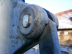

.jpg)
.jpg)

.jpg)
.jpg)
.jpg)


.jpg)
.jpg)


.jpg)
.jpg)

.jpg)


.jpg)


.jpg)


.jpg)
.jpg)
.jpg)

.jpg)
.jpg)
.jpg)

.jpg)

.jpg)
.jpg)

.jpg)


.jpg)


.jpg)


.jpg)


.jpg)

.jpg)


.jpg)

.jpg)


.jpg)


.jpg)


.jpg)


.jpg)


.jpg)


.jpg)


.jpg)
.jpg)


.jpg)
.jpg)


.jpg)


.jpg)
.jpg)


.jpg)
.jpg)


.jpg)


.jpg)


.jpg)
.jpg)