
List of selected street fountains in old Berlin
The list of selected street wells in old Berlin shows locations that offered public taps for drinking and extinguishing water. The street fountains in Berlin previously served to supply the population with water until the full expansion of the water network in the 1910s made it possible to supply Berlin with running water. Since then, the street wells have been used for emergency supplies in the event of a defense or disaster. At other times they serve dogs and birds as watering places and children use them as playgrounds, used by residents to water the trees on the street.

|
.jpg)
|
|
|
Kastenbrunnen: Köllnische Strasse (1888)
|
Lauchhammerbrunnen I in Chausseestrasse (1913)
|
If necessary, facts about the location or its change are given in the list elements. There are other pictures on which Berlin street fountains of the various stand types can be recognized, but there is no indication of the location of the picture in these photos and cannot be understood from the picture situation. Further statements on the type of the stand body and the construction of the street fountains can be found in the article forms Berliner Straße fountain .
The last pipe well


In the district of Mitte (standing position ) one of abandoned tube wells of the type Lohde I. It was erected in the period 1875-1892 and the population served for the supply of fresh water and the fire brigade as a sampling point. This pipe well ( see map ) in Wöhlertstrasse in front of house no. 18 has been without function since at least the mid-1970s: the water outlet, pipe and pull lever are missing and the empty (interior) space is "misused as a garbage can".
"Without the public street fountains in Berlin [...] there were private fountains in the courtyards [...] Since these fountains were designed in such a way that rain, snow and dust drifted into them, and often impurities were thrown into them out of courage, the Great Elector [1660] the introduction of tubular wells [...] The costs for this new facility were paid for until 1720 from the Consumtionsaccise. An ordinance was issued that year that the magistrate would again cover all costs necessary for the well system and have them raised by the citizens. "
The water was pumped from such wells by pulling the side handle. The fountain body (rest) at the Wöhlertstrasse site is a listed building monument. He lacks the characteristic of Lohdebrunnens on the well cap jewelry pin , the original (existing in 2003) instead of the curved rod was among them. This decoration was still present in 1999 according to the image of the State Monuments Office "LDA 2001" in contrast to the situation in 2010 and from May 2018. The apartment buildings on Wöhlertstrasse were largely undamaged during the air raids from 1943 and in the war days in 1945 (apart from hits in rear buildings 19 and 20), and the Lohdebrunnen also remained and was not taken into account in the post-war period and around the later wall area. In the Soviet sector, Wöhlertstrasse was located directly between the sectors and there was no construction planning in the 1950s.
In the mid-1870s, the well builder Louis Lohde created a well housing based on (Greiner's) pump principle with a deep suction point. The Lohdeschen Rohrbrunnen existed in three versions. Pumping was carried out by pulling open the piston rod with a handle on the side. Together with the Greiner fountains, these pipe fountains replaced the boiler wells that had previously existed in the 1880s. The installation began in 1877. In 1880 the city took over the 46 pipe wells and 836 well kettles with 1286 water sticks from the police headquarters. A total of 450 such wells (by Greiner and Lohde) had been set up by 1892, when construction was stopped. In 1937 there were 118 of them.
The water extraction points constructed by Ing.Otto Greiner were designed as shallow wells with a depth of five meters and otherwise as deep wells. The three case variants were designed for Greiner by the architect Eduard Jacobsthal ; the decorative jewelry for the three Lohde case types also came from him. The lined well shafts were a hindrance to laying pipes, and the six types of pipe wells had some weaknesses that turned out to be when they were used. The city administration asked for a simpler construction of the pumping station. The government architect Kuntze introduced the principle that the valve and lever were housed in the well housing. The lining of a shaft was no longer necessary. A competition was held in the architects' association in 1890 for the new construction . From the two award-winning designs, the municipal building deputation selected Otto Stahn's second prize design . The cast iron version was produced by the Lauchhammer stock corporation.
.jpg)
For locations from Rohrbrunnen to Lohde and Greiner there are only a few documents left in the 2010s. In the 1983 exhibition catalog for street furniture in Berlin, six types of pipe fountains from around 1930 are shown.
- Greiner Type I in Koppenstrasse
- Greiner Type II in Grimmstrasse
- Greiner Type III on Paul-Singer-Strasse
- Lohde Type I in Lindenstrasse
- Lohde Type II in Sebastianstrasse
- Lohde Type III in Liegnitzer Strasse
In pictures from the beginning of the 20th century, such fountains were mostly not the photo object, but locations can still be identified in some pictures.
- Insel- / Wallstraße ( location ): two neighboring pipe wells stood a few meters in Inselstraße diagonally across from the office building of the General German Trade Union Federation. on the southwest corner of Wallstrasse and Inselstrasse.
- Lohdebrunnen type II with the higher well dome was closer to the intersection
- Type I Greiner Fountain is thicker and stood next to it on Inselstrasse
- Lohdebrunnen type III was on the northeast corner of the Großer Jüdenhof in front of house number 8 ( location ). He was standing directly on the curb that had an extension for the drinking trough, the first two rows of paving stones wrap around this drinking stone.
- Lohde fountain type III: the pipe fountain stood in front of the Kronprinzenpalais (Oberwallstraße 22) 90 meters from Unter den Linden (place at the armory) to the south, at the level of the Schinkel Pavilion ( location ).
- The pipe well was still in place in 1947 - but without any identifiable address. The illustration can be found in the book Berlin under the emergency roof .
- Tube wells Greiner II at the Kaiser Wilhelm / corner Rosenstrasse location . It stood opposite the western corner of the tower of the Marienkirche on the western sidewalk Kaiser-Wilhelm-Strasse in front of the commercial building Kaiser-Wilhelm-Strasse 32-36 / Rosenstrasse 14 (Hamburg department store). The location is currently at the “Spandauer Straße / Marienkirche” bus stop, on the edge of the Karl-Liebknecht-Straße.
- Two pipe fountains stand in front of the Parochial Church in Klosterstrasse Lage . A Greiner fountain (close to the constricted shape) and no more than two meters away the Lohde fountain with its tapering shape stood on the corner of Parochialstrasse and Klosterstrasse near the southern exit at the Klosterstrasse underground station.
- more wells
- Fire extinguishing well in front of the Ermelerhaus at Breite Straße 11, which was manufactured by the Lauchhammer foundry. They were “introduced all over Berlin in 1925. [...] Under the cover decorated with a bear's head [on the lower part] is the connection piece for the connection hose to the pump. "
- Hofbrunnen at the Nicolaihaus at Brüderstraße 13
- In 1882, two enclosed kettle fountains stood in front of the French Cathedral on the roadside from Gendarmensmarkt , with three one-horse carriages of various types waiting at the corner of the Französische Strasse on the picture. An illustration from 1932 of a fountain of the same type is included in the exhibition catalog, Fig. 2, for Bergstrasse.
Soaking stones (granite slab with a hollow in the curb) were used as catches under the discharge pipes. They were suitable as horse troughs, but more often they were used for the pull dogs of the small dog teams . They were used in front of every newly erected pipe well. But they already existed at the older kettle wells. The soaking stones have different shapes in the pictures: in four pictures, the oval trough with a drainage channel is inserted in the curb, which swings out towards the road. In Lindenstrasse, the stone slab has a rectangular hollow with rounded corners that is inserted between the curbs. In Inselstraße there is probably a soaking stone in the edge of the curb, which, in addition to the drainage channel to the roadway, has a widened collecting channel under the outlet, which is directly connected to the foot of the well.
Old locations
Street fountains that can be shown in pictures were set up until 1900 and are sometimes still present in the urban area of Berlin later. Such locations are included in the list with their coordinates and notes on today's surroundings. A comparison with the book Street Names of Berlin from 1885 is recommended for the historical street names, which in the following can refer to different map material .
Until 1902, the regulations required the wells to be 300 meters apart. Of the old boiler wells with wooden box housings, there were 836 wells in the public street space in 1880. The water was pumped from the well boilers up to a depth of five meters using handle pumps. The pumping station was covered with wooden boxes. Such wells were also available uncovered as yard pumps within the property. The square boxes were filled with straw to protect against the weather and frost (probably also for a better view) and closed with a roof (often a slate plate). At selected locations in better urban locations, well housings were made of cast zinc . In 1865, 50 of the 937 public 'alley' wells were finished with cast zinc housings. The pumped water increasingly polluted, so from 1877 iron pipe wells were placed after Greiner. With this principle, water of better quality could be achieved at greater depths. When the list ended in 1892, there were around 450 copies. Using the Kuntze principle, 320 copies of the “Lauchhammer fountains” designed by Otto Stahn and manufactured in the iron foundry Lauchhammer were installed between 1893 and 1897.
In order to achieve a comparable list, the location information obtained from images and descriptions was converted into location coordinates by means of address comparison. Deviations of up to ten meters can arise from various imponderables. The internal numbering of the list with a preceding # is intended to provide an overview and facilitate assignment. Street names that no longer exist are set in italics, the address details match the time of the source.
- Fountain stand in Berlin on old pictures
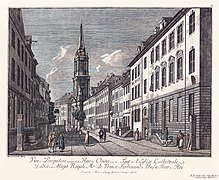
Two fountains: Klosterstrasse (1780)

Three box fountains:
Neuer Markt (1785)
Koellnischer Fischmarkt (1829)

Spittelmarkt (1833)

Location Alte Leipziger / Kurstrasse 1840
At the Stechbahn (1865)

Two box fountains: Spittelmarkt (1868)

New market fountain
north side (1880)
Klosterstrasse 87 / Bischofstrasse 1 (1885)

Nikolaikirchgasse (1885)

Greiner Type I: Neuköllnischer Fischmarkt (1886)

Greiner I (Old Stock Exchange, 1887)


_(Zeno_Fotografie).jpg)


Well map 1660
On a "fountain map of Berlin / Cölln" made according to the " Lindholz Plan " for the year 1660 (12 years after the Thirty Years' War ), 35 street fountains for Berlin 14 for Cölln are recorded. The following list indicates the well locations marked on the map and contains approximate coordinates. On the map in Bärthel, intersections from a list according to Mylius are marked for the location, but the assignment of the street corner is missing. The coordinates in the following list indicate the distances from the street corner as a radius. In addition to the listed “publicly usable alley fountains” there were many times more “courtyard fountains”; these were usually only available to the residents within the property for drawing water.
-
Berlin
- 4 = Stralauer Strasse
- 01: 25 meters west behind the Stralauer Mauer (Waisenstraße), level with the Grossen Friedrichs Hospital (orphanage) ( location )
- 02: Confluence with Klosterstraße (= 5), 25 meters west of Kleine Stralauer Straße ( location )
- 03: mouth of Jüdenstraße ( location )
- 04: 20 meters east of the Molkenmarkt ( Königsmarckt ) ( location )
- 5 = Klosterstrasse
- 05: 25 meters south of Kronengasse (opposite Stockhausgasse ), at the height of the Parochialkirche, which was built in 1695 ( Lage )
- 06: at the level of the monastery church (gray monastery) ( location )
- 07: 60 meters northwest of Königs Strasse , 55 meters southeast of Bischoffs Strasse ( location )
- 08: 40 meters northwest of Bischoffs Straße , passage to Marienkirche (height of the tower, next to Neue Gasse ) ( location )
- 09: (extended) Im Jeckhol , 65 meters north of Papenstrasse ( location )
- 6 = Jüdenstrasse
- 10: 50 meters north of Stralauer Straße, 45 meters south of Reetzengasse ( location )
- 11: Crossing Cronengasse / Reetzengasse ( location )
- 12: Square with Sieversgasse , 20 meters south of Nagels Gasse ( location )
- 13: (extended) Hoher Steinweg - 60 meters north of Königs Straße (halfway across Bischoffs Straße ) ( location )
- 14: Hoher Steinweg - junction with Bischoffs Straße ( location )
- New market
- 15: on the eastern edge halfway south of Papenstrasse and north of Bischoffs Strasse ( location )
- _ = Rosenstrasse
- 3 = Spandauer Strasse
- 18: North corner of Molkenmarkt to Eiergasse ( Kleine Kirchgasse ) ( location )
- 19: North exit Molkenmarkt, between Eiergasse and Kirchgasse ( opposite Reetzengasse ) ( location )
- 20: Nagels Gasse / Probstgasse intersection ( location )
- 21: 45 meters northwest of Königs Straße (Grappendorff's house) ( location )
- 22: before the corner of Bischoffs Straße / Bergheims Gasse (Kleine Poststraße) ( location )
- 23: 30 meters northwest of Bergheims Gasse , (at the Neuer Markt passage) ( location )
- 24: 10 meters north of Calands Gasse , at the level of the Papen Strasse exit on the Neuer Markt ( location )
- 25: south at the intersection of Heidereutergasse / Heilige Geist Gasse ( location )
- 1 = Königs Straße
- 26: 40 meters east of Klosterstrasse, 25 meters west of Behind the King's Wall , also Behind the Baraquen ( location )
- 27: a little west of the Klosterstrasse intersection ( location )
- 28: Jüdenstraße / Hoher Steinweg intersection ( location )
- 29: 25 meters east of the bank of the Spree (Lange Brücke, Burgstrasse) ( location )
-
Berlin fish market
- 30: Between Mühlendamm and Molkenmarkt ( location )
- 2 = Heilige Geist Straße - Poststraße (was still called Heiligengeist Straße in 1712)
- 31: Probstsgasse, height of the central axis Nikolaikirche, access to the meat pots ( location )
- 32: opposite the mouth on Königs Straße (near Jordan's house) ( location )
- 33: 10 meters north of the corner of Bergheimsgasse ( location )
- 34: 30 meters north of Calands Gasse, near the Joachimsthaler Gymnasium ( Lage )
- 35: near Heiligengeist Gasse, 70 meters east of the bank of the Spree ( location )
- 4 = Stralauer Strasse
-
Cölln
- 7 = wide street
- 13 = Scharren Straße
- 38: Height of Petrikirche, 25 meters east of Brüdergasse ( location )
- 14 = Brüderstraße
-
At the Petrikirche (Gertraudenstrasse)
- 43: 75 meters east of the canal (Gertraudenbrücke), behind the houses on Kurgasse (Kleine Gertraudenstraße), Grünstraße opens up 40 meters opposite ( location )
- 11 = Grünstraße
- 44: 65 meters south of An der Petrikirche ( location )
- 10 = Lappstraße ( Petristraße )
- 45: 75 meters south of An der Petrikirche ( location )
- 9 = Rosstrasse
- 8 = Fischer Strasse
Old well with box housing
.jpg)
.jpg)
In 1845 there were 817 street fountains in the urban street space for general use. 20 years later (1865) there were 937 street fountains in the Berlin urban area. The housing stood above the boiler well and, by operating a lever, pumped the water from the well to the outlet. Until the 18th century, there were still wells at the specified locations , where the water was pulled up in buckets or tubs by means of rope (often) over rollers that were attached to a support frame.
- Some locations of Kesselbrunnen (in the year 1868) are taken from the book by Isidor Albu (1877).
- There was a “castle fountain” (1868) in the pleasure garden and in the courtyard of the castle.
- There were 16 public street fountains : Karl and Albrechtstrasse corner ( location ), Landsberger and Kurzestrasse corner ( location ), Markgrafen and Besselstrasse corner ( location ), Mauer and Jägerstrasse corner ( location ), Mauerstrasse 3 (SO from Bethlehemskirche, Lage ), Melchiorstrasse 35 ( Lage ), Neue Jakob- and Rossstrasse-Corner ( Lage ), Neue König- and Lietzmannsstrasse-Corner ( Lage ), Oranienstraße 52 (Parodietheater, Lage ), Schönhauser- and Kastanienallee-Corner ( Lage ) , Schumann and Louisenstrasse corner ( location ), Wilhelm and Zimmerstrasse corner ( location ), Behren and Wilhelmstrasse corner ( location ), Grüner Weg 107 ( location ), Hagelsbergerstrasse 3 (Stahlsches Haus) ( location ), Jerusalemer- and Leipzigerstrasse corner ( location ).
- Eight courtyard fountains are named in the book for the following properties: Johanniterstraße 3 ( location ), Kurstraße 20 ( location ), Mittelstraße 18 ( location ), Möckernstraße 1 (east side of Anhalter Bahnhof> about location ), Nostizstraße 51 ( location ), Oranienstraße 80 (St. Jakobs-Hospital) ( location ), Teltower Straße 51 ( location ), Grünstrasse 27 ( location ).
- Georgenkirchplatz (house number 23, # 20 location ) there was a courtyard fountain with a wooden body (# 1) still in 1927, its fork is uncovered. The fountain is on plot 23 in an extension on the back of Neue Königstraße (house number 56). The location is in the middle between Otto-Braun- and Bernhard-Weiß-Straße on the edge of Alexanderstraße 7 (southwest edge of the building renovation).
- Klosterstrasse 87 (# 22, location ) Opposite the house N ° 87 (= Bischofstrasse 1) stood a well box 1885 on the west corner of the opening Bischofstrasse (house number 1). The Bischof- / Klosterstrasse is built over, the fountain location corresponds to the southern point of impact of the western reconstruction of the Berlin television tower and 7 m to the northwest.
- Bischofstraße 7 (# 23, location ) A fountain is shown in the photo from 1883 “Bischofstraße near Marienkirche”. The same fountain can be seen in the photo taken from the town hall tower through the Hoher Steinweg. Bischofstrasse was between Spandauer and Klosterstrasse
- Neue Friedrichstraße 2 (# 24, location ): Old well box 1888 next to the "flour magazine" in 1888.
- Neuer Markt (# 30, location ): Opposite the houses , in the position of house 4 to house 5, there is a box fountain in 1880. The fountain is also shown in a painting by Karl Friedrich Fechhelm for 1860 and 1882 and around 1770/1780. The box fountain can be seen on the etching by Johann Georg Rosenberg from 1785. For 1900 there is a Type III fountain of the Lauchhammer series that was installed between 1892 and 1897 near the old location.
- On the etching by Rosenberg from 1785 there are three box fountains on the north side of the Neuer Markt (from Papenstrasse ). From Papenstrasse , the fountains stood in front of house N ° 8, N ° 6 and N ° 4. The three fountains on the northeast side of the Neuer Markt are clearly visible on a lithograph from 1853 .
- House N ° 4 (# 85, location ): Still occupied on the photo made by Schwartz around 1880. File: Neuer Markt, Berlin 1880.jpg is the fountain in front of house N ° 5 (on the edge of 4).
- House N ° 6 (# 86, location ), also 1860
- House N ° 8 (# 87, location )
- Neuer Markt 16 (# 33, Lage , Südecke), opposite Bischofstrasse 12, there is an old fountain in 1888.
- On the etching by Rosenberg from 1785 there are three box fountains on the north side of the Neuer Markt (from Papenstrasse ). From Papenstrasse , the fountains stood in front of house N ° 8, N ° 6 and N ° 4. The three fountains on the northeast side of the Neuer Markt are clearly visible on a lithograph from 1853 .
- Molkenstrasse (# 46, location ): in 1888, there were two enclosed kettle fountains on the corners of the road to Molkenmarkt. Whereby the one on the right street corner was dismantled by 1900. The corner houses are: north of Molkenmarkt 13/12 (= Molkenstrasse 1, location Max Friedlaender jr.) And south of the corner house Molkenmarkt 14 (= Raack restaurant, Cigarren J. Neumann, hair cutting salon). Carl Engel's cloth warehouse is located in the adjoining house. Molkenstrasse is now run as Poststrasse, the locations of the two fountains would be 25 meters from the new house front at the corner house “Zur Rippe” and the green area into the Mühlendamm carriageway or 55 meters from Building Nikolaikirchplatz 1/3.
- Nicolaikirchgasse (# 32, location ): The fountain was on the south side opposite Spandauer Straße 39 in 1885. The houses at Spandauer Straße 39-44, between Eiergasse and Kirchhofgasse, were demolished from 1897 onwards.
- Friedrichstrasse 175 (# 10, Lage , NW corner of Jägerstrasse [= 62a]) was an old, enclosed kettle well around 1860. The street corner was rebuilt around 1871.
- Leipziger Street
- Leipziger Straße 4 (# 36, location ): In 1882, a box well stood in front of the Prussian mansion , Leipziger Straße 4, the property was converted after the previous mansion had been demolished and was completed in its existing form in 1904.
- Leipziger Straße 19 (# 35, location ) was an enclosed kettle fountain in 1872 at the SO corner of Mauerstraße ("Haus Mauerkrone") and was still there in 1892 after the corner building had been converted (compare the post box and advertising column to Mauerstraße). The Museum of Communication is located across Mauerstraße (property at Leipziger Straße 16-18 / Mauerstraße 69-74), which was built between 1871 and 1874 as the Reich Post Office (later Reich Post Museum ).
- Leipziger Strasse 43 (# 37, Lage , SO corner of Markgrafenstrasse 32a) was where the well box stood in 1887 and 1890, and the Tränkstein is on the curb. The street corner Markgrafenstraße is built over, here is the residential high-rise Leipziger Straße 40.
- Leipziger Straße 47 (# 38, location ): A box fountain was located in front of the house in 1890 (without the impregnation stone). This fountain (x14) is 100 meters from (# 13) in front of the corner house at Leipziger Straße 43.
- Leipziger Strasse 50a (# 39, location ): The next box fountain was at Leipziger Strasse and southwest corner Jerusalemer Strasse (Kisskalt's Hotel "Stadt London"). Another picture from the construction time of the Tietz department store still shows the hotel, but the fountain is missing in the mid-1890s . The location of the fountain would be in front of the flat building at number 45 of the most recent development, which also covers Jerusalemer Straße. This fountain was depicted as early as 1793 in a picture by the painter Leopold Ludwig Müller (1838) on the western corner of Dönhoffplatz on the corner house on Jerusalemer Strasse.
- Leipziger Straße 62 (# 76, Lage , Gertraudenhospital ): The detailed information under Spittelmarkt # 75.
- Leipziger Straße 112: (# 41, location WMF-Haus ), northeast corner with Mauerstraße, in 1872 there was a box fountain about 10 meters on the sidewalk of Mauerstraße with three horse-drawn carriages waiting at the well.
_(Zeno_Fotografie)_(Stra%C3%9Fenbrunnen).jpg)
- At Alte Leipziger Straße 4 (# 40, location , north lot Kurstraße 38) there was a box fountain, the picture is dated 1840. The location on Alte Leipziger Strasse is on the northern edge of Kurstrasse. For the extension of the Reichsbank , Alte Leipziger Strasse was enclosed between Kurstrasse and Jungfernbrücke. As a result, the fountain reached this building line.
- Behrenstrasse 14 (# 42, ( location , town house of the architect Heinrich Theising) the fountain) stood in 1900 (according to the caption) in Kanonierstrasse on the property at Behrenstrasse 14–15 / Kanonierstrasse 21 (now: Glinkastrasse 44). Today's view still shows the coat of arms on the corner bevel.

- Jägerstrasse 12 (# 43, location ): In 1886, in front of the one-story row of houses on the south side of Jägerstrasse, there was a box fountain (named here as # 19). In 1886 the fountain stood in front of building 12 with the “Café Humor”. During the air raids, the land to the west of Kanonierstrasse (Glinkastrasse) was destroyed but could be rebuilt, while the buildings to the east to Friedrichstrasse were destroyed and partially removed. The plots are still there: N ° 10-11 belongs to the Humboldt University and plot 12, combined with 13, is used by the Russian House in Berlin (Jägerstrasse 13-16, Friedrichstrasse 176-179, Taubenstrasse 37-41).
-
Gendarmenmarkt On the square were surrounded swivel fountains in wooden-clad boxes on kettle fountains. The frequent shots of the important buildings probably meant that street fountains were also shown. The "old wells" were cleared around 1895. The period of the etchings, engravings and photographs covers the period from the second half of the 18th century to the 19th century. For the years from 1895/1897 there are pictures with Lauchhammer fountains around the Gendarmenmarkt, but then on the house side of the streets and no longer on the square. More pictures around the Gendarmenmarkt are from Nicolas-Marie-Joseph Chapuy (1790-1858): Berlin Gendarmenmarkt Carl Julius Henning (1813-1848) Der Deutsche u. French Cathedral and Royal Schauspielhaus Carl Friedrich Calau: The Gensdarmesmarkt with the old playhouse and in the online collection of the city museum there are more graphics and images.
- Französische Straße 42: (# 44, location ): Berliner Handelsgesellschaft, the box fountain stood in 1888 on the north side of the Gensdarmenmarkt across from the French Cathedral . The street fountain is in the picture between the row of posts and thus across the street on the southern edge of the road. The fountain is missing in the picture from 1900.
- Franzische Straße 40 (# 45, location ): The Achard family's palace stood on the corner of Markgrafenstraße and street fountain # 21 opposite, on the northeast of Gendarmenmarkt, at an angle to the French Cathedral, i.e. on the southwest corner of the French / Markgrafenstraße intersection. The fountain stood on the south curb of the Französische Straße behind the row of bollards with which the area of the French Cathedral is cordoned off to the northeast to the street runs. The view of the photo falls on the buildings opposite, Markgrafenstrasse 49 and 50–51a. This street corner opposite the French Cathedral still exists with new developments: office and commercial building Französische Strasse 40/41, Markgrafenstrasse 39/41 and 42.43.
- Markgrafenstraße on the eastern edge of the Gendarmenmarkt are on the etching by Calau from 1820. The Gensdarmen-Markt taken from the Französische Straße three box fountains are lined up. The locations are occupied by Calaus etching The new theater and the two towers on the Gensdarmen market in Berlin. as well as an aquatint "The Gendarmenmarkt with the old theater / Le Marche des Gens´darmes et l´ancion theater"
- Jäger- / Markgrafenstraße (# 47, location ): On the east side of the Gendarmenmarkt , the Kastenbrunnen stands opposite the Royal Administrative Court or Lottery Office at Jägerstraße 56 (at that time also Markgrafenstraße 47). In the picture by Meydenbauer you can see both the street fountain at the corner of Französische on the east side, as well as the one a little further away on the (north corner of Jägerstraße = south-east French). See also the fountain on Jäger- / Markgrafenstrasse, the northeast corner of Gendarmenmarkt in the 1850s in this picture. The fountains are also in Poppel's picture from 1852: Gendarmenmarkt between the French cathedral and the theater . At the same location on the corner of Jägerstrasse and Markgrafenstrasse, a fountain next to the horse-drawn carriage can be seen in the photo by Hermann Rückwardt (1879) “The Gendarmenmarkt in Berlin” . The handle of the cylindrical fountain column points to the left, the column has a knob on the top.
- Mohren- / Markgrafenstraße (# 47a, Lage ): At the southeast corner of the Gedarmenmarkt a box fountain is depicted on an engraving in 1883. A picture with a view of the southeast of the German Cathedral from 1900 shows a Lauchhammer fountain type I, which probably replaced the box fountain from 1895
- Mohrenstrasse on the southern edge of the Gendarmenmarkt: On engravings by Calau from 1790 and also from 1820 three box fountains are drawn on the southern edge of the Gendarmenmarkt along Mohrenstrasse between Markgrafen and Charlottenstrasse. The view goes to Charlottenstrasse 59 (= Mohrenstrasse 46) with the Hotel de Brandenbourg . The fountain on the southwest corner of the Gendarmenmarkt was no longer in place in 1886.
- Mohrenstrasse 30 opposite (# 48, Lage , south-east corner of Gendarmenmarkt). This fountain is also shown in the painting (oil and canvas) by Eduard Gärtner from 1857 "Gendarmenmarkt im Winter" (southeast corner of the German Cathedral).
- Mohrenstrasse 27 opposite (# 49, Lage , southern edge of Gendarmenmarkt)
- Mohren- / Charlottenstraße (# 50, location , south-west corner of Gendarmenmarkt)
- opposite Charlottenstraße 59 (# 51, location ): In the photo from 1888 the fountain (about 30 meters) from the southwest corner of the Gendarmenmarkt was still opposite the new building, but no longer around 1900.
- Charlottenstrasse 56 at the corner of Taubenstrasse (# 52, location ): The fountain was on the northern edge of the German Cathedral, the view goes to Charlottenstrasse and the fountain is inserted into the square on Taubenstrasse.
- Jägerstrasse (# 53, Lage ) The fountain is on the northern edge of the street running through between the French Cathedral and the theater.
- Hunter / Charlotte Street (# 54 location , south corner of the French Cathedral): the box spring 1864 across from Charlotte Street 53 stands on the west side of the Gendarmenmarkt square in front of the French Cathedral. In the later photo, the fountain is shown on the far right in the picture.
- Charlottenstrasse 50/51 opposite (# 55, location ): The fountain is (probably) 20 meters from Französische Strasse (on the corner a Café Achteck ) and the corner house on Französische Strasse opposite. The photo is marked with 1895 as the date it was taken, and the southern fountain (# 54) can also be seen on the photo.
- Petriplatz (# 56, location ): The fountain is in front of the corner house at Petriplatz 3 on Scharrenstrasse , the building to the right of it is the Ratswaage . Petriplatz with the central Petrikirche and the Köllnisches Rathaus was located between Scharrenstrasse and Gertraudenstrasse and is covered by the new street Mühlendamm – Gertraudenstrasse – Spittelmarkt on the eastern side. The position of the old well is determined by the reactivated streets Petriplatz and Scharrenstraße, in the area of which new buildings will be built around 2020 ( House of One ).
- Kaiser-Wilhelm-Straße 36 (# 57, location ): The fountain in front of the houses on the western side of the street, opposite the Marienkirche , was photographed in 1888 according to the construction site on the corner house at Klosterstraße. Kaiser-Wilhelm-Strasse between Rosenstrasse and Klosterstrasse from the portal of the Marienkirche.
- Wilhelmstraße 65 (# 58, location ): The fountain stood in 1880 in front of the palace of Prince August Ferdinand , which became state-owned in 1844 . The palace was converted into the Reich Ministry of Justice. After the destruction and demolition, in 2009 Französische Straße was connected to Wilhelmstraße.
- Zimmerstrasse
- Zimmerstrasse 61 (# 59, location ) An old fountain stands in 1890 on the north side of the street between Markgrafenstrasse and Jerusalemer Strasse at house 61. Until 1990 in the area of the wall strip, house number 55 was rebuilt here while maintaining the house line.
- Zimmerstrasse 67 (# 60, location ): The old box fountain is in front of the corner house at Zimmerstrasse 67-68 at the corner of Markgrafenstrasse 72-73 on the northeast corner of Markgrafenstrasse.
- Zimmerstraße 100 (# 61, Lage , corner of Wilhelmstraße): At the corner from the house bevel to Wilhelmstraße there is a box fountain in 1885. The ruins of the street corner, which was destroyed in the war, were cleared in the post-war years and stood in the area of the Berlin Wall . The Hi-Flyer (balloon at Checkpoint Charly) is still undeveloped here in 2019 .
- Waisenstraße 27 (# 62, location ): The box fountain was in 1888 in Waisenstraße on the western sidewalk opposite the restaurant. Waisenstraße 1890, F. Albert Schwartz The building at Klosterstraße 68 is the Palais Podewils . The passage and the slope on property N ° 18 are still noted in the city map ( To the last instance , N ° 14).
- Mittelstrasse 28 (# 63, Lage , Dorotheenstädtische Kirche): The fountain body is located on the north side of Mittelstrasse and is shown for 1870 and 1880. The location is about 10 meters (one carriage length) east of the Predigerhaus in front of the churchyard, halfway between Schadowstrasse and Neustädtischer Kirchstrasse. The fountain was still in place in 1888. After 1945 the church was listed as “damaged, rebuildable”, on the square (Neustadtischer Kirchplatz) there is an undeveloped green area.
- Heiligegeiststraße 36 (# 64, location , 38 is the house with the envious head): The fountain box was in front of the left edge of house 36 in 1890/1891, a little offset from the entrance of the neighboring house 37. Location probably also in 1840. The previous location is in Area of the Marx-Engels-Forum (2019: edge of the construction site of the U 5 extension ).
- Heiligegeistgasse / Heiligegeiststraße (# 103, location ): The location is shown on the panel painting (?) From 1840. According to the Selter floor plan from 1846, the house in the background is the Cassen-Verein (later part of the stock exchange), while the fence on the right belongs to the Heiligen-Geist-Kirchhof and on the left the Heiligegeiststraße opens. Today the location is marked by St. Wolfgangstrasse.
- Poststrasse 31 (# 65, location ): The box fountain with Tränkstein stood 10 meters from the western corner of Königsstrasse into Poststrasse. The location would be in the reconstructed Nikolai district on the corner of Rathausstrasse and Poststrasse next to the new corner building of the Schmales Haus . Noteworthy is the picture, also marked 1894, of the same street corner on which a Lauchhammer fountain type III is already depicted.
- Auguststrasse 30 (# 66, location ): The fountain stands in front of the sloping corner house between Auguststrasse and Gipsstrasse N ° 33. After the war ruins and the remaining buildings, as well as the temporary storage area, have been cleared, there are playgrounds ( plaster triangle ) at the former location.
- Kaiser-Wilhelm-Straße 43 (# 67, location , Hotel "Münchener Hof"): The (box) fountain is about ten meters from the corner of the pavement west corner of Spandauer / Kaiser-Wilhelm-Straße on the edge of the sidewalk in Kaiser-Wilhelm- Street in. Replaced by a Lauchhammer fountain type I (# L7) at the end of the 1890s. The historic house front was on the current south-western roadway, the fountain location 5 m above the central island, corresponding to 25 meters from the current corner of Spandauer Strasse 3 with Karl-Liebknecht-Strasse 4 (here: Baker Wiedemann).
- Mittelstraße 62 (# 68, location , “Hotel du Pavillon”): In 1898 the old fountain with a box housing stood on the southern edge of the sidewalk in front of house 61 (edge of house 62).
.jpg)
- Stechbahn 4 (# 69, location ): In 1865 the box fountain stood at the same level as House Stechbahn 4 on the southern edge of Schloßplatz. The houses on the Stechbahn were demolished in 1865 to make way for the construction of the national monument. According to the current situation, the location at that time is in front of the State Council building (Schloßplatz 1), which is used by the ESMT management college .
- Hasenheide 1) (# 70, Lage , corner of Hermannplatz ): A box-shaped fountain stood on the edge of (old) Berlin in 1895 (then northwest corner of Hasenheide / Kottbuser Damm). The location can be seen in the southwest corner of Hermannplatz directly facing Hasenheide . The west side of Hermannplatz (still Kottbuser Damm in 1900) has been formed by the Karstadt building since 1930 .
- Dorotheenstrasse 96 (# 71, Lage , Alte Sternwarte ): In three pictures by Friedrich Wilhelm Klose between 1840 and 1848, the fountain is on the right (southern) corner of Dorotheen- / Charlottenstrasse across from the old observatory . The Deutsche Staatsbibliothek Unter den Linden (Charlottenstrasse 41) is located on their premises , the fountain location would be in front of (according to current addressing) Dorotheenstrasse 31.
_p2.693_BERLIN,_WERDERSCHE_KIRCHE_(Stra%C3%9Fenbrunnen).jpg)
- Werderscher Markt 9 (# 72, Lage , Alte Münze ): The fountain stood in 1840 (on the picture) on the left in front of the Alte Münze , with a picture by Carl Daniel Freydanck . The fountain is in front of the old mint on the corner of Am Packhof Markstrasse am Packhof, note the three water tubs that are next to the fountain.
- Werderscher Markt 4 (# 91, location ): On the Calauschen aquatint from 1810, in the depths of the picture, there is a box fountain at the mouth of Niederwallstrasse the fountain opposite Werderscher Markt 4 (towards Niederlagstrasse) and next door is the Friedrichswerder Church (then a French-German church ). The fountain with the two water tubs for extinguishing water is shown more clearly in the picture by Poppel 1852 next to the Friedrichswerder Church in front of Werderscher Markt 4. The large building in the picture is the Royal Mint. In the current construction plan for Schinkelplatz - Prinzengasse (southern edge).
- Koellniche Straße 11 (# 73, location ): The fountain is on the western edge of the walkway 40 meters from An der Fischerbrücke and 45 meters from Fischerstraße. It was dismantled after 1903. In one of Heinrich Zille's pictures , the fountain is no longer there. The previous location was built over in the 1970s by the standard construction of a children's combination when redesigning the Fischerinsel , currently used by Kreativhaus e. V (Fischerinsel 3). The street name was canceled in 1969.
- Breite Straße 36 (# 74, location ): The fountain stood in the row of trees in front of the left wing of the Old Marstall in 1890 and also in 1815 , adjacent to the Ribbeck House . The buildings on the northeast side of Breiten Straße 30-36 are currently used by the Berlin City Library.
- Spittelmarkt (# 75, Lage , Südwestecke ): The fountain was already in 1833 on the square (southwest) in front of the Gertraudenkirche, according to the picture from 1868 there was a second fountain at the Gertraudenhospital 20 meters away in front of the house at Leipziger Straße 62. The location of the fountain on the square in front of the Gertraudenkirche would be at the western confluence of the road (sidewalk) from Axel-Springer-Strasse (at that time An der Spaarwaldbrücke, later Beuthstrasse) on Leipziger Strasse, the second fountain at Leipziger Strasse 62 (formerly Gertraudenhospital ) comes up against the road change Northwest corner of the current skyscraper at Leipziger Strasse 51
- Mauerstraße: On the print by Johann Georg Rosenberg from 1776 Vue d'une partie de la Rue dite la Mauer = street avec l'Eglise de la Trinité (looking north) three fountains are shown. Also on the colored engraving from 1778. All three wells are in front of the houses on the roadside, each with a water tub in which extinguishing water should be kept. On the colored copper engraving of Mauerstraße with the Bohemian Church (Bethlehem Church) by Johann Georg Rosenberg from 1767 (the view to the south), two box fountains are shown on the left in the picture, the front one (in the picture) being at the "watch".
- House N ° 12 (# 77, location , probably the corner house Leipziger Straße): A box fountain on the east side of Mauerstraße is at the corner of Leipziger Straße.
- House N ° 15 (# 78, Lage , Wacht): A box well on the east side of Mauerstraße is on the corner of Kronenstraße, which extends into the picture from the right in front of the Trinity Church.
- House N ° 65 (# 79, location ): A box well on the west side of Mauerstraße is opposite the corner of Kronenstraße.
.jpg)
- Köllnischer Fischmarkt 6 (# 80, location ): With a view of the Cölln town hall, the fountain is on the left in 1829 ( in the picture ). After all the debris from the war and the surrounding new buildings had been removed, the fish market was built over and the street name was revoked in 1969. The former location is 40 meters from the Mühlendamm Bridge and six meters into today's road area from Mühlendamm , the distance to Roßstraße (since 1969: Fischerinsel) is 55 meters.
.jpg)
- Klosterstraße: On the colored engraving by Johann Georg Rosenberg - from around 1780 - with a view of the Parochial Church, there is (probably) a box housing above a kettle well on both street corners of Stralauer Straße. It should be noted that in the picture the boxes with handle and outlet pipe are a little over three meters high. There is a water tub on the west side of the street next to the fountain.
- Lot N ° 59 (# 81, location ): On the western corner of the street, the water tub belongs to the fountain, the protective board under the water pipe that is supposed to protect the wooden box from moisture is clearly visible.
- Plot N ° 60 (# 82, location ): On the eastern corner of the street (in the sunlight), the roof on the wooden housing and the water pipe at chest height of the woman standing next to the fountain can be clearly seen; the protective board placed at an angle is also under the pipe.
- Property N ° 67 (# 83, location , Parochialkirche): Another box fountain in Klosterstrasse is on the left in front of the Parochialkirche on the sidewalk of the street corner of the Kloster- / Parochialkirche. It can be clearly seen in the photo from 1881 (looking south) in the center of the picture. At this point on the left side of the road there was a Greiner-type and a Lohde-type pipe well in 1910. However, these two fountains are difficult to interpret in the photo .
- Lot N ° 74 (# 84, location ): In the photo from 1901 , the box fountain stood in front of the schoolyard wall next to the edge of the warehouse from the building of the grammar school to the gray monastery . The photo from 1907 documents the remaining stock. In 1934 the fountain no longer stood. After the demolition and widening of Grunerstraße, the location came to the edge of the sidewalk in front of the monastery church ruins .
- Pariser Platz 8 (# 89, location ): On an engraving by Chodowiecki in 1764 there is a fountain in front of the exit of the (previous) Brandenburg Gate , north of the road ( Unter den Linden ) next to the guard house. The location in Dorotheenstadt is recorded as Quarree Marckt on the map from 1738 . The fountain stood where the (right) guard building of the Langhans Gate (as a room of silence , → Pariser Platz 8) stands on the northwestern corner of the square on the (today's) Pariser Platz . The same location is recorded in 1820 on the colored etching by Friedrich August Calau (1769-1828) Das Brandenburger Thor . The box well is in front of the annex building of the right gatehouse, next to the well there are also two extinguishing water vats.
- Heidereutergasse 4 (# 88, location ): On the etching by Calau (around 1712/1714), to the right of the building of the Old Synagogue, the fountain in the box is shown on the right edge of the picture. Heidereutergasse was located between Rosenstrasse and Spandauer Strasse and was built over during the reconstruction (apartment block Spandauer Strasse 2/4) and deedicated in 1968. In the 1990s, the name was reassigned for the street race, which was preserved in a shortened form. The etching suggests that the fountain is depicted next to the gate of the Old Synagogue, meaning that the location was halfway between Spandauer and Rosenstrasse on the south side.
- Contre escarpe 69 (# 90, location , <Alexanderplatz>): On the copper engraving of Calau from 1796 the fountain (on the right in the picture) isoppositethe ox market at the Contre Escarpe 69 house. The view in the picture is from the Stelzenkrug inn (on the Bernauer Straße ) to the Königskollonaden The house Alexanderstraße 69 can (probably) be used to help determine the coordinates, so the fountain location would be 20 meters east-southeast to the fountain of friendship between nations .

- Probststraße 13 (# 91, Lage , <Nikolaikirche>): In the painting Nikolaikirche from the west , the kettle fountain with the case in front of the house is shown in the shadow, next to it a woman with a jug. According to the map from 1826 , the view is from Poststrasse, on the right the "Scharrn" (market stall) on the left the three-story corner house at Probstgasse 13. With the destruction in World War II and the clearing of the area around the Nikolaikirche , the Nikolaiviertel was in preparation for the 750th anniversary Rebuilt from 1980 to 1987 on an almost medieval floor plan. The location of the fountain would therefore be in front of the house at Poststrasse 25. Interestingly, there is a type II Lauchhammer fountain with impregnation stone on the sidewalk ( fountain center 26 ) in almost the same place.
- Neue Packhofstrasse # 2 (# 92, location ): On the engraving by Fincke after a drawing by Schwarz. from 1833: View of the old stock exchange at Berlin's Lustgarten , a box fountain can be seen in the center of the picture between the two people and the coach. It stands at the level of the Neue Packhofs-Brücke (Friedrichsbrücke) at the northern end of the Lustgarten (end of the street Am Lustgarten). The street in the picture is Neue Packhofstrasse (then Kolonnadenhof Museumstrasse 1–3, now Bodestrasse) in front of the (then) tax office. The location would be in front of the colonnades at the Alte Nationalgalerie and to the north of the Altes Museum opposite the opening Am Lustgarten on the north side of Bodestrasse.
- Wilhelmstraße 77 (# 93, location ): Opposite the entrance to the “ Palais Radziwill ”, used as the Imperial Chancellor's Palace since 1875 , an old fountain from 1833 is depicted on an engraving . You can see the square box for the pump piston on the handlebar and its sloping cladding on the floor. The building cut off in the picture on the right belongs to the Palais of Prince Carl ( Wilhelmplatz 9 ). As Thälmannplatz the Wilhelmplatz 1949 was renamed, came to the Berlin Wall still peripheral and was in the northern part of the 1980s with WBS70 built -Wohnhäusern. After the Reich Chancellery had been destroyed and the rubble had been cleared , the western development was set back with residential and commercial buildings and Wilhelmstrasse (1964–1993: Otto-Grotewohl-Strasse) was renumbered. The fountain location would thus be 10 meters next to the residential building Wilhelmstrasse 47.
- (# 97, Lage , Neue Wilhelmstrasse ): The picture from 1856 also shows the fountain at the Palais.
_p2.697_BERLIN,_BREITE_STRASSE_(Stra%C3%9Fenbrunnen).jpg)
- Breite Strasse 4 (# 94, location ): On the painting by Carl Daniel Freydanck from 1836 (view from the castle ) on the right and 1852 with a view of the south facade of the palace on the Breite Strasse in Berlin on the left, a fountain with an outlet pipe is shown. The fountain on the south side of Breite Straße is 115 meters from the castle front. On the opposite side of the street in front of the “Königlichen Marstall” (Breite Straße 36) you can see a column with two water tubs each - on both pictures, which are almost 20 years apart, an assignment as a well is not certain.
- Spandauer Straße 32 (# 95, location ): In the picture of the old Berlin town hall by Brücke from 1840, the fountain is shown in the picture on the right opposite the town hall . The picture is painted from the west corner of Königs- / Spandauer Straße. The fountain is in Spandauer Strasse. The fountain is (probably) in front of the corner house Spandauer Strasse 32 / Probstgasse, the course of which has been shifted in the new Nikolaiviertel.
- Lindenstrasse 20 (# 96, location ): In front of the fifth house on the right (northeast) of the " college building ", a fountain (pipe, roof and footing) on the east side of Lindenstrasse is shown on the color engraving by Hintze (around 1850). The course of Lindenstrasse south to the Rondell (Mehringplatz) was changed around 1965 and now curves eastwards directly to Gitschiner Strasse (Zossener Bridge).
- Unter den Linden (N ° 77) (# 98, Lage , Neue Wilhelmstrasse ): A box fountain stands in 1856 on the Mittelweg across from the old Schinkel University Library on Unter den Linden. The passage belongs to the Neue Wilhelmstrasse. According to the photo, the fountain was on the (future) western corner. According to the old numbering, Wilhelmstrasse ran across property 76 between 75 and 76a / 77. After the plot numbers were changed in 1937, there are 78 (narrow) and 80 on the west corner and 76 on the east corner. The European House (78/80) is currently on the east corner and the Hungarian Embassy (76 / Wilhelmstrasse 61) opposite .
- Hohenzollernstrasse 28 (# 99, location ): At the corner of Tiergartenstrasse and Hohenzollernstrasse (since 1989: Hiroshimastrasse) there was a box fountain in front of the villa on the southeast corner, offset by the width of the front garden from Tiergartenstrasse. The Italian Embassy has stood on the property between Hiroshima and Hildebrandtstrasse since 1941 (Hiroshimastrasse 1–7, Tiergartenstrasse 21a – 23 and Hildebrandtstrasse 1–3).
- Krausenstrasse opposite. 76 (# 100, location ): At the northwest corner of the Bethlehem Church there was a cauldron well with a box housing in 1895 (according to the picture entry, 1910). Apparently there is a drinking stone in the curb in front of the fountain. The Bethlehem Church was destroyed in an Allied air raid on November 24, 1943, after the clearing of the square in the 1950s, a paved floor plan on the corner of Krausenstrasse and Mauerstrasse has been visible since the 1990s.
- Kur- / corner Kleine Kurstraße: There is a photo on which the box housing can be seen on the northern corner, on the other hand one on which it can be recognized at the eastern corner.
- Kurstraße 29 (# 101, location ): In 1894 an old fountain still stood on the eastern corner of Kurstraße and Kleiner Kurstraße. The view in the picture goes from the northern tip of the Spittelmarkt to the northwest in 1894. A six-storey office building at Kleine Kurstrasse 15 / Gertraudenstrasse 10 has stood here since 2010 (facing Unterwasserstrasse and Kupfergraben).
- Kurstraße 30 (# 102, location ): The photo from Bildarchiv Marburg shows a fountain on the street corner in front of Kurstraße 30.
- Mohrenstrasse 1 (# 104, location ): The picture (panel painting) shows a view of the houses Mohrenstrasse 1-5 around 1830 (compare Reymann: Newest floor plan of Berlin, 1832), behind it the tower of the Trinity Church on the right edge of the picture. The Kaiserhof was later built on property 1-5 . The tower at a distance in the picture belongs to the cathedral on Gendarmenmarkt. Two well boxes can be seen, one on the right in the picture in front of the Mohrenstrasse 1. The second, to the left of the monument, is (probably) on the eastern edge of Wilhelmplatz (# 105, location ). Due to the structural changes in the 1970s, the location belongs to Zietenplatz on the northeast corner of the Czech Embassy , also across from the residential building Mohrenstrasse 69.
- Alexanderstraße 10/11 (# 106, location ): The fountain with a box housing was (in the picture) in front of the right third of the barracks building at that time (Alexanderstraße 10: "Franz Füsilier") opposite the Fourage-Magazin, Magazinstraße. The current development is the Alexa Center, with the location on the southern edge of the building, the western extension of Magazinstrasse is Voltairestrasse.
- Mohrenstrasse 62 (# 107, location ): At the northeast corner of Mohrenstrasse and Kanonierstrasse (since 1951 Glinkastrasse) a little bit into Mohrenstrasse there was a boiler well with a box housing for the handle pump station on the sidewalk. The picture was probably made before 1895: the shop sign reads “Letz, Herren, Lager, Stiefel”. The two houses at Kanonierstrasse 4 and 5 belonged to the Dreifaltigkeitskirche (superintendent, school building), the part of the building at Glinkastrasse 16 / Taubenstrasse 3 is a monument. The connecting portal on Glinkastraße (before 1951 Kanonierstraße ) has been preserved, the front house (No. 14) no longer. The then new building Mohrenstrasse 62 / Glinkastra0e 10/12 is recorded in the list of monuments, it is used by the Federal Ministry of Labor and Social Affairs .
- Spandauer Straße 4 (# 108, location ): At the western corner of Spandauer Straße and Heiligegeistgasse, a fountain with a box housing (1875 ... 1895, 1900 the fountain was no longer) stood directly in front of the Holy Spirit, according to the photo by FASchwartz (1887) Chapel (north corner of Spandauer / Heiligegeiststrasse) across from house N ° 78 / Heidereutergasse 12. The picture could have been taken between 1888 and 1892, most likely in 1892. The innkeeper Mende took over house N ° 79 from the previous owner Wartenberg in 1888, where he had a hairdresser Stephan his business. In 1893 the "Gasthof zur Stadt Ruppin" is explicitly mentioned, but "Barber, Hairdresser and Corn Surgeon Stephan" has moved to Neue Friedrichstrasse 45. The representative and agent S. Schey worked for various textile goods dealers. Warehouse in house N ° 78 (1st floor), in particular for E. Langlotz jr. Ronneburg near Gera in cashmere. The development at the western end of Spandauer Straße (Garnisonkirchplatz, Litfaßplatz) has changed, the Heilig-Geist-Chapel remained a landmark, the cross street was re-established as a promenade on Dom-Aquaree in 2004: St. Wolfgang-Straße.
- Belle-Alliance-Platz 11 (# 109, location ): The fountain can be seen in two pictures by Richard Neuhauss from 1883 on the eastern corner of Friedrichstrasse. After the destruction at Belle-Alliance-Platz, the clearing and rebuilding, the old location corresponds to the corner house on the outer ring (10 meters indented).
- Jüdenstrasse (34) (# 110, location ): On Jüdenstrasse - Ostecke to Stralauer Strasse - there was a box fountain in 1898 (1902–1911: construction of the town house ).
.jpg)
- Stralauer Straße 52-54 (# 111, location ): In 1865 there was a box fountain on the south side of Stralauer Straße. The location was 15 meters east of Kleine Stralauer Strasse, which corresponds to the location 50 meters east of the corner of Klosterstrasse (underground line). The current building (Klosterstraße 59, Stralauer Straße 48/56, Rolandufer 12) was erected in the 1930s as a “municipal administration building” (today: Senate Department for Finance ) at an angle from the town hall.
- Klosterstrasse 74 (# 112, location ): On the west side of Klosterstrasse at the level of the courtyard between the “warehouse” and (20 meters from) the new school building from the Berlin Gymnasium to the Gray Monastery stood a fountain (probably) with a zinc cast housing. The street fountain stood at this point in 1901 and 1907. After the destruction of the buildings in 1945 and the clearing of the ruins, the site at that time is on the northeast corner of Klosterstrasse and the widened Grunerstrasse, to the side of the ruins of the monastery church .
- Wallstraße 34, corner of Splittgerbergasse (# 113, location ): At the entrance to the box to the three globes through Splittgerbergasse (corner of Wallstraße) there was a box fountain around 1880/1890. The Wallstrasse buildings west of N ° 36 and Splittgerbergasse were destroyed in the war, after they were cleared by the mid-1960s (between and Roßstrasse), a new building with school buildings (Ernst-Fürstenberg-Schule, Willi-Bredel-Schule) took place in the early 1970s ). The former fountain location is next to the new residential building at Wallstrasse 35 and the school building (Wallstrasse 32, Berlin School Museum, Evangelical School Berlin-Zentrum).
- Linienstraße 109 (# 114, location ): On the north side of Linienstraße (according to the address book the hairdresser is in house 109, in the picture view to N ° 106) 50 meters from Kleine Hamburger Straße is the Kastenbrunnen.
.jpg)
|
.jpg)
|
|
|
East Side
|
West side
|
- Linienstraße 132/133 (# 115, location ): The box fountain (1890/1895) is located on the triangular square that is formed at the confluence of Linienstraße on Oranienburger Straße (corner of Friedrichstraße). In the 2000s, there was a frilled fountain at this point .
- Brüderstraße: The copper engraving from 1808 based on a template by Franz Ludwig Catel shows three box fountains.
- Jägerstrasse 71 (# 119, location ): Around 1880 there was a box well on the east side of Kanonierstrasse (now: Glinkastrasse) a few meters from the corner building at Jägerstrasse 71. At the time of the photograph, the corner building was where C. Meitzel's colonial goods store was located with the shop entrance and the house entrance from Jägerstrasse. At the street corner there is a post-war building (meanwhile as Otto-Nuschke-Straße 71), whereby the corner house, originally built after 1885, was listed as damaged in the air raids but could be rebuilt.
- Hausvogteiplatz 6/7 (# 120, location ): Around 1890, on the west side of Hausvogteiplatz, in front of the Jacob Landsberger office building (Hausvogtei-Platz 6/7), there was a kettle fountain clad with a wooden box. The location was on the curb with the water outlet to the street at the height of the right window of the Jacob Landsberger branch adjacent to the neighboring house N ° 5, corner house on Taubenstraße. Instead of the commercial building that was destroyed in the air raids, there is currently a triangular green area in the west of Hausvogteiplatz in front of a building at Taubenstrasse 23a, which is set back at right angles. This was built around 1980 as an institute building for the Humboldt University (Campus Mitte) after the cleared ruins had meanwhile turned into a green area and a car park in the 1970s.
- Franzische Straße 21 (# 121, location ): A box fountain stood on the southeast corner of Französischer and Friedrichstraße on the pavement of Französische Straße. The photo from 1885 shows the Germania commercial building (built 1878-1880 by the architects Kayser & von Großheim) with a view to the south-east around 1880. By the fountain there are three carriages with horses on the street corner. From the street lamp on the corner of the sidewalk there are three carriage lengths to the fountain stand, which is surrounded by four boards, the water outlet to the curb, the handle towards Friedrichstraße. The street corner has been preserved in its position with war damage, on the corner is the building complex "Friedrichstrasse 79/79, Französische Strasse 23" with the main entrance of La Galleries Lafayette .

- Jägerstraße 34 (SO corner to Oberwallstraße) (# 122, location ): Around 1901 the collotype (heliogravure) in front of the Reichsbank shows the box fountain. It stands in front of the main front of the building on Jägerstraße about 15 meters from the corner with Oberwallstraße. The entire building along the south side of Jägerstrasse (N ° 34-N ° 38) between Oberwallstrasse and Kurstrasse was 90 meters long. After the lantern on the street corner, followed by an advertising column, the fountain is in front of the third window and the next lantern is in front of the fourth window. The risalit at the main entrance with six windows and in between the main entrance stands between two candelabra, the six side windows are repeated on the eastern front. In the photo by Max Missmann from 1923, this box fountain, on the other hand, is missing the advertising pillar and a candelabra stands on the curb in front of the third window. The building complex to the south of Jägerstraße was cleared and greened in the 1960s, “ready for rebuilding,” and between 2005 and 2010 the residential and commercial building Jägerstraße 34/35 was built up to Caroline-von-Humboldt-Weg.
- Friedrichstraße 141 (courtyard side southeast) (# 123, location ): A box fountain with handle and splash board is on the far right of the tree in the photo by Hugo Hirsch from 1875 in the southeast of the courtyard of the Kaiser Wilhelm Academy in the corner of Friedrichstraße 141 and watch the right-angled annex. The corner of the courtyard (the outbuilding at the courtyard was still close to the Friedrichstrasse train station in 1910 ) was built over in the 1920s by expanding to the northeast. Now at the level of the eastern entrance from the north on the S-Bahn platforms, next to the Palace of Tears .
Pipe well
.JPG)

Some locations of such iron pipe wells erected between 1877 and 1892 are documented in old pictures. Further versions are available under The Last Pipe Well . There is evidence that many of these wells stood until the 1930s.
- Mohrenstrasse 56 (# R1, Lage , current address: Mohrenstrasse 59). Greiner I: A pipe well of this type stood (1894) on the northern sidewalk in front of the Mohrenstrasse 56 building (between Kanonierstrasse and Friedrichstrasse, next to the “Schmalen Handtuch” N ° 57). The building was destroyed in the war, the current address is Mohrenstrasse 59 . In 1910 the Zurich Insurance Company had house No. 58/59 rebuilt and in 1936, between 53 and 61, a new building was built as the administration building for Allianz and Stuttgarter Lebensversicherungsbank AG.
- Lustgarten (# R2, location ): At the Lustgarten (northeast corner) at the level of the (then) Seminar for Oriental Languages (Am Lustgarten N ° 6, Alte Börse ) there was a Greiner I pipe fountain at the edge of the sidewalk until around 1895.
- Kaiser-Wilhelm-Straße 36 (# R3, Lage , corner of Rosenstraße): A fountain “Lohde I” was opposite the Marienkirche in front of the “Kaufhaus Hamburg”. on the corner of Kaiser-Wilhelm- and Rosenstrasse. It stood opposite the western corner of the tower of the Marienkirche on the western sidewalk in front of the commercial building Kaiser-Wilhelm-Strasse 32-36 / Rosenstrasse 14 (Hamburg department store). The photo shows the same fountain around 1890. The location of the fountain at that time is currently at the bus stop “Spandauer Straße / Marienkirche”, on the edge of the Karl-Liebknecht-Straße.
- Petri Road 22 (# R4 position corner Ritterstraße): The Greiner Fountain Type I stood in 1925 in place of the restaurant Old Berlin on Fisherman's Island.
- Köllnischer Fischmarkt 5 (# R5 location ): The Greiner I fountain (see photo FA Schwartz ) is on the roadside in front of house 5 near 4. 1886 Presumably Greiner I The location of the location would be 40 meters from the Fischerinsel street the third lane east lane from Mühlendamm.
- Friedrichstrasse 209 (# R6 location ): There is a Greiner-I in 1880 and also on Schwartz's photo from 1888 on the roadside in front of house 209, house edge at 208. 209 is the corner house on Kochstrasse
- Big Jüdenhof before House 6 to 7 (# R7 position ): One of Greiner well "type I" was proven in 1899, 1902, 1904, 1910 and even in 1912, before the house Great Jüdenhof 6 before Hofzufahrt after the recording of 1930 is the Wells meanwhile been abandoned. The Große Jüdenhof was next to the New Town House ( built around 1935) (Parochialstraße 1) facing Grunerstraße. In 1935 the Greiner fountain no longer stood. The location of the fountain would be on the southern edge of the parking lot adjacent to the building.
- Alexanderstraße opposite. 41 (# R8 location ): A Lohde-I stood opposite the teachers' association building on the southeast corner of what was then the green area at Alexanderplatz (north of the police headquarters), further to the right outside the picture was in the 1900s / 1920s. The location corresponds to the confluence of Grunerstraße on Alexanderstraße about 30 meters south of the south corner of the business building Alexanderplatz 3 ("Die Mitte" / Saturn)
- Behrenstrasse opposite. 64/65 (# R9 location ): Opposite the (then) Hotel Windsor (addressed as Kleine Mauerstraße 4/5) was the - in the middle Greiner Type I (recognizable by the constriction in the middle section) on the southwest corner of Behrenstraße and Mauerstraße (Corner house Behrenstrasse 7a, Mauerstrasse 33). The residential building Behrenstrasse 4–8 and the building complex opposite to Unter den Linden currently belong to the Russian Embassy .
- Brüderstraße 6 (# R10 location ): The photo from 1888 Brüderstraße with Petrikirche shows a pipe well on the right side of the street (after the high dome with a clear dome, probably a Greiner type I). The house in the picture on the left is Brüderstraße 39 The light strip in the picture is therefore the passage from Neumanns- to Spreestrasse, with the fountain in the direction of Schlossplatz (out of the picture) in front of the house Brüderstraße 6, opposite N ° 39 is house 5. The course of the Brüderstraße between Sperlings- / Neumannsgasse and Schloßplatz is covered by the site of the European School of Management and Technology , until 1990 by the State Council building and additional facilities.
- Brückenallee 4 (# R11 location ): A Lohde I with an impregnation stone in front of it stood in front of the city villa (house with the keep) around 1910, which, like the surrounding buildings , was destroyed in the war . With redesign for the 1957 building exhibition , the bridges avenue was given the name Bartningallee in a partially changed course in the Hansaviertel. The property N ° 4 is therefore located in the southwest of the grounds of the Academy of the Arts (Hanseatenweg 10, on the western edge of the Bellevue Castle Park)
- Unter den Linden 26 (# R12 location ): Opposite Café Bauer on the edge of the central promenade there was a Greiner I in 1886. The Karree (formerly Hotel Bauer) is currently occupied by the commercial and office building Unter den Linden 23 / Friedrichstraße 84 / Rosmarinstraße Car exhibition of the VW Group.
- Molkenmarkt 7 (# R13 location ): At the Molkenmarkt in front of the corner house with Eiergasse a Lohde I (probably) still in the 1920s.
- Chausseestrasse 22 (# R14 location ): On the picture on the right on the northeast corner of the street, a Greiner fountain is shown next to the lamppost in 1927 (shape extended upwards, attached dome, probably type I).
- Gertraudenstrasse opposite. 22/23 (# R15 location ): In the photograph from 1888, at the beginning of Gertraudenstrasse on the western corner of the sidewalk (probably also Breitestrasse 20a), there is a Greiner pipe fountain (type I, because the constriction on the fountain body) between the two gas lanterns and next to the mailbox. The same location of the Greiner fountain next to the lantern and mailbox can also be seen in the photograph from 1893. According to the new street alignments from 2020, the location would be on the (new) Petriplatz on the widened Gertraudenstraße and 55 meters from the building line on Hausecken Brüderstraße, southeast of the House of One .
- Unter den Linden 5/6 ( Hotel Bristol ) (# R16 location ): According to a picture postcard, a Greinerscher I fountain was located on the southern edge of the central promenade 100 meters from the southern corner of Wilhelmstrasse - corresponding to the western edge of the "Hotel Bristol" at the neighboring building 4a ("Friedlaender / Herz business building"). In the mid-1930s, the linden trees were renumbered and the Hotel Bristol was given the N ° 65. After 1945, building N ° 65 was one of the damaged buildings that could be rebuilt, while N ° 63 (previously as the “Embassy of the USSR”, previously at N ° 7 with the “Imperial Russian Embassy Hotel”) was classified as destroyed. After plots 65–55 had been cleared, they were included in 1949/1953 for the new representative building of the Soviet embassy.
Lauchhammer fountain

.jpg)
These fountain bodies, designed by Otto Stahn and manufactured in the Lauchhammer iron foundry , were erected in Berlin from 1895–1897. They were set up in Berlin in three different shapes (round, cone, crown) on the fountain head. Modified by the Charlottenburg coat of arms, such fountains were also erected in the city of Charlottenburg between 1900 and 1905.
- Leipziger Strasse 101/102 (# L1, location ): In front of the "Equitable" corner house Leipziger Strasse 101/102 and Friedrichstrasse 59/60 ten meters to the street corner on the north side of Leipziger Strasse (in front of Cafè Kerkau) there is a line between 1900 and 1910 Lauchhammer fountain type I with impregnation stone (curve towards the road). There is evidence that the Lauchhammer fountain still stood at this point in the 1930s (as evidenced by a photo taken at Moka Efti ). The street corner still exists (corner house Friedrichstraße 60), the street fountain no longer stood by 1950 at the latest. At the same place (house entrance) there was still a boiler well with a box housing in 1890.
- Leipziger Straße 4 (# L2, location ): In 1898 there was a type II in front of the Prussian mansion (Leipziger Straße 4, the new building took place in 1904). In 1882 there was a well with a box housing in front of the building, its location was on the left at the gate entrance , the Lauchhammer fountain, which was set up between 1895 and 1897, stands about 5 meters to the left of the neighboring building (N ° 5, Ministry of War).
- Wilhelmplatz (# L3, location ): In 1905 there was a type I fountain in front of the corner building "Hotel Kaiserhof" in Mohrenstrasse (house numbers 1–5) with a drinking stone on the sidewalk. The location corresponds to the southeast corner at Zietenplatz, southern sidewalk edge of Mohrenstraße, street corner of the North Korean Embassy (Glinkastraße 5–7).
- Charlottenburg (# L4, location ): A street fountain of the Lauchhammer style (similar to type I) stood in 1904 about 10 meters from Kurfürstendamm on the eastern edge of the footpath on Grolmanstrasse, in front of the chamfered corner house at Kurfürstendamm 33. It is still standing on the second photo from 1910. It remains unclear until when the fountain stood: The corner house was totally destroyed in the war and the new corner building around 1953 has been rounded. The Grolmannstrasse has also been linked to the Uhlandstrasse to Kurfürstendamm since 1967, and the sidewalk has been widened.
- Ackerstraße 130 (# L5, location ): The Lauchhammer fountain type I with a drinking stone on the edge of the sidewalk stood in front of house 130 next to the front of Meyers Hof (across from house 57). The location would be at the Ernst-Reuter-Siedlung. Around 2020 the Lauchhammerbrunnen Type I (no Reko) No. 93 from Gesundbrunnen is still marked at this location with “Ackerstraße 129”.
- Markgrafenstraße 41/42 opposite (# L6, location ): On the left in the photo by FA Schwartz, 1895 opposite Markgrafen- / Nordecke Mohrenstraße is a Type-I Lauchhammer fountain (erected between 1894 and 1897). The location is in the southeast of the Gendarmenmarkt diagonally from the German Cathedral (north side of Mohrenstrasse a carriage length from the sidewalk corner), the photo from 1900 shows the fountain in front of the German Cathedral and in 1880 the box fountain stood on the corner. The opposite building owned by the "Victoria" General. Vers. Akt. Ges. Was torn down and renewed in 1894/1895. Today's corner building is now addressed as Markgrafenstrasse 34 / Mohrenstrasse 45.
.jpg)
.jpg)
- Markgrafenstrasse opposite. 45 (# L7 location ): The Lauchhammer fountain type II can be recognized by the pointed hood and is on the Gendarmenmarkt, in the picture behind the horse-drawn carriages that are on the southern edge of Taubenstrasse (in front of the German Cathedral ). The opposite corner house is Markgrafenstraße 45 / Taubenstraße 19. In the picture on the left, the building Markgrafenstraße 46 and the southern fountain on Schillerplatz (in front of the theater). The chimneys in the picture belonged to the Berliner Elektricitätswerke, Centralstation Markgrafenstrasse , the first public power plant in Germany.
- Kaiser-Wilhelm-Straße 43 (# L8, location ): The Lauchhammerbrunnen stands (next to the lantern) about ten meters from the corner of the pavement west corner Spandauer / Kaiser-Wilhelm-Straße on the sidewalk edge into Kaiser-Wilhelm-Straße. Until around 1895 there was an old fountain clad with a box (# 67). Correspondingly 25 meters from the current corner of Spandauer Straße 3 with Karl-Liebknecht-Straße 4.
- Joachimsthaler / Hardenbergstraße (# L9, Lage , Ostecke): A street fountain from the Lauchhammer series stood (1907) on the west corner of the Wilhelmshallen (exhibition halls at the zoo), which stood along Hardenbergstraße east of Joachimsthaler Straße. Photographs from 1908 and August 1926 document the remaining stock (the Type I fountain can be seen on the left edge of the exhibition halls behind the tram.) The fountain in front of the ruins of the exhibition halls was still there in 1945. The location was at an angle to the Zoo train station and 26 meters from the subway entrance from the Hardenbergstrasse 29d building ( DOB house ) on the northern edge of the footpath at Hardenbergstrasse. In 1947 the Lauchhammer fountain was still there, according to a photo by Harry Croner. The fountain is missing in pictures from 1955 and 1956 at this intersection (Hardenbergplatz). Around 1957 or even 1958, the similar fountain (Charlottenburg type) stood at the corner of Budapester Strasse and Breitscheidplatz (N ° # L44), 300 meters away on foot.
- Leipziger Straße 19 (# L10, location ): Around 1897 there was a Lauchhammer III at the corner of Kaffee Klose (photo Waldemar Titzenthaler). The Kaffee Klose was on the southeast corner of Mauerstrasse. The Bulgarian Embassy is currently located there (Leipziger Strasse 20/21, Mauerstrasse 10/11) opposite the Museum of Communication .
- Legiendamm 15 (# L11, location ): A Lauchhammer fountain type I stood in 1899 (photo Hermann Rückwardt) in front of Markthalle VII , about 10 meters from the Buckower Strasse intersection on the Luisenstadt Canal . On the corner of the street in Kreuzberg there is an unadorned six-story residential building after the war's destruction (residential and social project, Legiendamm 30–30a / Waldemarstraße 12).
- Chausseestraße 21: (# L12, location ): A Lauchhammer type I is in front of the corner house at Chausseestraße 21 with the women's clothing store Max Fabisch & Co. and tobacco trading company Loeser & Wolff (photo July 10, 1913). This corner house Invalidenstrasse 112 / Chausseestrasse 21 was damaged in the war, could be rebuilt and still exists.
- Gendarmenmarkt 7 # L13 Location : In 1904 there was a Lauchhammer fountain type II on the Gendarmenmarkt facing the French cathedral , diagonally across from the Prussian sea trade (Jägerstrasse 21 at the corner of Markgrafenstrasse, three carriage lengths on the northwest corner) , which is cut off on the photo, but identified by the conical fountain head can be. The buildings on Gendarmenmarkt were damaged and partly destroyed. The building shown has been home to the Berlin-Brandenburg Academy of Sciences and Humanities since it was renamed in 1992 .
- Jägerstraße 21 diagonally opposite (# L14, location ): Diagonally across from the new building of the Prussian Sea Trade , built in 1901/1903 , Jägerstraße 21 at the corner of Markgrafenstraße (southeast of the French Cathedral, Gendarmenmarkt N ° 7) was a Type II fountain from Lauchhammer in 1904, ( probably) 15 to 20 meters on the north edge of Jägerstraße, on the photo only the typical cone end can be seen. When it was dismantled or destroyed remains unclear, but it is already missing around 1950/1955 ("Platz der Akademie"). It is used today by the Berlin-Brandenburg Academy of Sciences .
- New market vs. 8–12 (# L15, location ): At the height of the Luther memorial , a Lauchhammer fountain III stood in the southwest on the Neuer Markt. The war-torn buildings on the corner of Spandauer Strasse were cleared, including the remains of the Luther memorial, and at the end of the 1960s they became the square around the TV tower and Marienkirche redesigned. Luther's monument was re-erected in 1989 (450 years of the Reformation) on the north side of the church.
- Neue Königstrasse 50 (# L16, location ): In 1910 a Lauchhammer III with the crown stood in front of the corner building of the Jung'sche pharmacy “Zum schwarzen Adler”, east side at the southern exit of Neue Königsstrasse ( near Georgenkirchplatz ). The entire area was redesigned in the design of Alexanderplatz and the car tunnel, the reference point here is the route of the tram.
- Lindenstrasse 101-102 (# L17 location ): A Lauchhammer II was on the left at the entrance to the commercial and residential building on Lindenstrasse, the property adjacent to Markthalle II extended to Friedrichstrasse. The area was completely destroyed in the war and after the clearing, Lindenstrasse was led past Belle-Alliance-Platz (Mehringplatz) to the east, starting with the arch. Opposite the former location is the Holocaust Tower from the Libeskind building of the Jewish Museum .
- Frankfurter Allee 290 (# L18, location ): A Lauchhammer Type I stood at the corner of Voigtstrasse 44 in front of the destroyed house front and was used intensively by the residents for water supply. See also the leeks' columns protected from air raids. The corner house in Friedrichshain now addresses Frankfurter Allee 67 / Voigtstraße 44 has been rebuilt.
- Markgrafenstrasse opposite 41/42 (# L19, location ): The Lauchhammer I is on the left in the photo by FA Schwartz (1895) in the picture southeast of the German Cathedral on Gendarmenmarkt, corner of Mohrenstrasse and Markgrafenstrasse. The Viktoriaversicherung house on Mohrenstrasse was demolished after 1895; after it was rebuilt and destroyed during the air raids, the war gap was closed in the early 1990s with the new development on Gendarmenmarkt.
- Lindenstrasse 31 (L # 20, location ): A Type III with the crown is on the corner of Feilnerstrasse at the Lehr-Eskadron-Kaserne with penal institution (later Post Office 68). in 1890 (photo FA Schwartz). The Type III is also available in 1914. In 1931 there was an advertising pillar at this point , but 15–20 meters further on Lindenstrasse there was a valve well from the 1900 series with a water mains connection, a later fire brigade well from the 1910s stood in front of the new building on the northeast corner. In Kreuzberg, the Lindenstrasse 34 building, which was somewhat damaged in the war, is still standing, the opposite corner of Feilnerstrasse with the residential building was rebuilt as part of the IBA 1987 residential complex "Ritterstrasse Nord".
- Kurfürstendamm opposite. 52 (# L21, location ): In Charlottenburg , at least at the beginning of the 20th century, there was a Lauchhammer fountain on the west side of Dreieckplatz (since 1983 Georg-Grosz-Platz) in Schlüterstraße. The fountain between the second and third street tree has the shape of type I, the Charlottenburg coat of arms is not recognizable, but the still independent city of Charlottenburg had set up its own series from 1900.
- Joachimsthaler Straße 36 (L # 22, location ): A Charlottenburg Lauchhammer fountain was still standing in 1955 in front of the round building on the southeast corner of Kurfürstendamm 227 to Joachimsthaler Straße, up to Augsburger Straße 44. ( Ku'damm-Eck ) The location was the beginning Bend in the sidewalk. This fountain can also be seen in the photos from 1927 and 1932, and in the night shot in 1929 it stands in front of the bright shop window of the (former) “ Grünfeld Laundry ”. On the Kurfürstendamm property 227, the “fountain” stood in front of the “Grünfeld laundry house”, which was built in 1928. In a photo from 1968 during the construction of the Kudammeck , the fountain cannot be seen due to a pedestrian canopy , although it was (probably already) dismantled. According to the independence of Charlottenburg before 1920, the location in Charlottenburg should have been a version of the Charlottenburg form .
- Poststrasse 31 (# L23, location ): The crown shows a type III fountain on the northeast corner of Poststrasse / Königstrasse in 1895/1896. The fountain with its impregnation stone on the northern sidewalk was about 10 meters to the corner of the house on Poststrasse. The ruins, which were cleared after the war damage, were rebuilt in preparation for the 750th anniversary in the Nikolaiviertel. The corner house at Poststrasse 30 / Rathausstrasse was newly built, but offset 10 meters from Rathausstrasse in the street front
- Flensburger Straße 2 (# L24, type Lage ): On the forecourt to the side of the Bellevue train station , at that time then on to Brückenallee, there was a fountain with the type III crown. Due to the effects of the war, the houses on Flensburger Strasse and south of the Stadtbahn line had total losses and the ruins were cleared, and the area was redesigned for the IBA in 1957 . The gap between Bartningallee and Claudiusstraße was closed in 1992. At the old location there has been a fountain stand to Schliephacke since the 1960s, again opposite the sixth arch.
- Unter den Linden opposite. 50 (# L25, location ): A type I stood on the northern edge of the central promenade, not far from Friedrichstrasse. The plots were re-addressed from 1937 to 28, and by 1940 the fountain no longer stands. The building from 1912 was damaged in the war and its structure is still preserved and reconstructed.
- Heiligegeiststraße 23 (# L26, location ): The type I fountain can be seen in the photo on the right. The view shows the five-story commercial building from Königstraße, the fountain is around the corner on the southwest side of Heiligengeiststraße. The square between Heiligeiststrasse and Burgstrasse (banks of the Spree) was completely cleared in the post-war years and redesigned into the Marx-Engels-Forum between Rathausstrasse and Karl-Liebknecht-Strasse.
- Askanischer Platz opposite. 5 (# L27, location ): On the street island (opposite the Royal Railway Inspection) north of the portal of the Anhalter Bahnhof , there was a type I Lauchhammer on the side at right angles to Schöneberger Straße. The fountain was still there in 1932 at least.
- Mohrenstrasse 50 (# L28 location ): A Lauchhammer I stood in Mohrenstrasse on the north side 20 meters from Friedrichstrasse at the corner house Mohrenstrasse50 / Friedrichstrasse 66. On Mohrenstrasse, the ruins and building damage had been cleared in the post-war years. After the fall of the Wall, the areas were primarily built on with commercial buildings. The corner house is addressed as Friedrichstrasse 67 and belongs to Quartier 205 .
- Kronenstrasse 45 (# L29, location ): A Lauchhammer III stood in Kronenstrasse in front of the northeast corner house on Markgrafenstrasse. After the war, the property at Kronenstrasse 45 / Markgrafenstrasse 36 was cleared and remained undeveloped. In 1977 the property at Kronenstrasse / Markgrafenstrasse / Mohrenstrasse was designated as a construction site. The entire development took place after the reunification of the Berlin administration in the second half of the 1990s, with the corner house being addressed as Markgrafenstraße 32.
- Belle-Alliance-Platz 15 (# L30, location ): A Lauchhammer fountain "Type III" stood in 1900 and (probably) a few years later on the southern corner of Wilhelmstrasse (corner house 148 / Belle-Alliance-Platz 15), picture by Hugo Rudolphy. Type III can be identified by the square base, the wall crown on the cap and the kite as the water outlet. On the left of the picture the fountain is shown under the street sign and opposite this street corner the corner house Belle-Alliance-Platz 14 (Café Riedel) corner Wilhelmstraße 1 (Restaurant Pfefferberg), with and Café Riedel. This street corner was destroyed by air raids , cleared and after the reconstruction the location shown is on the outer ring of Mehringplatz N ° 15 20 meters south of the Friedrich-Stampfer-Straße passage.
- Mariannenplatz (Waldemarstraße) (# L31, location ): Lauchhammer I was still in 1977 on Waldemarstraße at the level of the Mariannenplatz facility (15 meters south of the street corner). The date of dismantling is unclear.
.jpg)
- Bernauer Straße 107 (# L32, location ): The Lauchhammer II was on the western corner of Bernauer and Hussitenstraße. The fountain is shown in the foreground on a photo of the Wall from Wedding in 1965 in the direction of the Reconciliation Church . On another photo of the corner house at Ackerstraße 111 along the north-western front of the house with a view of the wall and church, the fountain is opposite the demolished house 2. The fountain was still standing when the church was blown up (1985), it was dismantled afterwards.
- Grenadierstraße 41 (since 1951: Almstadtstraße 40) (# L33, location ): The Lauchhammerbrunnen II stood 20 meters from the corner with Hirtenstraße on the east side of the street. The year is between 1900 and 1920.
- Henriettenplatz (# L34, location ): The street fountain with a Lauchhammer body (no more detailed assignment can be seen in the picture) is located in 1905 on the western edge of Seesener Straße in front of the reception building of Halensee station . The site with a fountain by Wilmersdorfer animal sculptor August Gaul is still in use in the 2000s.
- Wallstraße 50 (# L35, location ): The type I fountain with a round cap was on the south side of Wallstraße (opposite N ° 57) in front of the Köllnischer Park (probably 35 meters west of the Märkisches Museum ) (municipal park at the Märkisches Provinzialmuseum )
- Neue Friedrichstrasse 34 / Rochstrasse (# L36 location ): The Lauchhammerbrunnen in the picture from May 1945 stood in front of the Central Market Hall (compare the map on Commons ). The well body is damaged after the end of the war, the end cap is missing. For a type I, the (round) shape at the height of the outlet is evidence of the outlet, the fountain can be seen offset slightly to the left from the center of the image.
- Fichtestrasse 19 (# L37 location ): A Lauchhammer fountain of type I (with impregnation stone in the curb) stood (1920) in front of the corner house Fichte- / Graefestrasse (Hasenheide, pastry shop and Café Gerber). The picture was taken during the failure of the water network during the general strike against the Kapp Putsch. 15 people with milk cans, buckets and washtubs are standing at the well for water.
- Marheineckeplatz (# L38 location ): The Lauchhammerbrunnen (Type I - from 1895) was still in 1959 on the corner of Bergmannstrasse and Schleiermacherstrasse (north side of Bergmannstrasse between Heimstrasse and Passionskirche, on Schmuckplatz next to Marheinecke market hall XI). At the time of the photo, the end cap above the handle attachment and the mirror were missing, the well was delivering water. In the 1970s (or probably (?) 1981) with the location 50 meters to the west (towards the market hall in front of the playground), a rumbler pump was set up and replaced by a Wolf2 stand in the mid-2010s (see street fountain 4 in Kreuzberg .

- Wilhelmplatz (Charlottenburg, since 1934 Richard-Wagner-Platz) (# L39 location ): A Lauchhammer fountain from the "Charlottenburg series" made in 1900/1905 stood in 1907 on the southern sidewalk edge of Berliner Straße (since 1957: Otto-Suhr-Allee) on the Mittelinsel to the southern continuation of Spreestrasse (since 1950: Richard-Wagner-Strasse), which was not designed continuously at Wilhelmplatz . The location was in the southwest of the Charlottenburg town hall on the opposite side of the street. The Lauchhammer fountain made for the city of Charlottenburg could be recognized by the city coat of arms, which adorned the fountain body opposite the water outlet (sideways to the handle). In the two photographs by Max Missmann from 1907 he can be seen on the one hand diagonally across from the Charlottenburg town hall. In the other photo, the fountain is right on the edge of the sidewalk (southern central island) in the middle of Spreestrasse , the street of which at the time did not cross Berliner Strasse directly to the south .
- Holtzendorff corner Kantstraße (# L40 location ): A Lauchhammer fountain (obviously the Charlottenburg series from 1900/1905) is located in 1907 according to the photograph on the northeast corner of the district court square (Eckhaus Kantstraße 86) opposite the building Holtzendorffstraße 20 (with large distillation, Innkeeper Gembrius) What is particularly striking is the location opposite the kiosk that already existed at the time, so that the location of the fountain can be compared to that of 1907.
- Charlottenstrasse 62 (# L41 location ): With the square base of the fountain, the dragon as the water outlet and the (albeit poorly recognizable wall crown), another type III fountain from Lauchhammer stood on the west side of Charlottenstrasse about 40 meters from the corner of Mohrenstrasse. The street corner is still preserved, but the structure was badly hit by the Allied air raids. In the post-war years, the associated square was cleared, cleared and rebuilt after 1990.
- Schützenstraße opposite. 1 (# L42 location ): A photograph by Max Missmann: Friedrichstraße, corner of Schützenstraße from 1907 shows (in the picture next to the street sign Schützenstraße 1) a type III fountain for the northwest corner (at the commercial building Schützenstraße 78 / Friedrichstraße 203) of the iron foundry Lauchhammer. This street corner has further historical significance (in the meantime Schützenstraße was called Reinhold-Huhn-Straße ) and after the war-related destruction of the historic buildings and the demolition of the ruins, Checkpoint Charlie, which was important during the division of Berlin, was located 100 meters further south on this street corner (inner-city allied border crossing Friedrichstrasse). After 1990 the area was expanded and rebuilt.

(around 1957/1958)
- Heiligengeist Straße 34 (# L43 location ): Another type III fountain by Lauchhammer is shown in the picture by Georg Bartels from 1896. The recording at Heiligengeist Strasse No. 15-23 is taken from Kleine Poststraße to the west side of the houses, so the fountain location is on the northeast pavement in front of house 34. After the war destruction and clearing in the 1960s / 1970s, the former location is centrally located on the area of Marx- Engels Forum (Karl-Liebknecht- / Spandauer / Rathausstrasse / Spreeufer).
- Auguste-Victoria-Platz (access to Budapester Straße) (# L44 location (now) opposite Budapester Straße N ° 46): Around 1957 towards the end of the demolition work (north side of the choir ruins of the church has already been demolished in the picture) there was a “Lauchhammer fountain of the Charlottenburg type ”(the coat of arms of Charlottenburg can be seen on the middle part of the stand body) on the north side of the (then) Budapester Straße about 30 meters before its confluence with the street around Auguste-Victoria-Platz. With the redesign of Breitscheidplatz, this street situation was fundamentally changed. The former well location would be opposite the Bikinihaus Berlin (Budapester Strasse at number 46) on the connection line to the Wasserklops . At the time of the recording, Budapester Strasse was still single-lane at this point and ran in a straight line. Worth mentioning is the similar fountain from the Charlottenburg series at the corner of Hardenbergstrasse and Joachimstaler Strasse under N ° "# L9" (300 meters away on foot).


Examples of court fountains
According to the regulations, a corresponding courtyard fountain should be built on each property, these were privately initiated by the property owner and supplemented the system of public alley / street fountains. Those house supplies served as the basis for the supply of fresh water as long as the water network was not completed. Court fountains can be found up until the 1920s.
- Jägerstraße 49-50, courtyard view (# H1, location ): In the photograph from 1890 there is a courtyard fountain at the corner of Louis Rex's Comptoir & Lager. This is typical for other handle pumps with the fluted cylindrical metal housing and the handle on the side. There is a point at the top, while a sheet metal or wooden board is placed at an angle at the water outlet to protect the housing from splashing water.
- Große Hamburger Straße 29 (# H2, location ): In the photo by Albert Schwartz from 1887, you can see a simple courtyard fountain with a wooden housing next to the carriage in the courtyard of Hamburger Straße (in a simpler residential area). The handle sits on the cover of the wooden cylinder, which simplifies the coupling to the piston rod. The long outlet pipe means that there is no splash guard under the spout. The buildings in the street are still largely preserved.
- Alexanderstraße 41 (garden house, Haus Franz) (# H3, location ): The courtyard fountain with its fluted metal housing is (around 1868) on the left of the albumen paper photograph
- Wilmersdorf (location not specified) (# H4): On the photo (silver gelatin paper on cardboard) by Heinrich Zille, a cylindrical wooden courtyard fountain can be seen on the right, which has the handle on the side and is provided with a pointed cone attachment for the piston rod at the top.
- Petri road, "according to Title: Probably" (# H5): The courtyard fountain with fluted metal housing is slightly left of center on the wall with the Ausflaufrohr to the court and only about 1.5 meters from the photograph on abortion removed. Whereby such courtyard wells usually pumped the used / fresh water from a maximum of eight meters.
- Krögelhof (# H6 location ): On a painting by M. Lefeber there is a wooden court fountain with a curved metal handle on the far left of the support for the handling, the exact location is not assigned in the picture source, the picture is dated to 1913. The status of the picture is not substantiated. With the leave open the Krögels 1935 for the construction of the Royal Mint , the entire site was built over. The picture location would be (probably after the open building) south of the Molkenmarkt on the inside of buildings 1 and 2 ( Palais Schwerin ).
- Breite Straße 20a (# H7, location (provisional coordinates!)): The courtyard fountain with a fluted metal housing was in the large courtyard of the Märkisches Provinzialmuseum in the former Cologne town hall (Breite Straße 20a).
.jpg)


Other well shapes

- Johannaplatz (# S1, location ): House Griebenow is on the west side of the square in Grunewald. In 1898 there was a covered fountain column with a handle in front of it. The special feature were two outlets: the lower one at waist height could be closed with a tap and was used for normal water extraction. At an upper one, the water could be taken into barrels and vats, which, for example, stood on horse-drawn wagons to be transported further.
- Gubener Straße 21 (# K1, location ): In a photograph by Valery Faminsky from May 1945, there is a frilled fountain in front of "House N ° 21", where residents are pumping water into buckets. A “butcher's shop” and a restaurant (“Schultheiss” sign) in the picture enable the location to be determined.
- Werderscher Markt (# S2, location ): A photo from 1945/1946 shows a street fountain in the shape of a column. A service man in a leather apron fills three milk cans with pumped well water at the street fountain. The location at the corner of precipitation and Werderstrasse is in the small pavement strip of the sidewalk, behind piled stone slabs you can see the damaged bear fountain on Werder's market in front of the ruins of the building academy.
- Französische Straße 9 (opposite 62) (# S3, location ): In June 1945 there was an intact column fountain in front of the Reichspost building (post office W8), the water of which was used for washing clothes in June 1945, for example. The shape of the fountain column appears to be similar to a Loewe stand, due to the way it is attached to the floor above the standpipe, it could (probably) be an Allweiler stand.
- Poststraße 23 (# Z1, location ): In front of the Knoblauchhaus there is one of the "nobler" designed alley fountains with the zinc cast housing designed by Schinkel , as they were built for attractive locations above boiler fountains as a handle pump. The photo is dated to 1889. The location was on the corner of Poststrasse and Nikolaikirchhof. The view along Poststrasse to the southeast towards Mühlendamm. After the war-torn buildings in the district had been cleared and partially leveled in the 1960s, this street corner was roughly restored or rebuilt in 1987 when the Nikolaiviertel was redesigned for the 750s anniversary .
- Hausvogteiplatz 14 (# Z2, location ) In front of the Hausvogtei there was a fountain with a zinc cast housing, northeast corner Hausvogteiplatz 14. Recognizable in pictures from 1875, 1889, and also in 1894 in front of the extension of the Reichsbank with the same address. The residential and commercial building "Hausvogteiplatz 14" is currently located here.
- Wilhelmstraße: A picture by Max Pankow from the beginning of the 1870s shows a street pump with a zinc cast housing (as it has been installed since 1830).

|

|
|
|
Schinkel's cast zinc housing (Poststrasse, Knoblauchhaus, 1889)
|
Cast zinc street fountain in front of the Hausvogtei (1889)
|
Remarks
The location of the old well locations is determined by comparison e according to the possibilities of comparison, for example with Histomap Berlin. Errors in the meter range - also due to image perspectives - could not always be avoided.
- ↑ Some of the photos are cited according to the first location; the image source can be found, for example, at Bildindex.de ( bildindex.de: Suche Berlin ) or at bpk .
- ↑ Today's location from the Berlin City Hall (Südecke) 75 meters to the south, and 15 meters in front of House 29 at the Spandauer Straße / Molkenmarkt intersection.
- ↑ 10 meters sideways to Eiergasse and 20 meters in front of today's house front on Mühlendamm
- ↑ In the illustration, the difference to a Type-I cannot be seen, according to the time and location in the Charlottenburg area it is (probably) a fountain body with the coat of arms of Charlottenburg
- ↑ This picture offered on pinterest cannot be assigned by the location.
- ↑ The period can be tapped through the R. Teichmann cigar shop and the Blumenthal banking shop. Lauchhammer fountains were set up from 1895, the address books refer to the respective previous year's status.
- ↑ The tram tracks in the picture mark the course of Schöneberger Straße, the corners of the island are marked by two gas lanterns, the fountain stood on the edge five meters from the corner of the station.
- ↑ The corresponding picture with a view of the tower ruins and in particular the road location (with a right-of-way sign from Budapest on the ring road around the square, which has been valid since 1934 ) is accessible as a family photo.
Individual evidence
- ↑ The same applies to the suburbs and suburbs of the time, which were often equipped with their own waterworks, before Greater Berlin was formed.
- ↑ Compare: 1) Image LDA 2001 on the monument database obj_dok_nr = 09011329 2) Klinner: Street furniture in Berlin. Berlin 1983, p. 10, Fig. 10. The Greiner pumps had an ornament on the shaft, while the Lohde pumps had the decorations only on the thick lower area.
- ↑ a b Landesdenkmalamt Berlin: Monument database. Hydrant & pipe well in Wöhlertstrasse.
- ↑ (OSM ID: 5537784506 )
- ^ Ernst Fidicin: Historical-diplomatic contributions to the history of the city of Berlin . Volume 5, Issue 1, published by Duncker and Humblot, Berlin 1842, online in the Google book search
- ↑ That this copy of the fountain has survived despite its destruction is due to unusual circumstances. Wöhlertstrasse was located in the restricted area on the east side between the 1961 construction of the Berlin Wall and its fall in 1989 .
- ↑ Wöhlertstrasse . In: Berliner Adreßbuch , 1943, IV., P. 972. "← Pflugstrasse → 11, 12/13 tenement houses, 14 with 13 tenants, 15 with 37 tenants, 16 with 28 tenants, 17 with 43, 18 with 27 tenants, 19 with 18 and house 20 with 21 tenants, house 22 with 34 tenants ← Chausseestrasse → also on the opposite side tenement houses with up to 35 tenants. ".
- ^ Building damage in 1945: Wöhlerstraße
- ↑ Louis Lohde . In: Berliner Adreßbuch , 1880, I., S. 583. "Raths-Brunnenbaumeister, Fabrik. v. Pipe well, ice. Pumps and Wind Turbines, SW Belle Alliancestrasse 86, I. Floor “(Part II. Streets, # 1171, p. 31; Part III. Trade, # 1581, p. 441: Well and pipe master - a. Certified).
- ↑ “Most of the wells took their water from masonry boilers. The water from these fountains, earlier rightly praised for its properties, had lost a lot of its quality due to increasing pollution of the subsoil with putrid substances. "( Hans-Werner Klünner : Street furniture in Berlin . Berlin 1983, p. 6)
- ↑ Otto Greiner . In: Berliner Adreßbuch , 1880, II., P. 126. "Among the tenants of Berlin SW Großbeerenstrasse 27a (corner house Hornstrasse): Greiner, Civ.Ingen." (Part I. # 307 p. 288: Civ. Ingen. Greiner , Top; SW Großbeerenstraße 27 1st floor, office hours: -10 a.m.).
- ↑ "Constructed entirely of metal, they took up little space above the ground, but required an underground shaft for the fittings. The location of the soil layer, which provides both good drinking water and a sufficient amount of water for fire extinguishing purposes, was found at a soil depth of 30 to 40 meters below the road surface. ”( Hans-Werner Klünner : Straßenmöbel in Berlin . Berlin 1983, p. 6)
- ↑ a b c Klinner: Street furniture in Berlin. Berlin 1983.
- ^ Hans-Werner Klünner: Street furniture in Berlin. ENKA-Druck, Berlin 1983, p. 10 - picture 9.
- ^ Hans-Werner Klünner: Street furniture in Berlin. ENKA-Druck, Berlin 1983, p. 10 - picture 11.
- ^ Hans-Werner Klünner: Street furniture in Berlin. ENKA-Druck, Berlin 1983, p. 10 - picture 10.
- ^ Hans-Werner Klünner: Street furniture in Berlin. ENKA-Druck, Berlin 1983, p. 10 - picture 12.
- ^ Hans-Werner Klünner: Street furniture in Berlin. ENKA-Druck, Berlin 1983, p. 11 - picture 14.
- ^ Hans-Werner Klünner: Street furniture in Berlin. ENKA-Druck, Berlin 1983, p. 11 - picture 15.
- ^ ADGB office building . In: Berliner Adreßbuch , 1925, IV., P. 1020. “(Wallstrasse) 64/65: E (igentümer) General. German. Union federation… ← Inselstraße → “.
- ↑ E. M. Hajos, L. Zahn: Berlin architecture of the post-war period . Albertus-Verlag, Berlin W15 1925, p. 76: M. Taut, office building of the General German Trade Union Federation
- ^ Richard Schneider (Ed.): Berlin around 1900 . Nicolai, Berlon 2004, page 64
- ^ Richard Schneider (Ed.): Berlin around 1900 . Nicolai, Berlin 2004, ISBN 3-89479-164-0 , page 117
- ^ Fritz Eschen: Berlin under the emergency roof - photographs 1945–1950 . Mathias Bertram (Ed.): Pictures and Times , Volume 8. Verlag Lehmstedt, Leipzig 2010, ISBN 978 3937146-78-2 , page 64: Fig. An der Plumpe
- ^ Richard Schneider (Ed.): Berlin around 1900 . Nicolai, Berlin 2004, ISBN 3-89479-164-0 , page 56, The Marienkirche on the Neuer Markt, 1911
-
↑ Rosenstrasse 14 . In: Berliner Adreßbuch , 1911, III, p. 727. “9–13: New building ← Kaiser-Wilhelm-Strasse → 14: s. a. Kaiser-Wilhelm-Straße No. 33–36 Hamburg department store E: Baugesellschaft Rosenstraße GmbH / 15: Lübeck department store, 16: Bremen department store, 17: Leipzig department store, 18: Stettin department store, 19 Cologne department store ← Neue Friedrichstraße → “.
Kaiser-Wilhelm-Strasse . In: Berliner Adreßbuch , 1911, III, p. 396. “32–36: s. a. Rosenstrasse 14 E: Baugesellschaft Rosenstrasse GmbH ← Rosenstrasse → // opposite: 9: Altstadter Hof ← Neuer Markt → ← Marienkirche → 10: E: Cooperative bank of the Stralauer Quarter in Berlin CGmbH ← Klosterstrasse → “. - ^ Richard Schneider (Ed.): Berlin around 1900 . Nicolai, Berlin 2004, ISBN 3-89479-164-0 , page 63, The Parochial Church in Klosterstrasse, 1910 , description of the picture page 158
- ↑ To the west is the northeast corner of the town house (Parochialstraße 18, Klosterstraße 47), to the north is the Palais Podewil (Klosterstraße 68) and diagonally across the intersection were residential buildings; the new town house was not yet built in 1910.
- ^ Richard Schneider (Ed.): Berlin around 1900 . Nicolai, Berlin 2004, ISBN 3-89479-164-0 , page 78, Das Ermelerhaus, Breite Straße 11, 1910 , image description on page 175
- ^ Richard Schneider (Ed.): Berlin around 1900 . Nicolai, Berlin 2004, ISBN 3-89479-164-0 , page 89, The French Cathedral on Gendarmenmarkt, 1882
- ↑ Dog and Master at the Well (1932) . Original text: Scherl - In the fight against the heat. The four-legged housemate receives a refreshment at the fountain. 1932
- ↑ The coordinates can contain deviations of 5 to 10 meters. Unless otherwise determined, the center of the intersection of the carriageway or, in the case of the road, its center was used. Uncertainties in determining built-up areas can also give rise to deviations. In particular, Histomap-Berlin.de from the Straube plan and the current map cut-off were used to compare the old address details. To secure the address, picture elements were decrypted with the help of the ZLB's address books.
- ^ Hermann Vogt: Writings of the Association for the History of Berlin . Booklet XXII, The Street Names of Berlin, Berlin 1885, Verlag des Verein für die Geschichte Berlins, Ernst Siegfried Mittler and Son, p. 24
- ↑ Some of the photo documents come from the bpk photo agency, which is noted on “Zeitreisen Berlin” ( zeitreisen-berlin.de ) with the location.
- ^ A b Hilmar Bärthel: Water for Berlin . P. 42: Figure "Water pump and toilet close to each other". The causes were, for example, latrines not far from the well boiler. Due to the narrowness of the urban space, the sand on the building site was used for the mortar during construction and the building rubble, waste and rubbish were stored for it near the well.
- ↑ Government master builder Kuntze put valves and levers in the well housing, so no special lined shafts were necessary, as with the Greiner and Lohde systems.
- ↑ bildindex.de> discover
- ↑ The online address books of the ZLB and the maps on Histomap-Berlin.de are used as aids.
- ↑ This follows from the uncertainties in the exact map position. The aim of the location coordinates is to get close or identical positions of the different well locations.
- ↑ View of Klosterstrasse with the Parochial Church, around 1780, Johann Georg Rosenberg; seen from Stralauer Strasse to the north.
- ^ Johann Georg Rosenberg, 1785, Der Neue Markt in Berlin, colored etching
- ↑ Hand drawing from the collection of the Stadtmuseum Berlin Foundation: Eduard Gaertner: Der Köllnische Fischmarkt (The Cölln City Hall) 1829
- ^ Eduard Gaertner: Spittelmarkt . Painting 1833, Prussian Palaces and Gardens Foundation Berlin-Brandenburg, inventory number GK I 1584 (Sanssouci)
- ^ The buildings on the Stechbahn in the Berlin district of Cölln, directly south of the Berlin City Palace. Photo: 1865, Friedrich Albert Schwartz
- ^ In front of the Gertraudenkirche, Friedrich Albert Schwartz, 1868
- ↑ St. Mary's Church in Old Berlin around 1880. The open space with the Neptune Fountain in its center is now at this location. Photo: Friedrich Albert Schwartz 1880
- ↑ The building across the street at Klosterstrasse 87, the former home of the art collector Christian Wilhelm Broses. The building was demolished in 1908. This place belongs to the area of the Berlin TV tower. Photo: around 1885, Friedrich Albert Schwartz
- ^ Photo by F. Albert Schwartz
- ↑ The Kölln fish market in the Berlin district of Cölln was located at today's intersection of Breite Strasse and Gertraudenstrasse. 1886, Friedrich Albert Schwartz
- ^ The former building of the Berlin Stock Exchange next to the old Berlin Cathedral in the street Am Lustgarten - July 1887 - Baeblich-Becker
- ↑ A fountain map of Berlin / Cölln for the year 1660 from: Mylius, Des Corporis Constitutionum Mar-chicanum. Source: Berlin State Museums. The rebuilding of Berlin that took place after the Thirty Years' War was interrupted in 1659 by a great conflagration. This was the reason for an inventory of public and private wells (see • in the picture). At the top of the picture you can see some bastions.
- ↑ 1660 plan of Berlin and Cölln (so-called Lindholz plan) over the current Berlin city map
- ^ Hilmar Bärthel: Water for Berlin . P. 23
- ↑ Including the suburbs within the soft picture or the tariff wall.
- ^ Connection to Nikolaikirchgasse in the city map from 1812
- ^ Isidor Albu: The public health care in Berlin: For authorities, builders and doctors using the entire official material . Berlin 1877, published by EH Schroeder, online in the Google book search: Well locations of the listed water samples
- ↑ Georgenkirchplatz - house front from house 24 to the northeast to the orphanage No. 19 ++ View of the house front from No. 27 to the former orphanage, right in the picture wall edge of the Georgenkirche . In 1927 there was a fur shop at No. 19, the previous Korn-Messersche orphanage was demolished in 1897. Lot No. 18 was the XI. Mixed school, in 1927: War School for the Blind.
- ↑ Courtyard Fountain x20 . In: Berliner Adreßbuch , 1927, IV., P. 336. “23-25: s. a. Neue Königstrasse 55.56, owner Kauffrau M. Riedel from Hessenwinkel, 10 tenants ”(1927/5588 /: Neue Königstrasse 55.56 same owner, + 12 tenants // 1898/1963 – Part III. P. 179 / house number 19 demolished by Owner city of Berlin).
- ↑ Klosterstrasse 87 Christian Wilhelm Brose> Brosehaus (originally Fetschow department store and exchange store)
- ↑ For orientation: bpk image no .: 40011142 Gisela Stappenbeck: View from the Red Town Hall to St. Mary's Church and Neptune Fountain
- ↑ picture Donna Levinsohn on Roaring Berlin. The forgotten metropolis : 1883 - Bischofstrasse near the Marienkirche. The street ceased to exist in 1969. On the lower right (and in the attached detail), you can see the store of my great-great-grandfather Selig Hirsch (1826-1909), at Bischofstr. 5-6. He moved to Berlin from Bütow, Pommern approx. 1875, and was listed in the 1883 Berlin address book as "Hirsch, Selig, Shawls., Tücher. U. Wollwrfbrk., C. Bischofstr. 6. 7 Pt."
- ↑ Bischofstrasse . In: Berliner Adreßbuch , 1883, II.T., p. 41. "6.7 E: Bendix, Kfm. + - & Co. Cottonwrfbrk (Manufakturwr.hdl. Boehm, Fbrk. Hirsch, Kfm. Jaruslavsky, Kfm. Landsberg), between 7 and 8 passage to Marienkirchhof, 8 E: Kauffolk Krichelsdorf “(1883/1927 /: p.675: Wollenwaren a.Fabrik: Hirsch, Bischofstraße 6.7)., also Bildindex.de: Bischofstraße 6/7
- ↑ Connection diagram Marienkirche
- ↑ The area between the Neptune Fountain and the foot of the television tower corresponds to the course of the street . The location of the well would be three meters from the southern tip of the western water cascade, about 30 meters southeast of St. Mary's Church .
- ↑ In the picture at the gate to the left of the provision magazine Neue Friedrichstraße 2 + 1888 Provision magazine Neue Friedrichstraße 2
- ↑ The later extension of Stralauer Strasse led through the flour magazine building. According to the map “Situation plan of Berlin and Charlottenburg” ( digital.zlb.de), the location in front of Neue Friedrichstrasse (= Littenstrasse) 105 and the fountain location near property N ° 3 are obtained.
- ^ Plan of the New Market, 1812
- ↑ New market . In: Berliner Adreßbuch , 1884, II.T., p. 284. “between. 3 and 4 Marienkirchhof, 4 E: vw. Kammerger. Assess. (Rechtsanw. Durenfurth, Kfm. Hoffmeister, - J. & Co. Weißwr.Hdl., Goldarb. Hoppe, Kfm. Kayser, Kfm. U. Ww. Letz, Kfm. Levy, Papierhdl. Nieper, Kfm. Rindfleisch), 5 E. : also (Blümchen: J. Uhr-Furniturenhdl. and - E. Kfm., Fbrk. Cha n m, Schneider Laur) “.
- ↑ (? 1884) Neuer Markt and Marienkirche , Photo: FA Schwarz - Source: EasyDB, University of Bern, Institute for Art History, University Library of Bern
- ↑ New market with fountain, around 1860
- ↑ Marienkirche and the New Market, photo Wilhelm Hermes, 1882
- ↑ St. Marienkirche on the Neuer Markt to the left of the gallows from the court court 1770–1780
- ↑ The houses on the northeast side of the Neuer Markt No. 4–7 and 8–9 were demolished by 1900. The location of the fountain was about 30 meters south of the southwest corner of St. Mary's Church.
- ↑ New market . In: General Housing Gazette for Berlin, Charlottenburg and its surroundings , 1845, (II.), P. 636. “← Bischofstraße → House 1… 9 ← Papenstraße →” (earlier address books without street reference).
- ↑ View of Berlin - From the tower of the Marienkirche . Publishing and printing by L.Sachse & C ° in Berlin, on. and lith. from Borchel; © Stadtmuseum Berlin
- ↑ New market with market fountain, around 1860
- ↑ compare the demolition on Papestrasse : View of the Marienkirche and the houses at Neuer Markt, in the picture on the far right (1886)
- ↑ Rosenberg, engraving
- ^ Stadtbild-Deutschland.org entry 770 - image 188, Bischofstrasse 12 - 1888; and Bildindex.de: residential and commercial building at Bischofstrasse 12
- ↑ a b c d Heiligegeiststraße No. 38-35 photos from 1870 to 1890. On the facade of No. 38 the “Neidkopf”. In 1885 the houses for the Kaiser-Wilhelm-Straße were demolished. Photo: FA Schwartz / Source: bpk - picture portal of the art museums, picture agency for art, culture and history
- ↑ View of Molkenstrasse
- ↑ Fountain in Molkenstrasse, view of the Nikolaikirche (stated 1902)
- ↑ Carl Engel, businessman . In: Berliner Adreßbuch , 1908, I, p. 504. “Engel, Carl, Kaufmann, C2 Molkenmarkt 12.13 I. E (owner). TI 5118 ".
- ^ View of Nikolaikirchgasse 1885 , Nikolaikirchgasse 1883–1887, F. Albert Schwartz
- ↑ View through Nikolaikirchgasse to Nikolaikirche , photo FA Schwartz, 1885
- ↑ Spandauer Strasse / Nicolaikirchgasse . In: Berliner Adreßbuch , 1885, II.T., p. 381. “House 39: owner Kfm. Sternberg (dealer Durde; Kfm. Goldberg; Handschuhfbrk. Jacobi; distillate. March; Kfm. Schultz; opposite. House 38: owner Baker in Beirach and Kfm. Zielenziger, administrator of distillate). Fürstenau (Ww. Baumgart, Schneider Bollenhagen, Agent Frenzel, civil servant Hornig, Cigarrenhdl. Kerck, Schneider Warnitz, Ww. Thieme) ”(1885/1564 /: Nicolaikirchgasse House 8 = Spandauer Strasse 40).
- ↑ Photo: 1899 by Georg Bartels
- ↑ August Büttner . In: Allgemeiner Wohnungs-Anzeiger together with address and business handbook for Berlin , 1860, II., P. 37. “House 174: Cloth dealer Bock, Kürchner Franke; Friedrichstraße 175: Owner: Factory owner Büttner, Weber Büttner, administrator of the jam shop. Buttner; ← Jägerstrasse → 176 // also Jägerstrasse 63 “(1860/70 T.1 p. 66: Kfm. A. jun + Bonbon-Fabrikant, Friedrichstrasse 175 // 1860/694 /: Glass, crystal and porcelain merchants : Herrmann Friedrichstrasse 175 // 1850/611 /: no Büttner in Friedrichstrasse 175). ++ Friedrichstrasse 175 . In: Allgemeiner Wohnungs-Anzeiger together with address and business manual for Berlin , 1865, II .. “175: Owner Weber Büttner; Yarn fabr. Büttner jun., Baker Büttner ”(1865/74 /: Friedrichstrasse 175: baker O. Büttner, knitting yarn and hosiery manufacturer A. Büttner).
- ^ Friedrichstrasse at the corner of Jägerstrasse 1862–1865
- ↑ Friedrichstrasse 175
- ↑ Friedrichstrasse 175 . In: Allgemeine Wohnungs-Anzeiger together with address and business manual for Berlin , 1870, II., P. 67. "Owner Weber Büttner, 4 users". ++ Friedrichstrasse 175 . In: Allgemeiner Wohnungs-Anzeiger together with address and business manual for Berlin , 1872, II.Th, p. 73. “Owner: Bäcker u. Yarn manufacturer Büttner; User: Restaurant Antkowiak, Hotel Winkler, three merchants, a pack foreman, a tailor, a roofer, a piece “(1873> owner of the game dealer Hartung, user 7 dealers, one hotel).
- ↑ Northwest corner of Friedrichstrasse / Jägerstrasse, opposite today's Galeries Lafayette 1898–1902
- ↑ Leipzig 1-4 and 170-77, 1892 Schwartz
- ↑ The old fountain was replaced by a 'modern' type II fountain from Lauchhammer as early as 1895 before the building was demolished and rebuilt; it stood a few meters from the old location to the side of the entrance.
- ↑ Leipziger Strasse 19 / Mauerstrasse - FA Schwartz, 1870 : “The facade facing Leipziger Strasse is emphasized by a risalit in the middle. The ground floor is accentuated by three arches at the beginning, in the middle and at the end of the facade. "
- ^ Leipziger Strasse 110-112, corner of Mauerstrasse - 1872
- ^ House of Georg Christian Unger, built around 1780, photo: FA Schwartz, 1907 , Leipziger Strasse 18 / corner of Mauerstrasse, by FA Schwartz, 1870, shortly before the demolition for the Reichspostmuseum
- ^ Leipziger Straße 19 (To the wall crown) by Otto March, 1892
- ↑ Seidenhaus Michels, Ascher & Münchow office building , corner house Leipziger Strasse 43
- ↑ Leipziger Strasse 43 . In: Berliner Adreßbuch , 1888, II, p. 247. “← Markgrafenstraße → 43: Owners Ascher & Münchow, furniture fabric dealer”.
- ↑ Drinking stone in the beltline
- ↑ Contribution 190 : Leipziger Straße 43/44 (old), commercial building (not preserved)
- ↑ Leipziger Straße 47 around 1885 , advertisement on the house: Möbel.Spiegel.Polsterwaaren-Lager Eugen Halasz, W. Mohr
- ↑ Leipziger Strasse 47 . In: Berliner Adreßbuch , 1888, II, p. 248. "47: Owner Kaufmann Rathenau".
- ↑ These houses were demolished in 1898–1899 to make room for the Tietz department store (Leipziger Strasse 46-49).
- ^ Leipziger / Jerusalemer Strasse around 1885
- ↑ Hotel City of London without a fountain
- ↑ Leipziger Strasse 50a . In: Berliner Adreßbuch , 1888, II, p. 248. “See Jerusalemer 36.37: Owner Hotelbes. Widow Kißkalt ”.
- ↑ City Museum Collection Inv. IV V 65/298 . Reproduction of a hand drawing: Dönhoffplatz with milestone. Looking west into Leipziger Strasse , unknown photographer (b / w photo reproduction of a drawing on paper on cardboard) after Leopold Ludwig Müller, dating Berlin 1793.
- ^ Spittelmarkt, 1868, Gertraudenkirche without tower
- ↑ Leipziger Strasse 112 . In: Allgemeiner Wohnungs-Anzeiger together with address and business manual for Berlin , 1872, II., P. 162. “Owner Kaufmann Schwartze” (as in the picture: “Perfumery factory JFC Schwartze, purveyor to the court”).
- ^ Kutscher am Kesselbrunnen , Leipziger Straße 110-112, corner of Mauerstraße 1872 , to the opposite corner house Leipziger Straße 113, corner of Mauerstraße 1880
- ↑ Attention: The picture is reversed, the Alte Leipziger Straße curved northwards from Rauls Hof to the right to the Jungfernbrücke.
- ↑ Looking north-east to the Jungfernbrücke / Unterwasserstraße, in the background the tower of the Marienkirche
- ↑ The picture comes from a glass plate and is reversed. Likewise: Alte Leipziger Strasse 1840 (?)
- ↑ Alte Leipziger Strasse 1840
- ↑ Alte Leipziger Strasse . In: Allgemeine Wohnungs-Anzeiger together with address and business handbook for Berlin , 1860, II, p. 94. “House 4: Owner Stabsrath Seeger”.
- ↑ Compare the picture of the Lauchhammer fountain in the rubble field from 1945 in the course of the street on Alte Leipziger Straße.
- ↑ Behrenstrasse . In: Address book for Berlin and its suburbs , 1900, III., P. 41. “← Kanonierstraße → 14–16: Owner Architect H. Theising (Gr.Lichterfelde), User: Architect Atel. Theising, banks, innkeeper u. a. ".
- ^ SO corner of Behrenstrasse and Kanonierstrasse Behrenstrasse 14 1900–1910
- ^ Post 167 (Spreetunnel): Houses in Behrenstrasse - Berlin's banking district >>> Palais Theising
- ↑ Behrenstrasse 14 - 1900 same as 2020
- ↑ Jägerstrasse . In: Berliner Adreßbuch , 1889, II.Th., p. 185. “← Kanonierstrasse → 7–10, 11: owner Hofschlachter widow Nowack, 15 users; 12: Forming manufacturer Winter, 16 users; 13–16 ← Friedrichstrasse → “.
- ↑ Stadtmuseum.de Inv.-No. IV V 65/780 . F. Albert Schwartz (1836-1906): Jäger Strasse No. 11 u. 12 . “Jägerstrasse No. 11 and 12 in a photograph by F. Albert Schwartz from 1886, with a view to the south-east. The picture was taken shortly before the demolition of house no. 12, on the left in the picture. "
- ↑ After the photo was taken, these buildings soon gave way to higher buildings, Jägerstrasse 12 and 11 >> Page 39 Article 780 : image 139, Jägerstrasse no. 11, photo 1887
- ↑ Damage to buildings in 1945: between Otto-Nuschke- / Johannes-Dieckmann-Straße > = Jägerstraße to Taubenstraße
- ↑ North side along the Französische Straße , east side along Markgrafenstraße, south side along Mohrenstraße, west side along Charlottenstraße, between the French Cathedral and the Schauspielhaus are Jägerstraße and between the Schauspielhaus and the German Cathedral there is Taubenstraße.
- ↑ w collection City Museum Inventory number VII 97/39 . Lithograph with clay plate on cardboard. Representation of Berlin around 1850
- ↑ Inventory number GDR 69 / 58.5 steel engraving with aquatint, dating 1843
- ↑ Inventory number GDR 64 / 11,46 . Aquatint, dating 1815
- ^ French street 42 . In: Berliner Adreßbuch , 1889, II.T., p. 214. “Owner of Berliner Handelsgesell. Alt-Moabit, current total i. Liqu. ".
- ↑ Französische Strasse 42 - 1888, author: FA Schwartz , as well as franzsischestr42_ungezxq3e.jpg
- ↑ The central building was the home of the architect Georg Christian Unger and became the seat of the Berlin trading company, which gradually acquired almost the entire block and had it demolished.
- ↑ Berliner Handelsgesellschaft (front view of Französische Strasse 42) 1900
- ↑ Palais of the Achard family : Franz Carl Achard (1753–1821), chemist and physicist who discovered sugar in beets, the family palace was designed by Carl von Gontard.
- ↑ French Cathedral 1889
- ↑ French Cathedral, view over the Gendarmenmarkt to the south
- ↑ City Museum Collection Inv. IV 65/548 V : F. Albert Schwartz (1836-1906) View from the Gendarmenmarkt to the Markgrafen and the Französische Strasse , “View from the Gendarmenmarkt to the north-east, to the intersection of Markgrafenstrasse and Französische Strasse. On Markgrafenstrasse you can see (from right to left) houses no. 47 to 51A. ”Dating Berlin 1882
- ↑ a b Damage to the building in 1945: Französische Strasse between Friedrichstrasse and Markgrafenstrasse
- ^ Map of Berlin 1: 5000: Gendarmenmarkt on Markgrafenstrasse and Französische Strasse
- ↑ Stadtmuseum collection inventory number GDR 64 / 11,48 . Friedrich August Calau (1769-1828):
- ↑ Stadtmuseum collection inventory number GDR 76 / 57,17
- ↑ collection City Museum Inventory number VII 64/525 ad w , dating Berlin, 1819
- ^ Friedrich Calau: The Gendarmenmarkt in Berlin with the old theater and German cathedral. Around 1815, watercolor with pen drawing
- ^ French Cathedral, 1882, Albrecht Meydenbauer (1834–1921)
- ↑ View of the Nikolaikirche , Heinrich Hintze - around 1825
- ^ Gendarmenmarkt 1900 , Source: janwillemsen: PC Berlin Gendarmenmarkt German Cathedral> French Cathedral, 1900
- ^ Southern part of the FA Calau Gendarmenmarkt, around 1790
- ↑ w collection City Museum inventory number 84/563 VII . Friedrich August Calau (1769-1828, draftsman): Mohrenstrasse in Berlin as seen from Gensdarmen-Markt , colored etching on paper, dating 1820
- ↑ opposite Charlottenstrasse 59, corner Mohrenstrasse, Hotel de Brandenbourg, FA Schwartz
- ↑ pastvu.com
- ↑ Opposite Charlottenstrasse 59, photo 1888 : After the hotel was torn down, a new building was built around 1885. Via Krause's heirs, the house came to the Lübeck “Deutsche Lebens-Versicherungs-Gesellschaft”, which demolished it and had a commercial and residential building built in its place in 1886/1887 by the renowned architects Kayser and von Großheim in the splendid style of those years.
- ↑ Charlottenstraße seen from Mohrenstraße to the north by Lucien Levy, around 1900
- ↑ FASchwartz 1885 : The house in which ETA Hoffmann had his last apartment in Berlin. It had the house number Charlottenstrasse 56 / corner Taubenstrasse 31 and at that time belonged to the secret senior building officer and professor at the building academy M. von Alten
- ↑ View from the west along Jägerstrasse
- ^ Gendarmenmarkt 1886/1887, F. Albert Schwartz , and picture postcard, top left
- ↑ City Museum Inv.-No. IV 65/787 V : F. Albert Schwartz (1836-1906): Jägerstrasse 61-57 with a view of the French Church . "View from the roof of F. Albert Schwartz's photo studio (Friedrichstrasse 73), across Jägerstrasse to the north-east, to the tower of the French Church, in a photograph from 1864"
- ↑ Market activity on Gendarmenmarkt 1888, FA Schwartz
- ^ Charlottenstrasse, between French and Jägerstrasse, FA Schwartz, around 1895
- ^ F. Albert Schwartz: Berlin 1890 Petriplatz
- ↑ Petriplatz 1890, Author: F. Albert Schwartz, uploaded by Oleg Andreev
- ↑ Petriplatz . In: Berliner Adreßbuch , 1889, T.II., p. 391. “Petriplatz 1: Owner Magistrate: Rathswaage; Scharrenstrasse 20 s. a. Petriplatz 2/3 Owner Magistrat “(1889/1688 /: Gertraudenstraße 7: widow Koch, watch manufacturer Franz Koch + 1889/2350: F. Koch (court) watchmaker and dealer: Gertraudenstraße 7).
- ↑ additionally Gertraudenstrasse 1908
- ↑ Photo: FA Schwartz 1880 to 1900 View of Kaiser-Wilhelm-Straße, right portal of the Marienkirche (source: bpk - picture portal of the art museums, picture agency for art, culture and history, Prussian Cultural Heritage Foundation, Berlin)
- ↑ The fountain location would be in front of the last row of trees on the corner of Rosenstrasse, 15 meters from the corner of the building. // Kaiser Wilhelmstrasse 34.35 . In: Berliner Adreßbuch , 1889, II.T., p. 197. “34 E: Rent. Schleich (Schlachter Eichler, Fbrk. Gutkind, Ww. Schnecke), 35 E: Salbachsche Erben (Waschanst.Bes. Hermann, Schneider Koppehel, Literat. Lichtenstein), 36 s. a. Rosenstrasse 14 E: Baumstrasse. Lachmann & Zauber (Distill. Tillmann) “(1885/1580: Papenstrasse 5/6 with 15 tenants, No. 7 E: Schleich (Schlachter Eichler, product dealer. Schnelle, private school father) // 1887/1656 / as in 1885, in addition in 8 E: Salbach's heirs with administrator baker Jacob (Schneider Blumenthal)).
- ↑ between 28 u. 29 Klosterstrasse . In: Berliner Adreßbuch , 1889, II.T., p. 197. “Arch. Sorski: 29 new building, 30 renovation "(1889/1753: Klosterstraße 10: new building E: Arch. Sorski; opposite number 96: see also Kaiser Wilhelmstraße 28 - without tenant)., Klosterstraße 10 . In: Berliner Adreßbuch , 1887, II.T., p. 196. “s. a. Papenstrasse 1: E: Brewery owner, widow and pensioner Booß (Restaurateur Niebert) "(1887/1525: across from 94 and plot 8 Kaiser Wilhelmstrasse; plot 8-13 new buildings by the building company Kaiser Wilhelm Strasse)., 1888 address book is missing
- ↑ Photo: FA Schwartz 1880 to 1900 View of Kaiser-Wilhelm-Straße, right portal of the Marienkirche (source: bpk - picture portal of the art museums, picture agency for art, culture and history, Prussian Cultural Heritage Foundation, Berlin)
- ↑ The Papenstraße was with house number 1 and 24 on the Kloster- to Spandauerstrasse (13, 14). Papenstrasse . In: Berliner Adreßbuch , 1885, II.T., p. 309. In 1887 it became a project . Kaiser-Wilhelmstrasse . In: Berliner Adreßbuch , 1887, II.T., p. 309. in the course of Kaiser-Wilhem-Strasse from Kaiser-Wilhelm-Brücke (previously Cavalier-Brücke) with Burgstrasse (house numbers 1 and 49) to Münzstrasse (no. 18, 19) newly created. Kaiser Wilhelmstrasse . In: Berliner Adreßbuch , 1891, II.T., p. 187.
- ^ Palais Pennavaire on photo by F. A Schwartz around 1880.
- ^ Wilhelmstrasse 65 after the renovation
- ↑ Zimmerstrasse 59-61 in 1890 , www.stadtbild-deutschland.org: 260-berlin-in-alten-bildern, page No = 17
- ^ Photo by FA Schwartz, around 1880
- ↑ Zimmerstrasse 67-68, corner of Markgrafenstrasse 72-73
- ↑ built 1883-84 by Carl Lange
- ↑ The numbering of the street began with 1 on Stralauerstraße to 22 on the monastery church and back on the western side from 23 to 36. Waisenstraße . In: Berliner Adreßbuch , 1889, II.T., pp. 460, 461. “Passage z. New Friedrichstrasse; 17 go to Neue Friedrichstrasse 92, 18: owner of the bar host Troschak, user u. a. Tischler Schmidt / 27 go to Klosterstrasse 68, ← Parochialstrasse → 28: Parochial-Hospital: Owner Parochialkirche ”.
- ↑ Page 39 Entry 778 : Photo 276-Waisenstrasse to the monastery church, Photo 277-Waisenstrasse to the south.
- ↑ Waisenstrasse 18 ( Bullenwinkel ), next to the passage to Neue Friedrichstrasse , August 1901, photo: Heinrich Zille (1858–1929)
- ↑ 1870, Dorotheenstädtische Kirche in Dorotheenstrasse, view from Mittelstrasse, FA Schwartz , 1880, Dorotheenstädtische Kirche and Kirchhof from the southeast, FA Schwartz
- ↑ Mittelstrasse . In: Berliner Adreßbuch , 1878, II.T., p. 240. “← Neustädtischer Kirchstrasse → 28: Predigerhaus E: Neustädtische Kirche”.
- ↑ Mittelstrasse 28: Predigerhaus, 1888
- ↑ Entry 779 : bpk picture agency: picture 413 Heiligegeiststrasse 38-35 from 1891, picture 416 Heiligegeiststrasse 40-36 from 1890 / photos FASchwartz
- ↑ Heiligegeiststrasse . In: Berliner Adreßbuch , 1891, II.T., p. 189. “House 36: Dobler, Klempner; House 37: Stern, cotton wool ”.
- ↑ Berlin-Mitte, Heiligegeistgasse , around 1840
- ↑ Berlin-Mitte, Heiligegeistgasse , around 1840
- ↑ bpk picture archive 40005872, F. Albert Schwartz: View into Königstrasse ...
- ↑ Poststrasse . In: Berliner Adreßbuch , 1891, II.T., p. 390. “House 31: Teichmann, Cigarrenhdl. ← Königstrasse → “.
- ↑ Landesdenkmalamt recording no. mi03897b08 with Lauchhammer III // Landesdenkmalamt Photo No. mi03897b07 with box well
- ↑ 1880/1900 View from Auguststrasse into Gipsstrasse - Spandauer Vorstadt , photo: FA Schwartz, source: bpk - picture portal of the art museums, Prussian Cultural Heritage Foundation, Berlin
- ↑ Goetze . In: Berliner Adreßbuch , 1890, IT, p. 350. “Goetze, Rob .: Colonialwr., Paint, drug, plaster, cement, shot, powder u. Fireworks. Action, brush store, goldfish depot, peel-off paper, etc. -bilder, C, Auguststr. 30. Pt. 8–9 ".
- ↑ Damage to buildings 1945: Spandauer Vorstadt
- ^ Photo on Kaiser-Wilhelm-Straße 43 / Spandauer Straße 11/13 Source: Blätter für Architektur und Kunsthandwerk 1892
- ↑ Hotel du Pavillon . In: Address book for Berlin and its suburbs , 1898, IV Theil, p. 94. “Hotel du Pavillon (H.Janke) NW Mittelstrasse 61 T. >> # 2172 / p. 388: ← Friedrichstrasse → 57/58, 59 , 60, 61: Owner Hotel owner H. Janke: Hotel du Pavillon T., Coiffeur H. Janke; House 62: owner Schlächtermstr. Wehlisch; User: Bürstenmstr. W. Hüb (e) ner, Frau Gesindevermieth. O. Wein T .; 63, 64, 65 ← Charlottentraße → “.
- ↑ Mittelstrasse - Hotel du Pavillon
- ↑ Side view of the city palace . Photo: Leopold Ahrendts, 1856-1858
- ↑ Contribution 1060 map and 1865 photo by Schwartz , which shows the castle freedom from the south and cuts the northern houses of the Stechbahn
- ↑ Freedom of the Castle from the South 1865, Friedrich Albert Schwartz
- ^ The buildings on the Stechbahn in the Berlin district of Cölln, directly south of the Berlin City Palace.
- ↑ At the Stechbahn . In: Allgemeiner Wohnungs-Anzeiger together with address and business manual for Berlin , 1865, II., P. 181. “← Werdersche Mühlen → 1–3 Durchbr. z. Lock; 4: Gebr. Mittler Fabrik u. a. ".
- ↑ 30 meters to the side of the former "Portal IV of the Berlin Palace" and 20 meters in front of the building facade
- ↑ North of the Hasenheide and west at Hermannplatz, at that time still Kottbuser Damm bordered Berlin-Süd (later to the administrative district Kreuzberg )
- ↑ Hasenhaide . In: Address book for Berlin and its suburbs , 1900, III., P. 239. “← Kottbuser Damm → House 1: Owner Maurermstr. Borchert; 5 users // # 2280: Hermannplatz go to Rixdorf (includes the eastern development) // # 2353-S.318 (III.Theil): Kottbuser Damm: Property 43: Owner: Maurermstr. Borchert: Kohlenplatz, Manufact.-wrhndlg. Lefevre, Kohlenhdlg. Balance ← Hasenhaide → ← Hermannplatz → 44–61 do not exist ← Kaiser-Friedrich-Straße → “(# 3281, page 163: Theil V. (suburbs: Rixdorf): Hasenhaide see Berlin, Hermannplatz see Berlin noted).
- ↑ Postcard described with 1900.
- ↑ The picture shows the fountain on the left: southwest edge of Hermannplatz diagonally across from the historic Rollkrug Inn (Hermannstrasse 2)
- ↑ page 58, article 1159
- ↑ Hermannstrasse and Hermannplatz 1898–1902
- ↑ City Museum Collection Inv. GHZ 77/8 . Artist Friedrich Wilhelm Klose (1805): View from Dorotheenstrasse. to the old observatory . Graphic with brush in brown and watercolor on paper | Dating Berlin around 1835
- ↑ View from Dorotheenstrasse to the old Friedrich Wilhelm Klose observatory, picture from 1840
- ↑ Old old coin 1840
- ↑ On the engraving of Friedrichswerder Church Berlin , view by Schinkel, January 1, 1824 the fountain stand is missing.
- ↑ Кöllnische Strasse 1888, F. Albert Schwartz, view to the southwest to Fischerstrasse.
- ↑ Kesselbrunnen behind the wagon
- ^ In the picture by Walter Titzenthaler of the inn and restaurant " Zum Nußbaum " from 1903 the fountain is still standing.
- ↑ Breite Straße 1890 , Breite Straße and Alter Marstall (left half of the picture) in 1890
- ↑ a b City Museum Collection Inv.-Nr. GDR 75 / 17.7 . Friedrich August Calau (1769-1828): Die Breite Strasse / La grand rue . Aquatint etching on paper, dating 1815
- ↑ View from west-northwest of the house front
- ^ Eduard Gaertner: Spittelmarkt , painting 1833
- ↑ View of the Spittelmarkt with the Gertraudenkirche 1783 (painting by J. G. Rosenberg ) , behind it Leipziger Strasse
- ↑ The Spittelmarkt with the Gertraudenkapelle 1868 (photo Schwartz)
- ^ Spittelmarkt with the church of the Gertrauden Hospital 1868
- ↑ 1811: Spittelmarkt 1-16, District 63 - Spittelmarkt, location Gertraudenkirche + Spittelmarkt . In: Allgemeiner Wohnungs-Anzeiger together with address and business manual for Berlin , 1866, II., P. 189. “Leipzigerstrasse 61: dem Magistrat, 62: St.Gertraudt-Hospital, 63: d. St.Gertraudtkirche, 63 at Spaarwaldsbrücke, 64 at Spittelmarkt “(1868/1052 / page 313: First furniture magazine, court delivery magazine of the united masters of the joinery Leipziger Straße 65.66). + IIIA from 1910 : The numbering on Spittelmarkt began at the southeast corner of the triangular square with 1 on Wallstrasse, along the east side to 5, then as (Spittelmarkt) Strasse 6 and 7 to Gertraudensteg, Gertraudenbrücke, Oberwasserstrasse, (northwest side) building 8– 10, north corner of the square, Kurstraße (between corner houses Kurstraße 28 and 27), house 11–14, Oberwallstraße (between corner houses Oberwallstraße 24 and 23), Spittelmarkt 15–17, Oberwallstraße, Leipziger Straße. On the southern corner of the Spittelmarkt, Leipziger, Beuthstraße and Seydelstraße form the area where the Gertraudenkirche stood, to the west the corner house Seydelstraße / Wallstraße 1.
- ↑ View of the Spittelmarkt with the Gertraudenkirche 1783 (painting by J. G. Rosenberg ) , behind it Leipziger Strasse
- ↑ City Museum Collection Inv.Nr. SM 2012-0158 . Johann Georg Rosenberg (1739-1808): View of part of the Mauerstrasse with the Trinity Church . Oil on canvas, Berlin, around 1776/80
- ^ View of Mauerstrasse with the Trinity Church, around 1780, author: Johann Georg Rosenberg.
- ↑ For orientation of the house numbers (alternatively): Mauerstraße . In: General housing gazette for Berlin, Charlottenburg and surroundings , 1845, (II.), P. 325 f .. “between. 11 and 12 Leipzigerstrasse, 12: nine users, 13, 14, 15: seven users ← Mohrenstrasse → No. 16 “(1845/796 / (Part IV. P. 793: Churches: Bethlehem Church or Bohemian Church: Mauerstrasse a Krausenstrasse // Trinity Church: between the Mohren, Mauer and Kanonierstrasse, at the end of Kronenstrasse).
- ↑ Wall Street with the Bohemian Church 1776
- ↑ Koellnischer Fischmarkt . In: General Housing Gazette for Berlin, Charlottenburg and surroundings , 1843, (III.), P. 649. "1 am Mühlendamm, 1–3a ← Breite / Roßstraße → 4 (Dörflings Haus), 5, 6 ← Fischerstraße →".
- ↑ The oldest trading center in Cölln was at the intersection of Breite Straße ~ Roßstraße and Mühlendamm <> Gertraudenstraße as a separate square.
- ↑ Excerpt (bottom left) from the engraving by Johann Georg Rosenberg (around 1708): Vue et Perspective d'une partie de la Rue du Cloitre avec la Tour de l'Eglise Cathedrale ...
- ↑ On the painting (oil and canvas) Eduard Gaertner's Klosterstrasse from 1830, the painter's location is further down Klosterstrasse
- ^ Parochial Church from "Berlin and its Buildings". Wilhelm Ernst & Sohn, 1896
- ↑ Architekturmuseum.ub.tu-berlin.de: Inv. No. 12315, unknown photographer, photo on cardboard
- ↑ No longer available after 1910: Parochialkirche
- ↑ Gymnasium for the Gray Monastery in 1901
- ^ Daniel Chodowiecki 1764: Brandenburg Gate (designed by Philipp Gerlach, appearance from 1735 to 1788)
- ↑ The two house widths represent about 15-20 meters.
- ↑ City Museum Collection Inv.nr. GDR 76 / 57.1
- ↑ Old Synagogue, Berlin, Heidereutergasse, 1712-14, architect M. Kemmeter, view from the northwest, etching by Friedrich August Calau.
- ↑ Compare with this map from 1738 : (the map is geosted ), 21-Heidereuther G., 4-Spandausche Str., 5-Rosen Strasse, on the map up to the Neuer Markt: Die Juden Synagoge, in A = Berlin
- ↑ Old Synagogue, Heidereutergasse 1795
- ↑ On the (Friedrichs-) werder on the west side of the Friedrichswerder Church there was the (Werdersche) Rosenstraße.
- ↑ Alexanderplatz 1796 (in the middle the royal colonnades), copper engraving, artist: FA Calau
- ↑ Contre Escarpe 69
- ↑ These stood behind the royal bridge that led over the royal moat. In comparison, the Titzenthaler photo from 1909 and the view from southwest to northeast . The parallel street in the picture is Contre Escarpe (street train Münz- / Alexanderstraße). The connection between Bernauer Strasse (Otto-Braun-Strasse) and Königsstrasse runs through the picture . Dircksenstraße replaces Am Königsgraben. In the picture on the right the tower of the Marienkirche, on the left the monastery church. For the location and ox market, see Klaegerscher Viehmarkt .
- ↑ histomapberlin.de : Map 423D from 1993, 4232-1 / -2 from 1940, Straubeplan IA au 1910.
- ^ Johann Heinrich Hintze (1800–1861), painting oil on canvas, 1827, source: sammlung-online.stadtmuseum.de
- ↑ Damage to the building in 1945 around the Nikolaikirche
- ↑ histomapberlin.de : Straube-Plan III A from 1910, 4232 from 1940, 423D from 1966
- ↑ This fact remains unconfirmed: when the younger well was set, in particular its whereabouts between 1950 and 1980.
- ↑ On the right of the picture the old cathedral is cut, on the left behind the chimney of the machine hall the tower of the Marienkirche can be seen.
- ↑ histomapberlin.de : Straube-Plan IV A from 1910, 4232 from 1951, 423D from 1993
- ↑ In addition to the location without a well: bpk- image no. 40016021 Leopold Ahrendts: View from the Museum Island over the Friedrichbrücke to Burgstrasse , taken in 1856.
- ↑ Source: Spiker: Berlin und seine Umgebung , Berlin 1833 (reprint) //
- ↑ bpk-Bildagentur.de image no. 40016057: Leopold Ahrendts: The Radziwillsche Palais on Wilhelmstrasse from Wilhelmplatz , date of photo 1856
- ↑ Breite Strasse 1852
- ↑ location
- ↑ Due to the more direct view of the town hall, the location painting “The old Berlin town hall” by Carl Georg Anton Graeb from 1867 is missing .
- ↑ In the picture, the fountain is opposite the sixth house, including the clock tower. From Raymann's plan from 1832 , this is Spandauer Strasse 52.
- ↑ Based on the overlay of the city map with the Straubeplan 1910, the old location of the fountain is to be placed in the middle between the facade of the Red City Hall and the five- story block of flats at Am Nussbaum, about 6 meters on the lane of today's Spandauer Strasse.
- ↑ The 1737-1945 evangelical "Brandenburg Consistory" and 1737-1913, the "Royal Court of Appeal" was home. In the picture on the left the Jerusalem Church .
- ↑ The building of the Court of Appeal is indicated on the Selter plan at the corner of Husarenstrasse with N ° 15, the Straubeplan from 1910 indicates N ° 14 at the corner of Hollmanstrasse. This is where the northern part (previously the Berlin Museum) of the Jewish Museum is located in the preserved historical building.
- ↑ Unter den Linden 78-80, (until 1937: 76-78)
- ↑ Leopold Ahrendts: The old Schinkel University Library Unter den Linden with a passage to Neue Wilhelmstrasse . Source: bpk picture agency - picture no. 40016036 // Linden, Unter den . In: General housing gazette for Berlin, Charlottenburg and surroundings , 1845, II., P. 617. “74: Königl. unite. Artellerie and Engineering School, 75: v. Schwerin, Grf, Gh.Rath., 76: Bruns, Dr., Univ.-Biblioth. at ← Neue Wilhelmstrasse → 77: Königl. Jagdamt, 78: Königl. Chamberlain Count zu Putbus a. a. ← Pariser Platz → “.
- ↑ Histomapberlin.de : Map 4233 from 1932 and 4233 from 1936.
- ^ Residential and commercial building Unter den Linden 78
- ↑ Klaus D. Spangenberg: The Rittmeister Joseph Richard Marcuse Searching for traces (self-published, ISBN 978-3-00-056488-8 ), the villa was built in 1870/1871 and demolished in 1938 for the Italian embassy. See also: Hohenzollernstrasse . In: Berliner Adreßbuch , 1914, III, p. 377. "28: Owner: Rentier E. Oberwarth, User: Rentier O. Marcuse ← Tiergartenstrasse →" (1914/2011: Marcuse, Ottilie, nee Aron, Hohenzollernstrasse 28 pt . // also 1925/5164 / - 1922/1942 /: Lewinsky, Retzlaff & Co. Bank-Kommanditgesellschaft auf Aktien, C19 Hausvogteiplatz 5, branch NW7 Neust. Kirchstrasse 4.5). // as well as Histomapberlin.de : Map 4234 and Straubeplan from 1910. The property was in the meantime addressed to Graf-Spee-Straße 1.
- ↑ Berlin, Krausenstrasse 73-76
- ↑ Krausenstrasse . In: Berliner Adreßbuch , 1890, II.T., p. 242. “74: u. a. Kaufmann Krause * Krause & Sachs cigar dealer; 75: u. a. Music teacher M. Borner and Möbelhdl. E. Borner; 76: "Restoration": Innkeeper Lewandowska "(1890/119 / for the purpose of Borner for the furniture dealer Emil Börner recognizable in the picture). // In Part I, according to “1895/131” and “1896/272”, the furniture dealer E. Börner is still listed at Krausenstrasse 75 pt.; In 1897/136 he moved around the corner to Mauerstraße 8 and in 1898/140 to Charlottenburg-Wilmersdorf 39 1st floor. 1900/174 the coffin manufacturer Paetzoldt & Schlegel is mentioned in the street section.
- ↑ Krausenstrasse 73-76
- ^ State of the 2010s
- ↑ View of Kurstrasse from Spittelmarkt , photo archive Photo Marburg / © Landesdenkmalamt Berlin Photo link
- ↑ Kurstrasse 30, corner of Kleine Kurstrasse , © photo archive Photo Marburg, photo date: 1885/1920; Image link , noted here for 1907.
- ↑ House 30: Servants Rental Comptoir: Kurstrasse 30 . In: Berliner Adreßbuch , 1890, II.T., p. 253. “House 30: Widow Penzig, Gesinde-Vermieth. Kontor, House 31: Meyer, J. Damenmantelfbrk. “.
- ↑ Link: Photo archive Photo Marburg
- ↑ Kaserne, Alexanderstraße 10/11, built: 1773, J. Boumann , graphic print without a year.
- ^ Residential and commercial building Mohrenstrasse 62 - before 1920 - old fountain , on Predigerhäuser in dr Kanonierstrasse : same view, although cropped to the right, dated 1900-1910.
- ↑ Mohrenstrasse 62 . In: Address book for Berlin and its suburbs , 1900, III., P. 424. “Haus 62 s. a. Kanonierstr. 3: E: Schultze's heirs; Master tailor R.Letz, Pürschel E. u. E. Tailors, cigar merchants. F. Syrowattka ”.
- ↑ In 1885 Schneider Letz (Kanonierstrasse 3) and Widow Pürschel (Mohrenstrasse 62) are listed. R. Letz is a gentleman tailor in 1895 on the ground floor at Kanonierstrasse 3 with the apartment at Behrenstrasse 14, III. Floor. From 1896 he became a master tailor at Kanonierstrasse 3 pt. And has the apartment there. From 1897 he is a member of the guild (compulsory guild), the apartment at Friedrichstrasse 49 on the first floor. In 1899 he moved into Mohrenstrasse 6, III. Floor an apartment. In the house Mohrenstrasse 62, III. On Stock, the siblings Emmilie and Emma Pürschel worked as tailors from 1897 to 1901. In 1902 the corner house was a new building by Preuss. Life insurance Act. Ges. And Letz is indicated for Kanonierstraße 2. Schuhmacher Schmedsdorf in Mohrenstrasse 62 has been included in the address book of the boots since 1870 (1870/1068) to 1895 (1895/2072 + 1895/1197)
- ↑ Parish houses of the Holy Trinity Church
- ^ Building damage 1945: Mohren- / Glinkastraße
- ↑ Prussian Life Insurance AG
- ↑ Spandauer Straße No. 81-87 / corner of Heidereutergasse , in the background the Garrison Church (source: bpk - picture portal of the art museums, picture agency for art, culture and history)
- ^ Innkeeper Mende . In: Berliner Adreßbuch , 1891, I., S. 836. "Innkeeper W. Mende: zur St. Ruppin, Spandauer Straße 79, Pt. + II." (1892/1170: representative of S. Schey: Spandauer Straße 78 I. St., registered in the commercial register // 1892/1333: barber, hairdresser and corn surgeon A. Stephan in Spandauer Str. 79> 1893/1357 in Neue Friedrichstrasse 45 // 1893/2208: in 79 "Gasthof zur Stadt Ruppin" by W. Mende // 1889/1039… 1893/1190: S. Schey Spandauer Str. 78 I: Cashmere warehouse for E. Langlotz Jr. in Ronneburg * and others).
- ^ Belle-Alliance-Platz . In: Berliner Adreßbuch , 1883, II., P. 29. “zw. 11 u. 11a Friedrichstrasse ”.
- ^ Belle-Alliance-Platz, from Friedrichstrasse from inventory number IV 64/3347 V from September 1883, as well as inventory number IV 64/3348 V from October 1883
- ↑ Inventory number IV 68/770 V , Hugo Rudolphy: Stralauer Strasse, corner of Jüdenstrasse , 1898 (orientation to the Nikolaikirche in the picture), also Stralauer Strasse 23-31, corner of Jüdenstrasse and the State Monument Office: photo no. mi03914c04
- ↑ Landesdenkmalamt recording no. mi03915a05
- ↑ old postcard from 1901 // illustration 1907, author unknown
- ↑ Damage to buildings in 1945: Klosterstrasse / Grunerstrasse
- ↑ N ° 774125
- ↑ Landesdenkmalamt recording no. mi03921g06 : House and forge
- ↑ Damage to buildings 1945: Wallstrasse - between Inselstrasse and Roßstrasse
- ↑ ev-schule-zentrum.de
- ↑ N ° 1073931
- ↑ Residential and commercial building, Linienstraße 108
- ↑ N ° 1074990
- ^ Residential and commercial building, Linienstraße 131–133, weekly market at the Oranienburger Tor
- ↑ Inventory number IV 70/263 V : unknown photographer: old property Jägerstr. 71 Kannonierstraße corner : “House with 2 floors at Jägerstraße 71, corner Kanonierstraße, before the demolition and new construction in the years 1881-1882. The house belonged to the merchant August Wilhelm Albert Paul. "
- ↑ The Deutsche Bank building complex was later built on the opposite, western side of the street from Kanonierstrasse: Jägerstrasse 72–76, Kanonierstrasse 35/37, Französische Strasse 7–1, Mauerstrasse 28–25
- ↑ Damage to buildings in 1945: Jägerstrasse 71
- ↑ City Museum Collection - Inv.-No. IV 70/251 V : unknown photographer (Verlag von Ernst Wasmuth, Berlin 1845–1897): Jacob Landsberger office building, Hausvogtei-Platz 6/7 . "Plate 78 from" Architektur der Gegenwart ", published by Ernst Wasmuth Verlag, Berlin. The sheet shows the commercial building Hausvogteiplatz 6/7, built in 1885 by Wilhelm Martens for the cloth manufacturer Jacob Landsberger. "
- ↑ Inv-No. SK 01/245 VF : Hermann Rückwardt (1845-1919) Friedrichstrasse 78 / corner of Französische Strasse 21
- ↑ City Museum Collection Inv.Nr. IV 65/775 V : Stecher Meisenbach Riffarth & Co. in Berlin, Hauptstr. 7a (1841-1912): Reichsbank Berlin ; “Berliner Reichsbank, with a view from the corner of Jägerstrasse / Oberwallstrasse to the south-east, illustration (heliogravure) by Meisenbach-Riffarth & Co. published 1900 to 1902 by Eckstein's biographical publisher, Berlin W. Königgrätzerstr. 22. “
- ↑ Inv.-No. IV 65/773 V Photographer Max Missmann (1874-1945): Reichsbank, Jägerstrasse 34-38, corner of Oberwallstrasse ; 1869 to 1876, built according to plans by Friedrich Hitzig; Dating Berlin 1923.
- ↑ Damage to buildings 1945 Berlin-Mitte
- ↑ City Museum Collection Inv.Nr. IV 83/130 V
- ↑ collection City Museum Inv.Nr.IV 83/130 V . Collotype from Berlin 1875: Hugo Hirsch: Former "Pépinère" : at Friedrichstrasse 139 - 141, courtyard view facing south-east, collotype from the "Photographischen-Anstaltes für Kunst u. Handwerk H. Hirsch ”from 1875. The" Pépinière "(French for tree nursery) was founded on August 2, 1795 as an institution for the training and further education of military doctors in the Kingdom of Prussia. Besides the Charité, it was the second school for surgeons in Berlin. Its founder and first director was Johann Goercke. In 1818 the Pépinière was renamed the "Medicinisch-Surgical Friedrich Wilhelm Institute".
- ↑ In the picture there is a Greiner I pipe fountain next to Mohrenstrasse 57 (right). The house, then addressed as 56, is named as an apartment building.
- ↑ The building in 1887, now the Oriental Seminary of the University of Berlin (demolished in 1893), Campo Santo and the old cathedral ++ Berlin Cathedral West of Stüler's Cathedral and Campo Santo on the northern sidewalk Am Lustgarten
- ↑ At the pleasure garden . In: Berliner Adreßbuch , 1889, II.T., p. 285. "Cathedral Church, 5a: Sexton and Overseer, 6: Owner Treasury: Seminar for Oriental Languages and Steam Engine Buildings".
- ^ Kaiser-Wilhelm-Strasse 33-36_Kaufhaus
- ^ Department store Hamburg (1898) , Wollenwaaren wholesale stores . In: Address book for Berlin and its suburbs , 1897, IV. Theil, p. 328. “A. Bieber & Sohn, C, Kaiser-Wilhelm-Strasse 33–36 “(1897/1962 / = Theil III. Page 255: Kaiser-Wilhelm Strasse 33–36: owner of Baugesellschaft Rosenstrasse, user: A. Bieber & Sohn Wollwhdl., E Flatow Cotton Co., N. Jacoby Cotton Co. Engr., Müller & Hager Herren-Confect., H. Schiller Linen Engr. ← Rosenstrasse →). ++ stadtbild-deutschland.org Berlin in old pictures - page = 56, no. 1113
- ^ Richard Schneider (Ed.): Berlin around 1900 . Nicolai, Berlin 2004, ISBN 3-89479-164-0 , p. 56, The Marienkirche on the Neuer Markt, 1911
- ↑ Rosenstrasse 14 . In: Berliner Adreßbuch , 1911, III, p. 727. “9–13: New building ← Kaiser-Wilhelm-Strasse → 14: s. a. Kaiser-Wilhelm-Straße No. 33–36 Hamburg department store E: Baugesellschaft Rosenstraße GmbH / 15: Lübeck department store, 16: Bremen department store, 17: Leipzig department store, 18: Stettin department store, 19 Cologne department store ← Neue Friedrichstraße → “. Kaiser-Wilhelm-Strasse . In: Berliner Adreßbuch , 1911, III, p. 396. “32–36: s. a. Rosenstrasse 14 E: Baugesellschaft Rosenstrasse GmbH ← Rosenstrasse → // opposite: 9: Altstadter Hof ← Neuer Markt → ← Marienkirche → 10: E: Cooperative bank of the Stralauer Quarter in Berlin CGmbH ← Klosterstrasse → “.
- ↑ Rosenstrasse from Neuer Markt (details here 1900–1920) , ditto picture archive photo Marburg 20445182
- ↑ The house at Rosenstrasse 14 on Papenstrasse was rebuilt in 1888 in connection with the (now continuous) Kaiser-Wilhelm-Strasse (master builder Lachmann & Zauber owner) and addressed as Kaiser-Wilhelm-Strasse 36 in 1891. In 1892 the apron manufacturer Nolte was still based on Frankfurter Strasse. Kaiser-Wilhelm-Strasse 36 . In: Berliner Adreßbuch , 1893, II.T., p. 234. “36: E: Kfm.Sachs: therein Schlächter Eichler, Schürzenfbrk. Nolte ← Rosenstrasse → “(1892/965: Schürzenfbrk. Still Gr. Frankf. Str. 97 // 1894/1973: Eichler and Nolte in house N ° 36.)., In 1895 house 36 was on demolition and in 1896 the construction company built it Rosenstrasse on Kaiser-Wilhelm-Strasse 32–36 is now called “Hamburg Department Store”.
- ↑ Greiner-I-Brunnen 1925 in Petristraße The submerged Petristraße was located in Alt-Cölln from Friedrichsgracht to Gertraudenstraße and was characterized by a winding course and was originally called Lappstraße (between Grünstraße and Roßstraße)
- ↑ More pictures: 1) View of the Friedrichsgracht in the south, front right next to the inn the confluence of the Rittergasse / 2) Post-colored view of the inn, which was certainly also visited by Zille 3) Opposite was this subsequently added baroque semi-detached house with the number 19 / 20 /4) source: Digital architecture Museum of the TU Berlin / [... probably becoming dated from 1945 Photo: probably reworked from Photo 1945 // otherwise still look into the Petri street, 1888, F.Albert Schwartz
- ↑ The former fish market
- ^ Conditor Tettenborn . In: Berliner Adreßbuch , 1886, IT, p. 1089. “Tettenborn, R. Konditer, C Kölln. Fischmarkt 5 Pt. “(Street directory 1886/1485: House No. 4: see also Fischerstraße 1: Backwarenhdlin Lüdcke, Cigarren Hdl. Dobrinowicz // ← Roßstraße → 4, 5, 6 ← Fischerstraße →).
- ^ F Albert Schwartz Berlin 1890 Cologne City Hall Petriplatz
- ↑ Friedrichstrasse 209 / corner Kochstrasse, Café Schilling, around 1880 on the right in the picture a Greiner Type I // Friedrichstrasse 209 corner Kochstrasse, Café Schilling here dated as 1890-1900
- ↑ Friedrichstrasse 209-206 - on the left in the picture
- ↑ The corner house was then addressed as Kochstraße 64, today as Kochstraße 15, with the eastern continuation being named Rudi-Dutschke-Straße. The location belongs to Kreuzberg.
- ↑ These fountains were set up between 1875 and 1895.
- ↑ Source: Stadtmuseum Berlin, inventory number IV 65/823 V: Grosser Jüdenhof, 1899 , photographer F. Albert Schwartz: “Großer Jüdenhof with a view to the north-east, to houses no. 6-10 (from right to left), in a photograph by F. Albert Schwartz from 1899. Also in the picture is the often photographed, approximately 200-year-old acacia in front of house No. 9 and the gas lamp that was in the center of the Jüdenhof. "
- ^ Source: Stadtmuseum Berlin, inventory number IV 65/638 V; Georg Bartels: Grosser Jüdenhof, northern corner. 1902 .: Northern corner of the Großer Jüdenhof, with a view of houses no. 7-10, the approximately 200 year old acacia in front of house no. 9, and the gas lantern in the middle of the courtyard, in a photograph by Georg Bartels, 1902.
- ↑ Source: Stadtmuseum Berlin, inventory number IV 65/822 V, photographer Emil Salingré: Großer Jüdenhof : “Großer Jüdenhof with a view to the north-east, of houses No. 6-10 (from right to left), in a photograph by Emil Salingré from 1904. Also in the picture is the often photographed, around 200 year old acacia in front of house No. 9 and the gas lantern that was in the center of the Jüdenhof. "
- ↑ Source: Stadtmuseum Berlin, inventory number IV 65/820 V, Berlin 1910, “House in the Jüdenhof with a goat in front of it”, unknown photographer, “Grosser Jüdenhof No. 6-8, in a photograph from 1910, with a view to the north-east. In the picture from right to left a part of house no. 5 is visible, with the "Fuhr-Shop von Joseph Neumann, vorm. G. Hertzog", about in the middle No. 6 with the shop "Roll & Arbeitsfuhrwerk A. Walther" (Alfred Walther is the owner of the house at the time), several children in front of the house, on the left a goat is tied to the water pump. House no. 7 follows to the left and house no. 8 on the left, only partially in the picture. In the foreground you can see the gas lantern that was in the middle of the courtyard, next to it 2 children are playing on a BSR sandpit. "
- ↑ Source: Stadtmuseum Berlin, inventory number IV 65/819 V, unknown photographer Altes Haus Jüdenhof 9, Berlin, 1910 : “View of the Great Jüdenhof, with a view slightly to the north-west, in a photograph from 1910. In the center of the picture is one of the most popular photo motifs from back then, house No. 9 and the 200 year old acacia tree in front of it, in front of which there are three children and a dog. On the right in the picture the houses no. 7 and 8 are still visible at an angle, and on the left part of the house no. 10. "
- ↑ Source: Stadtmuseum Berlin, inventory number IV 65/816 V, unknown photographer Gr. Jüdenhof 9 : House Großer Jüdenhof No. 9 in a photograph with a view to the north-west, 1911/1912.
- ^ Source: Stadtmuseum Berlin, inventory number IV 65/810 V, photographer Karl Brandmann: Gr. Jüdenhof : "Large Jüdenhof with a view to the south-east, on houses No. 2 to 4 (from right to left), in a photograph by Karl Brandmann from 1912." Date Berlin November 1912.
- ^ F Albert Schwartz Berlin 1899-Grosse Jüdenhof
- ↑ Great Jüdenhof 1930
- ↑ Source: Stadtmuseum Berlin, inventory number SM 2010-0898: "Jüdenhof, old Berlin", photographer Hildegard Marggraff (around 1930): Large Jüdenhof facing east in a photograph, before 1935. In the center of the picture is the facade of house no. 6 visible, cut on the right the number 5 and on the left, also cut, the number 7.
- ↑ Alexanderstrasse 41
- ↑ City Museum inventory number 64/3313 IV V : Photography by Georg Bartels (1843-1912): Hotel Windsor, Behrenstr. 64-65 dating Berlin 1905
- ↑ Behrenstrasse 64-65, Hotel Windsor , with passage through Kleine Mauerstrasse, from 1871
- ↑ No = 39 Article 771 here image 191
- ^ Brothers Street . In: Berliner Adreßbuch , 1888, II.T., p. 58. “House 39: Motard & Co. Stearinlichtfbrk.” (Between 33 and 34 Neumannsgasse).
- ^ Brothers Street . In: Berliner Adreßbuch , 1888, II.T., p. 58. “between 9 and 9a Spreestrasse; 9: Ewers & Rieker Tapetenfbrk .; 8: Gebr. Haase Kolonialwrhdlg .; 7: Gebr. Gause Butterhdlg, Levin & Frey Schirmfbrk .; 6: Friedr. G. Schulze Seidenwrfbrk .; 5: Gen. Consulate v. Sweden and Norway, Anhalt & Wagner Nachf. Banking ".
- ↑ Brückenallee 4: House with the keep , Bertram Janiszewski: The old Hansa district in Berlin . Verlag Pro Business, Berlin 2014, ISBN 9783863867270 , pp. 72/73. Online in Google Book Search
- ^ Building damage 1945: Brückenallee
- ↑ Unter den Linden 26-28 : SO corner of Friedrichstraße with Café Bauer, photo FA Schwartz, 1886
- ↑ built-up Marienviertel, Molkenmarkt and old market hall , 1885 view from Molkenmarkt onto Spandauer Straße
- ^ Spandauer Strasse, view of the Red Town Hall, 1885
- ↑ Around 1890 Molkenmarkt
- ↑ Molkenmarkt 1902
- ^ Spandauer Strasse, view of the Red City Hall, 1926
- ↑ collection City Museum Inv Nr.IV 65/569 V . Georg Bartels (1843-1912): Gertraudten Straße vom Kölln. Fish market off. facing south-west
- ↑ in the background in the center of the picture, the towers of the Petrikirche tower above the five-story group of houses
- ↑ City Museum Collection Inv. IV V 65/564 . Photographer Georg Bartels (1843-1912): Gertraudten Strasse No. 21-23 . The picture by Georg Bartels from 1893 shows from right. to left houses No. 20-21, on the corner with Grünstraße (also Alte Grünstraße), in the middle No. 22, and right No. 23 on Gertraudenstraße, with a view to the south. Dating Berlin, 1893
- ↑ in the street as B 1
- ↑ The dating of the postcard in the collection of the Stadtmuseum says 1892–1923: according to the address book up to 1907 House 4a: Michaelis : Unter den Linden 8−4 . In: Berliner Adreßbuch , 1905, part III., P. 429. “4a: as tenant L. Michaelis, women's clothing” (according to 1907/3607 • III part, p. 463: owner still brothers association for mutual support (from 1910 court jewelers Gebr. Friedlaender): However: L. Michaelis women's clothing from February 15th in <Unter den Linden?> No. 75: that's northeast corner Wilhelmstrasse.). The Greiner pipe fountain (probably) still stood at this point in 1910, the exact date cannot be derived.
- ↑ City Museum Collection Inv. SM 2017-02023 . Postcard greetings from Berlin - Hôtel Bristol
- ↑ building damage 1945: Unter den Linden between Otto Grothewohl Street (William Street) and Glinkastraße
- ^ Leipziger Strasse . In: Berliner Adreßbuch , 1904, III., P. 399. "Owner:" Equitable "Lebens-Versich.Ges., Tenant: Aktien-Gesellsch. f. Butterick's Verlag, General Consulate v. North America and a., ← Friedrichstrasse → “.
- ↑ City Museum Collection Inv. IV V 65/517 . Max Missmann (1874-1945): Friedrichstrasse at the corner of Leipziger Strasse , "View along Friedrichstrasse to the north (north-east), at the intersection with Leipziger Strasse". Photography (b / w, portrait format) on paper, fixed in a passepartout, dating Berlin 1907
- ↑ Direct view of the Equitable House, well partially obscured
- ↑ The image under amount 274 - image 7 , (Globusverlag 1904)
- ^ Leipziger Strasse, corner of Friedrichstrasse, Max Missmann, around 1906
- ↑ Leipziger Str 101-106
- ↑ Leipziger Strasse 101-102
- ^ Postcard Equitable House
- ↑ View over the street crossing to the Rudolf Mosse house
- ↑ Florian Thalmann: Moka Efti - New Bar in Mitte brings back the Babylon feeling . In: Berliner Kurier , February 14, 2020, requested February 24, 2020.
- ↑ Anonymous: Gezicht op de Friedrichstrasse te Berlijn License from Rijksmuseum Amsterdam, accessed February 24, 2020.
- ↑ Prussian mansion
- ↑ Prussian mansion 1898
- ↑ Box fountain at the entrance in 1892
- ^ Wilhelms-Platz , Globus-Verlag 1905, picture on the left in front of the building
- ^ Kurfürstendamm, corner of Uhlandstraße and Grolmannstraße , and Kudamm corner of Joachimsthaler
- ↑ Grolmanstrasse at the corner of Uhlandstrasse 1900–1905
- ↑ building damage 1945: corner Grolman- / Uhlandstraße, Kurfürstendamm
- ↑ 1950/1954 the tram was moved from Grolmanstrasse to Uhlandstrasse.
- ↑ opposite side of Meyer`s Hof - Source: HeidICON - European Art History, Ruprecht-Karls-University of Heidelberg. Compare the aerial photo of Meyer`s Hof with the neighboring Eisengießerei AG
- ↑ coffin Magazine . In: Berliner Adreßbuch , 1927, II., P. 548. “Wenzel, P (aul) N31 Ackerstr. 55 ".
- ^ Building damage 1945: Ackerstraße
- ^ [Markgrafenstrasse at the corner of Mohrenstrasse | https://pastvu.com/_p/a/a/3/5/a35l1ckiv7o9fjkvch.jpg ], source: www.stadtbild-deutschland.org
- ^ Article 209 Building of the Viktoriaversicherung.
- ↑ Gendarmenmarkt 1900 - Source: Shooting direction: northwest
- ↑ German Cathedral 1880, photo: August Orth
- ↑ Markgrafenstrasse 41/42 . In: Berliner Adreßbuch , 1895, II.T., p. 383. “v. Dreyse, Kegler, Schwylvania ”. and Markgrafenstraße 41/42 . In: New address book for Berlin and its suburbs , 1896, II.T., p. 358. “v. Dreyse, Kfm. Graf, Schankwirth Kegler, Kuhnel, Sub-Direct. Lescyncky, Schönicke, Putzhandlg. Swears ".
- ↑ Quartier 32 on Gendarmenmarkt : residential and commercial building at Markgrafenstrasse 34
- ^ Markgrafenstrasse 43-44, Taubenstrasse
- ↑ Markgrafenstrasse . In: Address book for Berlin and its suburbs , 1900, III., P. 401. “43/44: Owner Berliner Elektricitäts Werke Act. Ges .; Women's coat factory M. Holz & Co .; 45 s. a. Taubenstrasse 19: L. Raehmel GmbH wine wholesaler; ← Taubenstrasse → “(1900/2643: Taubenstrasse >> N ° 18 ← Charlottenstrasse → ← Gendarmens-Markt → ← Markgrafenstrasse → N ° 19 sa Markgrafenstrasse 45 +++ N ° 30 ← Markgrafenstrasse → ← Schillerplatz → ← Charlottenstrasse → N ° 31 go to Charlottenstrasse 56).
- ^ Electricity company
- ^ Photo on Kaiser-Wilhelm-Strasse 8 , source: Berlin-Mitte Archive // and Hotel Münchener Hof Spandauer Strasse 11/13, source: Kunstanstalt W. Sommer 1898
- ↑ From the place of installation and the time of the recording before the incorporation of Charlottenburg into Greater Berlin, it could be a fountain body from the Charlottenburg series.
- ↑ At the height of the first carriages on the left edge of the building in the picture: https://abload.de/image.php?img=hardenbergstr_wilhelmzusml.jpg
- ↑ Overview of the (then) Auguste-Viktoria-Platz
- ^ Wilhelmshallen am Zoo, picture from 1905
- ↑ In 1908 the fountain is on the left in the picture with the Wilhelmshallen : In the Wilhelmshallen (exhibition halls at the zoological garden) the German Maritime Exhibition took place in 1908.
- ↑ Also on the picture: Wilhelmshallen 1924
- ↑ Well stand on the sidewalk at the corner of the ruins on Hardenbergstrasse
- ↑ Ride with the S-Bahn through Berlin from 1947 - Photos: Harry Croner | Stadtmuseum Berlin : 7:00 am: Under the S-Bahn tracks at the Zoo station, view of Hardenbergstrasse.
- ↑ Coffee Klose . In: Address book for Berlin and its suburbs , 1897, IV., P. 46. "Coffee Klose, Klose & Co., Leipziger Str. 19, T.".
- ^ Building damage 1945: Buckower / Waldemarstrasse, Legiendamm
- ↑ Lauchhammer II broached , new building of the Prussian Sea Trade from 1904
- ^ Jägerstrasse 21 at the corner of Markgrafenstrasse: recording of the new building for the Prussian Sea Trade - Source: Paul Kieschke (1851–1905) - Prussian Sea Trade, Berlin
- ↑ Damage to buildings in 1945: Gendarmenmarkt
- ^ Jägerstrasse 21 at the corner of Markgrafenstrasse: recording of the new building for the Prussian Sea Trade - Source: Paul Kieschke (1851–1905) - Prussian Sea Trade, Berlin
- ↑ For example: Academy of Sciences of the GDR 1953 (Photo: Weiss)
- ↑ The New Market, around 1900
- ↑ At the Luther Monument (corner of Neuer Markt and Kaiser-Wilhelm-Straße)
- ^ Building damage 1945 : Neuer Markt
- ↑ Location Georgenkirchplatz / Alexanderplatz
- ↑ Jung'sche Apotheke "Zum schwarzen Adler", Neue Königstrasse 50
- ↑ Built 1897-1900 by Traugott Krahn (BfAuK 1901)
- ↑ Lindenstrasse . In: Address book for Berlin and its suburbs , 1901, II., P. 375. “s. a. Friedrichstrasse 16, owner of the Belle Aliance Act trading center. Ges. ".
- ↑ Address book 1940/4670: Innkeeper Kleinmann, 1940/3787: Gaststätten J.Kleinmann Fft.A. 290, 1940/1464 / Johann Kleinmann innkeeper
- ↑ April / May 1945 : Women, men and children queue up at a functioning water pump on Voigtstrasse near Frankfurter Allee in Berlin. Photo: Berliner Verlag / Archive - Image ID: DW2WCD
- ↑ Berlin 1945-1947 : “In the post-war period, most of the water pipes were destroyed. Then it was time to fetch water from the water pumps in the streets. "(Source: Friedrich-Ebert-Stiftung)
- ^ Markgrafenstrasse at the corner of Mohrenstrasse, north corner with a building belonging to Viktoriaversicherung
- ^ Quartier 32 on Gendarmenmarkt
- ↑ View of Feilnerstrasse, around 1900
- ^ Lindenstrasse 31, corner of Feilnerstrasse, 1905–1910
- ↑ To the opposite street corner Lindenstrasse / Feilnerstrasse, by Curt Leschnitzer, from BAW March 1914 . , Curt Leschnitzer, from BAW: March 1914
- ^ Lindenstrasse 32, corner of Feilnerstrasse 14-15 , probably in the mid-1930s
- ^ Lindenstrasse 32-34, corner of Feilnerstrasse > Curt Leschnitzer, from BAW: March 1914
- ↑ Laying of the foundation stone in October 1981, blocks between Ritterstrasse and Feilnerstrasse completed in the IBA reporting year 1984
- ^ War damage 1945: Lindenstrasse / Oranienstrasse , building age (1992/93): Feilnerstrasse
- ↑ around 1910: View of Schlüterstrasse from Kurfürstendamm
- ^ Kurfürstendamm 51-52, corner of Schlueterstrasse, 1900
- ↑ Kurfürstendamm 51-52, corner of Schlüterstraße, around 1900
- ^ Corner of Joachimsthaler Strasse, 1955
- ↑ Kudamm / Joachimsthaler Straße 1932 , the fountain rises above the motor vehicle in the center of the picture.
- ^ Linenhaus Grünfeld in a night shot from 1929
- ↑ https://www.facebook.com/photo.php?fbid=653170145454317&set=gm.1592123150929181&type=3&theater&ifg=1 Nightly view of the illuminated department store Grünfeld, 1928. Photographer: Unknown Sammlung-online.stadtmuseum.de Inventory number: IV 97 / 2 (058)
- ↑ From the »Cafe megalomania« to death : The »Grünfeld corner« (on Ku'damm, corner of Fasanenstrasse) with its horizontally divided glass facade and the striking vertical neon lights was an eye-catcher from afar and henceforth the ideal meeting place for Berliners Ku'damm stroll. "Aryanized" in 1937 to the Max Kühl company. (Jewish Community of Berlin, January 1, 2010, accessed May 1, 2020)
- ↑ An archivist researched the history of the Jews on the boulevard . juedische-allgemeine.de , May 3, 2011, accessed May 1, 2020.
- ↑ 83. Stroll through the neighborhood on November 8th, 2008 - From Joachimstaler Platz to Stuttgarter Platz . Retrieved May 1, 2020
- ↑ Post Office 31 . In: Berliner Adreßbuch , 1895, II., P. 426. “Owner French. Colony; Cigars Teichmann, Ready-to-Wear Menke & Co., Bankgesch. Blumenthal vorm. S. W. Brandes “(1897/2144: noh all three listed // 1898/2228: still Teichmann and Menke, but no longer Blumenthal // 1905/3324 + 1910: Cigars J.Auerbach, Kleiderstoffe H. Loewenthal Nachf.).
- ↑ Looking north: Rotes Rathaus
- ^ Looking to the east: Nikolaikirche
- ^ Hansaviertel: Bellevue station in 1910
- ↑ Hansaviertel_Bhf Bellevue_Postkarte
- ^ Residential and commercial building, Unter den Linden (formerly) 50-53
- ↑ Description of the picture: Markt 6, commercial building, before 1920 However the camera position was Königstrasse 6 (Poststrasse 1)
- ↑ S. Zoegall linen factory . In: Berliner Adreßbuch , 1895, II., P. 267. "Königstrasse 62b see Heiligegeiststrasse 23: E: National Thanks Foundation for Veterans: Linen Factory S. Zoegall;" (1900/1814: S. Zoegall in Königstrasse 61 pt. // 1890/1712: the corner house belongs to the Treasury, Zoegall under No. 23).
- ^ Building damage 1945: Spree to Alexanderplatz
- ↑ View of the district with Anhalter Bahnhof . Angled aerial view from the north, photo: Walter Hahn, 1925, photo number: df_hauptkatalog_0305627.
- ↑ Anhalter Bahnhof 1902
- ↑ Mohrenstrasse 50 . In: Address book for Berlin and its suburbs , 1900, III., P. 424. “No. 49: owner Kfm. Brandt, farm groom A. Huster; No. 50: u. a. Ladies Confect. Business A. Lüders, innkeeper J. Polzin, Delicatessenhdlg. S. Taubenroth ← Friedrichstrasse → “.
- ^ Residential and commercial building Mohrenstrasse 49-50 before 1900
- ↑ Kronenstrasse 45 at the corner of Markgrafenstrasse , built 1904-05 by Hoeniger & Sedelmeyer, BfAuK 1906
- ↑ Quartier 30 on Gendarmenmarkt
- ^ Belle-Alliance-Platz . In: Address book for Berlin and its suburbs , 1901, III., P. 45. "14: see Wilhelmstrasse 1 ← Wilhelmstrasse → 15: see Wilhelmstrasse 148".
- ↑ Inventory number IV 64/3341 V : Belle-Alliance-Platz 14, corner of Wilhelmstrasse1
- ^ FHXB Friedrichshain-Kreuzberg . Retrieved February 23, 2020, photographer Jürgen Henschel: Family refreshes themselves at the handle pump in Waldemarstrasse
- ↑ Landesdenkmalamt recording no. mi03856a10 , residential and commercial building
- ^ Kurfürstendamm 116-118, Henriettenplatz, 1905
- ↑ Source: bpk / SBB / Neue Photographische Gesellschaft
- ↑ ADN-ZB / Donath, Berlin 1945, "In front of the central market hall on Alexanderplatz."
- ↑ Confectionery and Café Gerber . In: Berliner Adreßbuch , 1920, III, p. 347. "39 go. Zu Fichtestrasse 19 and Graefestrasse 43" (also 1920/3686-p. 227 and 1920/3767-p. 308) .. The coffee house owner is cafetier Philipp Busse ( Part I, 1920/365, p. 361), Willy Gerber is no longer listed in the residents' section in 1920 (Part I, 1920/745, p. 741). In 1914 Willy Gerber lived in Fichtestrasse 19 ( Willy Gerber . In: Berliner Adreßbuch , 1914, IV., P. 79 (pastry shop and café, Fichtestrasse 19 and 59 Hasenheide 39.).)
- ↑ The corner house (head building to Hasenheide) was damaged in air raids in 1944/1945 and rebuilt, the destroyed adjacent buildings were rebuilt in the mid-1950s.
- ↑ Photos: Helmut Kluge + Marcus Kluge, on "West Berlin Wall Children" (Facebook)
- ↑ City Museum Collection Inv. IV 64/3350 Va : Max Missmann (1874-1945): Berliner Strasse. View from Wilhelmplatz to Charlottenburg town hall , dating Berlin-Charlottenburg 1907
- ↑ City Museum Collection Inv-No. IV 64/3356 V : Max Missmann (1874-1945): Berliner Strasse with a view of Spreestrasse, dating Berlin-Charlottenburg 1907
- ↑ The fountain is still missing from a picture from 1905: Stadtmuseum Inv.-Nr. IV 64/3353 V : Max Missmann: Berliner Strasse. View from Wilhelmplatz to Charlottenburg Town Hall. Berlin-Charlottenburg, 1905
- ↑ City Museum Collection Inv.Nr. IV 65/1053 V : Max Missmann (1874-1945): Kantstrasse at the district court in Charlottenburg , facing east.
- ↑ In 1907 the tram continued to turn into Holtzendorffstraße from Kantstraße until around 1950.
- ↑ inventory number 65/269 IV V . Photographer Georg Bartels (1843-1912): Charlottenstrasse 60-63 / corner Mohrenstrasse 21-23 , dating Berlin August 14, 1902
- ↑ City Museum Collection Inv. IV 65/528 V
- ↑ Damage to buildings 1945 : Karl-Liebknecht- / Spandauer / Rathausstraße / Spreeufer
- ↑ City Museum Collection Inv.Nr. IV V 65/703 . Photographer Georg Bartels (1843-1912) - View of the street corner Heilige-Geist-Str. 23 / Königstrasse 62b, seen from Poststrasse, in the background the houses Heilige-Geist-Str. 22 to 16. Berlin 1896
- ↑ compare the location (Breitscheidplatz) of the Kaiser Wilhelm Memorial Church on "Google earth": date of picture taken 1/1 / 1953, 52 ° 30'17.67 "N, 13 ° 20'9.23", altitude 36 m, viewing height 350 m. // Compare also: Histomapberlin , Kartenblatt 4241 from the years 1934–1977
- ↑ The Kaiser Wilhelm Memorial Church was the building on Auguste-Victoria-Platz, which was surrounded by a street with a tram ring track. Clockwise followed Budapester Strasse (formerly Kurfürstendamm) - 60 m - Tauentzienstrasse - 50 m - Rankestrasse - 60 m - Kurfürstendamm - 70 m - Kantstrasse - directly - Hardenbergstrasse. The exhibition (Wilhlem) halls stood along Hardenbergstrasse and the Budapest Zoological Garden up to the mouth. Auguste Victoria Square . In: Berliner Adreßbuch , 1943, Part IV, p. 1012 (structural image around the Kaiser Wilhelm Memorial Church).
- ↑ collection City Museum Inv Nr.IV 65/781 V . F. Albert Schwartz (1836-1906): Jägerstrasse 49-50, courtyard view . Courtyard of the house Jägerstraße 49/50 with a view to the south-east, the picture shows the right side of the courtyard of the residential and commercial building and part of the building on Jägerstraße. The picture was taken before the house was demolished in 1891.
- ↑ City Museum Collection Inv. IV V 70/486 . F. Albert Schwartz (1836-1906): Grosse Hamburgerstrasse 29 . View into the courtyard of the "Zum Hamburger Wappen" inn at Grosse Hamburgerstrasse No. 29 (view to the north-east), photograph by F. Albert Schwartz from 1887.
- ↑ City Museum Collection Inv. SM 2011-0667 | Photographer Leopold Ahrendts (1825-1870): Garden house Alexanderstraße 41. House Franz . Unsigned - attributed to Leopold Ahrendts. The resident Rudolf Franz was a senior teacher at the Gray Monastery grammar school.
- ↑ City Museum Collection Inv. SM 2012-3009,308
- ^ Heinrich Zille (1858-1929): House with forecourt , note on the wall "To the bowling alleys", the given date is "Wilmersdorf 1901", new print from 1978
- ↑ City Museum Collection Inv.Nr. SM 2012-3009,343 : photographer unknown: courtyard with pump and toilet (probably on Petristraße); Berlin, around 1908; New print from 1978
- ↑ City Museum Collection Inv.-No GEM 75/28 Krögelhof . The Krögel, one of the oldest Berlin quarters, stretched between Mühlendamm, Molkenmarkt, Stralauer Strasse and the Spree. Since the rediscovery of old Berlin, numerous painters recorded it as a worthy motif at the end of the 19th century until it was demolished in 1934/35. The artist is probably Max Lefeber, life dates unknown, verifiable in Berlin until around 1930.
- ↑ see Hof am Krögel, Alt-Berlin 1912 . In: Wiener Bauindustrie-Zeitung . XXIX. Jg., 1912, p. 376; August 9, 1912. Looking backwards
- ↑ City Museum Collection Inv. XI 9756 . Photographer Georg Bartels (1843-1912): Märkisches Provincial Museum in the former Köllnisches Rathaus | Big yard . Photograph on album paper, Berlin 1899
- ↑ July 3, 1945: Source: No 5 Army Film & Photographic Unit, Wilkes A (Sergeant): “ German women doing their washing at a cold water hydrant in a Berlin street, a knocked out German scout car stands beside them. "(German:" Translation: German women wash their laundry at a public tap with cold water, a destroyed reconnaissance tank is standing next to it. ")
- ↑ Bismarck-Allee . In: Address book for Berlin and its suburbs , 1898, V. (suburbs: 6. Grunewald), p. 84. “← Königs Allee → 1–15 ← Joachim-Platz (1898: Bismarckplatz) → 17–27 ← Johanna-Platz → 29: Owner Chamberlain Count v. Griebenow / + Lynarstrasse 5 go to Bismarckstrasse 29 “(Suburbs: 6. Grunewald: Lynarstrasse from West, Bismarckallee from SW).
- ^ House Griebenow . In: Address book for Berlin and its suburbs , 1900, V., p. 94 (With the recounting, Bismarck-Allee was numbered from Bismarckplatz to SW: Villa Griebenow received N ° 13.).
- ↑ Grunewald: Johannaplatz-Haus Griebenow : The house was built by Ludwig Otte in 1893-95. The photo is from 1898. The smooth white fountain column can be seen in the picture on the right in front of the Griebenow house.
- ↑ Berlin May 1945 - Valery Faminsky : Artur Bondar's private collection.
- ↑ In the address book from 1940 and additionally from 1943 there are four houses with N ° 21 in which both "butcher" and "restaurant" are listed in the business directory. The pictured state of construction and the position of the window to the left of the house entrance in the direction of house number 22 (probably) allow the (1945) determined location in Friedrichshain.
- ↑ The cap of the fountain column appears to be damaged, the outlet is directed towards the curb (no drinking stone), the handle parallel to the curb, the fountain is functional.
- ↑ compare address book 1943: Französische Straße 62, s. a. Kanonierstraße 16: E (owner): v.Dircksen Foundation: tenant G. Busch & Sohn and six others: "Blumen-Busch"
- ↑ Loewe Grundfos Wasserknecht piston pumps
- ↑ Current homepage of the most traditional German pump manufacturer founded in 1860
- ↑ City Museum Collection Inv. IV 70/246 V , F. Albert Schwartz (1836-1906): Nikolaikirchhof and Poststrasse with Knoblauchhaus and a view of Mühlendamm . Photography Berlin, 1889
- ↑ Map of Berlin 1: 5000: Nikolaiviertel as in 2020
- ↑ Hausvogtei at Hausvogteiplatz 14 The old Hausvogtei was also a prison.
- ^ The old bailiwick in 1889 shortly before its demolition.
- ↑ 1894 Reichsbank Hausvogteiplatz 14
- ^ New building of the Reichsbank at Hausvogteiplatz 14
- ^ Penthouse “Meisterhaus” : Architects: Walter Nägeli, Gudrun Sack (Berlin), living, offices with masonry, reinforced concrete, gross floor area 13,900 m²
- ↑ Norbert Schwaldt: Berlin's most expensive apartment is on Hausvogteiplatz . In: Morgenpost , August 28, 2014
- ↑ bpk-Bildagentur, inv. No. Inventory no .: BG-FS 001 / 79,32 - picture no. 70347153: Max Panckow: Water pump in Wilhelmstrasse (with cast zinc housing ), date of photo: 1870–1875
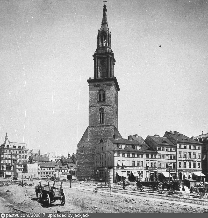
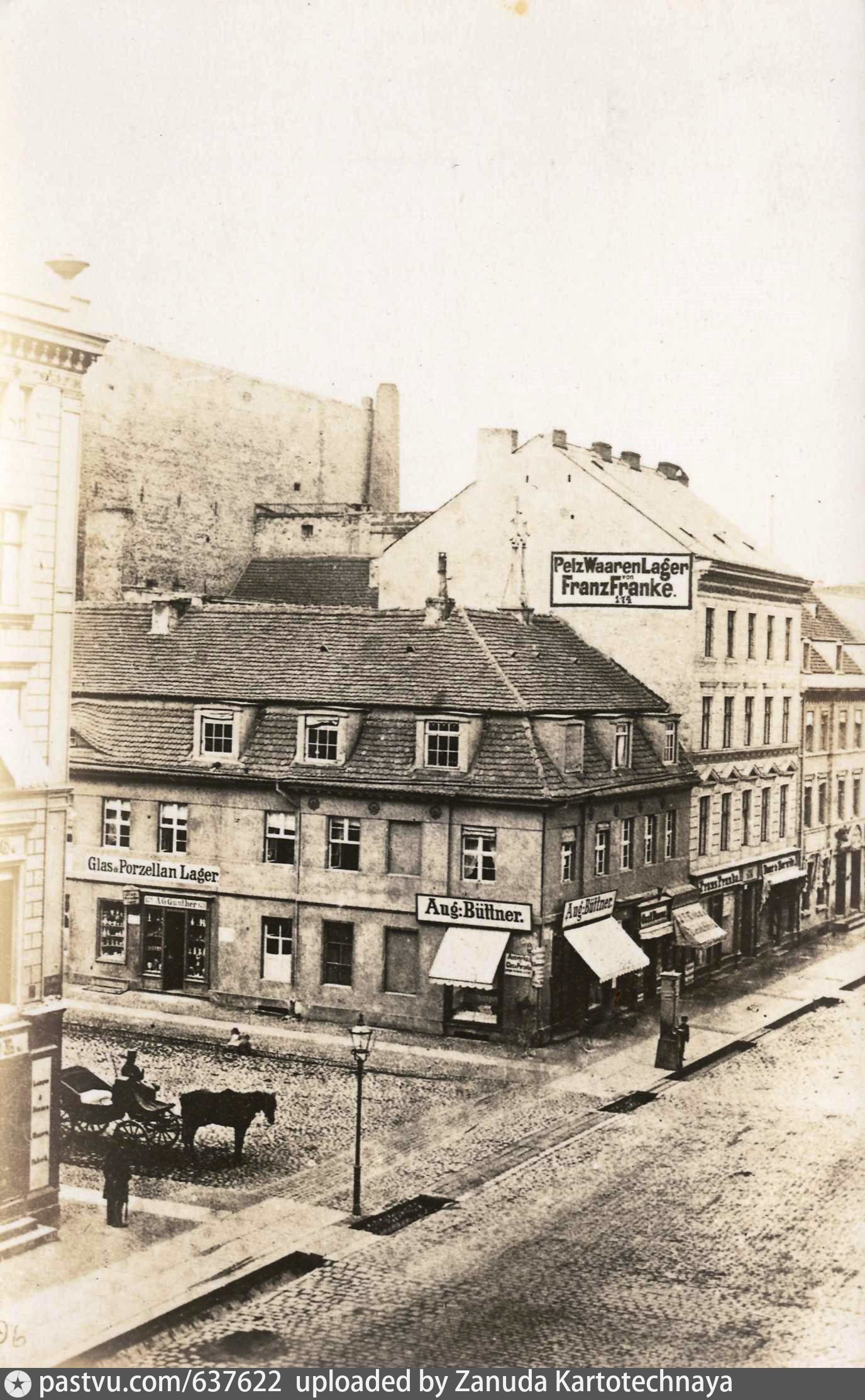
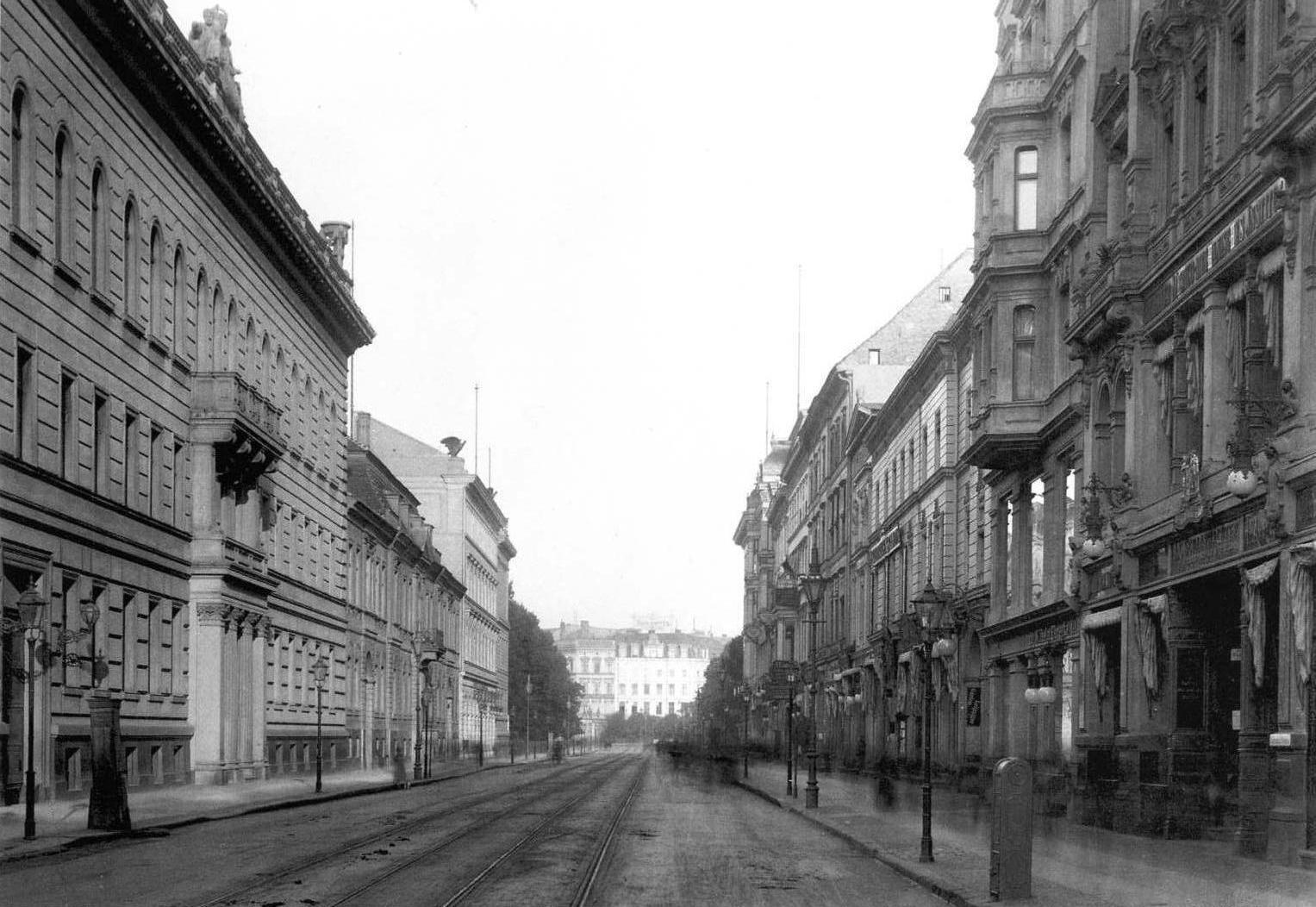
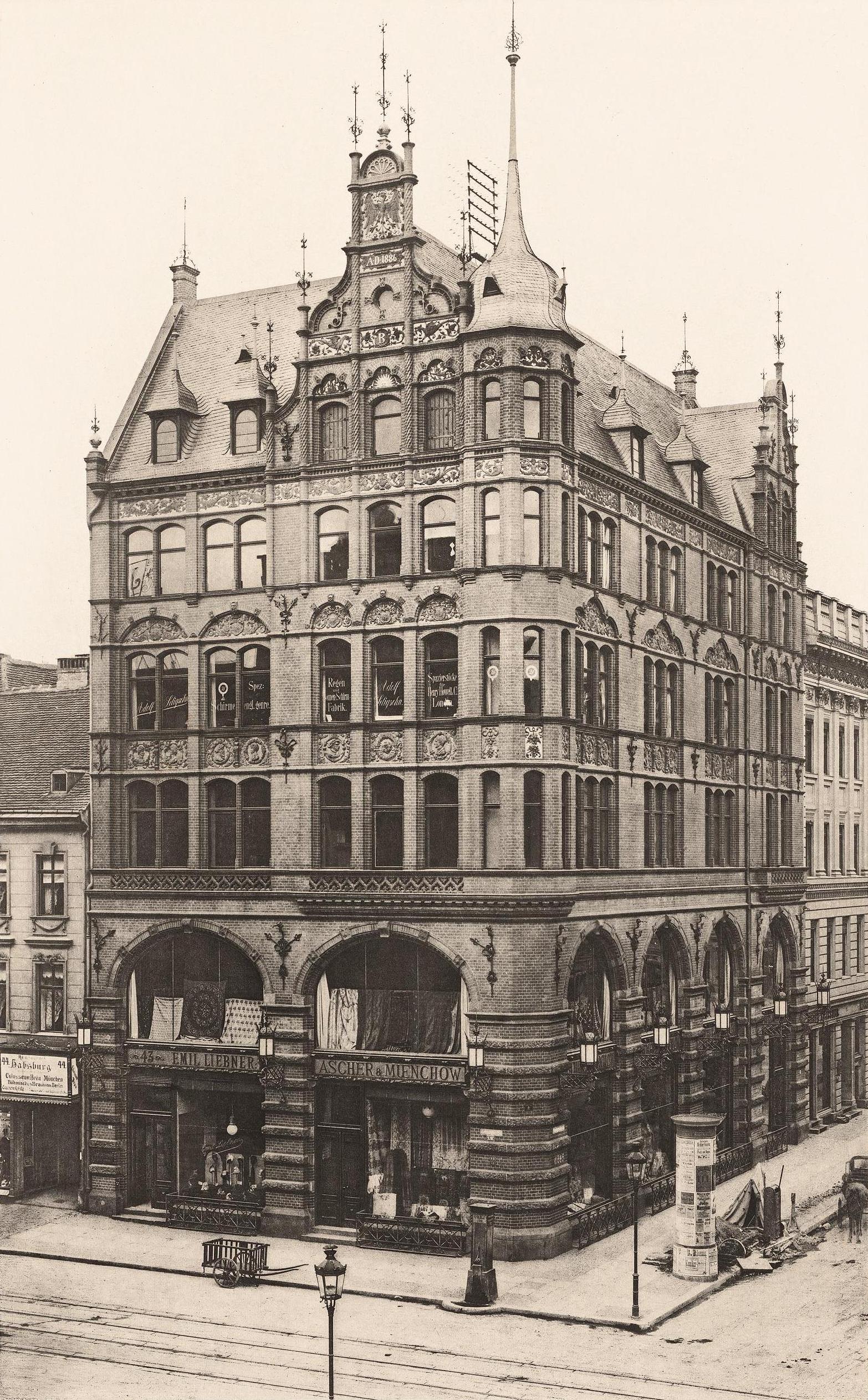
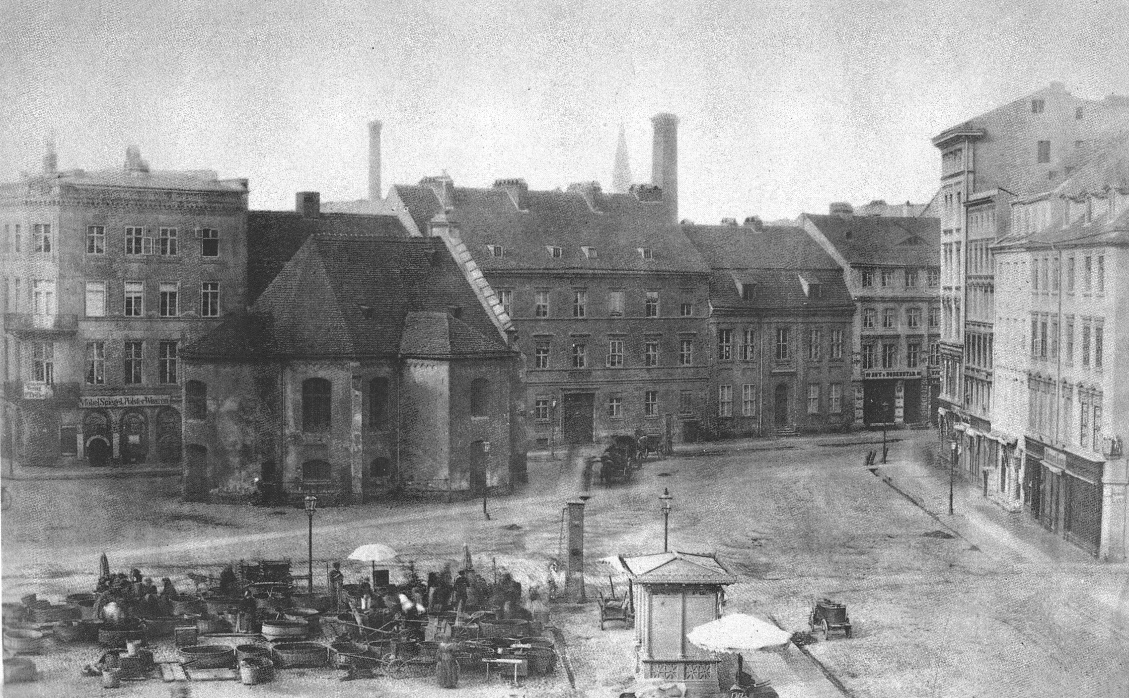
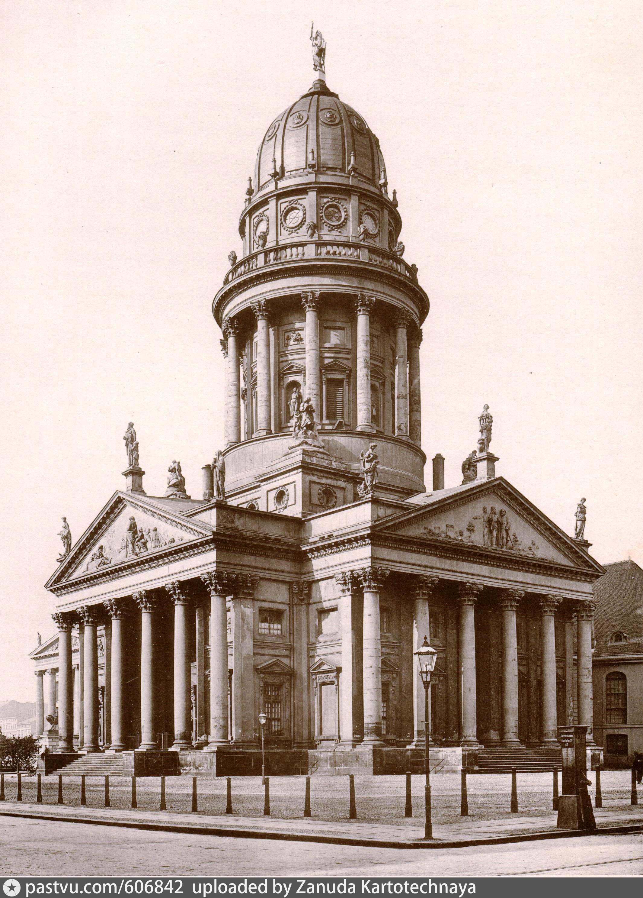
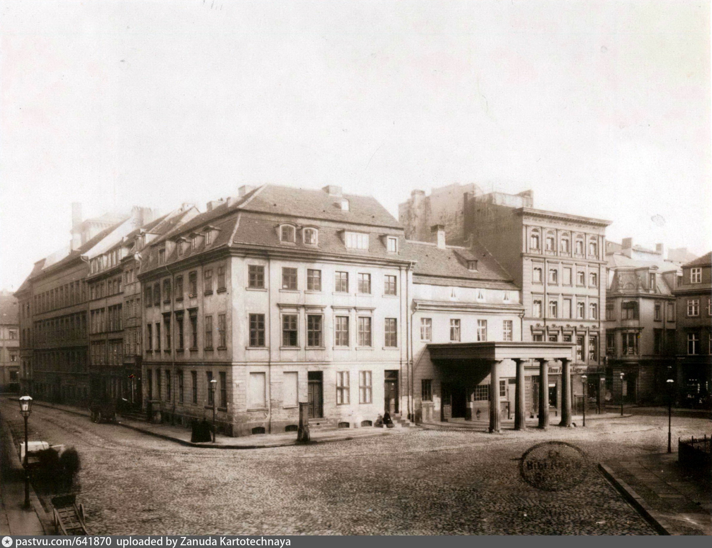
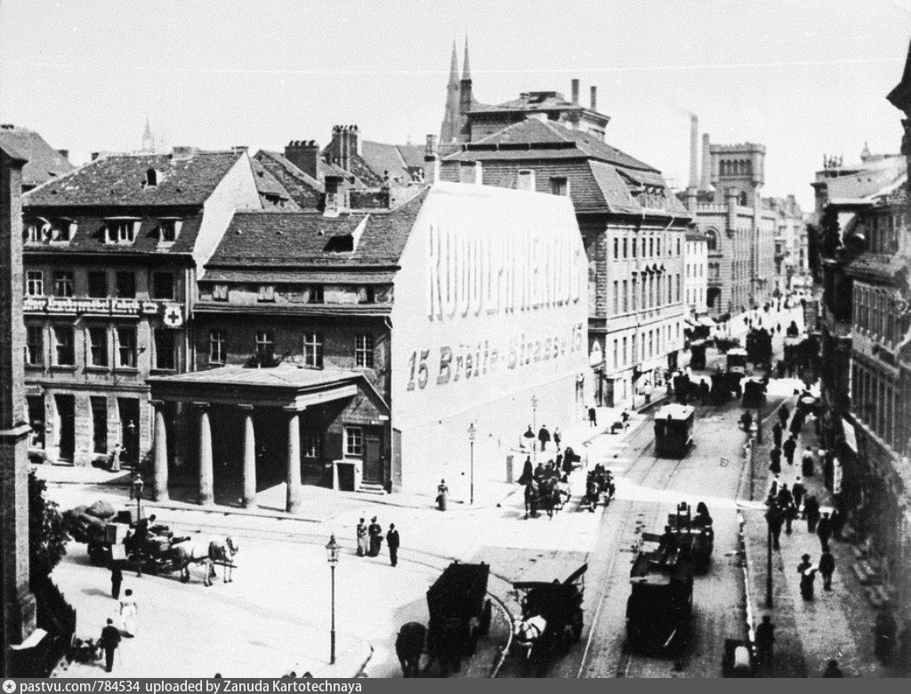
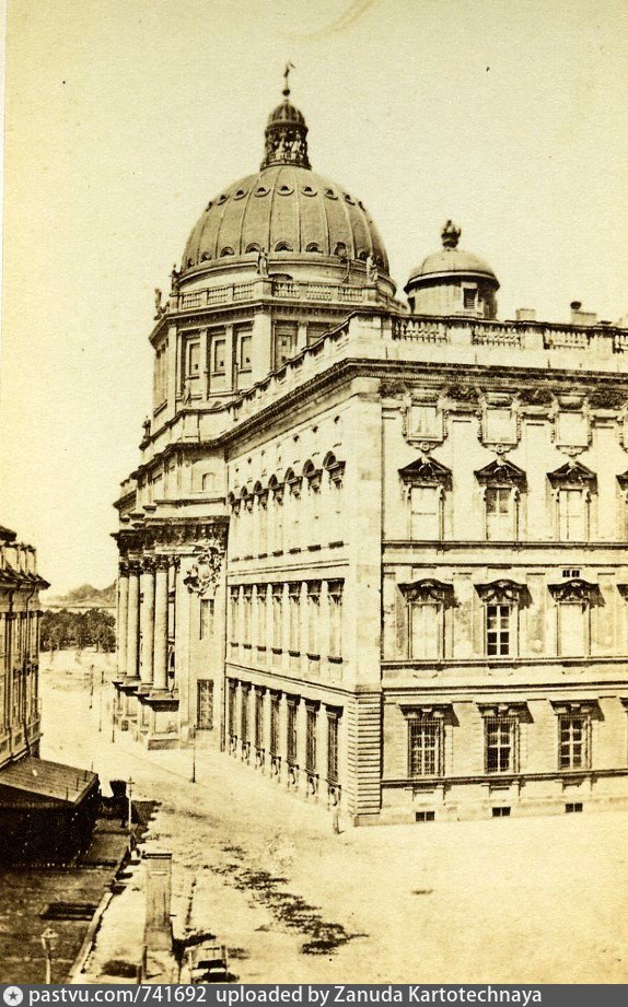
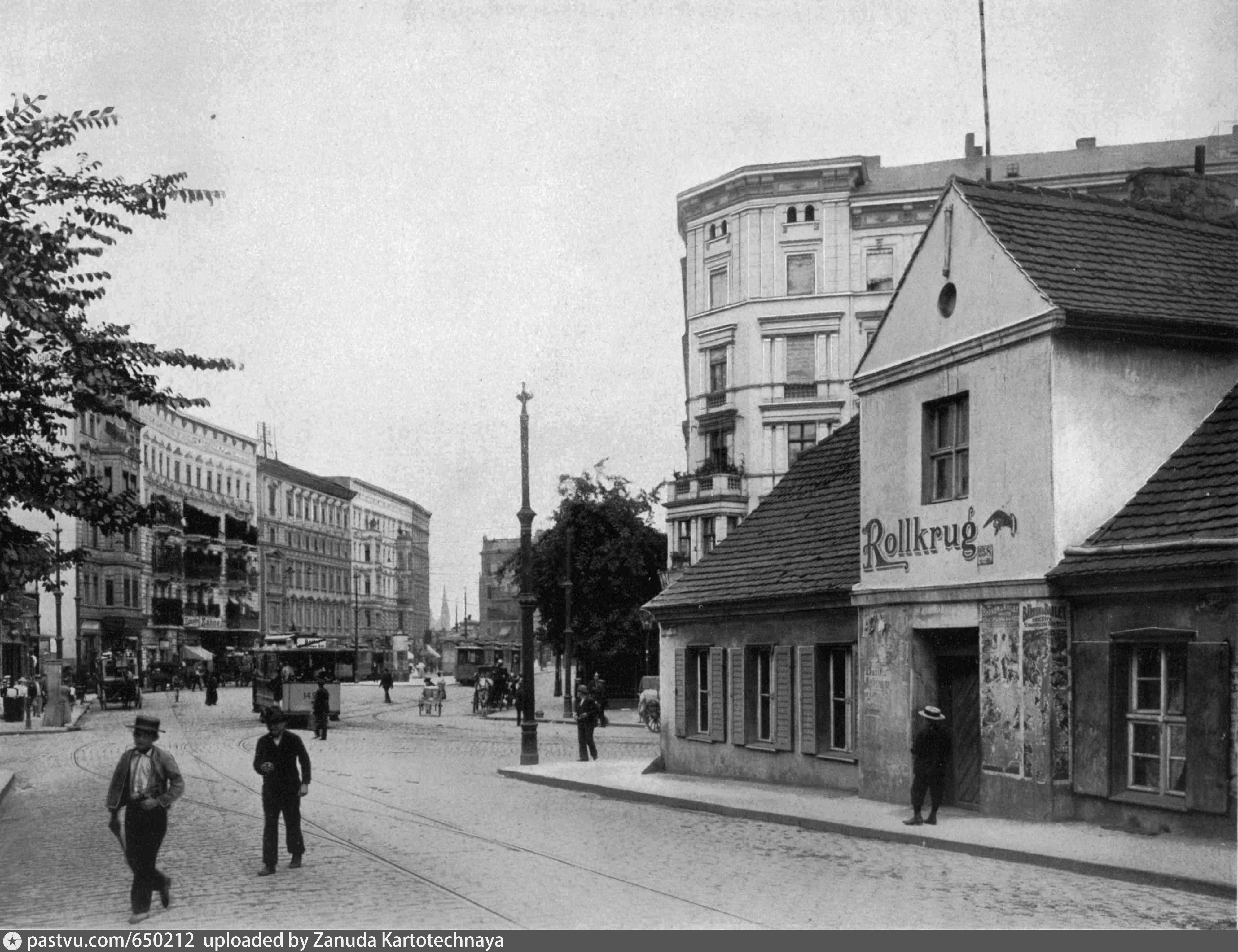
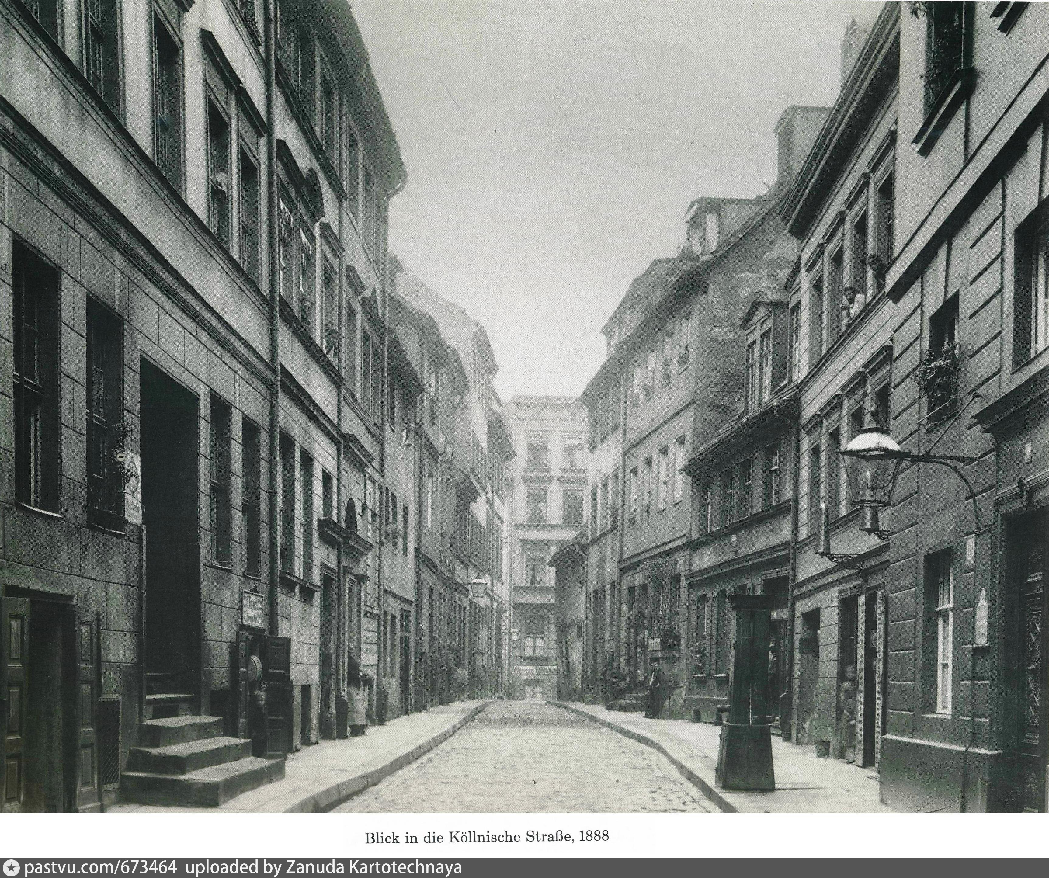
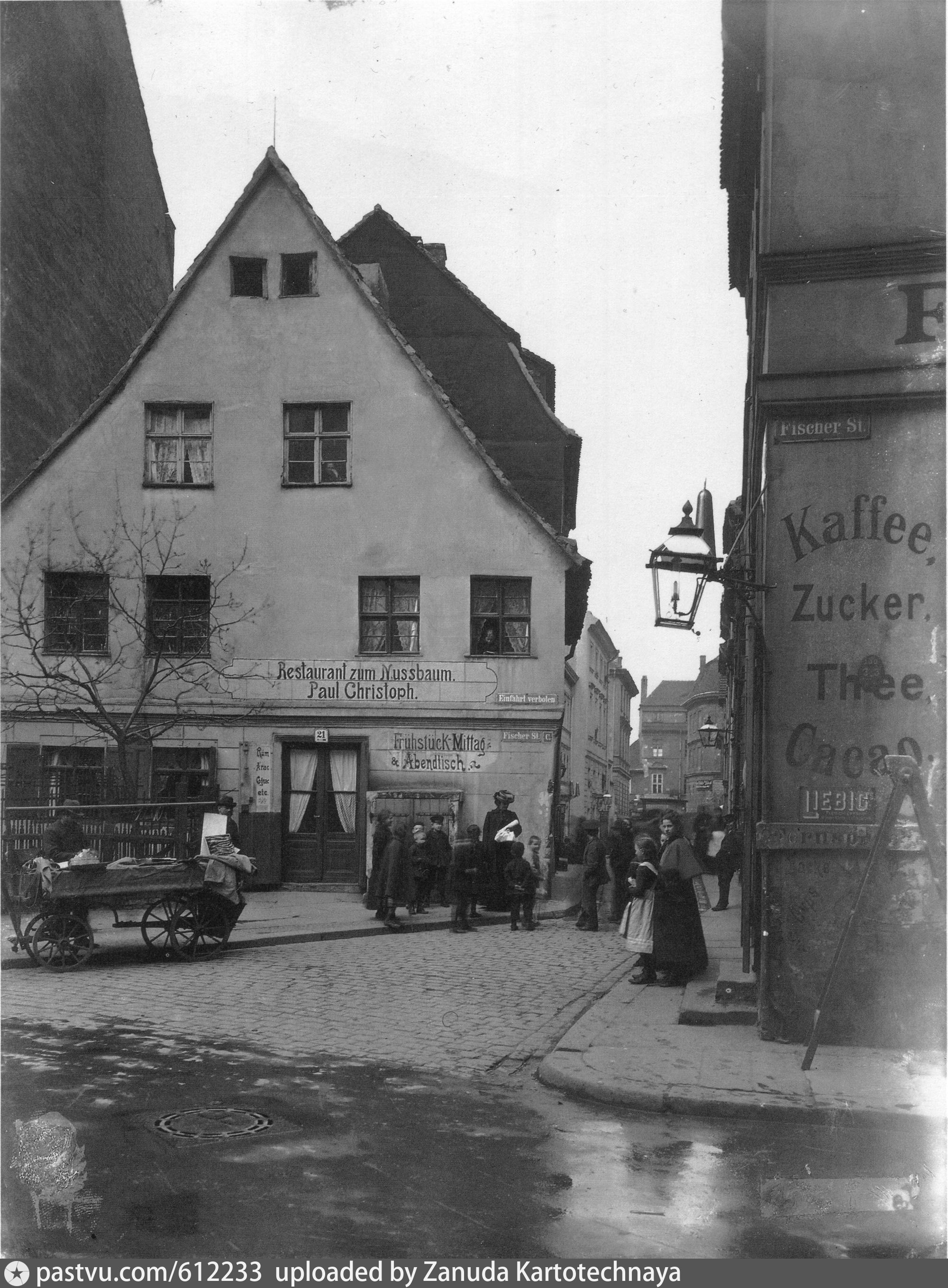
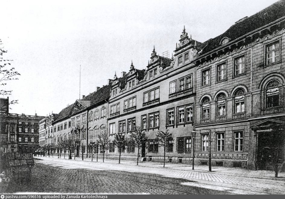
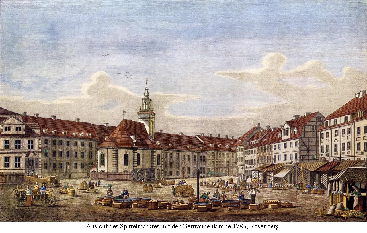
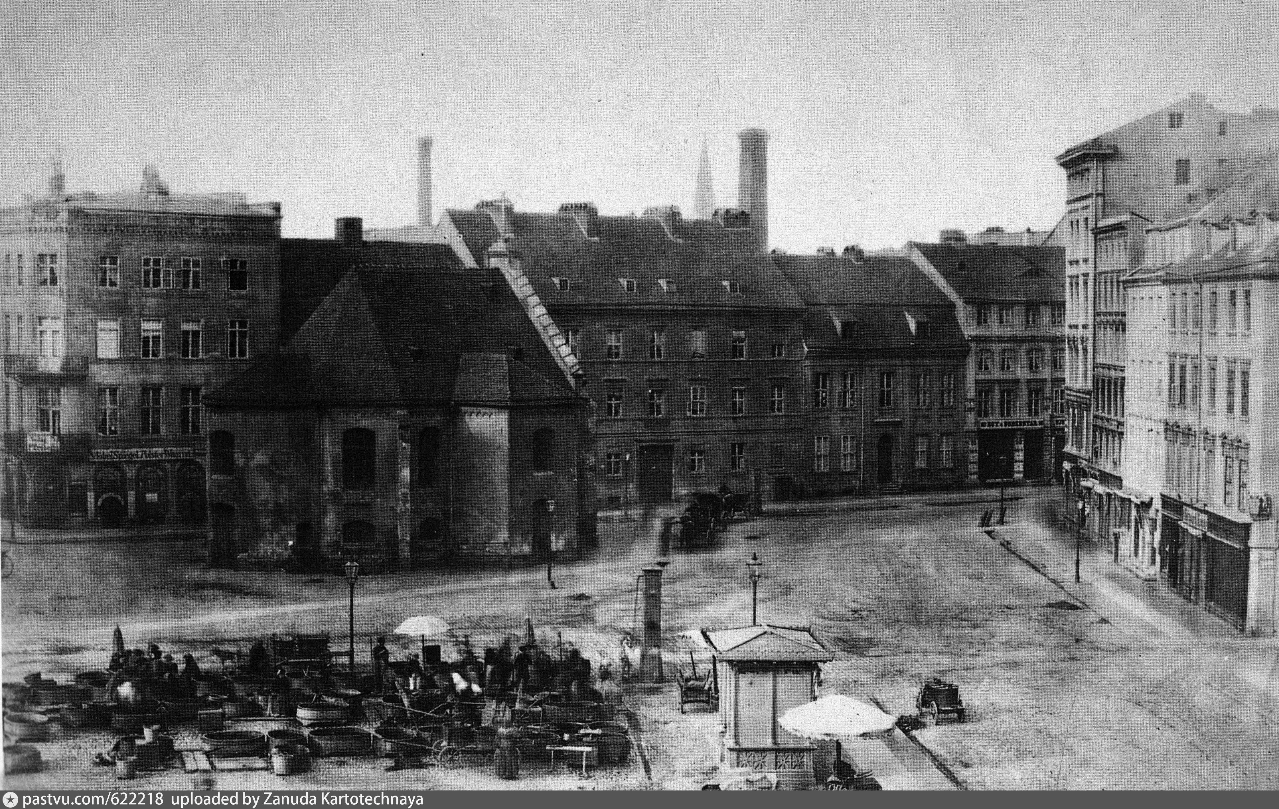
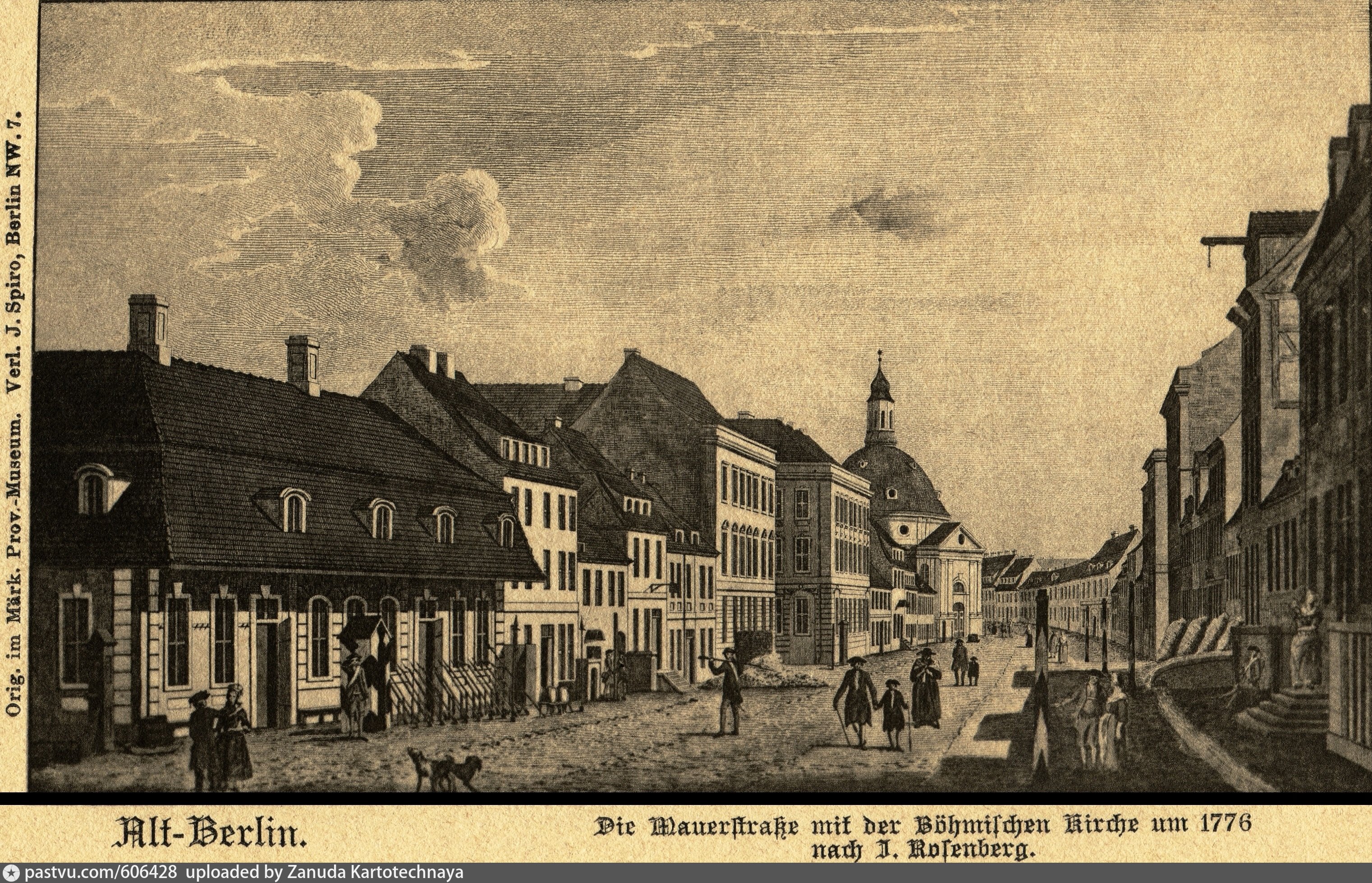
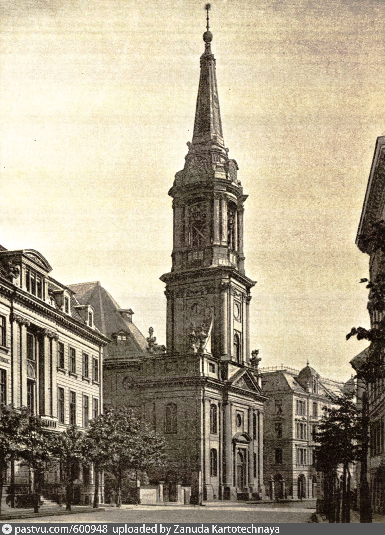
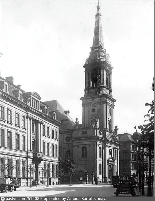
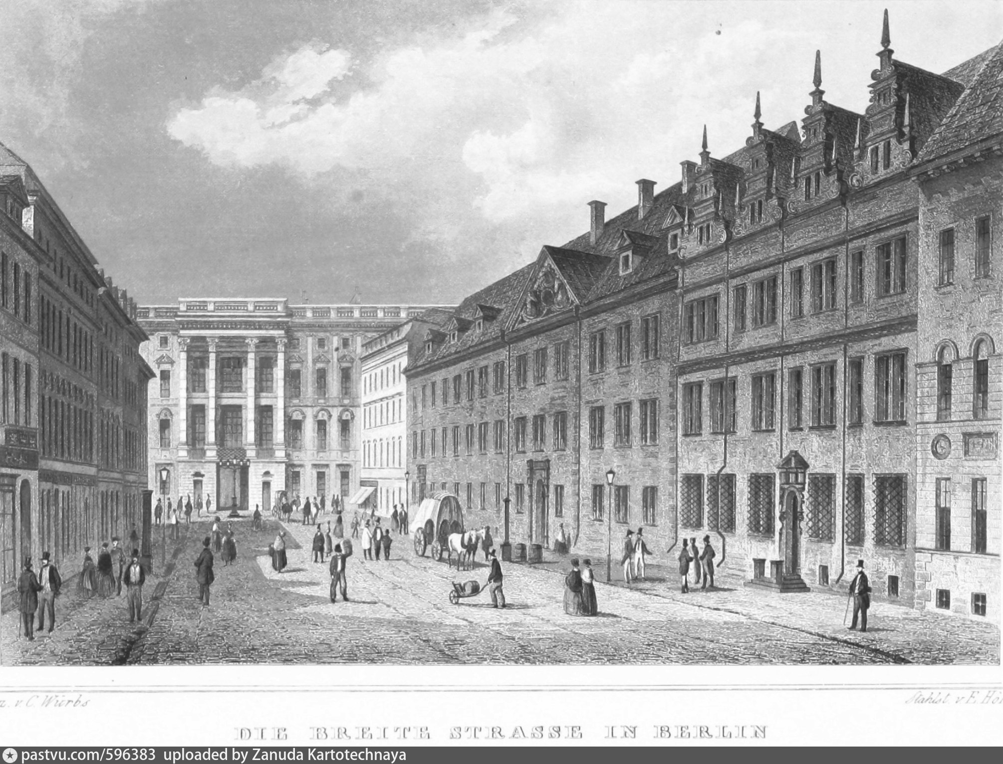
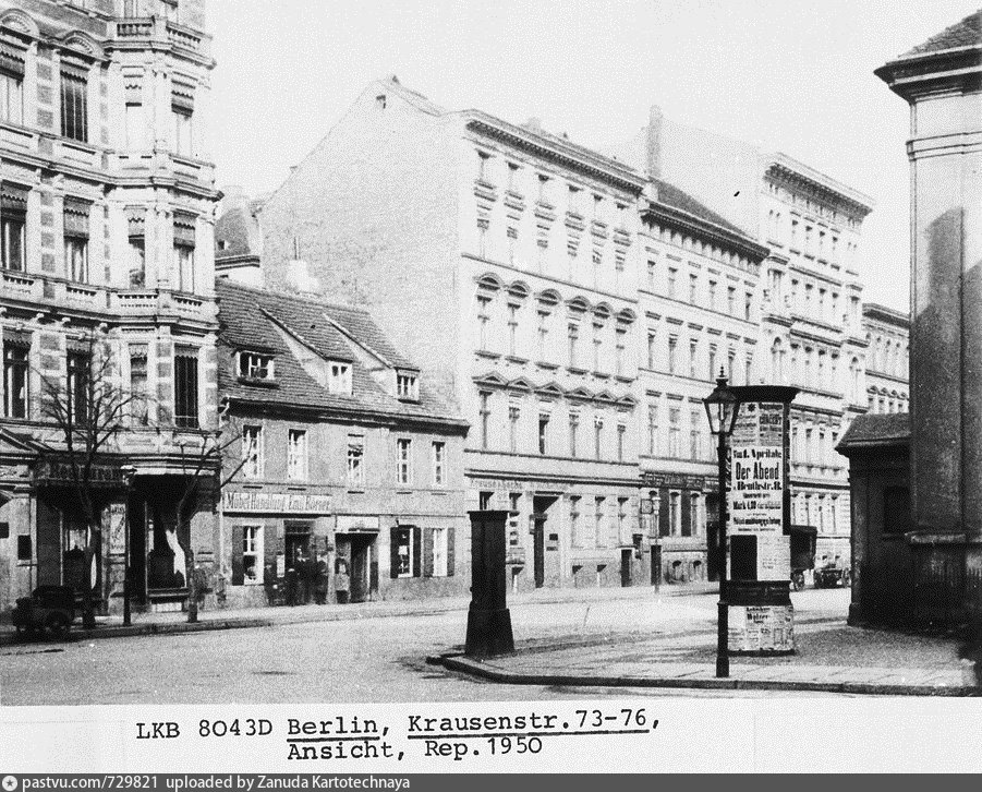
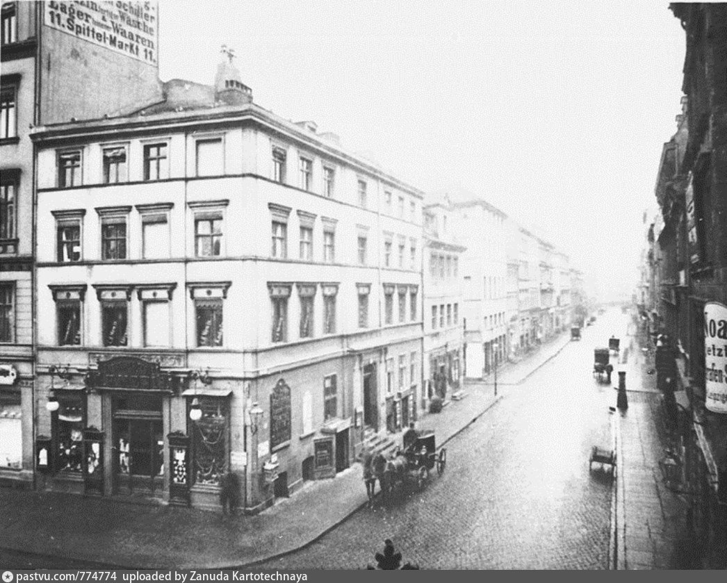
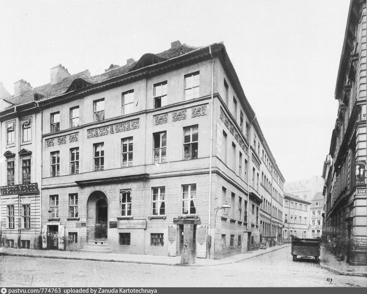
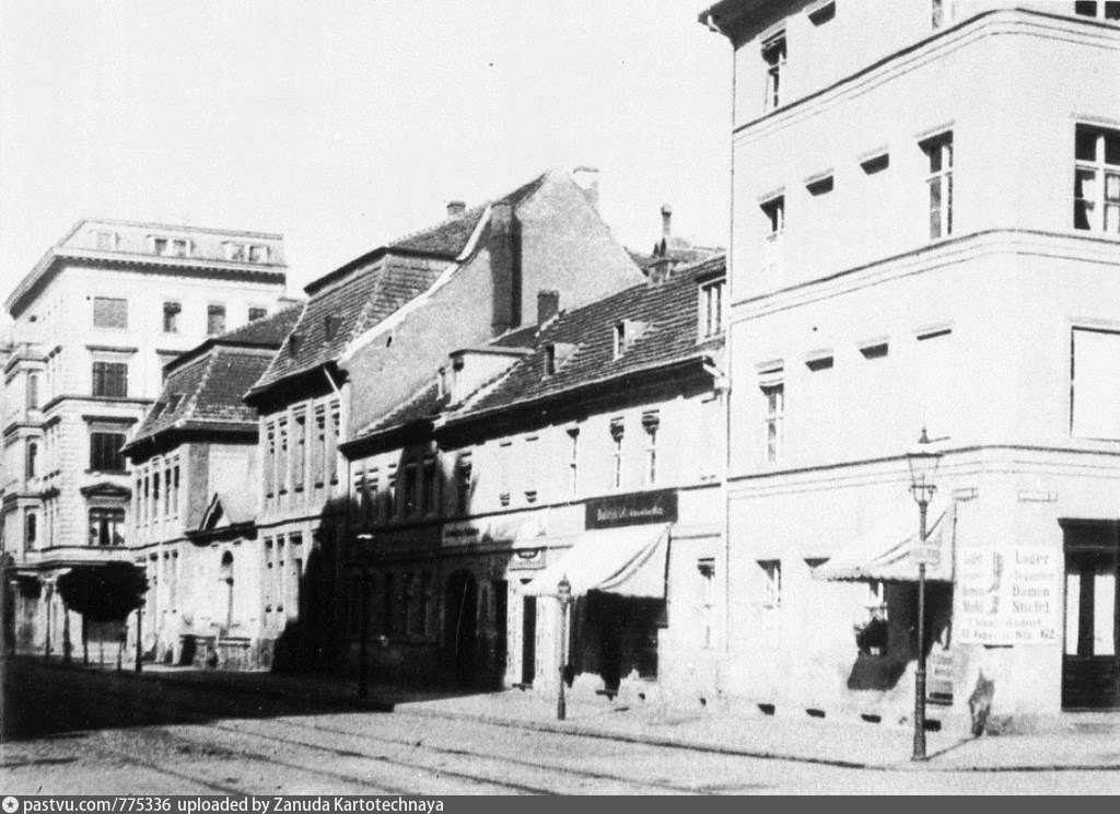
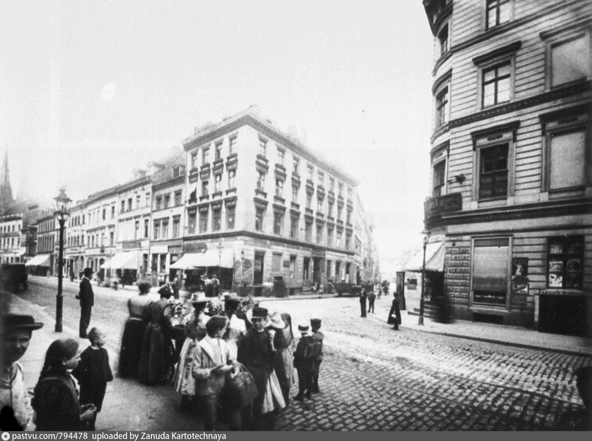
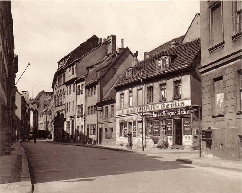
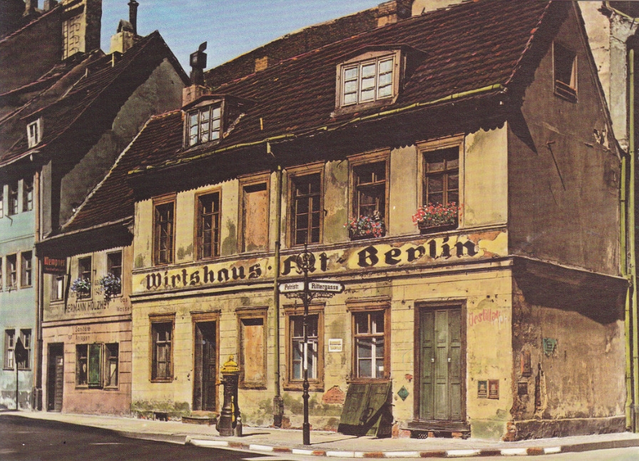
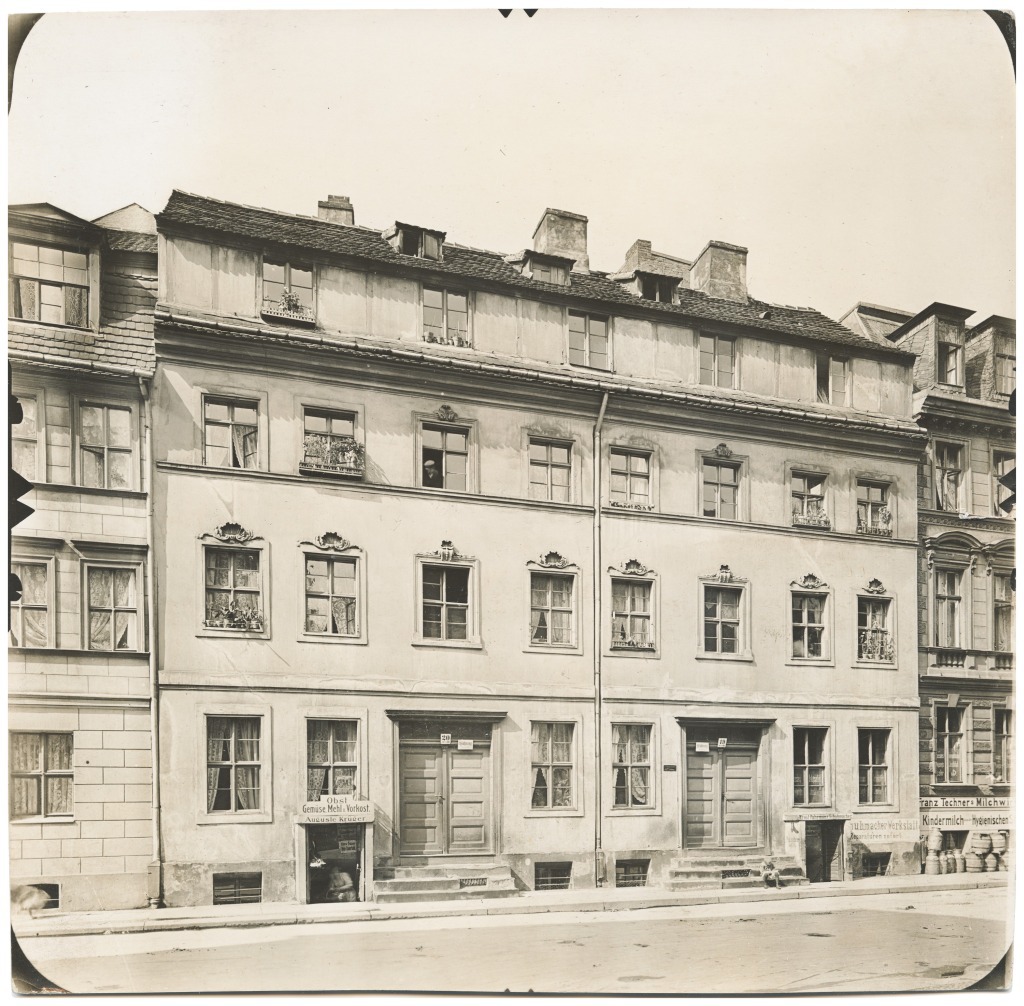
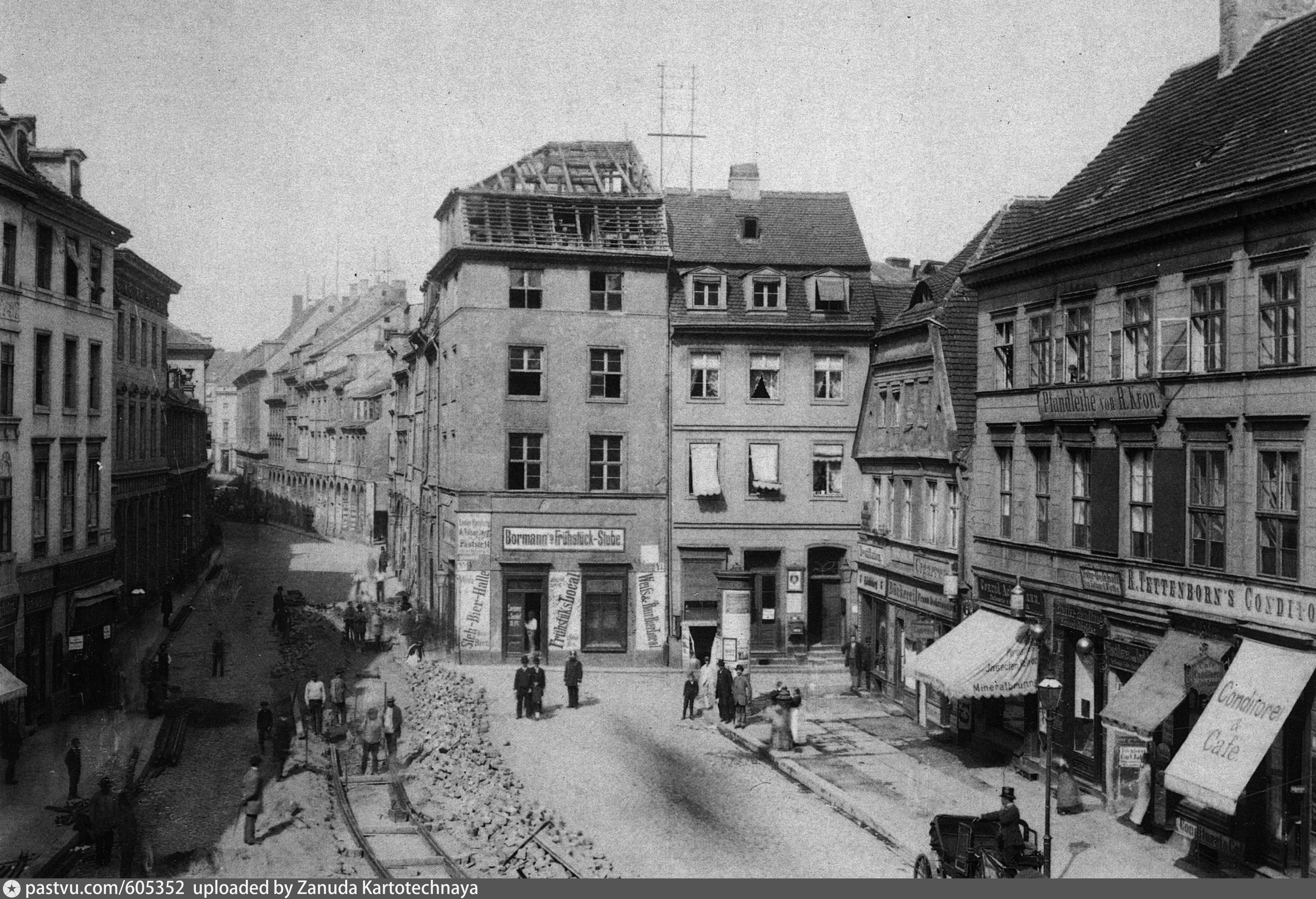
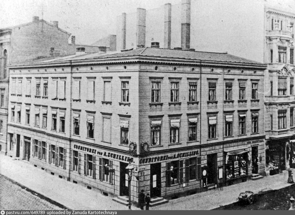
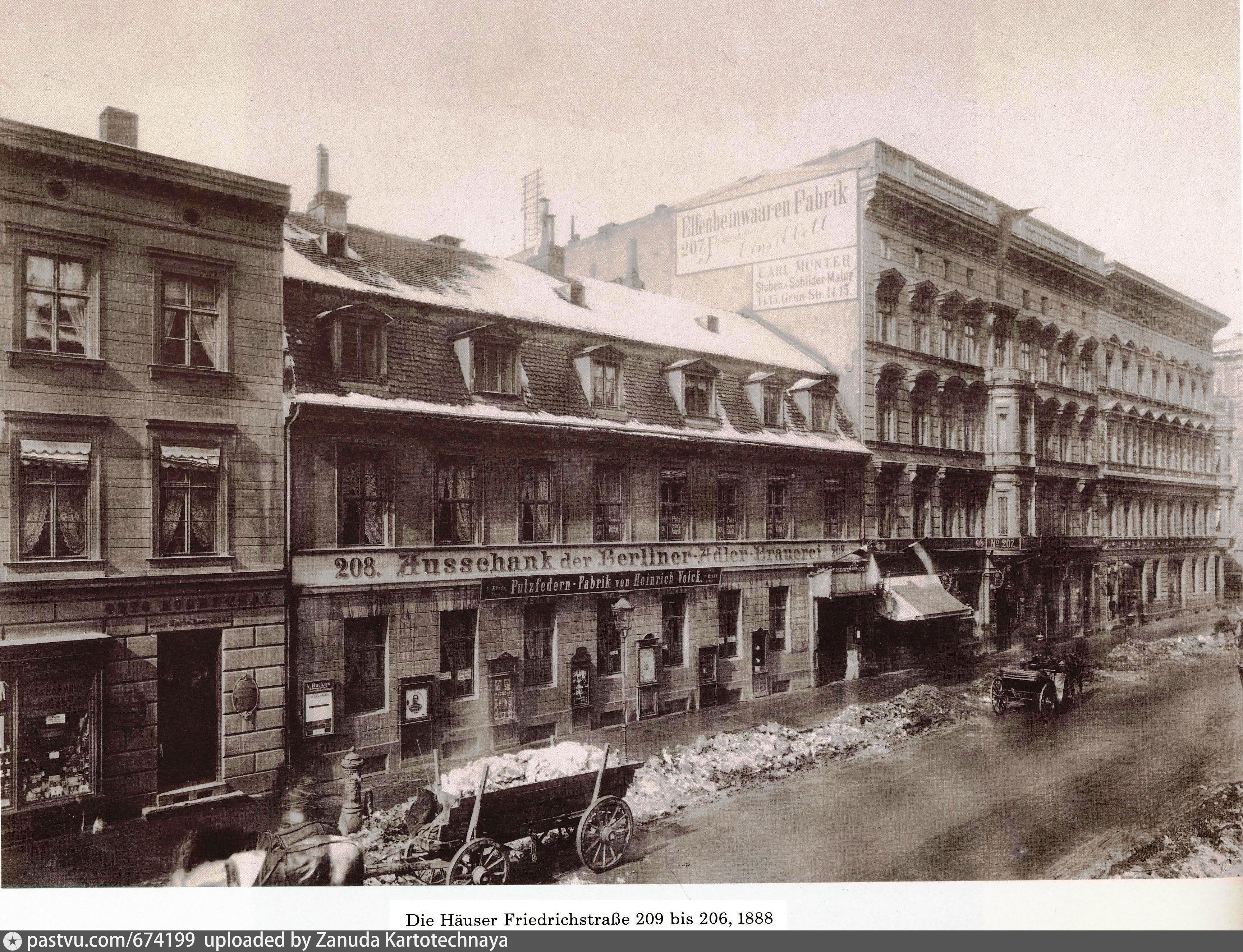
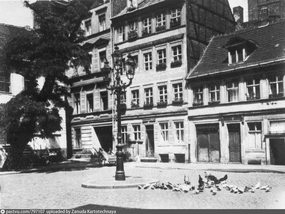
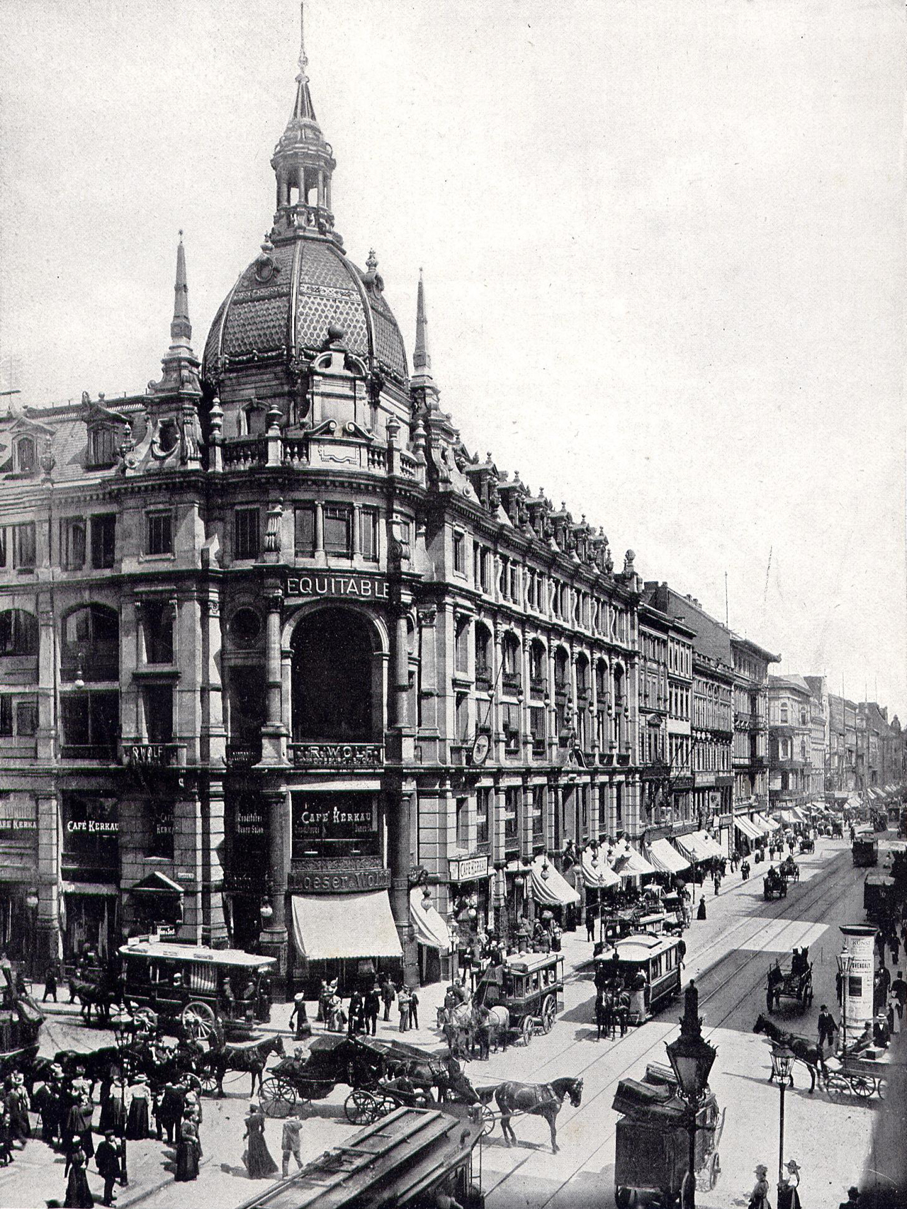
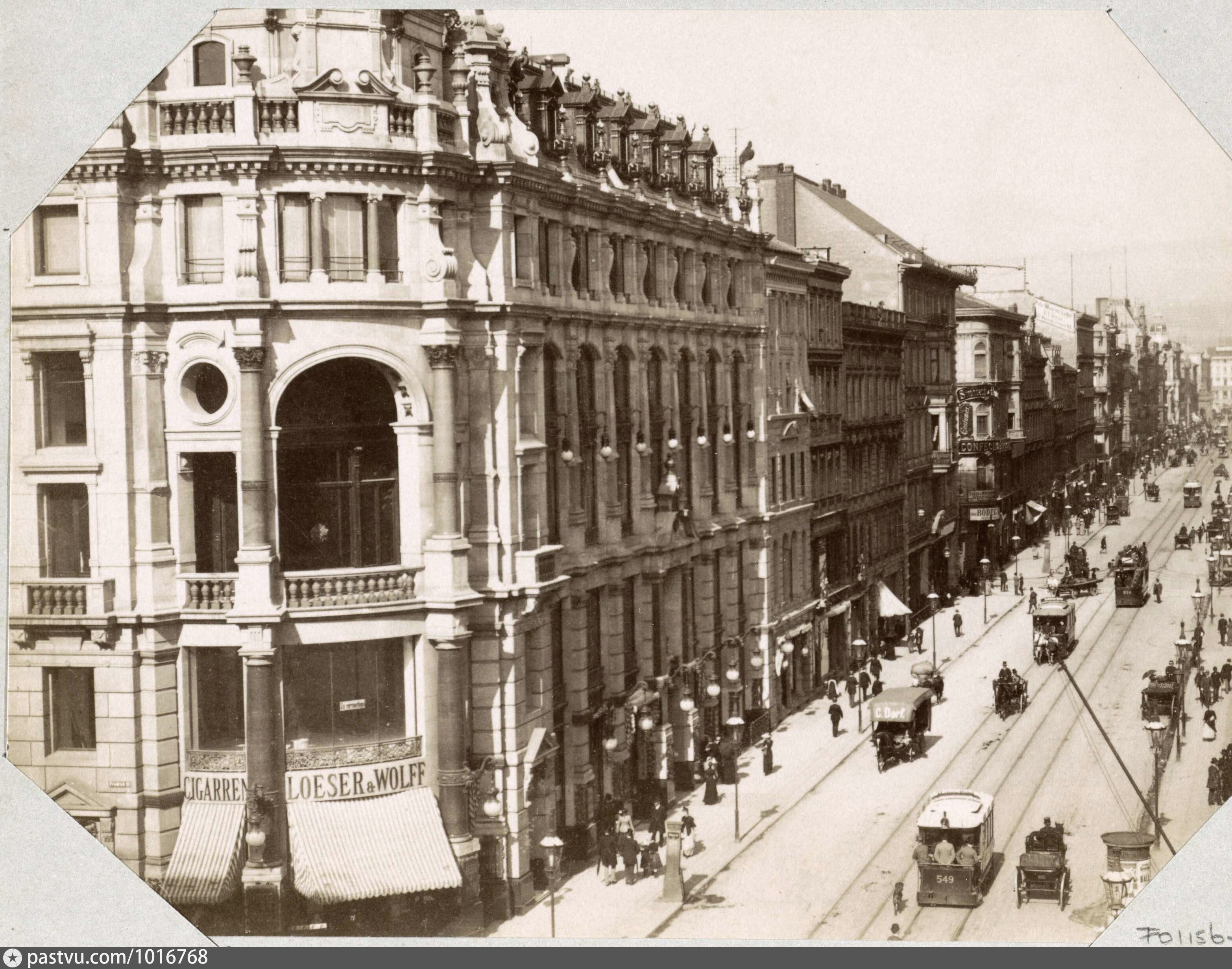
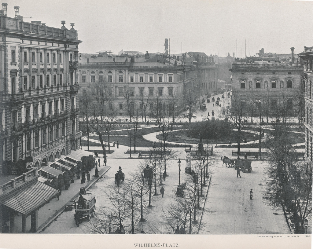
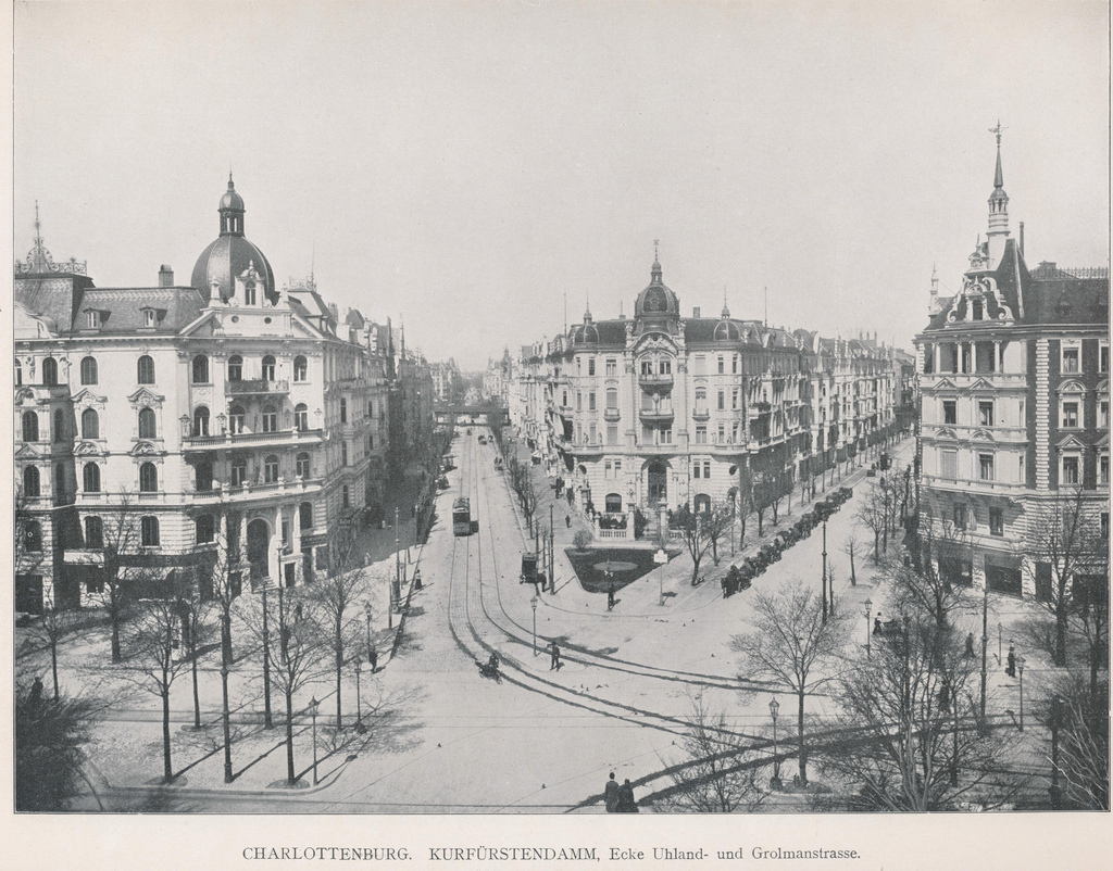
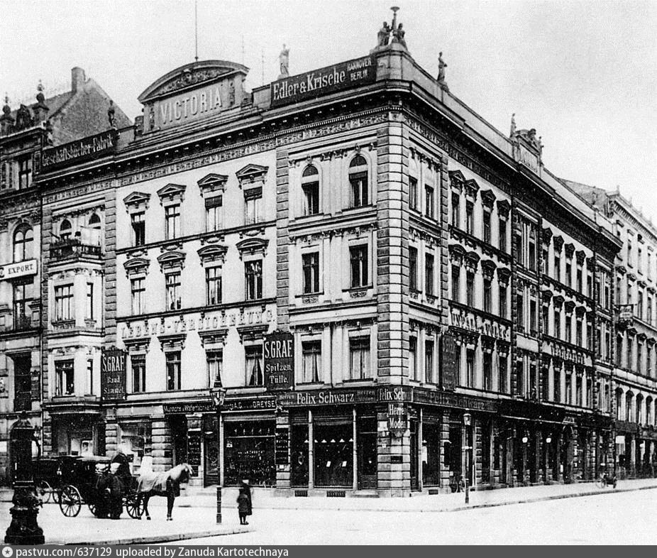
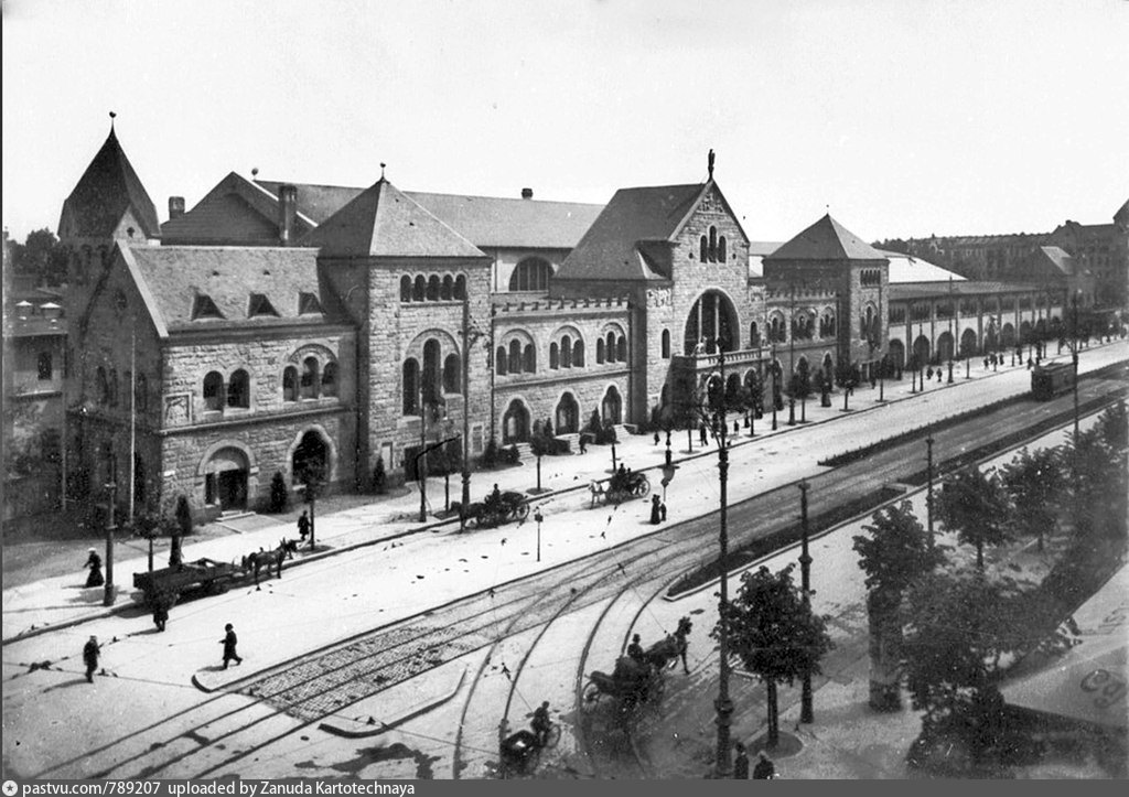
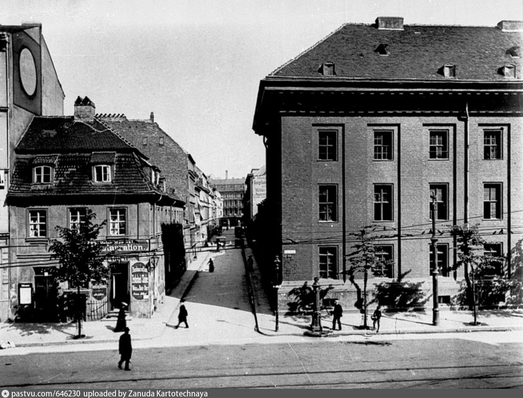
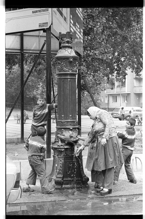
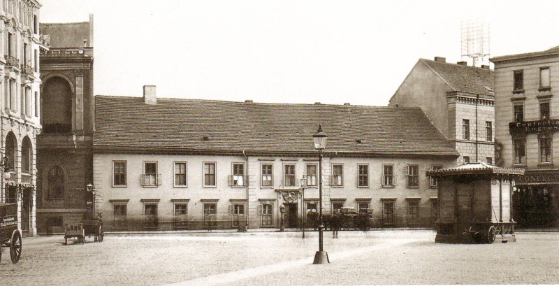