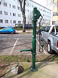
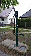
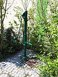
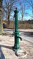
List of street fountains in the Berlin district of Treptow-Köpenick
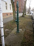
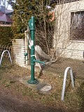
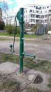
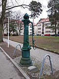
The list of street fountains in the Berlin district of Treptow-Köpenick is an overview of the currently existing fountains in the districts. It is also one of the 12 overview lists for the emergency water wells of the article street wells in Berlin .
overview
The list can be sorted according to districts, corridor distance of the groundwater (in 2009) and pump shape. Property numbers that cannot be identified are marked in brackets and in some cases with a preceding "#" in the address. The numbers on the pillars were assigned within the old districts before the district merger and can be repeated as digits. In the description, significant circumstances are compiled and supplemented with photographs and the entries can also be viewed on Wikimedia Commons, broken down by district. When collecting the list elements, recordings in Openstreetmap, the entries from the list of pirate inquiries in the House of Representatives from 2015 and images from older sources such as from StreetView from 2008 and 2009 were used.
According to information from the district office in response to a written request, there are 83 emergency water pumps in the district. According to the printed matter 7/15418 there are six state fountains in the district. The signs "No drinking water" are mainly located as a line of text on a metal sign above the outlet pipe at the level of the upper handle end. The water properties are regularly sampled by the health department; the information included in the list was essentially observed during the recording and inspection by Wikipedia and OpenStreetMap users in 2018. Changes can occur due to the regular official sampling for water quality and complex controls by well companies. If necessary, the timely condition at the respective location must be determined individually . The list is primarily intended to show the types and shapes of the well bodies. The location will be important for the user if he wants to look for such a well for emergency water supply if necessary.
A current location determination resulted from the site inspections by WP users and findings during the work on OpenStreetMap from the presentation of the results of the road inspection, which was commissioned by the Senate in 2014/2015 . The street furniture and pieces of equipment were then digitally evaluated and displayed on map material under the geoportal of the state survey office. The map material can be accessed via the link on the geoportal. The map details that are important for this article can be accessed using the search term “Straßenbefahrt 2014” and the relevant address. The locations of the road wells are marked with a blue square. Various map material can be selected as the background for the display. The overview of the locations of Berlin's street fountains can be obtained, among other things, from the results of the on-site inspections using an OSM-supported map in a comparison of the WP-recorded and the Plumpen recorded in 2014. The images released by Google Earth from 2008/2009 enable a further comparison of shapes and locations
Upon request to the district office, a list of 103 currently installed street fountains was sent in May 2020, with 57 “TW” fountains being assigned to the old Treptow district and 46 with “K” being assigned to the old Kopenick district . A corresponding list of the street wells in the district sorted by neighborhoods (LOR planning rooms) was published on the district office's website. The information in the list is associated with the locations of the street wells and zip code.
Notes on the list
According to the information provided by the Treptow-Köpenick district office in November 2019, there are a total of 105 wells in the district, compared to 96 in 2009. According to this document, 47 locations are not immediately suitable for drinking water because of chemical and 28 because of bacteriological contamination. For 2016, 83 functioning wells were named by the district office in response to a written request from 2017. The following list received from the District Office in June 2020 contains 103 entries, of which 46 (each consecutively numbered) are assigned to the (old) Köpenick district and 57 to the Treptow district . A number determined by district follows: xxxxxx. An indication of the LOR planning area in the Location column should reflect a spatial division more precisely. The list elements were coordinated with the state list from 2015 handed over to the House of Representatives, whereby "StrBr" not mentioned there are assigned to the federal wells. Another source on the locations results from the road inspection initiated by the Senate in 2014/2015 in which the emergency water wells (located near the road) were digitally recorded. With a targeted number of one well / tap per 1500 inhabitants (according to the regulations of the 1970s), there is a need for 171 street wells with the current number of inhabitants (334,351) in the district.
In the list provided by the district office, some street wells could not be precisely located based on the address. On the one hand, not all locations in the district are included or indicated in the traffic data from 2014. On the other hand, those on the StreetView images from 2008 are not available, which can speak for a list after 2010. In order to mark this location, the name of the coordinates is marked with a prefixed "??"; accordingly, the recorded geographic coordinates are only target values and should be specified more precisely during an inspection. For the year 2020 two wells have been entered for a new installation with "overbore": K0017 in Köpenick, Marienstraße 9, and TW038 in Treptowan on Otto-Franke- / Handjerystraße. A new borehole would require an investment of EUR 28,000 per well.
Abbreviations from the LOR lists of the statistics office are used for the districts of the district.
|
|
|
|
|
Emergency water well
| District | Name / number | Address location |
Shape / type | Corridor distance year |
Image, notes |
|---|---|---|---|---|---|
| Old door | TW001 | Schmollerplatz 27 Location Elsenstrasse |
FSH-L three-part column |
2-3 m | The fountain (OSM-ID: 1176680893 ; Mengerzeile / Schmollerplatz) is in front of the house at Schmollerplatz 27 in the extension of the Mengerzeile. |
| Plans | TW002 | Herkomer Strasse opposite. 12 Location Am Treptower Park Süd |
FSH-L three-part column |
Corridor clearance | The fountain is on the west side of the street 25 meters from Am Treptower Park. The fountain location is opposite the entrance to the corner building at Am Treptower Park 34/35. The Belarusian embassy is located on the adjacent property (Am Treptower Park 32/33). In the 1930s, the villa building housed the municipal youth home (property on Herkomer Strasse 1/2, Am Treptower Park 32/33) and from 1945 to around 1990 a post office. The southern entrance to the Soviet Memorial (Alt-Treptow district) is located across Am Treptower Park . |
| Old door | TW003 | Kiefholzstrasse 420 (Kiefholzstrasse / Wildenbruchstrasse) Location Elsenstrasse |
FSH-L three-part column |
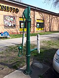
2-3 m | The fountain (OSM-ID: 4136447590 ) is on the east side of Kiefholzstrasse in front of Netto-Markt. Behind this is the site of the former Görlitzer Bahn, with the groundwater distance increasing there. |
| Old door | TW004 | Treptow 77 Location Elsenstraße |
FSH-L three-part column |
2–2.5 m | The fountain (OSM-ID: 6389108829 ) is on the east side of the street Am Treptower Park in front of the Centipede day care center. The Federal Criminal Police Office is on the other side of the street. |
| Old door | TW005 | Lohmühlenstraße 49 Location Elsenstraße (Kungerkiez) |
FSH-L three-part column |
2-3 m | The fountain (OSM-ID: 3689306373 , Lohmühlenstraße / Heidelberger Straße) is 15 meters from Lohmühlenstraße to the southeast on the footpath that leads behind the residential buildings to Schmollplatz. This path is the access road to houses 49-52 of Lohmühlenstraße in the Plumpe area, the entrances of which are on the courtyard side. |
| Old door | TW006 | Kiefholzstrasse opposite. 9 Location Elsenstrasse |
FSH-L three-part column |
Corridor clearance | The fountain is in the line of trees on the north side opposite the corner house number 9, 20 meters west of the confluence with Krüllstraße (formerly Erwin-Moritz-Straße). The embankment on the well side between Kiefholzstrasse and Jordanstrasse was the access to the Görlitzer Bahnhof , the area of the Görlitzer Park . The fountain is protected by two tree brackets, parking on this side of the street is prevented by wooden bollards. The fountain stands on a concrete slab, the drainage takes place in a street inlet on the footpath. |
| Plans | TW007 | At the Plänterwald opposite. Köpenicker Landstrasse 29 Location Köpenicker Landstrasse |
FSH-L three-part column |
2-3 m | The fountain (OSM-ID: 1726113340 ) is in front of the Parkstrasse allotment garden. The location is 30 meters northwest of the Köpenicker Landstrasse in the street Am Plänterwald. |
| Plans | TW008 | Orionstraße 56 Location Plänterwald |
FSH-L three-part column |
2–2.5 m | The fountain (OSM-ID: 6497342839 ) is on the edge of the sidewalk in the immediate vicinity of the Nettomarkt and approx. 10 m from the intersection with Dammweg. |
| Plans | TW009 | Willi-Singer-Strasse opposite. 2 Location Köpenicker Landstrasse |
FSH-L three-part column |
Corridor clearance | The fountain stands on a raised foot flange to the standpipe in the small paving strip in front of the garage. The street inlet is located under the water outlet. The grounds of the school at Plänterwald (Willi-Sänger-Straße 1 and Sophie-Brahe-Schule, Am Plänterwald 17/23) are located behind the facility's six garages, which are (probably) used for other purposes. They are to the well, however, so. The side street from Neue Krugallee to the south opens up the four-storey residential development from the 1960s, which was built on the grounds of the KGA "Treptows Idyll", the allotments across from the Plänterwald were up to the Köpenicker Landstrasse until the end of the 1950s, "Heimstättengarten- Area". Opposite the fountain location on the square-like extension, a narrow access road leads at right angles to the north to the residential buildings. |
| Plans | TW010 | Eichbuschallee opposite. 1 location Baumschulenstrasse |
FSH-L three-part column |
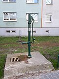
2.5-3 m | The street fountain Eichbuschallee / Neue Krugallee ( OSM-ID: 6381133348 ) is located on the Plänterwalder side of Eichbuschallee, 25 meters from the confluence with the Neue Krugallee. The blocks on the fountain side of the street are addressed to Neue Krugallee 120 (-112). The four-storey residential building 1 (-5) opposite the pump belongs to Baumschulenweg, as does the entire development in the southwest, to Plänterwald the street and both sidewalks belong. The handle and the water outlet pipe opposite are aligned parallel to the Eichbuschallee. A rectangular trough with a grate for rainwater drainage is inserted in the concrete surface for the drain. The fountain itself is next to the shoulder on the sidewalk. It should be noted the larger ring in the concrete around the base plate of the pump tube with which it is attached to the standpipe. |
| Tree | TW011 | Rodelbergweg opposite. 2 Location Baumschulenstrasse |
FSH-L three-part column |
4-7 m | The fountain (OSM-ID: 1759713969 -Rodelbergweg / Köpenicker Landstraße) is located southeast on the Rodelbergweg at the corner of Köpenicker Landstraße in front of the Plänterwaldbusch, 150 meters from the connecting canal (Markgrafbrücke). The well has a square cover next to the curb over which the plump water flows off. |
| Tree | TW012 | Hänselstraße / Heidekampweg Location Baumschulenstraße |
FSH-L three-part column |
Corridor clearance | The fountain (OSM-ID: 7781577388 ) stands on a concrete slab between two tree brackets. Hänselstraße is interrupted to the west by a row of posts to the section on Heidekampgraben (footpath / bike path). The fountain stands between the continuation of these bollards to the northwest section of the Heidekampweg. The location is opposite the course of the Heidekampweg to the southeast (house numbers 105 and 103, Heidekampweg day care center). The pump water is drained into a street inlet. The "Schule am Heidekampgraben" (branch of the 2nd community school, Hänselstraße 14) is located in the corner of Heidekampweg and Hänselstraße opposite the Bunnen. This interruption in Hänselstrasse on Heidekampgraben was caused by the course of the Berlin Wall ; after 1990 the green corridor on Heidekampgraben marked the district border between Neukölln and Treptow-Köpenick. |
| Tree | TW013 | Heidekampweg / Rinkartstraße Location Baumschulenstraße |
FSH-L three-part column |
Corridor clearance | The fountain is on the north side of Heidekampweg 20 meters from Rinkartstraße, 30 meters above the front of the four-story apartment block Rinkartstraße 28 ff. On the pavement with shaped stones there is a concrete slab with a round street inlet. |
| Tree | TW014 | Dornbrunner Straße / Frauenlobstraße Location Baumschulenstraße |
FSH-L three-part column |
Corridor clearance | The fountain (OSM-ID: 7830473685 ) is in Dornbrunner Straße (eastern parallel street to Baumschulenweg) across from house entrance 20 to corner house 22 on the eastern side of the street, that is 35 meters north of Frauenlobstraße. The foot of the well is located next to a manhole cover on a paved field in the area of the edge strip and the pavement slabs. On the property at the fountain is the area (south-west corner) of the Dornburger Straße day care center. |
| Tree | TW015 | Hohenbirker Weg opposite. 2 / Kiefholzstraße Location Baumschulenweg |
FSH-L three-part column |
3–4 m | The fountain (OSM-ID: 6966390503 ) is located on Hohenbirker Weg across from House 2. Behind the fountain, the green area begins, which runs along Kiefholzstrasse for approx. 100 m. |
| Tree | TW016 | Forsthausallee opposite. 2 Baumschulenstrasse 64 Location Baumschulenstrasse |
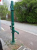
Krause | 3.5-5 m | The street fountain 16 (OSM-ID: 1767778181 - Forsthausallee / Baumschulenstraße) stands on the round lane of the Forsthausallee / corner of Baumschulenstraße between the shaped stones of the sidewalk. The pedestrian crossing is at this height. The lawn behind it to the adjacent allotment gardens Forsthausallee is addressed as property with house number 1. The location of the well is therefore to be indicated as opposite Forsthausallee 2. Pump handle and outlet pipe are at right angles to each other. The water drains into its own round, half-open grate (street inlet) for underground street drainage. Such separate inlets have been introduced due to a new regulation since the beginning of the 2010s. A sharp street corner was drawn in until 1960. This corresponds to a distance of 5 m to the two adjacent lanes. It should be noted that there were additional facilities for the Sonnenallee transition up until the fall of the Berlin Wall . |
| Plans | TW017 | Kiefholzstraße / before Dammweg 164, Plänterwald location |
FSH-L three-part column |
2-3 m | The fountain (OSM-ID: 1584145006 ) is on the roadway of Kiefholzstraße 10 meters from its northwest corner with Dammweg. The plump stands on a pavement square in the edge of the sidewalk, followed by a hedge to the other parking bays. The outlet pipe is located on a short extension of the central pipe above the well stand. |
| Plans | TW018 | Erich-Lodemann-Straße 125 Location Am Treptower Park Süd |
FSH-L three-part column |
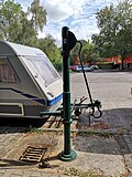
Corridor clearance | The fountain stands 130 meters from Eichbuschallee on a side branch of the Erich-Lodemann-Straße, which is along the railway line . The well is located on the corner of house 125 between house and the access road to house 125-133. The handle on the fountain stand is on the access road and the exit to the hedge in front of the garbage / recycling bin. |
| Plans | TW019 | Eichbuschallee 21 (Köpenicker Landstrasse) Location Plänterwald |
FSH-L three-part column |
2.5-3 m | The fountain (OSM-ID: 6381133347 ) is on the roadside in front of the house at Eichbuschallee 21, west of the intersection with Köpenicker Landstrasse. |
| Tree | TW020 | Frauenlobstraße / Rinkartstraße Location Baumschulenstraße |
FSH-L three-part column |
Corridor clearance | The fountain is on the Frauenlobstraße, west of Baumschulenweg. Across from Frauenlobstraße 5 is a lawn to the north of the four-story block of flats Heidekampweg 48-48b, which is bordered by Frauenlob- / Rinkartstraße / Heidekampweg. At the eastern corner of this lawn, the street fountain stands on a concrete slab in the lawn next to the sidewalk, with a street inlet at the exit to the sidewalk taking in the pumped water. |
| Johth | TW021 | At the Alten Fenn, next to Eibenweg 56 Lage Johannisthal West colonial official settlement |
Compact (Rümmlerschwengel) | 3–4 m | The fountain (OSM-ID: 7363607579 ) is in the "Colonial Officials ' settlement" Am Alten Fenn (north side) directly on the footpath in front of the parcel Eibenweg 56, 20 meters from the street corner. The cuboid pump housing is welded, the handle is designed similar to that of the Rümmler pumps and the water outlet opposite protrudes as a covered approach. A screwed metal sign No drinking water is on the broad side facing the street, while the addition "Suitable for emergency water" is affixed in blue above the water outlet. Overall, the fountain housing stands on a rectangular plate that protrudes above the level. In front of the exit side there is a slab in the sidewalk with a hollow and a drainage channel to the curb. The local settlement was already in the 1930s, the location of the fountain (probably) comes from this time, the casing is painted on a rusty surface. |
| Johth | TW022 | Fielitzstrasse 30 Location of the composers' quarter |
FSH-L three-part column |
4-7 m | The fountain (OSM-ID: 7363607578 ) is on the grass next to the house at Fielitzstrasse 30. This unnamed square with a lawn is bordered by Fielitz, Megede and Draesekestrasse. |
| Johth | TW023 | Springbornstraße 118 Location Johannisthal-Süd |
FSH-L three-part column |
2.5-3 m | The fountain (OSM-ID: 7363607577 ) is at the beginning of the access road to the houses Springbornstrasse 108 to 174 in the middle of a bushy green area between the street and the parking lot. In the BA list listed as Brunnen Springbornstrasse 174. |
| Johth | TW024 | Akeleiweg 46 Location Johannisthal-Süd |
FSH-L three-part column |
1.5-2 m | The fountain (OSM-ID: 7363607576) is on the green strip between the street and the sidewalk in front of house no.46. |
| Tree | TW025 | Mahonienweg / Berberitzenweg Lage Späthsfelde |
FSH-L three-part column |
Corridor clearance | The fountain is centrally located in the Späthsfelde settlement on Mahonienweg in front of building number 76, 30 meters southeast of the intersection with Berberitzenweg. The fountain is protected against collision damage with three protective bars. |
| Johth | TW026 | Südostalle 134 (children's home) location Johannisthal West |
Stand type | Corridor clearance | The fountain is ****** |
| Johth | TW027 | Groß-Berliner Damm 52 Location Johannisthal Ost |
FSH-L three-part column |
3–4 m | The fountain (OSM-ID: 1330383731 ) is on the west side of the Groß-Berliner Damm between Nieberstrasse and Pilotenstrasse (70 meters to the latter). This carriageway was set up around 2010 and the fountain was not in place until then. |
| Johth | TW028 | Vereinstrasse / Mühlbergstrasse location Johannisthal Ost |
FSH-L three-part column |
Corridor clearance | Vereinsstraße has two intersections with Mühlbergstraße: the TW28 fountain stands on the sloping front of the house in front of Dreieckplatz, which is formed on Lindhorstweg between Vereinsstraße and Mühlbergstraße and the five-storey residential building Mühlbergstraße 22 (front building). The fountain was not yet available on StreetView 2008. |
| Niesw | TW029 | Hasselwerderstrasse opposite. 12a / Fennstrasse, at the Niederschöneweide location |
FSH-L three-part column |
2.5-3 m | The fountain (OSM-ID: 7142981092 ) is located on the north side of Hasselwerderstrasse, opposite is the corner house with no. 12a. The Fennstrasse begins here. The Spree flows along here at a distance of approx. 170 m. |
| Niesw | TW030 | Britzer Strasse opposite. 12 (Schnellerstraße) able Niederschoeneweide |
FSH-L three-part column |
2.5-3 m | Brunnen (OSM-ID: 6381133349 ) is located on the curb of Britzer Straße in front of the former "Ernst Busch" drama school. The Spree is only approx. 100 m away. |
| Niesw | TW031 | Oberspreestraße 16a (Eisblumenstraße) able Oberspree |
FSH-L three-part column |
3–4 m | The fountain (OSM-ID: 6352015841 ) is located on the curb of the so-called small Oberspreestrasse in front of house no.16a. |
| Niesw | TW032 | Köllnische Strasse opposite. 40
|
FSH-L three-part column |
3–4 m | The fountain (OSM-ID: 6356188797 ) is located on the small green area opposite Köllnische Straße 40. |
| Niesw | TW033 | Schnellerstraße 83 position Oberspree |
FSH-L three-part column |
2.5-3 m | The fountain (OSM-ID: 63520158429 ) is on the western corner of Schnellerstraße and Bruno-Bürgel-Weg and is on the lawn of the front garden of house number 83, which is separated from the roadside by a fence. The fountain is on the private property directly behind the bus stop shelter. |
| Niesw | TW034 | Rudower Straße 4 Location Schnellerstraße |
Krause | 2.5-3 m | The fountain (OSM-ID: 7164201835 ) was rebuilt in early 2020. It stands on the green strip between the street and the sidewalk on the west side of Rudower Straße in front of the barrack-like building of a bowling club. The fountain replaces the FSH-L fountain of the same number on the eastern side of the street (Rudower Straße 10), which was demolished together with the Kaiser's department store in 2016. The fountain is located approx. 190 m from the Spree. To the south, in the corner between Grimau and Rudower Strasse, is the Archenhold School. |
| Niesw | TW035 | Sea buckthorn road opposite. Kita whirlwind able Oberspree |
FSH-L three-part column |
2.5-3 m | The fountain (OSM-ID: 7329229519 ) is somewhat hidden in a thorn hedge approx. 10 m from the confluence with Moosstraße. The Wirbelwind kindergarten is on the opposite side of Sanddornstrasse. |
| Eagle | TW036 | Florian-Geyer-Strasse opposite. 78 Location Adlershof Ost |
FSH-L three-part column |
2.5-3 m | The fountain (OSM-ID: 6336206829 ) is in Florian-Geyer-Straße on the roadside opposite House 78. Behind the fountain is the Pfingstberggasse kindergarten. |
| Eagle | (without) | Friedlander Straße 158 (Adlershof cemetery) Location Adlershof Ost |
FSH-L three-part column |
2.5-3 m | The fountain (OSM-ID: 6404690276 ) is 20 meters in the Adlershof cemetery at the entrance to Friedlander Straße (cemetery chapel as Friedlander Straße 156). On the other side of the cemetery enclosure is the residential building Friedlander Strasse 158, accessible from Helbigstrasse. |
| Eagle | TW037 | Friedlander Straße 57 Location Adlershof Ost |
FSH-L three-part column |
3–4 m | The fountain (OSM-ID: 6966390504 ,) is on the green strip between the street and the sidewalk in front of the property at Friedlander Straße 57. |
| Eagle | TW038 | / Handjerystraße, Adlershof Ost location |
<degraded> | Corridor clearance |
The fountain was on Otto-Franke-Strasse at the intersection with Handjerystrasse. Probably because of the groundwater situation, the condition of the well and probably also because of the proximity (200 meters on foot) to Arndtplatz (TW052), the street well was shut down, stored and pulled. For the year 2020, however, the repair through an overbore is planned and thus a restoration of the well in the Adlershof southeast. A new borehole could result in a location close to the previous setup. The fountain is owned by the State of Berlin. |
| Eagle | TW039 | Radickestraße 43 / 2. Comprehensive School Lage Adlershof Ost |
Stand type | Corridor clearance | The fountain is standing (******) |
| Eagle | TW040 | Vogelbeerstraße / Husstraße Location Adlershof Ost |
FSH-L three-part column |
Corridor clearance | The FSH-L fountain is on a concrete slab in the lawn in front of the houses, 30 meters in front of house 11. The location is on the north side of Vogelbeerstraße opposite the exit from Husstraße, a one-way street to Vogelbeerstraße. |
| Bohnd | TW041 | Lindenstrasse / Prieborner Strasse location Bohnsdorf |
FSH-L three-part column |
20-30 m | The fountain (OSM-ID: 7489006197 ) is 10 meters from Prieborner Straße on the north side of Lindenstraße on the corner lot on the lawn edge of the sidewalk. The housing estate on the corner is identified as Prieborner Strasse 79 / Lindenstrasse 78. To protect the fountain stand, which stands on a concrete slab, tree brackets are embedded on both sides. The handle and exit are aligned parallel to the sidewalk. |
| Bohnd | TW042 | Dahmestrasse opposite. 47 Location Bohnsdorf |
FSH-L three-part column |
20-30 m | The fountain (OSM-ID: 3179454285 , Dahmestraße 44 / Buntzelstraße) stands diagonally across from the Fritz-Kühn-Schule in the strip of trees on the northern edge of Dahmestraße and behind (south) the housing estate Buntzelstraße 91, the intersection of which is 60 meters to the west. |
| Bohnd | TW043 | Joachim Schulz street next Straße 12 Location Bohnsdorf |
FSH-L three-part column |
2-3 m | The fountain (OSM-ID: 3518234403 ) is located on the northern edge of Joachimstrasse 15 m from Schulzendorfer Strasse on the corner lot at Schulzendorfer Strasse 12. |
| Bohnd | TW044 | Kranichstrasse 6, Bohnsdorf location |
FSH-L three-part column |
15-20 m | The fountain (OSM-ID: 2687646269 , Kranichstrasse / Stromstrasse) is located in Kranichstrasse 30 meters south of Stromstrasse. From the location 90 meters to the east in the direction of Eichbuschstrasse, the corridor distance is reduced to 2 meters. |
| Altgl | TW045 | Markulfweg 23 Altglienicke location |
FSH-L three-part column (long sleeve) |
15-20 m | The fountain (OSM-ID: 7550051053 ) is at Markulfweg 23 on the eastern side of the street. The location of the well is a little to the right of the driveway to the rear lots 19 and 21. It stands in the shaped stones in the middle of the eastern sidewalk in a concrete border. The process takes place over the curb into the street gully. |
| Altgl | TW046 | Preußenstraße 55a / Schirnerstraße Location Altglienicke village |
three-part column |
20-30 m | The fountain (OSM-ID: 7550051050, Schirner Strasse opposite. 30) is on the western edge of Preußenstraße in front of residential building 55a and 20 meters from Schirnerstraße to the southeast. The fountain stands directly on the curb in a concrete slab that is bordered by tree brackets. The handle and exit are in the direction of the curb. A drainage channel is embedded in the concrete slab. |
| Altgl | TW047 | Schönefelder Chaussee opposite. 231 Location residential area II |
FSH-L three-part column |
20-30 m |
The fountain (OSM-ID: 6424154248 ) is located on the footpath from the parking lot in front of Schönefelder Chaussee 231 to the Edeka-Center, right next to the covered and fenced parking space for motorbikes. The fountain is owned by the State of Berlin . |
| Altgl | TW048 | Pegasuseck opposite. 2 (school) Location residential area II |
Wolf one-piece column |
15-20 m |
The fountain (OSM-ID: 6424154246 ) is located in the street Pegasuseck in front of the elementary school on Pegasuseck (Pegasuseck 5). Pegasuseck 2 is on the other side of the street. The fountain is on a paved piece of grass between the cycle path and the curb. There is a square inlet on the outlet side of the column for the pumped water to drain. Both the “No drinking water” sign and “Suitable for emergency water” are attached. The fountain is owned by the State of Berlin . |
| Altgl | TW049 clarify as 46 ?? in the picture |
Schönefelder Chaussee opposite. 191 (Kita) Location residential area II |
FSH-L three-part column |
15-20 m |
The fountain (OSM-ID: 6424154247 ) is located on the edge of the parking lot in front of the Schönefelder Chaussee 191 building next to the “An der Milchstraße” day care center. The well is somewhat hidden in a thick hedge. The number painter seems to have made a mistake here, especially since there is a second pump with the inscription 46 in the old Treptow district. The fountain is owned by the State of Berlin . |
| Altgl | TW050 | Ortolfstraße 192 / Kita Location residential area II |
FSH-L three-part column |
Corridor clearance | The fountain stands on the median of the restricted access path (connecting path to the houses on Schönefelder Chaussee) at the level of the front of the eight-storey residential building 192 in block 192–186. The well is on a concrete slab within a paving. |
| Altgl | TW051 | Schönefelder Chaussee 253 Location residential area II |
Stand type | Corridor clearance | The fountain is ****** |
| Eagle | TW052 | Arndtstrasse opposite. 46 (Arndtplatz) Location Adlershof Ost |
Wolf one-piece column |
1-2 m | The fountain (OSM-ID: 4221464093 ) is located on the southern continuation of Arndtstrasse from Arndtplatz on its eastern side. The location is on the undeveloped quarter ring of the square. In front of the Wolf column there is a rectangular collecting plate with a drainage channel to the curb, with tree brackets on both sides. On the well stand there is both the notice "No drinking water" above the water outlet, a bent pipe screwed to the stand with a flange, and a sign in blue with "Suitable for emergency water". |
| Eagle | TW053 | Abtstrasse 1 location Adlershof Ost |
Krausebrunnen | 2.5-3 m | The street fountain (OSM-ID: 6336206828 , Abtstraße / Adlergestell) is on Abtstraße to the west of Liberation Square. The roadway on Abtstrasse does not lead through to the eagle frame. The fountain is in the middle of the extended sidewalk facing the street and 10 meters from the eagle frame. |
| Eagle | TW054 | Genossenschaftsstraße opposite. 70 Location Adlershof Ost |
Pankow coat of arms GP |
2.5-3 m | The fountain (OSM-ID: 6349702716 , Marktplatz / Genossenschaftstraße) is located on the Adlershof market square. Opposite is the entrance to the Marktpassagen next to Genossenschaftsstrasse 70. |
| Altgl | TW055 | Germanenplatz 2 / Germanenstraße 32 Location Altglienicke village |
FSH-L three-part column |
20-30 m | The fountain (OSM-ID: 7550051051 ) is on the edge of the green space on the square on the strip between the street and the sidewalk, opposite the houses Germanenplatz 2 and Germanenstraße 32. |
| Altgl | TW056 | Malvenweg 129 Location Altglienicke village |
FSH-L three-part column |
10-15 m | The fountain (OSM-ID: 7550051052) is on the northwest corner of the street in front of the corner lot Malvenweg 129 10 meters into Malvenweg. Protected by a tree stirrup and a bollard, the fountain stands on a concrete slab within the green belt in front of the property. |
| Altgl | TW057 | Sachsenstrasse / Schirnerstrasse Location Altglienicke village |
FSH-L three-part column |
Corridor clearance |
In the north of the Sachsenstrasse / Schirnerstrasse intersection is the school at the Altglienicker Wasserturm. The fountain is on the meadow in front of the school on Sachsenstrasse.
|
| Köpen | K001 | Glienicker Straße 41 / Mahlower Straße 37 Location Köllnische Vorstadt |
FSH-L three-part column |
3–4 m | The fountain (OSM-ID: 7329229518 ) is located in front of the gable end of the house at Glienicker Straße 41a. A section of the branching Mahlower Straße begins here. |
| Köpen | K002 | Grünauer Strasse in front of 93 (# 100) Location Köllnische Vorstadt |
FSH-L three-part column |
2-3 m | The fountain (OSM-ID: 2735244200 ) is at the northern driveway of the recessed row 89–99. The bank of the Dahme (Miller's corner) is 150 meters away. The Vollkropf trench is about 50 meters north of the well location. |
| Köpen | K003 | Pablo-Neruda-Strasse opposite. 18 Location Salvador Allende district |
Krause | 2.5-3 m | The fountain (OSM-ID: 7329229516 ) is on the southern green strip on Pablo-Neruda-Straße. The Volkspark Köpenick borders on this side of the street. There is a larger block of flats across the street. The entrance of the opposite. The apartment at number 18 is on the back of the block. |
| Köpen | K004 | Ekhofplatz 3 Location Wendenschloß |
Krause | 2–2.5 m | The fountain (OSM-ID: 6835646130 ) is on the sidewalk directly at the roadside on the south-east side of the street leading around the square. The drain flows into a square grate with its own drain to the street sewer system. The south-eastern property at Ekhofplatz is identified as Ekhofplatz 3 / Ekhofstrasse 14 / Ostendorfstrasse 47. The fountain stand with two posts is limited. |
| Köpen | K005 | Ostendorfstrasse 2, location Wendenschloß |
Krause | Corridor clearance | The fountain stands on a concrete slab in the strip of lawn on the western sidewalk. The handle and exit are parallel to the curb, tree brackets protect the location on both sides. Lienhardstrasse crosses 35 meters to the north. |
| Köpen | K006 | Parrisiusstrasse 16 Location Dammvorstadt |
Krause | 2.5-3 m | The fountain (OSM-ID: 7757054683) stands on the edge of Parrisiusstrate in front of house number 16. A narrow drainage channel leads to the curb. |
| Köpen | K007 | Hämmerlingstrasse 134 Location Dammvorstadt |
FSH-L three-part column |
2.5-3 m | The fountain (OSM-ID: 7757054684) is at the northeast end of Hämmerlingstrasse approx. 70 m from Annenstrasse in front of the Hämmerlingstrasse 136 building of a car dealership. |
| Köpen | K008 | Kaulsdorfer Street 176 (# 180) located Koepenick North |
Krause | 3–4 m | The fountain (OSM-ID: 6375954296 ) is on the western side of the street on the sidewalk. Opposite the location is a green town square formed by Kaulsdorfer, Gehsener Straße and the extension of the Wuhleblick. The course of the Wuhle in Köpenick is 200 meters to the west. |
| Köpen | K009 | Kaulsdorfer next to 141 Lage Köpenick Nord |
Krause | 3–4 m | The fountain (OSM-ID: 6375954295 ) is on the eastern side of the street Kaulsdorfer on the wasteland with Kleinschewskystraße. Opposite the location, Bahrendorfer Straße joins Kaulsdorfer Straße, on this side there is a supermarket diagonally opposite . The Krausebrunnen was already at this point in 2008, but it was obviously refurbished in the 2010s. |
| Köpen | K010 | Rautendeleinweg / Schneewittchenstraße Location Wolfsgarten |
FSH-L three-part column |
1.5-2 m | The fountain (OSM-ID: 7334898905 ) is in Rautendeleinweg on the grassy area next to the street in front of the property at Schneewittchenstraße 23. |
| Frihg | K011 | Peter-Hille-Straße 1 Location Bölschestraße |
FSH-L three-part column |
3–4 m | The fountain (OSM-ID: 7412481545) is on the eastern sidewalk 40 meters north of the Friedrichshagen School (Peter-Hille-Straße 7). To Lindenallee it is to the south. The rectangular concrete slab for the fountain lies parallel to the roadway in the green strip on the sidewalk edge. The street inlet is also embedded in the bed, on the longer free side of the slab is the handle, so it serves as a standing area. The sleeve on the pipe for the outlet is long, drinking water and emergency water notices are attached above the outlet. |
| Frihg | K012 | Müllroser Straße opposite. 8 Location Bölschestrasse |
FSH-L three-part column |
4-7 m | The fountain (OSM-ID: 7412481544) “Müllroser Straße 7” stands in front of the corner lot at Am Damm 23, on the east side of the street and 15 meters to the north. The foot of the fountain and the street inlet in front of it stand in a concrete slab supplemented with small paving stones. The well is ready for use, the sign “No drinking water” is supplemented by a sticker “Suitable for emergency water”. The sleeve at the outlet is short, the body on the handle is a ball. |
| Rahnd | K013 | Plutoweg 69 (vs.. 66) location New Venice |
FSH-L three-part column |
4-7 m | The fountain (OSM-ID: 7341390972) is on the north side on the lawn of Plutoweg on the corner plot of Rialtoring 12 and is 20 meters away from Rialtoring. The functional well has a long sleeve for the water outlet and has a note "No drinking water" above the outlet and, as a second, the corresponding prohibition symbol when facing the street. With the street inlet, the fountain stands on a concrete slab and is protected by two tree brackets. The location borders on the town of New Venice . |
| Rahnd | K014 | Püttbergeweg 92, Rahnsdorf location |
FSH-L three-part column |
4-7 m | The fountain (OSM-ID: 7341390974) on the corner of the Fangschleuser / Püttbergeweg on the triangular lawn southwest of the Fangschleuser Straße. The base of the fountain, attached to the base pipe via an intermediate flange, stands on a concrete slab into which the street inlet is also inserted. On both sides of the plate, the fountain is protected against being hit by vehicles parked on the lawn. According to the sign, the operational well does not provide drinking water, but there is a sign “Suitable for emergency water”. |
| Rahnd | K015 | Frankenberg road 32 (compared. 31) capable Wilhelmshagen |
FSH-L three-part column |
7-10 m | The fountain (OSM-ID: 7341390973) is in Wilhelmshagen in front of the Schönblicker Straße 36 property on the northern sidewalk of Frankenbergstraße. Two tree brackets on the concrete slab on which the fountain with the street inlet stands, it is protected against starting. The fountain has a long sleeve for the outlet and is labeled “No drinking water” and the sign “Suitable for emergency water”. |
| Köpen | K016 | Oberspreestraße 138 Location Spindlersfeld |
Krause | 3–4 m | The Krausebrunnen (OSM-ID: 6475351180 ) is on the southwest corner of the intersection of Oberspreestraße and Ottomar-Geschke-Straße. The location is at the back of the sidewalk in front of the lawn to the Total petrol station 10 meters to Oberspreestrasse. The tram stop "S Spindlersfelde" is to the south of the fountain. The base of the fountain is screwed onto a concrete surface and the round street inlet of the fountain is under the water step. The location of the well results from the former edge of the property at Konstadter Weg 2, before the gas station was built on the property. The S-Bahn terminus Spindlersfelde is located north of Oberspreestrasse . The note "No drinking water" is located above the decorative bead on the body of the fountain and can be read from the outlet pipe. |
| Obers | K017 | Marienstraße 9, Oberschöneweide Ost location |
<degraded> | Corridor clearance |
The fountain is 60 meters north of the Plönzeile on the eastern sidewalk of Marienstraße. The corner building number 9 is on Kottmaierstrasse. Due to the groundwater situation and the condition of the well, it was shut down and pulled (probably before 2010). The well is planned to be repaired by over-drilling in / from 2020. The fountain is owned by the State of Berlin. |
| Obers | K018 | Treskowstrasse opposite. 5 (Waldowplatz) Location Oberschöneweide Ost |
Pankow coat of arms GP |
3–4 m |
The fountain (OSM-ID: 2804261174 ) is located north on Waldowplatz on the west side in Treskowstraße. The location is therefore south of the street An der Wuhlheide in front of the green area behind the row of houses. The fountain is owned by the State of Berlin . |
| Köpen | K019 | Oberspreestrasse opposite. 187 Location Spindlersfeld |
Krause | 3–4 m |
The fountain (OSM-ID: 3524354422 - Gutenbergstrasse / Oberspreestrasse) is on the eastern corner (plot number 1) of Gutenberg- with Oberspreestrasse (Köllnischer Platz). The green area at the fountain is 40 meters to the Dahmeufer ( long bridge ). The fountain is owned by the State of Berlin . |
| Köpen | K020 | Schubertstraße 15 (Birnbaumer Street) location Koepenick North |
Krause | 3–4 m |
The fountain (OSM-ID: 4582639877 ) is 15 meters south of Birnbaumer Straße on the eastern side of the street in front of the property. The bank of the Wuhle is 200 meters to the east from here, and it is 90 meters to the railway line. According to a resident, the Krausesäule was renovated in 2015 and since then the sign "No drinking water" has been on the well body, the pumped water is used by residents because, unlike tap water, it is free for garden purposes. The fountain is owned by the State of Berlin . |
| Köpen | K021 | Grüne Trift 33b (not to be found there) Location Kietzer Feld |
Stand type | Corridor clearance | The fountain is 40 meters north of Klepschweg at the southern end of apartment block 25–33b. To the east of this is the Green Trift School (Green Trift 23d, formerly the “Hermann Gramsch” Technical Aid School). |
| Köpen | K022 | Müggelschlößchenweg 54 Location Salvador_Allende_Viertel |
FSH-L three-part column |
3–4 m | The fountain (OSM-ID: 7341390975) is in dense bushes on the parking lot in front of the house Müggelschlößchenweg 54 and is therefore difficult to make out. |
| Köpen | K023 | Alfred-Randt-Straße 11 Location Kietzer Feld / Nachtheide |
FSH-L three-part column |
3–4 m | The fountain (OSM-ID: 7757054681) is on a playground behind Alfred-Randt-Straße 11. The 21- / 23-storey twin high-rise Alfred-Randt-Straße 11/13 is surrounded by parking lots and wooded areas and stands between Erwin-Bock-Straße and the surrounding Alfred-Randt -Street. |
| Köpen | K024 | Rudower Straße 32 Location Köllnische Vorstadt |
Stand type | Corridor clearance | The fountain is (probably) on the north side of the street. ****** |
| Köpen | K025 | Salvador-Allende-Strasse / Azaleenstrasse Location Allende II |
FSH-L three-part column |
3–4 m | The fountain (OSM-ID: 7757054682) stands on the edge of the forest south of the Azalea Road. |
| Frihg | K026 | Werlseestraße 30 (FAH-Park ???) Location Bölschestraße |
FSH-L three-part column |
4-7 m | The fountain (OSM-ID: 7757097185) is opposite the house Werlseestraße 30 and near the junction with Julius-Hart-Straße in the park there. |
| Müggh | K027 | Alt-Müggelheim 21 (church) Location Müggelheim |
Krause | 2.5-3 m | The fountain (OSM-ID: 6915271052 ) is on the village green of Müggelheim in front of the Alt-Müggelheim 21 house on the street leading into town near the village church. |
| Köpen | K028 | Jägerstraße 3 (Schüßlerplatz) Location old town |
Lauchhammer type Ⅱ | 3–4 m | The fountain (OSM-ID: 1530424378 ) is in the old town of Köpenick between the trees in the eastern corner on Schüßlerplatz between Jägerstrasse and Rosenstrasse. The area of the town square is paved, under the water outlet in the form of a dragon's head there is a round hollow made of small paving, which is led as a channel to the street channel. Too much pumped water is being led into the rainwater sewer. |
| Müggh | K029 | Becherbacher Strasse / Odernheimer Strasse Location Müggelheim |
FSH-L three-part column |
3–4 m | The fountain (OSM-ID: 6915271053 ) is located on the north side of Becherbacher Straße approx. 10 m from the confluence with Odernheimer Straße. The Müggelheim sports complex is located behind the fountain. |
| Schmö | K030 | Rohrwallallee 61a / b Location Karolinenhof |
Krause | 3–4 m | The fountain (OSM-ID: 7740239597) is on the eastern side of the street in front of the property line between Rohrwallallee 61a and 61b. Opposite the Peitzer Weg flows at an acute angle from the northwest. The Dahme is approx. 60 m away in an easterly direction. |
| Köpen | K031 | Müggelheimer Strasse opposite. 21 Location Salvador Allende Quarter |
FSH-L three-part column |
2.5-3 m | The fountain (OSM-ID: 7329229517 ) is located on the wasteland between the residential building Müggelheimer Straße 40 and the ALDI supermarket. For 2008, the FSH well was on the wasteland behind the site fence. The location is opposite the confluent Pohlestrasse in an extension of the course of the street. The site (plot 34/35) - southwest of the “ Schwefelberg ” - has been designated as a construction site since the 1980s . From here there was access to the Nitritfabrik AG, since the 2000s the residential buildings at Am Schloßberg 14–32 have stood here in the depths of Müggelheimer Strasse . |
| Schmö | K032 | Alt-Schmöckwitz 12 Schmöckwitz location |
Krause | 2.5-3 m |
The street fountain 32 (OSM-ID: 6374154737 ) is on the green area Alt-Schmöckwitz at the southern end of the eagle frame. The simple sign "No drinking water" is located on the handle and also below the upper decorative ring on the shaft of the well housing. The turning loop of tram line 68 (formerly Uferbahn ) is located around this green area . The fountain is in the middle of the plant path, a little beside it in the lawn. Embedded with the square grating for street drainage, both are cast in concrete. The fountain is 100 meters from the Grimnitz and 100 meters from the Dahmeufer .
|
| Frihg | K033 | Stillerzeile 127 Location Hirschgarten |
FSH-L three-part column |
3–4 m | The fountain (OSM-ID: 7757097186 ) is on the green area in front of the Stillerzeile 126 to 134 block opposite Stillerzeile 127. |
| Frihg | K034 | Bölschestraße 30 (church) Location Bölschestraße |
Krause | 3–4 m | The fountain (OSM-ID: 4893453207 ) is in the center of Friedrichshagen in front of the Christophorus Church . |
| Grüna | K035 | Regatta Road 175 location Grunau |
Krause | 1-2 m | The fountain (OSM-ID: 3400706772 ) is on the east side of Regattastraße on the edge of the green area towards the Dahme, opposite the opening Libboldallee on a plate set in the facility. To the north of the Plumpe stands the Grünau Society House (number 167). |
| Obers | K036 | Deulstraße 17 Location Oberschoeneweide West |
Krause | Corridor clearance | The fountain is on the western sidewalk at the level of the entrance to the four-story residential building. The location is in the small pavement of the tree line of the sidewalk. The Friedenskirche (Methodist Congregation Berlin-Oberschöneweide) is located on the corner plot at Helmholtzstrasse 17 / Deulstrasse 16 . |
| Obers | K037 | Greek Allee 24 Location Oberschoeneweide East |
Krause | 4-7 m | The fountain (OSM-ID: 3912758141 , Greek Allee / Triniusstraße) is in the Greek Park on the eastern edge of Triniusstraße. Greek Avenue 24 is the next building. |
| Obers | K038 | Rathenaustraße / Kottmeierstraße (not to be found there) Location Oberschöneweide Ost |
Stand type | Corridor clearance | The fountain is up? |
| Frihg | K039 | Bruno-Wille-Straße 62 / Rahnsdorfer Straße Location Bölschestraße |
Krause | 3–4 m | The Krausebrunnen (OSM-ID: 7412481543) is located in the Friedrichshagen area east of Bölschestrasse on the western slope 15 meters from Rahnsdorfer Strasse. The Gerhard-Hauptmann-Schule Friedrichshagen stands diagonally across the intersection (Bruno-Wille-Straße 37). The fountain stands on the rectangular concrete slab across the road in the green edge of the sidewalk. |
| Köpen | K040 | Mittelheide vs. 47 Location Märchenviertel |
Pankow coat of arms GP |
4-7 m | The fountain (OSM-ID: 6370728716 , Mittelheide 48) is on the sidewalk on the roadside opposite house 47. On the side of the fountain there is a green area in front of houses Mittelheide 48–64. |
| Rahnd | K041 | Triglawstraße opposite. 16 / Baldurstrasse Location Hessenwinkel |
FSH-L three-part column |
3–4 m | The fountain (OSM-ID: 4623679217 ) is on Triglaw Island in the northern corner between Triglawstrasse and Baldurstrasse. To the Spreeufer (Triglawbrücke) it is 90 meters to the north, the Old Spreearm to the west is 85 meters and to the east the Dämeritzsee is 200 meters away. Behind the fountain is the corner plot of Triglawstrasse 13 / Baldurstrasse 2. The fountain stands on a leaf-covered concrete slab in which the street inlet for the drain is located. The fountain is ready for use and is labeled “No drinking water” and “Suitable as emergency water”. The lawn on the street corner is used for parking cars, the fountain is secured against collision with two tree brackets. The sleeve with which the outlet is attached is short. The handle on the semicircular head has a spherical body on the handle to improve the pumping power. |
| Köpen | K042 | Mahlsdorfer Straße 97 Location Köpenick Nord (Dammfeld) |
FSH-L three-part column |
4-7 m | The fountain (OSM-ID: 6521586309 ) is located on the slightly larger green area Mahlsdorfer Straße at the corner of Gehsener Straße. |
| Grüna | K043 | Lahmertstrasse / Friedrich-Wolf-Strasse location Grünau |
FSH-L three-part column |
2.5-3 m | The fountain (OSM-ID: 6341152124 ) is located on the south side of Lahmertstraße in front of the corner house Lahmertstraße 22 / 22a, a little offset from the Friedrich-Wolf-Straße that opens opposite. The Dahmeufer is 400 meters to the east. |
| Frihg | K044 | Sternallee 9 (Hirteplatz) Location Hirschgarten |
FSH-L three-part column |
3–4 m | The fountain (OSM-ID: 6322426375 ) is in the north of the Hirteplatz to the Sternallee, the Hohe Weg runs 10 meters away to the northeast. The fountain in the Hirschgarten location stands together with the street inlet on a paving mosaic in the lawn area next to the paved sidewalk. The operational well is with the note that it does not provide drinking water, but that this can be used for emergency water. A manhole cover for the Friedrichshagen waterworks is located next to the base of the well. The (Müggel-) Spree flows 120 meters south. |
| Frihg | K045 | Scharnweberstraße next to 49 / Breestpromenade Lage Bölschestraße |
Krause | 3–4 m | The operational well (OSM-ID: 6322426330) is on the sidewalk of Scharnweberstrasse to the southeast corner with the Breest promenade. The foot of the Krausebrunnen is embedded in a paving mosaic on the base pipe, recognizable by the shape of the small pavement, the street inlet was inserted later. The handle on the handle has a ball weight. Two stickers “No drinking water” and “Suitable for emergency water” are located above the outlet. |
| Schmö | K046 | Schappachstrasse 10 Location Karolinenhof |
Krause | 2-3 m | The fountain (OSM-ID: 2673465209 , Schappachstraße / Treppendorfer Weg) is located on Schappachstraße 10 meters east of Treppendorfer Straße. |
| Rahnd | (Private) | Dorfstraße 11 Location Alt-Rahnsdorf |
NP75 | 1-2 m | The green street fountain privately set up by the resident stands on his property at Dorfstrasse 11 opposite the church . It is a commercially available manual garden fountain with an open handle approach marked by "HP" and the ring structure on the stand. The maintenance of operational readiness is also carried out by the installer, but the fountain is permitted for public use. Visitors to Alt-Rahnsdorf, and in particular cycle tourists who, for example, crossed the Müggelspree from the Müggelheimer Wiesen to Rahnsdorfer Kruggasse, use this tap in the summer months. It serves children as a playground, which is aided by the resting bench, and probably also leads to disturbances. For the winter months, the owner drains the water from the pump, removes the silt in the piston and envelops the housing. |
| Köpen | (without) | At the Generalshof opposite. 1a location Dammvorstadt |
Krause | 1-2 m | The fountain (OSM-ID: 6375954297 ) is on the footpath between Am Generalshof and Bahnhofstrasse and 40 meters south of Friedrichshagener Strasse. The Krausebrunnen is in a desolate and unusable condition or has not yet been renovated (like other Köpenick fountains). The handle and the closure for the well housing are missing, although the water outlet is still there. The footpath is opposite the Protestant parish hall (1a). Through the park north of Platz des 13 April, the banks of the Alte Spree are 250 meters away in the direction of Baumgarteninsel. The distance from the groundwater to the surface will continue to decrease until then. |
| Köpen | (without) | behind Kirchstraße 3 Location Old Town |
(A 11) | 1.5-2 m | The fountain (OSM-ID: 6389108830) was behind Kirchstrasse 3 on the footpath that leads to Futranplatz. The paved drainage channel led to the sand surface of a playground. The pump was no longer functional because the handle was missing. The fountain has been replaced by a playground fountain from Richter Spielgeräte GmbH with a connection to the drinking water network. The well stands on a metal plate that covers the well shaft. |
OpenStreetMap
- Street fountain of the district recorded on OpenStreetMap
- Street fountain in Berlin - OpenStreetMap Wiki. In: wiki.openstreetmap.org. June 21, 2010, accessed February 8, 2018 .
Web links
- Groundwater level maps in addition FIS broker links to groundwater level maps for 2002–2016 and Berlin Environmental Atlas: 02.12 Groundwater levels
- Health Department : Hygienic monitoring of the street wells as emergency water supply
- List of street fountains in Treptow-Köpenick with overview map and addresses. The addresses are listed according to Kiezen (LOR directory) and with post code lines.
Individual evidence
- ↑ "The street and green space department is responsible for maintaining the wells in the Berlin districts, the regular sampling of the water quality is arranged by the health authorities. This applies to both the federal and state wells. "
- ↑ Water pumps in Berlin
- ↑ a b Written question from Member of Parliament Christopher Lauer (PIRATE) of January 27, 2015 (received by the House of Representatives on January 29, 2015): Drinking water supply in the event of a power failure with an answer to question 2: The Senate has a current list. The list of state wells is attached.
- ↑ Statements about older types of wells or changes to the location can sometimes be found in the 3D images of Street View from Google Earth from 2008 and 2009, some of which are described in comparison to more recent images from on-site inspections.
- ↑ Printed matter 18/10 377 18th electoral term, written question from MP Daniel Buchholz (SPD) dated February 2, 2017
- ^ Geoportal (FIS broker) . "The online offer of the Senate Department for Urban Development and Housing is part of the Berlin city information system: www.berlin.de."
- ^ Street fountain : OSM - Road inspection 2014
- ↑ a b c d e f g h i j k Google Street View # Germany : From July 2008, Google recorded German streets in many cities and counties and published the locations where further recordings were planned. This included in particular the data set on Berlin. Due to objections from residents or roads that are not used, the evidence is not continuously available at this point in time.
- ↑ Strassen-und -gruenflaechenamt / Tiefbau / artikel.942303.php
- ↑ Printed matter 18/21 334 / Written question 18th electoral period - * - Written question by MP Daniel Buchholz (SPD) of October 22, 2019 (received by the House of Representatives on October 22, 2019) on the topic: Critical drinking water infrastructure (II): Was are the administrations doing against too few street wells for emergencies, non-functional pumps and poor water quality? and answer of November 7, 2019 (received by the House of Representatives on November 13, 2019)
- ↑ Printed matter 18/10 377 18th electoral term, written question from MP Daniel Buchholz (SPD) dated February 2, 2017
- ↑ a b c When a well is decommissioned or rehabilitated, the filter section lying in the ground, the attachment pipes and the annular space filling are removed by "over-drilling" and the borehole is filled with pressed material and sealed. The location is closed with a manhole cover or adapted to the surrounding soil. A manhole cover is particularly important when a new installation takes place at the same location as soon as the necessary finances are available again. The term overbore is based on the fact that most of the lowering is done with a larger diameter than the existing "source" diameter. In addition, locations marked with over-drilling are primarily brought back into operation by means of new drilling in the vicinity.
- ↑ Investment requirement for state wells
- ^ Office for Statistics Berlin-Brandenburg Regional reference system: according to VZ_AdrVerverzeichnisLOR09_2015_BE.pdf
- ↑ Distance from the groundwater to the corridor 2009 differentiated (environmental atlas). Generated on: December 1st, 2009, depth of the groundwater below the surface of the terrain - corridor distance, (in scale-dependent accuracy). Also: Explanation of content and description of the data format
- ↑ The annual figures relate to the year of installation and are orientation values derived from building times and the condition on site.
- ^ Embassy of the Republic of Belarus in the Federal Republic of Germany
- ↑ Distance to the corridor of the groundwater 2009: Kiefholzstrasse
- ↑ Cars park in front of the sidewalk, which hinders the access to the garage entrance.
- ^ School at the Plänterwald in Plänterwald, school number: 09S01
- ^ Sophie Brahe Community School
- ↑ Road inspection 2014: Hänselstraße / Heidekampweg
- ↑ Our school
- ↑ Road inspection 2014: Heidekampweg / Rinkartstraße
- ↑ Distance between corridors (calculated in 2009): Environment Baumschulenstrasse / Sonnenallee
- ↑ Road inspection 2014 - Erich-Lodemann-Straße
- ↑ Road inspection 2014: Frauenlob- / Rinkartstraße / Heidekampweg
- ↑ Road traffic 2014: Eibenweg / Am alten Fenn
- ↑ Road inspection 2014: Fielitzstrasse
- ↑ Traffic data 2014: Vereinsstraße and Lindhorstweg
- ↑ Road inspection: Friedlander / Hackenberg- / Helbigstraße
- ↑ Road inspection 2014: Friedlander Straße / Bohrauer path
- ↑ Traffic data 2014 area around Arndtplatz
- ↑ Access data for Bohnsdorf-Süd
- ↑ Distance to the corridor of the groundwater: Stromstrasse
- ↑ Road inspection 2014: Gerosteig * Dankmarsteig , in the BA list: Markulfstraße 15 / Gerosteig
- ↑ cf. picture on StreetView.
- ↑ Road inspection 2014: Preußenstraße / Schirnerstraße
- ↑ Mission elementary school on Pegasuseck
- ↑ Distance to the corridor of the groundwater 2009 (differentiated): Süßer Grund, surroundings of Brunnen 53
- ↑ Until it was renamed in 1948, this space between Adlergestell and the residential buildings, bounded by Abt and Posadowskystraße, was called Süßer Grund after an old field name.
- ↑ Sweet reason
- ↑ Road inspection 2014 Malvenweg / Kleiner Mohnweg
- ↑ Road inspection 2014: Sachsenstrasse / Schirnerstrasse
- ↑ Road inspection 2014 Parrisius- / Borgmannstraße
- ↑ Road inspection 2014 Hämmerlingstrasse / Annenallee
- ↑ Road inspection 2014: Peter-Hille-Straße / Lindenallee
- ↑ Musical elementary school
- ↑ Road inspection 2014: Schöneicher Strasse settlement
- ↑ Road inspection 2014: Püttberge- / Fangschleuser Weg
- ↑ Green Trift School in Köpenick
- ↑ Traffic data 2014 Karolinenhof
- ↑ By tram to the deep south of Berlin
- ↑ Data from road traffic 2014: Helmholtz- / Deul- / Edisonstraße
- ↑ Also no reference under FIS broker road inspection 2014
- ↑ Road inspection 2014 Bruno-Wille / Rahnsdorfer Straße
- ↑ Gerhart-Hauptmann-Gymnasium
- ↑ Road inspection 2014: Triglaw Island
- ↑ Traffic data between regatta and forest road
- ↑ Road inspection 2014: Hirschgarten
- ↑ Road inspection 2014: around the village church Rahnsdorf
- ↑ Hand lever pump made of cast iron, total height 131 cm, max. Suction height 8 m, base plate: 16 cm with four 12 mm holes for fastening screws, stand for water pump with a stand diameter of 23 cm.
- ↑ Distance to the corridor of the groundwater 2009 differentiated (Environmental Atlas): Köpenick
- ↑ The fountain has been replaced by a playground fountain from Richter Spielgeräte with a connection to the drinking water network.


