Charlottenburg connection canal
| Charlottenburg connection canal | |||||||||||||||||||||||||||||||||||||||||||||||||||||||||||||||||||||||||||||||||||||||||||||||||
|---|---|---|---|---|---|---|---|---|---|---|---|---|---|---|---|---|---|---|---|---|---|---|---|---|---|---|---|---|---|---|---|---|---|---|---|---|---|---|---|---|---|---|---|---|---|---|---|---|---|---|---|---|---|---|---|---|---|---|---|---|---|---|---|---|---|---|---|---|---|---|---|---|---|---|---|---|---|---|---|---|---|---|---|---|---|---|---|---|---|---|---|---|---|---|---|---|---|
| abbreviation | CVK | ||||||||||||||||||||||||||||||||||||||||||||||||||||||||||||||||||||||||||||||||||||||||||||||||
| location | Berlin | ||||||||||||||||||||||||||||||||||||||||||||||||||||||||||||||||||||||||||||||||||||||||||||||||
| length | 1.6 km (previously 3.2 km) | ||||||||||||||||||||||||||||||||||||||||||||||||||||||||||||||||||||||||||||||||||||||||||||||||
| Built | 1866-1875 | ||||||||||||||||||||||||||||||||||||||||||||||||||||||||||||||||||||||||||||||||||||||||||||||||
| Expanded | 1891-1902 | ||||||||||||||||||||||||||||||||||||||||||||||||||||||||||||||||||||||||||||||||||||||||||||||||
| Shut down | Northern section 1956 | ||||||||||||||||||||||||||||||||||||||||||||||||||||||||||||||||||||||||||||||||||||||||||||||||
| Covered in | Northern section 1956 | ||||||||||||||||||||||||||||||||||||||||||||||||||||||||||||||||||||||||||||||||||||||||||||||||
| class | IV | ||||||||||||||||||||||||||||||||||||||||||||||||||||||||||||||||||||||||||||||||||||||||||||||||
| Beginning | Spreekreuz Charlottenburg | ||||||||||||||||||||||||||||||||||||||||||||||||||||||||||||||||||||||||||||||||||||||||||||||||
| The End | Estuary into the Westhafenkanal | ||||||||||||||||||||||||||||||||||||||||||||||||||||||||||||||||||||||||||||||||||||||||||||||||
|
course
|
|||||||||||||||||||||||||||||||||||||||||||||||||||||||||||||||||||||||||||||||||||||||||||||||||
The Charlottenburg Connection Canal (CVK) is a federal waterway of waterway class IV in Berlin . It forms the border between the districts of Moabit (Neues Ufer) and Charlottenburg (Goslarer Ufer). The Berlin Waterways and Shipping Office is responsible for the administration .
Location and history
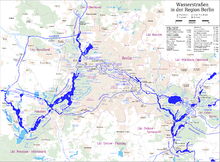
The Charlottenburg connecting canal is 1.6 kilometers long and runs from the western confluence of the Landwehr Canal into the Spree in a northerly direction to the confluence with the Westhafen Canal .
When the Spandauer Schiffahrtkanal was built between 1848 and 1859, the fact that a considerable part of the shipping traffic, especially the brick transport from the upper Havel , was aimed at the Landwehrkanal and the southern urban areas to be built on, was neglected. These ships now had to either take the old route via Spandau through the still unregulated lower Spree or the route from Humboldthafen five kilometers down the Spree to the Landwehr Canal. The 3.2 kilometer long Charlottenburg connecting canal was created as a direct connection between the Spree canal of the Spandau canal (from 1914: Berlin-Spandau canal ) near the Plötzensee lock and the Landwehr canal from 1872–1875.
After the completion of the Westhafenkanal, which ran further north, in 1956, the parts of the north-eastern section north of the Ringbahn that were not needed for the Westhafenkanal were filled in and the Beusselstrasse wholesale market was built over. The Charlottenburg connecting canal, which has now been shortened by half, has been flowing directly into the Westhafen Canal at right angles since then.
The place where the Charlottenburg connecting canal meets the Spree and Landwehr canal is called the "Spreekreuz".
Web links
- Information on the Charlottenburg connecting canal. Berlin Waterways and Shipping Authority, accessed on June 12, 2008 .
Individual evidence
- ↑ Directory E, Ser. No. 3 of the Chronicle ( Memento of the original of July 22, 2016 in the Internet Archive ) Info: The archive link was inserted automatically and has not yet been checked. Please check the original and archive link according to the instructions and then remove this notice. , Federal Waterways and Shipping Administration
- ↑ Lengths (in kilometers) of the main shipping lanes (main routes and certain secondary routes) of the federal inland waterways ( memento of the original from January 21, 2016 in the Internet Archive ) Info: The archive link was automatically inserted and not yet checked. Please check the original and archive link according to the instructions and then remove this notice. , Federal Waterways and Shipping Administration
- ↑ H.-J. Uhlemann: Berlin and the Märkische Wasserstraßen , DSV-Verlag Hamburg, 1994
Coordinates: 52 ° 31 ′ 41 ″ N , 13 ° 18 ′ 52 ″ E


