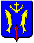
Aumetz
| Aumetz | ||
|---|---|---|

|
|
|
| region | Grand Est | |
| Department | Moselle | |
| Arrondissement | Thionville | |
| Canton | Algrange | |
| Community association | Pays Haut Val d'Alzette | |
| Coordinates | 49 ° 25 ' N , 5 ° 57' E | |
| height | 349-408 m | |
| surface | 10.35 km 2 | |
| Residents | 2,319 (January 1, 2017) | |
| Population density | 224 inhabitants / km 2 | |
| Post Code | 57710 | |
| INSEE code | 57041 | |
| Website | Aumetz | |
 Town Hall ( Hôtel de ville ) |
||
Aumetz is a French commune with 2319 inhabitants (as of January 1, 2017) in the Moselle department in the Grand Est region (until 2015 Lorraine ).
geography
The municipality of Aumetz is halfway between Thionville and Longwy near the border with Luxembourg .
history
The place was first mentioned in 636 as Talmatio and then in 933 as Almas . The name has nothing to do with the city of Metz , but derives from the Latin alta mansium ("high home"). In the Middle Ages, Aumetz was in the German-speaking area.
The place has been French since 1766. 1871–1918 it belonged again to the German Empire , but French remained the official and colloquial language.
Population development
| year | 1962 | 1968 | 1975 | 1982 | 1990 | 1999 | 2007 |
| Residents | 2722 | 2465 | 2375 | 2183 | 2161 | 2225 | 2252 |
Culture and sights
The Aumetz ore mine and its counterpart in Neufchef , 14 kilometers away, unite the two parts of the iron ore mining open-air museum Écomusée des mines de fer de Lorraine . It opened in 1989. In addition to exhibits on the history of mining in Lorraine from 1820 to 1998 (when the last mine was closed), entrances into a 1500-meter-deep shaft are offered.
Web links
- Presentation of the mining museum (German)
