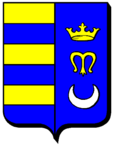
Entrange
| Entrange | ||
|---|---|---|

|
|
|
| region | Grand Est | |
| Department | Moselle | |
| Arrondissement | Thionville | |
| Canton | Yutz | |
| Community association | Cattenom et Environs | |
| Coordinates | 49 ° 25 ' N , 6 ° 6' E | |
| height | 186-416 m | |
| surface | 3.99 km 2 | |
| Residents | 1,241 (January 1, 2017) | |
| Population density | 311 inhabitants / km 2 | |
| Post Code | 57330 | |
| INSEE code | 57194 | |
 Miners Chapel Sainte-Jeanne |
||
Entrange (German Entringen , Lorraine Entréngen ) is a French commune with 1241 inhabitants (as of January 1, 2017) in the Moselle department in the Grand Est region (until 2015 Lorraine ).
geography
The municipality of Entrange is located about seven kilometers northwest of Thionville , near the border with Luxembourg .
history
The place has belonged to France since 1769, with an interruption from 1871 to 1918 ( Reichsland Alsace-Lorraine ). In the 20th century, the place was dominated by mining, the Charles Ferdinand ( Carl Ferdinand ) mine existed from 1899 to 1979.
From 1811 to 1902 Entrange was incorporated into the neighboring town of Œutrange (which in turn has belonged to the municipality of Thionville since 1970 ).
Population development
| year | 1910 | 1962 | 1968 | 1975 | 1982 | 1990 | 1999 | 2007 |
| Residents | 391 | 783 | 725 | 719 | 795 | 1,147 | 1,212 | 1,324 |
Web links
Commons : Entrange - collection of images, videos and audio files
