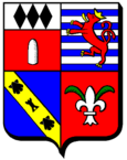
Moonlong
| Moonlong | ||
|---|---|---|

|
|
|
| region | Grand Est | |
| Department | Moselle | |
| Arrondissement | Thionville | |
| Canton | Fameck | |
| Community association | Rives de Moselle | |
| Coordinates | 49 ° 16 ' N , 6 ° 10' E | |
| height | 154-162 m | |
| surface | 4.10 km 2 | |
| Residents | 5,665 (January 1, 2017) | |
| Population density | 1,382 inhabitants / km 2 | |
| Post Code | 57300 | |
| INSEE code | 57474 | |
| Website | Moonlong | |
 Town Hall ( Hôtel de ville ) |
||
Mondelange (German Mondelingen ) is a French commune with 5665 inhabitants (as of January 1, 2017) in the Moselle department in the Grand Est region (until 2015 Lorraine ). It belongs to the Arrondissement of Thionville .
geography
Mondelange is ten kilometers south of Thionville and 15 kilometers north of Metz , near the confluence of the Orne and the Moselle at an altitude of between 154 and 162 m above sea level. The municipality covers 4.1 km². Together with the municipalities of Amnéville , Hagondange , Gandrange , Talange and Richemont , Mondelange forms a closed settlement area.
history
A burial ground occupied from the late urn field period to the beginning of the Roman period shows the prehistoric settlement of the place. Mondelange was part of the neighboring municipality of Richemont from 1812 to 1921.
Population development
| year | 1962 | 1968 | 1975 | 1982 | 1990 | 1999 | 2007 | 2017 |
| Residents | 3931 | 6470 | 6510 | 5993 | 5808 | 5610 | 5802 | 5665 |
Culture and sights
- Archaeological open-air museum directly at the site of the prehistoric necropolis
- Saint-Maximin Church

